Thompson, FredMareMagnum

199252 pages. Features: Cover photo of Holland America Line's Rotterdam and Nieuw Amsterdam; On the Waterfront; Ships Pictorial - official photos of the Royal New Zealand Navy's 50th Anniversary Fleet Review; A Captain and his Ship - Vincenzo Barbera is master of the Repubblica di Genova; Cargo Ship to Kirkenes - Fred Thompson travelled aboard Norway's famous coastal express service beyond the Arctic Circle; From Ocean to Ocean - Stephen M. Payne describes a memorable cruise through the Panama Canal aboard Holland America Line's cruise ship Rotterdam; Butter Boat Voyage - Keith Goss sails between Grimsby and Esbjerg in the DFDS freight ro-ros Dana Maxima and Dana Cimbria; Cruise Ship Review; Naval Occasions - colour photofeature; Twenty-five Years of container ships - part 2; 'T' Class Conversions - Roger Fry describes the conversion of eight WWII submarines into Fast Battery Drive boats between 1948-56; The Loss of the Empress of Asia - Neil McCart recalls the final days of the Canadian Pacific liner sunk by Japanese aircraft fifty years ago this month; Ports of Call; Ferry Fleets Update; Ferry Focus - Color Line; Signals; Large colour photo of the Nordnorge inside front cover; and more. Above-average wear to covers, with part of back cover missing. A worthy reference copy. Book
1991291 pages including index and 11 pages of colour photographic plates. Abundantly illustrated in black and white. In an easy and conversational style describes the origin, physical characteristics, and nature of the forces that act within and upon the eastern Pacific Ocean. Describes the origin, shape, and structure of the ocean floor as well as the development of coastlines and beaches. Carefully explains the complex movements of water masses, first in general terms and then specifically with regard to the various coastal regions of British Columbia. Describes the seasonal variations in salinity and temperature and, in a remarkably lucid manner, the complex interaction of planetary body forces which result in the variability of tides. Many of his own experiences as well as those of his colleagues are used to illustrate some of the more spectacular effects of water mass motions, such as the tidal rips in the northern Strait of Georgia, internal gravity waves in Knight Inlet, and the unique tidal whirlpools in Gilford Passage. These and many other aspects of coastal oceanography are presented in such a way that the excitement of the author for the nature of his work is transferred to the reader.... This book should have wide appeal. Not only is it suitable for scientists and their students, but should become a standard reference to be found in the libraries of commercial vessels as well as in the collections of yachtsmen. Although the author has no pretensions as to its evangelical significance, he has, with this book, made an outstanding contribution to the enjoyment of the coastal waters of British Columbia." - from Foreward by C.J. Yorath, Geological Survey of Canada. Chapters include: Historical Setting; The Coast Today; Tides and Tidal Streams; Secondary Currents; Upwelling - Bringing Cold Water to the Surface; Nature of Ocean Waves; Generation of Wind Waves; Shallow-Water Waves; Tsunamis (Tidal Waves); Strait of Georgia; Juan de Fuca Strait; Johnstone Strait Region; Deep-Sea Region; Northern Shelf Region. Clean and unmarked but for gift greetings inside front cover. Light wear externally. Nice tight and square copy. Book
1988292 pages. Reproductions of archival black and white photos. "The story of hardy people who dared to follow a dream. While trapping in the Rocky Mountains southwest of Beaverlodge, Alberta, Alex Monkman came upon a low pass the Indians had been using for hundreds of years. He recognized it as a potential shortcut fo the Pacific coast for the people of the Peace River Country in northeastern British Columbia... The Monkman Pass Highway Association was formed in 1936... The ingenuity, courage and endurance of the people who worked on the Pass is a story that begged to be told and this book is dedicated to them." - from back cover. Prior owner's details and blind stamp upon first page, otherwise clean, bright and unmarked with light wear. A quality copy. Book
1952Features: Dead Man's Double - the strange story of a landsman who, anxious to get home to Australia, shipped aboard a foreign tramp to work his passage; Baptism of Fire - the story of a young Forest Ranger employed by the British Columbia Forest Service in 1927, and how a fire trapped over 100 people in a logging camp; A Case of Contraband - An amusing story of how, between revolutions, men had ways of their own of getting around difficulties; The Golden Ingot - the diverting story of an ingenious Gold Coast version of the time-honoured "confidence trick"; Down Mexico Way - The exciting adventure of two young seafarers who light-heartedly set out to explore the Mexican countryside; The Fire-Walker; Pioneer Pilot - Mr. Peter Strong flew over the Drakensberg Mountains between Basutoland and Natal; One Thing After Another - Recalls the narator's fall and subsequent rise in the depression days of Australia; The Burma Road - will recall poignant memories to many ex-Servicemen; South Sea Burial Customs - Visiting the outlying islands of the remote Cook Group, in the South-East Pacific, the authoress came upon many curious death-customs; Olsen's Secret - A grim story from the American coalfields; Front cover was attached with tape but is now detached. Back cover missing. Contents unmarked and in decent condition. Magazine
199564 pages. Features: The Trials of Captain Zoderly; Robert C. Osborn (1904-1994); Where Are They Now? - Saburo Sakai; Japanese Carrier Operations - How Did They Do It?; 1,000 Trap Aircrew; Tales from a Rear Gunner - Embarrassment at Okinawa - Joe A. Ricciardi; Mountbatten's visit to the Pacific Fleet; CVW-15's Last Cruise - photo essay; Farewell patches of disestablished units; and more. Clean and unmarked with light wear. A quality copy. Magazine
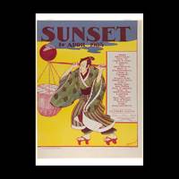
Best.-Nr. 341691Contentum Ltd. Loose sheet. New. High-quality art print based on an original work from the Met. Created in the 20th century 1903. Professionally printed on premium fine-art paper Museum Etching museum quality in size A2. The artwork is printed with a white border museum-style presentation. Contentum Ltd. unknown
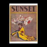
Best.-Nr. 341678Contentum Ltd. Loose sheet. New. High-quality art print based on an original work from the Met. Created in the 19th century ca. 1900. Professionally printed on premium fine-art paper Museum Etching museum quality in size A2. The artwork is printed with a white border museum-style presentation. Contentum Ltd. unknown
Best.-Nr. 200709026Paris, Société des océaniste, musée de l'Homme, 1966 ; in-8, 634 pp., broché (PTES USURES). Publication de la société n° 19.
2003Best.-Nr. NG145102003 xiii, 466 p., 127 (3 col.) figs, 25 tables, hardbound. Crisp new copy.
Best.-Nr. EG440591991 (2nd ed.) Two volumes (complete). xvii, 1137 p, over 2000 figures, 4to, cloth (dust jackets). Ex library Dr. J. Krikken (with his small Ex Libris). Spinal parts of dust jackets discoloured, else a very good set of the second edition.
900Anchorages in the Solomon Islands. In the upper part of the chart insert of Hat horn Sound Sketch Survey to Lieut. Marx & Torlesse, H.M.S. "Swinger" and Lieut. Elton, H.M.S. "Diamond" 1884. North of Marx P.t by Lieut. Bower, H.M.S. "Danae", 1879. With additions from a Survey by Lieut. Comm. W.U Moore, H.M.S. "Dart" 1884, Hathorn Sound Sketch Survey by Lieut C. W. Beresford and S.V. Messum under the direction of Lieut. Comm. W.U. Moore, H.M.S. "Dart" 1884, Port Diamond or Sinarango Sketch survey by the Officers of H.M.S. "Diamond", 1886. under the direction of Captain F.S. Clayton, Choiseul Bay Surveyed By Lieut. C.F. Oldham and the Officers of H.M.S. Lark, 1883. In the lower part of the chart insert of Blanche Harbour Surveyed By Lieut. C.F. Oldham and the Officers of H.M.S. Lark, 188, Plan of the Anchorage, Bambatani From a rough Sketch by Lieut. G. Stapleton, H.M.S. "Torch"1900. London Published at the Admiralty, 30th Dec. 1884, under the Superintendence of Captain W.J.L. Wharton, Hydrographer. Small corrections: 1929. Autore: Admiralty Charts. Luogo: Salomon islands - Pacific Ocean. Anno: '900. Tecnica: incisione. Dimensioni: 450x623 mm
900Anchorages in the Solomon Islands. In the upper part of the chart insert of Pavuvu Islands (Russell Islands) Sketch Survey by Lieut. G.E. Richards and the Officers of H.M.S. Renard 1880. Pepesala (Paddy) Bay from a sketch by M.r F.J. Bayldon, "Maresby" 1908. In the lower part of the chart insert of Viru Harbour Preliminary Survey By Commander A.F. Balfour, Assisted by the Officers of H.M. Surveying ship "Penguin" 1893, Rendova Harbour Preliminary Survey By Commander A.F. Balfour, Assisted by the Officers of H.M. Surveying ship "Penguin" 1893. London Published at the Admiralty, 28th Jan. 1895, under the Superintendence of Rear Admiral W.J.L. Wharton, Hydrographer. Small corrections: 1921. Autore: Admiralty Charts. Luogo: Salomon Islands - Pacific Ocean. Anno: '900. Tecnica: incisione. Dimensioni: 649x484 mm
900Anchorages in the Solomon Islands. In the upper part of the chart insert of Sketch of the Islands in Manning Strait between Choiseul and Ysabel Islands By M.r W. Hamilton 1908. Ysabel I from a sketch survey by Lieutenant F.C.C. Pasco, H.M. Surveying Ship "Dart" 1902. Taura Bay from an Austrian Government Plan, 1897. In the lower part of the chart insert of Sketch of the Southern portion of Lord Howe Islands (Ongtong Java or Leueneuwa) By Lieutenant G. Stapleton H.M.S. "Torch", 1900. London Published at the Admiralty, 9th May 1901, under the Superintendence of Rear Admiral Sir W.J.L. Wharton, Hydrographer. Small corrections: 1921. Autore: Admiralty Charts. Luogo: Salomon Islands - Pacific Ocean. Anno: '900. Tecnica: incisione. Dimensioni: 457x659 mm
900Anchorages in the Solomon Islands Surveyed by Commander A.F. Balfour, assisted by the Officers of H.M. Surveying ship "Penguin" 1894. In the upper part of the chart insert of Marovo Lagoon. In the lower part of the chart insert of Mongo Entrance, Charapoana Entrance, Tongoro Entrance. London Published at the Admiralty, 24th Feb. 1896, under the Superintendence of Rear Admiral W.J.L. Wharton, Hydrographer. Small corrections: 1919. Autore: Admiralty Charts. Luogo: Salomon Islands - Pacific Ocean. Anno: '900. Tecnica: incisione. Dimensioni: 626x481 mm
900Anchorages in the Solomon Islands. In the upper left corner of the chart insert of Beaufort Bay From a Sketch by M.r T.H. Switzer Master Schooner Roderick Dhu, 1896, Sutulahia Anch.e Sketch Survey by Lieut. W.R. Willis H.M.S. "Ringdove" 1895. In the middle part of the chart insert of Vura Anchorage From a Sketch by M.r T.H. Switzer, Master, Schooner, "Roderick Dhu"1896, Narovo Island Surveyed by Lieut. C.F. Odham and the Officers of H.M. Surveying Ship "Lark" 1882. In the right part of the chart insert of Auki Harbour Surveyed by Lieut. Com. R.L. Hancock and the Officers of H.M. Surveying Vessel "Sealark" 1913, Albatros Bay From an Austrian Government Sketch Survey, 1897, Ngora Fu Harbour From a Sketch Survey by Lieut. G.P. Bigg-Wither and the Officers of H.M.S. "Pylades", 1905. London Published at the Admiralty 20th Feb. 1907, under the Superintendence of Rear Admiral A. Mostyn Field, Hydrographer.Small corrections: 1927. Autore: Admiralty Charts. Luogo: Salomon Islands - Pacific Ocean. Anno: '900. Tecnica: incisione. Dimensioni: 617x470 mm
900Anchorages in the Solomon Islands. In the left part of the chart insert of Kunggava Bay From a sketch by Lieut. Com. R. Crookshank, 1928, Queen Carola Harbour From a German Government Survey, 1883, Wanderer Bay By Capt. H.M. Denham, 1855. In the middle part of the chart insert of Port Adam By W. Hilliard, Master H.M.S. Havannah 1850, Mallu Harbour By M.r Haddock, 1877, Astrolabe Harbour By Mons.r Marescot, Enseigne de Vaisseau Corvette Astrolabe French Royal Navy 1838, Cockatoo Anchorage By T.C. Tilly, Master, H.M.S. Cordelia, 1861, Aowawa Roadstead By Capt. H.M. Denham, 1854. In the right part of the chart insert of Hada or Recherche Bay By T.C. Tilly, Master, H.M.S. Cordelia, 1861, Kwakwaru and Kwi Harbours Sketch by M.r W.T. Wawn 1888, Port Mary By Lieut. C.F. Oldham, 1882, Makira Bay By Capt. H.M. Denham, 1855, Hunter Roadstead By Capt. H.M. Denham, 1854, Popau H.r Sketch by M.r R. Haddock, 1877. London Published at the Admiralty March 10th 1864, under the Superintendence of Capt. G.H. Richards, Hydrographer. Small corrections. Autore: Admiralty Charts. Luogo: Salomon Islands - Pacific Ocean. Anno: '900. Tecnica: incisione. Dimensioni: 643x495 mm
900Anchorages in Ysabel Island. In the left side of the chart insert of Kesuo Cove Surveyed by Lieutenant F.C.C. Pasco, assisted by Lieuts. C.E. Stainer, R. Aylen and K. Mackenzie-Grieve, H.M. Surveying Ship "Dart" 1902. In the right side of the chart insert of Tunnibuli Surveyed by Lieutenant F.C.C. Pasco, assisted by Lieuts. C.E. Stainer, R. Aylen and K. Mackenzie-Grieve, H.M. Surveying Ship "Dart" 1902. London Published at the Admiralty, 21st Dec. 1903, under the Superintendence of Rear Admiral Sir W.J.L. Wharton, Hydrographer. Small corrections: 1919. Autore: Admiralty Charts. Luogo: Ysabel Island - Salomon islands - Pacific Ocean. Anno: '900. Tecnica: incisione. Dimensioni: 461x662.
900Anchorages in Ysabel Island. In the left side of the chart insert of Korrigole Harbour Surveyed by Lieutenant F.C.C. Pasco, assisted by Lieuts. C.E. Stainer, R. Aylen and K. Mackenzie-Grieve, H.M. Surveying Ship "Dart" 1902. In the right side of the chart insert of Vulavu Anchorage Surveyed by Lieutenant F.C.C. Pasco, assisted by Lieuts. C.E. Stainer, R. Aylen and K. Mackenzie-Grieve, H.M. Surveying Ship "Dart" 1902. London Published at the Admiralty, 11th Dec. 1903, under the Superintendence of Rear Admiral Sir W.J.L. Wharton, Hydrographer. Small corrections: 1920. Autore: Admiralty Charts. Luogo: Ysabel Island - Salomon islands - Pacific Ocean. Anno: '900. Tecnica: incisione. Dimensioni: 457x652 mm
900Rough Sketches of Anchorages in the Solomon Islands. By M.r W.T. Wawn, Master, Brigantine "Ariel", 1888. In the left side of the chart insert of Tasman I.s or Niumanno Atoll, Atta Cove, Ariel Harbour From a Survey by Lieut. A.L. Jackson, under the direction of Lieut. Com. R.L. Hancock, H.M. Surveying Ship "Sealark", 1914, Manna Kwoi H.r. In the middle part of the chart insert of Deep Bay, Uras Cove, North Sister Anchorage, Double Bay. In the right side of the chart insert of Maramasike Passage. London Published at the Admiralty, 7th Oct. 1889, under the Superintendence of Captain W.J.L. Wharton, Hydrographer. Small corrections: 1930. Folded editorially. Autore: Admiralty Charts. Luogo: Salomon Islands - Pacific Ocean. Anno: '900. Tecnica: incisione. Dimensioni: 512x741 mm
1886In 8. Dim. 19x12 cm. Pp. 281+(3). Interessante opera di viaggi del 1886 di Albert David che descrive il suo viaggio lungo l'Oceano Pacifico. All'interno sono presenti dieci incisioni fuori testo che mostrano vedute: Baie Borja, Lima, Indiani peruviani, Tahiti ecc... Tra i luoghi descritti: Distretto di Magellano e Canali laterali della Patagonia, Lima durante vl'occupazione cilena, Valparaiso e i Cileni dopo la Guerra del Pacifico, Peru e Cile, Callao, Pisco, Pisagua, Arica e Tacna, Iquique, Lota, Una necropoli degli Incas, Honolulu, Un mese a Noukahiva, Tahiti ecc... In buone condizioni e completo Copertina editoriale in buone condizioni generali con lievi usure ai margini e dorso. Legatura in buone condizioni. All'interno le pagine si presentano in buone condizioni con fioriture. Interesting work of travel of 1886 written by Albert David describing his travel in the Pacific Ocean. Inside there are ten out of text planches showing different views: Baie Borja, Lima, Peruvian Indians, Tahiti ecc... Between the places described: District of Magellano and channels of Patagonia, Lima during Chile occupation, Valparaiso and Cileni after Pacific war, Peru and Cile, Callao, Pisco, Pisagua, Arica e Tacna, Iquique, Lota, a city of Incas, Honolulu, a month in Noukahiva, Tahiti ecc... In good conditions and complete. Editorial cover in good general conditions slightly worn in the edges and spine. Binding in good conditions. Inside pages are in good conditions with foxings.
1879In 8 (cm 18 x 27), pp. 14. Piatto anteriore originale, piatto posteriore rifatto con carta d'epoca. Rara e importante pubblicazione con l'accordo siglato da Balmaceda con Manuel Montes de Oca: l'accordo prevedeva che l'Argentina avrebbe mantenuto una posizione di neutralita' e non avrebbe tratto vantaggio dalle difficolta' del Cile nel conflitto del Pacifico. La guerra del Pacifico fu un combattuta tra il Cile e le forze alleate di Bolivia e Peru' dal 1879 al 1884; e' anche conosciuta come guerra del salnitro.
Best.-Nr. M12259Couverture rigide Lausanne , Société typographique , 1782 , in 12 plein veau , dos lisse , pièces de titres verte et rouge , 564pp. . Guyane - Brésil - Vice royauté de Buenos Ayres ou du Paraguay - Terres magellaniques - Isles Falkland ou Malouines - Terre de feu - Terre des états - Isle de la Nouvelle Géorgie - Chili - Pérou - Isles de l' Océan pacifique ( 165 pages ) .Langue: Français
Best.-Nr. M17341Couverture souple Robert Laffont, 1984, in8 broché, couverture ill. en couleur, quelques ill. noir et blanc, 219pp. Langue: Français
Best.-Nr. LBW02e67circa 1840 217 x 288 mm.
1998Best.-Nr. EA414601998 [4], 223 p., 7 figures, cloth. Monographs on Invertebrate Taxonomy Volume 6. Library stamps, else a very good copy.