5 806 résultats
réf. 58-0494San Francisco Calif.: Southern Pacific Company 1936. Blueline print switching zones map14 inches x 32 inches switching zones indicated in red purple green yellow brown with red pencil. File cover indicating "Switiching Limits of San Francisco" dated 1962. Three pages of Switching Charges effective 1960 attached. San Francisco, Calif.: Southern Pacific Company, 1936. unknown
réf. 56-0443San Francisco Calif.: Southern Pacific Company 1964. Blackline print 24" x 38". Topographical map of area around Giant with present and proposed railroad tracks indicated. From Pablo Bay to Richmond Golf Course extending approx 1 mile north and 1 1/2 miles east of Richmond Golf Course. Scale 1" = 300'. San Francisco, Calif.: Southern Pacific Company, 1964. unknown
réf. 58-0561San Francisco Calif.: Southern Pacific Company 1932 rev. 1942. Blueline print 24 inches x 48 inches red pencilling indicates station points and spur tracks. From Fairview Home and Geer to beyond Fairgrounds. Includes Salem Pringle Pinckney Asylum Spur. Position of many industries indicated. Scale 1 inch = 800 feet. San Francisco, Calif.: Southern Pacific Company, 1932, rev. 1942. unknown
réf. 58-0487Ogden Utah: Southern Pacific Company 1932 rev. 1945. Blueline print 21 inches x 48 inches. From two miles west of Reno yard to two miles east of Sparks yard. Both railway yards outlines in moderate detail. With red pencilling indicating switching limits. No industries indicated with listing of spurs and signals. Scale 1 inch = 800 feet. Ogden, Utah: Southern Pacific Company, 1932, rev. 1945. unknown
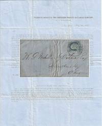
1857réf. 010681New York 1857. Envelope or Cover. Very good. This printed circular is titled “Transfer Office of the Southern Pacific Rail-Road Company / No. 54 Wall-Street / New York May 30 1857.” It is addressed to W. P. Mehville Wilne Esq. of Sandusky Ohio and franked with an imperforate Franklin stamp Scott #9 canceled by a black circular New York postmark. In nice shape with a tiny bit of soiling to the edges. The notice reads in part: “An installment of fifty cents a share will become due and payable on the three percent. Stock held by you in the Company on the first Monday of July next. . . Stock on which said instalment shall not be paid will be sold at auction in conformity with . . . the Charter. . . “About sixteen miles of our ‘Road’ are now graded and nearly furnished with cross-ties – twenty-four hundred and seventy-eight tons of rail-road iron have been bought and paid for and sent up Red River – sufficient to finish twenty-five miles of road.” . The Southern Pacific Rail-Road referenced in this document is not the much more famous transcontinental route. This railroad was founded on 16 February 1852 officially as the Vicksburg and El Paso Railroad although throughout the document it was referred to as the Texas Western Railroad. It was later bought by the Atlantic and Pacific Railroad for $600000. It was later acquired by Texas interests and its named officially changed to the Southern Pacific Railroad the predecessor of the Texas and Pacific Railway. It was never associated with the later and more famous transcontinental Southern Pacific. During 1857 the railroad laid 23 miles of track between Marshall and Swanson’s Landing on Caddo Creek. During the Civil War the line was connected to Shreveport Louisiana. In 1872 it was sold to the Texas Pacific Railroad Company which in 1976 merged with the Missouri Pacific Railroad. For more information see Werner’s “History of the Texas Western Railroad Companies” and “History of the Texas and Pacific Railway Company” both at the Texas State Historical Association website. Scarce. At the time of listing no other documents from this Southern Pacific Railroad are for sale in the trade. Although no other 1857 circulars documenting the construction of the first 16 miles of its track have been sold at auction other materials related to it have. OCLC shows no materials related to this Southern Pacific Railroad are held by institutions however it is possible there may some within the Texas & Pacific Railway Collection at the University of North Texas. . unknown books
1908réf. 12650The Pacific Telephone and Telegraph Co. Fine with no dust jacket. 1908. First Edition. Softcover. Still has the original string to hang it from. ; 8vo 8" - 9" tall; 488 pages . The Pacific Telephone and Telegraph Co. paperback
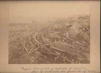
1900réf. 42650Miles City Montana: Wiley Bros. Photographers Successors to L. A. Huffman 1900. Photograph. Very Good. Large format photograph 18.5 x 24 cm on a tan mount 25 x 30 cm. Wiley Bros. backstamp "Wiley Bros. Photographers Successors to L. A. Huffman. Miles City - Montana.". Mount edges are lightly bumped and chipped. Photograph is gently rubbed and lightly faded but still showing good detail and contrast. Shows many workers constructing the bridge with Northern Pacific Railroad cars visible in the background. Photograph taken from above looking down. In ink by hand on the front of the mount "Progress showing detail of bench walls of Culvert detail of brick arch; also general view of Coulee Bridge 148. Yellowstone Riv. River. Wiley Bros., Photographers, Successors to L. A. Huffman unknown
1900réf. 42650Miles City Montana: Wiley Bros. Photographers Successors to L. A. Huffman 1900. Photograph. Very Good. Large format photograph 18.5 x 24 cm on a tan mount 25 x 30 cm. Wiley Bros. backstamp "Wiley Bros. Photographers Successors to L. A. Huffman. Miles City - Montana.". Mount edges are lightly bumped and chipped. Photograph is gently rubbed and lightly faded but still showing good detail and contrast. Shows many workers constructing the bridge with Northern Pacific Railroad cars visible in the background. Photograph taken from above looking down. In ink by hand on the front of the mount "Progress showing detail of bench walls of Culvert detail of brick arch; also general view of Coulee Bridge 148. Yellowstone Riv. River. Wiley Bros., Photographers, Successors to L. A. Huffman unknown books
18203 volumi, cm. 18, brossura editoriale, pag. XIV, 246 (su 248: manca ultima carta di indice) più ritratto in b/n; 267 più carta geografica rip. e 4 tavole f.t.; 274 (manca l'ultima c. con elenco delle tavole) più 6 tavole f.t. (manca la n° 4). La carta geografica riguarda le Isole Washington. Collana "Raccolta de' viaggi più interessanti eseguiti nelle varie parti del mondo, tanto per terra quanto per mare, dopo quelli del celebre Cook...". Ottimo esemplare.
réf. 18267636-nnew. unknown
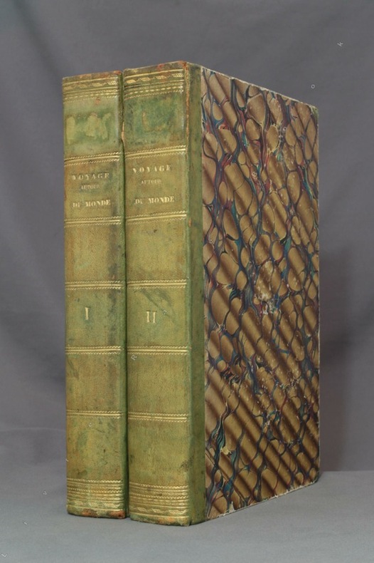
1834réf. 8783Paris, L. Tenré et Henri Dupuy, 1834. 2 volumes in-4 de [4]-VIII-576 et [4]-584 pages, demi-basane verte, dos lisses ornés de filets dorés, traces d'étiquette dans la partie supérieure des dos, petite fente à un mors, coiffes, coupes et coins frottés, premier cahier du tome second légèrement déboîté, avec une petite mouillure.
1940réf. 30946ABOxford, Clarendon Pewaa, 1940. XXIV, 464 Seiten, 62 Blatt. zahlreiche Illustrationen, graphische Darstellungen und Karten. Leinenband mit geprägter Rückenbeschriftung. Mit Schutzumschlag.
1897réf. R300313742Lib. Africaine & Coloniale. 1897. In-8. Broché. Etat d'usage, Couv. légèrement passée, Dos abîmé, Papier jauni. 221 pages - une carte dépliante en couleurs hors texte. Dos abîmé, scotché.. . . . Classification Dewey : 996-Autres régions du pacifique
19248vo., Third and Best Edition, with a frontispiece, 23 plates, 2 folding coloured maps (one map with near repair at fold) and illustrations in the text, some very light and occasional age-staining (mainly marginal); handsomely bound in navy blue full morocco, back with raised bands tooled in gilt, second compartment lettered in gilt, pictorial gilt from original front board and backstrip preserved and mounted on new and separate leaves, uncut, a most attractive copy ideal as a gift or for presentation. Reeves' classic account was first published in 1898 with a second edition in 1900. This is the most comprehensive issue, considerably augmented and with Wray's additions.
1827Carta apparsa nella sesta parte, "Océanique", dell'Atlas universel de géographie physique, politique, statistique et minéralogique di Vandermaelen. L'atlante fu prodotto in un'unica edizione nel 1827; furono venduti solo 810 esemplari completi. Questa grande opera, che comprende circa 378 mappe uniche e che fu compilata nell'arco di tre anni, fu il primo atlante litografico e il primo a rappresentare il mondo con la stessa proiezione e in una scala uniforme. Philippe Marie Guillaume Vandermaelen è stato un cartografo fiammingo attivo a Bruxelles nella prima parte del XIX secolo. A Vandermaelen si deve uno dei più notevoli sviluppi dell'impresa privata nella cartografia, ovvero il suo straordinario Atlas Universel de Geographie in sei volumi. Vandermaelen, nato a Bruxelles il 23 dicembre 1795, viene considerato come il più grande cartografo belga dopo Mercatore e Ortelius. Figlio di un medico che era diventato un ricco produttore di sapone, muovendosi in un ambiente commerciale e da autodidatta, divenne un commerciante di prodotti chimici e farmaceutici. Fanatico di geografia, la sua carriera subisce una svolta definitiva quando, nel 1825, inizia a pubblicare un rivoluzionario Atlas universel che lo consacra come cartografo. Primo atlante al mondo a rappresentare la Terra su una scala unica ed eccezionalmente grande, l'Atlas universel offriva la rappresentazione più ampia, completa e precisa mai realizzata. I suoi contemporanei lo capirono, come la Chiesa cattolica romana, che era in una fase di espansione. Negli anni Trenta del XIX secolo, Roma sosteneva che questo atlante era assolutamente il miglior atlante disponibile, prezioso strumento della sua politica missionaria nell'Oceano Pacifico e nelle isole meridionali. Bibliografia Marguerite Silvestre, Philippe Vandermaelen, Mercator de la jeune Belgique, 2016. Map appeared in the sixth part, 'Océanique,' of Vandermaelen's Atlas universel de géographie physique, politique, statistique et minéralogique. The atlas was produced in one edition in 1827; only 810 complete sets were sold. This great work, featuring some 378 unique maps and compiled over three years, was the first lithograph atlas, and the first to render the world on the same projection and at a uniform scale. Philippe Marie Guillaume Vandermaelen (December 23, 1795 - May 29, 1869) was a Flemish cartographer active in Brussels during the first part of the 19th century. Vandermaelen is created with "one of the most remarkable developments of private enterprise in cartography," namely his remarkable six volume Atlas Universel de Geographie. No one could have foreseen that Philippe Vandermaelen, born in Brussels on 23 December 1795, would become the greatest Belgian cartographer since Mercator and Ortelius. Son of a doctor who had become a wealthy soap maker, moving in a business environment and self-taught, he became a dealer of chemical and pharmaceutical products. As a geography fanatic, there was a definitive shift in his career when, in 1825, he began to publish a revolutionary Atlas universel which established him as a cartographer. As the first atlas in the world to represent the Earth on a single and exceptionally large scale, the Atlas universel offered the widest, most complete and most precise representation ever achieved. His contemporaries understood this, such as the Roman Catholic Church, which was in a phase of expansion. In the 1830s, Rome claimed that this atlas was “the best atlas available” and was the instrument of its missionary policy in the Pacific Ocean and the southern islands. Litograph, with original outline colour, very good condition. Bibliografia Marguerite Silvestre, Philippe Vandermaelen, Mercator de la jeune Belgique, 2016.
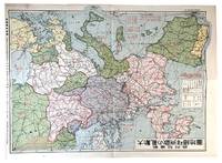
1939réf. 179796Nagoya: Shin'aichi 1939. Coloured folded map of Europe published at the beginning of World War II in Europe; 38.5 cm. x 54 cm.; a few tiny closed tears at margins; Shin'aichi Nagoya n.d.1939. The Japanese text on the map gives numbers of Europe's ethnic groups: Teutonic Latin Slav Asian while another block of text lists the population of the world's Jews in units of 10000 by country. The world population by region in units of 100000000 and those of the world's ethnic groups are shown to the left. In the upper right corner facts about World War I are given including number of troops by country in units of 10000. A legend shows national borders prior to World War I railways navigable rivers etc. Neutral powers are indicated together with naval bases place names in international dispute etc.; Originally purchased from Asia Bookroom the basis of whose catalogue description is used here. Shin'aichi unknown
2005réf. DADAX1570614695Brand: Sasquatch Books 2005-10-11. hardcover. New. 10.12x0.51x10.16. Buy with confidence. Excellent Customer Service & Return policy. Brand: Sasquatch Books hardcover
1910réf. 46775N. P.: Privately printed n. d. ca 1910. 1910. AROUND THE WORLD. 9" x 12" tri-fold color pictorial wrappers folds to 9" x 4" 44 1 pp. illustrated from photographs and line drawings. Includes cabin plans for steamers "Mongolia" "Manchuria" "Korea" "Siberia" and "China itineraries conditions of passage timetables route map exchange rates. Describes comforts of the ships cabins suites dining social hall music room and library smoking room etc. and includes sections on Honolulu and Hawaii; Japan; Shanghai and China; the Philippines; the China Sea and Singapore; Calcutta; Agra and Delhi; Side Trips to Egypt; Cairo; Nile Trips; Africa Across the American Continent Chicago Salt Lake City San Francisco; and famous California Resorts. This is a well-presented booklet and provides a great deal of information that is helpful to the traveler. Very good copy. Privately printed, n. d. (ca 1910). unknown
réf. 56-0236Oakland Calif.: Southern Pacific Company 1931. Map. Blueline print 25" x 48". Some red and black pencilling. Map of Oakland Railroad Yard Limits includes Air Force Intransit Depot. Scale 1" = 1500'. Oakland, Calif.: Southern Pacific Company, 1931. unknown
réf. 56-0233San Francisco Calif.: Southern Pacific Company 1931. Map. Blueline print. 24 x 47 inches. Map of Oakland Railroad Yard from Oakland Ferry 16th St. Station to San Rafael Ferry and Point Orient. Includes list of 3 transfers or cannonball moves Parr Terminal Wholesale Co all lines in Oakland. Scale: 1 inch = 1500 feet. San Francisco, Calif.: Southern Pacific Company, 1931. unknown
réf. 56-0359Los Angeles Calif.: Southern Pacific Company 1950. Map. Blueline print 24" x 60". Includes City of Yuma with detailed railroad yard Southwestern Ice & Cold Storage Co Ice Plant Union Oil Company. From Colorado River to beyond Seventh Street. Scale 1" = 100'. Los Angeles, Calif.: Southern Pacific Company, 1950. unknown
réf. 56-0223Los Angeles Calif.: Southern Pacific Company 1921 revised 1946. Map. Blueline print. 16 x 50 inches. With red orange green etc. pencilling. Map of Oxnard. Scale: 1 inch = 100 feet. With inset marginal map of region no scale. Los Angeles, Calif.: Southern Pacific Company, 1921, revised 1946. unknown
réf. 56-0360Tucson Ariz.: Southern Pacific Company 1932 revised 1949. Map. Blueline print 24" x 48" with red pencilling indicating present switching limits. From mile marker 729 to US Army Base. Includes Colorado Yuma East Yard points detailed function map of railroad yard Colorado River. Scale 1" = 1000'. Tucson, Ariz.: Southern Pacific Company, 1932, revised 1949. unknown
réf. 1630in 12 broché panorama dépliant de la ville de Sydney Galles du Sud (100x185cm) en frontispice.titre,298 pages,carte dépliante en couleurs d’après l’atlas de M.Bonnefont,illustrations Hors-texte sous serpentes.E.Plon & Cie 1883.Edition originale.