6.355 Ergebnisse
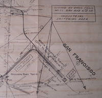
Best.-Nr. 58-0498San Francisco Calif.: Southern Pacific Company 1932. Blueprint 23 inches x 55 inches. From Kearny Street to Van Ness Avenue Fisherman's Wharves to Francisco Streets. Proposed Operation of State Belt Railroad over Souther Pacific Company's Track on Beach Street. With red yellow and green lines indicating new connection tracks abandoned tracks current tracks. Scale 1 inch = 100 feet. San Francisco, Calif.: Southern Pacific Company, 1932. unknown
Best.-Nr. 56-0378San Francisco Calif.: Southern Pacific Company 1930 rev. 1959. Blueline print 24" x 56". Sheet two of three. From Bassett Street to Guadalupe Creek. Includes Commercial Solvents Corporation Magnesia Plant Western Carbonic Acid Gas Co Lick Mill road Agnew State Hospital with description of each building on grounds. Scale 1" = 100'. San Francisco, Calif.: Southern Pacific Company, 1930, rev. 1959. unknown
Best.-Nr. 56-0383Oakland Calif.: Southern Pacific Company 1928 rev. 1961. Blueline print 24" x 56". From Webster Street to Alaska Packers Basin warehouses and Oakland Inner Harbor to Eagle Avenue. Includes University of California tract 32 John Huston plot JD Box Factory. Scale: 1" = 100'. Oakland, Calif.: Southern Pacific Company, 1928, rev. 1961. unknown
Best.-Nr. 56-0384Oakland Calif.: Southern Pacific Company 1931 rev. 1962. Blueline print 24" x 56". From beyond Oak Street to High Street and border of Oakland Estuary to Lincoln Avenue. Includes downtown Alameda businesses Lincoln Junction station point Boyle Manufacturing Co Pacific Coast Engineering Co Signal Oil Co. Scale 1" = 100'. Oakland, Calif.: Southern Pacific Company, 1931, rev. 1962. unknown
Best.-Nr. 56-0446Tucson Ariz.: Southern Pacific Company 1959 rev. 1960. Blackline print 24" x 83". Approx 2 mile stretch of present and proposed railroad tracks near Hayden Junction Arizona. Map details track measurements and calculations. With Tailings Pond hill. Scale 1" = 100'. Tucson, Ariz.: Southern Pacific Company, 1959, rev. 1960. unknown
Best.-Nr. 56-0320San Francisco Calif.: Southern Pacific Company 1918 revised 1945. Map. Blueline print 24" x 47" with red and black pencilled notation. From Aqua and Lomita Park stations west of San Bruno to Mission Bay yard and 3rd and Townsend Street station. Includes San Bruno South San Francisco Colma Army Street San Francisco. Scale 1" = 0.3 mile. San Francisco, Calif.: Southern Pacific Company, 1918, revised 1945. unknown
Best.-Nr. 58-0521San Francisco Calif.: Southern Pacific Company 1931. Blueprint 26 inches x 55 inches. From Station Point Curtiss to end of spurr track. Arizona Gypsum Plaster Company building only structure indicated map consists primarily of tracks signals and track measurements. Scale 1 inch = 100 feet. San Francisco, Calif.: Southern Pacific Company, 1931. unknown
Best.-Nr. 58-0523San Francisco Calif.: Southern Pacific Company 1929. Blueprint 26 inches x 55 inches. From San Diego Street and Panama Avenue to Citrus Avenue along railroad tracks. Includes Station point Daly City Hillcrest Vista Grande Tract Vista Grande Park Lake Merced Golf and Country Club all streets along railroad tracks. Scale 1 inch = 100 feet. San Francisco, Calif.: Southern Pacific Company, 1929. unknown
Best.-Nr. 58-0520San Francisco Calif.: Southern Pacific Company 1916. Blueprint 28 inches x 62 inches. Approximately 1 1/2 mile strech of railroad tracks along Sacramento River. Station building only structure indicated. Scale 1 inch = 100 feet. San Francisco, Calif.: Southern Pacific Company, 1916. unknown
Best.-Nr. 58-0522San Francisco Calif.: Southern Pacific Company 1921 rev. 1926. Blueprint 26 inches x 55 inches. From Panama Avenue to Citrus Avenue along railroad tracks. Includes Station points Daly City and Union Park Vista Grande Park all streets along railroad tracks. Scale 1 inch = 100 feet. San Francisco, Calif.: Southern Pacific Company, 1921, rev. 1926. unknown
Best.-Nr. 58-0518San Francisco Calif.: Southern Pacific Company 1931 rev. 1942. Blueprint 24 inches x 70 inches. From 1600 feet south of Inyo County Company Tracks to 1500 feet north of abandoned Cartago piping and water supplies building. Includes few buildings primarily track measurements. Scale 1 inch = 100 feet. San Francisco, Calif.: Southern Pacific Company, 1931, rev. 1942. unknown
Best.-Nr. 56-0382Oakland Calif.: Southern Pacific Company 1949 rev. 1959. Blueline print 24" x 56". Sheet two of two. From US Naval Air Station entrance to Main Street and Todd Shipyards Corporation. Includes US Naval Air Station with Officer's Quarters and Club Oakland Estuary Todd Shipyards Company. Scale 1" = 100'. Oakland, Calif.: Southern Pacific Company, 1949, rev. 1959. unknown
Best.-Nr. 56-0381Oakland Calif.: Southern Pacific Company 1947 rev. 1960. Blueline print 24" x 56". Sheet one of two. From Main Street to Webster Street and Singleton Avenue to US Pierhead Line. Includes Air Force Intransit Depot Federal Housing Authority Todd Shipyards Company Associated Oil Company. Scale 1" = 100'. Oakland, Calif.: Southern Pacific Company, 1947, rev. 1960. unknown
Best.-Nr. 56-0331Oakland Calif.: Southern Pacific Company 1935. Map. Blueline print 21" x 71". From State Highway and McKinley Avenue to Harding Way. Includes Mormon Slough Stockton State Hospital 10 blocks by 27 blocks of downtown along railroad tracks. Scale 1" = 400'. Oakland, Calif.: Southern Pacific Company, 1935. unknown
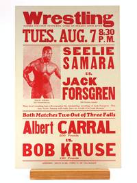
1939Best.-Nr. 505696Hood River News 1939. Paperback. FINE. Printed Red on 11 x 17' white cardstock. We date this poster around 1939 based on martching Hood River News wrestling broadsides with dated newspaper clippings. 'Former location Penny-Wise Store on Heights Hood River.' Some very trivial rubbing to the tips otherwise uncommonly clean and sharp. Top billing heavyweight match features an absolutely yoked and glistening Seelie Samara stage-name for George Hardison an African-American athlete and one of the most prominent characters in the early years of the 'Golden Age' revival of dramatic/entertainment wrestling in America. Hardison was born in Georgia and after a stint as a carnival strongman was scouted by 'Tiger Man' John Pesek who became his boxing trainer. Sometime in the late 30's Hardison began competing in staged Wrestling matches in the Northeast. In 1938 he signed with promoter Jack Pfefer with whom he began traveling extensively; while he was regularly billed in the Midwest and California this broadside is the only record we found of Pacific Northwest appearance. From the early-40's onward Hardison's appearances were confined to segregated 'Race Matches'; he would hold claim to the 'Negro World Heavyweight Championship' belt through the early 50's. Cory Santos writes 'A fan favorite Samara had power and technical prowess in equal measures. His muscularity was unique for the era; his bulging physique was a striking contrast to the bulkier frames of many heavyweights of the period. The Samara character also included costume elements — the most noteworthy of which was a Muslim head wrap Hardison used when being advertised from Algeria his most common birthplace or Afghanistan. Still given the huge number of strange hometowns it is difficult to keep track of exactly what character elements are geographically based and which are just random items based on the fanciful imaginations of “Africa” from countless midwestern promoters. But a sense of fair play honor and respect defined the Seelie and variants Ras and Haille Samara characters to audiences. Combined with his impressive physique these virtues earned him lasting nicknames including “Negro Hercules” “Black Adonis” the “insert location here Wildman” and famously the “Black Panther.” 'Seelie Samara: A Forgotten African-American Great.'. [Hood River News] paperback
18608vo [23 x 15.5 cm]; xii, 456 pp, 8 fine lithographed plates, 7 being hand-colored, other tinted, other engraved illustrations from drwgs, the plates drawn by J. Wolf, W. Fitch, George Angas (4 are botanical, others animals, birds). original blind-stamped cloth, gilt spine title lettering, cloth faded and rear internal hinge repaired, old inscription on title margin dated 1861, interior clean and near fine, excellent plates. A picture of this book is available upon request by email. Ripley 26. Ferguson 6929. Wood 231: 'An interesting account of the author's observations on the flora and fauna of Australasia, in which birds figure large, at least half of the 23 chapters containing references to them'. The book contains an extensive chapter on the platypus, which the author here calls a water mole, together with a hand colored plate of same. Fitch, who painted the botanical subjects, was one of the most respected botanical artists of his time. Other subjects are by artists G.F. Angas, Thomas Baines and Joseph Wolf, each a highly respected and important natural history artist. An important contribution including marine biology, ornithology, bird migration, plants including those with agricultural application, botanic garden, medicinal remedies, etc.
18538vo [22.5 x 15 cm]; vi, [i, errata sheet inserted loose], 488, 32 [publisher's ads dated January 1853] pp, 7 plates including 4 colored lithographed plates, frontis, other engraved illus, large folding engraved map, tables. later cloth, gilt title lettering on red leather spine label, minor foxing or light stain on few leaves, mostly marginal, short presentation inscription to the Survey of the North Pacific & China Seas, from 'the Observatory', 1853, very good+ copy, sound. Abbey Travel 602. Ferguson 9436. Snow 633. Taylor 80. Hill p. 98. Good descriptions of customs, society, conditions, bit on cannibalism, etc, Savage Island, Manua, Tutuila, Upolu, Samoa, Vavau, Lifuka, Tonga, Fiji, New Hebrides, New Caledonia, Port Jackson, etc.
1854Original Australian parliamentary paper, printed on a single folio blue sheet, double sided, measuring approximately 13.5 inches x 8.5 inches (34cm x 22cm). In very good and original condition. This is an original document printed by the government of Victoria, Australia, during the Victorian gold rush, providing rules and regulations respecting the issue of licenses for mining, under the authority of the Local Act, entitled "An Act for the better management of the gold fields of Victoria".
18078vo, 50 pages, with map and portrait bound in recent green paper boards. Text in German. This a monthly issue of an obscure and rare Geographical publication issued in Weimar/ Germany in the late 1700's and early 1800's named 'Geographische Ephemeriden.' It contains a large 50 page report about New Georgia which today is part of the Solomon Islands in the South Pacific. In this report the author explores the history, fauna, flora and people of the islands and draws on accounts by John Hunter, Bougainville, Carteret, Labillardiere and others who visited them. The report is accompanied by a portrait of Captain John Hunter as well a fold-out map measuring 250 mm x 190 mm. A very early report and map on the Solomon Islands and very rare.
18048vo, 16 pages, contained in a complete 200 page monthly issue of the Geographische phemeriden, attractively bound in brown cloth with marbled boards and gilt spine. Very good condition and very crisp inside. Text in German. This is the 1804 Edition of an obscure and rare Geographical publication issued in Weimar/ Germany in the late 1700's and early 1800's named 'Geographische Ephemeriden.' It contains a portrait of Hernando Maghellan and a 16 page report about the Spanish Voyages to North America. Little was known about these Spanish voyages as the Spanish kept things secret. In 1791, Alessandro Malaspina undertook a search for the Northwest Passage. He surveyed the Alaska coast from Yakutat Bay to Prince William Sound. At Yakutat Bay, the expedition made contact with the Tlingit. The expedition's scientists made a study of the tribe, recording information on social mores, language, economy, warfare methods, and burial practices. During the return to Mexico, Malaspina's expedition spent a month at the Spanish outpost in Nootka Sound on Vancouver Island (see below). The expedition made a study of the Nootka. The two ships then sailed south to Mexico, stopping at the Spanish settlement and mission at Monterey, California on the way. Simultaneously an expedition under Francisco de Eliza, exploring the Strait of Juan de Fuca, discovered an entrance to the Strait of Georgia, which prompted further investigation. In Acapulco, Malaspina took over two schooners, the Sutil and Mexicana, placed them under the command of one of his officers, Dionisio Alcalá Galiano, and had them sail north to explore the Strait of Georgia. Galiano's expedition took place in 1792 at the same time as that of George Vancouver. The two expeditions met in the Strait of Georgia and worked together to map the waters and establish the insularity of Vancouver Island
1873South Pacific Ocean, 20 May 1873. Manuscript signed letter written by an American merchant, Captain Summers of Honolulu, penned onboard a barque recently purchased by him, as he made his return voyage from Iquique (then part of the Viceroyalty of Peru) to the Sandwich Islands (Hawaii). 8vo. 4 pages. Double leaf letterhead measuring approximately 12,5 x 20 cm, with small embossed image of a colonial building. Mild age-toning and tearing at folds, otherwise in very good condition. In the July 1st 1873 issue of Honolulu's 'The Friend" magazine for mariners, this specific voyage was recorded as follows: "Liberian bark Clara Louise, Master Summers, Sailed from Iquiqui, Peru, May 4th, ... crossed the line... during three days had heavy winds and calms, took the NE trade... with fair weather, arrived on the 17th June." A letter of excellent content concerning one Honolulu ship owner's experience in the sea trade, Captain Summers describes his attempts to obtain cargo at Iquique (now in Chile, then part of Peru), mentioning saltpeter and copper, as well as the high price of fresh water. Finding little success in purchasing goods to resell on the Pacific coast of South America, he makes efforts to earn income by chartering cargo. He rightfully blames the introduction of the steamship for reduced opportunity available to independent merchants such as himself, still using sails to navigate large wooden vessels. Still, he remains optimistic of the opportunity to secure cargo in the Sandwich Islands, possibly owing to his Honolulu connections. Especially damaging to his endeavour and ambition is one unscrupulous character, referred to as 'Old Fearrington', from whom he purchased the barque Clara Louise. Upon trying to sell the vessel itself, in Callao, he found some of the vessel's wood to be rotten. His ship was therefore neither sellable, nor sea-worthy for cross-Atlantic voyages. Perhaps most disappointing, the captain could not afford the risk of transporting sugar, a lucrative and prolific commodity at the time, as the ship's hull could not be trusted with such weight. The recipient of this correspondence is the captain's brother Tom who appears to live in the San Francisco Bay area. The captain ends his letter with a request for his brother to write to San Francisco wholesaler and importer Cross & Co., most likely the captain's client. Excerpts from the letter: "My dear Tom, I have been down this way again and after a passage of 80 days anchored in Iquique itis one of the most desolate holes... not a spear of grass for 60 miles of the town, water 10 cents per gallon... 40 cents for washing a shirt." "... I discharged after 20 days delay what with holidays... I could get no cargo on this boat so I thought it best to try the Sandwich Islands... but 400 miles out of the way." "I might got some sugar if I had not been deceived in this vessel. I have had plenty of chance to sell but old Fearrington had the rotten wood all covered... had to trust his word but he did lie... I have sent him $2200 in gold of of this freight so you see that he has received $6000 from me in 15 months..." "... he deceived me, told me she was sound all through and I had not the money to spare to have her overhauled... if she had been a good sound vessel I could have sold her and made good a profit by it for both of us..." "When I wanted to sell it at Callao they overhalled and found some of her timbers rotten..." "I have not taken any wages since leaving and I think if I can get some more good charters I shall make myself whole and give him back his rotten old ship..." "... getting down to Iquique she commenced leaking... had to keep the pump going all the time... had to get caulked all over and now she is tite... " "I have been told by one of my best friends in Boston that old Fearrington will do me out of the profets & ship yet he has done so with several captains ruined them..." "... I don't know whether I will get any cargo at the Sandwich Islands but I am in hopes..." "... the business in both oceans is very dull the steamers take all the trade. If she was a sound vessel I would go to Japan or China and sell... she will not carry 300 tons with safety..." "I must now close... give my love to Sarah and all of your dear family. Write direct Cross & Co. California Strait S. Fran." "goodby from your affectionate Brother, Wm H Summers." End Excerpts. Further research is warranted to learn more about the Captain, although it appears from historical records that his home was in Honolulu. The present letter suggests that he was a man of integrity, and that he had family in San Francisco. The Annual Report of the Hawaiian Historical Society, Vol 5, mentions a Captain Summers of Honolulu who was involved in hunting seals in 1826 with a brig called Waverley. This may be the same Summers or a relation, possibly his father. A San Francisco Ship Passenger List names William Summers as making a voyage on a British schooner named Koh-i-noor in November 1851 from Lahaina to San Francisco, presumably to visit his brother. The ship had only a scant few passengers, but a substantial cargo of potatoes from Hobart Town, as well as potatoes and oranges from Hawaii. A book titled "History of Bucks County, Pennsylvania," edited by J.H. Battle; published by A. Warner & Co. in 1887, outlines genealogical connections and mentions, "Sir Richard Summers, from whom the Sandwich islands derived the name by which they were first known, as the Summers islands". This reference may lead to the lineage of Captain Summers who wrote the present letter. "The Friend" began as a monthly newspaper for seamen, which included news from both American and English newspapers, and gradually expanded to adding announcements of upcoming events, reprints of sermons, poetry, local news, editorials, ship arrivals and departures and a listing of marriages and deaths. Reverend Samuel Chenery Damon was sent by the American Seamen's Friend Society to be chaplain in Honolulu, where he began to edit and publish the periodical in 1843. Reverend Damon had published between a half million and a million copies of The Friend, most of which he personally distributed, by the time he retired in 1885. Manuscript
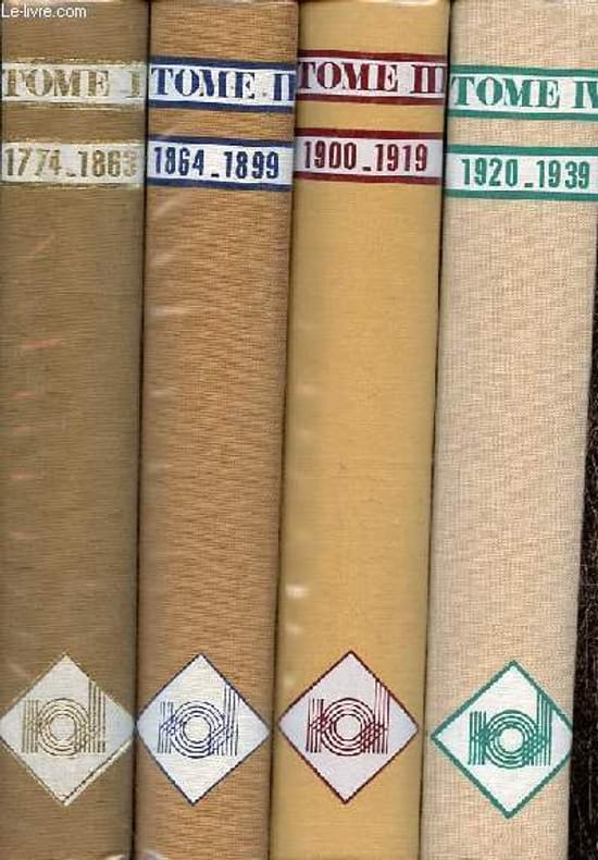
1978Best.-Nr. R100071956Noumea Diffusion. 1978. In-4. Relié toilé. Bon état, Couv. convenable, Dos satisfaisant, Intérieur frais. 466 pages + 506 pages + 501 pages + 521 pages + 549 pages + 451 pages - textes sur deux colonnes - nombreuses illustrations, photos, dessins, cartes en noir et blanc et en couleurs dans et hors texte - rodhoïd conservé - signet conservé - illustration en couleur/noir et blanc contre collée sur le 1er plat de chaque volume.. . . . Classification Dewey : 996-Autres régions du pacifique
1925512 pages. The third of seven reports which cover the survey and demarcation of the international boundary between Alaska and Canada and between the United States and Canada from the Atlantic Ocean to the Pacific Ocean, excepting that part of the boundary through the Great Lakes and the St. Lawrence River, which was surveyed and reported upon by the International Waterways Commission. Compiled in accordance with the provisions of Article III of the treaty between the United States and Great Britain, signed at Washington, April 11, 1908. Printed on high quality coated paper. Includes four colour fold-out maps, all of which are in excellent condition. Dozens of fascinating black and white photographs. Detailed Table of Contents, List of Illustrations, and Indeces. Clean, bright and unmarked. Very light wear. Binding tight. Bright gilt lettering upon green spine. Lettering upon front board significantly faded. Top and bottom corners of the last 60 pages bear minor moisture-induced undulations. Very nice copy. Please note: Sketches of the triangulation and precise traverse were printed under separate cover which is not included. Book
1903714 pages. Contents include: How Mrs. S.E. Waller's Pictures Have Been Painted; The Money Kings of the New World, by W.T. Stead; Dr. Niels Finsen and his remarkable discovery of healing rays - with wonderful photos; The Making of a Flume - with great photos; The Tame Fish of Logan; The New Khartoum - with many photos; The Floor of the Pacific, by The Hon. W.E. Meehan, Fish Commissioner of the State of Pennsylvania - with photos; The Money Kings of the Modern World II - The Rothschilds, by W.T. Stead - with several photos and illustrations; The Momentous Motor - great vintage technology article with photos; "Skin O' My Tooth" - Edited and Compiled by Baroness Orczy; Bird Babies; Strong Mac; The Making of a Mandolin - with photos; The Money Kings of the Modern World - Part III - Mr. J. P. (Pierpont) Morgan; Municipal Ambulance Work - with fantastic photos of horse-drawn ambulances; Baron Shibusawa of Japan - with great photos; The Game of Sticke - its evolution and progress; The Fiscal Policy of The Empire, by John Holt Schooling; Coalport Porcelain - the story of an ancient and famous industry; The Most Wonderful Map in the World - France, in Jasper, Set with Jems; Hints on Sea-Swimming - Mr. Montagu A. Holbein give advice, and suits the action to the world for photographic illustration; The Nelson Room at Trafalgar House; The Money Kings of the Modern World - Some European Potentates - M. Witte, Baron Hirsch, Alfred Nobel, Alfred Beit, Herr Krupp, M. Jean de Bloch; The Fiscal Policy of the Empire - Part II; A Painter of the Sea-Coast - Mr. Elmer Keene and his Art; Sir James Brooke - Rajah of Sarawak; Pictures in Postage Stamps - using old postage stamps to create art; Capturing A Sperm Whale - with awesome photos; plus many fictional stories. Backstrip all but detached. Front free endpaper and first several pages loose but present. Several other pages loose. Hinges open. Above-average wear. Reading copy only, but remains a very informative and enjoyable reference. Book
900Anchorages in the Galapagos Islands.In the left part of the chart insert of Wreck Bay and approaches From a British survey in 1849 with additions and corrections. In the middle of the chart insert of Iguana Cove From a British survey in 1836, Webb Cove From a British survey in 1886, James Bay From a British survey in 1836, Sulivan Bay From a British survey in 1836, Terrapin Road From a British survey in 1836, Freshwater Bay From a British survey in 1836, Conway Bay From a British survey in 1846, Wreck Bay to Stephens Bay From Italian surveys in 1882 and 1885. In the right part of the chart insert of Tagus Cove From a British survey in 1835, Gardner Bay From a British survey in 1835, Post Office Bay From British surveys in 1836 and 1846, Sappho Cove From a British survey in 1883, Black Beach Anchorage From a French survey in 1887. Washington D.C., published July, 1899, at the Hydrographic Office, under the authority of the Secretary of the Navy. Small corrections: Printed: Oct. 1926. Folded editorially. Autore: Admiralty Charts. Luogo: Galapagos Islands - Pacific Ocean. Anno: '900. Tecnica: incisione. Dimensioni: 639x1105 mm