6355 risultati
rif. 60409 ½ inches 24 cm. diameter; 21 inches 53 cm. total height. Single pedestal globe with horizon ring armature & meridian all of wood wear and staining on meridian at point where fits into stand some chipping at extremities else fine; globe with vibrant original color and clear sharp patina; some abrasion & losses mostly in lower and upper extremities; overall very good plus condition. An attractive very capably executed table or desk globe in the distinctive style of the Delamarche firm "the most successful French entrepreneurs in maps and globes" Dekker/ van der Krogt. This was an original work by the son Felix who succeeded his father in the management of the firm in 1817. The globe is geographically up-to-date notably in the South Pacific and Alaska with information from then recent Russian voyages such as Krusenstern's. Related to this at the time the globe appeared and reflected on it Europeans were beginning to differentiate between various regions of the Pacific. These were based on a better understanding of cultural and other differences between the peoples of various areas encountered on these recent voyages. For example in 1831 the French explorer Dumont d'Urville proposed the use of the terms "Micronesia" and "Melanesia" for various parts of the Pacific as distinguished from Polynesia. Printed dashed lines on this globe labeled "Division Oceanique" roughly approximate the three eventually accepted divisions of what is referred to as the South Pacific though the regions are not named on the globe. Delamarche also clearly identifies on the globe the more traditional divisions of the Pacific between "Grand Ocean Boreal" "Grand Ocean Equinoxial" and "Grand Ocean Austral." The Delamarche firm was the first to successfully reach a fairly sizable general market of globe buyers. It accomplished this by reducing the cost of constructing globe stands and other parts while maintaining a high level of quality in the maps of their globes which are cleanly and attractively engraved. Traditional brass meridians were replaced by wooden ones and the horizon rings and armatures supporting the rings were greatly simplified and made from either wood or stiff board. Also the firm generally used simpler single-pedestal stands rather than four-legged designs. Yet as this well-preserved example demonstrates Delamarche's design and materials proved to be very durable. Charles-Francois Delamarche 1740-1817 the founder of the family firm was the successor of the great map and globe-making family the Robert De Vaugondys as is cited in the title of this globe. Delamarche in fact seemed to have cornered the globe market in France by also incorporating the stocks of Jean Fortin and Jean Lattre. Delamarche's son Felix took over the firm upon his father's death and managed it until 1848 when Gosselin succeeded him. The firm continued well into the latter 19th century under yet another Delamarche descendent. Dekker/ Van der Krogt Globes from the Western World pp. 63 74; Dekker E. Globes at Greenwich pp. 321-25; Suarez T. Early Mapping of the Pacific p. 25.
rif. 60409 ½ inches 24 cm. diameter; 21 inches 53 cm. total height. Single pedestal globe with horizon ring armature & meridian all of wood wear and staining on meridian at point where fits into stand some chipping at extremities else fine; globe with vibrant original color and clear sharp patina; some abrasion & losses mostly in lower and upper extremities; overall very good plus condition. An attractive very capably executed table or desk globe in the distinctive style of the Delamarche firm "the most successful French entrepreneurs in maps and globes" Dekker/ van der Krogt. This was an original work by the son Felix who succeeded his father in the management of the firm in 1817. The globe is geographically up-to-date notably in the South Pacific and Alaska with information from then recent Russian voyages such as Krusenstern's. Related to this at the time the globe appeared and reflected on it Europeans were beginning to differentiate between various regions of the Pacific. These were based on a better understanding of cultural and other differences between the peoples of various areas encountered on these recent voyages. For example in 1831 the French explorer Dumont d'Urville proposed the use of the terms "Micronesia" and "Melanesia" for various parts of the Pacific as distinguished from Polynesia. Printed dashed lines on this globe labeled "Division Oceanique" roughly approximate the three eventually accepted divisions of what is referred to as the South Pacific though the regions are not named on the globe. Delamarche also clearly identifies on the globe the more traditional divisions of the Pacific between "Grand Ocean Boreal" "Grand Ocean Equinoxial" and "Grand Ocean Austral." The Delamarche firm was the first to successfully reach a fairly sizable general market of globe buyers. It accomplished this by reducing the cost of constructing globe stands and other parts while maintaining a high level of quality in the maps of their globes which are cleanly and attractively engraved. Traditional brass meridians were replaced by wooden ones and the horizon rings and armatures supporting the rings were greatly simplified and made from either wood or stiff board. Also the firm generally used simpler single-pedestal stands rather than four-legged designs. Yet as this well-preserved example demonstrates Delamarche's design and materials proved to be very durable. Charles-Francois Delamarche 1740-1817 the founder of the family firm was the successor of the great map and globe-making family the Robert De Vaugondys as is cited in the title of this globe. Delamarche in fact seemed to have cornered the globe market in France by also incorporating the stocks of Jean Fortin and Jean Lattre. Delamarche's son Felix took over the firm upon his father's death and managed it until 1848 when Gosselin succeeded him. The firm continued well into the latter 19th century under yet another Delamarche descendent. Dekker/ Van der Krogt Globes from the Western World pp. 63 74; Dekker E. Globes at Greenwich pp. 321-25; Suarez T. Early Mapping of the Pacific p. 25. books
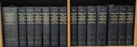
1861rif. 55725Washington DC: Beverley Tucker; A. O. P. Nicholson; George W. Bowman; Thomas H. Ford 1861. Mixed Senate and House editions. Leather bound. Very Good. Twelve volumes in thirteen books Volume twelve in two parts plus one thick volume with the following title in gilt on the spine: "Explorations and Surveys for a Railroad Route from the Mississippi River to the Pacific Ocean. General Report." Large quartos 30 cm Bound in modern black leather with the title stamped in gilt on the spines and blind-tooled embellishments on the spines and boards. "Senate" and "House" stamped in gilt at the head of the spines. "War Department" stamped at the foot. New endpapers. Spines of a couple volumes a bit faded. Sporadic foxing and toning throughout though a large majority of the color lithographs remain in excellent condition. Stitching periodically visible in the inside margins. Occasional moisture stains other light stains and darkening to the pages. Tide mark staining more frequent in volume VI and the General Report. Volumes VIII and XII Book 1 are ex-library with discreet markings. Volume XI with maps and plates is heavily foxed at the beginning mostly affecting the text. This volume contains Warren's great map. Many of the large maps and profiles are fragile and have many splits normally encountered in these kinds of sets. "General Map of Explanations and Surveys in California" in Volume XI completely detached from binding but present. With 665 illustrated plates 64 maps/sections/profiles and 15 diagrams. Collation Notes: Volume II: 12 scenic plates one nearly detached; 20 botanical plates; 4 geological plates; 1 large folding map; 1 large folding geological section. Volume III: 12 scenic plates; 7 diagrams; 8 Native American plates missing illustration titled "Pictographs at Yampais Spring"; 3 geological plates; 2 folding sections and 1 folding map at the rear. Not present in this volume: "General Map from Fort Smith to Rio Del Norte" "General Map from Rio del Norte to the Pacific Ocean" and "Profile of a route for the Pacific Railroad from Fort Smith to Martinez." Volume IV: 1 large folding botanical plate with explanation of signs; 24 plates related to Cacti; 25 other botany plates; 10 plates devoted to Mosses and Liverworts. Volume V: 12 views; 4 maps; 14 sections; 13 views missing plate XII- "Mirage on the Colorado Desert"; 11 fossil and shell plates missing plate X; 28 botany plates. Volume VI: 13 General Report plates; 5 geology plates; 14 botany plates missing Plate I- "Quercus Hindsii"; missing plate X- "Juniperus occidentalis"; 11 fish plates; 3 mammal plates; 2 bird plates. Volume VII: 8 scenic plates; 10 paleontological plates; 14 geological plates; 2 fold-out maps; 8 botanical plates; 11 meteorological plates. Volume VIII: 20 mammal plates plates XVII-LX. Volume X: 33 reptile plates missing plate VI- "Dipsosaurus dorsalis Hallow & Sceloporus biseriatus Hallow"; reptile plate II mislabeled as III; 51 fish plates; 9 mammal plates plate XI- "Sciurus fremonti Towns" mislabeled as plate VI; plate VIII- "Lepus audubonii Baird" mislabeled XIII; 28 bird plates. Volume XI: 4 map plates; 13 sketches of Route of Forty-First Parallel- Beckwith's Report Vol. II; Warren Map plus 31 maps and profiles. Volume XII Book I: 70 lithographs. Volume XII Book II: 6 botany plates; 2 insect plates; 5 mammal plates missing plate VIII- "Texas Mouse etc."; 8 bird plates; 10 reptile plates; 21 fish plates. Some fish plates that are listed in Volume XII Book II as being present in Volume X appear to be absent LXXVI XXVb XXV XXVI LXX LXXV. General Report: 8 diagrams; 3 large folding maps/profiles at rear one with tape repairs- "Milk R. to the Crossing of the Columbia R."; 120 illustrated plates lacking "View of Fort Smith" and "Pictographs at Yampais Spring". No general title page. A mixed Senate and House set in attractive modern leather bindings. The quarto edition of the Pacific Railroad Reports first appeared in 1855 and concluded in 1861 with volume XII. The Surveys aimed at determining the best route for a transcontinental railroad. It embodied the most comprehensive information source on the American West in the mid-19th century. Numerous illustrators engravers lithographers cartographers and printing firms contributed to the publication. This monumental work is rarely found in such nice condition. ".it was the best cartographical work on the West up to its time." - Wright Howes. ".these volumes contain a monumental collection of scientific information geographical zoological botanical geological of the still mysterious American West." - Henry Wagner. Howes P3. Moffat 3536 & 49. Wagner/Camp 262-267 pp. 468-507. Beverley Tucker; A. O. P. Nicholson; George W. Bowman; Thomas H. Ford unknown
1861rif. 55725Washington DC: Beverley Tucker; A. O. P. Nicholson; George W. Bowman; Thomas H. Ford 1861. Mixed Senate and House editions. Leather bound. Very Good. Twelve volumes in thirteen books Volume twelve in two parts plus one thick volume with the following title in gilt on the spine: "Explorations and Surveys for a Railroad Route from the Mississippi River to the Pacific Ocean. General Report." Large quartos 30 cm Bound in modern black leather with the title stamped in gilt on the spines and blind-tooled embellishments on the spines and boards. "Senate" and "House" stamped in gilt at the head of the spines. "War Department" stamped at the foot. New endpapers. Spines of a couple volumes a bit faded. Sporadic foxing and toning throughout though a large majority of the color lithographs remain in excellent condition. Stitching periodically visible in the inside margins. Occasional moisture stains other light stains and darkening to the pages. Tide mark staining more frequent in volume VI and the General Report. Volumes VIII and XII Book 1 are ex-library with discreet markings. Volume XI with maps and plates is heavily foxed at the beginning mostly affecting the text. This volume contains Warren's great map. Many of the large maps and profiles are fragile and have many splits normally encountered in these kinds of sets. "General Map of Explanations and Surveys in California" in Volume XI completely detached from binding but present. With 665 illustrated plates 64 maps/sections/profiles and 15 diagrams. Collation Notes: Volume II: 12 scenic plates one nearly detached; 20 botanical plates; 4 geological plates; 1 large folding map; 1 large folding geological section. Volume III: 12 scenic plates; 7 diagrams; 8 Native American plates missing illustration titled "Pictographs at Yampais Spring"; 3 geological plates; 2 folding sections and 1 folding map at the rear. Not present in this volume: "General Map from Fort Smith to Rio Del Norte" "General Map from Rio del Norte to the Pacific Ocean" and "Profile of a route for the Pacific Railroad from Fort Smith to Martinez." Volume IV: 1 large folding botanical plate with explanation of signs; 24 plates related to Cacti; 25 other botany plates; 10 plates devoted to Mosses and Liverworts. Volume V: 12 views; 4 maps; 14 sections; 13 views missing plate XII- "Mirage on the Colorado Desert"; 11 fossil and shell plates missing plate X; 28 botany plates. Volume VI: 13 General Report plates; 5 geology plates; 14 botany plates missing Plate I- "Quercus Hindsii"; missing plate X- "Juniperus occidentalis"; 11 fish plates; 3 mammal plates; 2 bird plates. Volume VII: 8 scenic plates; 10 paleontological plates; 14 geological plates; 2 fold-out maps; 8 botanical plates; 11 meteorological plates. Volume VIII: 20 mammal plates plates XVII-LX. Volume X: 33 reptile plates missing plate VI- "Dipsosaurus dorsalis Hallow & Sceloporus biseriatus Hallow"; reptile plate II mislabeled as III; 51 fish plates; 9 mammal plates plate XI- "Sciurus fremonti Towns" mislabeled as plate VI; plate VIII- "Lepus audubonii Baird" mislabeled XIII; 28 bird plates. Volume XI: 4 map plates; 13 sketches of Route of Forty-First Parallel- Beckwith's Report Vol. II; Warren Map plus 31 maps and profiles. Volume XII Book I: 70 lithographs. Volume XII Book II: 6 botany plates; 2 insect plates; 5 mammal plates missing plate VIII- "Texas Mouse etc."; 8 bird plates; 10 reptile plates; 21 fish plates. Some fish plates that are listed in Volume XII Book II as being present in Volume X appear to be absent LXXVI XXVb XXV XXVI LXX LXXV. General Report: 8 diagrams; 3 large folding maps/profiles at rear one with tape repairs- "Milk R. to the Crossing of the Columbia R."; 120 illustrated plates lacking "View of Fort Smith" and "Pictographs at Yampais Spring". No general title page. A mixed Senate and House set in attractive modern leather bindings. The quarto edition of the Pacific Railroad Reports first appeared in 1855 and concluded in 1861 with volume XII. The Surveys aimed at determining the best route for a transcontinental railroad. It embodied the most comprehensive information source on the American West in the mid-19th century. Numerous illustrators engravers lithographers cartographers and printing firms contributed to the publication. This monumental work is rarely found in such nice condition. ".it was the best cartographical work on the West up to its time." - Wright Howes. ".these volumes contain a monumental collection of scientific information geographical zoological botanical geological of the still mysterious American West." - Henry Wagner. Howes P3. Moffat 3536 & 49. Wagner/Camp 262-267 pp. 468-507. Beverley Tucker; A. O. P. Nicholson; George W. Bowman; Thomas H. Ford unknown books
2007rif. N4333Belin, 2007, 288 p.