Multiple ContributorsMareMagnum

7 051 résultats
1903714 pages. Contents include: How Mrs. S.E. Waller's Pictures Have Been Painted; The Money Kings of the New World, by W.T. Stead; Dr. Niels Finsen and his remarkable discovery of healing rays - with wonderful photos; The Making of a Flume - with great photos; The Tame Fish of Logan; The New Khartoum - with many photos; The Floor of the Pacific, by The Hon. W.E. Meehan, Fish Commissioner of the State of Pennsylvania - with photos; The Money Kings of the Modern World II - The Rothschilds, by W.T. Stead - with several photos and illustrations; The Momentous Motor - great vintage technology article with photos; "Skin O' My Tooth" - Edited and Compiled by Baroness Orczy; Bird Babies; Strong Mac; The Making of a Mandolin - with photos; The Money Kings of the Modern World - Part III - Mr. J. P. (Pierpont) Morgan; Municipal Ambulance Work - with fantastic photos of horse-drawn ambulances; Baron Shibusawa of Japan - with great photos; The Game of Sticke - its evolution and progress; The Fiscal Policy of The Empire, by John Holt Schooling; Coalport Porcelain - the story of an ancient and famous industry; The Most Wonderful Map in the World - France, in Jasper, Set with Jems; Hints on Sea-Swimming - Mr. Montagu A. Holbein give advice, and suits the action to the world for photographic illustration; The Nelson Room at Trafalgar House; The Money Kings of the Modern World - Some European Potentates - M. Witte, Baron Hirsch, Alfred Nobel, Alfred Beit, Herr Krupp, M. Jean de Bloch; The Fiscal Policy of the Empire - Part II; A Painter of the Sea-Coast - Mr. Elmer Keene and his Art; Sir James Brooke - Rajah of Sarawak; Pictures in Postage Stamps - using old postage stamps to create art; Capturing A Sperm Whale - with awesome photos; plus many fictional stories. Backstrip all but detached. Front free endpaper and first several pages loose but present. Several other pages loose. Hinges open. Above-average wear. Reading copy only, but remains a very informative and enjoyable reference. Book
900Anchorages in the Galapagos Islands.In the left part of the chart insert of Wreck Bay and approaches From a British survey in 1849 with additions and corrections. In the middle of the chart insert of Iguana Cove From a British survey in 1836, Webb Cove From a British survey in 1886, James Bay From a British survey in 1836, Sulivan Bay From a British survey in 1836, Terrapin Road From a British survey in 1836, Freshwater Bay From a British survey in 1836, Conway Bay From a British survey in 1846, Wreck Bay to Stephens Bay From Italian surveys in 1882 and 1885. In the right part of the chart insert of Tagus Cove From a British survey in 1835, Gardner Bay From a British survey in 1835, Post Office Bay From British surveys in 1836 and 1846, Sappho Cove From a British survey in 1883, Black Beach Anchorage From a French survey in 1887. Washington D.C., published July, 1899, at the Hydrographic Office, under the authority of the Secretary of the Navy. Small corrections: Printed: Oct. 1926. Folded editorially. Autore: Admiralty Charts. Luogo: Galapagos Islands - Pacific Ocean. Anno: '900. Tecnica: incisione. Dimensioni: 639x1105 mm
1911Wonderful vintage brochure in brown decorated card covers. Measures 23 cm x 10.5 cm when closed. Opens to reveal six large double-side leaves, each measuring 30.5 cm x 23 cm when folded-out. Includes twenty-three black and white reproductions of photos plus a map, all supported by considerable text. Rates for cottages and tents provided inside back cover. A plaque located near the former site of the inn states it closed in 1928 and burned down in 1936. It was purchased in 1910, a year before this brochure was printed, by Toronto feminist Flora MacDonald Denison who, inspired by the philosophy of Walt Whitman, set out to build a wilderness retreat for the avant-garde. Guests were offered painting lessons, amateur theatre, and poetry readings. Many well-known Canadian artists, including members of the Group of Seven, painted and sketched in this area, drawn by the strking landscape. Moderate wear. Unmarked. Binding intact. A marvelous piece of Canadiana. Book
197060 pages. Many reproductions of wonderful archival black and white photos. Features include: The Patrick Family Legend; The First Game; The First Year; The First Stanley Cup; The Second Stanley Cup; The Great Denman Fire; Fred (Cyclone) Taylor; The Life and Times of Coley Hall; The Glorious Smokies; The Brat Called Pistol - Eddie Dorohoy; The Rollicking, Raggedy Vees; The Spirit of the Canucks; The Drillers of Kimberley; The Heart of Fred J. Hume; The Life and Laughs of Babe Pratt; The Palace by the Sea - Pacific Coliseum; The Anatomy of a Franchise; and more. One page CKNW 98 ad highlights play-by-play man Jim Robson. Molson ad features photos of their 1969-70 hockey scholarship winners including: John Cumberbirth, Bob Gaston, Pat Russell, Keith, Nordin, Richard Beauchamp, Daryl Fedorak, Brian Debiasio, Brenk Kaufmann, Robert Little, George Walton and Don Young. One-page pricelist of Canucks merchandise. Printed upon glossy stock. Clean and unmarked with moderate wear. A sound copy of this very informative, nostalgic and uncommon work from the year the Canucks entered the NHL. Book
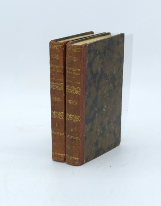
réf. 52383Belin.1783.In-8 reliure d'époque.376 p.Gravure en frontispice de la mort de Cook.Carte absente.Etat correct.
1851Una mappa dettagliata centrata sull'Oceania. Basata sui dati della spedizione di Dumont d'Urville.Litografia, in buono stato di conservazione. A detailed map centred on Oceania. From the expedition of Dumont d'Urville.Good and dark impression.
1854réf. 2457Paris ; Niort, Allouard et Kaeppelin ; Robin, [1854]. In-8 de (6)-368-(2) pp., toile verte, décor à froid sur les plats, tranches dorées (reliure de l'époque).
1911Features: Are the Hill Lines Preparing to Invade California Territory?; Big Railway Systems of U.S. Cutting Expenses; Prepare for the Panama Canal! (Editorial); Nautical biography of Capt. James S. Gibson (with photo); What Should We Do To Be Prepared For the Opening of the Panama Canal?; Salvage of Steamer Spokane is Praised by Marine Experts - article with photo; Portland to have powerful fireboat; Review of Marine Insurance and Shipping Law; New Collier Neptune Takes on 13,000 tons of coal in One Day - article with photo; Floating Gridiron for Scows designed by George Francis Fay is built by the Drummond Lighterage Co. - feature article with two photos and three diagrams; News of Tacoma; Casualties to Pacific Coast Shipping; Largest scow on the Pacific Coast built by Nelson & Kelez of Seattle - brief article with photo; and more. 44 pages including several pages of nostalgic ads, some illustrated in black and white, featuring local marine and rail interests. Printed upon glossy coated stock. Average wear. Binding intact. Few library markings to front cover. A well-preserved copy of this highly-informative memento of Pacific Northwest transportation over a century ago. 12" x 9". Magazine
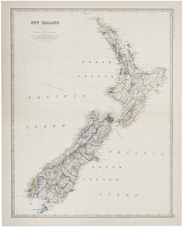
1884réf. LBW-509Edinburgh, 1884. 571 x 441 mm.
1911Features: Julius Kruttschnitt of the Harriman Lines Claims Railroads and Labor Friendly; Great Northern Finances for Fiscal Year; Steel Bridge Across Chehalis River at Aberdeen to Open 23 September; Rapid Work on Argo Terminals; Innovation of Ticket Cases - article with photo of modern ticket case; Final Bursting of Controller Bay Bubble (editorial about Alaskan nautical dangers); Business Profile of Kenneth C. Kerr, Industrial Agent of the Alaska Steamship Company (with photo); Improper Packing Causes Great Loss; Record Freight Train runs from Altoona to Enola, PA; Many Abandoned Railways in U.S.; Free Baggage Allowances in Various States and Countries; The World's Wheat Crop; Bernard N. Baker Outlines Plans of Atlantic and Pacific Transportation Co.; General H.M. Chittenden Makes Statement for Seattle Port Commission; What the (New) Port Commission May Do for Seattle; The Proposed West Point Immigration Station - article with map showing location of the proposed station and the proposed West Point Waterway Improvement as planned by Virgil Bogue; Review of Marine Insurance and Shipping Law; Empress of China Crew Exonerated; Decision in Princess May Stranding; Marine Decisions; Diagrams illustrating work to soon begin on Pier 1, owned by the Northern Pacific Railway Company; Casualties to Pacific Coast Shipping; The San Pedro - New C.P.R. Steamer for Trans-Pacific Service - article with illustration; and more. 44 pages including several pages of nostalgic ads, some illustrated in black and white, featuring local marine and rail interests. Printed upon glossy coated stock. Average wear. Binding intact. Few library markings to front cover. A well-preserved copy of this highly-informative memento of Pacific Northwest transportation over a century ago. 12" x 9". Magazine
1857Bella carta dell'Australia di Benedetto Marzolla, che elenca le sue fonti cartografiche e fornisce informazioni politiche e statistiche sulle aree coperte. La carta è inserita nell’ Atlante geografico. Corredato di notizie relative alla geografia fisica politica, ed in generale alla statistica delle varie regioni del Globo. Compilato ed eseguito in litografia per cura e sotto la direzione di Benedetto Marzolla edito a Napoli nel 1856. Marzolla, autore di importanti atlanti sulle provincie del Regno di Napoli, è anche autore di diverse carte sulle Circoscrizioni Ecclesiastiche nel Regno delle Due Sicilie, pubblicate postume, nello stesso anno della morte (1858) a Napoli nello Stabilimento Geografico diretto da Luigi Manzella. Benedetto Marzolla fu disegnatore topografo e litografo; geografo e cartografo; membro della Commissione di statistica presso il Ministero dell'Interno. Personaggio di grandissimo rilievo nella cartografia napoletana ed italiana del XIX secolo, Marzolla ottenne in vita pubblici riconoscimenti ed attestati per la produzione cartografica di altissima qualità. La sua notorietà si è lentamente dissolta dopo la morte; va tuttavia osservato che solo la mancanza di uno spiccato coinvolgimento politico in senso risorgimentale e di una valenza letteraria nella sua opera non lo hanno reso famoso come i contemporanei Francesco Costantino Marmocchi (1805-1858) e Attilio Zuccagni-Orlandini (1783-1872), con i quali può certamente confrontarsi. I progetti culturali didattici e editoriali di Marzolla furono e rimangono di straordinaria modernità; egli inventò, è il caso di dire, un nuovo modo di intendere e di disegnare la carta geografica, fornendo una visione assolutamente originale della comunicazione dei dati geografici attraverso la combinazione di testo e immagine. Con tale operazione, egli riuscì a fondere in un'unica opera, storia, geografia, economia, statistica e cartografia, raggiungendo un equilibrio grafico di rara efficacia (cfr. V. Valerio, Benedetto Marzolla Brindisino, Geografo e Cartografo dell'800 Europeo, Brindisi 2008). Bell’esemplare con coloritura coeva dei contorni, in ottimo stato di conservazione. Bibliografia V. Valerio, Benedetto Marzolla Brindisino, Geografo e Cartografo dell’800 Europeo (2008). Attractive map of Australia by Benedetto Marzolla, listing his cartographic sources and giving political and statistical information on the areas covered. Map taken from the Atlante geografico. Corredato di notizie relative alla geografia fisica politica, ed in generale alla statistica delle varie regioni del Globo. Compilato ed eseguito in litografia per cura e sotto la direzione di Benedetto Marzolla published in Naples in 1856. Marzolla, author of important atlases on the provinces of the Kingdom of Naples, is also the author of several maps on the Ecclesiastical Circumscriptions in the Kingdom of the Two Sicilies, published posthumously in the same year of his death (1858) in Naples in the Stabilimento Geografico directed by Luigi Manzella. Benedetto Marzolla was draftsman topographer and lithographer, geographer and cartographer. Personality of great importance in the Neapolitan and Italian cartography of the nineteenth century, Marzolla obtained during his life public recognition and certificates for the production of high-quality cartography. His notoriety slowly faded after his death; it should be noted, however, that only the lack of a strong political involvement in the sense of the Risorgimento and of a literary value in his work did not make him as famous as his contemporaries Francesco Costantino Marmocchi (1805-1858) and Attilio Zuccagni-Orlandini (1783-1872), with whom he can certainly compare himself. Marzolla's cultural, didactic and editorial projects were, and remain, extraordinarily modern; he invented a new way of understanding and drawing maps, providing an absolutely original vision of the communication of geographical data through the combination of text and image. With this operation, he was able to merge in a single work, history, geography, economics, statistics and cartography, achieving a graphic balance of rare effectiveness. Benedetto Marzolla is famous for being among the most important cartographers of the XIX century, for being the one to print geographic maps using high quality lithographies.His Atlante Geografico, made of 58 maps, presents finely sketched works. Six maps depict North America, among them famous map of gold diggers in California, deriving from Hippolite Ferry. Extremely relevant are also the maps of Antarctic, South Africa with the plan of Cape Town and those about Australia.Though the maps are dated between 1843 and 1856, this 1858 edition, printed in Naples at the Stabilimento Geografico Strada San Carlo (founded by Marzolla himself), represents the final version of his atlas, the last one before his death. A posthumous edition will be published in 1865.The atlas is pretty rare, is not actually listed in Phillips, British Library e OCLC. Beautiful specimen with contemporary outline coloring, in excellent condition. Bibliografia V. Valerio, Benedetto Marzolla Brindisino, Geografo e Cartografo dell’800 Europeo (2008).
1834réf. 2587Paris, Imp. de Cosson, 1834. In-8 de VIII-318 pp., demi-veau brun, dos orné à nerfs, pièce de titre en veau noir (reliure de l'époque).
2008In-4 p., 5 voll., cartonato editoriale figurato a colori, pp. 758; 848; 665; 676; 628; con complessive 1600 tavv. a colori. Uno degli studi più completi ed esaustivi sui molluschi marini indo-pacifici. Complessivamente la fauna filippina conta, ad oggi, 5835 specie identificate e documentate, appartenenti a 297 famiglie diverse. L’opera, così suddivisa: “Gastropoda. Part 1 - Gastropoda. Part 2 - Gastropoda. Part 3 & Bivalvia, Part 1 - Bivalvia. Part 2 / Scaphopoda, Polyplacophora, Cephalopoda & Addenda - New records, completing the volumes I to IV”. Allo stato di nuovo.
1835réf. PHO-1525Paris, chez Bellizard, Barthés, Dufour et Lowell ,1835, 2 volumes in-8, lxi-1fnch-456pp., 2ffnch-544pp., relié demi basane époque, dos lisse avec auteur et titre, tranches jaunes, petits frottements, coins usés, petites rousseurs carte et portrait.
1913réf. 63071Seattle WA: Seattle Union Record 1913. Folio. 9 x 12 in. 132 pp. With photo illustrations text illustrations illustrated ads throughout. Colour-illustrated softcovers cover art of miner holding pick-axe w/ Seattle waterfront in the background in tan & blue Rainier Beer advertisement on back cover minor chipping head & foot of spine dustsoiling & soiling front cover minor bumping to corners still a G copy. First edition of this scarce and important supplement issued in conjunction with the 33rd Annual Convention for the AFL composed of craft unions for cigar makers garment workers carpenters electricians and others. They also served as the umbrella union for the United Mine Workers of America and at the time were supporting the Coal strike in Colorado as well as the Michigan Copper strike organized by the Western Federation of miners. Union locals such as the Brewery Workers Women Waitresses Women Garment Workers the women’s Union Card & Label League and others include sections on their histories labor organizing and philanthropic efforts. Worldcat locates 5 copies NYPL Bancroft Seattle Public U of W U of MI Seattle Union Record, paperback
1907réf. 53081St. Louis: Sam'l F. Myerson Prtg. Co. n.d. ca 1907. ca 1907. 8 3/4" x 5" in colorful pictorial wrappers. 52pp. Map. Black and white illustrations throughout. Information on preparing for a trip to Mexico followed by information and photographs of what might expect to see and experience along the way from St. Louis to Mexico City. Photographs and information on Topo Chico Monterrey Saltillo Cedral Bocas San Luis Potosi Tampico Queretaro Patzcuaro Chapultepec the Viga Canal Mexico City bullfights ancient pyramids etc. A wonderful collection of photographs taken by S.W. Matteson C.W. Archer and C.B. Waite. Fold-out map 14 1/2" x 8 3/4" showing system route from St. Louis to Mexico City inside rear wrapper. Covers and title page lightly soiled. Crease at top corner of front wrapper and with 1/2" closed tear along with scuffing and rubbing to both wrappers and to spine. Very good. A very nicely produced booklet. Sam'l F. Myerson Prtg., Co., n.d. [ca 1907]. unknown
1911réf. 100851Souvenir pamphlet 8vo colored printed pictorial wrappers illustrated 16 pp. Folded and creased down the middle with a little wear at the fold some minor rubbing to wrappers normal aging; otherwise very good. This is a scarce piece of ephemera commemorating the 1911 groundbreaking ceremony by President William H. Taft for the exhibition in the Golden Gate Park. While the purpose of the exhibition was to celebrate the completion of the Panama Canal it seemed to function more as a worlds fair held in San Francisco. It took over three years to construct and the exhibition ran from February through December 1915. There are a number of black and white photographs in the booklet including a double page panoramic view of the city of San Francisco. The activities of the ceremony are recorded in this pamphlet which feature speakers songs marches and what they had for dinner Blair-Murdock Co.,
1911réf. 100851Souvenir pamphlet 8vo colored printed pictorial wrappers illustrated 16 pp. Folded and creased down the middle with a little wear at the fold some minor rubbing to wrappers normal aging; otherwise very good. This is a scarce piece of ephemera commemorating the 1911 groundbreaking ceremony by President William H. Taft for the exhibition in the Golden Gate Park. While the purpose of the exhibition was to celebrate the completion of the Panama Canal it seemed to function more as a worlds fair held in San Francisco. It took over three years to construct and the exhibition ran from February through December 1915. There are a number of black and white photographs in the booklet including a double page panoramic view of the city of San Francisco. The activities of the ceremony are recorded in this pamphlet which feature speakers songs marches and what they had for dinner Blair-Murdock Co., books
1884réf. 23845New York. 1884. Annual stockholder's report for the famous western railway. With detailed financial statement and other statistics relative to western lands etc. Total surplus earnings for 1883 topped $12700000. The handsome and quite large folding map of the United States west of the Mississippi shows the Union Pacific Route and its connections. Original printed wrappers. Wrappers a bit soiled and worn front wrapper wrinkled with small closed tears titlepage soiled. Still very good. unknown
1884réf. 23845New York. 1884. Annual stockholder's report for the famous western railway. With detailed financial statement and other statistics relative to western lands etc. Total surplus earnings for 1883 topped $12700000. The handsome and quite large folding map of the United States west of the Mississippi shows the Union Pacific Route and its connections. Original printed wrappers. Wrappers a bit soiled and worn front wrapper wrinkled with small closed tears titlepage soiled. Still very good. unknown books
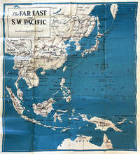
1940réf. 64220N.P. Washington D.C.: N.P. Prepared and distributed by Army Orientation Course Special Service Division ca. 1940. One double-atlas folio colour map sized 38 x 41.75 in. colour lithograph on thick paper stock fold creases as issued minor age toning some minor edgewear slight weakening to fold creases at corners still a VG bright copy. First edition thus of this nicely executed map issued possibly printed by the Army Service Forces Orientation map series sometime during the Second Sino-Japanese War and possibly just prior to U.S. entry into World War II indicating much of the Pacific was still dominated by the Japanese Empire - Taiwan with Formosa Seoul Korea still indicated as Keijo Chosen as well as Port Arthur still indicated as Ryojun now Lushun China. The map features latitude and longitude lines but no coordinates with the Northeastern corner depicting the Aleutian Islands of Attu and Agattu Northwestern Corner Nepal & Tibet Southwestern corner ocean and Java & Sumatra while the Southeastern corner caputres the Coral Sea and tip of Australia coloured blue with white and brown. This has some similarities to the “waterproof” maps issued. No legend or printing information supplied. Worldcat locates 1 copy U of MT Mansfield Library also copy located at NIOD Instituut voor Oorlogs- Holocaust- en Genocidestudies Netherlands No. 6101. N.P., Prepared and distributed by Army Orientation Course, Special Service Division?, unknown
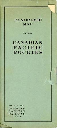
1924réf. 53471N. P.: Privately printed 1924. 1924. A lovely color pictorial map 17" x 45.5" folding to 8.5" x 4" and showing the route of the Canadian Pacific from Calgary and Macleod in the east to Vancouver and Seattle in the west as well as several shorter branch lines. Map has a split at one fold but is otherwise in fine condition. Over-sized folder has chips and tears. Includes excellent detail of topography with different mountain ranges identified and names and elevations given for many individual peaks. Parks are also identified as are numerous small towns. Steamer lines are shown in Kootenay Lake Arrow Lake Okanagan Lake and the Straits of Georgia and Juan de Fuca. There is a table of distances at the lower right and an inset map of the coastline from Seattle to Skagway Alaska. Privately printed, 1924. unknown
réf. 05180094Good. Covers show light surface and moderate corner wear. Edges of text block and endpapers toned; text appears clean otherwise. unknown
réf. 56-0237San Francisco Calif.: Southern Pacific Company 1947 revised 1949. Map. Blueline print 35" x 78" with multicolor lines indicating switching zones. Map from San Francisco Bay to San Leandro and north Berkeley to Alameda and Oakland airport. Index of Industries with approx. 600 entries. Scale 1" = 1000'. San Francisco, Calif.: Southern Pacific Company, 1947, revised 1949. unknown
réf. 56-0330San Francisco Calif.: Southern Pacific Company 1950. Map. Blueline print 42" x 73" with extensive red purple orange and green pencilling indicating structures zones yard limits track lines and crossings. From French Camp to Calaveras River and San Joaquin River to US 99/Manteca Road. Includes Index to Industries wiith approx 250 listings. Scale 1" = 800'. with insert showing Rough and Ready Island scale 1" = 2000'. San Francisco, Calif.: Southern Pacific Company, 1950. unknown