7 051 résultats
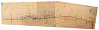
réf. 51-0841Sacramento Division: 1937. Original blueprint dated Nov. 1937. 24 x 55 inches. Scale 1"=100'. Detailed plan of the buildings. Sacramento Division: 1937. unknown
réf. 56-0462San Francisco Calif.: Southern Pacific Company 1953 rev. 1960. Blueline print 24" x 66". From intersection of railroad tracks with State Highway 74 to approx 1 1/4 miles northwest. Few buildings plan primarily indicates track measurements and signals. With Engine House private road crossing. Scale 1" = 100'. San Francisco, Calif.: Southern Pacific Company, 1953, rev. 1960. unknown
réf. 51-0843Sacramento Division: Updated to 1961. Original blueprint dated 1961. 15 x 55 inches. Shows all the tracks and plat plans all throughout Woodland to Sugarfield with the mail line to Portland. Annotated in red by hand. Scale 1"=100'. Very useful for Phase 1 EIRs. Sacramento Division: Updated to 1961. unknown
1892réf. 0008437Chicago: Rand McNally 1892. First edition. Hardcover. Very Good. 12mo 226 pages original brown cloth bright gilt rehinged "Spears favors his readers with an intimate word-picture of Death Valley as it appeared in 1891. . It is noted for its early photographs in almost the same degree as for its textual content. It is conceivable that these may be the first pictures ever published - perhaps ever taken - of the Death Valley region. Maximum importance attaches to them - Edwards ENDURING DESERT p.227." Howes S821; Cowan p.604; Graff 3926; not in Soliday; Paher 1844. With a map of the Borax Fields and 56 photographic illustrations per Contents pages. Rand McNally hardcover
1946réf. 77869Washington DC: U. S. Government Printing Office 1946. Presumed First Edition First printing thus. Hardcover. Good. Volume I xv 1 1-286 pages. Volume II 287-576 pages. 2 volumes. Illustrations including fold-outs. Maps. Tables. Index. Cover has wear and lettering has fading. Corners bumped. The United States Strategic Bombing Survey was a written report created by a board of experts assembled to produce an impartial assessment of the effects of Anglo-American strategic bombing of Nazi Germany during the European theater of World War II. After publishing its report the Survey members then turned their attention to the efforts against Imperial Japan during the Pacific War including a separate section on the recent use of the atomic bombs. In total the reports contained 208 volumes for Europe and another 108 for the Pacific comprising thousands of pages. The reports' called strategic bombing "decisive". This is designated OPNAV-P-03-100. It includes lists of Interrogations arranged numerically and by subject matter. It has an index of major battles operations and Japanese officials It includes in volume II Japanese notes of battles and brief biographies of Interrogated Japanese Officials. The interrogations were conducted in Tokyo during the final months of 1945. The purpose of the interrogations was to gain evidence for an assessment of the role of airpower in the war with Japan. Permission was obtained from General MacArthur to retain a nucleus of experienced officers at the Naval War College at Hiyoshi. In addition to being interrogated on their particular specialties and experiences these officers performed research at the direction of the Naval Analysis Division and together with the Japanese Naval Liaison Officer gave useful assistance in identifying and procuring other officers for interrogation. U. S. Government Printing Office hardcover
réf. DADAX0803951132New unknown
19614to., First Edition, text entirely in Japanese, skeleton picture captions in English, with very numerous photographs and illustrations throughout; original blue boards, blue cloth back, upper board lettered in gilt in English, backstrip lettered in gilt in Japanese, brown silk marker, a near fine copy in unclipped dustwrapper, the whole housed in the publisher's original card slip-case, the case mildly worn and frayed at extremities. A PRESENTATION COPY FROM THE AUTHOR TO ANTHONY PAVIA WITH THE FORMER'S SIGNED HOLOGRAPH INSCRIPTION ON FRONT FREE ENDPAPER. With the publisher's separately printed slip giving the context of the work, and the original bilingual price slip. The publisher's note makes it clear that this work, although the first to appear in print, was conceived as the third volume of a projected three-volume series 'Survey on the Japanese Naval Vessels 1925-1947'. It seems unlikely, however, that any further volumes were published and that this volume therefore stands alone; CERTAINLY IT CONSTITUTES THE FINEST PUBLISHED COLLECTION OF PHOTOGRAPHS OF ITS TYPE. Constructor Lieutenant-Commander Shizuo Fukui (1913-1993), Imperial Japanese Navy, was one of the world's foremost experts on ship design and naval construction. He was the author of some fourteen books and numerous magazine articles, which form collectively the definitive photographic record of the IJN. His wartime appointments ranged from the HQ of the Combined Fleet to the Navy Technical Institute; he ended his service career as Chief Officer and Director of Naval Construction at one of the major naval shipyards. After the war he devoted himself to historical research and made a lifelong contribution to the preservation of the records of ships of the Imperial Navy. His private library eventually contained over 20,000 photos, most of them unique, of which the great majority remains unpublished. Anthony Pavia was the owner of an archive of related photographs which it is believed found a home in the UK after Pavia's death. We are indebted to Mr. Robin Bursell for the information on Anthony Pavia. SIGNED COPIES OF ANY WORK BY FUKUI ARE RARE.
réf. DADAX0879059885New unknown
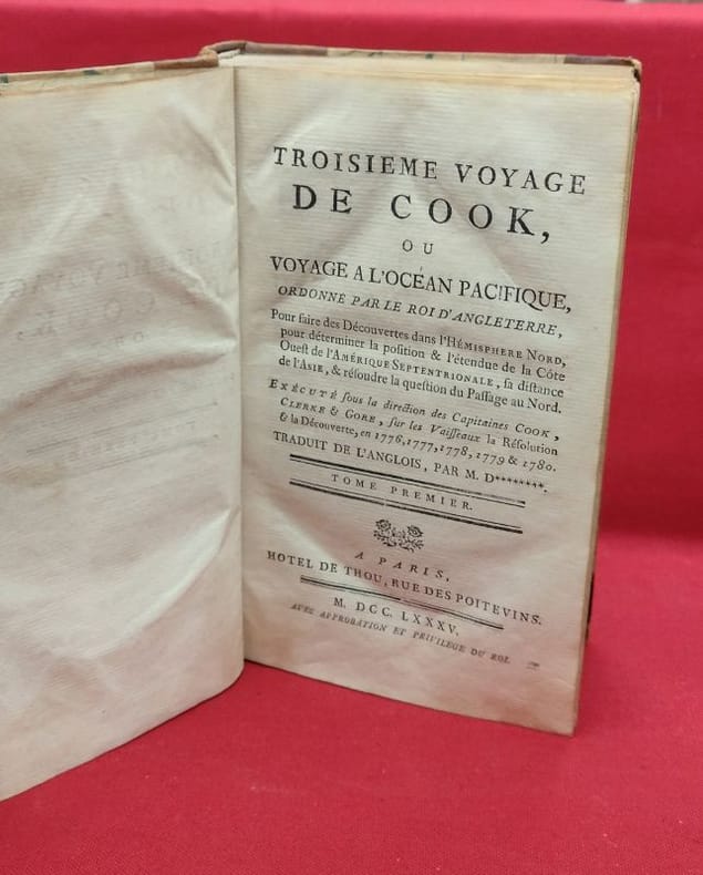
1785réf. 118723paris thou 1785 4 A Paris, Hotel de Thou, 1785, 4 volumes in-8, 512 - 512 - 592 - 584, 111 pages, contient les 2 tableaux dépliants et les appendices, sans l'atlas de planches.Demi reliure à coins, dos longs portant titres et tomaisons dorés sur pièce de cuir respectivement orangé et vert, tranches mouchetées, gardes blanches. Reliures usées mais solides (cuir épidermé, coins frottés, mors interne en partie apparent), nombreuse erreurs de pagination, sans manque, un cahier du tome I dont les pages ne sont imprimées que sur une face du feuillet (sans manque) intérieur frais, bon état général.
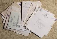
1946réf. 2206008Nampa: Private Correspondence 1946. Soft cover. Very Good. Historian Bird of Nampa Idaho over a period of many years corresponded with rare book dealer Jerome Peltier of Clarks Old Book Store in Spokane. In this clutch of letters and cards 23 in all depending on what you count but a minimum Bird tries to answer questions from Peltier. While much of the content is personal she talks about school teaching - was a high school teacher of history-her cats a few trips and even teaching Sunday School the content discussed some figures of Pacific Northwest History Bird was researching particularly William Wallace who was governor of both Idaho and Washington Territories. Bird is trying to add to the data she is compiling but often comes up on dead ends. A published articles is included in duplicate sent at two different times. There are no letters from Peltier only Bird to Peltier. Most are from 1946-48 but a handful also as late as the 1960s. The letters are original as typed and signed by Bird and have their accompanying mailing envelopes. Peltier corresponded with countless historians and saved everything they sent him it seemed. Now there was a rare book dealer who just soaked up history particular that of the Pacific Northwest. Here is what the Idaho State Archives says of Bird: Annie Laurie Bird was born August 21 1893 in Billings Montana. Bird moved with her parents to Idaho in 1905 where they homesteaded in Owyhee County. The family moved to Caldwell in 1906 and to Nampa in 1918. Annie Bird attended the College of Idaho and Columbia University and was awarded a Doctor of Letters Degree from Northwest Nazarene College in 1970. A teacher in Nampa for 35 years Bird became a regionally-noted historian writer and researcher. She was the author of many books and articles. State newspapers also published her poetry. Annie Laurie Bird died on December 26 1972 in Nampa Idaho. Books by Annie Laurie Bird: Boise The Peace Valley. Caldwell Idaho Caxton Printers 1934. reprint Nampa Idaho Canyon County Historical Society 1975 >My Home Town. Caldwell Idaho Caxton Printers 1968 Old Fort Boise. Parma Idaho Old Fort Boise Historical Society 1971 Thomas McKay. Caldwell Idaho Caxton Printers 1972. Private Correspondence unknown
19048vo [22 x 14.5 cm]; xv, 180 pp, 15 plates from photos including frontis, index. original cloth, gilt title lettering on front cover and spine, cover lightly soiled, interior is clean, else a fine copy. A picture of this book is available upon request by email. The first half of the book describes the author's journey in 1901 to Baghdad, Basra, Bahirin, Muscat, Sherpore, etc around the Persian Gulf where he visits some areas off the beaten track. The second half of the book describes his stay on several Pacific islands including Tonga, Haapai, Fiji, etc and is remarkable for its explicit illustrations of cannibals, including one entitled 'Cannibals dragging prisoners to the ovens', two others showing cannibals slaughtering their victims. The author didn't seem too concerned about becoming a victim. There have been only two copies at auction in the last 25 years, the last at Sotheby's in 1997 selling at US$782, although it wasn't in as good a condition as this copy.
19812 vols., 8vo., First Edition, with portrait frontispieces, numerous plates and maps (a number folding), neat uniform signature on front free endpapers; navy cloth, gilt backs, a near fine set in unclipped dustwrapper. Marder's final work (sadly, he died as it went to press). The second volume is co-authored by Mark Jacobsen and John Horsfield. SCARCE AS A SET, ESPECIALLY IN THIS CONDITION. Enser, p.197; Law, 0055.
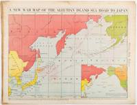
1942réf. 206849Chicago.: Chicago Daily Tribune. 28 January1942. Printed colour map 40.3 x 53.6 cm; 46.5 x 60 cm sheet inset map of the North Pacific back cover from a section of the Chicago Daily Tribune newspaper pages 21-34 January 28 1942; central fold edgewear and browning with a few minor tears not affecting the map in very good condition. Based on a Rand McNally map and issued less than two months after the bombing of Pearl Harbour by the Japanese. The Tribune briskly got to work issuing maps for readers showing the beginnings of the war with Japan. Later maps were also published for sale separately but remarkably few have survived. The map shows "the nearness of our Aleutian Island chain west of Alaska to the islands of Japan. At Dutch Harbor and other points in the Aleutians are actual and potential sea and air bases lying on the shortest route from northwestern United States to Japan." The inset map at lower right situates the areas in the larger map in respect to the countries bordering the North Pacific Ocean. Included with the map is the complete newspaper section from which it is the final full page. Covering sport and the market with half a dozen popular comic strips including "Dick Tracy" and "Little Orphan Annie" it shows a domestic United States a world away from what had been seen as a European War. ". the historic Chicago Tribune was an innovator in color inks and printing but also a pioneer in bringing colorful art in the form of illustrations photographs cartoons and advertisements to the average person in an everyday medium." see The Janet A. Ginsburg Chicago Tribune Collection Michigan State University Libraries." . Chicago Daily Tribune. unknown
1953réf. ZB573181Noumea: South Pacific Commission 1953-1959. volumes 3 through 9 an uninterrupted run of complete volumes pam bound original paper wrappers preserved illustrated ex library overall very good. - If you are reading this this item is actually physically in our stock and ready for shipment once ordered. We are not bookjackers. Buyer is responsible for any additional duties taxes or fees required by recipient's country. Photos available upon request. Noumea: South Pacific Commission unknown
1906réf. 1412110Seattle: Privately Printed 1906. First Edition. Hardcover. Good. 1st printing. Gilt-stamped red cloth. 80pp. Decorated endpapers. 11 line presentation in ink by Prosch on the verso of the ffep to "Mrs. R. S. Shackelford one of the pioneers of Puget Sound." Dated by Prosch Seattle Oct 17 1906. There is a small modern name/address sticker at bottom corner of this page. Also a 1962 note at bottom referencing ownership. Also pencil note on same & a few pencil marginalia names of folks etc. by a knowing person. Frontispiece portrait of Dr. Maynard. WA State encyclopedia says "Doc" Maynard was proprietor of Seattle's first store a physician and surgeon realtor justice of the peace school superintendent notary public clerk of the court attorney-at-law etc." Shackelford was a Pac NW historian located in The Dalles Oregon. Good condition or better. Top of spine is frayed at corner joint. Rare. Smith 8385. Privately Printed hardcover
réf. 56-0366Portland Ore.: Commission of Public Docks 1935. Map. Blackline print 23" x 49" with multicolor shading indicating switching zones. From meeting of Williamette and Colombia to eastern city boundary Linnton District to Vancouver Washington. With index to Port facilities approx 70 listings of docks grain elevators shipping industries and misc. industries using Harbor frontage. Scale approx 1" = 1700'. Portland, Ore.: Commission of Public Docks, 1935. unknown
réf. 56-0365Portland Ore.: Commission of Public Docks 1924. Map. Blueline print 23" x 49" with multicolor shading indicating switching zones. From meeting of Williamette and Colombia to eastern city boundary Linnton District to Vancouver Washington. With index to Port facilities approx 75 listings of docks shipping industries and misc. industries using Harbor frontage. Scale approx 1" = 1700'. Portland, Ore.: Commission of Public Docks, 1924. unknown
réf. 56-0332San Francisco Calif.: Southern Pacific Company 1950 revised 1959. Map. Blueline print 28" x 49" with extensive brown red blue orange and green pencilling indicating zones and yard limits. From French Camp to Calaveras River and San Joaquin River to US 99/Manteca Road. Includes Index to Industries wiith approx 250 listings. Scale 1" = 800'. with insert showing Rough and Ready Island scale 1" = 2000'. San Francisco, Calif.: Southern Pacific Company, 1950, revised 1959. unknown
réf. 56-0257San Francisco Calif.: Southern Pacific Company 1946. Map. Blueline print 36" x 67." From Fruitvale to Hayward with Melrose Mulford Stonehurst Russell City. Includes proposed Highway Route 69 shaded. With Key to Industries approx. 40 listed. Includes Scale 1" = 1000'. San Francisco, Calif.: Southern Pacific Company, 1946. unknown
1950réf. 2406045Spokane: n.p. 1950. Soft cover. Very Good. Original letters and envelopes. I met Peltier only once but mainly I remember his remarkable bookstore filled with treasures. Peltier over the course of his bookselling career wrote without ceasing it seems to authors librarians publishers government authorities on various subjects asking for information signatures stories books etc. In turn many of them wrote back and he saved their correspondence. Remarkably he had old-timers and pioneers write monographs in their own hand about their experiences. This group also includes book orders from various people as well as Peltier's questions about various subjects specific to each party. Almost all letters have their mailing envelopes. To be clear I did not find stunning groundbreaking information in this big packet of correspondence but they are all still personal to some degree. From: Clarence Gorchels 1953 State College of WA Keith Murray 1953 WA State Advisory Board on Historic Sites Louis Caywood 1951 Ella Clark 1950 State College of WA Mary Masterson 1948 student at Whitman College 2 letters Richard Montgomery 1942 author Young Northwest 2 letters John Hotchkiss 1946 Publishers Western Representative Santa Monica Helene Magaret 1944 author of Father DeSmet J. Ronald Todd 1945 Northwest Librarian U of WA library Mary Lewis 1945 donated at collection to Maryhill Museum WA B. H. King D.D.S. 1950 three page handwritten letter on Hotel Marysville CA hotel talking above visiting the Britzmans authorities on Charley Russell plus another letter in 1946 Kenneth Roberts 1945 author of Northwest Passage Ellen Centers 1945 Garibaldi Or writer who has a story she wants someone to write Blanche C. Grant 1945 from Taos authority and author on the Southwest C. F. Allen 1945 an old-timer Elizabeth Marion 1944 author from Spangle WA J. Chadwick Brooks 1945 Hudson's Bay Society Record - clutch of letters pertaining to Peltier catching up on his membership and acquiring several years of annual publications F. M. Setzler 1946 Sect'y Advisory Board US Dept of Interior Lancaster Pollard 1945 Supt. Oregon Hist Soc. re Philip Ashton Rollins 1946 cattle trade historian; brief note from his wife telling Peltier that Rollins is quite ill C. M. Brewster 1945 State College of WA in Pullman clutch of letters / lists of books Peltier is offering the library Ronald F. Lee Chief Historian US Dept of the Interior Fred Lockley 1943-49 noted Seattle bookman and reprint publisher of Pacific Northwest historical booklets clutch of letters Ernest Horn College of Educ. State Univ of Iowa John C. Kuhns 1945 Ass't. Regional Forester U S Dept of Ag F. E. Thieme 1945 Ass't. Regional Forester signed by "acting" individual Elmer Hall 1945: Hall says he has nothing to give Peltier "due to my situation during the Nez Perce War." Arthur H. Clark Co. 1946 re Settle's The March of the Mounted Rifleman R. P. Newland 1945 District Engineer State of WA Dept of Highways. Almost all of these letters and envelopes are in very good condition. n.p. unknown
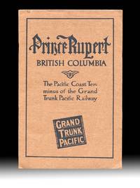
1911réf. 4499Montreal QC: The Grand Trunk Pacific Railway Company 1911. Paperback. Fine. With "Fourth Edition April 1911" printed at foot of the "Announcements" page giving a good indication of the amount interest that the new terminal town and surrounding areas were generating at the time. Includes two fold-out maps one tipped in at title page and the other a real lithographic beauty and excellent promotional map is in color and tipped in at the rear with an additional two insert maps in it's corners. Both maps are in very fine condition. Brown printed wraps 8vo size 9.25 inches tall pp. 24 illustrated w. B&W photo reproductions showing the current stage of development of the town harbor and their surrounds with some images dated "September 1910" table of summit elevations and rwy grades on verso of terminal leaf. Volume w. a touch of rust to staples one leaf w. two light creases and a 1/4 inch closed tear at fore-edge else clean and unmarked throughout. The large color map at rear 33.5 x 26 inches wide is titled "Map Of The Grand Trunk Pacific Railway In British Columbia Showing Terminus At Prince Rupert" plate mark "4824" at lower left and has a copyright date of 1907 by Poole Bros. An additional date of "4-10-'11" is printed at the lower edge matching the pub. date of "Fourth Edition April 1911" printed on the "Announcements" page. These matching dates would have confirmed for potential investors and settlers that the map and pamphlet had the most up to date information available at the time. The two insert maps are "Map Of Price Rupert And Vicinity" and "Latitude Map". The frontis map 9x17 inches wide is titled "General Plan for the Development of Prince Rupert B.C. and was executed by Brett & Hall Landscape Architects Boston who used "City Beautiful" principles with success in Smithers and Fort Prince George as well. Evidently most of the Prince Rupert today is based upon this Brett & Hall plan. OCLC finds no copies of this 1911 edition of this GTPR pamphlet. Rumsey's copy of the large color map lacking the pamphlet and the frontis map is dated "3-28-'10 The Grand Trunk Pacific Railway Company paperback
réf. BN370452The Milwaukee Road in Color Vol. 5: Pacific Extension 1941-1961 Hardcover The Milwaukee Road in Color Vol. 5: Pacific Extension 1941-1961 Hardcover The Milwaukee Road in Color Vol. 5: Pacific Extension 1941-1961 Hardcover hardcover
1980réf. 3627254Canberra, National Library of Australia, (1976-1980). Gr.-8vo. Mit einigen Abbildungen. OLwdbde (mit OUmschlag) (Umschläge teils etwas verblaßt und mit kleinen Randläsuren).
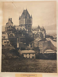
réf. 42578Artist Unknown. Quebec 1940. printed size: 68.5x 55cm 25.5"x 21.5"; frame is 90x 74cm 35.5" x 29.25" original B/W photograph some age toning as usual but a good clear image short tear on the upper right with a small puncture. . B/W historic photo of Chƒteau Frontenac an imposing hotel with five brick and stone wings and a central tower erected in seven stages between 1892 and 1993. It is prominently located on a cliff overlooking the St. Lawrence River within the Qu‚bec historic district. The Chƒteau Frontenac was designed by American architect Bruce Price as one of a series of "chƒteau" style hotels built for the Canadian Pacific Railway company during the late 19th and early 20th centuries. CPR'S policy was to promote luxury tourism by appealing to wealthy travellers. The Chƒteau Frontenac opened in 1893 five years after the Banff Springs Hotel which was owned by the same company and similar in style. Artist Unknown. Quebec, 1940 unknown
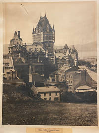
réf. 40187np. 1940. Artist Unknown. printed size: 68.5x 55cm 25.5"x 21.5"; frame is 90x 74cm 35.5" x 29.25" original B/W photograph some age toning as usual but a good clear image short tear on the upper right with a small puncture. B/W historic photo of Chteau Frontenac an imposing hotel with five brick and stone wings and a central tower erected in seven stages between 1892 and 1993. It is prominently located on a cliff overlooking the St. Lawrence River within the Qubec historic district. The Chteau Frontenac was designed by American architect Bruce Price as one of a series of "chteau" style hotels built for the Canadian Pacific Railway company during the late 19th and early 20th centuries. CPR'S policy was to promote luxury tourism by appealing to wealthy travellers. The Chteau Frontenac opened in 1893 five years after the Banff Springs Hotel which was owned by the same company and similar in style. np. 1940 unknown