Union Pacific SystemBiblio.com
7 001 résultats
réf. FRE8151 p. 295x23 cm. 11 ½x 9 in. With a folded map ca. 136 x 60 cm. 53 ½x 23 ½ in. By the late 1910s the Union Pacific Railroad UP was one of the largest and most strategically important rail systems in the United States: Operated a core network of roughly 9000–10000 miles of track including subsidiaries and controlled lines the broader system was significantly larger it formed a central component of the transcontinental rail system linking: Omaha / Council Bluffs Midwest hub across Nebraska Wyoming Utah to connections reaching the Pacific Coast via Southern Pacific and other lines controlled or was closely associated with major lines such as: Oregon Short Line Oregon–Washington Railroad & Navigation Company as outlined on the map included in the report. In practical terms UP was a backbone carrier of western U.S. transportation moving both freight and passengers across vast distances. 1918 was important year in UP history as for the first time it became component of a single national logistics machine not a fully autonomous company - after half a century of operation as a for-profit private corporation it became a part of a nationalized system run by the USRA begun Dec. 1917 fully implemented in 1918. These changes are reflected in the report in the ‘Federal Control of Railroads’ section as well as ‘Physical Changes’ and ‘Water Companies - Federal Control’. Other sections of the report included the equipment asset accounts status as well as the all kinds of passenger and car statistics for the board of directors to review. The map shows UP lines in its pre-WWI glory: once the U.S. entered World War I the federal government through the United States Railroad Administration imposed strict limits on new construction prioritization of maintenance and war traffic/ As a result large-scale new line construction was effectively frozen capital projects were deferred unless militarily necessary. Present report is not found on Worldcat copies in trade seen often lack the map. unknown
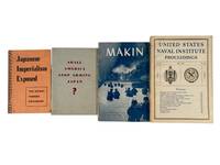
1939réf. 214021939. Four wartime pamphlets and periodicals 1939-1945 documenting American interpretations of Japanese expansionism prewar economic policy debates and U.S. military operations in the Pacific Theater. The materials illustratr how military governmental and institutional publications framed Japanese imperial strategy and justified American military response while also presenting technical and battlefield analysis intended for both military and informed civilian audiences. These works collectively offer insight into wartime messaging strategic interpretation and the evolving American understanding of Pacific conflict from prewar trade tensions through active combat operations. Four printed works issued between 1939 and 1945 including Shall America Stop Arming Japan 1939; Japanese Imperialism Exposed: The Secret Tanaka Document 1942; United States Naval Institute Proceedings Vol. 69 No. 485 May 1943; and Makin U.S. War Department 1944. Staple-bound and softcover formats illustrated with photographs maps charts and technical diagrams. Shall America Stop Arming Japan presents statistical charts detailing American exports of strategic materials noting that Japan sourced significant percentages of copper scrap iron and petroleum from the United States accompanied by arguments advocating embargo. Japanese Imperialism Exposed reproduces the controversial Tanaka Memorial describing a proposed sequence of territorial conquest beginning with China and extending across Asia and the Pacific. Makin issued by the War Department's Historical Division provides a detailed narrative of the U.S. Marine assault on Makin Atoll with photographs of tanks infantry movement and captured terrain alongside fold-out maps showing defensive positions and invasion routes. United States Naval Institute Proceedings includes articles analyzing naval aviation logistics and strategic doctrine with photographic illustrations of aircraft such as the XLRQ-1 seaplane glider and PV-1 Ventura patrol plane as well as discussions of wartime and postwar naval policy. Together these publications trace the progression of American engagement with Japan from economic and diplomatic tension to full-scale military conflict combining advocacy intelligence interpretation and operational reporting. The juxtaposition of prewar policy argument with wartime combat analysis and technical discussion demonstrates the range of printed materials used to inform persuade and document during the Pacific War. These works support research into wartime propaganda military strategy and the informational frameworks through which the United States understood and prosecuted the war against Japan. Light wear to spines and edges with minor toning to pages; overall very good condition. A cohesive grouping illustrating the intersection of policy debate ideological framing and battlefield documentation in World War II print culture. unknown
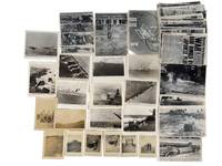
1945réf. 213921945. U.S. military operations in the Pacific Theater during World War II photograph and newspaper archive 1941-1945 documenting the Battle of Iwo Jima and the attack on Pearl Harbor. The archive pairs soldier-taken snapshots with official U.S. Navy and press photographs showing how combat equipment and battlefield conditions. The featured original snapshots contain handwritten notations en verso identifying dates specific locations soldiers and equipment. The archive comprises 39 silver gelatin photographs ranging from roughly 3.5 x 5 to 6 x 8 inches together with original wartime front pages of the Honolulu Star-Bulletin covering the attack on Pearl Harbor the fall of Italy and the Allied invasion of Europe. Images include amphibious landings on the black sand beaches of Iwo Jima with landing craft advancing under naval bombardment; U.S. Navy battleships destroyers and landing craft firing on shore defenses; and aerial scenes of dogfights and bombing runs. Close-up battlefield images depict the wreckage left in the wake of combat including destroyed landing craft craters from naval artillery and Japanese fortifications. Several photographs focus on the role of air power with images of Japanese aircraft under attack U.S. planes engaging in dogfights and B-29 Superfortresses bombing enemy positions. A particularly striking image captures a Japanese bomber scoring a direct hit on the USS Yorktown with billowing smoke rising from the carrier. Handwritten notations on some images identify U.S. servicemen locations such as Mount Suribachi and captured Japanese positions. The series of larger military-produced photographs and newspaper clippings have inscriptions on verso identifying locations and vessels depicted as well as the name tag "K .Benden." Among these are portraits of American soldiers posing at key strategic points inspecting captured bunkers and standing beside wrecked aircraft. Reconnaissance images show terrain and fortified positions; ground-level views show cratered landscapes wrecked landing craft and captured Japanese fortifications. One image shows the USS West Virginia during the Pearl Harbor attack with fire damage and crew visible; another shows a Japanese aircraft striking the USS Yorktown. Other photographs show servicemen near Mount Suribachi inspecting bunkers and beside wrecked aircraft. Many images carry printed captions within the negatives; others have handwritten verso annotations identifying locations dates vessels and personnel including one marked "K. Benden." Light wear minor edge creasing and occasional surface marks; overall in very good with strong image clarity. unknown
1945réf. 213921945. U.S. military operations in the Pacific Theater during World War II photograph and newspaper archive 1941-1945 documenting the Battle of Iwo Jima and the attack on Pearl Harbor. The archive pairs soldier-taken snapshots with official U.S. Navy and press photographs showing how combat equipment and battlefield conditions. The featured original snapshots contain handwritten notations en verso identifying dates specific locations soldiers and equipment. The archive comprises 39 silver gelatin photographs ranging from roughly 3.5 x 5 to 6 x 8 inches together with original wartime front pages of the Honolulu Star-Bulletin covering the attack on Pearl Harbor the fall of Italy and the Allied invasion of Europe. Images include amphibious landings on the black sand beaches of Iwo Jima with landing craft advancing under naval bombardment; U.S. Navy battleships destroyers and landing craft firing on shore defenses; and aerial scenes of dogfights and bombing runs. Close-up battlefield images depict the wreckage left in the wake of combat including destroyed landing craft craters from naval artillery and Japanese fortifications. Several photographs focus on the role of air power with images of Japanese aircraft under attack U.S. planes engaging in dogfights and B-29 Superfortresses bombing enemy positions. A particularly striking image captures a Japanese bomber scoring a direct hit on the USS Yorktown with billowing smoke rising from the carrier. Handwritten notations on some images identify U.S. servicemen locations such as Mount Suribachi and captured Japanese positions. The series of larger military-produced photographs and newspaper clippings have inscriptions on verso identifying locations and vessels depicted as well as the name tag "K .Benden." Among these are portraits of American soldiers posing at key strategic points inspecting captured bunkers and standing beside wrecked aircraft. Reconnaissance images show terrain and fortified positions; ground-level views show cratered landscapes wrecked landing craft and captured Japanese fortifications. One image shows the USS West Virginia during the Pearl Harbor attack with fire damage and crew visible; another shows a Japanese aircraft striking the USS Yorktown. Other photographs show servicemen near Mount Suribachi inspecting bunkers and beside wrecked aircraft. Many images carry printed captions within the negatives; others have handwritten verso annotations identifying locations dates vessels and personnel including one marked "K. Benden." Light wear minor edge creasing and occasional surface marks; overall in very good with strong image clarity. unknown books
1939réf. 214021939. Four wartime pamphlets and periodicals 1939-1945 documenting American interpretations of Japanese expansionism prewar economic policy debates and U.S. military operations in the Pacific Theater. The materials illustratr how military governmental and institutional publications framed Japanese imperial strategy and justified American military response while also presenting technical and battlefield analysis intended for both military and informed civilian audiences. These works collectively offer insight into wartime messaging strategic interpretation and the evolving American understanding of Pacific conflict from prewar trade tensions through active combat operations. Four printed works issued between 1939 and 1945 including Shall America Stop Arming Japan 1939; Japanese Imperialism Exposed: The Secret Tanaka Document 1942; United States Naval Institute Proceedings Vol. 69 No. 485 May 1943; and Makin U.S. War Department 1944. Staple-bound and softcover formats illustrated with photographs maps charts and technical diagrams. Shall America Stop Arming Japan presents statistical charts detailing American exports of strategic materials noting that Japan sourced significant percentages of copper scrap iron and petroleum from the United States accompanied by arguments advocating embargo. Japanese Imperialism Exposed reproduces the controversial Tanaka Memorial describing a proposed sequence of territorial conquest beginning with China and extending across Asia and the Pacific. Makin issued by the War Department's Historical Division provides a detailed narrative of the U.S. Marine assault on Makin Atoll with photographs of tanks infantry movement and captured terrain alongside fold-out maps showing defensive positions and invasion routes. United States Naval Institute Proceedings includes articles analyzing naval aviation logistics and strategic doctrine with photographic illustrations of aircraft such as the XLRQ-1 seaplane glider and PV-1 Ventura patrol plane as well as discussions of wartime and postwar naval policy. Together these publications trace the progression of American engagement with Japan from economic and diplomatic tension to full-scale military conflict combining advocacy intelligence interpretation and operational reporting. The juxtaposition of prewar policy argument with wartime combat analysis and technical discussion demonstrates the range of printed materials used to inform persuade and document during the Pacific War. These works support research into wartime propaganda military strategy and the informational frameworks through which the United States understood and prosecuted the war against Japan. Light wear to spines and edges with minor toning to pages; overall very good condition. A cohesive grouping illustrating the intersection of policy debate ideological framing and battlefield documentation in World War II print culture. unknown books
1914xiv, 403 p. "A record of missionary work among the Indian tribes of the Northern Pacific Coast of our country and of the wonderful transformation in character and conditions which the introduction of the blessed Gospel has brought about." - Preface. List of illustrations includes twenty-seven black and white plates, two of which (at pages 144 and 208) are not present, although there is no evidence they ever were. New front and back endpapers applied over originals. Narrow opening in binding at half-title page. Somewhat above-average wear to maroon cloth covered boards adorned with gilt lettering and photo of author. LOWTHER 1611, TOURVILLE 1128, AMTMANN 3501, RICKS p.75, SMITH 2135, MATTHEWS 295, TOD & CORDINGLEY p.85. Book
191893 pages plus 8 pages of wonderful vintage ads. Features: My Bear Hunt in the B.C. Rockies - Part I, by E. Ashmead-Bartlett; Thrilling stories of the Air, with amazing crash photos; A Doctor in the Holy Land - Dr. H.J. Bailey in Palestine - Gaza and Nablus; Facing Death for Cinema Thrills - some hairbreadth escapes of well-known motion-picture stars, related by themselves, with photos; Tales of the Service - part IV - Tossed into the Bog - a true tale by a Customs Officer from the West Coast of Scotland; The Pirate of the Pacific - Count von Luckner - with photos; A Woman's Journey Across Africa - part V of Eva J. Jordan's 4,000 mile honeymoon trip across the dark continent; Beyond the Law - part IV, by Emmett Dalton, the sole survivor of the Dalton Gang; Exploring the Ice-Wilds of Eastern Karakoram - Part IV, by Fanny Bullock Workman and William Hunter Workman - with photos by the authors; The Drover Dempster - A.A. Beattie relates a deadly drive of 500 miles in Australia; The Disappearing Island - Helen Darbishire describes Ocean Island in the South Pacific - built entirely of phosphates - with nice photos; "Lionel - Because of the Lions" - Mrs. Fred Maturin (Edith Porch) explains how she came to name a lonely station near the Congo, on the Cape-to-Cairo Railway; The Water Miracles of India - how the engineer has wiped out India's famine scourge and reclaimed millions of acres of land by the erection of vast irrigation works - with great photos; Photo of 28-lb lobster; Photo of French school-children in war zone wearing gas masks; Photo of a Mormon Church in Salt Lake City converted into an auto shop; photo of the quaint circumcision garb worn in Uganda. Nostalgic back cover ad by the Haywood Tire & Equipment Co. of Indianapolis proves that the tire repair business was booming in 1918! Full-page ad inside back cover boasts that the Newell Pharmacal Co. can banish the smoking habit in 48 to 72 hours. Small ad for Emblem motorcycles and bicycles. Moderate wear. Unmarked. Binding intact. A sound copy of this excellent vintage issue. Book
1917Abundant black and white illustrations and reproductions of photos. Features: The Six Skulls - Part I - Sequel to "In the Grip of the Hip Sings" - the twenty-five year persecution of Walter G. Patterson who, while a young man in Butte, Montana, was compelled to join a lawless Chinese tong; An Amazing Voyage - The escape from Spain of a number of interned German officers; A Flying Man in South America - Part VI - The adventures of John G. Barron, who spent 2.5 years giving flying exhibitions in South America, often to people who had never before seen an aircraft; The Child of Terbeeke - How a child saved a British Battalion from annihilation; Humours of the East African Campaign; Panton's Feud - how aviators and artillery co-operate at the Front; On the Borders of Tibet - Part V - Photo-illustrated account of the author's two years wanderings in these wild lands of wilder people; A Bandit's Bride - Part III - The strange story of Pancho Villa's wife, with photos, including photo of Villa and Zapata on horseback in Mexico City in 1915 when they practically controlled Mexico; Railway Building in the Wilderness - Part I - Construction of the Grand Trunk Pacific through the Canadian Rockies, with great photos; The Faithful Lover - The history of William Anderson and Catherine Burthe; Photo of Mashukwlumbwe tribesmen with hair spikes over two feet tall!; Ten-page investment ad for the Sugar Cane By-Products Co., which apparently sought to solve the shortage of wood pulp by using sugar cane; and more. pp. 8 [ads], [3], 388-472, 8-24 [ads]. Unmarked with light wear. A quality vintage copy of this wonderful issue. Book
1976298 pages including index. Compiles all available references relevant to the environmental aspect of the Nanaimo River Estuary. Summarizes pertinent information and provides lists on plant and animal life, to provide readers with some idea of the ecological characteristics. Contents include topics such as: Geology; Economic Geology; Surficial Geology; Climatology; Hydrology; Oceanography; Invertebrate Biology; Invertebrate Fisheries Resource; Flora; Wildlife; Land and Water Use; Pollution; plus an extensive Bibliography. Includes a variety of maps. Report of the Estuary Working Group, Department of the Environment, Regional Pacific Region. Clean and unmarked with moderate wear. Binding sound. A wonderful reference. Book
1848réf. 13620Franck Paris 1848 1 vol. In-4 de 4 ff.n.ch. 326 pp.; demi-chagrin de l'époque, dos à nerfs richement orné, tranches dorées.
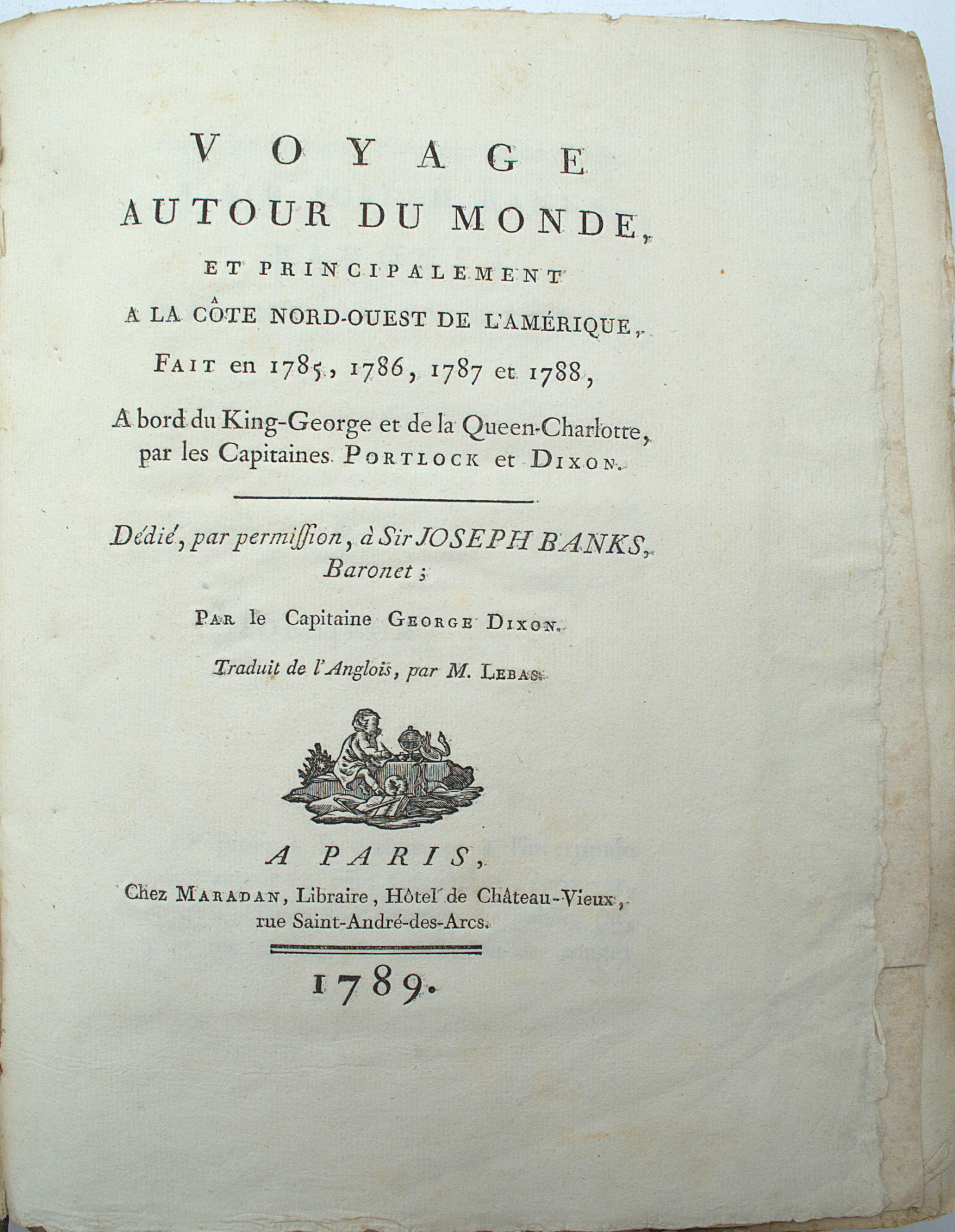
1789réf. PHO-2526Paris, Maradan, 1789, in-4 (28x21,5cm), 2ff.-499pp.-46pp.-1f., reliure d’attente, dos manquant, coins usés, quelques rousseurs.
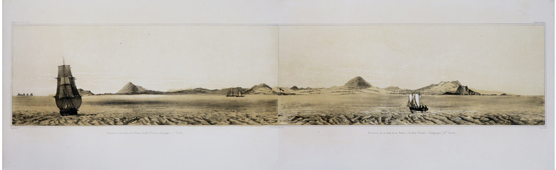
1841réf. LBW-1781[Paris, 1841]. En deux feuilles non jointes pouvant former un panorama d'environ 211 mm x 1,02 m.
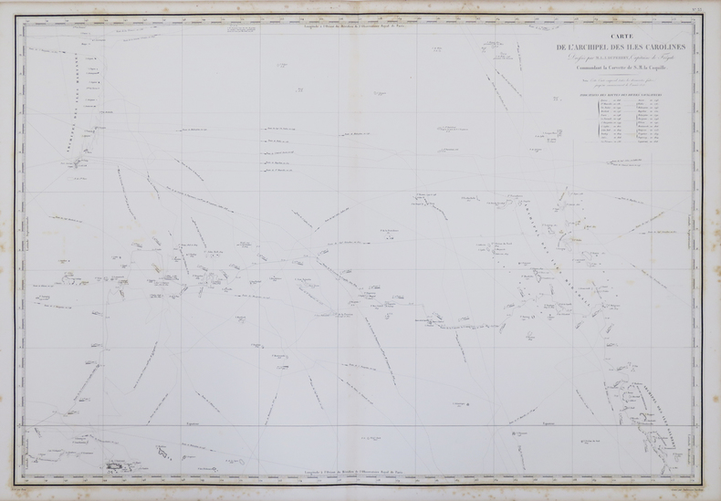
1833réf. LBW-5461[Paris, 1833]. 430 x 585 mm.
1833réf. LBW-5448[Paris, 1833]. 343 x 240 mm.
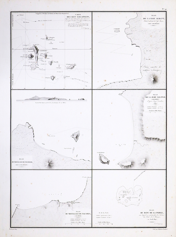
1827réf. LBW-4426[1827]. 500 x 361 mm.
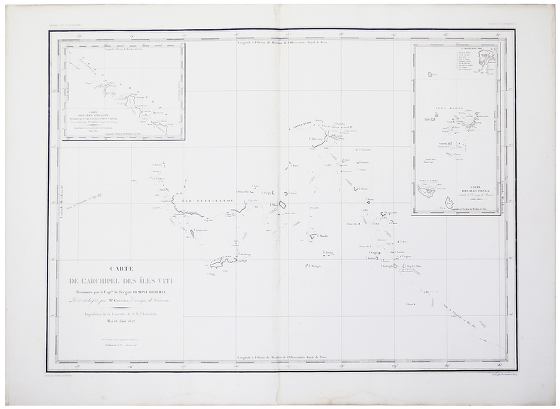
1827réf. LBW-4422[1827]. 470 x 739 mm.
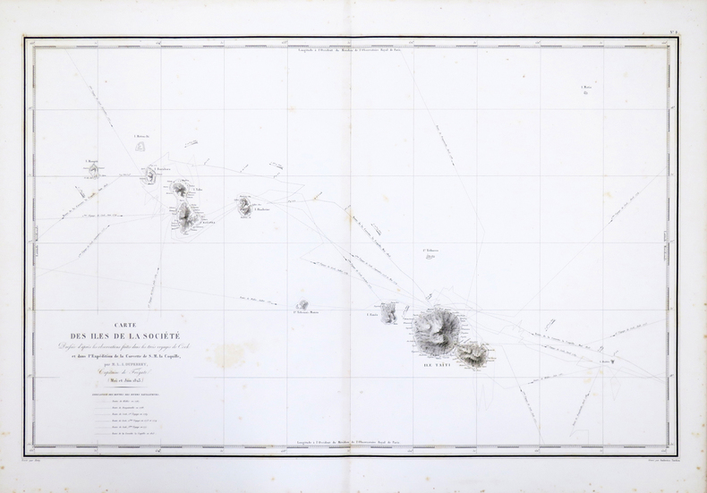
1827réf. LBW-4425[1827]. 537 x 767 mm.
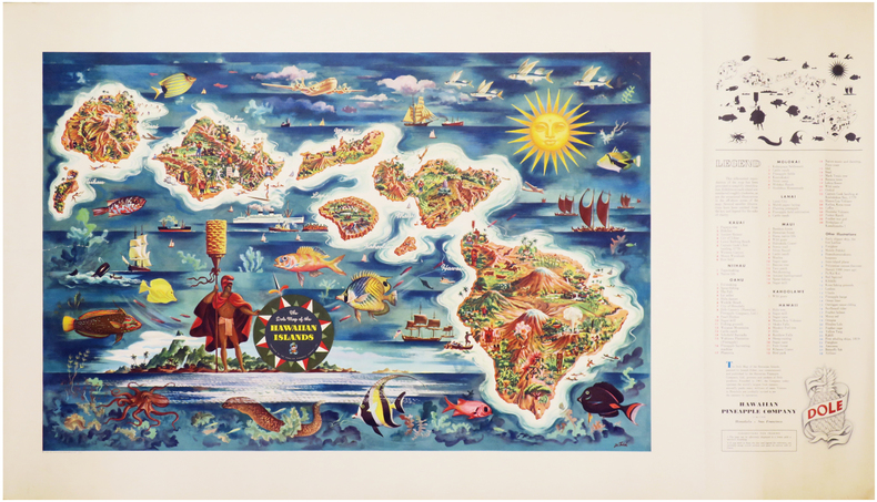
1950réf. LBW-7046Honolulu & San Francisco, Hawaiian Pineapple Company Limited, 1950. Lithographie en couleurs de 475 x 960 mm.
1825réf. 2452Paris, Anselin et Pochard, 1825. In-8 de VIII-63 pp., 1 tableau replié, demi-chagrin bleu, couverture imprimée et dos conservés (reliure moderne).
1858Carta geografica raffigurante le legazioni ecclesiastiche della regione, tratta dall’Orbe Cattolico di Girolamo Petri. L'Orbe Cattolico ossia Atlante Geografico Storico Ecclesiastico fu pubblicato a Roma in 3 volumi nel 1858-1859. Le mappe di grande formato sono finemente incise e ben colorate. È senza dubbio una delle opere più finemente incise ed eleganti della metà del XIX secolo. Ogni mappa mostra le varie diocesi, ognuna delle quali è contraddistinta da colori vivaci che ne segnano la sede, e altre città importanti. Sebbene le caratteristiche geografiche siano chiaramente espresse, le mappe sono volutamente piuttosto scarne di dettagli, in modo da non sminuire visivamente il loro scopo, che è quello di mostrare le divisioni ecclesiastiche. Nel creare l'atlante, Petri ha sottolineato di aver attinto solo alle "fonti più attendibili", comprese le mappe degli archivi vaticani e delle diocesi d'oltremare L'atlante fu pubblicato in un numero molto limitato di esemplari ad uso esclusivo dei cardinali e degli amministratori di alto rango, il che ne spiega la grande rarità odierna. Girolamo Petri (1806 - 1871) fu una figura importante nell'amministrazione della Chiesa cattolica romana durante il regno di Pio IX. Nacque a Onano (Viterbo, Lazio), figlio di un funzionario vaticano che in seguito divenne governatore di Frascati. Il lavoro di Petri fu svolto in un periodo in cui la Chiesa era sotto assedio in Europa, ma, al contrario, aveva grandi ambizioni di espansione all'estero, in particolare in Asia e in Africa. La metà del XIX secolo fu un periodo di grandi cambiamenti a Roma. L'atlante faceva senza dubbio parte degli ultimi sforzi del Vaticano per comprendere e controllare la sua vasta influenza in tutto il mondo, resuscitando il concetto popolare di province ecclesiastiche diffuso nelle opere di Nicolas Sanson e altri cartografi del XVII secolo. La Calcografia Nazionale (Istituto per la Grafica) conserva ancora 135 rami di questo rarissimo atlante. Incisione in rame, coloritura coeva, in ottimo stato di conservazione. Bibliografia Walter Goffart, Historical Atlases: The First Three Hundred Years, 1570-1870 (Chicago, 2003), p. 427-8; J.A.B. Jongeneel, Philosophy, Science, and Theology of Mission in the 19th and 20th Centuries: A Missiological Encyclopedia (1995), p. 264. A very rare map showing the dioceses of Catholic organization, taken from L'Orbe Cattolico by Girolamo Petri. L’Orbe Cattolico ossia Atlante Geografico Storico Ecclesiastico’ was published in Rome in 3 volumes in 1858-1859. The large-format maps are finely engraved and beautifully colored. The atlas is a testament to the artistry of the engravers and the relative indifference of the publisher to the commercial success of the work. It is without question one of the most finely engraved and elegant works of the mid-19th Century. Each map shows the various dioceses, which are each distinguished by their own bright colors, marking their seats, as well as other major towns. While key geographical features are expressed throughout, the maps are otherwise intentionally rather sparing of detail, so as not to visually detract from their purpose, which is the show the ecclesiastical divisions. In creating the atlas, Petri noted that he drew only upon the “most trusted sources”, including maps from the Vatican archives and overseas dioceses. The atlas was by far and away the finest ecclesiastical atlas created during the 19th Century, featuring exceptionally beautiful examples of thematic cartography. The uncommonly beautiful atlas was published in only a very small number of examples for the exclusive use of Cardinals and high-ranking administrators, accounting for the great rarity today. Petri who was commissioned by Pope Pius XI thus created during a time when the Church was under siege within Europe, but, conversely, while it had major ambitions for expansion overseas, particularly in Asia and Africa. The mid-19th Century was a period of dramatic change in Rome. The atlas was no doubt part of the Vatican's last-ditch efforts to understand and control its vast influence around the world, resurrecting the popular concept of ecclesiastical provinces popularized in works by Nicholas Sanson and others during the 17th Century. The Calcografia Nazionale still preserves 135 copperplates of this extremely rare atlas. Bibliografia Walter Goffart, Historical Atlases: The First Three Hundred Years, 1570-1870 (Chicago, 2003), p. 427-8; J.A.B. Jongeneel, Philosophy, Science, and Theology of Mission in the 19th and 20th Centuries: A Missiological Encyclopedia (1995), p. 264.
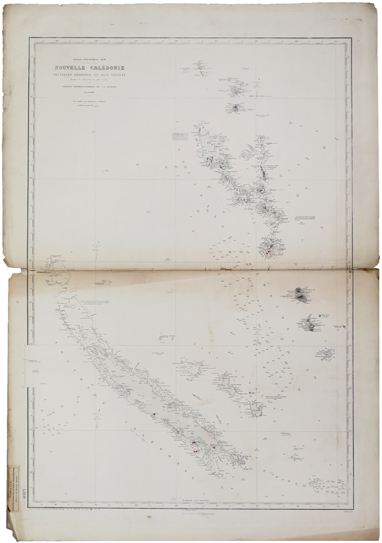
1888réf. LBW-6011Paris, Service Hydrographique de la Marine, 1888-1909. 943 x 654 mm.
18478vo [20.5 x 13 cm]; 2 volumes, xxiv, 288, 32 [publisher's ads dated April 1847]; xii, 278, [ii, ads] pp. original cloth with blind-stamped design on covers and spines, gilt lettering on spine, rear joint of volume I with crack but holding firm, light wear at spine ends and corners, covers a little faded, but a clean very good set. A picture of this book is a Sabin 17143. Howes C802. Cowan 145. Hill I, 70: 'The early materials on California and Melanesia are of importance'. A detailed and interesting account, with much on Pacific island life, the native peoples, the first chapter describes a whale chase. This copy has both the half title pages and the ads in each volume, often lacking.
18378vo [22.5 x 14.5 cm]; xii, 461 pp, 4 maps including foldout frontis map, music notation in text, tables. later red cloth, which is a little faded and stained, interior is clean and near fine with only light offsetting from maps, and a few corners bent, overall quite good. A picture of this book is available upon request by email. There is considerable detail on Singapore including the economy with tables of imports and exports and number of ships over three years, as well as details on government, politics, people. The author, noted for his linguistic abilities, describes the Dayak (Dyak) people, their customs, head-hunting, and the geography of the area. There are appendices on the commercial resources of the Indian Archipelago and observations on the unexplored parts of north and north-western Australia. Hill 411. National Maritime Museum 458 (their copy has only 3 maps).
1847small 8vo [17.5 x 12 cm]; xiii, 321 pp, map frontispiece, text illus. contemporary half calf, raised bands, decorated in gilt and blind, red title labels with gilt lettering, marbled boards, rubbed at edges, a very good copy, clean throughout. A picture of this book is available upon request by email. BAL 13655, with the 'P' at p. 209, as signature mark, showing top half only, no priority of states. The London edition preceeded the US edition by several weeks. Hill 196: "This work deals with Melville and his part in the mutiny aboard the Julia, called in this book, Lucy Ann. Melville then spent about three months wandering in various parts of Tahiti and Imeeo (Moorea) as a beachcomber and was able to make extensive observations on the social conditions of the natives. This work is also a true story." The author has been described as "the most important of all the great American writers" and later wrote Moby Dick. This is the author's second book.
1851Sm. 8vo., Second Edition, with lithographed portrait frontispiece (original tissue guard present), lithographed portrait of John Adams, lithographed plate of the landing beach and full-page illustration in the text, some minimal spotting on title; attractively bound in contemporary half calf, maroon pebble-grain cloth sides, expertly rebacked with old backstrip gilt laid down, backstrip with gilt ruled, second compartment with green leather label lettered in gilt, red sprinkled edges, terracotta endpapers, a remarkably bright, crisp, clean copy. With the record of shipping and list of of subscribers. This famous and invaluable account of the Bounty mutineers was published three times in the first year. The author, en route from New Zealand to the gold fields of California, was stranded at Pitcairn when his vessel was blown offshore. During his enforced stay he compiled an extensive account of the later events of the Bounty Mutiny, with a detailed list of Bounty descendants and a valuable record of vessels calling at the island. EXTREMELY SCARCE IN THIS CONDITION.