7001 risultati
1895rif. 64099Portland OR: Lewis & Dryden Printing Co. 1895. Folio. 10 x 14.75 in. xxiii 1 494 pp. Frontisp. 100s of illusts. photos decorated initials. Original publisher’s brown morocco over beveled boards gilt lettering & decoration on spine paneled in gilt ruling on covers marbled fore-edges & endpapers very slight rubbing slight shelfwear to corners and very slight sunning to spine still a near fine entirely unsophisticated copy. First edition of this invaluable maritime history in the Pacific Northwest with an excellent index and lavishly illustrated and perhaps one of the best copies this cataloguer has ever examined. Wright 1863-1930 as manager of the Portland Merchant’s Exchange had access to a vast store of original documents letters journals and accounts of marine shipping and development on the Columbia River and Pacific Northwest much of which has not survived. With the help of Harriman he later became director of the Port of Portland and later operated the shipyards in Astoria OR. Howes W963. Lewis & Dryden Printing Co., hardcover
1895rif. 47595Portland OR: Lewis & Dryden Printing Co. 1895. Folio. xxiii 1 494 pp. Frntsp. 100s of illusts. photos decorated initials. Original publisher’s brown morocco over beveled boards gilt lettering & decoration on spine paneled in gilt ruling on covers gilt inner dentelles a.e.g. marbled endpapers minor bumping & wear to corners some rubbing edgewear rebacked with original spine laid back down still a VG copy from the library of Thea Foss 1857-1927 of Foss Launch & Tug Company later Foss Maritime -- who served as the inspiration for the story and Tugboat Annie movie based on her life. First edition of this invaluable maritime history in the Pacific Northwest with an excellent index and lavishly illustrated. Howes W963. Lewis & Dryden Printing Co., hardcover
1848rif. DEMO015918IGand / Ghent: Chez Ve Vander Schelden 1848. First Belgian edition. Hardcover. Very Good. Small octavo 589 pages contemporary full green sheep extra gilt aeg scuffed. Inked presentation in 1912 from Rev. Francis J. Harbe: Harbe died in 1913 at age 37 in San Antonio Texas. He may have acquired this when a seminarian at Belgium in 1900. Howes D286; Graff 3826; Field 1425; Sabin 82266; Smith 9549; Strathern 511:iii. "This edition seems to have been prepared by the author himself. It contains more material than the edition in English "Oregon Missions" the illustrations are different and the three maps are entirely new - Sabin 82265." It has several additional letters and an Appendix pp. 360 - 378. "Origine des Americains." Contains Fr. De Smet's description of his travels through and about the central Columbia River Plateau . he continued . to the Fort Vancouver by way of Fort Colville -- Wagner-Cam-Becker 141.2." Contains 16 plates including the pictorial title-age and 3 folding maps. Chez Ve Vander Schelden hardcover
1961rif. 224201961. U.S. Naval Missile Center Authors and Editors Handbook 1961 establishes standardized authorship formatting and editorial control for technical reports produced at the Pacific Missile Range documenting the internal communication systems that supported U.S. guided missile and early satellite programs during the Cold War. Issued for personnel at Point Mugu California the manual defines procedures for drafting reviewing and disseminating classified and technical material tied to weapons development providing direct evidence of how military knowledge was structured codified and circulated within federal defense infrastructure. The inclusion of a contemporaneous typescript insert History of the Pacific Missile Range February 1961 further situates the handbook within active missile testing and space recovery operations supporting research into Cold War science military bureaucracy and the integration of documentation practices into weapons development. Pacific Missile Range and U.S. Naval Missile Center. Authors and Editors Handbook. Point Mugu CA: U.S. Naval Missile Center 1 August 1961. First edition. Publication No. NMC-MP-61-9. Quarto format 218 pages with an additional 5-page typescript insert titled History of the Pacific Missile Range February 1961 issued by the Public Affairs Office. Three-hole-punched sheets bound with cloth tape and printed card wrappers. The handbook is organized into four sections: Report Preparation Manuscript Preparation Language Grammar and Punctuation and Matters of Style outlining requirements for technical clarity typographic consistency and standardized formatting across naval missile documentation. The inserted historical report traces the establishment of the Pacific Missile Range in 1957 under William Holaday and details its expansion into "an ocean-spanning instrumented network capable of supplying information on the launching guidance and impact of the nation's largest missiles and satellites." Documented events include "On 16 Dec 1958 the first REGULUS II missile was fired" and the recovery of "DISCOVERER XIII. making it the first man-made object ever recovered from orbit" providing a contemporaneous record of early U.S. missile and satellite operations. Produced during a period of rapid expansion in U.S. missile testing and space reconnaissance the manual demonstrates how technical writing standards were integrated into military systems to ensure uniformity precision and reliability in the production of strategic knowledge. References to parallel guides such as Guide for Air Force Writing and Preparation of Weapon-Test Reports indicate alignment across branches of the armed services in codifying technical communication. The Pacific Missile Range functioned as a central node in Cold War weapons testing linking launch sites tracking stations and recovery operations across the Pacific and the documentation practices outlined here formed part of the operational infrastructure supporting those activities. Chipping to spine tape light edge wear to wrappers and faint soiling to covers; interior clean and complete including all tables figures and inserted report. Overall very good condition. unknown
1961rif. 224201961. U.S. Naval Missile Center Authors and Editors Handbook 1961 establishes standardized authorship formatting and editorial control for technical reports produced at the Pacific Missile Range documenting the internal communication systems that supported U.S. guided missile and early satellite programs during the Cold War. Issued for personnel at Point Mugu California the manual defines procedures for drafting reviewing and disseminating classified and technical material tied to weapons development providing direct evidence of how military knowledge was structured codified and circulated within federal defense infrastructure. The inclusion of a contemporaneous typescript insert History of the Pacific Missile Range February 1961 further situates the handbook within active missile testing and space recovery operations supporting research into Cold War science military bureaucracy and the integration of documentation practices into weapons development. Pacific Missile Range and U.S. Naval Missile Center. Authors and Editors Handbook. Point Mugu CA: U.S. Naval Missile Center 1 August 1961. First edition. Publication No. NMC-MP-61-9. Quarto format 218 pages with an additional 5-page typescript insert titled History of the Pacific Missile Range February 1961 issued by the Public Affairs Office. Three-hole-punched sheets bound with cloth tape and printed card wrappers. The handbook is organized into four sections: Report Preparation Manuscript Preparation Language Grammar and Punctuation and Matters of Style outlining requirements for technical clarity typographic consistency and standardized formatting across naval missile documentation. The inserted historical report traces the establishment of the Pacific Missile Range in 1957 under William Holaday and details its expansion into "an ocean-spanning instrumented network capable of supplying information on the launching guidance and impact of the nation's largest missiles and satellites." Documented events include "On 16 Dec 1958 the first REGULUS II missile was fired" and the recovery of "DISCOVERER XIII. making it the first man-made object ever recovered from orbit" providing a contemporaneous record of early U.S. missile and satellite operations. Produced during a period of rapid expansion in U.S. missile testing and space reconnaissance the manual demonstrates how technical writing standards were integrated into military systems to ensure uniformity precision and reliability in the production of strategic knowledge. References to parallel guides such as Guide for Air Force Writing and Preparation of Weapon-Test Reports indicate alignment across branches of the armed services in codifying technical communication. The Pacific Missile Range functioned as a central node in Cold War weapons testing linking launch sites tracking stations and recovery operations across the Pacific and the documentation practices outlined here formed part of the operational infrastructure supporting those activities. Chipping to spine tape light edge wear to wrappers and faint soiling to covers; interior clean and complete including all tables figures and inserted report. Overall very good condition. unknown books
rif. 58-0493San Francisco Calif.: Southern Pacific Company 1949 rev. 1958 collected 1962. Blueline print 27 inches x 96 inches. From Millbrae to Yerba Buena Island Hunter's Point to Daly City. With index to industry approx. 1000 entries listed both Alphabetically and by numerical location on map. Scale approx 1 inch = 1200 feet. With attached blueline print switching zones map14 inches x 32 inches four colors indicating zones. File cover indicating "Switiching Limits of San Francisco" dated 1962. Three pages of Switching Charges effective 1960 attached. San Francisco, Calif.: Southern Pacific Company, 1949, rev. 1958, collected 1962. unknown
rif. 56-0430San Francisco Calif.: Southern Pacific Company 1951 rev. 1958. Blueline print 36" x 91". From Anapra station point near Bowen and Brickland station points to Ed Anderson Municipal Airport and Rio Grande River north to Biggs Field. WIth Index to Industries approx 650 entries indexed to map by number. Scale approx 1" = 1000'. San Francisco, Calif.: Southern Pacific Company, 1951, rev. 1958. unknown
rif. 58-0497San Francisco Calif.: Southern Pacific Company 1949 rev. 1958 switching limit map 1961. Blueline print 27 inches x 96 inches. From Millbrae to Yerba Buena Island Hunter's Point to Daly City. With index to industry approx. 1000 entries listed both Alphabetically and by numerical location on map. Scale approx 1 inch = 1200 feet. With two attached blueline print switching zones map14 inches x 32 inches four colors indicating zones one dated 1961 one undated. From San Bruno to Presidio. Four pages of Switching Charges effective 1960 attached. San Francisco, Calif.: Southern Pacific Company, 1949, rev. 1958, switching limit map 1961. unknown
rif. 58-0492San Francisco Calif.: Southern Pacific Company 1949 rev. 1958. Blueline print 27 inches x 96 inches. From Millbrae to Yerba Buena Island Hunter's Point to Daly City. With index to industry approx. 1000 entries listed both Alphabetically and by numerical location on map. Scale approx 1 inch = 1200 feet. San Francisco, Calif.: Southern Pacific Company, 1949, rev. 1958. unknown
rif. 58-0503San Francisco Calif.: Southern Pacific Company 1953 rev. 1956. Blueline print 28 inches x 10 feet. From First Street and Linden Street in Oakland to Sobrante Avenue and First Street. With Richmond Belt Giant Harbor Channel Berkeley Albany Emeryville. With Index to Industry approx 700 listings indexed Alphabetically and Numerically to map location. Scale 1 inch = 1000 feet. San Francisco, Calif.: Southern Pacific Company, 1953, rev. 1956. unknown
rif. 56-0400San Francisco Calif.: Southern Pacific Company 1932. Blueline print 48 inches x 20 feet. From 26th Street and US Highway 99 to Pentz Street along railroad tracks with details of buildings within 1000 feet in each direction of railroad lines. Scale 1" = 100'. With insert detailing Garces Circle and old Kern County Fair Grounds. San Francisco, Calif.: Southern Pacific Company, 1932. unknown
rif. 58-0495San Francisco Calif.: Southern Pacific Company 1949. Blueline print 26 inches x 67 inches. From Millbrae to Yerba Buena Island Hunter's Point to Daly City. With index to industry approx. 850 entries listed both Alphabetically and by numerical location on map. Scale approx 1 inch = 1200 feet. San Francisco, Calif.: Southern Pacific Company, 1949. unknown
1819rif. 249959N.p. Paris 1819. One page in French. 8vo. One page in French. 8vo. The Neapolitan-born Gaspare Luigi Pacifico Spontini 1774-1851 was a celebrated composer of operas in his day who made his career in Paris under the patronage of the Empress Josephine. His most famous opera LA VESTALE premiered in Paris in 1807 and according to Grove's Dictionary underwent over 200 performances in Paris by the year 1824. As late as 1954 in fact in celebration of the composer's 180th birthday it enjoyed a revival at La Scala with Maria Callas in the leading role. According to calendars only these two years during Spontini's time in Paris had a September 22 which fell on Wednesday. Spontini left Paris in 1819 to accept a position with the Dresden opera. unknown
1819rif. 249959N.p. Paris 1819. One page in French. 8vo. One page in French. 8vo. The Neapolitan-born Gaspare Luigi Pacifico Spontini 1774-1851 was a celebrated composer of operas in his day who made his career in Paris under the patronage of the Empress Josephine. His most famous opera LA VESTALE premiered in Paris in 1807 and according to Grove's Dictionary underwent over 200 performances in Paris by the year 1824. As late as 1954 in fact in celebration of the composer's 180th birthday it enjoyed a revival at La Scala with Maria Callas in the leading role. According to calendars only these two years during Spontini's time in Paris had a September 22 which fell on Wednesday. Spontini left Paris in 1819 to accept a position with the Dresden opera. unknown books
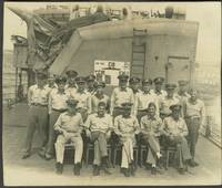
1946rif. 24943South Pacific 1946. Photography. Overall very good condition. 100 real photographs of the USS Bennion in the South Pacific and Japan. Some which are annotated in the image with locations and dates appear to be taken by the ship's photographer; others are candid shots by a crew member. Some are described on the verso naming crew members. A group snap shot which identifies the personnel on the verso includes: Lt. Scott Kollert Mach. Flaherty Ens Hulkill Lt. McCool Loomis Morrison Dabbs Matlack Cobb & Murray. A note on the verso explains the scorecard poster displayed behind the men: "Score card shows 16 Jap planes 8 shore bombardments & 1 Jap battleship sunk by torpedoes in Battle of Surigao Strait. 13 planes since I've been aboard" the reference to the sunk battleship refers to October 1944 when Bennion helped sink the Japanese battleship Yamashiro. Many shots of life on board the ship. Some snap shots indicate the crew was segregated by role with gunners mates and fire control men all white while the steward mates are all African American. Numerous group photographs include: CPOs cooks radar men radio men 2nd Division and the Bridge force. Additional snap shots include the ship at Club Saipan showing Admiral Whiting and a "nurse . was the last one to leave Corregidor and got a lot of publicity" Kuluk Bay Adak Aleutians in August 1945; Vanikoro Feb 1943 snap shots of Officers Club Solomon Islands. Interior and exterior views; numerous images of Ominato including Japanese service men and villagers Ominato was a major navy base for the Imperial Japanese Navy in northern Honshu; and USO performers. The USS Bennion won a Presidential Unit Citation for her actions off Okinawa during the Battle of Iwo Jima. The citation to the ship was presented "For extraordinary heroism in action as a Fighter Direction ship on Radar Picket duty during the Okinawa Campaign April 1 to June 1 1945". USS Bennion DD-662 was a US Navy Fletcher-class destroyer launched in 1943. It served in the Pacific as a fighter director and radar picket ship and supported operations at Leyte and Luzon in the liberation of the Philippines and at Iwo Jima February - March 1945. In July and August 1945 USS Bennion took part in Third Fleet Operations Against Japan. Bennion received her citation for actions off Okinawa 1 April-1 June 1945 as well as eight battle stars. Photographs which identify personnel include the presentation of medals: the Bronze Star to the Bennion's Commander R. H. Holmes on May 17 1945; presentation of Silver Star to T. C. Beale; and James Holloway III "who assisted sinking with torpedoes of Japanese battleship Yamashiro"; Vice Admiral H. W. Hill addressing the crew; Commodore Moosbrugger; Lt. Comd. Brokenshire. A total of 100 real photographs mostly in postcard size format 4 3/4 x 3 3/4" some 5 x 4". Very good condition. unknown
1975rif. 2412050448xbvkHoniara, British Solomon Islands Protectorate, printed by the Government Printer, 1971-1975. Detailed collation: I. Annual titlepage, v pages 'Index', 224 pages (Issue #1-#4 individually paginated [16 p. in total], Issue 5 starts with p. 17, then onwards to p. 224). / II. Annual titlepage, xiii pages 'Index', 245 pages. / III. Annual titlepage, xi pages 'Index', 200 pages. / IV. Annual titlepage, x pages 'Index', 245 pages. / V. Annual titlepage, xi pages 'Index', 196 pages. - 'Publisher's' titled greyblue halfcloth bindings with yellow thick cardboard-panels; 8vo.(ca. 20,5 x 14 x 9 cm; ca. 2,5 kg.).
1946rif. 2409300270xbvkJapan, 1946. 33 (1) pages, with few illustrations; Texts American or Japanese, each which translational-aid for the other language, incl. American-Japanese glossary. - Publisher's photographically illustrated wrapper 8vo.(19 x 12 cm).
1974518 pages. Report of the estuary working group, Department of the Environment, Regional Board Pacific Region. Summarizes existing knowledge pertinent to potential ecological changes rising from estuarine modification. Contents include: Geology; Climatology, Hydrology and Water Quality; Oceanography; Invertebrate Biology; Fish; Bacteria; Flora; Wildlife; Land Use; Waste Disposal and Pollution Problems; Food Chains; and more. Clean and unmarked with light wear. Tight and square. Nice copy. Book
1837rif. PHO-2143Paris, Arthus Bertrand, 1837, 1 volume (3) grand in-4° (30x24,5cm), VIII pp., 742 pp., demi basane époque, dos lisse avec auteur, titre et tomaison, frottements au dos, quelques rousseurs, défaut à la coiffe sup., de la bibliothèque de Cayrol avec son cachet et signature manuscrite.
1767rif. 14642Molini Paris 1767 1 vol. In-12 de 2 ff.n.ch. LXVIII 335 pp., veau fauve de l'époque, dos à nerfs orné, pièce de titre, tranches rouges.
1780rif. LBW-4310[1780]. 535 x 535 mm.
1827rif. LBW-4441[1827]. 495 x 361 mm.
1827rif. LBW-4419[1827]. 489 x 360 mm.
1893rif. 0711262Salem: M P RW Co. St. Louis 1893 Woodward & Tiernan Printing Co. 1893. 2nd Edition. Soft cover. Fair. 2nd edition issued same year as 1st edition. Printed wraps 5 1/4" x 7 1/2". 85pp. Illustrated with several full page & smaller engravings. Ads. Folding map in facsimile. Title page in facsimile & on paper virtually the same as the text. A rare promotional booklet issued by the railroad to prepare homesteaders about to rush into the Cherokee Strip. Contents include: historical background including references to the 1889 land rush; information table of Indian groups occupying the Strip including location of agency acreage square miles population; analysis of the soil; info on favorable crops; "How To Locate Your Land"; etc. This rare booklet has insect damage 2 3/4" diagonally to the upper corner of the last four leaves & the back cover but there is very little loss of text -- only a few words. Quarter coin size insect loss to upper right edge of front cover -- no loss of text or even close to it as cover title & decoration is in center of cover. Stains to upper fore edge of last one-half of book. The large 16 1/4" x 22" 1889 folding facsimile map "A Correct Map of the Oklahoma Country and Cherokee Outlet reached via the Missouri Pacific Railway and Iron Mountain Route" was done from an original copy. There was top edge damage on the original with loss of a few title letters from the phrase "Oklahoma and Cherokee Strip 'THE HOMESEEKERS' Mecca" most of "Mecca" lost. Map includes all of Kansas & parts of adjacent states to Oklahoma. In spite of noted damage a very usable booklet with flexible paper. Professional stabilizing to the binding. Herd 1706 indicates an 1894 issuance but material in the book reasonably points to the earlier 1893 date. Herd 1706. Hargrett Gilcrease Imprints p92 references an 1898 edition but their copy was at the time of bibliography's publication not at hand for editor to double-check against records. M P RW Co., St. Louis, (1893) (Woodward & Tiernan Printing Co.) unknown
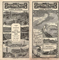
1890rif. 46165San Francisco: Crocker & Co. December 1890. 1890. 7" x 21" sheet on cream-colored stock folded to 12 panels each 7" x 3 1/2." 2 pictorial cover panels. Ticket rates from San Francisco to Monterey Pacific Grove or Santa Cruz along with excursion rates. 2 panels offering "Schedule of Stage Connections Showing Routes Distances Rates of Fare Etc." Black and white illustration showing bird's eye view of Hotel del Monte. Time schedules for the Monterey Line Pacific Grove Extension Santa Cruz Line Almaden Line Tres Pinos Line and Sta. Margarita Line. Light soiling to cover panels else near fine. Crocker & Co., December, 1890. unknown