1913réf. 63071Seattle WA: Seattle Union Record 1913. Folio. 9 x 12 in. 132 pp. With photo illustrations text illustrations illustrated ads throughout. Colour-illustrated softcovers cover art of miner holding pick-axe w/ Seattle waterfront in the background in tan & blue Rainier Beer advertisement on back cover minor chipping head & foot of spine dustsoiling & soiling front cover minor bumping to corners still a G copy. First edition of this scarce and important supplement issued in conjunction with the 33rd Annual Convention for the AFL composed of craft unions for cigar makers garment workers carpenters electricians and others. They also served as the umbrella union for the United Mine Workers of America and at the time were supporting the Coal strike in Colorado as well as the Michigan Copper strike organized by the Western Federation of miners. Union locals such as the Brewery Workers Women Waitresses Women Garment Workers the women’s Union Card & Label League and others include sections on their histories labor organizing and philanthropic efforts. Worldcat locates 5 copies NYPL Bancroft Seattle Public U of W U of MI Seattle Union Record, paperback
1912réf. 65871Boston: The Tudor Press n.d. but ca. 1912. Elaborate Wyoming and Colorado Railroad Promotion Printed in an unspecified number for private distribution by the company this is an elaborately printed and illustrated promotional book issued by the Laramie Hahns Peak & Pacific Railway Company. The line ran southwest from Laramie through Colorado passing through North Park Walden Hebron and Coalmont with projected extensions through Hayden Craig Meeker Grand Junction and into Utah. A prefatory note asserts that "no one connected with the work has any ambition to become a railroad king or to build up a through line with its complications and responsibilities. The builders recognize the most wonderful future in store for this particular country an are opening it up and will serve it with a local system which will assist in its acute development." The text and fine photographic views describe the agricultural and mineral potential of Wyoming northwestern Colorado and northeastern Utah with descriptions of a number of towns. Included are scenes of railroad construction mining operations logging strawberry and alfalfa fields apple and peach orchards cattle and sheep dam construction and numerous town views. The partially colored folding map is drawn on a scale of approximately fourteen miles to the inch and shows an area from just west of the Great Salt Lake to just east of Denver highlighting the route of the railroad from Laramie to Coalmont and identifying deposits of oil coal iron and gold and copper; forests; and agricultural lands. Laid into this copy are two typed letters signed from bookseller Fred Rosenstock of Denver offering this copy to his customer Walter Steenstra in 1961 and attesting to the volume's scarcity. This is only the second copy we have handled. Oblong quarto. Original purple cloth gilt title on front cover. Light wear at spine ends and corners spine lightly sunned light wear and scuffing to boards. 1½-inch closed tear in upper edge of folding map. Very clean internally. Near fine. WYNAR 6652. hardcover
1912réf. 65871Boston: The Tudor Press n.d. but ca. 1912. Elaborate Wyoming and Colorado Railroad Promotion Printed in an unspecified number for private distribution by the company this is an elaborately printed and illustrated promotional book issued by the Laramie Hahns Peak & Pacific Railway Company. The line ran southwest from Laramie through Colorado passing through North Park Walden Hebron and Coalmont with projected extensions through Hayden Craig Meeker Grand Junction and into Utah. A prefatory note asserts that "no one connected with the work has any ambition to become a railroad king or to build up a through line with its complications and responsibilities. The builders recognize the most wonderful future in store for this particular country an are opening it up and will serve it with a local system which will assist in its acute development." The text and fine photographic views describe the agricultural and mineral potential of Wyoming northwestern Colorado and northeastern Utah with descriptions of a number of towns. Included are scenes of railroad construction mining operations logging strawberry and alfalfa fields apple and peach orchards cattle and sheep dam construction and numerous town views. The partially colored folding map is drawn on a scale of approximately fourteen miles to the inch and shows an area from just west of the Great Salt Lake to just east of Denver highlighting the route of the railroad from Laramie to Coalmont and identifying deposits of oil coal iron and gold and copper; forests; and agricultural lands. Laid into this copy are two typed letters signed from bookseller Fred Rosenstock of Denver offering this copy to his customer Walter Steenstra in 1961 and attesting to the volume's scarcity. This is only the second copy we have handled. Oblong quarto. Original purple cloth gilt title on front cover. Light wear at spine ends and corners spine lightly sunned light wear and scuffing to boards. 1½-inch closed tear in upper edge of folding map. Very clean internally. Near fine. WYNAR 6652. hardcover books
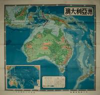
1954réf. 224585上海 Shanghai.: 地圖出版社 Ditu chubanshe. 1954. Coloured topographical map of the Australian continent inluding Papua New Guinea and New Zealand 106 x 112cm text in traditional Chinese characters. Legend includes desert coral reef seasonal rivers and lakes continental boundaries and so on. Inset map of Australia and the Pacific Islands also with key indicating altitude and sea depth. Folds into lightly worn original paper envelope measuring 38 x 25.5cm. Pinholes upper right and left corners small hole at fold point and tear in upper margin now repaired with archival washi paper 澳大利亞handwritten on reverse. Both envelope and the reverse of the map have small production labels attached. Map very bright with clear strong colours. Striking map in very good condition. . 地圖出版社 [Ditu chubanshe]. unknown
1971Two fold-out maps in color. Text in French; Les Guides Bleus Illustrés; B&W Photographs; 16mo 6" - 7" tall; 214 pages
1927réf. 51699San Francisco: Southern Pacific Lines Printed by Sunset Press ca. 1927. 4to. 80 pp unpaginated. 74 photo plates. Colour-illustrated softcovers yapp edges wraparound cover art by Maurice Logan 1886-1966 one of the California Society of Six Painters who produced boldly coloured impressionistic paintings and watercolours in constrast to the muted tonalims and landscapes of earlier San Francisco painters such as Keith and Hill. The front cover painting of New Orleans Broulatour Mansion in the French Quarter was commissioned by the Southern Pacific for their 1927 souvenir book travel poster and postcard slight shelfwear very slight creasing slight tidemark upper left corner still a VG bright copy. First edition of this beautiful brochure chronicling the points of interest along the Sunset Route including New Orleans African-Americans picking peppers Houston Waco San Antonio Charles Nackee famous Apache Scout in southern Arizona Yaqui Indian Village orange groves near Los Angeles filming movies in Hollywood and more. Southern Pacific Lines, Printed by Sunset Press, paperback
1938réf. 63046Portland OR & Kelso WA: Kilham Stationery & Printing Co. Marsh Underwood 1938. 12mo. 62 pp. Photo illustrations throughout. Green publisher’s cloth gilt lettering front cover slight shelfwear very slight rubbing & faint spotting still NF copy. First edition of this self-published memoir detailing this Cowlitz County logger’s beginnings in New England Wisconsin and finally working lumber camps along the Lewis River in Southwest Washington and in Snohomish Washington. He has included a sketch of a Wisconsin logging camp as well as many historic photographs describing logging methods early logging companies in the West and more. Underwood 1876-1939 originally worked as a Vermont logger and by 1910 was a River Driver directing log rafts from Woodland WA down to Portland OR on the Columbia River and later as logging camp superintendent in Snohomish WA. Kilham Stationery & Printing Co., [Marsh Underwood, hardcover
1981réf. 197204Los Angeles California n.p. 1981. 1981. Folding 6 panel brochure 8" x 22". 11 tinted color photographs; map by D.W. Pontius; blue background on front panel. Very good. Scarce. Includes advertisements for Mt. Lowe Orange Empire Trolley trip to Redlands Balloon trip Old Mission Trip. No Binding. Very Good. Los Angeles, California [n.p.] 1981. unknown
1981réf. 197204Los Angeles California n.p. 1981. 1981. Folding 6 panel brochure 8" x 22". 11 tinted color photographs; map by D.W. Pontius; blue background on front panel. Very good. Scarce. Includes advertisements for Mt. Lowe Orange Empire Trolley trip to Redlands Balloon trip Old Mission Trip. No Binding. Very Good. Los Angeles, California [n.p.] 1981. unknown books
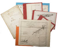
1755réf. ABC_474521755. Manuscript of 24 pages 6 printed maps on cardboard. This wonderful logbook details the journey of a French captain from Manila to the Maluku Islands in todays Indonesia. The journey took place during the months of March to May of 1755. The captain of the ship recounted with great detail the events of every day of the journey with detailed daily accounts of the weather winds manoeuvres of the ship its departures anchorages and precise coordinates at every point of the journey. The captain furthermore had a keen eye for the geographical and nautical details along the journey. He recounted the exact locations of for example sandbanks and bays where ships and their crews can take provisions and fresh water. The accounts are detailed and captivating: "After our boats were back on board we set sail . in the afternoon to moor under the old Portuguese fort on the Solor island Indonesia the winds for the tide were fresh at 1:34 a.m. . sand and gravel and then I went back to mooring. The pavilion of the fort . the village is under the said fort at 3 cables from us .". The captain goes on to describe the geographical features of the islands as well as other places en route with great detail. Curiously we find inscriptions in Spanish and the names of one don Phelipe Qui who describes himself as el piloto and one Padre Don Estevan de Melo. The latter might be identical with Don Estevan Roxas y Melo a native of Lima Peru and secretary to the Archbishop of Manila Rodriguez since 1736. Roxas y Melo was part of the 1751 reconstruction of the Cathedral of Manila working under the auspice of the Italian architect Juan de Uguccioni.The logbook comes with six printed maps partly illustrating the journey of the captain pasted on contemporary cardboard. They depict the Bay of Sulavesi with the city of Bantang Pitcairn the coast of New Guinea the coast of Queensland the Santa Cruz Islands in the present-day Solomon Islands and Alejandro Selkirk Island. The plates stem from the French translation of James Hawkesworths An Account of the Voyages Hawkesworth Relation des voyages entrepris par ordre de sa Majesté Britannique actuellement regnante; pour faire des découvertes dans l'hemisphère meridional Paris 1774.Some holes on the first sheet not affecting the text. Small water damage some slighlty affecting the text. Remnants of seals on last page. Otherwise in good condition. unknown
réf. 16212Manuscrit du XVIIIe siècle ; in-folio, br. ; 100 pp., (8) pp. complément d'une autre main et sur un autre papier du XIXe siècle. Les ratures indiquent un texte en cours de finition.
1931réf. 60944Syracuse NY: Empire New England Company Inc. 1931. One large 6-panel dissected colour linen-backed map featuring one hemisphere map of Pacific Ocean 34 inches in diameter within larger 40 x 52 in. colour-printed wall map with scale at Equator of 1:23300000 folding down to 19.5 x 17.25 brass grommets mounted for hanging at upper fore-edge minor edgewear rubbing at crease folds minor age toning light fraying to the linen still VG copy. Second printing of this scarce linen-backed dissected wall map reflecting the extent of Imperialist Colonial spheres of influence in the Pacific just 10 years before the outbreak of World War II. These educational maps served as key instructional tools for detailing Japanese British Dutch French Portuguese and U.S. colonies dependencies and mandated territories demarcated here in respective colours spanning from Asia to the Americas and include British holdings in Antarctica. Worldcat locates 1 copy Boston Public. Empire New England Company, Inc., unknown
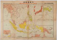
1719réf. 219230東京. Tokyo.: 日本放送協会. Nihon Hōsō Shuppan Kyōkai. Showa 17 1942. Colour folding map scale 1: 10000000 54.7cm x 79.5cm chronology of building the Greater East Asia Co-Prosperity Sphere on reverse. Some light browning a little darker at folds and reverse washi repairs to folds on reverse. This colour map of Asia and the Pacific published on 30 January 1942—just one month after Japan's attack on Pearl Harbor—offers a striking glimpse into wartime strategy and propaganda. Remarkably despite being produced at the war's outset it accurately anticipated key battlegrounds that would define the conflict. The main map is supplemented by two inset maps: one in the upper right highlighting Japan the Hawaiian Islands and Honolulu and another in the lower left focusing on Singapore with Darwin marked along the lower edge. The reverse side features a revealing chronological chart titled "Building Great East Asia" documenting Japan's military expansion from the 1931 Manchurian Incident through January 1942 as troops advanced across Southeast Asia. Notably two blank rows were intentionally left at the chart's end anticipating future victories to be recorded as the war progressed—a telling detail that underscores the map's dual role as both strategic document and propaganda tool. An interesting map which combines geographical precision with ideological messaging. . 日本放送協会. [Nihon Hōsō Shuppan Kyōkai]. unknown
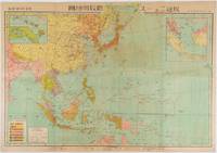
1719réf. 176771東京. Tokyo.: 日本放送出版会社. Nihon Hōsō Shuppan Kaisha. Showa 17 1942. Colour folding map scale 1:14500000 55cm x 80cm naval warship photographic illustrations on reverse. The wartime paper is browned and friable but small closed tears along fold lines and edges have been neatly repaired with archival washi on the verso. 79 x 53cm This colour map of Asia and the Pacific was published as a supplement to a magazine Hoso 放送 on January 1942 less than one month after the Pearl Harbor attack by the Japanese Forces. The war had just started but amazingly the map accurately predicted where the fighting would take place throughout the war. An inset map on upper right shows Singapore Borneo Sumatra and Java where battles took place in the area in early 1942. An inset chart on lower left shows various resources and their location including coal tin and iron ore clearly showing that the war was fought over securing resources. On reverse eleven photographic illustrations of war ships from Germany Britain the US and Japan are shown including the Prince of Wales and Enterprise. . 日本放送出版会社. [Nihon Hōsō Shuppan Kaisha]. unknown
1923réf. 63359Victoria B.C.: Archives of British Columbia Printed by William H. Cullin 1923. 8vo. xx 171 1 pp. With portrait numerous plates and two maps. Beige-coloured publisher’s cloth over beveled boards black lettering front cover & spine rough-cut fore-edge textblock as issued minor shelfwear rubbing slightly shaken very faint ex-lib markings on spine dustsoiling still G copy from the libraries of Dr. John C. Brougher 1901-1983 founder of Vancouver Clinic and famed obstetrician & gynecologist believed to have delivered over 10000 children in SW Washington during his years of practice and Clark County Historical Society Collections recently deaccessioned bookplates on front pastedown. First Archives of British Columbia edition drawing from the original journal kept by Archibald Menzies who served as naturalist on the Discovery in Vancouver’s famed voyage around the World from 1790-1794 and this specifically deals with his notes observations and naturalist explorations in the Puget Sound and Vancouver Island in 1792. This journal expands substantially on Prof. Meany’s “Vancouver’s Discovery of Puget Sound” includes specific tables and index of the thousands of specimens collected as well as including the expedition’s frequent encounters with the Northwest Coast Native American Indigenous Peoples. Archives of British Columbia, Printed by William H. Cullin, hardcover
1920réf. 64773Portland OR: Shaver Transportation; Sowell Studio Photos 145 1/2 3rd St. ca. 1920. Three oblong folio original silver gelatin photographs sized 14 x 9.75 in. all w/ photographer’s rubber stamp on verso two w/in negative at lower fore-edge very slight age toning minor shelfwear a couple corners creased still an excellent set of three. These scarce three large original silver gelatin photographs depict the expanding fleet of tugboats from the Shaver Transportation Company from before World War I into the Roaring 20’s. Those depicted here included the “Hercules” the “Cascades” originally built by the US Army Corps of Engineers for constructing the Cascade Locks and used by the Shaver Company until World War II; the historic “Henderson” wooden-hulled sternwheeler first built in 1901 as freight carrier and towboat operated for decades towing log rafts pushing barges and by 1950 was one of the last two wooden-hulled sternwheelers working the river and starred in the “River Queen” film in 1952; the “Sarah Dixon” another sternwheeler named for George Shaver’s wife; and the “No Wonder” originally built in Portland in 1889 from dismantled components from the 1877 Wonder and served as workhorse for the log-towing operations until retired and abandoned in 1933. Also depicted are the tugs such as the “James W” designed by Captain Delmar Shaver owned by the Shaver Transportation Co. powered by a direct-reversible 350 Atlas Diesel engine with electrically powered monkey rudder system and during the height of the Kaiser World War II shipyard boom she worked around the clock as she was built for speed and minimal wake effect eventually being retired by the company in the 1950’s. Also featured are the “Echo” which was the Shaver Transportation Co.’s first propeller-driven gasoline-powered boat as well as the large Shaver sternwheeler which later was converted into a twin-screw semi-tunnel diesel tug. Founded originally in 1880 by George Washington Shaver and partner’s as the People’s Freighting Co. with their steamboat Manzanillo the company was later incorporated in 1893 as Shaver Transportation by George with his two sons James and George and by the post-World War I era as depicted in these photos had expanded to 7 and then 10 tugs and their diesel power and scientific hull designs dominated Pacific Northwest waterways towing. Gustin 1884-1959 began as a photographer in The Dalles and then Pendleton before established as photographer and proprietor of Sowell Studio formerly Simon-Sowell Studio in 1914-1916 and operated as a photographer for the next three decades. Simon 1890-1986 became the manager for the Sowell Studio sometime in the early 1920’s and continued as professional photographer until his later retirement. Shaver Transportation; Sowell Studio Photos, 145 1/2 3rd St., unknown
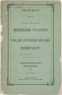
1856réf. 27974Nueva-York: Imprenta de Hallet 1856. Coal Mining in Mexico A Spanish-language prospectus for an American mining and land company on the Pacific coast of Mexico. Original printed wrappers. Rear wrapper detached spine mostly perished library blindstamp on front wrapper and withdrawal stamp on wrapper interior. Foxed. Good overall. SABIN 48572 note. unknown
1856réf. 27974Nueva-York: Imprenta de Hallet 1856. Coal Mining in Mexico A Spanish-language prospectus for an American mining and land company on the Pacific coast of Mexico. Original printed wrappers. Rear wrapper detached spine mostly perished library blindstamp on front wrapper and withdrawal stamp on wrapper interior. Foxed. Good overall. SABIN 48572 note. unknown books
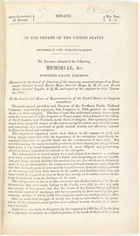
1868réf. 33573Washington. 1868. With Johnson's Great Map of the Northern Pacific Route An application to Congress by the Northern Pacific Railroad headed by Minnesota railroad magnate James J. Hill for federal aid to support the Railroad's expansion to the West Coast. The petition reviews the railroad's original charter and includes an impressive color folding map "Map of the Country from Lake Superior to the Pacific Ocean" which illustrates the railroad's route from Duluth to Seattle and Portland. This map was originally produced to accompany Edwin Johnson's report on the feasibility of the railroad. This is one of the finest maps of the region traversed to be issued up to this time and was produced by Colton in New York not by the government. Wheat devotes several pages to discussing it noting that "the detail of such a map defies cataloging." Above the map appears an elevation chart for the same distance. A fine account of railroad expansion in the Northwest. Rare. Not on OCLC. 39pp. plus large color folding map. Modern maroon cloth gilt maroon morocco label. Minor dust soiling in text. Map bright and clean. Overall very good. MIDLAND NOTES 68-164. WHEAT TRANSMISSISSIPPI 1169. hardcover
1868réf. 33573Washington. 1868. With Johnson's Great Map of the Northern Pacific Route An application to Congress by the Northern Pacific Railroad headed by Minnesota railroad magnate James J. Hill for federal aid to support the Railroad's expansion to the West Coast. The petition reviews the railroad's original charter and includes an impressive color folding map "Map of the Country from Lake Superior to the Pacific Ocean" which illustrates the railroad's route from Duluth to Seattle and Portland. This map was originally produced to accompany Edwin Johnson's report on the feasibility of the railroad. This is one of the finest maps of the region traversed to be issued up to this time and was produced by Colton in New York not by the government. Wheat devotes several pages to discussing it noting that "the detail of such a map defies cataloging." Above the map appears an elevation chart for the same distance. A fine account of railroad expansion in the Northwest. Rare. Not on OCLC. 39pp. plus large color folding map. Modern maroon cloth gilt maroon morocco label. Minor dust soiling in text. Map bright and clean. Overall very good. MIDLAND NOTES 68-164. WHEAT TRANSMISSISSIPPI 1169. hardcover books
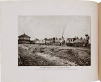
1891réf. 32829St. Louis: Woodward & Tiernan Printing Co. n.d. 1891. 1891. First edition. Third edition. 12mo. Original orange wrappers printed in black ink 82 2 pp. illustrated map. advertising. Issued by the general passenger department of the Missouri Pacific Railway. A general description of the state and its place in history is provided. Plus soil rainfall churches schools higher educational opportunities newspapers population and wealth corn wheat oats stock farming wild flowers orchards and vineyards salt lead and zinc stone brick and lime coal gas hunting and fishing cities irrigation etc. Views are offered of farms and ranches parade grounds city parks etc. of various cities. Herd 1204 says "Issued by the Missouri Pacific Railway Company this book appeared in many editions though all are now rare." Prior to this copy the earliest edition of a similar booklet was a 13th edition and that was 15 years ago. Fine clean copy with a fine folding map. An exceptional copy of a rare item. Woodward & Tiernan Printing Co., n.d. (1891)]. unknown
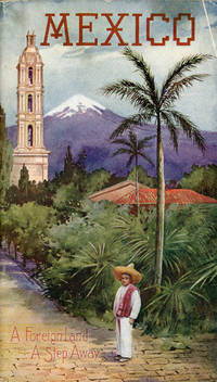
1907réf. 53081St. Louis: Sam'l F. Myerson Prtg. Co. n.d. ca 1907. ca 1907. 8 3/4" x 5" in colorful pictorial wrappers. 52pp. Map. Black and white illustrations throughout. Information on preparing for a trip to Mexico followed by information and photographs of what might expect to see and experience along the way from St. Louis to Mexico City. Photographs and information on Topo Chico Monterrey Saltillo Cedral Bocas San Luis Potosi Tampico Queretaro Patzcuaro Chapultepec the Viga Canal Mexico City bullfights ancient pyramids etc. A wonderful collection of photographs taken by S.W. Matteson C.W. Archer and C.B. Waite. Fold-out map 14 1/2" x 8 3/4" showing system route from St. Louis to Mexico City inside rear wrapper. Covers and title page lightly soiled. Crease at top corner of front wrapper and with 1/2" closed tear along with scuffing and rubbing to both wrappers and to spine. Very good. A very nicely produced booklet. Sam'l F. Myerson Prtg., Co., n.d. [ca 1907]. unknown
1930réf. 44298St. Louis: A.D. Bell Passenger Traffic Manager Missouri Pacific Railroad n.d. ca 1930. ca 1930. 8 3/4" x 5" in bright colorful pictorial wrappers showing a market scene on the front wrapper. 50pp. Illustrations. Map. Written with the potential tourist in mind the brochure discusses a trip from St. Louis to Mexico City describing what one will see and experience on the trip. Black and white photographs include Chapultepec Castle scenery caverns various falls Saddle Mountain street scenes monuments important buildings churches locals etc. Fold-out colored system map at end of brochure showing the Missouri Pacific Railway lines and its connections from St. Louis southward thru Texarkana Austin San Antonio and down to Mexico City. Chart showing how to pronounce Spanish and Indian names. Light soiling to wrappers and with minor wear to the extremities. A nicely produced and informative brochure. A.D. Bell, Passenger Traffic Manager, Missouri Pacific Railroad, n.d. [ca 1930]. unknown
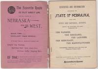
1892réf. 87869St. Louis MO: Printed by Woodward and Tiernan Printing Co 1892. Second Edition. Staplebound Pamphlet. Good Plus. Stapled pamphlet. 7.5 in. x 5.25 in. pp. 64. Illustrated with in-text drawings and a fold-out map of Nebraska 21 in. x 26 in. Pink cardpaper wraps with black title to front. Light soiling to covers with chips to top/bottom of spine; older tape repairs to length of spine reattaching front cover and to left edge of rear cover. Fragile edges with chips to corners and several short closed tears to cover edges. Clean interior with very good plus map. This brochure was presented "With the Compliments of the General Passenger Department of the Missouri Pacific Railway." The text provides description and chart of information related to population geography geology weather land prices distances horticulture churches and more. Printed by Woodward and Tiernan Printing Co unknown
1892réf. 46034St. Louis: Woodward & Tiernan Print. Co. 1892. Stapled paper wrappers. A good copy wrappers chipped soiled starting to detach seller stamp to front wrapper occasional soiling to contents. Lacking folding map. 64 pp. Illus. with b/w engravings. 12mo. Promotional booklet published by the Missouri Pacific Railway encouraging settlement in Nebraska. Lacks folding map. Woodward & Tiernan Print. Co. unknown