Panama Canal & City PhotosBiblio.com
849 résultats
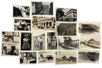
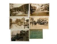
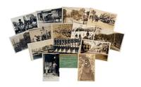
1910réf. 226891910. Early twentieth-century Panama photo archive circa 1910s to 1920s documents Panama during the decades surrounding the completion and early operation of the Panama Canal supporting research into U.S. engineering influence urban modernization Indigenous representation tourism waterfront labor and the transformation of Panama City and Colón into canal-era commercial spaces. The Panama Canal was completed and opened in 1914 linking the Atlantic and Pacific through one of the period's most consequential engineered waterways and the Gatun Locks formed part of the lock system that lifted vessels to Gatun Lake before lowering them at the opposite end of the route. These photographs record not only canal machinery and civic streets but also the human geography around the canal: tourists workers traders children waterfront activity ruins and leisure businesses appear together in a visual record of Panama's modernization under strong American commercial and infrastructural presence. Fifteen pieces comprising fourteen silver gelatin photographs and real photo postcards with one printed business advertisement card Panama circa 1910s to 1920s measuring approximately 2½ x 3¾ inches to 4 x 6 inches. The canal views include "Operating Emergency Dam Gatun Locks Panama Canal" and a view captioned "Gatun Locks" showing massive steel gates and early twentieth-century bridgework. Urban scenes include "Street Scene Panama City on Southern Cruise 1923" with American tourists Model T automobiles and colonial façades and "The Plaza Panama City" showing palm trees streetcar tracks and civic space. Local and historical subjects include a real photo postcard captioned "Circular Stairway in Old Panama ruins of Old Panama standing at the foot and looking directly up" documenting Panama Viejo the site of the original Panama City founded in 1519 and later recognized as part of a UNESCO World Heritage site. Other images include "Panama Water Front at High Tide" with fishing boats and market activity; dockworkers and traders near the canal's edge; and "Children in San Blas Panama" foregrounding Indigenous presence during the Canal era. The San Blas Islands are associated with the Guna an Indigenous people of Panama and Colombia whose communities are strongly identified with Guna Yala and the San Blas archipelago. The advertisement card reading "When in Colon Visit the Café Hollywood" places the photographic group within the leisure and service economy that grew around canal traffic tourism and foreign presence. Together the images clarify the different but connected worlds of early twentieth-century Panama: the engineered landscape of Gatun Locks the colonial and modern streets of Panama City the ruins of Old Panama the working waterfront Indigenous children in San Blas and the commercial culture of Colón. Minor corner wear and toning; images sharp and well preserved very good overall. Cohesive Panama Canal era archive documenting the intersection of American engineering urban transformation Indigenous life waterfront labor and tourist commerce in the early decades of the Canal Zone. unknown
1920réf. 230431920. Panama City photograph archive ca. 1920s documenting the urban environment of the Panamanian capital and the infrastructure of the Panama Canal during the decades following the canal's opening in 1914. The photographs record the interconnected worlds of canal engineering international commerce tourism and everyday street life that developed as Panama City became a strategic hub of global shipping and American geopolitical influence in the Caribbean basin. Urban scenes depict commercial storefronts streetcars automobiles and pedestrian activity along central avenues while other photographs capture the canal's mechanical landscape of locks spillways and industrial structures. Together the images illustrate the transformation of Panama City into a cosmopolitan port city shaped by canal traffic international trade and the presence of the U.S. Canal Zone administration. Archive of eighteen original silver gelatin photographs depicting Panama City and surrounding canal infrastructure. Each measure approximately 3.5 x 5.5 inches. Several images show major canal engineering features including a photograph captioned "Purifying Plant and Spillway - Panama Canal" as well as views of lock systems and canal transport routes where cargo vessels pass through the waterway. Urban photographs record commercial and entertainment districts including a façade marked "American Cabaret" a busy street labeled "Street Scene - Panama City" and a view of the Hotel Central along a principal thoroughfare lined with automobiles and electric streetcars. One photograph bears the caption "264 - President's Palace on day of Riot Panama 2-28-." showing crowds gathered along balconies and streets near the presidential residence during a moment of public unrest. Additional photographs document daily life and local commerce including outdoor market scenes pedestrians and vendors workers posing near canal machinery and residents standing beside storefront displays. Landscapes and travel images appear as well including a waterfall and rural roadside scenes with automobiles indicating the expansion of modern transportation and tourism into the Panamanian countryside during the early twentieth century. The photographs collectively capture the layered social and industrial landscape that emerged in Panama after the completion of the Panama Canal when the city became a focal point of hemispheric trade and international transit. The canal drastically shortened maritime routes between the Atlantic and Pacific Oceans and reshaped the economy of the Caribbean and Pacific coasts of the Americas. Panama City consequently developed a complex urban culture combining local Panamanian communities canal workers foreign merchants travelers and U.S. officials connected to canal administration. Light surface wear and minor edge handling visible on several prints overall very good condition. These images document that environment through views of transportation infrastructure entertainment venues commercial streets and civic spaces offering a visual record of Panama City during the formative decades of the canal era. Photographs measure approximately postcard size. unknown
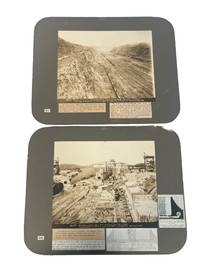
1912réf. 201831912. Panama Canal Early Photography Two large albumen photographs of the construction of the Panama Canal 1912. Photographs are pasted down to grey cardstock with captions and articles describing the imagery below. Photos measure 11" x 14". The building of the Panama Canal was not met with ease as the former French owned project was abandoned due to lack of investment and a high worker mortality rate and the grappling of territory between Panama Columbia and the United States. In 1903 Panama gained it's independence and as the United States recognized this Roosevelt used buying power to his advantage to funnel millions of dollars towards Panama and the funding of this project. These two photographs are early large scale displays of the massive amounts of land and infrastructure that went into this long awaited project. One photograph shows the Culebra Cut in June 1912. The article pasted to the front states that "To remove the 105000000 cubicyards of earth from the backbone of the Americas required about 6000000 pounds of high-grade dynamite each year to break up the material.in which time some 19000000 pounds were exploded in Culebra Cut only eight men were killed." The second photograph dated January 1912 shows the Miraflores Upper Locks with a diagram of what the final construction would look like. The photograph shows a partially built sill multiple tracks for hauling material heavy duty cranes and other industrial equipment. Thousands of local men were hired for this dangerous and underpaying job over the course of a decade. These Caribbean workers endured poor working conditions low wages and unbearable temperatures for a government that was not theirs over 5000 becoming casualties. By it's opening ceremony in 1914 The Panama Canal was the most expensive project in US history estimated at $350000000. These early photographs show only a portion of what went into this costly construction. Minor wear to edges of board upper right corner of one is chipped. Images are crisp and clear overall very good condition. unknown
réf. 17090Panama Canal Company. 1975. Paperback. Very good. 8 x 10.5 inches with stiff cardboard covers manuals mostly about "Locks Division" canal repairs with frequent pictures. "Strut Arm Assembly Replacement Proceedure Chamber Caissons Installation And Removal Procedures Center Wall Culvert Inlet/Outlet Bulkheads Installation & Removal Procedures Installation Operation And Removal Of Culvert Dewatering Pumps Miter Gate Crank Gear Re0placement Procedures Center Wall Culvert Elevators Split Bevel Gear Assembly Center Wall Bulkheads In Side Wall Culvert Intake Screen slots Side Wall Culvert Intake Screens Chamber Dewatering And Filling Procedures Gatun Locks Installation And Removal Of Lateral Culvert Plugs and Side Wall Adit Drainage Culvert And T-Culvert Bulkheads. Panama Canal Company paperback
1904réf. 182051904. Photograph album circa 1904-1914 documenting maritime activity canal construction and social life in Panama during the period of American engineering control of the Panama Canal project. The images center on a group of American men traveling aboard a small yacht identified in several photographs by the presence of the American yacht ensign indicating a private pleasure vessel rather than a military or commercial ship. Several photographs appear to show large-scale excavation and infrastructure consistent with canal construction situating the album within the decade of intensive labor and engineering that culminated in the canal's completion in 1914. Alongside these scenes are numerous images of local life including Indigenous children and adults along coastal and riverine environments as well as built landscapes featuring plantation-style houses adapted to tropical climates. The album provides visual evidence of the intersection of American presence large-scale infrastructure development and local communities in early twentieth-century Panama. Photograph album containing images mounted on black pages within a black leather-bound volume measuring approximately 10 x 7 inches and comprising 86 pages. The photographs depict shipboard life including crew members steering and managing vessels group portraits of men in bathing attire and social gatherings such as shared meals. Additional images show coastal scenes with canoes swimmers and shoreline activity as well as occasional figures in military dress. The composition of the album reflects both travel documentation and informal social photography capturing a range of maritime domestic and environmental subjects. 86-page album with photographs mounted throughout; one page partially clipped and one page removed with small tears to several pages not affecting images. Light sunning to some photographs; overall very good condition. A cohesive visual record of American maritime travel and canal-era activity in Panama documenting both infrastructure development and everyday life in the region. unknown
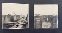
1915réf. 224481915. Unknown photographer Panama Canal Zone and local life photo archive 1915 documents Panama during the first year after the canal's opening to traffic and supports research into U.S. imperial administration Canal Zone settlement travel photography military protection of infrastructure and the visual ordering of colonial space. The Panama Canal opened to traffic on August 15 1914 after U.S. construction created a strategic interoceanic route administered through the Canal Zone and Balboa Heights became a key administrative and residential center for the U.S.-controlled canal system. These photographs capture the built and natural environment through which American authority was made visible: locks river landscapes official buildings hilltop housing city views and naval practice appear together as evidence of a recently completed engineering project becoming an occupied administrative territory. Twenty-four original silver gelatin photographs including two real photo postcards dated 1915 with some undated images several with handwritten inscriptions in English on versos and some with printed captions on rectos. Photographs measure approximately 3½ x 5 inches to 5½ x 7 inches. The archive includes views of the Chagres River the largest river in the Panama Canal drainage basin and a major part of the canal water system together with photographs of the Gatun Locks canal gates aerial views of Panama City the main city plaza a bull ring and Balboa Heights. The Balboa Heights images show American-style bungalows arranged along curving terraced roads with broad verandas raised foundations and landscaped grounds visual evidence of the residential hierarchy attached to U.S. canal administration. Additional images show the Administration Building at Balboa Heights completed in 1914 and positioned above the town as a central administrative landmark while a real photo postcard captioned "Ready to Fire-Division Practice" shows U.S. naval boats in formation off the coast connecting sightseeing views to the military protection of the newly opened canal. The archive's research value lies in its combination of personal travel documentation official-looking captioned views urban and infrastructural scenes and military imagery from the early Canal Zone era. Its views of Balboa Heights are especially significant because U.S. canal society was organized through racialized and occupational distinctions including the "gold roll" and "silver roll" labor categories that separated white American workers from largely Black Caribbean and Latin American workers and shaped housing pay and privilege within the zone. Light edge wear legible inscriptions and preserved image surfaces very good overall. Cohesive Panama Canal Zone photo archive documenting the immediate post-opening landscape of U.S. power in Panama through canal infrastructure river systems segregated administrative space urban views and naval readiness. unknown
1920réf. 230431920. Panama City photograph archive ca. 1920s documenting the urban environment of the Panamanian capital and the infrastructure of the Panama Canal during the decades following the canal's opening in 1914. The photographs record the interconnected worlds of canal engineering international commerce tourism and everyday street life that developed as Panama City became a strategic hub of global shipping and American geopolitical influence in the Caribbean basin. Urban scenes depict commercial storefronts streetcars automobiles and pedestrian activity along central avenues while other photographs capture the canal's mechanical landscape of locks spillways and industrial structures. Together the images illustrate the transformation of Panama City into a cosmopolitan port city shaped by canal traffic international trade and the presence of the U.S. Canal Zone administration. Archive of eighteen original silver gelatin photographs depicting Panama City and surrounding canal infrastructure. Each measure approximately 3.5 x 5.5 inches. Several images show major canal engineering features including a photograph captioned "Purifying Plant and Spillway - Panama Canal" as well as views of lock systems and canal transport routes where cargo vessels pass through the waterway. Urban photographs record commercial and entertainment districts including a façade marked "American Cabaret" a busy street labeled "Street Scene - Panama City" and a view of the Hotel Central along a principal thoroughfare lined with automobiles and electric streetcars. One photograph bears the caption "264 - President's Palace on day of Riot Panama 2-28-." showing crowds gathered along balconies and streets near the presidential residence during a moment of public unrest. Additional photographs document daily life and local commerce including outdoor market scenes pedestrians and vendors workers posing near canal machinery and residents standing beside storefront displays. Landscapes and travel images appear as well including a waterfall and rural roadside scenes with automobiles indicating the expansion of modern transportation and tourism into the Panamanian countryside during the early twentieth century. The photographs collectively capture the layered social and industrial landscape that emerged in Panama after the completion of the Panama Canal when the city became a focal point of hemispheric trade and international transit. The canal drastically shortened maritime routes between the Atlantic and Pacific Oceans and reshaped the economy of the Caribbean and Pacific coasts of the Americas. Panama City consequently developed a complex urban culture combining local Panamanian communities canal workers foreign merchants travelers and U.S. officials connected to canal administration. Light surface wear and minor edge handling visible on several prints overall very good condition. These images document that environment through views of transportation infrastructure entertainment venues commercial streets and civic spaces offering a visual record of Panama City during the formative decades of the canal era. Photographs measure approximately postcard size. unknown books
1912réf. 201831912. Panama Canal Early Photography Two large albumen photographs of the construction of the Panama Canal 1912. Photographs are pasted down to grey cardstock with captions and articles describing the imagery below. Photos measure 11" x 14". The building of the Panama Canal was not met with ease as the former French owned project was abandoned due to lack of investment and a high worker mortality rate and the grappling of territory between Panama Columbia and the United States. In 1903 Panama gained it's independence and as the United States recognized this Roosevelt used buying power to his advantage to funnel millions of dollars towards Panama and the funding of this project. These two photographs are early large scale displays of the massive amounts of land and infrastructure that went into this long awaited project. One photograph shows the Culebra Cut in June 1912. The article pasted to the front states that "To remove the 105000000 cubicyards of earth from the backbone of the Americas required about 6000000 pounds of high-grade dynamite each year to break up the material.in which time some 19000000 pounds were exploded in Culebra Cut only eight men were killed." The second photograph dated January 1912 shows the Miraflores Upper Locks with a diagram of what the final construction would look like. The photograph shows a partially built sill multiple tracks for hauling material heavy duty cranes and other industrial equipment. Thousands of local men were hired for this dangerous and underpaying job over the course of a decade. These Caribbean workers endured poor working conditions low wages and unbearable temperatures for a government that was not theirs over 5000 becoming casualties. By it's opening ceremony in 1914 The Panama Canal was the most expensive project in US history estimated at $350000000. These early photographs show only a portion of what went into this costly construction. Minor wear to edges of board upper right corner of one is chipped. Images are crisp and clear overall very good condition. unknown books
1904réf. 182051904. Photograph album circa 1904-1914 documenting maritime activity canal construction and social life in Panama during the period of American engineering control of the Panama Canal project. The images center on a group of American men traveling aboard a small yacht identified in several photographs by the presence of the American yacht ensign indicating a private pleasure vessel rather than a military or commercial ship. Several photographs appear to show large-scale excavation and infrastructure consistent with canal construction situating the album within the decade of intensive labor and engineering that culminated in the canal's completion in 1914. Alongside these scenes are numerous images of local life including Indigenous children and adults along coastal and riverine environments as well as built landscapes featuring plantation-style houses adapted to tropical climates. The album provides visual evidence of the intersection of American presence large-scale infrastructure development and local communities in early twentieth-century Panama. Photograph album containing images mounted on black pages within a black leather-bound volume measuring approximately 10 x 7 inches and comprising 86 pages. The photographs depict shipboard life including crew members steering and managing vessels group portraits of men in bathing attire and social gatherings such as shared meals. Additional images show coastal scenes with canoes swimmers and shoreline activity as well as occasional figures in military dress. The composition of the album reflects both travel documentation and informal social photography capturing a range of maritime domestic and environmental subjects. 86-page album with photographs mounted throughout; one page partially clipped and one page removed with small tears to several pages not affecting images. Light sunning to some photographs; overall very good condition. A cohesive visual record of American maritime travel and canal-era activity in Panama documenting both infrastructure development and everyday life in the region. unknown books
1910réf. 226891910. Early twentieth-century Panama photo archive circa 1910s to 1920s documents Panama during the decades surrounding the completion and early operation of the Panama Canal supporting research into U.S. engineering influence urban modernization Indigenous representation tourism waterfront labor and the transformation of Panama City and Colón into canal-era commercial spaces. The Panama Canal was completed and opened in 1914 linking the Atlantic and Pacific through one of the period's most consequential engineered waterways and the Gatun Locks formed part of the lock system that lifted vessels to Gatun Lake before lowering them at the opposite end of the route. These photographs record not only canal machinery and civic streets but also the human geography around the canal: tourists workers traders children waterfront activity ruins and leisure businesses appear together in a visual record of Panama's modernization under strong American commercial and infrastructural presence. Fifteen pieces comprising fourteen silver gelatin photographs and real photo postcards with one printed business advertisement card Panama circa 1910s to 1920s measuring approximately 2½ x 3¾ inches to 4 x 6 inches. The canal views include "Operating Emergency Dam Gatun Locks Panama Canal" and a view captioned "Gatun Locks" showing massive steel gates and early twentieth-century bridgework. Urban scenes include "Street Scene Panama City on Southern Cruise 1923" with American tourists Model T automobiles and colonial façades and "The Plaza Panama City" showing palm trees streetcar tracks and civic space. Local and historical subjects include a real photo postcard captioned "Circular Stairway in Old Panama ruins of Old Panama standing at the foot and looking directly up" documenting Panama Viejo the site of the original Panama City founded in 1519 and later recognized as part of a UNESCO World Heritage site. Other images include "Panama Water Front at High Tide" with fishing boats and market activity; dockworkers and traders near the canal's edge; and "Children in San Blas Panama" foregrounding Indigenous presence during the Canal era. The San Blas Islands are associated with the Guna an Indigenous people of Panama and Colombia whose communities are strongly identified with Guna Yala and the San Blas archipelago. The advertisement card reading "When in Colon Visit the Café Hollywood" places the photographic group within the leisure and service economy that grew around canal traffic tourism and foreign presence. Together the images clarify the different but connected worlds of early twentieth-century Panama: the engineered landscape of Gatun Locks the colonial and modern streets of Panama City the ruins of Old Panama the working waterfront Indigenous children in San Blas and the commercial culture of Colón. Minor corner wear and toning; images sharp and well preserved very good overall. Cohesive Panama Canal era archive documenting the intersection of American engineering urban transformation Indigenous life waterfront labor and tourist commerce in the early decades of the Canal Zone. unknown books
1915réf. 224481915. Unknown photographer Panama Canal Zone and local life photo archive 1915 documents Panama during the first year after the canal's opening to traffic and supports research into U.S. imperial administration Canal Zone settlement travel photography military protection of infrastructure and the visual ordering of colonial space. The Panama Canal opened to traffic on August 15 1914 after U.S. construction created a strategic interoceanic route administered through the Canal Zone and Balboa Heights became a key administrative and residential center for the U.S.-controlled canal system. These photographs capture the built and natural environment through which American authority was made visible: locks river landscapes official buildings hilltop housing city views and naval practice appear together as evidence of a recently completed engineering project becoming an occupied administrative territory. Twenty-four original silver gelatin photographs including two real photo postcards dated 1915 with some undated images several with handwritten inscriptions in English on versos and some with printed captions on rectos. Photographs measure approximately 3½ x 5 inches to 5½ x 7 inches. The archive includes views of the Chagres River the largest river in the Panama Canal drainage basin and a major part of the canal water system together with photographs of the Gatun Locks canal gates aerial views of Panama City the main city plaza a bull ring and Balboa Heights. The Balboa Heights images show American-style bungalows arranged along curving terraced roads with broad verandas raised foundations and landscaped grounds visual evidence of the residential hierarchy attached to U.S. canal administration. Additional images show the Administration Building at Balboa Heights completed in 1914 and positioned above the town as a central administrative landmark while a real photo postcard captioned "Ready to Fire-Division Practice" shows U.S. naval boats in formation off the coast connecting sightseeing views to the military protection of the newly opened canal. The archive's research value lies in its combination of personal travel documentation official-looking captioned views urban and infrastructural scenes and military imagery from the early Canal Zone era. Its views of Balboa Heights are especially significant because U.S. canal society was organized through racialized and occupational distinctions including the "gold roll" and "silver roll" labor categories that separated white American workers from largely Black Caribbean and Latin American workers and shaped housing pay and privilege within the zone. Light edge wear legible inscriptions and preserved image surfaces very good overall. Cohesive Panama Canal Zone photo archive documenting the immediate post-opening landscape of U.S. power in Panama through canal infrastructure river systems segregated administrative space urban views and naval readiness. unknown books
réf. 10696PA CTY PCIO 1964. FIRST EDITION VERY GOOD-FINE. F. PA CTY, PCIO, 1964 unknown books
S.L. (Padova?), s.d. (primi del ‘900), in-8, br., pp. 7. Estratto.
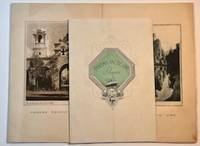
1934réf. 021125004Panama Pacific Line 1934. Very Good. Two dinner menus and an entertainment program from July 1934 voyage of the S.S. Virginia. The S.S. Virginia along with two sister ships ran a route from New York to San Francisco via the Panama Canal. The menus feature photographically illustrated covers and a wide range of items from Lobster ala Newburg to Cherry Jello. The entertainments included a masquerade ball horse racing and dancing. Staining to the menus creasing to the entertainment program. Very Good. Panama Pacific Line unknown
1977Flammarion 1977, In-8 broché 262 p. Bon état.
Broché. 251 pages. Rousseurs.
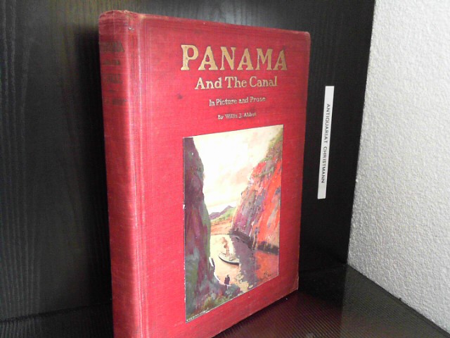
1913réf. 20017Sydicate Publ. Comp., New York 1913. 414 S. mit über 600 Fotos u. zahlr. Aquarell-Tafeln von E. J. read u. G. Grant., original farbig illustr. Leinen- gebundene Ausgabe, roter illustrierter Leinenband, goldgeprägter Deckel und Rücken, Gebrauchsspuren am Einband, sonst guter Zustand
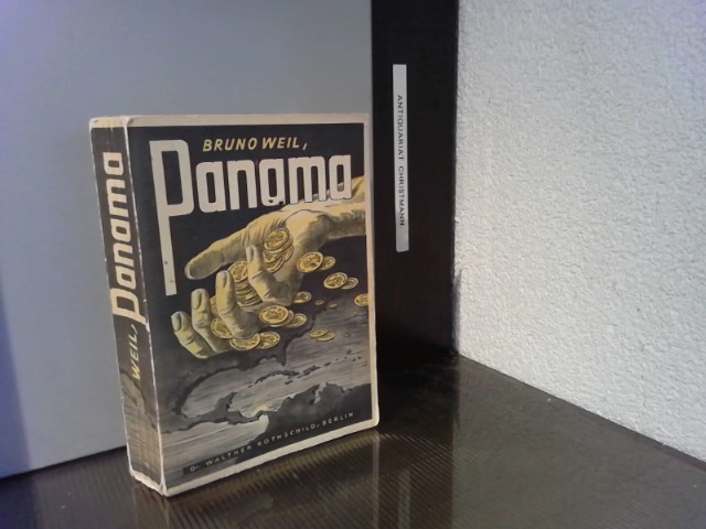
1933réf. 35792Berlin-Grunewald : Rothschild 1933. 579 S. ; 8 + Mit 6 Bildbeil. Broschiert, Exemplar in gutem Erhaltungszustand
1930In-8 p., mz. pergam., tit. oro su tassello al dorso, pp. 148,(2), con 4 cartine geografiche nel t. e alc. ill. fotografiche in b.n. in tavv. f.t. Monografia geografica con cenni storici ed etnografici. Ben conservato.
1914In-16° (cm. 18,7x12,5), pp. (4), 251, (1) + 20 TAVOLE fotogr. + 1 CARTA ripiegata del canale b.n. fuori testo. Mezza tela coeva, tit. oro al dorso. Molte e diffuse fioriture alle pagine di testo. Importante storia, descrizione dei lavori, dettagli tecnici (dighe, ferrovie, canali, frane ecc.) ed economici (tra cui le tariffe di retribuzione e le condizioni degli sterratori e degli altri lavoratori, americani, neri, cinesi ecc., vitto e costi, alloggi, servizi, zanzare ecc).; vantaggi e previsioni alla soglia dell'inaugurazione (1914).
1913In-8 gr., brossura (piccole mancanze), pp. (6),II,774, con numerose tavole fotografiche in b.n. fuori testo e 2 cartine piu' volte ripieg. Storia del Canale di Panama a partire dal 1879 fino ai lavori quasi ultimati. Testo ben conservato.
1913In-8° (23,5 x 16 cm). (6), II, 774 pp. Tav. fotografiche e 2 cartine ripiegate nel testo. Buon esemplare rilegato in piena tela, con titoli oro al dorso. Bunau-Varilla (1859-1940), ingegnere francese e soldato, si adoperò presso il governo degli Stati Uniti per la costruzione del Canale di Panama.
Carta geografica scolastica murale raffigurante il Canale di Panama. Cromolitografia, cm. 90x190. Scala 1:400000. Qualche strappo abilmente restaurato. Alcune pieghe.
1913In 8°, pp. XX+568. Legatura originale in tela. Alcune gore nelle prime pagine. Tavole f.t. in nero. Un foglio parzialmente staccato. Per il resto buona copia.
1925Milano, 1925, stralcio con copertina posticcia muta, pp. 761/772 con 2 cartine e 12 fotografie. - !! ATTENZIONE !!: Con il termine estratto (o stralcio) intendiamo riferirci ad un fascicolo contenente un articolo di rivista, sia che esso sia stato stampato a parte utilizzando la stessa composizione sia che provenga direttamente da una rivista. Le pagine sono indicate come "da/a", ad esempio: 229/231 significa che il testo è composto da tre pagine. Quando la rivista di provenienza non viene indicata é perchè ci è sconosciuta. - !! ATTENTION !!: : NOT A BOOK : “estratto” or “stralcio” means simply a few pages, original nonetheless, printed in a magazine. Pages are indicated as in "from” “to", for example: 229/231 means the text comprises three pages (229, 230 and 231). If the magazine that contained the pages is not mentioned, it is because it is unknown to us.