[INDIA - MISSIONARY WORK].Biblio.com
4 820 résultats
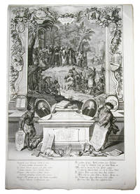
1730réf. ABC_47423Augsburg 1730. 86 x 59 cm. Copperplate engraving. A grand engraving commemorating the achievements of the August Protestant Church in India features various scenes and elements. In the background there are mountains palm trees houses and people including a Chinese person. The foreground shows deciduous and palm trees with a lit grotto holding an idol inscribed with "Brama". In front of the grotto an evangelical missionary preaches to a large congregation of natives while holding a book of music in his left hand and pointing to Brama with his right hand. The missionary wears a turban a priest's cloak and has flappers. The audience under the hill is depicted in interesting groups with some closer to us appearing larger and clearer. At the bottom of the engraving there is an art altar with several books including the "Biblia Malabarica" "Catechism Malabaricus" and the hymnal "Liber Cantion. Malabar." The engraving was made by the German engraver painter draughtsman and art publisher Johann Elias Ridinger 1698-1767. He trained in Ulm and Augsburg under Christoph Resch and Johann Falch and learned engraving from Georg Philipp Rugendas. Ridinger later spent three years in Regensburg where he developed his style through coursing and visits to the riding school. His ornamental works show Rococo stylistic tendencies and he founded his own publishing house in Augsburg. His precise and tasteful drawings were highly regarded and transferred to decoration porcelain and ceramics.With two minor tears one partly repaired the other one not affecting the engraving. Overall in very good condition.l Thienemann Leben und Wirken des unvergleichlichen Thiermalers und Kupferstechers Johann Elias Ridinger 913; Thienemann "Nachträge Zusätze und Berichtigungen C. L. zu : Leben und Wirken des unvergleichlichen Thiermalers und Kupfer stechers Johann Elias Ridinger etc." in Archiv für die zeichnenden Künste 5 1859 pp. 148-149. unknown
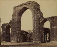
1866réf. 32820551This is a splendid pair of Samuel Bourne views of the Qutb complex in Delhi. The first photograph shows the Delhi minaret and "victory tower" at the Qutb complex the tallest minaret in the world built of bricks. "The Qutb Minar is one of the most famous monuments in India and one of the most significant examples of early Indo-Islamic architecture. It is a tower of victory which also served as a minaret for the adjacent Quwwat al-Islam Might of Islam mosque. It was begun by Qutb-ud-Din Aybak ruled 1206-1210 the first Sultan of Delhi and founder of the Mamluk or Slave Dynasty and continued by Shams-ud-Din Iltutmish ruled 1211-1236. It is 72.5 m 238 ft high and rises in five tapering fluted" British Library. The second photograph shows the screen of the Quwwat-ul-Islam mosque. "The screen which is often referred to as the 'Great Arch' is 6.7 metres wide and 16 metres high. An inscription on the central arch states that it was built in 1199 by Qutbuddin Aibak. It was one of the first Islamic monuments to be built by Hindu craftsmen in India. The craftsmen used the traditional method of laying blocks of stone horizontally and rounding the sides of individual stones to create the curve of the arch. The screen was ornately decorated with carved calligraphy and repeating scroll-like designs" Victoria and Albert Museum. The iron pillar at the left is cropped as issued. The dark tones and strong contrast wonderfully highlight the intricate carvings. British photographer Samuel Bourne traveled throughout India from 1863-1870 photographing monuments people and landscapes. "By the time Bourne left India in 1870 to return to England he had produced over 2500 views mostly of architecture and landscapes which distributed by his partner Charles Shepherd constitute the most exhaustive record made in India by a single photographer. Bourne's carefully thought-out meticulously crafted images were collected by tourists archaeologists and botanists alike" Metropolitan Museum of Art.
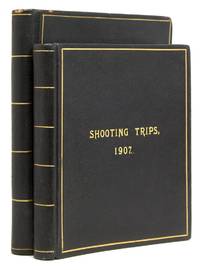
1909réf. 312711N.p. India 1909. 126 tipped in gelatin photographs 63 in each volume; with four manuscript sketch maps 2 in each volume. 153 pp.; 7 numbered a-g 124 ff. including blanks. 2 vols. 8vo and 4to. Contemporary full brown morocco covers ruled and lettered in gilt black coated endpapers by Thacker & Co. Bombay with their red ticket at the back. Corners bumped faintest traces of rubbing. 126 tipped in gelatin photographs 63 in each volume; with four manuscript sketch maps 2 in each volume. 153 pp.; 7 numbered a-g 124 ff. including blanks. 2 vols. 8vo and 4to. Substantial detailed and extensively illustrated chronicle of travel and sport in the area north and east of Simla Sutlej River Adampur Jhansi and elsewhere in India including a trip in the Himalayas. The author was Lawrence Christian Gordon a major in the artillery; at this time he was staioned in Jhansi. The first volume is divided in three parts: Part I. Trip near Adampur after black buck and gazelle pp. 1-26 dated 23 December 1906 to 3 January 1907 Part II. Near Jhansi after black buck pp. 27-37 Part III. Himalayas after burhel and ibex pp. 39-153 dated April to July 1907 up the Sutlej river from Simla with mention of Asirang Lipi Jangi The second volume is a continuous narrative describing short shooting and fishing trips in 1908 and one longer account of three months' shooting leave March to June 1909 in the terrain upriver from Simla close to the border with Tibet and indeed many of the villages and monasteries passed were of TIbetan culture. The photographs are well composed and printed; burhel was the chief game hunted. Gordon writes candidly with many observations on local conditions and weather. Provenance: Norman James Anderson Galleries 9 November 1928 lot 784; Harvard Travellers Club in May 1934 bookplates unknown
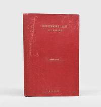
1925réf. 180767Allahabad: Improvement Trust 1925-30. From the personal collection of the chairman First editions of these rare reports charting the overhaul of the infrastructure in the "City of Prime Ministers" a center of Indian nationalism. They were collected by Baldev Ram Dave Chairman of the Improvement Trust and cover the first five years of his tenure. This set documents the projects of the Allahabad trust over half a decade with multiple maps tables and illustrations of the progress. Such projects include the extension of Allahabad University the construction of Sir Harcourt Butler Market and the establishment of multiple housing schemes for those evicted from their homes. The number of volumes in the complete run is unclear but we have traced only one other set on WorldCat: 11 volumes held in Harvard University Library. In addition to the reports are three pamphlets. A Brief Note on the Improvement Trust of Allahabad gives an overview of its early history with blueprints to illustrate major projects. The addresses to Sirs William Malcom Hailey and Alexander Muddiman both governors of the United Provinces of Agra and Oudh in 1928 lay out the trust's goals and request further central funding. Rai Bahadur Pandit Baldev Ram Dave 1863-1942 was the trust's second chairman from 1925. The loosely inserted documents all relate to his projects including a hand-drawn sketch of the expansion of Zero Road up to Sheocharanlal Road a typescript letter from the notable engineer Raja Jwala Prasad discussing various initiatives and a government report on the efficiency of the trust in 1930. Dave is mentioned in an article in the Times of India from 11 November 2014 which notes that his department was responsible for the demolition of Nehru's family home in 1931. He reportedly took the last photograph of the building which was later gifted to Prime Minister Indira Gandhi. 8 works bound in 1 vol. quarto 327 x 210 mm. With 15 halftone photographic plates 1 folding 19 hand-coloured maps 14 folding heliozincographed folding map 5 folding blueprints; tables in text. Contemporary red cloth front board lettered in gilt. With 5 loosely inserted letters reports and sketches. Light wear and silverfishing three maps repaired with archival tape two plates tipped in Brief Note front wrapper chipped with loss foxing internally: a very good collection. hardcover
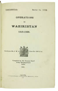
1921réf. ABC_45215Calcutta: Superintendent of Government Printing 1921. Contemporary half calf green cloth sides gold-stamped red spine labels. 8vo. With frontispiece 31 plates 7 maps 3 in pocket on inside of back board and 8 panoramas mostly folding. First edition of the British-Indian armys official account of the 1919-20 Waziristan campaign marked "Confidential" on the title-page. The operations followed unrest that arose in the aftermath of the Third Anglo-Afghan War; they were conducted in the mountainous region of Waziristan now in Pakistan by British and Indian forces against the fiercely independent Waziri and Mahsud tribesmen that inhabited it. Since the 1870s the British government agencies were assiduous in compiling internally published histories of their military frontier operations with the intention of providing a "valuable guide" to such British commanders and policymakers as "might have future dealings with these turbulent neighbours" as the Punjab Government phrased it in 1866.The title-page reports the catalogue number and location of what may be the original report: Catalogue no. C.W. 4 - Case no. 8987 N.S..Serial No. 1235 stamped on the title-page. Occasional light marginal staining. A few edge flaws consistent with army use repaired by a contemporary owner. Otherwise in very good condition.l WorldCat 11497145. Superintendent of Government Printing, hardcover
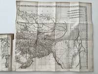
1800réf. 19106AB1800. Paris Poignee An VIII 1800 Four large folding engraved maps six engraved foloding maps and one plan. The four large folding engraved maps are forming the 'Carte de L'Indostan ou de L'Empire Mogol' the oulines contemporary hand-coloured. First French edition with maps revised by Jean Nicholas Buache incorporating the four maps that compose Rennell's "second great work. the construction of the first approximately correct map of India" DNB. "The Father of Indian Surveying" Gole "Early Maps of India" Rennell charted the currents through the India Ocean and around Africa and later surveyed the Indian interior. He recognized Europe's growing fascination with India: "As almost every particular relating to Hindoostan is become an object of popular curiosity it can hardly be deemed superfluous to lay before the public an improved system of its geography" Rennell Preface. With Rennell's first map of Hindoostan the result of 500 separate surveys and stretching from the Himalayas in the north to Ceylon in the south and the "Great Sandy Deserts" in the west. Born in Chudleigh in Devon England James Rennell who was to become one of the mosst celebrated cartographers of his time joined the British Navy as a midshipman at the age of 14. Amidst the Seven Years' War 1756-1763 he travelled the world and learned marine surveying and hydrography. This led to his appointment at age 24 as surveyor of the British East India Company's dominions in Bengal. In 1765 Rennell began surveying India. By this time the British East India Company had maintained its foothold on the region for over one hundred years but it was still another century before Queen Victoria would set her eyes eastward and Rennell's explorations and accounts helped to fill that gap in time. Rennell combined data from British Army columns with Ain-e-Akbari 1598 a translation of Islamic geography of the empire which helped him acquire information about old divisions he therefore subdivided the country according to the Mughal provinces of 'subas'. unknown
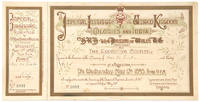
réf. 110625London Waterlow and Sons Ltd. 10 May 1893 & 17 May 1893. . Two over-sized colour-printed illuminated card invitations numbered addressed in pen & ink 22.7 x 31.2 cm; 16.5 x 32.6 cm; a printed manila envelope for replying to 'The Secretary / Imperial Institute / London SW'; a letter printed in red on Imperial Institute 4to headed paper requesting a reply to the invitation to the opening ceremony in order to reserve seats; single folio sheet 'General Outline of the Ceremonial' for the opening; 2 copies of printed folio sheet verso blank 'General Arrangements for the Reception of HRH the Prince of Wales. Wednesday May 17th 1893'. The first of these two over-sized invitations received by Louisa Da Costa was to the opening of the Imperial Institute on 10th May 1893 with Queen Victoria and the Prince of Wales in attendance. Since the Great Hall of the Institute wasn't completed in time a temporary hall was constructed for the opening. The second evening invitation from HRH the Prince of Wales invites Miss Da Costa and a friend to an evening reception from 9pm with 'Instrumental and Vocal Music. and Refreshments' in the illuminated gardens of the Imperial Institute in South Kensington - now the site of Imperial College London. The accompanying 'General Arrangements.' sheet give details of the evening's entertainments as well as travel arrangements special trains on the Inner Circle Line at 1am and 1:30am and the arrangements for 'Cold Suppers'. Louisa Da Costa was the sister of Mr Benjamin Mendes Da Costa both being descendants of the well-known wealthy Portuguese-Jewish trading dynasty. After his great success with real estate in Adelaide Australia Mr Da Costa sold his business there and sailed to England together with his sister. He died in Brighton in 1868 and his sister was the sole beneficiary of his will. Miss Da Costa died in 1898 bequeathing all her real estate in Adelaide to the Governor of South Australia to establish a Samaritan fund for convalescents from the Adelaide Hospital - the Louisa DaCosta Trust still operating today. London, Waterlow and Sons Ltd., 10 May 1893 & 17 May 1893. unknown
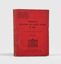
1928réf. 192613Calcutta: Printed by Manager Government of India Press 1928. Untraced institutionally First edition marked "For Official Use Only" and covering 106 locations. In the year of publication the RAF's strength in India finally reached eight squadrons the level recommended by Air Vice Marshal Sir John Salmond's influential 1922 report. Commissioned on the instructions of Air Vice Marshal Hugh Trenchard Salmond's review found that the RAF in India "was to all intents and purposes nonexistent as a fighting force." Increased funding and the operational opportunities offered by the 1925 Waziristan Campaign enabled a significant expansion in aviation infrastructure and increased recruitment of pilots. The progress seen in the 1920s laid a foundation for the formation of the Indian Air Force in 1932. The largest section provides in tabular form information on each location giving its type dimensions position surface slope prevailing wind altitude air approaches local military authority and repair station as well as a rough sketch and the relevant grid reference on the folding map in the end pocket. The text also notes the presence or absence of a petrol shed a "chowkidar" attendant medical and onward transportation facilities and accommodation and food. Other chapters list aerial and military routes in India discuss the selection marking inspection and maintenance of landing grounds detail prohibited flying areas and describe the correct use of the landing T. Small octavo. Folding sheet folding map paper watermarked "Government of India" in end pocket tables in text. Some tabular leaves trimmed at fore edge as issued to enable cross-referencing. Original red cloth front cover lettered in black. Front free endpaper initialled "Air Officer Commanding" in contemporary hand. Binding lightly worn and marked joints repaired: very good. hardcover
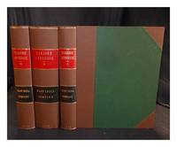
1777réf. 390089London : East India Company 1777. 1st edition. Hardcover. Finely bound in modern half tan buckram over contrasting fine ribbed-cloth boards. Particularly well-preserved; tight bright clean and strong. Further scans images and additional bibliographical material available on request. Physical description 3 v. Subjects; Appendix. East India Company. Tanjore. London : East India Company hardcover
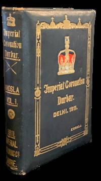
1911réf. 4764Lahore Punjab: The Imperial Publishing Co. Khosla Bros. 1911. First edition. Folio 34 x 26cm 4 i iv 3 481 1pp. Presentation binding full black morocco over padded beveled edged boards stamped in gilt on covers and spine with lettering elaborate border and Imperial Crown g. e. Crown is hand painted in red blue and white. Gilt dentelles blue silk endpapers platinum photographs throughout printed red borders of different shades and black lettering on thick glossy paper. Letter of presentation from the publisher to The Hon'ble Sir Harvey Adamson K.C.S.I. M.A. L.L.D. Lieutenant-Governor of Burma printed in gilt on red silk and mounted to front free endpaper. Some rubbing to corners and spine ends some paint loss to the crown front endpaper lightly chipped along the lower edge with a few silk threads of the letter of presentation becoming unwound else clean internally. A large heavy volume in nearly fine condition. Printed as a memento of the historic Imperial Coronation Durbar at Delhi 1911 honoring King George V and Queen Mary as Emperor and Empress of India. In the presentation letter to Harvey Adamson the publishers lay out the intent of the volume which is "graced by Your Honor's portrait" as giving a "bird's-eye view of the present political condition of India" through "historical and biographical sketches of the various Ruling Chiefs and Princes of India.suitable memoirs of distinguished personages.and of men famous in Literature Science Art and other spheres of useful activity accompanied with their portraits as far as possible." The book is indeed lavishly produced and illustrated with roughly 600 biographical sketches most with photographs many of which are credited including several from Bourne and Shepherd of Calcutta the official photographers of the Durbar. The last of three Durbars the others in 1877 and 1903 the 1911 assembly was notable as only one attended by the King and Queen the first time a British monarch had visited India the crown jewel of empire. The event was held at Coronation Park in Delhi from December 7th-16th and was attended by the vast majority of ruling princes and noblemen making it the largest of its kind. Underneath the pomp and regalia however were the roots of resentment and stirrings of independence. The scandal of the Durbar came when the Gaekwar of Baroda Maharajah Sayajirao III briefly bowed only once instead of the required three times when approaching the emperor and then turned his back to walk to his seat instead of walking backwards. This and other happenings of the Durbar were captured on film most famously and in color by Charles Urban the British-American producer and film maker. "With Our King and Queen through India" became the first color cinematography to be viewed by the majority Western audiences. Sir Harvey Adamson served as Lieutenant Governor in Burma from 1910 when he was appointed Knight Commander of the Order of the Star of India until 1915. Of interesting note a steamship built for the British India Steam Navigation Company in 1914 and named after the General went missing at sea along with its 269 passengers in 1947. An immense trove of photographic evidence of a time and place being the crest of British Imperialism in India the book is institutionally scarce. Our research finds only a few copies of either volume held worldwide the book on offer with a tangible and important provenance. The Imperial Publishing Co. (Khosla Bros.) unknown
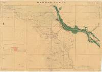
réf. 66212Dehradun: Published under the direction of Colonel Sir S.G. Burrard K.C.S.I. R.E. F.R.S. Surveyor General of India 1917. Original heliozincographed map 73 x 105 cm printed at the Survey of India Offices in partial colour folding between publisher's original buff paper covers printed in black and with key map to back cover. The map compiled from ground and air reconnaissance is centred on Basrah and the Shatt al-Arab River with its date groves printed in green. The map shows roads suitable for wheeled traffic camel roads mule paths foot paths telegraph lines wells oil wells Mosques imamzadehs a shrine-tomb of a holy person in Shi'a Islam forts watch-towers deserted villages and springs pipelines graves trigonometrical stations post offices and telegraph offices and camping grounds. Map overprinted with numeric reference grid. Old ownership inscription to front cover. Some light toning some splits along folds some dampstaining and a few spots some light wear to covers scribbling to one panel of verso generally very good. A very scarce map with just one copy traced by OCLC at the Staatsbibliothek zu Berlin focusing on the key strategic regions of Basra-Zubair in south-eastern Iraq and the adjacent Khorramshahr area of Persia and it is one of the first maps to show Abadan the first oil boomtown of the Middle East. While there are oil wells marked throughout the map there is a particular accumulation of wells and refineries in and around Abadan on the far right which was the Middle East's first oil 'boomtown.' It appears here along with the Anglo-Persian Oil Company A.P.O.C. Refinery. Rich oil fields were discovered here in the early 20th century and in 1909 secret negotiations with the British led to the formation of the Anglo-Persian Oil Company which completed its refinery here in 1912. This company would play a central role in Iran's political and economic life throughout the 20th century. As military cartography it is marked 'For Official use only' in red to upper margin. Reg. No.888 D.D.D. 1917 2.D.O. S.I. 2000. Mesopotamia. Sheet No. 1. OCLC: 1235951984 Dehradun: Published under the direction of Colonel Sir S.G. Burrard, K.C.S.I., R.E., F.R.S., Surveyor General of India, 1917. unknown
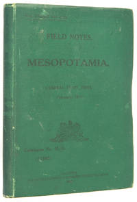
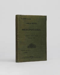
réf. 116512Calcutta Superintendent Government Printer India February 1917. . Second enlarged edition; 8vo 18 x 13 cm; folding lithographic map of Lower Mesopotamia in pocket 3 folding tables; early issue without the later published index pamphlet original green cloth wallet binding spine and upper panel lettered in black little wear to extremities a very good copy; 4 326 1pp. The second enlarged edition of this scarce intelligence guide produced for the British Indian Army operating in Mesopotamia Iraq and the Arabian peninsular during the First World War with the improved colour-printed lithograph map extending from Samarra in the North to Hafar al-Batin in the South and from the Wadi al-Khair in the West to Kuwait in the East as well as additional information on the Saudi family Nedj and Al Hasa. Designed for official use only the map and guide put particular emphasis on routes and rivers but also provides an interesting overview of the region's history and an assessment of its current political climate. Qatar and Kuwait which 'now flies a flag of its own' in the region both receive early mentions p.4. A glossary located to the rear provides helpful definitions of local words like 'Ghazi. A champion of Islam' and 'Qalib. A well with a wide mouth and very broad near the water. Men often descend into it to fill their water-skins'. Interestingly Arab is translated as 'A man of one of the Arab tribes but not necessarily a Bedouin. The plural Aarab denotes the people the nation. When applied to a Shaikh as "Zaid's Aarab" it means followers'. Calcutta, Superintendent Government Printer India, February, 1917. hardcover
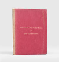
1884réf. 189408London: Printed by the Ballatyne Press "For Private Circulation" 1884. Duleep Singh reclaims his throne First and only edition privately issued of this controversial presentation of the maharajah's grievances against the British Government's claims to the Punjab. Decidedly uncommon around 14 copies traced institutionally just a couple at auction. An excellent copy of a fragile fugitive and highly desirable work here in a variant binding to the black skiver usually encountered. The child king Duleep Singh 1838-1893 Maharajah of Lahorewas carried into exile following defeat in the Second Anglo-Sikh War 1848-9 converting to Christianity in 1854 obtaining a royal audience and becoming "an immediate success" with the Queen and eventually settling in Elveden Suffolk with Bamba Müller his "part-Ethiopian part-German" ODNB wife who he had met in Cairo when returning from his mother's funeral in India; "Duleep Singh loved Elveden and rebuilt the church cottages and the school. His fame as a shooter of game was revived in the grounds of the great estate". However "amid European glamour the spirit that had tasted sovereignty was hibernating somewhere in the mind of Duleep Singh. Prompted initially by his mother then by his cousin Thakur Singh Sandhanwalia and finally by the supposed prophecies of the tenth Sikh guru Duleep Singh began a battle with the British government asserting the illegality of the annexation of the Punjab and demanded to be reinstated as maharajah. In 1886 he tried to return to India to place himself as the prophesied head of the Sikh people but was arrested at Aden. Here he was received back into the Sikh faith". From Paris he made himself the centre of various plots to overthrow British rule in the Punjab scheming with Russian and Irish revolutionaries to force the Khyber Pass but all of these conspiracies came to nothing. Increasingly dogged by ill health he sought a reconciliation with Victoria who "responded with a full pardon through the secretary of state on 1 August 1890". He died in Paris in 1893 and was carried back to his beloved Elveden and buried in the graveyard of St Andrew's and St Patrick's Church. The present work represents the historical groundwork to his campaign for reinstatement to the throne and was distributed solely to those who he felt could be of influence to that end. It was "compiled partly from historical sources and partly from private information and documents furnished" Preface by Duleep Singh himself and encompasses a sketch of the early history of the Punjab; a biographical narrative of the Maharajah; and an explanation "of the peculiar Relations in which the Maharajah stands towards the Government and the causes of the differences between them". Octavo. pp. viii 183. Original moderate red cloth over flexible boards title gilt to the front cover single fillet blind panel to both covers grey-blue decorative endpapers. Slightly rubbed the spine sunned; endpapers a little browned pale toning to the text-block else a very good copy. hardcover
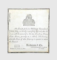
1807réf. 122432Calcutta: Star Press 24 January 1807. Haunting piece of Company-rule ephemera announcing the funeral of William Townsend Jones c.1757-1807 attorney on the council of the Supreme Court of Judicature at Fort William the highest court of British India from its foundation in 1774 until 1862. Jones's name is now usually connected with his indictment in December 1789 for flogging to death one Sheriut Allah the brother of his durwan gate-porter whom he suspected of stealing one of his dogs which was "an unlikely crime for a Muslim" Franklin. He was acquitted by the Supreme Court who concluded that Sheriut Allah had died by suicide by eating opium. The affair arose only two years after the impeachment of Warren Hastings in 1787 whose fall from grace had begun with a similar miscarriage of justice involving the execution of a native East India Company administrator Nandakumar. Jones is also a recurring character in the recently published diaries of Calcutta surveyor and builder Richard Blechynden 1759-1822 which reveal that he was also rumoured to have killed another of his servants his mater sweeper. The undertaker Peter Lindeman 1771-1856 of Scottish descent worked from premises at 144 Durrumtollah; from 1803 the Calcutta Missionaries held services in his house on Cossitollah Street until the completion of a new chapel at Lall Bazar in 1809 of which he became a trustee. Single sheet of laid paper 130 x 139 mm printed on one side. Mourning border motif of urn on an altar. Contemporary signature "T. R. R" on verso shaved; the leaf sometime removed from an album or mount adhesive markings and 3 strips of adhesive paper verso 3 faint creases from folding minute hole to one intersection of folds. In excellent condition. Franklin "Orientalist Jones": Sir William Jones Poet Lawyer and Linguist 1746-1794 pp. 300-1; Robb "Memory Place and British Memoirals in Early Calcutta" in Rashkow et al. eds Memory Identity and the Colonial Encounter in India online accessed 4/11/2017; see further Robb ed. Sex and Sensibility: Richard Blechynden's Calcutta Diaries 1791-1822 online. unknown
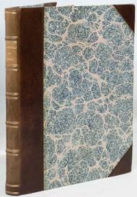
1813réf. 222915London.: Edward Orme. 1813. 20 hand coloured aquatint plates 149pp x Index including the Half Title and List of Plates; contemporary half calf over marbled boards spine gilt-lettered in compartments marbled edges 28.2 x 22 cm the first plate a trifle spotted with a small chip from the bottom margin slight age-toning and minor spotting in very good condition. Scarce suite of finely hand coloured aquatints depicting domestic colonial life in British India: the Europeans at their leisure attended by Indian servants. Doyley's compositions are often quietly satirical: Plate IV "A Gentleman Dressing Attended by His Head-Bearer and Other Servants" shows a young man in his gown relaxed seated and reading while an Indian servant washes his feet another in the background pours his drink and yet another makes his bed all overseen by the "Head-Bearer". The artist Charles Doyley was illustrating and observing a world in which was an intimate participant he had been born in India into a family that had long served in India himself serving as a member of the Bengal Civil Service from 1797 to 1838. Abbey Travel 435; Tooley 185 . Edward Orme. hardcover
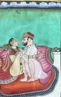
réf. TK0040India: 19th century. Collection from various sources meaning clearly this group includes work from several different artists. Please view added illustrations online under this description. [19th century]. unknown
réf. elala6164London: 1804. The second Anglo-Maratha War 1803-05 saw the British gain significant territories and influence including regions around Delhi and in present-day Gujarat falling into direct Company rule. The two rulers who fought the EIC were Daulat Rao Sindhia 1779-1827 and Raghuji Bhonsle II d. 1816. General Gerard Lake and General Arthur Wellesley commanded the EIC army. Included here are the texts of government dispatches government correspondence with the secret committee of the EIC agents ministers and military officers commanding in the field and correspondence and proceedings with the Maratha Princes of States. The plates include two maps of India by A.Arrowsmith and six plans showing General Lake’s encampment at Secundra Aug. 26 1803 the battle of Assye Sept. 23 1803 the attack on Perron's Camp before Allyghur Aug. 29 1803 the entrance into the fort on Sept. 4 the Battle of Delhi Sept. 11 1803 and the Battle of Laswaree November 1 1803. “At the Battle of Assaye on 23 September 1803 General Sir Arthur Wellesley 1769-1852 the future Duke of Wellington masterminded victory for the EIC over the Maratha army of Daulat Rao Sindhia head of the Gwalior state. The cause was greatly helped by Wellesley first steadily building up supplies and then bribing British and Anglo-Indian mercenary officers in the Marathas' employ not to fight. When the Marathas heard of this subterfuge they promptly dismissed all their European officers believing them all of suspect loyalty. The unfortunate consequence for the Marathas was that their army now had no command structure and was routed but not before their artillery had caused tremendous damage to the British. The costs for the EIC victory in this bloody battle were high with around one-third of its army killed or wounded. 6000 Maratha soldiers were killed at Assaye. The experienced British officers were all in agreement that the Maratha artillery was as well organized and deadly as that of any European army they had ever faced. There was some consolation for the human losses in the capture of 98 Maratha cannons. Wellesley then won another battle at Argaum aka Argaon in November 1803 but at the end of his career and even after defeating Napoleon Bonaparte at Waterloo in June 1815 Wellesley declared that his greatest ever military challenge had been at Assaye. On 1 November 1803 the EIC won another decisive victory at the Battle of Laswari this time with a force of 10000 men under the able command of General Gerard Lake 1744-1808 a veteran of the American War of Independence. Again the costs of victory were high with around 838 EIC troops killed or wounded. The EIC then took over Delhi and its surrounding territory. There were a few minor Maratha successes such as the defence of Bhurtpore aka Bharatpur against multiple British attacks in early 1805 but with the large losses in central India to Wellesley and in northern India to Lake the Maratha Confederacy was now but a shadow of its former self. The Hindu princes were largely obliged to follow EIC policies and put up with a permanent resident backed by sepoys EIC Indian troops. However there would be one more conflict to come in a doomed effort to regain the Marathas' lost independence.” Mark Cartwright The World History Encyc. folio. pp. xix 1 587. 2 folding hand-coloured maps & 6 folding partly hand-coloured plans. modern half calf a few minor marks on spine. elala6164 [London]: 1804 unknown
réf. 122631Nova Goa Panaji 1874. . 4to 31 x 20.5 cm; Portuguese manuscript in ink 471 ll. in fair copy paper watermarked 'ALMASSO' 'MARIA NAIA' 'THOMA'; later half calf blue cloth boards gilt morocco spine label near fine internally. Fair manuscript copies of four of the original founding documents of the first convent in India the Convent of Santa Monica in Goa founded in 1598 and completed in 1627. The four documents were originally compiled by Frei Diogo de Santa Anna 1571-1644 the sole confessor of the convent probably in 1627 as part of the dedication of the completion of the building. The imprimatur of the compilation was given by Frei Sebastian de San Pedro ca. 1549-1629 the Archbishop of Goa on 10 February 1628. This present volume was copied from the original compiled manuscript in 1874 in Goa under the supervision of Joaquim Heliodoro da Cunha Rivara 1809-1879 the Secretary General of the Portuguese colony of Goa. He brought this volume back to Portugal in 1877 and it was then donated on his death two years later to the Biblioteca Publica de Evora. The documents themselves contain the Statutes Regimen and Divine Office of the Convent and the dedicatory sermon delivered on the completion of the convent in 1627 by Frei Diogo de Santa Anna. The sermon also contains the history of the first years of the convent. The only portion we can find record of is the sermon of which a single manuscript copy survives in the Arquivo Nacional da Torro do Tombo MS no.1869. We can find no record of the original manuscripts of the Statutes Regimen and Divine Office from which this volume. Nova Goa, [Panaji], 1874. hardcover
réf. 120369Calcutta Superintendent Government Printer India February 1917. . Second enlarged edition; 8vo 18 x 13 cm; folding lithographic map of Lower Mesopotamia in pocket with a few fold tears repaired 3 folding tables; original green cloth wallet binding spine and upper panel lettered in black ownership inscription to first blank some minor restoration a very good copy; 4 326 1pp. The second enlarged edition of this scarce intelligence guide produced for the British Indian Army operating in Mesopotamia Iraq and the Arabian peninsular during the First World War with the improved colour-printed lithograph map extending from Samarra in the North to Hafar al-Batin in the South and from the Wadi al-Khair in the West to Kuwait in the East. Designed for official use only the map and guide put particular emphasis on routes and rivers but also provides an interesting overview of the region's history and an assessment of its current political climate. Qatar and Kuwait which 'now flies a flag of its own' in the region both receive early mentions p.4. A glossary located to the rear provides helpful definitions of local words like 'Ghazi. A champion of Islam' and 'Qalib. A well with a wide mouth and very broad near the water. Men often descend into it to fill their water-skins'. Interestingly Arab is translated as 'A man of one of the Arab tribes but not necessarily a Bedouin. The plural Aarab denotes the people the nation. When applied to a Shaikh as "Zaid's Aarab" it means followers'. The copy of Alan Sillitoe 1928-2010 important British writer noted for his works in the 1950s and 60s. Calcutta, Superintendent Government Printer India, February, 1917. hardcover
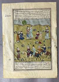
1580réf. 007146India 1580. No Binding. Good. Single leaf on paper approx. 345 x 245 mm recto with a finely executed polychrome miniature painting framed within ruled borders and surmounted by Arabic manuscript text in a clear Naskh hand. The painting depicts a narrative scene of figures in animated conversation within a pastoral landscape including standing and seated courtiers and mounted riders arriving from the right. The figures wear Mughal court dress- long jamas sashes and wrapped turbans- and are rendered with individualized facial features and subtle gesture hallmarks of early Mughal painting. The verso is densely written in Arabic in black ink with rubrication in red and extensive marginal annotations indicating scholarly use. The presence of commentary and corrections suggests the leaf once formed part of a learned or historical manuscript rather than a purely literary work. Executed in opaque watercolor and ink the miniature displays a restrained palette of olive green pale blue soft pink cream and lapis tones with stylized floral motifs scattered across the ground. The composition and painterly handling point to an Akbari-early Jahangiri period workshop. Moderate overall wear consistent with age and use. Paper toned with surface wear. Edges worn with small closed tears; remnants of old tape at corners of verso. Minor pigment abrasion and flaking. Text remains largely legible; image stable and visually appealing. Ships unmounted and unframed unknown
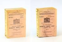
1943réf. 223j2732New Delhi India: The Manager of Publications India. Fair with No dust jacket as issued. 1943. First Edition. Paperback. An encyclopedic reference "detailing British and Indian officers including names ranks commissions promotions unit assignments and war services during WWII. Served as an official reference for appointments awards and casualties within the Indian Army." - Google AI. 2790 pages in two volumes. Interesting vintage advertisements. Few markings to covers. Above-average wear. Bindings intact. A rare example of this extraordinarily informative WWII reference. ; Sm 4to . The Manager of Publications, India paperback
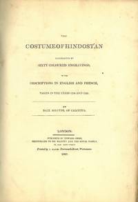
1807réf. 78470London 1807. Folio. Nyere burgunder skinnryggbind med ryggforgylling og opphøyde ryggbånd marmorerte dekler. Ubeskåret. Upaginert. 12 60 håndkolorerte farveplansjer. Med to s. tekst til hver plansje - med tekst på engelsk og fransk. Folio. Recent burgundy red half calf spine gilt raised bands marbled covers. Uncut. 12 pp. 60 handcloured copper engravings. With 2pp. text to each plate - in English and French. Printed by Edward Orme. Engelsk. Abbey 429. Colas 2766. Lipperheide 1479. Rent og fint eksemplar.Very nice copy. hardcover
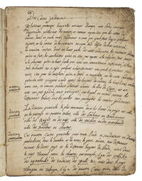
1743réf. ABC_45492Karaikal 1743. Blue mottled stiff paper wrappers. 4to ca. 24 x 18.5 cm. Manuscript written in dark brown ink on beige laid paper. French manuscript written in Karaikal French India since 1739 which gives a detailed explanation of the Indian caste system: the author explains in the beginning of the text that the French people are ill-informed about it. To illustrate the Indian caste system the anonymous author tells lively anecdotes and makes comparisons with French social classes and parallels to biblical stories. The author not only describes the details of the four castes Brahmin Raj Vaisya and Sudra including their hierarchy and advantages the purpose of this social structure and the experience of those who lose their caste. He goes further speculates about the way different cultures criticize each others morals. He argues that all nations criticize each other in some way simply because the habits of cultures differ each with its own good reasons. He also wrote about the extent of superstition in the customs of Indian people for example the beliefs surrounding cows. He concludes that not all their customs are superstitious. The author clearly views Indian cultural practices with a certain gentleness.Somewhat worn at the extremities and spine slightly foxed on the front paste-down and a little dust soiled on the first page. Otherwise in good condition. unknown
1859réf. 320421Calcutta: Thacker Spink & Co. printed by P.M. Craneburgh at the Bengal Military Orphan Press 1859. First edition. iv 244 viii pp. 8vo. Original blue ribbed cloth spine gilt bookplate to front pastedown of Sir Charles P. Hobhouse Bart. Bradford-on-Avon presentation inscription to title page. A fine copy. First edition. iv 244 viii pp. 8vo. Inscribed on the title page: "For Annie with the Author's love." This copy also formerly belonged to Sir Charles Parry Hobhouse 3rd Baronet of Westbury. A crisp copy recording the anonymous author's seven month's of exploring through South East Asia in 1851 and 1853. Departing 8 September 1851 the author who remains anonymous to this day spent four months travelling to Ceylon and Singapore before returning to Calcutta. In 1853 he set off again this time for a three month excursion to the Madras and Bombay Presidencies. There are vivid descriptions of Singapore Penang Malacca Madras Calcutta Bombay Bangalore and Candy as well as coffee plantations and Buddhist temples. The author spends quite some time travelling overland and describes an ascent of Pedro Tallagalla and Kilkamany and camping at Makoortie Peak. Despite the scarcity of this little book it did attract critical attention. A favourable notice appeared in the Calcutta Review which states that the author had "seen and noted down . as much as any one who had preceded or who has since followed him in the same track." The work concludes with an appendix in two parts the first being a table showing the route modes of transport ship rail bandy pony and the amount of time spent at each location. The second is titled "Hints for travellers" which concludes: "Travellers will find it wiser never to have coolies to their palanquins when they can procure bearers; never to go in palanquins when they can with safety from the sun ride; never ride down passes when they can walk and never to be discouraged by indifference or dissuaded by alarms from prosecuting any enterprise." There is nothing in the preface to explain the six year delay between the conclusion of his travel and the publication of the account. Exceedingly rare. No copies on OCLC or COPAC. The only other copy we know of is the Brooke-Hitching copy identically bound; the present copy is in superior condition. The Calcutta Review vol. 33. July-December 1859. Serampore: "Friend of India" Press 1859 pp. lxviii-lxxi Thacker, Spink & Co. (printed by P.M. Craneburgh at the [Bengal] Military Orphan Press) unknown
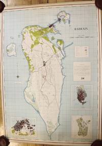
1951réf. M9730London c.1951-1953. Very Good mounted on contemporary linen. Notes: A very scarce wall map of Bahrain published jointly by the Royal Geographical Society and the Bahrain Petroleum Company. The map depicts roads tracks buildings cultivated areas marshland and the Bahrain Refinery. Major cities as Awali Manama Town and Muharraq Town are shown in detail. The map has three large insets of Muharraq Awali and Manama. Bahrain small Arab state situated in a bay on the southwestern coast of the Persian Gulf. It is an archipelago consisting of Bahrain Island and some 30 smaller islands. Its name is from the Arabic term al-baḥrayn meaning “two seas.” The economy has long relied on processing crude oil from neighbouring countries and more recently the financial commercial services and communications sectors have grown markedly as has tourism. Britain’s decision to withdraw all of its forces from the gulf in 1968 led Bahrain’s independence in August 1971. A treaty of friendship was signed with the United Kingdom terminating Bahrain’s status as a British protectorate. Size : 925x655 mm 36.42x25.79 Inches Coloring: Hand Colored Category: Maps Asia Middle East Persian Gulf; unknown