Shah, Jignesh; Rath, BiswajeetMareMagnum

12 056 résultats
2009Book is in excellent condition in every respect, with an equally clean and new dust jacket. Text is clean and unmarked in any way. Solid, square, straight, tight binding. 143 pages, maps, photos, charts, diagrams, tables.
réf. 201007680, Baedeker reisefuhrer - verlag karl baedeker, 2000 ; grand in-12, 576 pp., broché, couverture illustr. Très bon état - mit grosser reisekarte - 576 seiten, 306 fargige bilder und karten, viel aktuelle tips, hotels, restaurants.
1954DISPONIBILITÀ GARANTITA AL 99%; SPEDIZIONE ENTRO 12 ORE DALL'ORDINE. TIMBRI/SEGNI DI CATALOGAZIONE DI BIBLIOTECA ESTINTA IN ANTIPORTA. OTTIME CONDIZIONI, LIEVI SEGNI DEL TEMPO ALLA COPERTINA, LIVE INGIALLIMENTO. Descrizione bibliografica Titolo: Baffo di rame racconta... Autore: Bettino Banfo Illustrazioni di: Angelo Corrias Editore: Torino [etc.]: Paravia, 1954 Collana: Racconti d'avventure Lunghezza: 131 pagine; 24 cm; illustrato Soggetti: Infanzia, Letteratura italiana, Letteratura per ragazzi, Viaggi, India, Racconti, seconda fascia di età, Medie, Gandhi, Avventure, Viaggio, Esplorazioni, Scimmie, Pantera Rosa, Marajà, Maharaja, Bombay, Perle, Fachiri, Tesoro, Baratoga, Siva, Narrativa italiana, Libri vintage, Fiabe, Favole, Bambini, Antichi, Fantasy, Adventure, Classici, Illustrati, Prime edizioni, Storytelling, Rari, Collezionismo
1995Fine Turkish Paperback. Cr. 8vo. (20 x 14 cm). In Turkish. 102, [2] p. Bagavad Gita: Hint efsanesi. Translated by Sevda Çaliskan.
Fourth edition, large 8vo, vi, 120, [4], [259]pp., orig. cloth, spine lettered in gilt, minor worm track to upper board otherwise a very nice copy. Provenance: Ownership signature of 'W. R. Partridge, May 1882' to front endpaper.
2002Fine Turkish Paperback. Pbo. Dust wrapper. Cr. 8vo. (20 x 14 cm). In Turkish. 319 p., color plts. Bahname. Itirli bahçe. Translated by Haluk Iker, Münire Yilmaer.
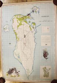
1951réf. M9730London c.1951-1953. Very Good mounted on contemporary linen. Notes: A very scarce wall map of Bahrain published jointly by the Royal Geographical Society and the Bahrain Petroleum Company. The map depicts roads tracks buildings cultivated areas marshland and the Bahrain Refinery. Major cities as Awali Manama Town and Muharraq Town are shown in detail. The map has three large insets of Muharraq Awali and Manama. Bahrain small Arab state situated in a bay on the southwestern coast of the Persian Gulf. It is an archipelago consisting of Bahrain Island and some 30 smaller islands. Its name is from the Arabic term al-baḥrayn meaning “two seas.” The economy has long relied on processing crude oil from neighbouring countries and more recently the financial commercial services and communications sectors have grown markedly as has tourism. Britain’s decision to withdraw all of its forces from the gulf in 1968 led Bahrain’s independence in August 1971. A treaty of friendship was signed with the United Kingdom terminating Bahrain’s status as a British protectorate. Size : 925x655 mm 36.42x25.79 Inches Coloring: Hand Colored Category: Maps Asia Middle East Persian Gulf; unknown
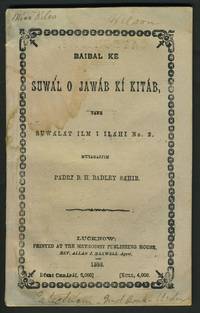
1888réf. 23582Lucknow India: Methodist Publishing House 1888. Paperback. Very good condition. Methodist pamphlet printed in Urdu in a question and answer format. Owners' signatures at top of front wrapper "Miss Niles" and Mr. "Wilson" and "Catechism 2nd Book Urdu" in ink. Brenton Hamline Badley 1849-1891 American missionary was born in Monmouth Indiana in 1849. He was first assigned to the North India Annual Conference. He preached his first sermon in the local dialect within a short period and spent the next four years preaching throughout the countryside. He later returned to Lucknow and served there until the end of his life. Badley helped with the development of the Centennial Boys School into Reid Christian College now Lucknow Christian College. Mr. Badley authored books and articles on Indian Missions for American publications and put together the 1876 Indian Missionary Directory. 12mo 68pp advertisements 8pp. Printed plum paper wrappers. Wrappers slightly marked; text clean and bright. Methodist Publishing House paperback
2004réf. LFA01ac7Un ouvrage de 173 pages, format 110 x 180 mm, broché couverture couleurs, publié en 2004, Collection "Histoires d'Ailleurs", bon état
réf. 202300126Boofzheim, ACM édition collection LIgnes Vagabondes, 2000 ; in-8, 286 pp., broché, couverture illustr. BON ÉTAT - récit / guide de voyage.
2004Broché. 173 pages. Format de poche.
1984Large octavo in blue boards; xiv, 241 pages ; 23 cm. No dust jacket; bibliographical references (pages 225-230) and index. Fine copy lacking jacket. Uncommon || Economic history. India -- Economic conditions -- 1947- India.
réf. 27362o.J. Filippus Baelde. Niederländ. reform. Theologe, Ethnologe, Indologe. Zunächst in Jakarta /Indonesien, dann in Südindien, Sri Lanka /Ceylon. 1665 zurück in den Niederlanden. 1632 Delft - 1671 Geervliet. Brustbild im Oval, auf Sockel mit Legende. Kupferstich von A. Bloeteling. 269 x 188 mm.
1989réf. RO80094929PERIPLUS. 1989. In-4. Cartonné. Très bon état, Couv. fraîche, Dos satisfaisant, Intérieur frais. 77 pages. Nombreuses photos en couleurs, en hors-texte et dans le texte.. Avec Jaquette. . . Classification Dewey : 954-Asie du Sud, Inde
1978réf. RO80189012PRESSES DE LA CITE. 1978. In-4. Cartonné. Bon état, Couv. convenable, Dos satisfaisant, Intérieur frais. 121 Pages. Nombreuses photos en couleur dans et hors texte.. . . . Classification Dewey : 954-Asie du Sud, Inde
1998réf. R240007408SOLAR. 1998. In-4. Cartonné. Bon état, Couv. convenable, Dos satisfaisant, Intérieur frais. 127 pages. Nombreuses photographies en couleur, dans le texte et hors texte.. . . A l'italienne. Classification Dewey : 954-Asie du Sud, Inde
1984réf. RO80085276CHENE. 1984. In-4. Cartonné. Très bon état, Couv. convenable, Dos satisfaisant, Intérieur frais. Environ 135 pages. Nombreuses photos en noir et blanc et en couleurs, dans le texte et en hors-texte.. Avec Jaquette. . A l'italienne. Classification Dewey : 954-Asie du Sud, Inde
réf. R200049278APA PRODUCTIONS. NON DATE. In-8. Broché. Bon état, Couv. convenable, Dos satisfaisant, Intérieur frais. 321 pages augmentées de nombreuses illustrations en couleurs dans et hors texte- texte sur 2 colonnes. . . . Classification Dewey : 954-Asie du Sud, Inde
ISBN : 2862604097. AUTREMENT. 1993. In-8 Carré. Broché. Bon état. Couv. convenable. Dos satisfaisant. Intérieur frais. 250 pages environ
1993réf. R150197756AUTREMENT. 1993. In-8. Broché. Bon état, Couv. convenable, Dos satisfaisant, Intérieur frais. 250 pages environ. . . . Classification Dewey : 954-Asie du Sud, Inde
réf. 671 catalogue avec notes et commentaires de paul métadier tours SD (1978 ) 39 pages 192 numéros décrits et 14 fascicules publiés par l association des amis de saché 1951-1978 56/40/25/15/30/32/32/40/56/32/32/20/31/36 pages reliés en 1 volume in 8 bradel pleine toile piece de titre - couvertures conservées
2010réf. R200139252Lustre Press / Roli Books. 2010. In-4. Broché. Etat d'usage, Coins frottés, Dos satisfaisant, Intérieur frais. 88 pages, nombreuses photos en couleur dans et hors texte, texte en 2 colonnes.. . . . Classification Dewey : 954-Asie du Sud, Inde
1956Copertina illustrata a colori in fascicolo originale completo de "La Domenica del Corriere" del 26/02/1956
1941réf. 1093113Berlin, Dt. Archiv-Vlg, (1941). 151, (1) S. m. Bildtaf. OLwd.
1915réf. 56328Bangalore: Office of the Director Southern Circle Survey of India P.B. No. 44 1915. 4to. 7.25 x 9.75 in. which holds a 32-panel linen backed colour-printed map which folds out into double atlas folio sized map sized 36.5 x 53 in. Mounted within Navy-blue linen portfolio printed label w/ manuscript annotations on front cover indicating the sheet number minor shelfwear slight rubbing still NF copy. First edition thus of this map of Bangalore prepared under the auspices of the Survey of India Office of the Director in the opening years of World War I. This remarkable topographical map featuring a scale of 1” to 1 mile is based on the surveys first launched by William Lambton in the 19th Century known as the Great Trigonometrical Survey of India led successively by Lambton George Everest Andrew Waugh and James Walker. These fulfilled the premise that geodetic survey was the only option for accurate maps of large areas and much of this work in the survey of India was based upon the base lines in Bangalore originally measured by Warren and the base lines of Kumta by De Penning. These original linen-backed survey maps of India from the early 20th Century have become quite scarce. No copies located in Worldcat; See; Rama Deb Roy The Great Trigonometrical Survey of India in a Historical Perspective Pre-Census Population Studies Unit Indian Journal of History of Science 1986 Vol. 21 1 pp. 22-32. Office of the Director, Southern Circle, Survey of India, P.B. No. 44, unknown