12 056 résultats
réf. 36375aafBatavia, H.M. van Dorp, 1866, in-8°, XI + 200 S., Stempel .d. Titelbl., Original-Pappband.
1956Copertina illustrata a colori in fascicolo originale completo de "La Domenica del Corriere" del 26/02/1956
1941réf. 1093113Berlin, Dt. Archiv-Vlg, (1941). 151, (1) S. m. Bildtaf. OLwd.
1915réf. 56328Bangalore: Office of the Director Southern Circle Survey of India P.B. No. 44 1915. 4to. 7.25 x 9.75 in. which holds a 32-panel linen backed colour-printed map which folds out into double atlas folio sized map sized 36.5 x 53 in. Mounted within Navy-blue linen portfolio printed label w/ manuscript annotations on front cover indicating the sheet number minor shelfwear slight rubbing still NF copy. First edition thus of this map of Bangalore prepared under the auspices of the Survey of India Office of the Director in the opening years of World War I. This remarkable topographical map featuring a scale of 1” to 1 mile is based on the surveys first launched by William Lambton in the 19th Century known as the Great Trigonometrical Survey of India led successively by Lambton George Everest Andrew Waugh and James Walker. These fulfilled the premise that geodetic survey was the only option for accurate maps of large areas and much of this work in the survey of India was based upon the base lines in Bangalore originally measured by Warren and the base lines of Kumta by De Penning. These original linen-backed survey maps of India from the early 20th Century have become quite scarce. No copies located in Worldcat; See; Rama Deb Roy The Great Trigonometrical Survey of India in a Historical Perspective Pre-Census Population Studies Unit Indian Journal of History of Science 1986 Vol. 21 1 pp. 22-32. Office of the Director, Southern Circle, Survey of India, P.B. No. 44, unknown
1983pp. xiii, 310 + Plus 25 photographs and a large folding map. Map slightly foxed. Endpapers foxed. Small 4to. Original full green paper binding, some wear. Hardbound. Very scarce. **PRICE JUST REDUCED! INDIA BOX 1
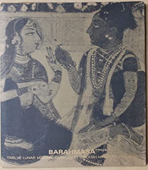
1966réf. 143460Maharashtra Tourism Development 1966. Portfolio of twelve folded color plates and accompanying texts within printed paper case.
réf. VLE-642New Dehli, , 1959, in-4, 125 pp. illustrées de 38 planches en couleurs, d'une carte et de quelques reproductions en noir relié plein cartonnage éditeur toilé sous jaquette illustrée dont la reproduction centrale manque (jaquette légèrement défraichie)
réf. 0521729475.Gpaperback. Good. Access codes and supplements are not guaranteed with used items. May be an ex-library book. paperback
2021réf. DBS-9781774077191Society Publishing 2021. 1st. Hardcover. New. Society Publishing hardcover
2021réf. AME_9781774077191Society Publishing 2021. UNKNOWN. Hardcover. New/New. _ Society Publishing hardcover
2020réf. DBS-9781774073599ARCLER PRESS 2020. 1st. Paperback. New. ARCLER PRESS paperback
1981K.C. ARYAN Basis of decorative element in indian art. India, Rekha Prakashan 1981 italian, 141 CR.65 Copertina rigida, volume in buone condizioni, segni di usura causati dal fattore tempo sulla copertina, interno in ottimo stato, legatura salda, tavle fuori testo in b\n, testo in inglese 141 pagine circa Copertina come da foto
19591 32x24 cm., legatura in piena tela grezza, sovraccoperta con planchetta applicata, pagg. 125, 38 tavole con illustrazioni a colori applicate e ampie descrizioni, 1 tavola in antiporta e altre illustrazioni nel testo, prima edizione ufficiale, in inglese, buone condizioni, soltanto piccole lacerazioni alla sovraccoperta.
1959réf. 1094845(Delhi), Ministry of Information & Broadcasting, (1959). 4to. 125 S. m. sehr zahlr. mont., ganzs. u. farb. Tafelabb. u. einigen mont. Abb. im Text. OLwd m. OUmschl.
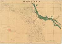
réf. 66212Dehradun: Published under the direction of Colonel Sir S.G. Burrard K.C.S.I. R.E. F.R.S. Surveyor General of India 1917. Original heliozincographed map 73 x 105 cm printed at the Survey of India Offices in partial colour folding between publisher's original buff paper covers printed in black and with key map to back cover. The map compiled from ground and air reconnaissance is centred on Basrah and the Shatt al-Arab River with its date groves printed in green. The map shows roads suitable for wheeled traffic camel roads mule paths foot paths telegraph lines wells oil wells Mosques imamzadehs a shrine-tomb of a holy person in Shi'a Islam forts watch-towers deserted villages and springs pipelines graves trigonometrical stations post offices and telegraph offices and camping grounds. Map overprinted with numeric reference grid. Old ownership inscription to front cover. Some light toning some splits along folds some dampstaining and a few spots some light wear to covers scribbling to one panel of verso generally very good. A very scarce map with just one copy traced by OCLC at the Staatsbibliothek zu Berlin focusing on the key strategic regions of Basra-Zubair in south-eastern Iraq and the adjacent Khorramshahr area of Persia and it is one of the first maps to show Abadan the first oil boomtown of the Middle East. While there are oil wells marked throughout the map there is a particular accumulation of wells and refineries in and around Abadan on the far right which was the Middle East's first oil 'boomtown.' It appears here along with the Anglo-Persian Oil Company A.P.O.C. Refinery. Rich oil fields were discovered here in the early 20th century and in 1909 secret negotiations with the British led to the formation of the Anglo-Persian Oil Company which completed its refinery here in 1912. This company would play a central role in Iran's political and economic life throughout the 20th century. As military cartography it is marked 'For Official use only' in red to upper margin. Reg. No.888 D.D.D. 1917 2.D.O. S.I. 2000. Mesopotamia. Sheet No. 1. OCLC: 1235951984 Dehradun: Published under the direction of Colonel Sir S.G. Burrard, K.C.S.I., R.E., F.R.S., Surveyor General of India, 1917. unknown
Small 4to, 26.3cm. Pp. 23, 1 fold. map. Orig. printed wrs., uncut. Some old stamps, good otherwise. Scarce.
1821réf. RO80188002ALEXIX EYMERY. 1821. In-12. Relié. Etat d'usage, Plats abîmés, Dos abîmé, Quelques rousseurs. 428 Pages. Nombreuses gravures en noir et blanc dans et hors texte dont un frontispice. Quelques rousseurs sans conséquence pour la lecture. Pages désolidarisées. Déchirures sur le dos et les plats. Tranches marbrées. 1 Etiquette collée sur le 1er contre plat.. . . . Classification Dewey : 954-Asie du Sud, Inde
1821réf. 127060Paris Alexis Eymery 1821 2 vol. reliés 2 vol. in-12, plein veau marbré fauve, dos lisses ornés de caissons, fleurons, guirlandes et filets dorés, tranches mouchetées, 440 et 428 pp. Édition originale de ce traité historique destiné à la jeunesse, illustré de 12 charmantes planches gravées (dont 2 frontispices) hors-texte. Ex-libris manuscrits. Bonne reliure de l'époque.
1821réf. 113917Paris, Alexis Eymery 1821 Tome 2 seul. In-16 17 x 10 cm. Reliure de l’époque basane fauve marbrée, dos lisse orné de petits fers encadrés de roulettes dorées, fer de la pension Mathieu sur le premier plat, 428 pp., 6 gravures coloriées hors texte, table des matières. Coins émoussés et frottés, intérieur frais.
1821réf. 99937916Paris Eymeri 1821, In Paris Eymeri 1821, In-12 relié pleine basane de l'époque, dos lisse trés orné, guirlande d'encadrement sur les plats. 428 pages. Gravures. Mors un peu fragile, bon exemplaire.
1821Paris Eymeri 1821, In-12 relié pleine basane de l'époque, dos lisse trés orné, guirlande d'encadrement sur les plats. 428 pages. Gravures. Mors un peu fragile, bon exemplaire.
Paris, Alexis Eymery, 1821, 2 tomos, 18,5 x 11 cm., 2 h. ? 440 págs. = 428 págs. y un total de 12 láminas grabadas en cobre