MARMIER (Xavier).Livre Rare Book
3 287 résultats
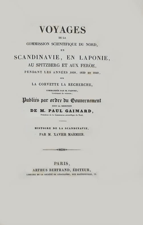
1842réf. 125329P., Arthus Bertrand, s.d. (1842), gr. in-8°, 515 pp, la page de titre indique “Voyages de la Commission scientifique du Nord en Scandinavie, en Laponie, au Spitzberg et aux Féröe, pendant les années 1838, 1839 et 1840, sur la corvette La Recherche..., publiés par ordre du Gouvernement sous la direction de M. Paul Gaimard. – Histoire de la Scandinavie par M. Xavier Marmier”, reliure demi-veau fauve, dos à 5 nerfs filetés et soulignés à froid, pièce de titre chagrin noir et doubles filets dorés (rel. de l'époque), qqs rares rousseurs, bon état. Rare
2014réf. 27674(Ostfildern), Hatje Cantz,, 2014. Katalogbuch zu den Ausstellungen in der Fotogallery, Cardiff, und dem Museum on the Seam, Jerusalem. Mit einer Beilage mit 30 Abbildungn und 128 z.T. ausfaltbaren, ganzseitigen Fotoabbildungen. 32,5/28,5 cm. 29,1 S. + 128 Tafeln. Farb. ill. OPappband. Recht schön.
réf. 243377Londres, Hydrographic office, J. D. Potter [printed by William Clowes and sons], 1853 in-8, xii pp., [3] ff. n. ch., dont un d'addenda entre les pp. ii et iii, 552 pp., avec 9 planches hors texte, demi-basane aubergine à coins, dos à faux-nerfs orné de filets dorés, guirlande à froid sur les plats, tranches mouchetées de rouge (reliure de l'époque). Manque la pièce de titre, épidermures au dos, coins frottés.
2006réf. x-1573316679Blackwell Pub 2006. Paperback. New. volume 1087 edition. 389 pages. 8.75x5.75x0.75 inches. Blackwell Pub paperback
2026réf. x-1501392751Bloomsbury Publishing Plc 2026. Hardcover. New. 296 pages. 6.00x0.69x9.00 inches. Bloomsbury Publishing Plc hardcover
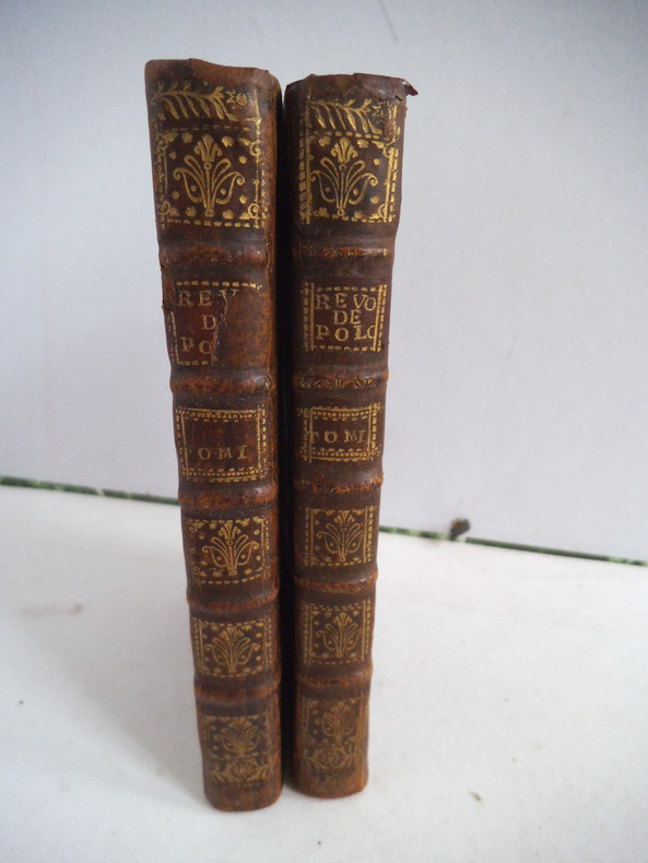
réf. 11421depuis le commencement de cette monarchie jusqu’à la mort d’Auguste II. Deux tomes en deux volumes in 12 plein cuir fauve raciné à nerfs, pièce de titre , tomaisons, fers, roulette dorés. Roulette dorée sur coupes. Tranches rouges. Tome 1 : titre orné d’une vignette de B. PICARD-XXIV- 1 carte dépliante des Estats de la couronne de Pologne, 243 pages Tome 2 : titre orné d’une vignette par B. PICARD- 206 pages, Une carte dépliante en regard de la page 113 Scandinavie où sont les estats de Danemark et Suède ; Une carte dépliante en regard de la page 159 Russie blanche ou Moscovie. 38 pages de table des principales matières contenues dans les deux tomes de cet ouvrage. A Amsterdam chez François l’Honoré 1735 Petit manque à la pièce titre du tome premier. Sinon bon exemplaire
réf. 35096152like new. unknown
2014réf. STM-9781118841907United States: John Wiley & Sons 2014. Hardbound. Brand New. Book Condition:- Brand New. Secured Packaging. Fast DeliveryBookseller Inventory # 9781118841907 John Wiley & Sons hardcover
réf. DADAX1118841905Wiley 2014-07-08. 1. hardcover. New. 6.30x1.10x9.30. Buy with confidence. Excellent Customer Service & Return policy. Wiley hardcover
réf. 35721457like new. unknown
réf. 35721457-nnew. unknown
réf. ria9781118509418_inpHardback. New. New Book; Fast Shipping from UK; Not signed; Not First Edition; Volume 79 in the venerable Organic Reactions series contains two chapters. The first addresses cross-coupling reactions of organotrifluoroborate salts useful in the development of natural products materials and pharmacologically acti hardcover
2014réf. __1118841905John Wiley & Sons Inc 2014. Hardcover. New. 464 pages. 9.50x6.25x1.25 inches. John Wiley & Sons Inc hardcover
2020réf. x-0231197640Columbia Univ Pr 2020. Hardcover. New. 316 pages. 8.50x5.50x1.00 inches. Columbia Univ Pr hardcover
réf. 5713069-nnew. unknown
2013réf. DADAX1118674286Wiley 2013-09-03. 1. hardcover. New. 6.42x1.58x9.32. Buy with confidence. Excellent Customer Service & Return policy. Wiley hardcover
2013réf. DADAX1118674251Wiley 2013-07-22. 1. hardcover. New. 6.30x1.30x9.30. Buy with confidence. Excellent Customer Service & Return policy. Wiley hardcover
2014réf. STM-9781118835227United States: John Wiley & Sons 2014. Hardbound. Brand New. Book Condition:- Brand New. Secured Packaging. Fast DeliveryBookseller Inventory # 9781118835227 John Wiley & Sons hardcover
1877réf. EEzz9086Kjobenhavn, Immanuel Rée og Schmidt & Bering 1877. 4°. 128, 159 S., stummer grüner LnBd.d.Zt. Einband leicht gewellt, etwas schief gelesen. Innen nahezu fleckenfrei. Seltene Ausgabe in Dänischer Sprache. Enthält über 100 gesellschaftskritische Karikaturen, in denen Grandville mittels der für ihn typischen Mischwesen (Tiere mit Menschenantlitz, Menschen mit Tierköpfen).
1944réf. 100786Kobenhavn, Ejnar Munksgaard 1944. Auflage 600 Exemplare. Mit zahlreichen, meist ganzseit. Abb., eine farbig. 415 S. Kl.-4to. OBrosch.
1791réf. 156041791 demi-basane, dos lisse (dos usagé) in-8, (4ff.), 280pp., Kiøbenhaun trykt hos Sebastian Popp, 1791
1780réf. 200039AG1780. Paris De l'Isle et Buache 1780. Original hand-coloured engraving. Plate Size: 64.4 cm x 48.7 cm. Sheet Size: 66.6 cm x 52.7 cm. Original map. In very good condition with the slightest traces of browning only. A very detailed and interesting map of Denmark - the Jutland peninsula and the archipelago of islands such as Funen Zealand and Bornholm- and the and southern Sweden. The Duchies of Brem and Meckelbourg and Pomeranie on the German coast can be seen in the lower part of the map. The cities of Hamburg Copenhagen and Rostock are included on the map. Relief is depicted pictorially. The sand banks and shallows along the coasts are also depicted. Block of annotative French text lies within the Baltic Sea. Guillaume Delisle 1675-1726 was a renowned mapmaker who led the reform of French cartography. A brother of the astronomer Joseph-Nicolas Delisle and a student of the astronomer Jean-Dominique Cassini Delisle learned to fix accurate positions by astronomical observation. The accuracy of his continental outlines and his reduction of gross errors in determining lines of longitude were considerable improvements over earlier maps. His earliest works published in 1700 were a pair of globes terrestrial and celestial maps of the continents and a world map in hemispheres. He prepared about 100 maps and wrote on mensuration and ancient geography. At 27 Delisle was admitted into the French Académie Royale des Sciences an institution financed by the French state. After that date he signed his maps with the title of "Géographe de l'Académie". Five years later he moved to the Quai de l'Horloge in Paris a true publishing hub where his business prospered. In 1718 he was the first to become chief geographer to the king. Encylopedia Britannica unknown
1817réf. 271445Stuttgart / Tübingen Cotta 1816/1817. 2 Bl., 278 S., 2 Bl., 348 S. Interims-Broschur. *unaufgeschnitten* bei Bd 1 fehlt der vordere Umschlag*.
Augsburg, Opera Et Studio Matthaei Seütteri, [c. 1730-1740], carta geografica incisa in rame, leggermente acquerellata a mano d'epoca, mm. 508x581 (l'impronta della lastra), mm. 520x603 (il foglio). Bel cartiglio figurato in alto a destra. Lievi restauri al margine bianco, leggeri aloni.
réf. DADAX1118835220Wiley 2014-01-21. 1. hardcover. New. 6.30x1.40x9.30. Buy with confidence. Excellent Customer Service & Return policy. Wiley hardcover