57.911 risultati
180020 cm, in 8°, rilegatura coeva in cartone alla rustica, taglispruzzati in rosso, p. VII, 71 (1) con 25 carte geografiche più volte ripiegate e graziosamente incise su rame, con gli itinerari che collegano le principali città e le tappe intermedie dei viaggi postali. Le tavole sono arricchite del dettaglio dei fiumi e dei promontori che si incontrano nei vari percorsi. Doppio frontespizio bilingue e testo su due colonne in italiano e francese. La parte finale del volume descrive i regolamenti e le tasse di pedaggio per valicare il confine tra Francia ed Italia attraverso il passaggio del Moncenisio in Piemonte. Ottimo lo stato di conservazione generale del testo e delle tavole ad eccezione del solo itinerario "da Milano a Venezia" che presenta minimi segni di consultazione. Al frontespizio (francese) due piccole note di possesso coeve.
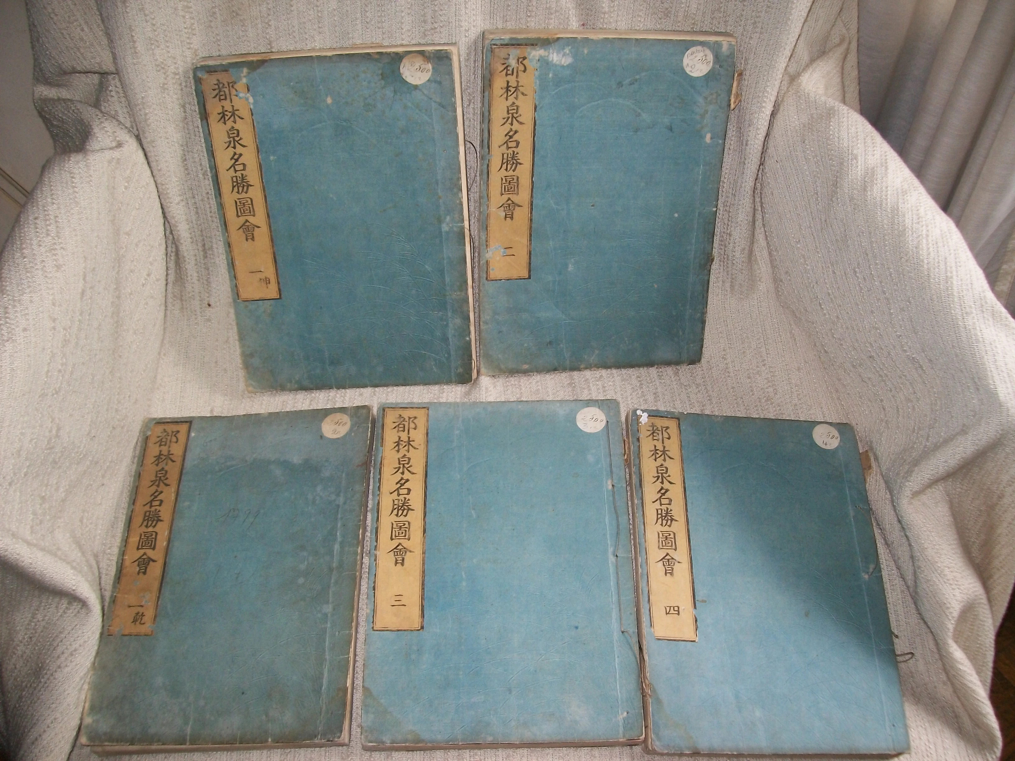
1799rif. GITk824(Kyoto 1799). 5 volumes sur 6 (26,5cm sur 18,5cm) imprimés sur beau papier de mûrier selon la technique traditionnelle du fukurotoji (pages doublées et cousues au moyen de ligatures), plats de couverture cartonnée bleue avec le titre imprimé en noir sur fond ocre, appliqué sur le 1er. *TOME I 1re partie: 37 feuillets non chiffrés soit 74pp *TOME I 2e partie: 58 feuillets non chiffrés soit 116pp *TOME II: 38 feuillets non chiffrés soit 76pp *TOME III: 40 feuillets non chiffrés soit 80pp *TOME IV: 54 feuillets non chiffrés soit 108pp. SANS LE TOME V ET DERNIER. Orné de 139 magnifiques gravures sur bois bien nettes et d'une grande fraîcheur (24 à pleine page et 115 sur double page) représentant principalement des vues de jardins de temples, monastères, pavillons de thé. La plupart offrant un foisonnement de personnages de tous âges, sexe et condition sociale. Sutures décousues; petits manques sur les étiquettes de titre; auréole claire ancienne en tête des feuillets des deux parties du Tome I et au bas des fonds des Tomes II, III, IV; petite galerie de vers marginale sans gravité sur 7 feuillets du Tome I 2e partie et 5 feuillets du Tome II, plus importante dans les fonds du Tomme III sans dommage pour le texte et les gravures. BEL EXEMPLAIRE MALGRE LES DEFAUTS SIGNALES l'impression du texte (en japonais et en chinois), ainsi que celle des gravures étant fraîche et bien nette.
1846(8), XXIV, 309pp., 1 carte et 8 plans cartonnage d'éditeur jaune imprimé en noir, dos lisse orné (cartonnage à la cathédrale, dit Biedermeier) 1846 ;, 1846 ;, in-16, (8), XXIV, 309pp, 1 carte et 8 plans, cartonnage d'éditeur jaune imprimé en noir, dos lisse orné (cartonnage à la cathédrale, dit Biedermeier), 1 carte à deux pages du Rhin. 8 plans de villes (Strasbourg, Francfort, Mayence, Coblence, Bonn, Cologne, Aix et Düsseldorff). PREMIÈRE ÉDITION DE CE GUIDE TRÈS RARE. Elle est traduite d'après la 5° édition allemande. Il s'agit du second ouvrage en français de Karl Baedeker, après le Voyage du Rhin de Mayence à Cologne, publié en 1832. L'ouvrage est relié dans son beau cartonnage à la cathédrale, dit Biedermeier, avec sur les plats, entre des rinceaux, des représentations de vues et de monuments. Après avoir été utilisé quelques années, il fut remplacé par le célèbre cartonnage rouge, marque de fabrique de la maison Baedeker. Rousseurs claires éparses. Cartonnage usé sur les coupes et aux coins. Néanmoins EXEMPLAIRE ATTRACTIF, DANS SON JOLI CARTONNAGE D'ÉDITEUR TRÈS RECHERCHÉ
1587In 8° (146 x 97); 8 cc. nn., 213 pp. (su 215, mancano le p.111-112, corrispondenti alla carta G8); 8 cc. n., 64 cc n. Il frontespizio presenta un indice dei contenuti dell'opera. Marca tipografica in basso con serpente attorcigliato su bastone di legno a forma di "T", sostenuto in basso da due mani. La marca tipografica è una variante. Nota manoscritta in matita blu che riporta la data di edizione dell'opera. Segue una tavola alfabetica dei contenuti dell'opera. Graziosi capilettera silografici. Legatura in pergamena molle coeva. La prima opera è una guida storico-artistica che assume la forma di un dialogo fra un veneziano ed un forestiero: il lettore viene guidato attraverso le meraviglie di Venezia e la sua storia. Si tratta sostanzialmente, dice Cicognara, di una ristampa dell'opera "Descrizione di tutte le cose notabili, che sono in Venezia, tra un Viniziano ed un Forestiero", pubblicato da Franceschi nel 1568 (Cicognara stesso al numero 4359 cita peraltro la medesima opera in una edizione di Rampazzetto, 1565). Edizione originale e prima tiratura (distinguibile dal verso bianco dell'ultima carta) della Dichiarazione di tutte le istorie, qui aggiunta editorialmente, come dice il titolo della prima opera, ma pubblicata a sè stante nel medesimo anno; descrive affreschi e tele nelle sale del palazzo ducale, principalmente quella del Gran Consiglio e quella dello Scrutinio, riorganizzata dopo un incendio. Bardi descrive la disposizione fisica dei dipinti ad anche i ritratti dei dogi. Segnaliamo fra le pitture la tela di Tintoretto relativa alla vittoria navale ottenuta dai Veneziani sul Lago di Garda contro i Milanesi nel 1440 durante il conflitto per il controllo del lago e del territorio bresciano nella fase di espansione in terraferma della Serenissima. Volume in discrete condizioni. La legatura è leggermente staccata dal corpo del volume nella parte inferiore, con tracce d'uso e piccole mancanze. Leggeri arrossamenti e fioriture in alcune pagine. Piccolo tarlo al margine inferiore della seconda opera. Aloni di umidità in diverse pagine e qualche macchia. Piccolo restauro approssimativo alla prima carta ed uno strappo con piccola perdita di testo all'ultima carta. Cicogna 4669; Schlosser 369; Fossati Bellani 2248. Lozzi 5895: "Molto interessante per la storia, perchè quei famosi dipinti riguardano le più segnalate vittorie riportate dai veneziani".
1840In-4°; in antip. la mappa di Bologna, e pp. 48, (2), 34 tavole (le pp. 17 e 18 posposte). Cartonato. Il testo contiene una trattazione storico topografica sulla città; le tavole sono molto raffinate e ci mostrano la Bologna ottocentesca come in una passeggiata. Fori di tarlo passanti.
1868-1908, 7 vol. compresa la miscellanea e il supplemento di Breventani; 32 cm. ril. in mezza pelle, titolo e fregi in oro al dorso, piatti marmorizzati. Vol. I, 1868, p. 510; vol. 2, 1869, p. 422; vol. 3, 1870, p. 383; vol. 4, 1872, p. 383; vol. 5, 1873, p. 254; Miscellanea 1872, p. (8), 391. Il Supplemento, 1908, 33 cm. p. 10, (2), 299, conserva le cop. originali e una pianta di Bologna su doppia pag. f.t. Il terzo vol. ha una rilegatura leggermente diversa, ma omogenea con gli altri volumi. Bell'esemplare in stato di conservazione molto buono, raro da trovarsi completo
1826in-16, pp.XVI, 352, legatura coeva in mezza pelle, titolo e fregi oro al dorso liscio. Adorno di una grande pianta della città ripiega più volte e di 18 belle vedute fuori testo inc. in rame, 14 di piazze e luoghi artistici di Torino, e quattro di Moncalieri, Rivoli, Stupinigi e Racconigi. Trattasi della prima guida ''moderna'' di Torino assai importante e rara. Esemplare a buoni marigini, fresco.. Peyrot, Torino nei secoli, 328. Cat. Collez. Simeon, G11. Bovolato, Archivio storico, p.310..
1793In-8°; pp. (8), 312, 11 tavole; pp. 408 (piccoli fori di tarlo alle ultime carte), tavole 7. Piccola marginale integrazione alle prime due carte del tomo primo e alla prima del secondo. LEgature in cartonato coevo, dorso restaurato al secondo volume. Completo delle 18 tavole fuori testo incise su rame, alcune più volte ripiegate.
rif. 2927[s'Graavenhaague], Uitgegeven op last van het Departement van koloniën, s.d. [1883-1885]. 65,5 x 47,5 cm, n.p., double page de titre et 26 planches doubles contenant 24 cartes, montées sur onglets. Relié, cartonnage d'éditeur. Rare atlas de très grand format dont les cartes, en couleurs, sont particulièrement détaillées, avec légendes, complet. Java, Sumatra, Molukken, Nieuw-Guinea, Kleine Soenda Eilanden, Celebes, Borneo, Bangka, Blitoeng... Les cartes sont en excellent état, on remarque à peine quelques piqûres pâles sur les deux premières uniquement, excepté la 6e qui comporte une déchirure sans manque. La reliure est passée et usée, avec des fentes aux mors. Tooley p. 597, 581.
1846rif. AQ31443London: Seeley Burnside and Seeley 1846. 2 xix 1 472pp. With an engraved folding map and 45 woodcut illustrations in the text. Original publisher's blind-stamped green cloth lettered in gilt to spine. Lightly rubbed marked spine sunned. Internally clean and crisp. 'Let us all pray for New Zealand that it may please Almighty God to avert the evils of a civil war from this newly-acquired and interesting colony'. The sole edition of an authoritative work of ecclesiastical geography that provides a detailed account of the rise and progress of Protestant missions throughout the world. The anonymous compiler provides detailed information on the political and colonial history of the regions in which missionaries laboured as well as valuable accounts of the 'superstitions' of the natives including instances of human sacrifice the 'prevalence of Paganism and Mahommetanism' cannibalism and the practice of 'Devil-Worship'. The majority of the text is devoted to the missions of Africa and India though extensive chapters relate Christian efforts in inter alia the West Indies Australasia and North America. In regards to West Indies the author provides notices on the origin of the Slave Trade its abolition and the death of the 'ever-to-be revered Mr. Wilberforce'. The chapter concerning North America is predominantly dedicated to Canada in particular the operations of the Hudson's Bay Fur Companies and the 'Native Indians of these Territories favourable to British trade'. The chapter concerning Australasia is divided between New Holland and New Zealand and notably include remarks in character and appearance of the Aborigines and 'the most warlike savages in the world' the New Zealanders respectively. The section on New Zealand strikingly concludes with a brief account of the eruption of conflicts between British and native forces that would prove to be the initial sorties of the bloody and protracted New Zealand Wars. . First edition. 8vo. Seeley, Burnside, and Seeley hardcover
1999STATO: USATO, COME NUOVO. TITOLO: Americus Vesputius 1499-1999. AUTORE: Varela Bueno,Consuelo. CURATORE: Prefazione di Guillermo Moron. EDITORE: Enzo Papi - Trec DATA ED.: 1999, COLLANA: Testi in spagnolo, inglese, italiano. Scultura di Italo Celli in bassorilievo in bronzo, con la tecnica della cera persa, sul piatto anteriore. In custodia. Edizione numerata d Esemplare in ottimo stato.
rif. DADAX1934547131New unknown
rif. 4277Londres. Henry Sotheran 1870. 36 x 27 cm, une page de titre sur carte avec une chromolithographie centrale colorée à la main contrecollée, vi pp. de liste des planches et 24 planches lithographiques sous serpente colorées à la main, toutes montées sur carte avec bordures dorées, une page de texte explicatif pour chaque gravure. Relié pleine percaline verte, plat décoré et titre doré, dos lisse décoré et titre doré. Reliure usée, coiffes abimées, quatre planches déreliées. Sinon intérieur en bel état et planches très fraîches. Complet. James Baker Pyne (1800-1870) était un peintre paysagiste anglais devenu disciple de Turner.
rif. DADAX0321812808New unknown
rif. SONG0826182224Used: Good unknown
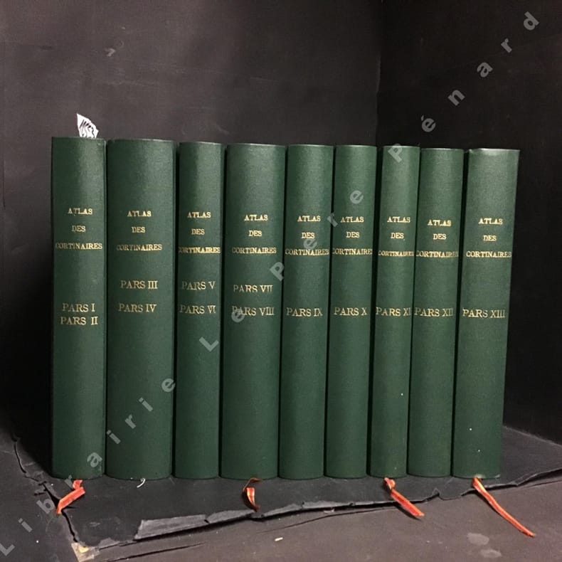
1994rif. 1255341994 Fédération mycologique Dauphiné-Savoie - 1994 - 16 volumes in-8, reliés, formats carrés, pleine percaline verte, titres et tomaisons sur les dos en doré, toutes tranches mouchetées, signets rouges - Contient 913 planches hors-texte en couleur
rif. DADAX1843533294New unknown
1884Very Good French Original map. Oblong Double Elephant Folio. (96x156 cm). In French. Scale: 1/1.500.000. With explanation of geographical terms in Greek, Turkish, Arabic and Persian; With overview sheet: Aperçu general de la division administrative des provinces asiatiques de l'Empire Ottoman. (Jaar: 2011 - Europeana Collections). French edition of Kiepert's huge map of the Imperial Ottoman territories. "Includes list of geographic terms in eastern languages and notes on administrative divisions. Includes notes on materials the cartographer used to put together the map". (See LC copy). Kiepert, (1818-1899), was born in Berlin. He traveled frequently as a youth with his family and documented his travels by drawing. His family was friends with Leopold von Ranke, who inspired Kiepert's creative endeavors. Kiepert was taught by August Meineke in school. Meineke influenced Kiepert's interest in classical antiquity. He attended Humboldt University of Berlin. He studied history, philology, and geography. He published his first geographical work, with Carl Ritter, in 1840, titled Atlas von Hellas und den hellenischen Kolonien. The atlas focused on ancient Greece. In 1848 his Historisch-geographischer Atlas der alten Welt was published. In 1854, his atlas, Atlas antiquus was released. It was translated into five languages. Neuer Handatlas über alle Teile der Erde was first published in 1855. In 1877 his Lehrbuch der alten Geographie was published, and in 1879 Leitfaden der alten Geographie, which was translated into English (A Manual of Ancient Geography, 1881) and into French. In 1894 he created the first part of a larger atlas of the ancient world titled Formae orbis antiqui. He traveled to Asia Minor four times between 1841 and 1848. He created two maps of the region, including Karte des osmanischen Reiches in Asien, in 1844. Kiepert taught geography at the University of Humboldt-Berlin starting in 1854. He taught at the university until his death. Akyol, article 536.; Dagtekin p. 22 (With detailed bibliography on Kiepert's maps). Rare. Preserved in a frame, will be sent without its frame. A wall map.
1921Very Good Turkish, Ottoman (1500-1928) An extremely rare litho propaganda map published as an extra supplement to the Tercümân-i Hakîkat [i.e. The Translator of Truth] newspaper just before the proclamation of Republic in Turkey in 1923 by Mustafa Kemal Atatürk (1881-1938), showing the front in West Anatolia during the War of Independence (or National Struggle) between 1919-1922 against Greek forces. The upside of the map between the note as title 'Gift to the readers of 'Tercümân-i Hakîkat', Mustafa Kemal Atatürk's portrait among decorated heroic lithographed drawings. In the lower right corner, can be seen legends of the map, scale, and mapmaker's signature. Tercümân-i Hakîkat was a daily newspaper published in Istanbul between 1878-1921 during the Ottoman Empire. Tercüman-i Hakîkat, the most important newspaper published during the reign of Sultan Abdülhamid II, was founded by novelist Ahmed Midhat Efendi, (1844-1912). In the beginning, most of the articles were written by Ahmed Midhat Efendi. It was an encyclopedic newspaper with the aim of inculcating and educating reading habits among the Turks and it played an important role in the training of many famous Ottoman journalists. Its first issue was published on June 26, 1878. After Ahmed Midhat's death in 1913, the newspaper changed owners, and the last issue was published on February 11, 1921. Ibrahim Alaettin Gövsa, (1889-1949), was an Ottoman / Turkish journalist, educator, and intellectual who supported the War of Independence the most. This propaganda map published in Tercümân-i Hakîkat, during the war in 1920 or 1921, is a propaganda tool that calls on the literate people belonging to a certain class, especially those living in Istanbul, to support the war, and aims to spread the word that Turkey is winning the war. Original lithograph map. 50x35,5 cm. In Ottoman script (Turkish with Arabic letters). Scale: 1: 250.000. Occasionally foxing and slight stains on paper, folded traces. Otherwise a very good copy.
1877Very Good Turkish, Ottoman (1500-1928) Original wrappers. Large roy. 8vo. (25 x 17 cm). In Ottoman script (Turkish with Arabic letters). [1], 39 p. First and Only Edition of the description of an early pilot guide to the Aegean Archipelago with the Mediterranean shores of Africa, Cyprus et alli, not including Morea (Peloponnese peninsula) which was published separately as 'Tarîfât-i Sevâhil-i Mora' [i.e. Description of the shores of Morea]. Admiral / General Süleyman Faik Pasha, who graduated from the Ottoman Naval Academy, was promoted to captain in 1864 after his travel to the Cape of Good Hope, and with the information, he obtained during this trip, he published and translated three guides, especially on the seas and coasts under Turkish / Ottoman rule. This early and rare book was one of his translations from its original pilot guide in English, printed in the Bahriye Matbaasi [i.e. The Press of the Turkish Naval Forces] located in Kasimpasa district which is a quarter within the Pera area of Constantinople, a low-lying area north of the Golden Horn. is one of the oldest residential areas in Istanbul with a strong naval tradition. The ships of Sultan Mehmed II sailed into the Golden Horn from this quarter. After the fall of Constantinople, Kasimpasa flourished. By the 16th century, it contained the Imperial Arsenal and docks of the Ottoman Navy, home to 120 ships. The Turkish Naval High School was founded in 1773 within a printing house shortly after foundation, to teach geometry and navigation to naval and civilian merchant captains on board a galleon anchored at Kasimpasa. The Turkish Naval Academy was housed in Kasimpasa from 1838 to 1850. Extremely rare. Only one copy in OCLC 1030771711 (Orient-Institut of Istanbul).; Özege 19742. Not in ATYB (Askerî Tarih Yayinlari Bibliyografyasi).
1882Very Good Turkish, Ottoman (1500-1928) Contemporary handsome quarter leather binding raised four bands and gilt lettering to spine. Roy. 8vo. (24 x 17 cm). In Ottoman script (Old Turkish with Arabic letters. 171, [1] p., 15 folded maps. First and only edition of this early naval guide to the Mediterranean and Aegean Islands and shores prepared by the Ottoman Admiral Süleyman Faik. A comprehensive early printed guide to the Cezâyir-i Bahr-i Sefid [i.e. Ottoman Province of the Archipelago] including the descriptions of all islands in the Archipelago such as Patmos, Peraka, Paros, Delos, Ipsara, Acina, Sekino, Mikonos, Bozcaada (Tenedos), Istanköy (Kos), Imroz, Crete, Anti Paros, Alosis Islands with West and East of the Archipelago, and Edremit Bay, Doris Bay, Rafti Port, Aynaroz Bay; and Anatolian shores such as Izmir (Smyrna), Kusadasi, Gallipoli. This rare book has 15 folded portolan maps of Marmaris Port, Makri Port, Naghos Port, Karaagach (Ptelea, Evros in Greece) Port, Kakuve and Tertumos Ports, portolan of Iskenderun (Alexandrietta), portolan of Lazkiye (Al-Lazkiyya in Syria), portolan of Avret Island and Trablus-Sam, and portolan of Beirut and Sida. Süleyman Faik (1845-1909) was a general, and afterwards an admiral and a Chairman of the Turkish / Ottoman Navy General Staff, divisional. Only six copies in OCLC: 773143926, 67075343.; Özege 16579.; Not in ATYB: Askerî Tarih Yayinlari Bibliyografyasi [= Bibliography of Turkish History of Military Books].
rif. SONG1452162468Used: Good unknown
2016New Persian Original bdg. HC. Folio. (34 x 24 cm). In Persian with abstracts in English. 392 p., color and b/w ills. Tehran became a major city of Iran after 1554 A.D. during the Safavid period when Shah Tahmasb I, son of Shah Ismail, ordered the implementation of two large-scale public works. The first project was the construction of ramparts and moats surrounding the entire city, which defined the city's perimeters and increased its defense. The rampart consisted of 114 towers, representing the 114 chapters within the Holy Quran and enclosed an area of 4.35 km2. The second project was the establishment of the bazaar, the heart of the industrial and commercial activities of the city, surrounded by numerous holy shrines. However, it was 240 years later in the Spring of 1796 A.D. that Tehran became the national capital of Iran, during Agha Mohammad Khan Qajar's reign. 2016 A.D. actually marks the 220th year since Tehran became the political centre of Iran. The first known map of Tehran (page 18), a Russian spy map, dates back to 1826 A.D. The next Russian map of Tehran (page 24) from 1852 A.D. was translated into Persian and presented as a gift to Naser al-Din Shah Qajar (page 29). After the establishment of the military polytechnic school in 1851 A.D. and the arrival of Europe an military instructors, the importance of accurate topographical maps was recognized by the nation's leaders. The Austrian artillery trainer for cannons, August Karl Krziz, coordinated in 1858 A.D. the preparation of the maps of Tehran (page 39) and its surrounding area (page 35). This was the beginning of scientific cartography in Iran. By 1863 A.D., maps of Tehran Province for the purpose of tax collection (page 58) were being produced by engineer Abdul Rasool Khan. Tehran dramatically expanded after a huge flood in 1867 A.D. destroyed a large portion of the Safavid period ramparts and moats, after which Alexander Bohler, a French military instructor, designed a new and enlarged rampart and moat enclosure. Within four years between 1867 A.D. and 1871 A.D., Tehran grew from 4 .35 km2 to 19.75 km2 with these new constructions. By 1891 A.D., a highly detailed and technical map of Tehran (page 64) had been produced by Abdul Ghafar Najmolmoq. During the reigning years of Mozafar al-Din Shah, Mohammad Ali Shah, and Ahmad Shah, maps for Tehran postal services (page 126) and Tehran provincial delineation (page 127) were produced. During these years, the Russian, British and French prepared several geopolitical maps of the region including Tehran. For example, the map on page 323 reproduces a map prepared in 1892 A.D. by the British Survey of India at the scale of 1:506,880. In 1914 A.D., German publisher Wagner & Debes prepared a touristic map of Tehran (page 134). In 1922 A.D. the Ministry of Culture's Investigation Section prepared a map of schools in Tehran (page 138). During the Pahlavi I period (1925~1941 A.D.), modernization of Tehran became a national priority. By 1930 A.D. a map for street enlargement in Tehran (page 158) had been published. In 1932 A.D., the demolition of the Naser al-Din Shah Qajar period ramparts began simultaneous to further expansion of urbanized Tehran. The 1936 A.D. military map of Tehran (page 169) is testimony to the changes in the urban morphology of this period. The creation of a dedicated military cartographic service in 1935 A.D. marked an important milestone in the history of cartography in Iran. The 1937 A.D. urban development plan of Tehran (page 170) clearly shows the new streets, squares and urban development envisioned. The first known aerial photograph of Tehran dating from 1940 A.D. (page 177) displays the realization of this urban development plan. After the invasions by the Russians, British and Americans in 1941 A.D., cartographic activities in Iran suddenly increased. Sergeant Mohammad Reza Ghaffari privately published maps of Tehran [.] The above mentioned maps are a few representative samples of the over 270 maps