LA PEROUSE, Jean Francois Comte deBiblio.com
178 résultats
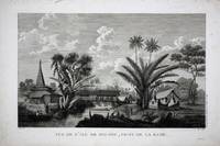
réf. 8786Paris: 1797. No binding. Very Good. 270 x 410 mm. in good condition. This is a view of the town of Buru in Indonesia recording the visit of the French Admiral and explorer le Comte de La Pérouse. Jean-Francois de Galoup Comte de La Perouse led a French scientific expedition to the Pacific in 1785-88. He was one of the most noted naval commanders and navigators in France and was selected by King Louis XVI to complete Captain James Cook's exploration of the western Pacific. In a rare moment of co-operation the British Admiralty furnished scientific equipment to measure variations in magnetic north and for determining longitude. Fortunately for us La Perouse was meticulous in sending copies of his detailed logs and surveying via other ships as well as overland. His last contact was in the spring of 1788 with a British ship in Botany Bay Australia. The expedition was never heard from again. When the French Government realised that it had been lost they decided to publish an account as in many other ways it is regarded as one the greatest French voyages of exploration. It was not until 1827 that their fate was known. Howes USIana L93; Nordenskiold Collection v. 2; Phillips 688; Sabin 38960; Shirley 'Atlases in the BL' G.LPR-1a. 1797 unknown
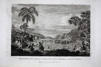
réf. 8794London: 1798. No binding. Very Good. 225 x 310 mm. in good condition. This is a view of the massacre of twelve members of the expedition of the French Admiral and explorer le Comte de La Pérouse at Tatuila on the island of Maouna in Samoa. It was a great loss to the expedition Robert de Lamanon was a botanist and physician. La Perouse's second in command Paul Antoine Fleuriot also lost his life. Jean-Francois de Galoup Comte de La Perouse led a French scientific expedition to the Pacific in 1785-88. He was one of the most noted naval commanders and navigators in France and was selected by King Louis XVI to complete Captain James Cook's exploration of the western Pacific. In a rare moment of co-operation the British Admiralty furnished scientific equipment to measure variations in magnetic north and for determining longitude. Fortunately for us La Perouse was meticulous in sending copies of his detailed logs and surveying via other ships as well as overland. His last contact was in the spring of 1788 with a British ship in Botany Bay Australia. The expedition was never heard from again. When the French Government realised that it had been lost they decided to publish an account as in many other ways it is regarded as one the greatest French voyages of exploration. It was not until 1827 that their fate was known. Howes USIana L93; Nordenskiold Collection v. 2; Phillips 688; Sabin 38960; Shirley 'Atlases in the BL' G.LPR-1a. 1798 unknown
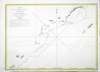
réf. 6294London: 1798. No binding. Very Good. 380 x 495 mm. in good condition. This is a map representing the visit of the French Admiral and explorer le Comte de La Pérouse to Korea in 1786. This is from the first English edition of La Perouse's voyage. A superb large-scale chart showing the track of La Perouse's expedition in the ships Boussole and Astrolabe. The route from Manila Bay to Taiwan Formosa to Korea through the Sea of Japan named by La Perouse to the Kuriles reaching southern Kamchatka on September 16 1787. Jean-Francois de Galoup Comte de La Perouse led a French scientific expedition to the Pacific in 1785-88. He was one of the most noted naval commanders and navigators in France and was selected by King Louis XVI to complete Captain James Cook's exploration of the western Pacific. In a rare moment of co-operation the British Admiralty furnished scientific equipment to measure variations in magnetic north and for determining longitude. Fortunately for us La Perouse was meticulous in sending copies of his detailed logs and surveying via other ships as well as overland. His last contact was in the spring of 1788 with a British ship in Botany Bay Australia. The expedition was never heard from again. When the French Government realised that it had been lost they decided to publish an account as in many other ways it is regarded as one the greatest French voyages of exploration. It was not until 1827 that their fate was known. Howes 1962 L93; Nordenskiold 1979 133; Sabin 1868-1936 38960; Shirley 2004 G.LPR-3a. 1798 unknown
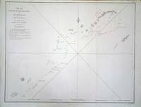
réf. 8124Paris: 1797. No binding. Very Good. 495 x 690 mm. recent outline colour in good condition. This is a map representing the visit of the French Admiral and explorer le Comte de La Pérouse to Korea in 1786. A superb large-scale chart showing the track of La Perouse's expedition in the ships Boussole and Astrolabe. The route to him from Manila Bay to Taiwan Formosa to Korea through the Sea of Japan named by La Perouse to the Kuriles reaching southern Kamchatka on September 16 1787. This is a map representing his visit to Korea in 1786. The tracks of La Perouse are shown. Jean-Francois de Galoup Comte de La Perouse led a French scientific expedition to the Pacific in 1785-88. He was one of the most noted naval commanders and navigators in France and was selected by King Louis XVI to complete Captain James Cook's exploration of the western Pacific. In a rare moment of co-operation the British Admiralty furnished scientific equipment to measure variations in magnetic north and for determining longitude. Fortunately for us La Perouse was meticulous in sending copies of his detailed logs and surveying via other ships as well as overland. His last contact was in the spring of 1788 with a British ship in Botany Bay Australia. The expedition was never heard from again. When the French Government realised that it had been lost they decided to publish an account as in many other ways it is regarded as one the greatest French voyages of exploration. It was not until 1827 that their fate was known. Howes 1962 L93; Nordenskiold Collection 1979 v. 2 no. 133; Phillips 1909- 688; Sabin 1868-1936 38960; Shirley 2004 G.LPR-1a. 1797 unknown
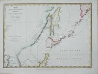
réf. 7585London: 1798. No binding. Very Good. 360 x 490 mm. recent wash colour in good condition. This is a map representing the visit of the French Admiral and explorer le Comte de La Pérouse to Korea and Japan in 1786. This is from the first English edition of La Perouse's voyage. Cortazzi H. pl.62 French ed.; Howes USIana L93; Sabin 38960; Shirley 'Atlases in the BL' G.LPR-2a curiously not listing this chart. 1798 unknown
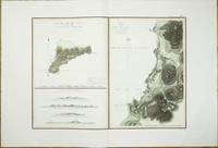
réf. 8107Paris: 1797. No binding. Good. 500 x 680 mm. with recent wash colour in very good condition on lovely quality large margined paper. This map features Easter Island in the Pacific Ocean. From the 'Atlas du Voyage de La Perouse'. The island is best known for the famous stone heads. This map records the visit of the French Admiral and explorer La Pérouse. Jean-Francois de Galoup Comte de La Pérouse 1741-88 led a French scientific expedition to the Pacific in 1785-88. He was one of the most noted naval commanders and navigators in France and was selected by King Louis XVI to complete Captain James Cook's exploration of the western Pacific. In a rare moment of co-operation the British Admiralty furnished scientific equipment to measure variations in magnetic north and for determining longitude. Fortunately for us La Perouse was meticulous in sending copies of his detailed logs and surveying via other ships as well as overland. His last contact was in the spring of 1788 with a British ship in Botany Bay Australia. The expedition was never heard from again. When the French Government realised that it had been lost they decided to publish an account as in many other ways it is regarded as one the greatest French voyages of exploration. It was not until 1827 that their fate was known. They had been shipwrecked on the island of Vanikoro and many of the survivors were killed. Howes 1962 L93; Howgego 2003 L20; Nordenskiold Collection 1979 132 no. 3; Phillips 1909- 688; Sabin 1868-1936 38960; Shirley 2004 G.LPR-1a no. 10; Suarez 2004 p. 169 fig. 164. 1797 unknown
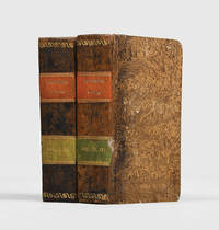
1815réf. 183470Milano: Sonzogno e Compagni Editori 1815. One of the finest narratives of maritime exploration ever written First Italian edition. The most significant results of La Pérouse's voyage are the details of "the peculiarities he observed in the natives of the North West coast of North America which are especially valuable" Sabin. La Pérouse's account was originally published in French in 1797 this edition was published as part of the series Raccolta di Viaggi dopo quelli di Cook. La Pérouse's 1741-c.1788 expedition left France in 1785 to seek an inter-oceanic passage examining the parts of the Pacific not yet explored by Cook conducting scientific observations on the various peoples and regions assessing the extent of Spanish settlement in California and determining the possibilities of French expansion in the Pacific. En route to Kamchatka La Pérouse was the first to navigate safely and chart the Japan Sea and the strait between the island of Sakhalin and the northernmost island of Japan which bears his name. At Kamchatka he received instructions to proceed to Australia to assess the extent of British plans in New South Wales. Travelling via Samoa where he discovered the islands of Savaii Manono and Apolima in December 1787 and through the Tongan group he arrived at Botany Bay in January 1788 just hours after Captain Phillip had arrived with the First Fleet. La Pérouse's habit of forwarding despatches whenever the opportunity offered ensured their survival; the final despatches were sent from Botany Bay after which the expedition was never seen again. Evidence slowly came to light that both ships were wrecked on the reefs around the islands north-west of Australia. Forbes examined three copies at the Alexander Turnbull Library the collection of Rodney Davidson and the University of Washington Seattle; none of these nor the four other copies he cites have the portrait. This copy also does not include the frontispiece portrait. 4 vols bound in 2 small octavo 164 x 99 mm pp. xxviii 236 28 pp. 294; pp. 271 pp. 297 14. With 16 plates coloured folding map. List of subscribers to vols 1 and 4. Text in Italian. Vol. 1 bound without frontispiece portrait not usually found. Contemporary quarter calf flat spines red and green morocco labels lettered and decorated in gilt spine ends rolled in gilt brown pulled paste paper sides edges sprinkled red and brown. Spines toned spots of worming to spines boards and extremities rubbed label residue to front pastedowns sporadic foxing marginal tear to leaf at rear of vol. 1 not affecting contents. A very good copy. Ferguson 609; Forbes 445. hardcover
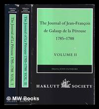
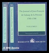
1994réf. 487295London : Hakluyt Society 1994. First Edition. Hardcover. Near fine cloth copies both in very good if slightly edge-nicked and dust-toned dust-wrappers now mylar-sleeved. Remains a well-preserved set overall; tight bright clean and especially sharp-cornered. Series; Works issued by the Hakluyt Society 2nd series no. 179-180. Physical description; complete in 2 volumes ccxl 613 pages : illustrations maps ; 23 cm. Notes; Published 1994-1995. Translated from the French. Subjects; La Pérouse Jean-François de Galaup comte de 1741-1788 travel. Pacific Area discovery and exploration French. Astrolabe frigate. Boussole frigate. Discoveries in geography French. London : Hakluyt Society hardcover
1994réf. 448960London : The Hakluyt Society 1994. First Edition. Hardcover. Fine cloth copies in a fine very slightly edge-dulled dust wrappers. Well-preserved overall. Not price-clipped. Volumes one and two. Series: Works issued by the Hakluyt Society. 2nd series ; 179. Physical description: 2 volumes ccxl 613 pages : illustrations maps ; 23 cm. Notes: Translated from the French. Subjects; Boussole Ship. Astrolabe Ship. Voyages and travels History 18th century. Explorers France Biography. London : The Hakluyt Society hardcover
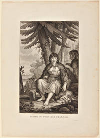
1792réf. 3107Paris. 1792. Print of a plate taken from La Pérouse's atlas of his voyage around the world undertaken in 1785-88. The image shows two Indian girls seated under a tree one facing forward the other in profile both clad in primitive garb with two masted ships and onlookers in the background. Lithograph image 39 x 25 cm. captioned. A couple of small tears and smudges at edges of border image fine. Archival matting and protected with Mylar sheet. unknown
1801réf. 55883Boston: Printed for Joseph Bumstead 1801. First American Edition of an Important Pacific Voyage This copy bears the bookplate on the front pastedown of James Edge Partington 1854-1930 the well-respected British anthropologist who was especially interested in Pacific island ethnology. The rare first American edition of one of the most important Pacific voyages. The La Pérouse account was first published in Paris in French in 1797 and in English in 1798. This is one of the earliest Pacific voyages to appear in an American edition and published much less modestly than the French and British editions would have been the way the average American would have learned about La Pérouse's important surveys of the Pacific coast and his descriptions of native Americans there. This is also the first American version although only a précis of Vancouver's voyage first published in London in 1798. The 1781 voyage of Spanish naval officer Francisco Antonio Mourelle incorrectly spelled in this edition's title went from the Philippines to the South Pacific where he explored in the vicinity of New Guinea and the Tonga Islands before sailing to Mexico. Howes is inaccurate in his pagination of this edition and the Hill copy contains a map that was added later. Contemporary tree calf rebacked in modern calf ruled in gilt gilt leather label. Corners and edges worn boards moderately rubbed. Bookplate on front pastedown see below. Moderate tanning scattered foxing. Good plus. HILL 976. SABIN 38966. HOWES L93. FORBES 331. SHAW & SHOEMAKER 789. FERGUSON 333. KROEPELIEN 1331. hardcover
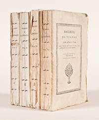
1815réf. 57571Milano: Dalla Tipografia Sonzogno e Comp. 1815. Italian Edition of La Pérouse in Remarkable Original Condition The first Italian edition of La Pérouse's monumental journey here in beautiful original condition and rarely encountered thus. "La Pérouse's expedition was one of the most important scientific explorations ever undertaken to the Pacific and the west coast of North America.The charge to the expedition was to examine such parts of the region as had not been explored by Captain Cook; to seek for an interoceanic passage; to make scientific observations on the various countries peoples and products; to obtain reliable information about the fur trade and the extent of Spanish settlements in California; and to promote the inducements for French enterprise in that quarter.La Pérouse and his men did important geographical research including visits to Easter Island the first on-shore visit to Hawaii by Europeans Macao Formosa the Aleutian Islands Samoa Tonga and Australia.The voyage also included the first foreign scientific group ever to visit Alta California.La Pérouse sent dispatches back to France from Kamchatka and Botany Bay." - Hill. La Pérouse sent back copies of his journals throughout the journey both overland across Russia and via British ships met at Botany Bay in the spring of 1788. After he left Australia his party was never seen again and it was not until the 1820s that the wrecks of his ships were discovered on a reef in the Santa Cruz group. When it became clear that something had happened to the expedition a decision was made to publish the journals he had transmitted home. This first Italian edition printed in Milan in 1815 as the first in a series of post-Cook voyages published by Sonzogno e Compagni precedes the first Italian edition of Cook and is testament to La Pérouse's enduring popularity on the continent. Very rare in any state this copy is untrimmed and complete in original wrappers. Included are the frontispiece portrait of La Pérouse often lacking all sixteen beautiful colored plates the folding map subscriber lists in both the first and fourth volumes and laid-in publisher's circulars in volumes three and four. A beautiful copy of one of the finest narratives of maritime exploration. 12mo. Original pictorial wrappers. Minor soiling to wrappers chip to upper outer corner of front wrapper of first volume slight chipping to extremities of spines. Light foxing to first few pages of first volume. An exceptional set. Untrimmed. In individual cloth chemises and cloth slipcase gilt leather label. FORBES 445. FERGUSON 609. McLAREN 25. HOWES L93. hardcover
réf. 117147234X.Gpaperback. Good. Access codes and supplements are not guaranteed with used items. May be an ex-library book. paperback
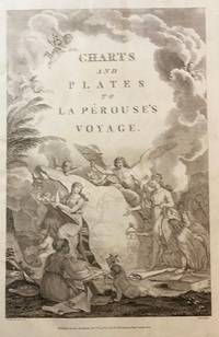
1798réf. 43609London: Published as the Act directs Nov 1st 1798. by G.G.& J. Robinson 1798. Folio. 43x 27cm. 17" x 14.5". Atlas Volume First English Edition foliated engraved frontis portrait and engraved title-page 68 fine engraved plates maps charts and views many double page and include several plate illustrations on botanical and ornithological subjects. The plates are numbered 2 - 69 without the world map as usual plates are all very good to fine in contemporary half crimson morocco and marbled boards binding heavily dust worn similar wear on the edges upper hinge loose internally very good to fine condition. The map of the world is sometimes described as wanting however it would usually be in the two volume and is not call for in the list of plates ~ ~ ~ Hill #'s 972-979. "La Perouse expedition was one of the most important scientific explorations ever undertaken to the Pacific and North West Coast of North America. Hill. "Sabin 38960; Cox I-67. Fine copy of this Important 'Surveying Atlas' to the Pacific and west coast of North America. 1798. The plates are spectacular. - Atlas to the English edition of the report of the famous voyage around the world. Cook Bougainville and La Pérouse contributed decisively to the exploration of the Pacific. On the unexpected publication of this famous voyage at Paris in the previous year 1797 there was considerable competition among English publishers to bring out the English translation. Three different translations were made and published during 1798-99 and different engravers were employed for making the plates. Stockdale's appeared first in June 1798. Robinson's edition of 1799 is the most esteemed edition in English later editions being usually based on it." The atlas bears the date 1798 in the imprint but was published together with two text volumes in 1799. Published, as the Act directs, Nov, 1st, 1798. by G.G.& J. Robinson unknown
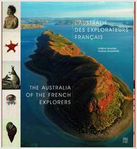
2014réf. 106444n.p.: Somogy Editions d'Art. 2014. 1st ed. square quarto text in French and English pp.192 profusely illus with colour and b&w plates maps photographs original boards in dust-jacket. Near fine condition. Explorations to the Australian coast of French explorers during the 18th and 19th centuries documented here through contemporary photographs expedition drawings and historical commentary. Explorers include Saint-Alouarn La Perouse Bruny d'Entrecasteaux Labillardiere Baudin Henri Freycinet Louis Freycinet Rose Freycinet Hamelin Peron and others. Includes artworks by artists Lesueur and Petit. 1st edition. Boards in d.j. Somogy Editions d'Art hardcover
réf. 1171460058.Gpaperback. Good. Access codes and supplements are not guaranteed with used items. May be an ex-library book. paperback
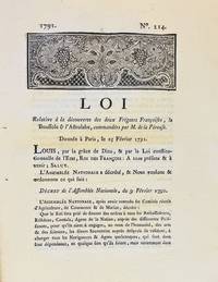
1791réf. 3590A Dijon: De l'Imprimerie de Capel 1791. First edition. Woodcut headpiece. Contemporary manuscript certification at the end signed by two officials of the Département de la Côte-d'Or dated Dijon 23 avril 1791. Unbound as issued. In fine condition. First edition. Woodcut headpiece. Contemporary manuscript certification at the end signed by two officials of the Département de la Côte-d'Or dated Dijon 23 avril 1791. Unbound as issued. 3 1 blank p. The first formal document acknowledging fears of La Pérouse's disappearance in a rare provincial printing issued shortly after the royal decree. Very rare Dijon printing of the first formal decree acknowledging concern over the disappearance of La Pérouse's expedition. This decree issued by the Assemblée Nationale and promulgated in the name of Louis XVI on 25 February 1791 initiated the official search for La Boussole and L'Astrolabe last heard from in 1788 following their departure from Botany Bay. It instructed France's ambassadors consuls and agents abroad to solicit assistance from foreign powers and navigators-especially in the southern Pacific-"de faire toutes recherches des deux frégates Françoises La Boussole & L'Astrolabe. de même que toute perquisition qui pourroit constater leur existence ou naufrage." The decree also called for the arming of one or more vessels carrying scientists naturalists and artists tasked with both locating La Pérouse and conducting a broader exploratory mission "utile & avantageuse à la navigation à la géographie au commerce aux arts & aux sciences." This ultimately led to the voyage of Rear Admiral Bruni d'Entrecasteaux 1791-1794. La Pérouse's expedition 1785-88 commissioned by Louis XVI and modelled in part on the voyages of Cook was the most ambitious French maritime expedition of the Enlightenment. Departing from Brest in August 1785 the two frigates visited South America including Chile Easter Island Alaska California Macao the Philippines and Australia Botany Bay sending reports and scientific observations until their disappearance after March 1788. Their fate remained a mystery until the wreckage was found decades later on Vanikoro Island. The Dijon edition printed by Capel and officially certified by the departmental administration is part of a coordinated provincial dissemination of the decree alongside other issues printed in Pau Orléans Grenoble Valenciennes Auxerre and Évreux. References: cf. Ferguson 106a Auxerre ed.; Kroepelien 710; McLaren 132 Valenciennes ed.; Horner Looking for La Pérouse pp. 4-6. . De l'Imprimerie de Capel unknown
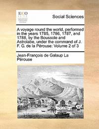
1801réf. 843601801. LA PEROUSE Jean Francois. A Voyage Round the World. Performed in the Years 1785 1786 1787 1788.TO which are added A Voyage from Manilla to California by Don Antonio Maurelle: and an Abstract of the Voyage and Discoveries of the Late Capt. G. Vancouver. Boston: Joseph Bumstead 1801 333pp. Contemporary full leather morocco spine label skillfully rebacked. Some toning throughout else very good. Hill 976. Sabin 38966. Howes L-93. Forbes 331. Shaw & Shoemaker 789. Ferguson 333. Reese Best of the West 20. Kroepelien 1331.The rare first American edition of one of the most important Pacific voyages. The La Perouse account was first published in Paris in French in 1797 and in English in 1798. This is one of the earliest Pacific voyages to appear in an American edition and published much less modestly than the French and British editions would have been the way the average American would have learned about La Perouse's important surveys of the Pacific coast and his descriptions of native Americans there. This is also the first American version although only a precis of Vancouver's voyage first published in London in 1798. The 1781 voyage of Spanish naval officer Francisco Antonio Mourelle incorrectly spelled in this edition's title went from the Philippines to the South Pacific where he explored in the vicinity of New Guinea and the Tonga Islands before sailing to Mexico. Howes is inaccurate in his pagination of this edition and the Hill copy contains a map that was added later. unknown
réf. 0259332135.Gpaperback. Good. Access codes and supplements are not guaranteed with used items. May be an ex-library book. paperback
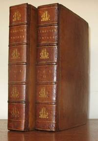
1798réf. 23577London: John Stockdale 1798. First Stockdale edition. Hardcover. Recently expertly rebacked retaining all original materials some toning to text and plates but a very good copy. 2 volumes contemporary full tan calf by H. Faulkner; 20 cxc 290; viii 442 119 pp 51 engraved plates in the 2 volumes including 3 folding maps in first volume. Printed label at upper corner of verso of front free endpaper: "Bound by H. Faulkner George Court Adelphi." The British Book Trade Directory finds a Henry Faulkner Sr. succeded by Henry Faulkner Jr. at a George Court Adelphi from 1790 to 1825. Originally published in French in 1797 this is one of two English-language translations published in 1798. This edition preceded earlier in the year by the Johnson edition which had only 41 plates. "The narrative of the enterprising but ill-fated Pérouse is full of interest in all portions but his relations of the peculiarities he observed in the natives of the northwest coast of North America are especially valuable. The mysterious fate of this distinguished navigator has never been satisfactorily cleared up. The above account was transmitted from Botany Bay after leaving this place the expedition was never heard of again" Sabin. In fact recent investigations into the fate of La Perouse have determined that both ships in the expedition were wrecked on the reefs of Vanikoro in the Solomon Islands. Cox I p. 67; Hill 974 observing that "The preface to the Stockdale edition leads one to suppose that the Johnson edition was published slightly earlier; Sabin 38964. John Stockdale hardcover
1798réf. 117441Paris: chez Plassan An VI - 1798. In-8 p. mm. 216x136 4 volumi brossura muta coeva dorsi con mancanze pp. 4LXVIII368; 4414; 316148; 4328; con una grande carta geografica più e più volte ripieg. i.e. mappemonde ou carte reduite des parties connues du globe. In Appendice al III volume: Tables de la route de "La Boussole" pendant les années 1785-1786-1787-1788 depuis son départ d'Europe jusqu'à Botany-Bay Tables de la route de "L'Astrolabe" pendant les années 1785-1786-1787 depuis son départ d'Europe jusqu'au Kamtschatka. "Manca l'Atlante di tavole".Relazione del viaggio intorno al mondo in cui si tratta anche di astronomia fisica chimica mineralogia zoologia botanica e medicina. "Seconda edizione" la prima è del 1797 di questa importante opera che fu anche tradotta in varie lingue. Cfr. BrunetIII828 - GraesseIV103 - The Hill Collect. of Pacific Voyages972 per la prima edizione di one of the most important scientific explorations ever undertaken to the Pacific and the West coast of North America.Solo qualche lieve fioriture altrimenti esemplare con barbe ben conservato."Jean-François de Galaup Conte di La Pérouse navigatore francese 1741-1788 ebbe da Luigi XVI il comando di un grande viaggio di circumnavigazione allo scopo di esplorare le regioni ancora sconosciute del Pacifico. Partito con due navi su cui erano alcuni scienziati 1785 si portò all'isola di Pasqua alle Hawaii e quindi lungo le coste dell'Alasca. Nel 1787 toccate le Marianne Macao e Manila costeggiò la Manciuria ed esplorò i mari intorno al Giappone settentrionale spingendosi fino alla Camciatca. Mandò dalla Nuova Olanda le sue ultime notizie in patria e salpato dalla Baia del Botanico con le due navi scomparve per sempre 1788. Secondo le tracce scoperte da P. Dillon e da Dumont d'Urville sarebbe naufragato presso l'isola Vanikoro gruppo S. Croce". Così Diz. TreccaniVI p. 691. chez Plassan, unknown
réf. 1385794992.Ghardcover. Good. Access codes and supplements are not guaranteed with used items. May be an ex-library book. hardcover
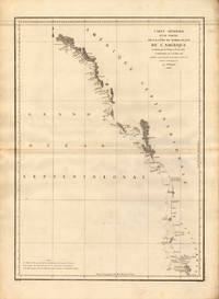
1797réf. 24538Paris 1797. Other. In excellent condition. 690 by 490mm 27 by 19 inches. 690 by 490mm 27 by 19 inches. Copper Engraving uncolored by La Perouse Jean-Francois de Galup published 1797 by Paris. Image size: 690 by 490mm 27 by 19 inches. By Lapérouse among the rarest and most historically important charts of the Northwest Coast ever produced. Jean-François de Galaup Comte de Lapérouse 17411788 was the foremost French navigator and explorer of the late 18th century. Commissioned by Louis XVI to lead a major scientific and commercial expedition to the Pacific he departed Brest in 1785 with two frigates the Boussole and the Astrolabe and spent three years charting the Pacific and North American coasts with extraordinary precision. His charts of the Northwest Coast of North America 1786 were the first scientific surveys of many sections of that coastline and were published posthumously in the celebrated four-volume Voyage de Lapérouse autour du monde 1797. The expedition disappeared without trace near Vanikoro in 1788. Lapérouse's charts are among the most historically important and rarest maps of the Pacific and Northwest Coast ever produced.This antique map of Carte Générale D `une Partie de la Cote du Nord-Quest. De L´ was published in 1797 by Paris 690 by 490mm 27 by 19 inches. It is printed as a copper engraving uncolored. The map documents the region with careful attention to rivers settlements roads and political boundaries reflecting the geographical knowledge available at the time of publication and offering an invaluable primary source for historians and collectors of North American antique cartography. In excellent condition. unknown
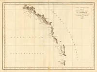
1786réf. 24536Paris 1786. Other. In excellent condition. 495 by 685mm 19 by 27 inches. 495 by 685mm 19 by 27 inches. Copper Engraving uncolored by La Perouse Jean-Francois de Galup published 1786 by Paris. Image size: 495 by 685mm 19 by 27 inches. By Lapérouse among the rarest and most historically important charts of the Northwest Coast ever produced. Jean-François de Galaup Comte de Lapérouse 17411788 was the foremost French navigator and explorer of the late 18th century. Commissioned by Louis XVI to lead a major scientific and commercial expedition to the Pacific he departed Brest in 1785 with two frigates the Boussole and the Astrolabe and spent three years charting the Pacific and North American coasts with extraordinary precision. His charts of the Northwest Coast of North America 1786 were the first scientific surveys of many sections of that coastline and were published posthumously in the celebrated four-volume Voyage de Lapérouse autour du monde 1797. The expedition disappeared without trace near Vanikoro in 1788. Lapérouse's charts are among the most historically important and rarest maps of the Pacific and Northwest Coast ever produced.This antique map of Carte Particuliere de la Còte du Nord-Quest de L Amerique r was published in 1786 by Paris 495 by 685mm 19 by 27 inches. It is printed as a copper engraving uncolored. The map documents the region with careful attention to rivers settlements roads and political boundaries reflecting the geographical knowledge available at the time of publication and offering an invaluable primary source for historians and collectors of North American antique cartography. In excellent condition. 495 by 685mm 19 by 27 inches. unknown
réf. 138579917X.Ghardcover. Good. Access codes and supplements are not guaranteed with used items. May be an ex-library book. hardcover