LA PEROUSE, Jean Francois Comte deBiblio.com
177 résultats
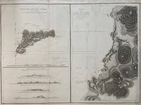
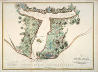
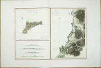
réf. 8107Paris: 1797. No binding. Good. 500 x 680 mm. with recent wash colour in very good condition on lovely quality large margined paper. This map features Easter Island in the Pacific Ocean. From the 'Atlas du Voyage de La Perouse'. The island is best known for the famous stone heads. This map records the visit of the French Admiral and explorer La Pérouse. Jean-Francois de Galoup Comte de La Pérouse 1741-88 led a French scientific expedition to the Pacific in 1785-88. He was one of the most noted naval commanders and navigators in France and was selected by King Louis XVI to complete Captain James Cook's exploration of the western Pacific. In a rare moment of co-operation the British Admiralty furnished scientific equipment to measure variations in magnetic north and for determining longitude. Fortunately for us La Perouse was meticulous in sending copies of his detailed logs and surveying via other ships as well as overland. His last contact was in the spring of 1788 with a British ship in Botany Bay Australia. The expedition was never heard from again. When the French Government realised that it had been lost they decided to publish an account as in many other ways it is regarded as one the greatest French voyages of exploration. It was not until 1827 that their fate was known. They had been shipwrecked on the island of Vanikoro and many of the survivors were killed. Howes 1962 L93; Howgego 2003 L20; Nordenskiold Collection 1979 132 no. 3; Phillips 1909- 688; Sabin 1868-1936 38960; Shirley 2004 G.LPR-1a no. 10; Suarez 2004 p. 169 fig. 164. 1797 unknown
1797réf. 299774Paris: L'Imprimerie de la Republique 1797. Map. Engraving with hand coloring. Sheet measures 21 1/4" x 28" This chart depicts Easter Island with a close-up of Cook's Bay. Relief is depicted by hachure and elevation is shown from several vantage points. Points and peaks of the elevation views correspond to labels on the map. The Bay shows depths and various structures are labeled. The map appeared as Plate 10 in "Atlas du Voyage de La Perouse." It is in very good condition. Stain to upper margin minor foxing marks. Jean Francois de Galaup 1741-c.1788 was a French Navy officer and explorer known for his travels in Oceania. In 1787 he explored the northeast and mainland Asian coasts in the area of Korea. Other voyages included Alaska Japan Australia and the South Pacific. This map demonstrates some of the many observations and findings made on his journeys. L'Imprimerie de la Republique unknown
1797réf. 016788Paris: La Perouse 1797. Map. Very good condition. Unbound. First Edition. Folio. A large map beautifully decorated with original outline color. The map is included in the Atlas volume of La Perouse's Voyages but was drawn from Spanish manuscripts as it was thought that it might be a part of the Northwest Passage. The map has an extra vertical crease from mis-folding but is quite clean and has large margins which are lightly soiled here and there. La Perouse Paperback
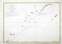
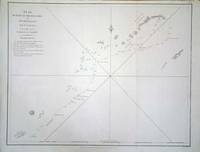
réf. 8124Paris: 1797. No binding. Very Good. 495 x 690 mm. recent outline colour in good condition. This is a map representing the visit of the French Admiral and explorer le Comte de La Pérouse to Korea in 1786. A superb large-scale chart showing the track of La Perouse's expedition in the ships Boussole and Astrolabe. The route to him from Manila Bay to Taiwan Formosa to Korea through the Sea of Japan named by La Perouse to the Kuriles reaching southern Kamchatka on September 16 1787. This is a map representing his visit to Korea in 1786. The tracks of La Perouse are shown. Jean-Francois de Galoup Comte de La Perouse led a French scientific expedition to the Pacific in 1785-88. He was one of the most noted naval commanders and navigators in France and was selected by King Louis XVI to complete Captain James Cook's exploration of the western Pacific. In a rare moment of co-operation the British Admiralty furnished scientific equipment to measure variations in magnetic north and for determining longitude. Fortunately for us La Perouse was meticulous in sending copies of his detailed logs and surveying via other ships as well as overland. His last contact was in the spring of 1788 with a British ship in Botany Bay Australia. The expedition was never heard from again. When the French Government realised that it had been lost they decided to publish an account as in many other ways it is regarded as one the greatest French voyages of exploration. It was not until 1827 that their fate was known. Howes 1962 L93; Nordenskiold Collection 1979 v. 2 no. 133; Phillips 1909- 688; Sabin 1868-1936 38960; Shirley 2004 G.LPR-1a. 1797 unknown
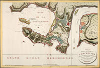
1797réf. 56362Paris: 1797. Fine sea chart of the bay and Bio Bio River region with great topographical and hydrological detail. Villages and Fort St. Pierre are depicted. From the Voyages of La Pérouse who set sail from France in 1785 to continue the discoveries of Captain Cook. He was shipwrecked in 1788 but his narrative maps and views survived and were published in 1797. Thirty-eight years later the scattered remains of La Boussole and L'Astrolabe was discovered wrecked on a vicious reef on an atoll in the New Hebrides. Copper engraving. Very good condition; slight browning to the centrefold. Hand coloured. Size: 57 x 42 cm. unknown
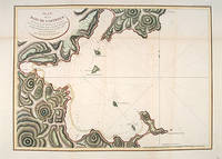
1797réf. 55877Atlas Du Voyage De La Pérouse. Paris: L'Imprimerie de la Republique. 1797. From the Voyages of La Pérouse who set sail from France in 1785 to continue the discoveries of Captain Cook. He was shipwrecked in 1788 but his narrative maps and views survived and were published in 1797. An attractive sea chart showing a bay at the coast of Eastern Tartary. Relief shown by hachures; depths by soundings. This is how this part of La Pérouse's journey was described in a diary: 'On 11 August they reached the southwestern point of Sakhalin Island which La Pérouse named Cap Crillon Mys Kril'on. The ships anchored near Mys Kril'on and Vaujuas went ashore where he met more Ainu people some of whom also visited the ship. The ships began to sail through the strait the next day. La Pérouse called it Canal de Castries but it would later be called La Perouse Strait.' Copper engraving. Very good condition. Faint vertical waterstains. Some very slight browning to lower margin. Good margins. Hand coloured. Size: 68 x 49 cm. 27 x 19½ inches unknown
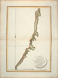
1797réf. 55866Paris: L'Imprimerie de la Republique.Atlas Du Voyage De La Pérouse. 1797. From the Voyages of La Pérouse who set sail from France in 1785 to continue the discoveries of Captain Cook. He was shipwrecked in 1788 but his narrative maps and views survived and were published in 1797. Tomari Region Russia ; Sakhalin Russia Full Title: Plan de la Baie de Langle. Situee a la partie ouest de l'Ile de Tchoka par 47048'36" de latitude nord et 139057'54" de longitude orientale. L. Aubert scripsit. Atlas du Voyage de la Perouse no. 49. Paris: L'Imprimerie de la Republique An V 1797. Engraved by AUBERTL. Size: 255 x 400 mm. Copper engraving. Hand coloured. Very good condition. unknown
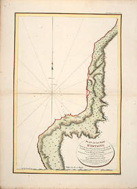
1797réf. 55865Atlas Du Voyage De La Pérouse. 1797. From the Voyages of La Pérouse who set sail from France in 1785 to continue the discoveries of Captain Cook. He was shipwrecked in 1788 but his narrative maps and views survived and were published in 1797. Uglegorsk Region Russia Full Title: Plan de la Baie d'Estaing. Situee a la cote de l'ouest de Tchoka par 48059'38" de latitude nord et par 14000'42" de longitude orientale prise du mouillage de l'Astrolabe. Cette Baie fut decouverte le 20 juillet 1787 par les Fregates Francaises la Boussole et l'Astrolabe commandees par MM. de La Perouse et de Langle. L. Aubert scripsit. Atlas du Voyage de la Perouse no. 51. Paris: L'Imprimerie de la Republique An V 1797. Engraved by AUBERTL. Size: 255 x 400 mm. Copper engraving. Uncoloured. Very good condition. unknown
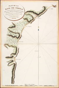
1797réf. 56364Atlas Du Voyage De La Pérouse. Paris: L'Imprimerie de la Republique. 1797. A crisp clear map of the Bay of Ternai in Tartary. Relief shown by hachures; depths by soundings. From the Voyages of La Pérouse who set sail from France in 1785 to continue the discoveries of Captain Cook. He was shipwrecked in 1788 but his narrative maps and views survived and were published in 1797. Thirty-eight years later the scattered remains of La Boussole and L'Astrolabe was discovered wrecked on a vicious reef on an atoll in the New Hebrides. Copper engraving. Fine condition; slight browning and foxing to wide margins not affecting the image. Hand coloured. Size: 42.5 x 56.5 cm. 16½ x 22 inches unknown
1788réf. M4779Paris 1788. Very Good. Size : 685x495 mm 27x19.5 Inches Coloring: Hand Colored Category: Maps Russia; Maps Asia Far East Japan & Korea; unknown
1797réf. 55881Paris: 1797. From the Voyages of La Pérouse who set sail from France in 1785 to continue the discoveries of Captain Cook. He was shipwrecked in 1788 but his narrative maps and views survived and were published in 1797. Thirty-eight years later the scattered remains of La Boussole and L'Astrolabe was discovered wrecked on a vicious reef on an atoll in the New Hebrides. Attractive sea chart showing the entrance to Port des Français. Engraved by BOUCLET. Atlas Du Voyage De La Pérouse. Size: 680 x 495 mm. Copper engraving. Hand coloured. Fine condition. Good margins. unknown
réf. 6294London: 1798. No binding. Very Good. 380 x 495 mm. in good condition. This is a map representing the visit of the French Admiral and explorer le Comte de La Pérouse to Korea in 1786. This is from the first English edition of La Perouse's voyage. A superb large-scale chart showing the track of La Perouse's expedition in the ships Boussole and Astrolabe. The route from Manila Bay to Taiwan Formosa to Korea through the Sea of Japan named by La Perouse to the Kuriles reaching southern Kamchatka on September 16 1787. Jean-Francois de Galoup Comte de La Perouse led a French scientific expedition to the Pacific in 1785-88. He was one of the most noted naval commanders and navigators in France and was selected by King Louis XVI to complete Captain James Cook's exploration of the western Pacific. In a rare moment of co-operation the British Admiralty furnished scientific equipment to measure variations in magnetic north and for determining longitude. Fortunately for us La Perouse was meticulous in sending copies of his detailed logs and surveying via other ships as well as overland. His last contact was in the spring of 1788 with a British ship in Botany Bay Australia. The expedition was never heard from again. When the French Government realised that it had been lost they decided to publish an account as in many other ways it is regarded as one the greatest French voyages of exploration. It was not until 1827 that their fate was known. Howes 1962 L93; Nordenskiold 1979 133; Sabin 1868-1936 38960; Shirley 2004 G.LPR-3a. 1798 unknown
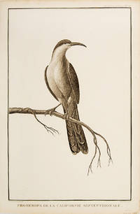
1797réf. 55673Paris. 1797. Print of a Californian Cape bird. From the Voyages of La Pérouse who set sail from France in 1785 to continue the discoveries of Captain Cook. He was shipwrecked in 1788 but his narrative maps and views survived and were published in 1797. Atlas Du Voyage De La Pérouse Size: 255 x 400 mm. Copper engraving. Uncoloured. Very good condition. Slight browing around edges but not effecting image. unknown
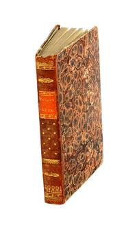
1799réf. 53594Leipsick No publisher 1799. Contemp. hcalf. Spine gilt and with gilt lettering. XXXVI562 pp. 5 engraved plates and 1 large folded engraved world map: "Mappemonde ou Carte réduite des Parties connues du Globe pour servir au Voyage de la Pérouse." 52 x 425 cm. A few margins of text at beginning and at end stained. The portrait lacks. Sabin 38959. unknown
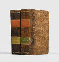
1799réf. 3812959Stockholm: Johan Pfeiffer 1799. A few light spots but a very good copy. Small octavo; in attractive original Scandinavian half calf binding. Rare Swedish edition of the voyage of La Pérouse whose fame was so widespread that there was a ready market for accounts of his voyage across Europe and beyond. Within four years of the publication of the official French edition in 1797 translations appeared in London Edinburgh Paris Stockholm Leipzig Berlin Copenhagen Haarlem St. Petersburg Boston and Amsterdam. This Swedish version was prepared by Samuel Ödmann from the octavo French edition. He also provides a preface. Not in the catalogue of the Hill collection; Ferguson knew the book only from copies in the Mitchell Library and the Kroepelien Collection Oslo. . Johan Pfeiffer unknown
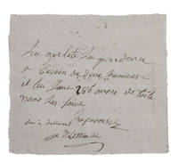
1781réf. H1RDFKW35E6FAt sea 1781. Short manuscript note in ink on a small sheet of laid paper 12 x 13.5 cm. An exceptionally rare autograph note signed by the great French explorer La Pérouse. The extraordinary story and achievements of La Pérouse are well known and recounted in the handsome official account of his expedition. However because he was lost without trace mid-voyage manuscript material relating to his life is very rare indeed. In the present note La Pérouse asks that his boat be given an impressive 286 "aunes" of canvas which is needed on board. An "aune" is an old-fashioned French measure usually translated as ell or cubit: its length could vary but the normal French/Parisian aune was about 118 cm meaning that La Pérouse is in fact asking for about 340 metres of canvas. The sheer quantity of the request speaks to La Pérouse having written the note while in charge of a large vessel.The document is counter-signed and noted as "delivered" by one "Deletombe": it seems very likely that this is Philippe-André-Joseph de Létombe who arrived in the United States in 1781 and was the French Consul in Boston and a correspondent of Thomas Jefferson. If this identification is correct the note would possibly date from La Pérouse's cruising in the West Indies and along the coast to Hudson Bay in 1781 and 1782.With old folds clearly and legibly written and docketed; in very good condition. unknown
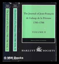
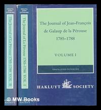
1994réf. 487295London : Hakluyt Society 1994. First Edition. Hardcover. Near fine cloth copies both in very good if slightly edge-nicked and dust-toned dust-wrappers now mylar-sleeved. Remains a well-preserved set overall; tight bright clean and especially sharp-cornered. Series; Works issued by the Hakluyt Society 2nd series no. 179-180. Physical description; complete in 2 volumes ccxl 613 pages : illustrations maps ; 23 cm. Notes; Published 1994-1995. Translated from the French. Subjects; La Pérouse Jean-François de Galaup comte de 1741-1788 travel. Pacific Area discovery and exploration French. Astrolabe frigate. Boussole frigate. Discoveries in geography French. London : Hakluyt Society hardcover
1994réf. 448960London : The Hakluyt Society 1994. First Edition. Hardcover. Fine cloth copies in a fine very slightly edge-dulled dust wrappers. Well-preserved overall. Not price-clipped. Volumes one and two. Series: Works issued by the Hakluyt Society. 2nd series ; 179. Physical description: 2 volumes ccxl 613 pages : illustrations maps ; 23 cm. Notes: Translated from the French. Subjects; Boussole Ship. Astrolabe Ship. Voyages and travels History 18th century. Explorers France Biography. London : The Hakluyt Society hardcover
1797réf. 55668Atlas Du Voyage De La Pérouse. 1797. From the Voyages of La Pérouse who set sail from France in 1785 to continue the discoveries of Captain Cook. He was shipwrecked in 1788 but his narrative maps and views survived and were published in 1797. Size: 400 x 255 mm. Copper engraving. Uncoloured. Very good condition. slight browing around edges not affecting image. unknown
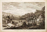
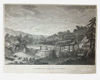
1798réf. 003681G. G & J. Robinson. LA PAROUSE John Francis Galaup; DUCHÉ DE VANCY Jean Baptiste; HEATH James: Tombs of Baie de Castries. An engraving from Charts and Plates to La Pérouse's Voyage London: G. G. & J. Robinson 1798. Copper engraving 310 × 230 mm plate on laid paper with good margins; plate mark visible; light overall toning and a few faint spots with a shallow horizontal fold as issued otherwise in very good condition. A view of the tombs at Baie de Castries showing a small settlement with two figures in the foreground and the distinctive raised wooden burial structures. Bais de Castries described in contemporary sources as lying on the eastern coast of Tartary corresponds to the North Pacific explored by La Perouse in 1787 in the region now identified with the northwest coast of America southeast Alaska. The drawing was made by Jean-Baptiste Louis Claude Théodore duc de Vancy one of the official artists attached to the expedition of Jean-François de Galaup comte de La Pérouse whose role was to record landscapes sites and customs encountered during the voyage. La Perouse and his crew wouldn't make it back to Paris with it latterly being discovered that his ship was wrecked at Vanikoro now the Solomon Islands. The plate was engraved in London by James Heath among the leading line engravers of the late eighteenth century and published by G. G. & J. Robinson for the atlas volume Charts and Plates to La Pérouse's Voyage Round the World issued in 1798 as part of the English edition of the expedition's results. . Very Good. Soft cover. 1st Edition. 1st Printing. 1798. G. G & J. Robinson paperback
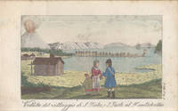
1815réf. 183470Milano: Sonzogno e Compagni Editori 1815. One of the finest narratives of maritime exploration ever written First Italian edition. The most significant results of La Pérouse's voyage are the details of "the peculiarities he observed in the natives of the North West coast of North America which are especially valuable" Sabin. La Pérouse's account was originally published in French in 1797 this edition was published as part of the series Raccolta di Viaggi dopo quelli di Cook. La Pérouse's 1741-c.1788 expedition left France in 1785 to seek an inter-oceanic passage examining the parts of the Pacific not yet explored by Cook conducting scientific observations on the various peoples and regions assessing the extent of Spanish settlement in California and determining the possibilities of French expansion in the Pacific. En route to Kamchatka La Pérouse was the first to navigate safely and chart the Japan Sea and the strait between the island of Sakhalin and the northernmost island of Japan which bears his name. At Kamchatka he received instructions to proceed to Australia to assess the extent of British plans in New South Wales. Travelling via Samoa where he discovered the islands of Savaii Manono and Apolima in December 1787 and through the Tongan group he arrived at Botany Bay in January 1788 just hours after Captain Phillip had arrived with the First Fleet. La Pérouse's habit of forwarding despatches whenever the opportunity offered ensured their survival; the final despatches were sent from Botany Bay after which the expedition was never seen again. Evidence slowly came to light that both ships were wrecked on the reefs around the islands north-west of Australia. Forbes examined three copies at the Alexander Turnbull Library the collection of Rodney Davidson and the University of Washington Seattle; none of these nor the four other copies he cites have the portrait. This copy also does not include the frontispiece portrait. 4 vols bound in 2 small octavo 164 x 99 mm pp. xxviii 236 28 pp. 294; pp. 271 pp. 297 14. With 16 plates coloured folding map. List of subscribers to vols 1 and 4. Text in Italian. Vol. 1 bound without frontispiece portrait not usually found. Contemporary quarter calf flat spines red and green morocco labels lettered and decorated in gilt spine ends rolled in gilt brown pulled paste paper sides edges sprinkled red and brown. Spines toned spots of worming to spines boards and extremities rubbed label residue to front pastedowns sporadic foxing marginal tear to leaf at rear of vol. 1 not affecting contents. A very good copy. Ferguson 609; Forbes 445. hardcover
1827réf. 4011312Livorno: Tipografia Vignozzi 1827. Three leaves a little short at the margins printer's error a little foxing but very good. Three volumes duodecimo three frontispieces and three plates all with good contemporary handcolouring; contemporary quarter roan binding lettered in gilt marbled boards with vellum tips. Attractive early Italian edition of La Pérouse's voyage containing six charming coloured plates three of which are not recorded in the standard bibliographies. The first of these unrecorded plates is a costume study captioned "Uomo e Donna volgari della Concezione"; the second a view of Macao and the third depicts the death of botanist and savant Robert de Lamanon amidst a melée in Samoa during 1787. Neither Ferguson Forbes nor McLaren note the three plates additional to the frontispieces. Forbes did not in fact manage to inspect a copy of the book. Ferguson cites his own copy while McLaren consulted the Nan Kivell copy held by the National Library. This edition was part of a larger collection of voyages published in uniform duodecimo format with the series title Biblioteca Istruttiva e Piacevole ovvero raccolta dei più interessanti viaggi. Forbes confirms that each of the voyages was available separately. The spines in this set number the volumes within the series. . Tipografia Vignozzi unknown
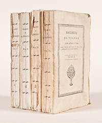
1815réf. 57571Milano: Dalla Tipografia Sonzogno e Comp. 1815. Italian Edition of La Pérouse in Remarkable Original Condition The first Italian edition of La Pérouse's monumental journey here in beautiful original condition and rarely encountered thus. "La Pérouse's expedition was one of the most important scientific explorations ever undertaken to the Pacific and the west coast of North America.The charge to the expedition was to examine such parts of the region as had not been explored by Captain Cook; to seek for an interoceanic passage; to make scientific observations on the various countries peoples and products; to obtain reliable information about the fur trade and the extent of Spanish settlements in California; and to promote the inducements for French enterprise in that quarter.La Pérouse and his men did important geographical research including visits to Easter Island the first on-shore visit to Hawaii by Europeans Macao Formosa the Aleutian Islands Samoa Tonga and Australia.The voyage also included the first foreign scientific group ever to visit Alta California.La Pérouse sent dispatches back to France from Kamchatka and Botany Bay." - Hill. La Pérouse sent back copies of his journals throughout the journey both overland across Russia and via British ships met at Botany Bay in the spring of 1788. After he left Australia his party was never seen again and it was not until the 1820s that the wrecks of his ships were discovered on a reef in the Santa Cruz group. When it became clear that something had happened to the expedition a decision was made to publish the journals he had transmitted home. This first Italian edition printed in Milan in 1815 as the first in a series of post-Cook voyages published by Sonzogno e Compagni precedes the first Italian edition of Cook and is testament to La Pérouse's enduring popularity on the continent. Very rare in any state this copy is untrimmed and complete in original wrappers. Included are the frontispiece portrait of La Pérouse often lacking all sixteen beautiful colored plates the folding map subscriber lists in both the first and fourth volumes and laid-in publisher's circulars in volumes three and four. A beautiful copy of one of the finest narratives of maritime exploration. 12mo. Original pictorial wrappers. Minor soiling to wrappers chip to upper outer corner of front wrapper of first volume slight chipping to extremities of spines. Light foxing to first few pages of first volume. An exceptional set. Untrimmed. In individual cloth chemises and cloth slipcase gilt leather label. FORBES 445. FERGUSON 609. McLAREN 25. HOWES L93. hardcover
1797réf. 181908Paris: L'Imprimerie de la Republique 1797. One of the great documents of French exploration" in the original boards First edition an attractive set with strong impressions of the plates. La Pérouse's work is a "magnificent production and some authorities consider the engraving and craftsmanship to be superior even to that in the Cook-Webber atlas It is one of the finest narratives of maritime exploration ever written and certainly deserves to hold a place of high honour among the great travel accounts of the 18th century" Howell. La Pérouse's 1741-c.1788 expedition left France in 1785 to seek an inter-oceanic passage examining the parts of the Pacific not yet explored by Cook conducting scientific observations on the various peoples and regions assessing the extent of Spanish settlement in California and determining the possibilities of French expansion in the Pacific. En route to Kamchatka La Pérouse was the first to navigate safely and chart the Japan Sea and the strait between the island of Sakhalin and the northernmost island of Japan which bears his name. At Kamchatka he received instructions to proceed to Australia arriving at Botany Bay in January 1788 just hours after Captain Phillip had arrived with the First Fleet. After leaving later the same year the expedition was never seen again. Evidence slowly came to light that both ships were wrecked on the reefs around the islands north-west of Australia. This account is based on dispatches sent from Australia and Kamchatka before this. The atlas volume contains maps of Russian Asia Japan San Francisco Monterey and the Sandwich Islands. The most significant results of La Pérouse's voyage are the charts of the Asiatic side of the Pacific and the details of "the peculiarities he observed in the Native Americans of the northwest coast of North America are especially valuable" Sabin. It also features the first representation of the crested quail. The engraved portrait of La Pérouse counted as the 70th plate is here bound as the frontispiece in Volume I as often. The atlas was published in two forms: on regular usually trimmed and large or thick paper. Forbes and Lada-Mocarski give the measurements for the large paper issue variously at 620 x 455 and 563 x 420 mm. Provenance: Amandine Doré 1911-2012 the French painter illustrator and writer her pencilled signature on the front free endpaper of Volume I dated 1955 her signature and initialled booklabel on the front endpapers of the atlas. Doré produced works for travel narratives such as Mexique pay a trois etages 1955. 5 vols comprising 4 quarto text vols 307 x 256 mm and folio atlas 585 x 440 mm. Engraved portrait of La Perouse after Tardieu. Atlas: engraved allegorical title page by Moreau le Jeune 69 engraved plates and maps some double-page or folding many with original tissue guards loosely inserted. Original pulled paste paper boards flat paper covered spines tinted pink twin dark green spine labels original sheep corners housed together in light brown slipcase; atlas original pulled paste paper boards flat vellum spine covered with white paper dark green morocco spine label recent sheep corners. Text with occasional marginal pencillings or notes. Text vols: bookplate removed from front pastedown of vol. I rubbed a few superficial chips to spines and early recolouring vol. I starting before title; atlas: spine and sides extensively rubbed superficial split to foot of front joint marginal tear to Plate 28 and two others. A very good copy. Anker 276; Ferguson 251 dated 1798; Forbes 272; Hill 972; Lada-Mocarski 52; Sabin 38960; Streeter VI: 3493. Richard Reed in Howell Anniversary Catalogue 72 1982. hardcover
1797réf. 18688Paris: Imprimerie de la République 1797. Contemporary uniform gold-tooled marbled calf richly gold-tooled spines with a red title-label and a small green volume number label both lettered in gold gold-tooled board edges marbled endpapers. 4to 30 x ca. 23 cm. and large folio ca. 57 x 40 cm. Ad 1: with an engraved portrait of De la Pérouse by Tardieu and tables in the text. The atlas contains an engraved title page 1 large double-page folding map of De la Pérouse's journey 20 double-page maps and 48 full-page maps views and illustrations. Ad 2: with tables in the text. The atlas contains an engraved title page 1 double-page map and 43 full-page plates. Ad 3: with 33 folding engraved plates and with tables in the text. The atlas contains an engraved title page an engraved table of contents 37 large double-page folding maps 2 large double-page folding views and 10 full-page maps and illustrations. The three atlases for ads 1-3 are bound together in a large folio matching contemporary gold-tooled marbled calf binding. 9 volumes: ad 1 in 4 volumes; ad 2 in 2 volumes; ad 3 in 2 volumes with the atlases of the 3 works bound together in 1 volume. With:2 LABILLARDIÉRE Jacques Julien Houton de. Voyage à la recherche de Lapérouse.Paris H.J. Jansen An VIII = 1799-1800.3 ENTRECASTEAUX Antoine Raymond Joseph de Bruni chevalier d'. Voyage envoyé à la recherche de Lapérouse.Paris Imprimerie Impériale 1808. Three first editions of descriptions of the rarest and most interesting 18th-century expeditions bound as a set in beautiful contemporary uniform bindings. A milestone set in the history of exploration of the Pacific.Ad 1: Record of an important French scientific expedition in which participated a number of scientists and artists. De la Pérouse left France in 1785 with two frigates the Astrolabe and Boussole to explore the Pacific and the west coast of North America. He was sent there to explore the regions not explored by Captain Cook. Furthermore he was to seek for an interoceanic passage to scientifically observe the various countries peoples and products and to obtain reliable information about the fur trade and the extent of the Spanish settlements in California. This way De la Pérouse made a valuable contribution to the history of geographical discovery particularly concerning the American coast and its natives. The account describes expeditions to Easter Island Hawaii Macao Formosa the Aleutian Islands Samoa Tonga and Australia. The best results were obtained in exploring and mapping the unknown territories on the Asiatic side of the Pacific. This includes the discovery of the strait - still bearing De la Pérouse's name - between the island of Sakhalin and the northernmost island of Japan. De la Pérouse sent his accounts to France from Kamchatka and Botany Bay. But after the expedition left Botany Bay it was never heard from again. Two expeditions were sent out to look for him: the first was led by Dillon in 1827 the second by Dumont d'Urville in 1828. Only 39 years later the remnants of De la Pérouse's two frigates were discovered on the reef of Vanikoro one of the Santa Cruz Islands by Peter Dillon. The maps included in the present travel account is a large general map of the journey detailed maps of different isles several views and beautiful illustrations of plants birds ships people etc.Ad 2: Account of the naturalist De Labillardiére who accompanied one of the futile searches for De la Pérouse. The present expedition was sent out under d'Entrecasteaux and Huon de Kermadec in 1791-1794. Although the expedition was not successful it is of considerable importance because of the scientific observations and surveys of the coasts of Tasmania New Caledonia the north coast of New Guinea and the southwest coast of Australia it produced. De Labillardière's account of the Tongans is among the best contributions to their ethnology. The illustrations include views a portrait of a native illustrations of jewellery and 14 engraved botanical plates after Redouté.Ad 3: Scientific account of a search for De la Pérouse the same expedition as described in the work mentioned above ad 2. The expedition did not succeed but d'Entrecasteaux made important geographical discoveries and his account is extraordinarily rich in cartographical and astronomical material. The Recherche and the Espérance were under his command second captain was Huon de Kermadec after whom the islands north of New Zealand were named. The d'Entrecasteaux Islands near New Guinea were discovered and named for the admiral who later died of colic near the north coast of New Guinea. The beautiful large maps in the atlas depict wonderfully detailed illustrations of isles and coasts along the South Sea. The French Revolution divided the expedition: the royalists joined the Dutch on Java and the Republicans fell into the hands of the British Royal Navy. Also captured were the expedition's journal charts and natural history specimens. Sir Joseph Banks ordered that they be delivered to the coast of France under a flag of truce. With two small book plates on the front endpapers of Clemens Platen-Hallermund and IvR in every volume. Occasionally very slightly foxed in the margins and with a few minor tears in the bottom margin of some leaves otherwise in very good condition. Beautiful copies of an extremely rare and complete set of De la Pérouse's expedition and two descriptions of one of the two expeditions in search of De la Pérouse.l Ad 1: Chadenat 106; Cox I 67; Hill p. 173; Lada-Mocarski 52; Nissen ZBI 281; Sabin 38960; ad 2: Chadenat 99; Cox I 68; Nissen ZBI 2331; Sabin 38420; cf. Hill p. 168 English ed.; ad 3: Chadenat 5056; Hill p. 97 only 32 plates in text vols.; Poggendorf I 671; Sabin 22671. Imprimerie de la République, unknown