162 risultati
1987rif. BN257250Stuttgart ; Wien : Ed. Erdmann 1987. 1987. Zu den Klippen von Vanikoro : Weltreise im Auftr. Ludwigs XVI. 1785 - 1788. Jean-François de Lapérouse. Nach Lapérouses Tagebüchern aufgezeichn. von M. L.-A. Milet-Mureau. Übers. bearb. u. hrsg. von Klaus Fischer Alte abenteuerliche Reiseberichte Zu den Klippen von Vanikoro : Weltreise im Auftr. Ludwigs XVI. 1785 - 1788. Jean-François de Lapérouse. Nach Lapérouses Tagebüchern aufgezeichn. von M. L.-A. Milet-Mureau. Übers. bearb. u. hrsg. von Klaus Fischer Alte abenteuerliche Reiseberichte La Pérouse Jean-François de Galaup und Klaus Fischer Stuttgart ; Wien : Ed. Erdmann unknown
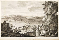
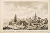
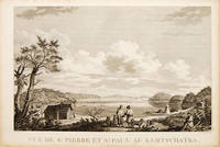
1797rif. 55670Atlas Du Voyage De La Pérouse. 1797. View of St Pierre and St Paul in Kamtschatka. From the Voyages of La Pérouse who set sail from France in 1785 to continue the discoveries of Captain Cook. He was shipwrecked in 1788 but his narrative maps and views survived and were published in 1797. Size: 400 x 255 mm. Copper engraving. Uncoloured. Very good condition. slight browing around edges but not effecting image. unknown
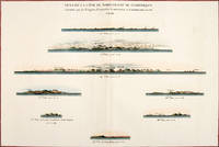
1797rif. 56369Paris: 1797. Eight profiles showing Mt. la Touche Baie de la Touche present Englefield Bay C. Hector present Cape St. James I. Kerouard Iles Sartine Scott Islands and Cap Blanc. The map is from the Voyages of La Pérouse who set sail from France in 1785 to continue the discoveries of Captain Cook. He was shipwrecked in 1788 but his narrative maps and views survived and were published in 1797. Thirty-eight years later the scattered remains of La Boussole and L'Astrolabe was discovered wrecked on a vicious reef on an atoll in the New Hebrides. Atlas Du Voyage De La Pérouse. Paris: Copper engraving. Very good condition; slight browning along the centrefold and foxing to wide margins a tear to the bottom margin along the centrefold not affecting the image. Hand coloured. Size: 58.5 x 43 cm. unknown
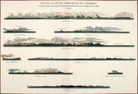
1797rif. 56368Paris: 1797. Nine profiles showing Mt. Beautems Mt. Crillon Mt.St. Hyacinthe Port Guibert Iles des Espagnols Iles Necker Necker Islands Ile Sn. Carlos Pointe des Brisants present Estevan Point and Baie Clonard Beresford Bay. The map is from the Voyages of La Pérouse who set sail from France in 1785 to continue the discoveries of Captain Cook. He was shipwrecked in 1788 but his narrative maps and views survived and were published in 1797. Thirty-eight years later the scattered remains of La Boussole and L'Astrolabe was discovered wrecked on a vicious reef on an atoll in the New Hebrides. Atlas Du Voyage De La Pérouse. Paris: Copper engraving. Very good condition; slight browning along the centrefold and foxing to wide margins a tear to the bottom margin along the centrefold not affecting the image. Hand coloured. Size: 58.5 x 43 cm. unknown
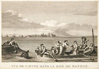
1797rif. 55649Paris. 1797. View of Brazil from the Voyages of La Perouse who set sail from France in 1785 to continue the discoveries of Captain Cook. He was shipwrecked in 1788 but his narrative maps and views survived and were published in 1797. Atlas Du Voyage De La Pérouse. Copper engraving. Very good condition. slight browing around edges but not effecting image. Uncoloured. Size: 40 x 25.5 cm. unknown
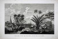
rif. 8786Paris: 1797. No binding. Very Good. 270 x 410 mm. in good condition. This is a view of the town of Buru in Indonesia recording the visit of the French Admiral and explorer le Comte de La Pérouse. Jean-Francois de Galoup Comte de La Perouse led a French scientific expedition to the Pacific in 1785-88. He was one of the most noted naval commanders and navigators in France and was selected by King Louis XVI to complete Captain James Cook's exploration of the western Pacific. In a rare moment of co-operation the British Admiralty furnished scientific equipment to measure variations in magnetic north and for determining longitude. Fortunately for us La Perouse was meticulous in sending copies of his detailed logs and surveying via other ships as well as overland. His last contact was in the spring of 1788 with a British ship in Botany Bay Australia. The expedition was never heard from again. When the French Government realised that it had been lost they decided to publish an account as in many other ways it is regarded as one the greatest French voyages of exploration. It was not until 1827 that their fate was known. Howes USIana L93; Nordenskiold Collection v. 2; Phillips 688; Sabin 38960; Shirley 'Atlases in the BL' G.LPR-1a. 1797 unknown
1797rif. 55645Paris. 1797. This dramatic and attractive print is from the Voyages of La Perouse who set sail from France in 1785 to continue the discoveries of Captain Cook. He was shipwrecked in 1788 but his narrative maps and views survived and were published in 1797. Atlas du Voyage de la Perouse Copper engraving. Good margins crisp clear impression very good condition. slight browing around edges but not effecting image Uncoloured. Size: 40 x 25.5 cm. unknown
1797rif. 55666Paris. 1797. Scene showing inhabitants of Lituya Bay Alaska in fishing season. From the Voyages of La Perouse who set sail from France in 1785 to continue the discoveries of Captain Cook. He was shipwrecked in 1788 but his narrative maps and views survived and were published in 1797. Atlas Du Voyage De La Pérouse. Size: 400 x 255 mm. Copper engraving. Uncoloured. Very good condition. slight browing around edges but not effecting image. unknown
1790rif. 0032791790 A Paris, Chez Letellier, 1789-1790. Deux ouvrages reliés en un volume in-8 (131 X 200) basane fauve, double filet doré en place des nerfs, pièce de titre maroquin ocre, tranches mouchetées en rouge (reliure de l'époque) ; (1) f. blanc, titre, (1) f. d'avis préliminaire, 213 pages ; (1) f. blanc, VIII pages (dont faux-titre et titre), 266 pages, (1) f. blanc. Cernes de mouillures claires à certains feuillets, plus marqués aux premiers feuillets du volume. Manque de papier à l'angle inférieur des feuillets 153/154 et 169/170 de l'ouvrage de Tench, avec perte d'une lettre ("e" final de "espac[e]") au second feuillet. Quelques rares rousseurs. Minimes restaurations à la reliure.
1981rif. 1232631981 Chez Jean de Bonnot - 1981 - Deux volumes in-8, reliure pleine peau bleue marine de l'éditeur, dos lisse avec titres et décors dorés, avec riches décors à froid sur les plats représentant des cartes, tranche de tête dorée - 387 pages + 330 pages - Illustrations en N&B de l'époque de l'auteur
1801rif. 843601801. LA PEROUSE Jean Francois. A Voyage Round the World. Performed in the Years 1785 1786 1787 1788.TO which are added A Voyage from Manilla to California by Don Antonio Maurelle: and an Abstract of the Voyage and Discoveries of the Late Capt. G. Vancouver. Boston: Joseph Bumstead 1801 333pp. Contemporary full leather morocco spine label skillfully rebacked. Some toning throughout else very good. Hill 976. Sabin 38966. Howes L-93. Forbes 331. Shaw & Shoemaker 789. Ferguson 333. Reese Best of the West 20. Kroepelien 1331.The rare first American edition of one of the most important Pacific voyages. The La Perouse account was first published in Paris in French in 1797 and in English in 1798. This is one of the earliest Pacific voyages to appear in an American edition and published much less modestly than the French and British editions would have been the way the average American would have learned about La Perouse's important surveys of the Pacific coast and his descriptions of native Americans there. This is also the first American version although only a precis of Vancouver's voyage first published in London in 1798. The 1781 voyage of Spanish naval officer Francisco Antonio Mourelle incorrectly spelled in this edition's title went from the Philippines to the South Pacific where he explored in the vicinity of New Guinea and the Tonga Islands before sailing to Mexico. Howes is inaccurate in his pagination of this edition and the Hill copy contains a map that was added later. unknown
rif. PHO-1184Paris, chez Patris , an VII (1799), 2 volumes in-8, lviii-373 pp ,332 pp.-xix , relié plein basane raciné , dos lisse orné avec titre et tomaison , tranches jaunes mouchetées ,T1, titre , extrait du 3eme voyage du capitaine Cook , A la Pérouse , préface , grande carte de la route de Samuel Hearne (60x80cm)déchirure sans manque , introduction, 2 planches et 2 cartes ,T2 , 3 cartes et 2 planches , table des chapitres , errata et placements des planches , intérieur très frais. Complet des 9 planches et cartes , 1 carte volante , manque page 17 à 32 .
1933rif. 743771933 Paris, Pierre Roger, 1933, petit in 8° broché, 298 pages ; couverture illustrée (avec quelques infimes défauts).
rif. c5370Paris, Collection Voyages et découvertes, Editions du Carrefour,1930 ; grand in-8° carré broché, couverture rempliée bleu-gris imprimée en noir; XVIpp.,293pp.; 19 gravures à pleine page dont 11 à double page.
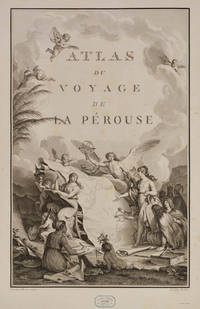
1798rif. 53622Paris, Plassin, 1798. 8vo. and folio (44 x 30) cm. Textvolumes bound in 4 contemporary half calf. Gilt spines with gilt lettering. Tome-label on volume one eroded. Stamp on title-pages. (4),LXVIII,368(4),414316,(120 = Tables)"(4),328 pp. A few scattered brownspots. Atlasvolume bound in matching hcalf. Spine gilt and rubbed. Lower compartment of spine with wear and tear. Engraved portrai of Pérouse as frontispiece. Engraved pictorial titlepage with cupids and naviogational instruments (dessinée par Moreau le Jeune) and 69 engraved maps, plans and plates of which 32 are large folded engraved maps. Mild foxing to some parts of some maps, occasionally mild dampstains to some plates, marginal browning and some spotting. One map with a repair to folding.
1798rif. 17370Paris Plassan 1798 - An VI in-8 br. non rogné. T II : (2ff.), 414pp.
1833rif. PHO-1811Paris,1833, in-folio, demi-reliure basane rouge, dos lisse, muet (rel. mod.), illustré avec 1 portrait en frontispice, lithographié par Lemercier d'après A. Maurin, [1] f. (titre gravé avec vignette), 20 planches disparates (8 cartes gravées sur acier dont 6 doubles, 11 vues reliées (dont 5 coloriées) et 15 planches en feuilles, papier des plats gondolé, quelques rousseurs aux planches libres avec défauts en marges.Recueil réunissant : 1 carte générale ; 1 carte de Nouvelle-Zélande (côte partielle); 1 carte du Pacifique; 1 de Nouvelle-Guinée; 1 de l'Archipel des îles Viti; 1 de l'île Tonga-Tabou; 1 des îles Vanikoro; 1 de Nouvelle-Zélande (nord); des vues de paysages; de personnages locaux (dont 7 coloriées).
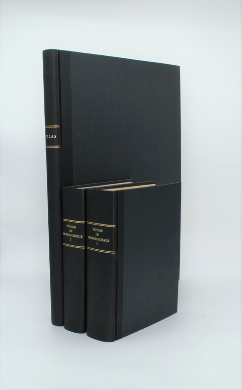
1807rif. PHO-1A Paris, Dépôt général des Cartes et Plans de la Marine et des Colonies, 1807 et De L’Imprimerie Impériale, 1808 RARE ENSEMBLE COMPLET en 3 volumes TEXTE ; 2 forts vol. in-4° ; (2)-LVI-704 pp.-32 pl. h.-t. repliées in-fine (I-XXXII)/(2)-VIII-692 pp.-1 pl. h.-t. Repliée sur papier bleuté , relié demi cuir , dos lisse avec titre et tomaison , tranches mouchetées , mouillure angulaire sur 7 planches, petites rousseurs sur les planches . ATLAS ; 1 volume grand in-folio (560x445) ,page de titre-1 fnch. (Table )-39 cartes et vues h.-t. , dont 29 à double page ,dressées par l'ingénieur hydrographe C. F. Beautemps Beaupré et gravées sur cuivre par E. Collin , relié demi cuir , dos lisse ,cachets répétés , petites rousseurs .
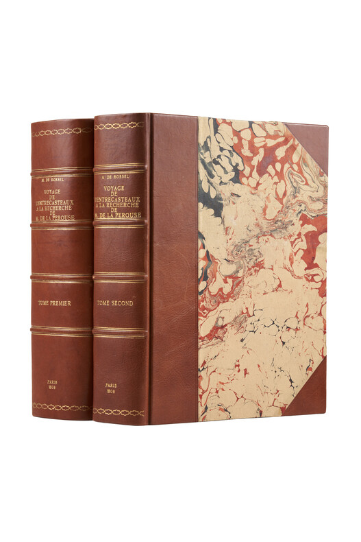
1808rif. PHO-1626Paris, Imprimerie impériale, 1808. 2 grands et forts volumes in-4 (32x24), lvi, 704 p., 33 pl. ; viii, 692 p., relié demi basane et coins moderne, dos avec auteur, titre, tomaison, lieu et date, exlibris en page de garde, non rogné, tome 2 non coupé, petite mouillure au tome 2, petites rousseurs aux illustrations du tome 1. Exemplaire sur papier bleuté, complet de son illustration mais sans son atlas de cartes
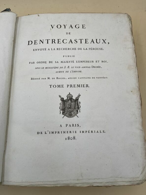
1808A Paris, de l'Imprimerie Impériale, 1808. Tome I seul, Un volume très fort In-folio, relié cartonnage d'attente de l'époque, LVI + 704 pages et 32 planches dépliantes. Le corps de l'ouvrage est en très bon état, les pages, à grandes marges ne sont ni tachées ni affectéees de rousseurs, imprimées sur beau papier. Les planches dépliantes sont également en bon état, présentant juste quelques petites pointes de rousseurs dans les marges sans gravité. La reliure (cartonnage d'attente) est en mauvais état. Rappelons que d'Entrecateaux avait été envoyé, en 1781) par Louis XVI à la recherche de La Pérouse
1808rif. 164452Imprimerie Impériale A Paris, de l'Imprimerie Impériale, 1808. Tome I seul, Un volume très fort In-folio, relié cartonnage d'attente de l'époque, LVI + 704 pages et 32 planches dépliantes. Le corps de l'ouvrage est en très bon état, les pages, à grandes marges ne sont ni tachées ni affectéees de rousseurs, imprimées sur beau papier. Les planches dépliantes sont également en bon état, présentant juste quelques petites pointes de rousseurs dans les marges sans gravité. La reliure (cartonnage d'attente) est en mauvais état. Rappelons que d'Entrecateaux avait été envoyé, en 1781) par Louis XVI à la recherche de La Pérouse
rif. 11090Paris: Chez Plassan Imprimeur-Libraire rue du Cimetiere Andre-des-Arcs no 10. 1798. No binding. Good. Second edition first octavo. Four octavo text volumes 205 x 125 mm. full contemporary mottled calf ornate gilt panelled boards spines with ornate gilt ruled band each compartment with further gilt decoration red calf gilt title labels to spines marbled endpapers with typographic half and full titles to each volume pp. 4 lxviii 368; 4 414; 316 148; 4 328 lower right corner of title to third volume torn away without loss; one folio atlas volume 465 x 310 mm. recent full cloth with calf gilt title label affixed to upper board with engraved portrait of La Pérouse after Tardieu engraved allegorical title-page by Moreau le Jeune 69 plates including 18 double page maps a folding world map 35 views and natural history plates 33 maps or coastal profiles all uncut in good condition. The first octavo edition of La Perouse's voyage one of the most important scientific explorations ever undertaken to the Pacific and the northwest American coast and the first scientific voyage to California. It is accompanied by the atlas volume published the previous year 1797. Jean-Francois de Galoup Comte de La Pérouse 1741-88 led a French scientific expedition to the Pacific in 1785-88. He was one of the most noted naval commanders and navigators in France and was selected by King Louis XVI to complete Captain James Cook's exploration of the Pacific especially regarding a possible north-west passage. In a rare moment of co-operation the British Admiralty furnished scientific equipment to measure variations in magnetic north and for determining longitude. The two corvettes called 'La Boussole' and 'L'Astrolabe' left Brest on 1 August 1785. Rounding Cape Horn they undertook repairs in Chile before heading to the Sandwich Islands Hawaii and Alaska. From here he turned south exploring the west coast of North America into California refitting again at Monterey. They then headed across the Pacific Ocean on 23 September 1786 reaching Macao on 1 January 1787. He then travelled to Manilla Taiwan and north along the Asian coastline towards Korea Japan and Kamchatka. There he received orders from Paris to head for Australia. De Lesseps was sent back to Paris with various reports and charts to date. He arrived at Botany Bay on 24 January 1788 and had good relations with the English First Fleet settlers who had only just arrived. They remained there for six weeks and left on 10 March never to be seen again. Fortunately for us La Perouse was meticulous in sending copies of his detailed logs and surveying via other ships as well as overland. When the French Government realised that it had been lost they decided to publish this account as in many other ways it is regarded as one the greatest French voyages of exploration. Despite attempts to discover its fate it was not until 1827 that the vessels were discovered shipwrecked on the island of Vanikoro one of the remote Santa Cruz Islands. The exact fate of the survivors has been the source of considerable speculation ever since. The largest contribution the expedition made was to the knowledge of the Asiatic coast of the Pacific. Especially the waters in and around Japan. The atlas includes superb charts of this and the west coast of North America including charts of San Francisco Bay Monterey Bay and San Diego. Also the first chart of Samoa. There are several views including the first of Maui in the Sandwich Islands. They are complimented by a series of botanical and ornithological engravings including the California quail. Provenance: Libraria de Antanao 2002; Juan and Peggy Rada Collection. Falk 1983 1797.5-13; Ferguson 1941-69 268; Fitzpatrick 1986 pp. 25-31; Hill 1974 p. 173-4; Howes 1962 L93; Howgego 2003 L20; refer Lada-Mocarski 1969 52; refer Nordenskiold Collection 1979 132; refer Phillips 1909- 688; Sabin 1868-1936 38960; refer Shirley 2004 Atlases G.Lpr 1a; Suarez Chez Plassan, Imprimeur-Libraire, rue du Cimetiere Andre-des-Arcs, no 10. 1798 unknown
rif. 98498Paris Imprimerie de la République An V An V 1797. . First edition. 4 text vols 4to 30 x 23 cms and folio atlas 58 x 45 cms engraved portrait of La Pérouse after Tardieu atlas with engraved allegorical title-page by Moreau le Jeune titled Atlas du voyage de La Pérouse without imprint and 69 engraved plates comprising folding world map 35 views and natural history plates 33 maps or coastal profiles of which 20 double-page. Text volumes contemporary half-calf marbled boards chip to head of spine vol. I light marginal water-staining vol. II and title-page vol. III bound without half-titles joints vol. I cracked but sound lightly rubbed some scraping to boards; atlas 19th-century red morocco-backed boards neatly rebacked royal cypher of Prince Philippe of Belgium to cover and spine marginal repair to tear circa 7 cms to blank outer margin plate 15 not touching image occasional light foxing at beginning and end a very good set. The first edition of one of the most important scientific explorations ever undertaken to the Pacific and the northwest American coast and the first scientific voyage to California. 'The voyage round the world under the command of La Pérouse was intended as the French equivalent of Captain Cook's Third Voyage and was enthusiastically endorsed by the Academy of Sciences and particularly by Louis XVI. The most significant results of the voyage are the charts of the then imperfectly known Asiatic coast of the Pacific' Forbes. La Pérouse was the first explorer to navigate and chart the Japan sea and the strait between the island of Sakhalin and the northernmost island of Japan which bears his name. At Kamchatka he received instructions to proceed to Australia to assess the extent of British plans. He arrived at Botany Bay in January 1788 just hours after Governor Phillip had arrived with the First Fleet. La Pérouse's habit of forwarding copies of journals and drawings when opportunity offered ensured their survival for as is well known the accomplishments of the voyage have been overshadowed by the disappearance of the entire expedition. The folio atlas contains magnificent maps of Russian Asia Japan the Pacific North-West Coast Hawaii San Francisco and Monterey; the views include a fine series of botanical and ornithological plates including the California quail. Of particular interest to Hawaii is the plate that depicts French ships off Makena Maui. It is the first fully developed view of that island. Hill 972; Forbes 272; Lada-Mocarski 52; Ferguson 251; Brunet III 828-829; Sabin 4797. Paris, Imprimerie de la République, An V, An V [1797]. hardcover
1798rif. 53622Paris Plassin 1798. 8vo. and folio 44 x 30 cm. Textvolumes bound in 4 contemporary half calf. Gilt spines with gilt lettering. Tome-label on volume one eroded. Stamp on title-pages. 4LXVIII368;4414;316120 = Tables;4328 pp. A few scattered brownspots. Atlasvolume bound in matching hcalf. Spine gilt and rubbed. Lower compartment of spine with wear and tear. Engraved portrai of Pérouse as frontispiece. Engraved pictorial titlepage with cupids and naviogational instruments dessinée par Moreau le Jeune and 69 engraved maps plans and plates of which 32 are large folded engraved maps. Mild foxing to some parts of some maps occasionally mild dampstains to some plates marginal browning and some spotting. One map with a repair to folding. Second edition of the textvolumes the first appeared the year before 1797 and first edition of plates. 69 plates to the first 70 to the second."In 1785 Jean-Francois de Galaup Comte de la Perouse began preparations for an extensive sea voyage. His aim was to explore the Pacific regions of North and South America Asia and Australasia. The sponsor of the expedition was the French king Louis XVI who was inspired by Captain James Cook's Pacific voyages. Louis ordered the French expedition to show the world that France could also dominate in ocean exploration. The expedition consisted of two ships - La Boussole and L'Astrolabe. They carried a total of 225 crew officers and scientists. The ships left France in August 1785 and sailed south around Cape Horn. The voyage was expected to last four years. During the voyage La Perouse sent back regular reports to France. The expedition mapped coastlines and explored uncharted areas of ocean. The expedition's scientists also spent time onshore at various ports observing the habits and customs of local people and collecting natural history specimens. The expedition's progess until September 1787 was published by the French government as Voyage de La Perouse autour du monde La Perouse's voyage around the world. It was reprinted many times and translated into several languages. In 1791 when La Perouse had not returned to France or made any contact by dispatch the French government sent out a search party. It was commanded by Rear Admiral Joseph Antoine Bruni d'Entrecasteaux and consisted of two ships Recherche and Esperance. The complete disappearance of La Perouse caught the imagination of the European public. Songs stories and plays were written about the possible fate of the expedition including a popular play called Perouse or The desolate island. It was not until 1964 that the wreck of La Boussole was finally discovered on Vanikoro's reefs. At last the fate of La Perouse and his crew was known. The expedition is commemorated in the name of a Sydney suburb on the shores of Botany Bay - La Perouse." State Library of New South Wales Website.Sabin 38960. unknown
1830rif. 98208Pillet 1830 2 vol. relié 2 vol. in-8, demi-veau glacé tabac, dos à nerfs rehaussés de frises dorées, caissons ornés de fleurons à froid et de filets et frises dorés, tranches marbrées, LX + 294 et 361, 1 frontispice dépliant (sur 2), 1 carte dépliante et 1 planche hors-texte (rousseurs éparses sinon fine reliure de l'époque agréablement patinée). Edition originale. Peter Dillon (1788-1847) est né en Martinique d'un père Irlandais de passage sur l'île. L'âme aventureuse, il se fait négociant en bois de santal et découvre le lieu d'échouage de l'expédition de La Pérouse sur l'île de Mannicolo dans l'archipel des Salomon. Manque le frontispice dépliant du tome I.