[South Australian Governors]Biblio.com

6.500 resultados
ref. 118411All portraits are albumen paper photographs approximately 140 × 103 mm mounted on cabinet cards 165 × 107 mm with the first 16 uniformly presented as oval vignettes 68 × 48 mm on plain black gilt-edged cards with the subject's name and period in office printed in gilt in the margin below the photograph; the last one ninth Earl of Kintore in office from 11 April 1889 to 10 April 1895 is on a white card of Stump & Co. Gresham Gallery Adelaide with only 'Earl Kintore' written in ink on the verso. It seems likely that the uniform series was produced during this period. Two photographs have minimal loss to one edge; a number are a little scuffed or marked; five have a marginal stain well clear of the portrait proper; a bottom corner of one card is cracked but firm; one card Lieutenant-Colonel F.G. Hamley had broken in two a few millimetres above the portrait proper and was held together with clear tape now removed by our conservator leaving only a light residual stain. In chronological order the governors and administrators A present are Hindmarsh Stephen A Gawler Grey Robe Young Finniss A MacDonnell Daly Hamley A Hanson A Musgrave Cairns A Jervois Robinson Boucaut A and Kintore. The only one not represented is Sir James Fergusson 16 February 1869 to 18 April 1873. 17 items. unknown
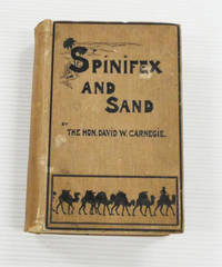
1898ref. BIB329903London: C. Arthur Pearson Ltd. 1898. Large octavo size 16x24cm approx. Good condition. Decorated brown boards. Gilt top edge and Gilt title to spine. Four 4 folded maps - two to text block and two in pocket at rear. Maps are worn but complete and some have repairs done by previous owner. Hinges professionally repaired with strengthening tape. Black & white illustrations - all present. Fergusson 7959 refers. 454 pages. The Hon. David Wynford Carnegie 23 March 1871 - 27 November 1900 was an explorer and gold prospector in Western Australia. In 1896 he led an expedition from Coolgardie through the Gibson and Great Sandy Deserts to Halls Creek and then back again. . Good. 1st Edition. Hardback. C. Arthur Pearson Ltd hardcover
Splendida carta intelata incisa su rame, confini acquarellati, cm. 135x156 composta da 35 riquadri. In grande formato rivela il fascino dell'India e dell'Asia Orientale a fianco della vasta regione australiana. Al margine inferiore, in due riquadri raffigurate "The Colony of New Zealan" e "Continuation of Australia on the same scale as the Map". Figlio di un grande cartografo John Cary (1791-1852), prosegu? il percorso del padre e fu attivo a Londra nella prima metà dell'800. Bella conservaz.
1848ref. 24537Paris A. Franck 1848 in-4 demi-chagrin vert, dos à nerfs, caissons de filets et fleurons dorés au dos, tranches mouchetées [Rel. de l'époque], qqs très lég. épidermures et rouss. pâles éparses
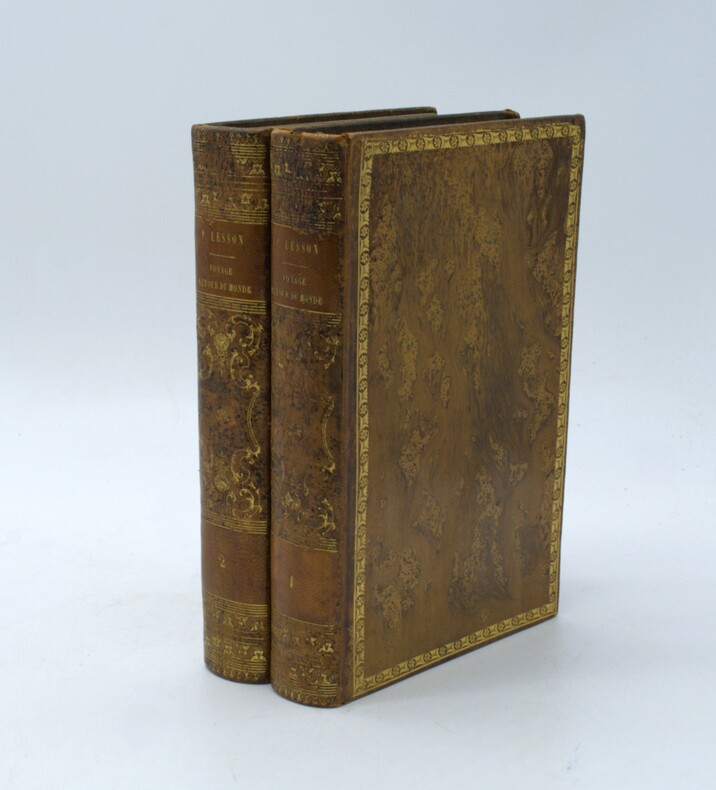
1839ref. PHO-1704Paris, Pourrat frères, 1839. 2 volumes in-8 (220x150), plein veau raciné époque, dos lisse orné avec pièces de titre, auteur et tomaison, frises aux plats et aux coupes, , 2ff.-510pp.-1f. , 2ff.-547pp.-2ff. , illustré d’un frontispice et de 41 planches dont 19 en couleurs d’époque représentant des animaux, des poissons et des oiseaux, un cahier (tome 2) dérelié, 1 planche volante, petits frottements, 1 coin usé, quelques rousseurs .
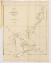
1875ref. 24335Adelaide: Government Printer 1875. Fine. Adelaide Government Printer 1875. A large map 690 x 550 mm folding down to foolscap folio size. One edge very slightly chipped; one tiny marginal tear expertly repaired; a fine copy detached from a bound volume with the preceding one-leaf parliamentary paper retained for the time being for protection. South Australian Parliamentary Paper Number 57 of 1875 no text accompanied this map. McLaren 12530-31-32 are confusing confused: the first entry refers to this item by correct Parliamentary Paper number but the title is incorrect; the third entry shows the correct title for a map accompanying the journal published the following year as SAPP19 of 1876. Feeken Feeken and Spate comment on the fact that although Lewis reported his arrival at Beltana on 12 July 1875 after completing his surveys 'Curiously the map of his surveys was signed by Surveyor-General Goyder already on 15 July'. We have not inspected the map issued in 1876 but the present copy contains a lithographed note that may explain the apparent anomaly: 'Copied from Plan forwarded by J.W. Lewis Esq. in the Office of The Surveyor General by Edwin S. Berry and H.C. Talbot . June 15th 1875'. Little is known about J.W. Lewis not to be confused with John Lewis of 'Fought and Won' fame but he accompanied Warburton across the Great Sandy Desert in 1872-73. 'Warburton admitted that Lewis had several times saved the party from perishing on that epic journey' Feeken. An abridged account of Lewis' Lake Eyre expedition will be found in Threadgill along with a reduced facsimile of a later version of the map which includes 'a detailed examination of the course of the Barcoo as far as Innamincka'. Government Printer unknown
1884ref. 056002Brisbane: James C. Beal Government Printer. 1884. 210 pages. Publisher's green cloth decorated in blind and titled in gilt to front. Foxing to endpapers/prelims some foxing to page edges. A very nice copy with the binding in particular in superb condition-appears unread. The Journals of the Explorations by Messrs Gregory in the Western Northern and Central portions of Australia had previously only been partially published in a fragmentary form. This was their first appearance in toto and is scarce as such. Includes explorations in Western Australia what is now Queensland Victoria and New South Wales. Of note is the inclusion of papers concerning the expedition to determine the fate of Leichhardt. Ferguson 10075 listed in error as having illustrations Wantrup 190a correcting Ferguson's error. An attractive clean complete and entirely original copy that would grace any collection. First Edition. Hard Cover. Very Good. 8vo. James C. Beal, Government Printer. Hardcover
1839ref. 674191839. together 7 items. together 7 items. Parliamentary Documents Relating to the Penal Colony of Van Dieman's Land and New South Wales 1839-1855 Australia. Transportation. Van Dieman's Land. Van Dieman's Land. Copies of Despatches from the Lieutenant-Governor of Van Dieman's Land Relative to Transportation and the Assignment of Convicts. London: Ordered By the House of Commons To be Printed 12 August 1839. 4 pp. With An Act for the Government of New South Wales and Van Dieman's Land 30th July 1842. Running title. London: Printed by George E. Eyre and Andrew Spottiswoode 1842. 833-850 pp. And An Act to Explain and Amend the Act for the Government of New South Wales and Van Dieman's Land 6th August 1844. Running title. London: Printed by George E. Eyre and Andrew Spottiswoode 1842. 577-580 pp. And South Australia. Convicts Van Dieman's Land. Copies of All the Correspondence Between Any Person or Persons Interested in South Australia and the Colonial Office Respecting the Effect Upon that Province of the Official Notice of the Comptroller General of Van Dieman's Land Of the 21st Day of June 1845 Relative to Convicts in that Colony Who were Holders of Conditional Pardons. London: Ordered By the House of Commons To be Printed 26 August 1846. 9. 1 pp. And Transportation. Van Dieman's Land. Copy of a Communication upon the Subject of Transportation Addressed to Earl Grey by the Lord Bishop of Tasmania. Viscount Mahon. London: Ordered By the House of Commons To be Printed 23 July 1847. 11 1 pp. And Van Dieman's Land. Copies of Despatches With Their Enclosures Relating to the Cases of Mr. Justice Montagu and Chief Justice Pedder With Other Documents. London: Ordered By the House of Commons To be Printed 29 July 1848. 112 2 pp. And An Act to Enable Her Majesty to Assent to a Bill As Amended Of the Legislature of New South Wales "To Confer a Constitution on New South Wales And to Grant a Civil List to Her Majesty 16th July 1855. Running title. London: Printed by George E. Eyre and Andrew Spottiswoode 1855. 401-422 pp. 7 items in all ranging in size from 12" x 7-1/2" to 13" x 8." Disbound moderate toning occasional edgewear 4 items have small library marking of the Netherlands Foreign Office Van Dieman's Land. unknown
1839ref. 674191839. together 7 items. together 7 items. Parliamentary Documents Relating to the Penal Colony of Van Dieman's Land and New South Wales 1839-1855 Australia. Transportation. Van Dieman's Land. Van Dieman's Land. Copies of Despatches from the Lieutenant-Governor of Van Dieman's Land Relative to Transportation and the Assignment of Convicts. London: Ordered By the House of Commons To be Printed 12 August 1839. 4 pp. With An Act for the Government of New South Wales and Van Dieman's Land 30th July 1842. Running title. London: Printed by George E. Eyre and Andrew Spottiswoode 1842. 833-850 pp. And An Act to Explain and Amend the Act for the Government of New South Wales and Van Dieman's Land 6th August 1844. Running title. London: Printed by George E. Eyre and Andrew Spottiswoode 1842. 577-580 pp. And South Australia. Convicts Van Dieman's Land. Copies of All the Correspondence Between Any Person or Persons Interested in South Australia and the Colonial Office Respecting the Effect Upon that Province of the Official Notice of the Comptroller General of Van Dieman's Land Of the 21st Day of June 1845 Relative to Convicts in that Colony Who were Holders of Conditional Pardons. London: Ordered By the House of Commons To be Printed 26 August 1846. 9. 1 pp. And Transportation. Van Dieman's Land. Copy of a Communication upon the Subject of Transportation Addressed to Earl Grey by the Lord Bishop of Tasmania. Viscount Mahon. London: Ordered By the House of Commons To be Printed 23 July 1847. 11 1 pp. And Van Dieman's Land. Copies of Despatches With Their Enclosures Relating to the Cases of Mr. Justice Montagu and Chief Justice Pedder With Other Documents. London: Ordered By the House of Commons To be Printed 29 July 1848. 112 2 pp. And An Act to Enable Her Majesty to Assent to a Bill As Amended Of the Legislature of New South Wales "To Confer a Constitution on New South Wales And to Grant a Civil List to Her Majesty 16th July 1855. Running title. London: Printed by George E. Eyre and Andrew Spottiswoode 1855. 401-422 pp. 7 items in all ranging in size from 12" x 7-1/2" to 13" x 8." Disbound moderate toning occasional edgewear 4 items have small library marking of the Netherlands Foreign Office Van Dieman's Land. unknown books
1841ref. BOOKS0057972 Volumes: Volume I xiv412 pages with black and white frontispiece 5 color and 5 black and white plates 11 in text illustrations 2 maps in pocket. Volume II viii482 pages with color frontispiece 10 black and white plates 17 in text illustrations lacks four page prospectus for Gould's Birds of Australia. Royal Octavo " x 6" bound in original publisher's brown cloth with gilt lettering to spine. Ferguson 3228 First edition. Grey is best known for his expeditions in the north-west interior of the continent which resulted in the discover of the Glenelg River Stephen Range and Mount Lyell. As a young lieutenant he had made a proposal to the Colonial Office to mount an expedition to the north-west coast of Australia for the purposes of establishing a settlement there for starving Irish peasants. His plans were approved and he sailed for Australia in the Beagle in 1837. He wen on to mount two expedition in the north-west in 1838 and 1839 which yielded particularly important geographical discoveries: "His expeditions were the first to examine the previously ignored north-west interior of the continent and he discovered much useful territory. The inland explorations of Grey and Lushington his deputy complemented by the associated coastal explorations of Wickham and Stokes in the Beagle were a major advance in the discovery of the Australian continent" Wantrup p 206 Condition: Recased with original spines laid on scattered foxing corners bumped. Else a very good copy. T & W Boone hardcover
1841ref. BOOKS0057972 Volumes: Volume I xiv412 pages with black and white frontispiece 5 color and 5 black and white plates 11 in text illustrations 2 maps in pocket. Volume II viii482 pages with color frontispiece 10 black and white plates 17 in text illustrations lacks four page prospectus for Gould's Birds of Australia. Royal Octavo " x 6" bound in original publisher's brown cloth with gilt lettering to spine. Ferguson 3228 First edition. Grey is best known for his expeditions in the north-west interior of the continent which resulted in the discover of the Glenelg River Stephen Range and Mount Lyell. As a young lieutenant he had made a proposal to the Colonial Office to mount an expedition to the north-west coast of Australia for the purposes of establishing a settlement there for starving Irish peasants. His plans were approved and he sailed for Australia in the Beagle in 1837. He wen on to mount two expedition in the north-west in 1838 and 1839 which yielded particularly important geographical discoveries: "His expeditions were the first to examine the previously ignored north-west interior of the continent and he discovered much useful territory. The inland explorations of Grey and Lushington his deputy complemented by the associated coastal explorations of Wickham and Stokes in the Beagle were a major advance in the discovery of the Australian continent" Wantrup p 206 Condition: Recased with original spines laid on scattered foxing corners bumped. Else a very good copy. T & W Boone hardcover books
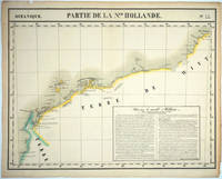
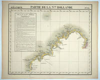
1827ref. 25576Brussels: P. Vandermaelen 1827. An early map of the Exmouth Western Australia area from the North West Cape to Roebuck Bay. Lithograph with original outline color 15 3/4 x 21". Scale ca. 1:1 650 000. Plate no. 44 Partie de La Nlle. Hollande in vol. 6 Oceanique of Atlas Universal de Geographie Physique Politique Statistique et Mineralogique" by P. Vandermaelen 1827. Tooley 1286; Phillips 749; Bib ID 1553060. P. Vandermaelen unknown
1827ref. 25575Brussels: P. Vandermaelen 1827. Maps. Very good condition. An early map of the Broome & the Kimberly Western Australia area from P. Cantheaume to Cambridge Gulf including the Lacepede Islands. Broome is at the bottom of the Dampier Peninsula called "C. Boileau." Lithograph with original outline color 25 x 21.5". Plate no. 35 Partie de La Nlle. Hollande in vol. 6 Oceanique of Atlas Universal de Geographie Physique Politique Statistique et Mineralogique" by P. Vandermaelen 1827. Tooley 1282; Phillips 749; Bib ID 30855. P. Vandermaelen unknown
1888ref. 324991Hobart: William Thomas Strutt Government Printer 1888. 1st Edition . Hardcover. Very Good. 4to - over 9¾ - 12" tall. Hardcover with morocco and gilt spine titles. Looks like an older rebind.in tan cloth. Preface contents bibliography extensive 408ppfolding map of Tasmania torn numerous illus. including 57 lithographs of fossils elevations including one in colour. Some wear to edge of this foldout. Paper shows some tanning William Thomas Strutt Government Printer hardcover
2002ref. BN573488Explore Australia 2002. 2002. Bush Tucker Field Guide Bush Tucker Field Guide Australia Explore Explore Australia unknown
1840ref. PHO-1421Gayet et Lebrun, Paris, 1840. 4 tomes en 2 volumes in-8 (220x142) ,2ff-400pp ,2ff-417pp, 4ff-399pp ,3ff-451 pp , illustré de 56 (60) gravures colorisées et gommées, et de deux portraits en noir de Jacques et François Arago ,petit dictionnaire du dialecte des différents peuples rencontrés à la fin du quatrième tome . Relié demi cuir époque ,dos lisse avec auteur , titre et tomaison, frottements au plats , coins , coupes et coiffes usées ,début de fente aux charnières, peu de rousseurs , qlqs planches brunies, titre tome 1 et feuillets détachés , certains avec marge abîmée .
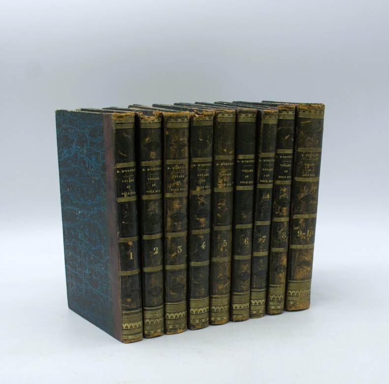
1841ref. PHO-2141Paris, Gide, 1841-1846, 10 tomes en 9 volumes in-8 (22,5x14cm), demi basane, dos lisse orné avec auteur, titre et tomaison, ex-libris manuscrit au faux titre du tome 1 et cachet répété « ex-libris de Cayrol », frottements aux reliures, quelques coiffes abimées, rousseurs, papier bruni, complet des 9 cartes dépliantes in fine.
1864An English translation by Dr. C. F. Fisher, from the Scientific Publications of the Novara Expedition, comprising important and fascinating observations and survey work by German-Austrian geologist Ferdinand von Hochstetter at the onset of British settlement in the region. 8vo. 113 pages, plus table of contents, title page. Red cloth boards titled in gilt to front. Volume measures approximately 14 x 21 cm. Faint blemish to boards, otherwise very good condition, clean and bright. An early work presenting discoveries made in New Zealand, specifically in Auckland and Nelson, during the Austrian Imperial Novara Expedition. It includes two important lectures delivered by esteemed geologist and expedition leader Ferdinand von Hochstetter. A principal member of the expedition, Hochstetter was involved in its planning from the onset. His surveys were used in the making of the first geological map of New Zealand, created the bases for future geological research. The Novara Expedition (1857-1859) was the first large-scale scientific, around-the-world mission of the Austrian Imperial navy. In 1859, during the expedition, Hochstetter was funded by the government of New Zealand to make a rapid geological survey of the islands. Over 150 years later, his work is regarded as an authoritative primary source still today. the volume's content centers largely on Hochstetter's survey of Auckland, beginning with his lecture on the region's geology. Subjects further include its extinct volcanos, Lake Rotomahana and its hot springs [Te Tarata thermal springs], and three inlets on North Island - Whaingaroa [now known as Raglan], Aotea, and Kawhia. Approximately one quarter of the text is devoted to his geological work in the Province of Nelson.
1708pp. [12], 915, (41) [Index] + Engraved frontis title page (drawn by Joseph Mulder and engraved by Willem de Broen) showing an enormous globe, the author and allegorical figures; Plus + Folding engraved map of the Old World (31 x 42 cm.) - "Orbis Terrarum Veteribus Cogniti Tabula" by Christoph CELLARIUS, showing not only Europe, Africa and Asia, but also Australia; and four woodcut decorated initial letters. Regular title printed in red and black with the Wetstein's engraved whetstone publisher's device. Latin text in roman types, with extensive passages in italic and Greek, and occasional Hebrew and fraktur. 4to. 205 mm. Old damp stain on the first few leaves. The early full leather binding is quite worn. ** The front pastedown bears an early autograph ownership - apparently that of Noel Antoine Pluche (1688-1761), noted French naturalist and writer. Full Title: Nicolai Gurtleri Origines Mundi & in eo Regnorum, Rerumpubl. Populorum; horumque Duces, Migrationes, Dii, Religio, Mores, Instituta, Res gesta, civiles, sacra, bellica. Referuntur omnia ad loca & tempora sua, & ex ipsis fontibus, fereque propriis Historicorum verbis ad modum Historiae Universalis, cum maxime Ecclesiasticae reprasentantur. Cum Indicibus necessariis, iisque locupletissimis. First and only edition of a detailed history of the ancient world, covering and comparing the cultures, religions, governments, (civil and ecclesiastical) legal systems, etc. of societies throughout the Old World. After a brief discussion of the pre-diluvian world, it covers the ancient Middle East, Africa, Asia and Europe country by country or region by region, citing both biblical and classical sources. The Cellarius map appears to be based on the 1664 map of the same title by Johannes Strubius (Shirley 434, in the same projection and showing the same regions, but not including Australia), but its more accurate and up-to-date cartographic data appears to have been taken from one of the world maps in two hemispheres that were common from at least 1658 (Visscher's, Shirley 406). As in those maps, the coast of Australia shows a small break at 30 degrees south latitude. Cellarius (1638-1707) had produced a series of historical maps for his Notitia Orbis Antiqui, first published at Leipzig in 1701, and the present map may be based on one from that book. A detailed ancient history, with an attractive and unusually accurate folding map of the Old World. SCARCE. NCC (5 copies); OCLC WorldCat (7 copies); STCN (1 copy). **PRICE JUST REDUCED! W153
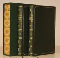
1952ref. 11532John Murray 1952-57. 2 vols. 8vo. First Edition with title-vignettes several illustrations in the text and 2 maps one double-page on green stock; handsomely bound in full dark green crushed morocco sides with gilt frame borders backs with raised bands second and fourth compartments ruled and lettered in gilt all other compartments tooled in gilt gilt tops hand-made endpapers ribbon markers original backstrips and upper board images preserved and mounted on new and separate leaves at front custom-made slip-case an elegant set ideal as a gift or for presentation. Bright set of Grimble's classic travel-autobiography set in the Gilbert and Ellice Islands of the Central Pacific John Murray, hardcover
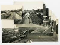
ref. 146428Very Good. Nine vintage gelatin silver prints eight approximately 220 × 285 mm one 138 × 206 mm all but two captioned or dated on the verso. Some prints with some residue on the verso from previous mounting; two with drawing pin-holes in some corners one of them with slight surface loss near a bottom corner the other with slight loss to a top corner; some with trifling chips or creases at the extremities; overall in excellent condition. The earliest image dated June 1926 shows the site on North Terrace before the commencement of construction; two show the station platforms in October 1926 and March 1927; two show the railway yards at the approach to the station one before construction one in December 1927; and four show the progressive construction of the western southern and eastern frontages of the station dated between April 1927 and March 1928. An interesting observation by Paul McGuire appeared in 'The New Triad' Volume 2 Number 7 1 July 1928: 'The Railway Department also has been showing its superiority to mere prettiness too. A magnificent station is nearing completion and the Assembly hall has already revealed itself as a splendidly conceived piece far superior to anything of its kind in Australia. The walls are scarcely finished and they are already blotted with posters dodgers and various advertising signs. The architects themselves have protested but in this case too we will be pleasureably sic surprised if the official mind sees beyond its balance sheets'. We have not identified the photographer or traced these particular images in institutional collections or elsewhere but they have the appearance of official photographs by a professional. 9 items. unknown
1825ref. 80009London: William Darton 1825. First Edition. Hardcover. Very Good. London William Darton circa 1825. Octavo xii 64 pages plus 64 engraved portraits with tissue-guards. Early gilt-decorated half calf and marbled papered boards a little rubbed and bumped at the extremities; corners and the rear leading edge a little worn; 'Vol III' label missing from the spine; occasional scattered foxing and offsetting; a very good copy. Provenance: James Hurtle Fisher with his armorial bookplate on the pastedown and his signature in ink at the head of the engraved title page. Sir James Hurtle Fisher 1790-1875 'was one of the most important pioneers of South Australia' 'Australian Dictionary of Biography'. He commenced practice as a solicitor in London in 1816 and 'was drawn into the colonizing movement in 1835. He was selected as resident commissioner one of the most important offices under the South Australian Act . second only to the governor'. Fisher 'left England in July 1836 with the governor's party in the "Buffalo" arriving on 28 December 1836 at Holdfast Bay where the official oaths were administered a proclamation was read and a ceremony marked the beginning of settlement. In January 1837 Fisher erected his reed hut and Land Office near the survey camp of Colonel William Light at the north-western corner of the new capital site; the destruction of these temporary buildings by fire on 23 January 1839 caused both men serious loss. Fisher had been allowed to draft his own instructions which were not shown to Governor Sir John Hindmarsh. Disputes between the two men over their respective powers had begun on the voyage and were soon revived in the new Council of Government and more violently outside and led in February 1837 to the Resident Magistrate's Court binding the participants over to keep the peace towards each other. The new governor George Gawler was appointed both governor and resident commissioner a radical departure from the principles on which the colony had been founded'. Fisher returned to his profession and became a leader of the South Australian Bar. In October 1840 he was elected first mayor of Adelaide; in 1860 he became the first resident South Australian to be knighted. The destructive fire referred to above is described in detail in the biography of Light Dutton and Elder 1991. Light was living 'in the wood and reed surveyor's hut alongside Fisher's equally combustible house in the parklands on North Terrace. In his own account ". we discovered Fisher's house to be on fire. At the same time the breeze freshening up the destruction to both houses became inevitable. In less than ten minutes both houses were burnt to the ground mine catching fire at the roof by a lighted piece from Fisher's. We saved nothing of value"'. Accordingly personal mementoes such as this presumably brought by Fisher to South Australia on the 'Buffalo' must be of the utmost rarity. William Darton hardcover
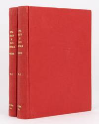
1900ref. 134834Adelaide: W.C. Rigby for the Royal Society of South Australia 1900. First Edition. Paperback. Very Good. Adelaide W.C. Rigby for the Royal Society of South Australia 1900 to 1913. Large quarto eight parts issued as and here bound in two volumes; full details of each part are listed below. Later binder's cloth retaining the original wrappers; cloth slightly scuffed and rubbed; both volumes a little bumped at the foot of the spines; small cancelled library stamp on each front wrapper 'College of Advanced Education Library Adelaide. 7 June 1973'; small light tidemark to the top inner corner of Volume I Part 3; minimal signs of age and use; in excellent condition. All four parts of the first volume are by STIRLING E.C. and A.H.C. ZIETZ: Fossil Remains of Lake Callabonna. An interesting note from the editor is printed on the verso of the front wrapper of the first part: 'For the purpose of presenting the descriptions of the "Fossil Remains ." in a more suitable form than is permitted by the size of the "Transactions" the Council has decided to publish in royal octavo a series of "Memoirs" . This issue is the first Fasciculus of the first Volume . of which other parts will appear as circumstances permit'. Individual subtitles are as follows. Volume I Part 1. Description of the Manus and Pes of 'Diprotodon Australia' Owen. 1900. 40 pages plus 18 plates. Volume 1 Part 2. Genyornis Newtoni. A New Genus and Species of Fossil Struthious Bird. and The Physical Features of Lake Callabonna. Circa 1900. iv 41-80 xv pages plus 7 pages of plates 3 of them folding. Volume 1 Part 3. Description of the Vertebrae of Genyornis Newtoni. 1905. ii 81-110 pages plus 11 pages of plates. Volume 1 Part 4. Description of Some Further Remains . 1913. vi 111-178 pages plus 23 pages of plates. Loosely inserted in the first part is a colour transparency of a watercolour illustration of a diprotodon. Volume II Part 1. ETHERIDGE Robert: The Cretaceous Mollusca of South Australia and the Northern Territory. 1902. iv 54 pages plus 7 pages of plates and a publisher's slip tipped in at the first page 'The remainder of Vol. I of these Memoirs has been reserved for further descriptions of the "Fossil Remains of Lake Callabonna"'. Volume II Part 2. TAYLOR T. Griffith: The Archaeocyathinae from the Cambrian of South Australia. An Account of the Morphology and Affinities of the Whole Class. Edited by Walter Howchin. 1910. vi 55-188 pages with 51 illustrations plus 15 pages of plates a large folding chart and a large 'Index Slip' tipped in at the contents page. Volume II Part 3. MAWSON Douglas: Chiastolites from Bimbowrie South Australia . Edited by Walter Howchin. 1911. iv 189-210 pages with a map and 12 illustrations plus 11 pages of plates including one colour plate. Volume II Part 4. MAWSON Douglas: Geological Investigations in the Broken Hill Area . Edited by Walter Howchin. 1912. viii 211-319 pages plus 26 pages of plates containing 81 plates and an illustration 5 pages of illustrations containing 3 maps and 4 sections and a very large folding colour geological map 525 × 680 mm 'Geological Sketch Map of the Olary-Broken Hill Area. In all instances each page of plates is accompanied by a leaf of text. The first part of the first volume and the first two parts of the second volume must be considered rare if our experience is any guide. 2 items. W.C. Rigby (for the Royal Society of South Australia) paperback
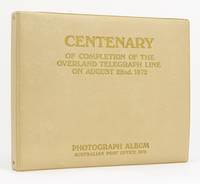
ref. 130931Melbourne: Australian Post Office 1972. First Edition. Hardcover. Fine. Melbourne Australian Post Office 1972. An oblong folio album approximately 300 × 390 mm containing 51 original gelatin silver photographs each approximately 165 × 200 mm mounted individually on both sides of 26 ring-bound card leaves most with captions printed on slips mounted below the plate. Original padded imitation leather aka vinyl lettered on the front cover; in fine condition inside and out. The photographs show the official centenary celebrations at Alice Springs on 22 August 1972 46 photographs including the reopening of the restored Old Telegraph Station and in Adelaide on 21 and 22 August 5 photographs. Dignitaries present include Sir Alan Hulme Postmaster General Sir Arthur Petfield Commissioner of the Overseas Telecommunications Commission and descendants of Sir Charles Todd and others who had worked on the construction of the line or in the telegraph station. Included in the latter and featured prominently in two photographs is an elderly Indigenous woman Mrs Amelia Kunoth an 'employee late 1800s'. Offered together with a large-format commemorative publication with the same title as the album containing seven facsimiles of newspaper articles relating to the Overland Telegraph Line Australian Post Office 1972; folio; saddle-stapled overlapping wrappers; in excellent condition. Bound in at the rear of the album is a booklet for the 'Alice Springs Telegraph Station National Park Northern Territory Reserves Board 1969; quarto; saddle-stapled colour pictorial wrappers; 24 pages; a little creased. 3 items. Australian Post Office hardcover
ref. 116711Very Good. Folio 324 × 198 mm one leaf printed recto and verso the latter gives information on transferring the order: 'As the Land Order is issued in Duplicate both Copies marked Part 1 and Part 2 must be transferred'; blind-stamped seal at the foot of the document signed see below and dated 3 May 1838. Creased where folded with minimal wear in a few tiny spots; three short marginal splits neatly sealed; left-hand edge slightly chipped and a little unevenly trimmed; in very good condition. The land order issued in London states that 'Captain Daniel Pring of Guildford Street hath paid for One Section of Rural Land consisting of Eighty Acres and also for Ten other Acres of Town Land forming a portion of the 9000 Acres purchased by certain Directors of an Association for the purchase of one or more special survey or surveys of Land in South Australia'. The document is signed by two Colonization Commissioners for South Australia Josiah Roberts and Jacob Montefiore and the Secretary Rowland Hill. Sir Rowland Hill 1795-1879 British administrator educator and social reformer is perhaps best remembered for 'originating the basic concepts of the modern postal service including the invention of the postage stamp . but he also served from 1833 until 1839 as secretary of the South Australian Colonization Commission which worked successfully to establish a settlement without convicts at what is today Adelaide' Wikipedia. Daniel Pring 1788-1846 a British naval officer did not settle on the land in question nor did he emigrate. However his lengthy entry in the 'Canadian Dictionary of National Biography' indicates he played a significant role in Canada's history: 'Neither Pring nor his contemporaries were forthcoming about his private affairs. He spent his first years and his years on half pay at his home in Devon Ivedon Penn. When he died he left a considerable amount of land to his widow and other property to a close friend in Tavistock. There is no known portrait of Pring and no memorial. The fact remains that he played an indispensable part in protecting the Montreal frontier during the War of 1812'. unknown