WEYGAND (Général) Cartes et photos hors texte.Livre Rare Book
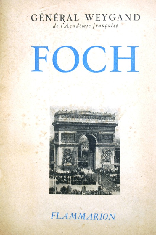
1947rif. 103197Couverture souple. Broché. 370 pages.
2015Ex-library book with the usual stamps, stickers, etc. Binding is solid and text/interior is clean and free of marking of any kind. Barely used; interior is perfect, covers show no wear, maps, b&w illustrations throughout.
2014New English Paperback. Pbo. Large 8vo. (21 x 21 cm). In English and Turkish. 42 p. Color and b/w ills. Beyoglu - Pera (Constantinople) from incunabulum to present day. Maps of Beyoglu.= Beyoglu haritalari. [Exhibition catalogue]. 04-15 December 2012.
1982pp. 298 + Plus photographs. Numerous battle and combat diagrams and maps. 8vo. Original full cloth backed binding, stained. Reprint of the 1967 edition. Coldwar/Economics 1
1946175p. + 21 Two page color maps of individual arrondissements, tab indexed + a Large folding colored map, broken at some folds. Text in French and some English. Penciled addresses. Inked ownership of John Wolf, 1947, on title page. 24mo. Original full cloth binding, lettered in silver. Very worn. Hardbound. TRAVEL/3
1985Fine English Paperback. Pbo. 12mo. (17 x 11 cm). In English. 16 p., 1 map. Map of Japan by Mahmud of Kashgar; The oldest map of Japan drawn by a Turk, Mahmud Kashgar.
1986Fine English Paperback. Pbo. Roy. 8vo. (24 x 17 cm). In English. 20 p., 1 map. The oldest map of Japan drawn by a Turk Mahmud of Kashgar. The map of America by Pirî Reis.
1954pp. vii, 311. Text maps. 8vo. Original full cloth binding. Original dust jacket, worn at extremities. AFRICA/4
1906rif. ABE-4557144886EN COUVERTURE LES AFRIKANDERS A L'ENTRAINEMENT UNE PASSE DE BROOKS-LA COURSE DE VITESSE EN 1907-LES VOITURETTES AU SALON-AU GUIDON ELLEGAARD/PHOTO-COMMENT ON GAGNE UNE COURSE DE VITESSE/2P-LES VIRAGES EN TOBOGGAN/DOUBLE PAGE-LE DECHIREUR DE CARTES PAR JACQUES MORTANE/1P/3 PHOTOS-L'ECOLE DES ACROBATES/2P/5 PHOTOS-LES SPRINGBOCKS HORS DES TOUCHES/2P-LE TROTTING EN HIVER-PAS DE COUV EXT
1750rif. A163Paris, s.e., s.d. (vers 1750) ; 250/325 mm, 1 pp., une feuille. Carte provenant certainement d'un livre de voyage du XVIIIème siècle. Bon état.
1750rif. A169S.l., s.e., s.d. (vers 1750) ; 255/185 mm, 1 pp., une feuille. Plan provenant certainement d'un livre de voyage du XVIIIème siècle. Bon état.
1750Paris, s.e., s.d. (vers 1750); 165/175 mm, 1 pp., une feuille. Planche provenant très certainement d'un livre de voyage du XVIIIème siècle. Bon état.
1750Paris, s.e., s.d. (vers 1750); 220/265 mm, 1 pp., une feuille. Plan provenant certainement d'un livre de voyage du XVIIIème siècle. Bon état.
1750Paris, s.e., s.d. (vers 1750); 170/220 mm, 1 pp., une feuille. Plan provenant d'un livre de voyage du XVIIIème siècle. Bon état.
1750Paris, s.e., s.d. (vers 1750); 220/160 mm, 1 pp., une feuille. Planche provenant certainement d'un livre de voyage du XVIIIème siècle. Bon état.
rif. 20334Guilherand, Impressions Modernes, 2002, Broché, couverture illustrée. in-8, titre illustré, 182 pages, nombreuses photos (reproduction de cartes postales anciennes) avec un texte d'accompagnement, envoi autographe signé de l'auteur.
1890Feuille 34 x 26 cm. Rousseurs.
rif. 35142Paris, M.A. Editions, 1982. 16 x 24, 255 pp., très nombreux dessins, broché, bon état (2 cachets privés).
1950rif. 59371950 1 carte sous chemise éditeur in-octavo, couverture recto illustrée, plan déplié in-folio, 1 cartouche plan sommaire de la ville de Nantes et en dessous carte sommaire de lile de Noirmoutier, les années 30-40 environ nantes Offert par Bugnot - Lacroix et Noël Tailleurs au Grand Bon Marché,
1890Une feuille 90x63 cm. Plis r?par?s.
Une feuille 44x64 cm.
1feuille 75x56 cm.
1949Couerture orange. R?par?e, traces de scotch.
