12.630 risultati
rif. U1-S-AO-new_HK_19469-NDHardcover. New. Free shipping. Dispatch on all orders before 3pm same day. Seller SKU: U1-S-AO-new_HK_19469-ND hardcover
1940Very Good Turkish Original b/w folded geological map of Ramandag oil field / area in Mardin and Batman. Oblong folio. (38 x 59 cm). Legends in Turkish; bilingual title in English and Turkish. It shows Raman oil field in Mardin and Batman cities of Southeast Anatolia, and Dicle River (Tigris). on south. Rare.
1874pp. 541, (3) [Publisher's catalogue] + Color lithograph folding map of Jerusalem and Color lithograph Frontis + Ninety full page engravings. Map has 1 1/2" tear in left margin with no loss. Some engravings have dampstaining in margins. Text elaborately ruled throughout. Lacks front and rear marbled fly leaves. 225mm. Front board detached. Spine very worn. Virtually disbound. This perhaps should best be considered a candidate for rebinding. **PRICE JUST REDUCED! HOLY LAND BX 1
1860pp. lviii, 560, 32 [Publisher's catalogue] + Seven colored folding maps and five woodcut maps. Foxed. Offsetting from folding maps. Frontis folding map slightly torn at margin. Slight damp staining last signature. Bookplate of John D. Zimmerman. Large 8vo. 9 x 5 1/2 inches. Original full dark blue publisher's cloth binding. Gilt lettered spine. Bottom corner of front and rear boards damp stained. Hardbound. Arthur Penrhyn Stanley (1815-1881) was an English churchman, Dean of Westminster. He was a 'Broad Churchman' and was the author of various works on Church History. **PRICE JUST REDUCED! JUDAICA BOX 1
1970Informative vintage guide to Poland for visitors fiinely packed with details of historic places and attractions. Includes :28 itineraries, 61 alternative routes and diversions, 52 schematic plans of towns, 6 diagrams of the regions, 30 diagrams of historical monuments,7 schemes of itineraries, car map of Poland about 8,500 miles of described routes, 877 localities. 439p. index.A pocket inside back cover has an unused folded detachable map of Poland, and also endpaper maps.Enought to deflates Michelin! [6 copies found in WorldCat] Book
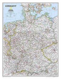
2012rif. DADAX1597755052National Geographic Maps 2012-03-19. 2012. map. New. 3.50x3.50x37.15. Buy with confidence. Excellent Customer Service & Return policy. National Geographic Maps unknown
rif. 0007395426.Gpaperback. Good. Access codes and supplements are not guaranteed with used items. May be an ex-library book. paperback
2020rif. G000834440XI4N00Collins Publishers 2020. Hardcover. Very Good. May have limited writing in cover pages. Pages are unmarked. ~ ThriftBooks: Read More Spend Less.Dust jacket quality is not guaranteed. Collins Publishers hardcover
rif. SONG1420313487Used: Good unknown
rif. 42599476like new. unknown
rif. 1332615007.Gpaperback. Good. Access codes and supplements are not guaranteed with used items. May be an ex-library book. paperback
rif. DADAX0803630522New unknown
rif. DADAX0831713720New unknown
rif. DADAX0792250265Natl Geographic Society Maps 2015-10-13. 2015. map. New. 8.31x0.20x10.98. Buy with confidence. Excellent Customer Service & Return policy. Natl Geographic Society Maps unknown
rif. 1845879619.Gmap. Good. Access codes and supplements are not guaranteed with used items. May be an ex-library book. unknown
rif. 1877689742.Gmap. Good. Access codes and supplements are not guaranteed with used items. May be an ex-library book. unknown
1714rif. 145701Pieter van der Aa, Leiden, 1714. schöne Kupferstich-Karte,
1930rif. 26129Chateaubriant André Quinquette Imprimeur 1930 -in-8 broché une plaquette, brochée bleue in-octavo Editeur (booklet in-octavo Editor)(25,3 x 16,8 cm), dos muet (spine without title), première de couverture imprimée en noir(front cover printed), quatrième de couverture muette (back cover without text), toutes tranches non rognées (all smooth edges), Envoi autographe manuscrit de l'Auteur à l'encre noire en haut de la page de garde : "...à Mr Chapeau avec toute ma sympathie....(signé).. Chapron..."[François Chapeau (1863-1939)Ébéniste devenu photographe, librairie, bouquiniste et éditeur de cartes postales historiques créées à partir de documents anciens (gravures, daguerréotypes, etc.)]illustration :1 plan dépliant en frontispice sur double page du château (illustration : 1 folding plan of the castle) + 6 photographies hors-texte en noir sur papier glaçé , 63 pages, 1930 à Chateaubriant André Quinquette Imprimeur-Editeur,
1842rif. 27459Chatellerault J. Henry imprimeur-lithographe 1842 carte ancienne gravée en noir , cartouche colorée d'époque en vert , rouge, marron, bleu et jaune. Lithographie recto-verso d'Alexandre Corbin, Format total : 40 centimètres de haut par 26,5 centimètres de large, 1842 [Chatellerault] : [J. Henry imprimeur-lithographe] Editeur,
rif. 1841393312.Gmap. Good. Access codes and supplements are not guaranteed with used items. May be an ex-library book. unknown
rif. SONG1856487334Used: Good unknown
rif. 0484452460.Ghardcover. Good. Access codes and supplements are not guaranteed with used items. May be an ex-library book. hardcover
rif. 0364915072.Ghardcover. Good. Access codes and supplements are not guaranteed with used items. May be an ex-library book. hardcover
rif. 9993347159.Gmap. Good. Access codes and supplements are not guaranteed with used items. May be an ex-library book. unknown
rif. 30643499-nnew. unknown