Antiquariat.de
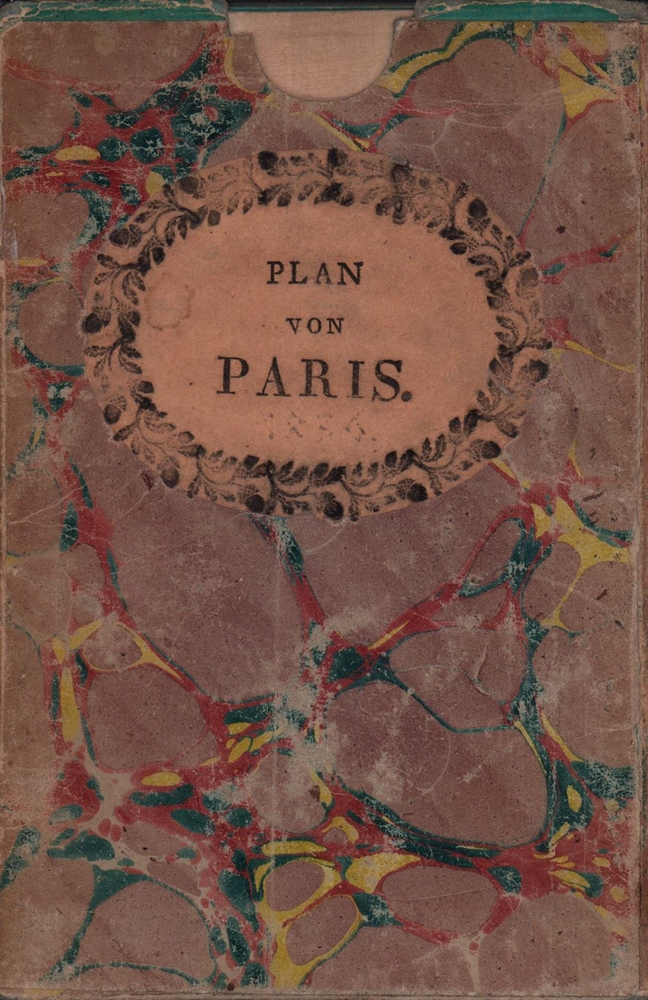
1836Best.-Nr. 78791München, in der literarisch artistischen Anstalt, 1836. 1 mehrfach gefalteter teilkolor. lithogr. Plan im Maßstab 1:16.000 mit eingeschaltetem kl. Umgebungsplan im Maßstab 1: 350.000. Blattgröße ca. 46 x 60 cm. Mit türkisfarb. Papierstreifen gefaßt. In marmor. Karton-Schuber der Zeit (16 x 10,5 cm).
Best.-Nr. 37425 volumes petit in 4 demi-cuir marron à nerfs,tomaison, fers,filets dorés.Texte sur 2 colonnes,très nombreuse illustrations par Hubert CLERGET dans et hors texte Très nombreuses cartes et plans en couleurs, la plupart sur double page,gravés par ERHARD Jules Rouff & Cie 1888,très bon état.Tome I: Avant-propos des auteurs et bibliographie ayant servie à l'élaboration de cette collection,Etude Générale,Villes Hanséatiques,Etats Hambourgeois,Lubeckois, Brêmois et Alsace-Lorraine-Tome II:Grand-Duché de Hesse, de Bade,Etats de la Thuringe,Grand-Duché de Mecklembourg-Schwerin,Grand-Duché de Mecklembourg-Strelitz,Duché de Brunswick,Duché d'Anhalt,Principautés de Waldeck,de Lippe, de Lippe-Schaumbourg et Grand- Duché d'Oldenbourg-Tome III: Royaumes de Bavière,de Saxe et de Wurtemberg-Tome IV:Etude Générale de la Prusse,PrusseRhénane,Brandebourg, Prusse Orientale,Prusse Occidentale,Poméranie-Tome V:Posnanie, Silésie,Saxe(Province de),Schleswig-Holstein,Westphalie, Hesse-Nassau,Hanovre,Hohenzollern Complet en cinq volumes.Rousseurs éparses plus ou moins fotres.Plus concentrées à certaines pages,quelques palts légèrement frottés . Bon ensemble, très solide,coloris frais
Best.-Nr. 12029DBo.J. Peter Schenk der Jüngere, geboren am 15. Februar 1693 in Amsterdam, gestorben am 14. Januar 1775 ebenda. Deutscher Kupferstecher und Kartenverleger, der als bedeutendster Verleger sächsischer Spezialkarten in der ersten Hälfte des 18. Jahrhunderts gilt. [4 Warenabbildungen]
Best.-Nr. 10768Les inondations de l’Yser et la compagnie des sapeurs pompiers du génie Belge. In 4 demi cuir fauve raciné à nerfs, faux-titre, titre, portrait de Léopold CALBERG tué à l’écluse de l’Yser le 16 juillet 1917. XX-148 pages, 551 figures (photos) et plans, certains dépliants, table des gravures III tables des photographies et des croquis supplémentaires relatifs aux chapitres I à XII (photos 138 à 551) 1pgae lexique de la terminologie locale, errata, 2 table des matières. Grande carte dépliante des inondations de l’Yser et Wateringue du nord de Furnes. Paris Berger-Levrault-Liège, Henri Desoer- Londres, Constable & Cie 1922. L’ensemble sur papier couché, non rogné. Edition originale. Bon exemplaire, peu courant
184712mo [20 x 13 cm]; vii, 358 pp, lithographed folding map as frontis (short tears at stub & fold), half title page is present. contemporary half leather, marbled boards, gilt title lettering on leather spine label, light wear at edges, very good, sound and solid copy. A picture of this book is available upon request by email. A narrative and intelligent description by a Scot who travelled extensively in the area, including politics, towns and cities, agriculture, natural history, indigenous peoples, business opportunities, geology, volcanoes, etc. This contains the first map of the Republic of Central America and one of the few ever published since the republic broke up shortly after into the separate nations that exist today. Sabin 21317. Parker, Travels in Central America. Markman 49: 'General description of Central America at mid-nineteenth century. Also has a description of Antigua, Guatemala and Guatemalan houses'. Welch 61. Spain & Spanish America 223. Humphreys 1707. The author's name has been spelled Dunlap in one reference. Grieb GU391: 'More than just a travelogue or journal, it includes historical accounts drawn from the existing literature. . . his accounts of contemporary political maneuvers and revolts are valuable to the historian of this era'.
1861Best.-Nr. 46642Gotha, Julius Perthes, 1861. 4to. Contemp, hcalf. Gilt spine. A small stamp to titlepage. VIII,482 pp. and 16, partly folded, lithographed maps and plans. Internally clean. + Ergänzungshäfte.
1700Best.-Nr. 86515London / Oxford, [ca. 1700). Kupferstichkarte mit zartem Grenzkolorit. Mit wappengekrönter, von figürlicher Staffage umgebener Titelkartusche, Windrose, Meilenzeiger u. Legende. Plattengröße 36,5 x 48,5 cm. Gerahmt (42,3 x 51,9 cm).
1944Pages 617-644. Features: Cover photos of the Mosquito Mark XVIII and its U-Boat strafing gun and six-pounder cannon; One-page Karsh photo-portrait of Sam Rayburn; Twelve excellent photos from Geilenkirchen, recently captured by British and French forces; Four photos at the Koenigsmacher Fort, which apparently made marine fittings; The Liberatioin of Metz - six photos in the city; Photos in the recently liberated cities of Belfort and Strasbourg; Photos of the advance on Venlo; Variety of photos of mine-clearing, destroyed German rolling stock, and humorous signs; Article entitled "Allied Advance to the Rhine" with maps; Photos of Field-Marshal Sir Harold Alexander, General Sir Henry Maitland-Wilson, and Lieut.-General Mark Clark; Two pages of illustrations of the launching of V-2 rocket bombs with explanation; Six photos of V-2 rocket parts found wrecked in Belgium; One page of illustrations explaining a simple system for castaways to make sea water drinkable; Photo of the U.S.S. "Missouri"; Interesting photos shows long contrail of V-2 rocket, four short contrails of fighters and flying fortress in foreground; Two photos of the burning U.S. light aircraft carrier "Princeton" which sunk in the battle of the Philippines; Aerial photos of the obliterated towns of Duren and Julich; Before and after aerial photos of V-2 factory at Weimar which was hammered by U.S. heavy bombers; Photos of personalities of the week include General Philippe Leclerc, Sir George Clausen, Daniel Sultan, Naik Yeshwant Chadge, V.C., John D. Baskeyfield, V.C., Col. C. Meyer, Maj.-Gen. Dunckern, Duncan Sandys, M. Mikolajczyk, David Vivian Currie, V.C., Sir Edward Grigg, M. Joseph Caillaux, C.W. Alfrey, Sir A.S. Eddington, Count Carandini, and Tulbahadur Pun, V.C.; Photos of damage to Florence - medieval sites destroyed by hun vandalism; and more. Unmarked with average wear. Coverfold taped. A sound vintage copy. Book
1944Pages 589-616. Features: Cover illustration of the capsized "Tirptz" in Tromso Fjord; One-page Karsh photo-portrait of Elmer H. Davis, U.S. Director of the Office of War Information; Two-page illustration of Captain David Jamieson winning a V.C. as he directs an action to save a bridgehead; Photo of Himmler reading Hitler's proclamation at delayed celebration of the Munich beer cellar putsch; Photo of Hitler awarding Belgian Rexist leader, Leon Degrelle; Photos of British Second Army tanks in action on the Western Front; Photo-illustrated article entitled "The Allied Offensive in the West; Five photos in the wrecked German town of Gressenich, captured by the U.S. First Army; Two pages of maps showing the Western Front; Six photos of the U.S. Sixth Army in action in Germany; Photos of personalities of the week include Sir Charles Craven, Rhoderick McGrigor, Sir Robert Kelly, General Koenig, Major-General Bedell Smith, Churchill visiting French troops at Besancon, Air Chief-Marshal Sir Trafford Leigh-Mallory and his wife, Marjorie Maxse, A.C. Maclaren, Dr. H. Colijn, A.G. Williams and J.B. Tait (the men who led the attack on the "Tirpitz"; Centrefold compilation of seven photos with General Patton's Third Army in and around Metz; Two pages of fascinating illustrations explain the "Hollow Charge" - the deadly explosive principle which uses blast to bore a hole through solid armour; Photo of American jet-propelled P-59A Airacomet; Photo of U-boat"U-570" renamed H.M. Submarine "Graph" on surface; Photos of "Buffalo" amphibious tank; Nostalgic ads; Two pages of photos of the U.S. Liberation of Leyte; and more. Unmarked with average wear. Coverfold taped. A sound vintage copy. Book
1889Counties individually colored. Outer dimensions: 21.75" x 14.5". Unmarked with moderate wear. Center fold. 2" opening to bottom edge near fold mended with archival tape. A quality vintage copy. Bonus: includes separate extensive list of New York's counties and towns/cities and their (1889) populations. Book
1918This copy bearing the ink stamp of F.R. Swanton of Davis Point, Manitoba. Frederick Swanton served in the 200th (Winnipeg) Battalion, Canadian Expeditionary Force (CEF) during WWI. Illustrated red card covers measure 8.25" x 5.5". Map folds out to 40" by 31". Undated but appears to be circa 1918. Issued as a supplement to Montreal publications The Family Herald and Weekly Star by permission G.W. Bacon & Co. Ltd., 127 Strand, London. Detailed black and white map of Europe presents the setting of World War I, presumably as a reference for Canadians following the progress of the war. Average wear. Several unobtrusive clear tape repairs. A sound vintage copy of this Canadian WWI memento with special noted provenance. Book
1994198 pages including index. Maps and mapping strategies in Contemporary Canadian and Australian fiction. Examines maps as ambivalent symbols of national culture, as vehicles for the representation of cultural history, and as often self-parodic analogues for the literary text. Clean, bright and fresh copy in attractive green cloth boards. Small chips from upper edge of dust jacket back panel. An excellent copy. Book
195464 pages. Features: Nice colour RCAF ad inside front cover; Dispute Still Surrounds Duff Cooper; More Canadians than Jobs; Lovely colour full-page ad for 1954 DeSoto automobiles; The Seven Living Ghosts of Nuremberg - an uncensored first-hand report from behind the bars of Spandau where Rudolf Hess, Karl Doenitz, Baldur Von Schirach, Walther Funk, Erich Raeder, Albert Speer and Baron Konstantin Von Neurath - top Nazis - imprisoned for crimes against humanity wait out the tortuous years while the world forgets they exist - with photos; Athabaska's Atom Boom - Albert Zeemel's discovery of Uranium sparks the development of Uranium City, Saskatchewan - great article with many photos; The Maps that Charted our History - a famous collection, published here for the first time, show the slow evolution of Europe's knowledge about Canada; How Early Map Makers Saw the Great Lakes; The Brainiest School in the Country - Dalhousie Law School - article with photos; How Papa Masella Made His Boys Make Music - Frank Masella of Montreal and his eight musical sons; In the Lost World of the Cypress Hills - this strange mountain on the prairies harbors tropical scorpions, petrified figs, fourteen kinds of orchid and a lawless past that sparked the formation of the Mounties; Are People Monkees? - fiction by James McNamee; Ford colour V-8 ad; 1954 Plymouth ad; Colour Buick ad; Chevrolet truck ad; and more. Average wear. Couple of small chips from covers. Unmarked. A quality copy. Book
1944Cover: U.S. President Franklin D. Roosevelt. Features include: Our Notebook; Book Review: "Henry Yevele, c. 1320 to 1400" by John H. Harvey; The Great World War: A Survey of Naval Operations (inc maps); Books of the Day; and The World of Science: Pastures of the Sea. Pictorial Journals include: Novel Ships of War of the Royal Navy (illus. by C.E. Turner): Sketches From Holland: Dutch Civil Guards and U.S. Paratroops (illus. Capt. Bryan de Grineau); The Ubiquitous Bulldozer: A Mechanical Tool of Peace Now Becomes an Important Weapon of War (illus. by G.H. Davis); Battlegrounds of Holland: Scenes of Walcheren Island and the Moerdijk Bridges; The Perilous and Exhausting Operations of British Troops on Walcheren Island: Landing-Craft Difficulties; The Gallant Landing of British Marine Commandos at Westkapelle, Walcheren Island, in the Face of Heavy Enemy Fire; Our Steady Advance in Italy: Scenes in the Mountain War; Shakespeare's London Modelled; Glasgow Faces Housing Problem; The Funeral of Dr. (William) Temple, Archbishop of Canterbury, in Canterbury Cathedral; The War in Europe: A Gibraltar "Find": An Historic Enthronement; How the Battle of the Flying Bomb was Won: An Exhibition in London; News Items of Interest from Holland, France, Belgium and Russia; Oxford in Wartime: Uniforms, Caps and Gowns; and Oxford "The Mother of Arts and Eloquence". Page 535/536 missing. Page 557/558 loose but present. Binding sound. Contents clean and unmarked with minimal wear. A worthy reference copy. Book
1866Best.-Nr. 10181Paris, Toulouse Hachette, Privat 1866 Un volume in-12 broché, couverture verte, 297 pages, complet de ses 12 cartes. Bon état.
1944Cover: Our Royal Field-Marshal (King George VI) Viewing the Fighting in Italy. Features include: Our Notebook; Book Review: "Excellenz X: The Leader of To-Morrow's Germans" by R.G. Waldeck; The Great World War: What Next on the Eastern Front? (inc maps); Books of the Day; and The World of Science: Summer's Emptying Nests. Pictorial Journals include: The King (George VI) in Italy: His Majesty Awards Honours and Decorations; Obstacles in the Path of Our Normandy Advance: German Defensive Methods in a Compact Countryside (illustrated by Captain Bryan de Grineau); Britain's 17-Pounder: More than a Match for German Tanks (illustrated by G.H. Davis); The Armour Against Us: Some Details of Germany's Modern Armoured Vehicles in Use in Normandy To-Day (illustrated by G.H. Davis); Blazing the Trail: Bulldozers Carving Roads Through Debris in Normandy; The Allied Offensive in Normandy: Montgomery's Great Drive; Scenes of Action at Caumont and Other Sites; Advance in Normandy: The Type of Landscape Our Forces Experience; The Devastation of Modern War: St. Lo Cathedral and Other Ruined Sites; Three Famous Places in Brittany - Now in the War News; The Scene of an Invasion Rehearsal - The Invasion Staged in Reality; The 14th Army's Success in Burma Amid Arduous Conditions; Warsaw Yesterday: Poland's Capital Under Nazi Domination; The War From Varied Angles: Topicalities Recorded by the Camera; Flying Our Wounded Home From the Battlefields of Normandy (Illus. by Flight Lieut. H.W. Hailstone); Dover-Photographed by the Enemy for His Cross-Channel Guns; and A Puzzle Posed by High-Speed Photographs of a Bullet in Flight. Prior owners ink stamp with some writing centre front cover. Some ink smudges to back cover. Contents clean and unmarked. Moderate wear. Book
1944Cover: The First Entry of Canadians into Caen. Features include: Our Notebook; Book Review: "The Bank of England: 1694 - 1944" by Reginald Saw; The Great World War: Moving on in Italy (inc maps); Books of the Day; and The World of Science: Wood Comes of Age. Pictorial Journals include: In Liberated Caen: The Mayor Hoisting the Tricolour; Caen After the Battle: The Key City of Lower Normandy, whose Capture Marked a Valorous British Victory; Two Aerial Photos: German Atlantic Wall, Eastern Section of the Cherbourg Peninsula; On the Western Front (Battle of Normandy): War and Its Aftermath; On the Western Front: Scenes From the Battle Zones of British and American Armies in Normandy; The Red Army Surges On: Important Cities in the Path of Battle; A Lancashire Fusilier's V.C.: Fusilier (Francis Arthur) Jefferson, Single-Handed, Breaking Up an Enemy Tank Attack (illustrated by Captain Bryan de Grineau); The Onward Advance of Gen. Alexander's Armies: War Scenes at Castiglione, Lake Trasimeno, The French Entry into Siena; Mediaeval San Gimignano and Its Towers; The War in Burma: The Clearing of the Kohima-Imphal Road; The Japanese Main Fleet Caught Napping - Another U.S. Sea Victory (Battle of Philippine Sea); New Additions to our Fighting Power: Flying Bombs from Start to Finish; A Threatened View - Durham Cathedral from River and Railway (illustrated by Sir Muirhead Bone); and War's Trail of Devastation in Normandy: Historic Buildings Wrecked in Fierce Armoured Battles on the Allied Front. Binding sound. Clean and unmarked with minimal wear. A quality copy. Book
1945Cover: A Triumph of Road-making: The First Allied Convoy to China to Break the Japanese Blockade. Features include: Our Notebook; Book Review: "Persons and Places" by George Santayana; The Great World War: The American Passage of the Roer (inc maps); Books of the Day; and The World of Science: The Locust's Year of Decision. Pictorial Journals include: The Rocket That Would Not Go Up! - Photos of an ill-fated rocked experiement by Herr Johannes Winkler in 1932; U-Boat Warfare - 1939 - 1945: A Survey of Changing German Submarines and Tactics in a Never-Ceasing Battle (Illus. by G.H. Davis); War Scraps: Incidents at the Front and Behind the Lines; On the Western Front: The American Advance into Germany; Battle Incidents with the Third and Seventh U.S. Armies; The Battle for Goch: British Troops in the Wrecked German Fortress Town; General Crerar's Offensive: The Storming of Cleve (Illus. by Capt. Bryan de Grineau); General Crerar's Offensive: British Troops in Mortal Combat With the Germans in the Reichswald (Illus. by Capt. Bryan de Grineau); The Zeitz Synthetic Oil Plant: Before the R.A.F. Attack - And After; War in the Pacific: Luzon Island and Iwo Jima; With the Red Army: Scenes From Liberated Poznan; Bombed Bath: Proposals for Replanning; and Masterpieces of Painting From the Cook Collection. 8" opening to page 241/242. Remaining contents clean and unmarked with minimal wear. A worthy copy. Book
191416 pages. Features: A German Friend of America to the Americans, by Ludwig Fulda; Sohmer Piano ad inside front cover; The German Sailor has "Arrived"; English Barbarism, by Hans F. Kammeyer - an account of how Germans living in England have been degraded and how terribly they are still being persecuted (2-page article); The Commander-in-Chief of the Russian Army has declared that Emperor Francis Joseph has ceased to be the ruler of Austria-Hungary and is now the King of the Jews; Alsace-Lorraine and Ireland, by James K. McGuire; Help the Germans in Canada - Aliens in their own land - Arthur v. Briesen Shows How; The Iron Cross - a poem by Frederick H. Martens; Belgium's Breach of Neutrality - article with reproductions of maps offering proof of the Anglo-Belgian military convention; "The Leopard's Spots" - a chapter of facts about England's Method of Making War, by Frederick F. Schrader; and more. Unmarked. Average wear. Two-inch opening to top of cover fold. Binding intact. A sound copy. Magazine
1861Gotha, Julius Perthes, 1861. 4to. Contemp, hcalf. Gilt spine. A small stamp to titlepage. VIII,482 pp. and 16, partly folded, lithographed maps and plans. Internally clean. + Ergänzungshäfte.
1796Best.-Nr. 209283London.: George Nicol. 1796. Engraved copperplate map on Whatman paper 43.8 x 33.6 cm; 57 x 42 cm sheet including plate markscale in nautical and English miles; light undulation to sheet marginal toning and edgewear but in very good condition. Finely engraved and detailed map of two routes to Pekin Beijing along the White River Baihe from the Gulf of Petcheli and along the Imperial Highway from Jehol and includes commentary locating palaces and gardens type of cultivation "many barges" and "the road shaded by willow trees". The map elegantly drawn by Henry William Parish was published in George Staunton's account of Earl Macartney's embassy to China 1792-1794. . George Nicol. unknown
1859Best.-Nr. 189711Calcutta.: Surveyor Generals Office. 1870. Reissue of 1859 edition. Lithographed map 57.2 x 93 cms; 61.1 x 96 cms sheet original folds old paper repairs to the verso and a sealed marginal tear central folds archivally strengthened some toning to the folds and creasing but the map in remarkably good clean condition. Impressive large Calcutta printing from the Survey of India showing Rajasthan Uttar Pradesh and surrounding states with extremely detailed delineation of settlements roads railways rivers and major points of interest the Taj Mahal is highlighted. . Surveyor Generals Office. unknown
1991Best.-Nr. 26432Paris, Christian Desbois, 1991. Série complète en 4 portraits, carte de transit imprimée aux versos.
194034.5" x 26.5" reinforced paper. N.W. 48/2. Geographical Section, General Staff, No. 4072. Compiled and drawn at War Office, 1940. Heliographed and printed at Ordnance Survey, 1940. Identifies Land Aerodromes, Landing Grounds, Water Aerodromes, Radioelectric Stations, Explosives Areas, and more. Average wear and soiling. Name in ink in upper right corner. Name in pencil along top edge. Cover not included. Book
192933" x 25" coloured map. "Showing Dominion Lands Vacant. For complete information and regulations governing homestead entry apply to agent at Peace River..." Coal mines, water developed, other minerals, undeveloped minerals, oil and gas wells, power transmission lines and main roads indicated. Unmarked with moderate wear. A quality copy of this excellent homesteading memento of the Peace River/Grande-Prairie District. Book