LABAUME (Eugène).Livre Rare Book

12.595 Ergebnisse
1815Best.-Nr. PHO-1757Paris, C. L. F. Panckoucke et Magimel, février 1815. In-8, demi-basane fauve, dos lisse orné de filets dorés, pièce de titre basane rouge, tranches jaspées.
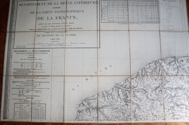
Best.-Nr. 20608Paris, Longuet, succ. de Simonneau, 1841. Ensemble complet de quatre grandes cartes (99 X 70 chacune) , échelle 1/80000e, en feuilles et contrecollées sur toile écrue (rousseurs à la toile). La première porte de grands cartouches : division, population, territoire; état indicatif du nombre et du tonnage des batiments entrés dans les ports du département (bureaux principaux des douanes, Le Havre, Rouen, Fécamp, Dieppe). Très bon état pour l'ensemble. Dans son étui de cartonnage en papier marbré, titre en long sur papier rouge. Usagé.
Best.-Nr. 7963entièrement refondue et mise au courant de la science Par Th. LAVALLEE. Six tomes en six volumes grand in 8 demi-cuir rouge à nerfs,titre,tomaison fers dorés.Furne Jouvet & Cie 1865 1869.Tome 1 faux-titre,frontispice sous serpente (Ségovie)VIII,722 pages,y compris le frontispice,33 figures en 4 planches gravées, dépliantes,et planches hors-texte gravées sur acier,sous serpente. Tome 2:faux-titre, frontispice sous serpente(Bordeaux)731 pages,y compris le frontispice,11 planches hors-texte gravées sur acier,sous serpente,y compris le frontispice.Tome 3:faux-titre, frontispice sous serpente (Venise) 692 pages,14 planches hors-texte gravées sur acier,sous serpente,y compris le frontispice.Tome 4:faux-titre,frontispice sous serpente(St Pétersbourg)722 pages,1 page de placement des gravures.12 planches hors-texte gravées sur acier,sous serpente,y compris le frontispice.Tome 5:faux-titre,frontispice sous serpente(Jérusalem)687 pages,6 planches hors-texte gravées sur acier,sous serpente,y compris le frontispice.Tome 6:faux-titre,frontispice sous serpente(Alexandrie)739 pages,1 page de table de placement des gravures.8 planches hors-texte gravées sur acier, sous serpente,y compris le frontispice.Au tome 6:Une déchirure ancienne,réparée,aux pages de table sans gravité,quelques épidermures, sans gravité pratiquement pas de rousseurs,belles gravures.Bon état d’ensemble
Best.-Nr. 4571Géographie,histoire,administration,statistiques.3 volumes grand in 8 demi-chagrin vert,titre,filets dorés,filets à froid,complet des belles cartes,par DUFOUR,en couleurs,sur papier fort,montées sur onglets.Très nombreuses gravures sur bois,Gustave BARBA éditeur sans date(1855 ?)coiffe supérieure du volume 2 fragile.Coloris très frais
1955Best.-Nr. 20488AB1955. Madrid 1955 36 : 26 cm. X pages 1 leaf 378 pages 1 leaf 241 facsimiles of maps some folded and titles. Original half calftwo back lables. One of 500 numbered copies on special paper. the illustrations are made in Photogravure a high-quality engraving technique that uses light to transfer a photographic image onto a plate traditionally copper but now often photopolymer to create deep reliefs that reproduce soft tones and fine details when printed on paper. It is ideal for artistic reproductions and precision applications on various materials combining craftsmanship with digital technology. unknown
1848Pianta di Roma edita da Alessandro Moschetti nel 1848. Viene attribuita ad Angelo Bertini – in qualità di editore – ed Enrico Salandri come incisore. “è la seconda edizione della pianta del Bertini/Salandri. Attorno alla pianta ci sono sei vedutine di Roma e 117 numeri di legenda come nella prima edizione. Le varie ristampe, come rilevato dal Frutaz, si differenziano tra loro solo per alcuni particolari dell’apparato decorativo estreno. Il prototipo di questa pianta dovrebbe essere quella di anonimo del 1820 circa, in cui piazza del Popolo si presenta ancora con un solo emiciclo realizzato. I nomi del Bertini e del Salandri sono presenti solo nella prima edizione” (cfr. Marigliani p. 363). Alessandro Moschetti, secondo quanto si legge in Giovanna Sapori e Sonia Amadio, Il mercato delle stampe a Roma, XVI-XIX secolo (p. 334) fu incisore di architetture con bottega a Roma in via Bocca di Leone, 63. Secondo altre fonti fu invece attivo a Roma prima e Napoli poi fino al 1868. Si dedicò con successo all’intaglio di vedute della città eterna, pubblicate per la prima volta nella Raccolta delle principali vedute di Roma antica e moderna (1843). La raccolta, che comprende un frontespizio figurato e 35 tavole incise in rame dal Moschetti su disegni di Marchi, Ciconnetti e Zolla, "il cui numero può variare da un esemplare all'altro" (cfr. S. Rossetti, n. 7252) è assai ricercata per la pianta di Roma nel 1843 e soprattutto per le vedute arricchite di scene popolari tipiche del folclore civile e religioso dell'epoca. Successivamente le vedute di Moschetti furono ristampate, in numero sempre crescente. Il presente esemplare è tratto dalle 70 Principali vedute di Roma 1861. Proprietà Cesari, reperibile in via Petra n.89. Scudi 6. Incisione in rame, in ottimo stato di conservazione. Bibliografia Cfr. Marigliani, Le piante di Roma nelle collezioni private (2007), p. 363, n. 297; Frutaz n. 199; Scaccia Scarafoni n. 298. Map of Rome edited by Alessandro Moschetti in 1848. It is attributed to Angelo Bertini -as publisher - and Enrico Salandri, as engraver. “è la seconda edizione della pianta del Bertini/Salandri. Attorno alla pianta ci sono sei vedutine di Roma e 117 numeri di legenda come nella prima edizione. Le varie ristampe, come rilevato dal Frutaz, si differenziano tra loro solo per alcuni particolari dell’apparato decorativo estreno. Il prototipo di questa pianta dovrebbe essere quella di anonimo del 1820 circa, in cui piazza del Popolo si presenta ancora con un solo emiciclo realizzato. I nomi del Bertini e del Salandri sono presenti solo nella prima edizione” (cfr. Marigliani p. 363). Alessandro Moschetti, according to Giovanna Sapori and Sonia Amadio, Il mercato delle stampe a Roma, XVI-XIX secolo (p. 334) was an engraver of architecture with a workshop in Rome at Via Bocca di Leone, 63. According to other sources, he was active first in Rome and then in Naples until 1868. He devoted himself successfully to the engraving of views of the Eternal City, published for the first time in the Raccolta delle principali vedute di Roma antica e moderna (1843). The collection, which includes an illustrated frontispiece and 35 plates engraved in copper by Moschetti on drawings by Marchi, Ciconnetti and Zolla, "the number of which may vary from one copy to another" (cf. S. Rossetti, n. 7252) is much sought after for the plan of Rome in 1843 and especially for the views enriched with popular scenes typical of the civil and religious folklore of the time. Subsequently, Moschetti's views were reprinted in increasing numbers. The present example is taken from the 70 Principal Views of Rome 1861. Copper engraving, in excellent condition. Bibliografia Cfr. Marigliani, Le piante di Roma nelle collezioni private (2007), p. 363, n. 297; Frutaz n. 199; Scaccia Scarafoni n. 298.
196620 planches et 20 feuilles de descriptions et notices. Couverture d?fraichie.
Best.-Nr. 6788S. l., P. F. Tardieu et P.H. Macquet, circa 1790. 2 feuilles à superposer (102 x 49,5 cm) x 2. Exemplaire avec réhauts de couleurs et à très grandes marges avec les îles Anglo-normandes dans un encart.
1819A Paris, chez Debray, 1819. In-4 relié cartonnage vert de l'époque de 2, 40, 8, 8, 8, 8 et 8 pages.Ce plan gravé et réduit géométriquement d'après MM Verniquet, Architecte, et Lagrive, Ingénieur, s'étend au-delà des limites nouvellements fixées ; ou sont figurées divers embranchements et bassins des Canaux de l'Ourcq et de l'Yvette tant projetés qu'exécutés, avec leur description ; l'indice de principaux monumens et Etablissemens publics, tant anciens que nouveaux, qui sont établis dans cette vaste cité ; suivi de quelques notes véridiques des Evènemens extraordinaires arrivés dans cette grande ville. Bien complet des 4 plans dépliants en couleurs, ainsi que des 4 tableaux : Du plan de St Denis, lieu destiné depuis plusieurs siècles à la sépulture des Princes français. Du plan ou carte générale du canal de l'Ourcq à Paris, conçu en 1520, où plus de 22 millions ont déjà été employés. D'un plan et description de la Scie mécanique, destinée à récéper les pilotis au fond de l'eau, sans bâtardeaux ni épuisemens dans les travaux hydraulyques, et au moyen de laquelle on économise un tiers dans les dépenses, d'après MM. Perronet, Voclio et Cessart, célèbres ingénieurs de France, méritant d'être connus. D'un plan du premier Pont construit à Paris par ce procédé, avec description. Notes de l'éditeur sur quelques articles des embellissemens de Paris. Précis historique des canaux de l'Ourcq, de Saint Denis et de Saint Maur, à Paris. Analyse des canaux, des rivières de l'Yvette, de la Bièvre, de l'Orge, de la Juine et de l'Essone. Des rousseurs néanmoins bon exemplaire pour cet ouvrage intéressant sur les canaux de PARIS.
1819Best.-Nr. 193641chez Debray A Paris, chez Debray, 1819. In-4 relié cartonnage vert de l'époque de 2, 40, 8, 8, 8, 8 et 8 pages.Ce plan gravé et réduit géométriquement d'après MM Verniquet, Architecte, et Lagrive, Ingénieur, s'étend au-delà des limites nouvellements fixées ; ou sont figurées divers embranchements et bassins des Canaux de l'Ourcq et de l'Yvette tant projetés qu'exécutés, avec leur description ; l'indice de principaux monumens et Etablissemens publics, tant anciens que nouveaux, qui sont établis dans cette vaste cité ; suivi de quelques notes véridiques des Evènemens extraordinaires arrivés dans cette grande ville. Bien complet des 4 plans dépliants en couleurs, ainsi que des 4 tableaux : Du plan de St Denis, lieu destiné depuis plusieurs siècles à la sépulture des Princes français. Du plan ou carte générale du canal de l'Ourcq à Paris, conçu en 1520, où plus de 22 millions ont déjà été employés. D'un plan et description de la Scie mécanique, destinée à récéper les pilotis au fond de l'eau, sans bâtardeaux ni épuisemens dans les travaux hydraulyques, et au moyen de laquelle on économise un tiers dans les dépenses, d'après MM. Perronet, Voclio et Cessart, célèbres ingénieurs de France, méritant d'être connus. D'un plan du premier Pont construit à Paris par ce procédé, avec description. Notes de l'éditeur sur quelques articles des embellissemens de Paris. Précis historique des canaux de l'Ourcq, de Saint Denis et de Saint Maur, à Paris. Analyse des canaux, des rivières de l'Yvette, de la Bièvre, de l'Orge, de la Juine et de l'Essone. Des rousseurs néanmoins bon exemplaire pour cet ouvrage intéressant sur les canaux de PARIS. Auteurs / Cartographes de référence : Ce plan a été réduit et gravé géométriquement d'après les travaux colossaux d'Edme Verniquet (célèbre architecte auteur du monumental plan de Paris de 1791) et de Jean-Baptiste de La Grive (ingénieur géographe). L'intérêt de ce document réside dans le fait qu'il ne se contente pas de cartographier le Paris de l'époque, mais propose une véritable rétrospective urbanistique en deux volets : L'évolution des différentes enceintes successives de la ville (l'enceinte romaine, celle de Philippe Auguste, de Charles V, de Louis XIV, et le mur des Fermiers généraux).L'indice des monuments anciens disparus et des nouveaux établissements publics. Des notes historiques sur les événements extraordinaires survenus à Paris. Un précis et une analyse des canaux de l'Ourcq, de Saint-Denis, de Saint-Maur, de l'Yvette ou de la Bièvre (projets majeurs de Napoléon pour alimenter Paris en eau potable et faciliter le commerce). L'ingénierie moderne : Les éditions contiennent souvent des planches techniques aquarellées, comme une coupe du célèbre Pont de la Cité ou le schéma d'une "scie mécanique destinée à recéper les pilotis au fond de l'eau sans bâtardeaux".
1924Best.-Nr. 846CG1924. Bleistiftzeichnung. Bildausschnitt: 20 x 27 cm.
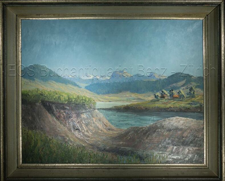
Best.-Nr. 664DGOel auf Leinwand. Bildausschnitt: 40 x 62 cm.
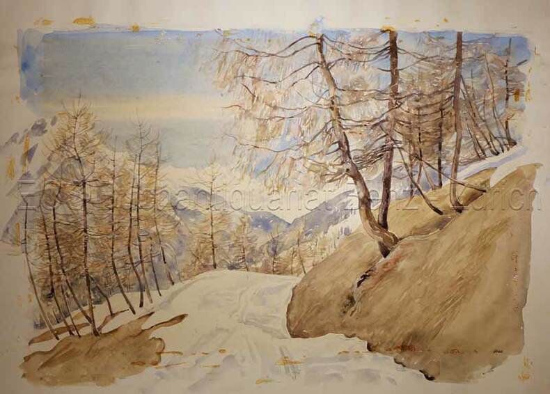
1950Best.-Nr. 633DGum 1950. Aquarell auf festem Papier. Blattgrösse: 36 x 50 cm.
Best.-Nr. 661DGOel auf Leinwand. Bildausschnitt: 43 x 54 cm.
1966Best.-Nr. 744DGGattikon, Verlag Dorfpresse. 1966. Zehnfarben Lithografie auf festem Papier. Blattgrösse: 97 x 139 cm.
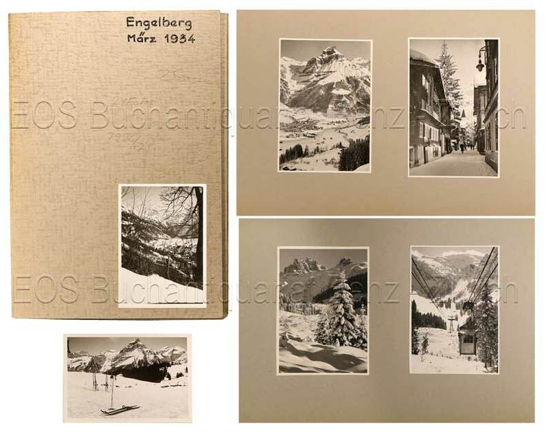
1934Best.-Nr. 792CG1934. 24 Fotografien, montiert auf Halbkarton. Format: ca. 8 x 6 u. 6 x 8 cm.
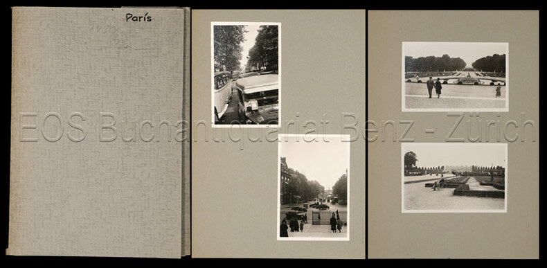
1930Best.-Nr. 743CGum 1930. 36 Fotografien, montiert auf farb. Halbkarton. Format: ca. 8 x 6 u. 6 x 8 cm.
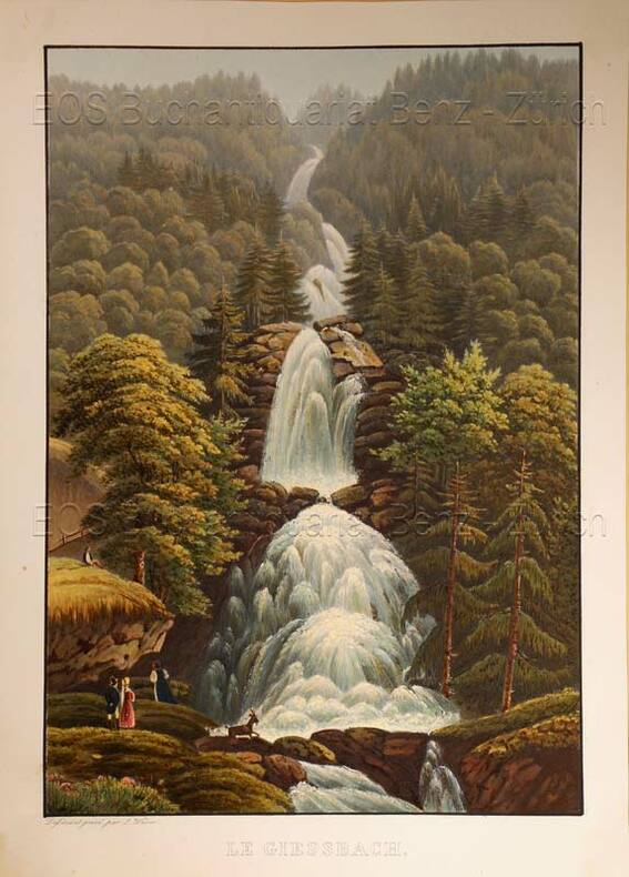
1935Best.-Nr. 619DGO.O., um 1935. Altkolorierte Aquatinta von Lukas Weber. Bildgrösse: 24,8 x 17,3 cm. Blattgrösse: 28,3 x 20,2 cm.
1947Best.-Nr. 811CG1947. Oel auf Leinwand. Bildausschnitt: 37 x 49 cm.
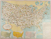
1955Best.-Nr. 172003Washington D.C.: 国務省. Kokumishō. No date. circa1955. Large folding Japanese coloured map of the United States with 3 inset maps at foot of map showing main railways air and highway routes and hemispheres at the top right. Some browning mainly visible on reverse still a good copy. 66 x 81cm. An intricate and detailed pictorial map of the United States published in Japanese by the US State Department. The same type of map had been published since 1945 in English and subsequently in other languages. The Japanese language map is hard to find. The map is undated but was probably produced in the 1950's. The images include depictions of women board riders in two piece swimsuits of the sort popular in the 1950s but the inset text lists Alaska and Hawaii as external territories of the US indicating that the map was produced before they attained statehood in 1959. An inset panel provides information on the area and population of the US the population of major American cities mineral and other resources climate and topography. A note at the bottom right hand corner of the map states that copies of the map can be obtained free of charge from your nearest US Information Office. Every region of the country is decorated with an illustration of the natural resources industries or cultural or historical resources associated with that particular place. These include images of early colonial settlers the birthplaces of Mark Twain and Woodrow Wilson Booker T. Washington's house and Abraham Lincoln's grave; images of major dams oil fields coal mines cotton plantations etc. various animals and crops and images of ships cars and public buildings including the Statue of Liberty located rather oddly far out at sea. . 国務省. [Kokumishō]. unknown
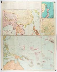
1943Best.-Nr. 206908Chicago.: Geographical Publishing Company. 1943. 10 printed colour maps on a large single sheet 91 x 71 cm small inset map of the European theatre chronology of events original folds a few short fold splits archivally sealed; in very good condition. A suite of numbered U.S. war maps with Allied action overstamped in red by the publisher that for Germany and France with pictorial stamps for strategic targets including "Chemical Factories" and "Airplane Factories". The maps numbered 1 to 10: English Channel; Italy; Southern Greece; Western Mediterranean Sea; Germany and France; Baltic Sea and Scandinavia; China Burma India; Japan; Tokyo; and Greater Pacific Battle Zone: a large half sheet map noting the placement of US and Japanese bases. The "Chronology of Important War Events" lists action from the bombing of Pearl Harbour: "Japan's day of Infamy: Japanese air attack cripples American Fleet at Pearl Harbour" to March 21 1944 "Germans take over key political posts in Bulgaria and Romania". Issued by the Geographical Publishing Company of Chicago this educational sheet includes an advertisement for WLS Chicago "The prairie farmer station" with a list of their war broadcasts and a world clock. . Geographical Publishing Company. unknown
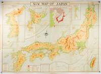
1935Best.-Nr. 214827Tokyo.: Nihon-Kenkyusha. 1935. Large folding colour map of Japan 74.3 x 10⁵ cms; folding into printed card covers 27 x 19.5 cms: 9 insets: Chosen Korea; Hokkaido; Chisima Islands; General Map of Japan and Manchuokuo; Karafuto Saghalien; Okinawa Loochoo; Taiwan Formosa; Micronesia; Ogasawara; Hajijoshima; the covers a litle worn and marked and the sheet slightly toned but the map is in very bright clean condition. Scarce World War II era map of Japan including Korea published in English by Kenkyusha. Founded in 1907 it had a history of publishing for students of English and the English market. An attractively composed map in remarkbable condition; with the insets circled around the islands of Japan heights marked in graduations from green to red and showing provinces railways roads steamer routes Buddhist and Shinto Temples. . Nihon-Kenkyusha. unknown
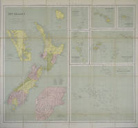
1865Best.-Nr. 154409London.: George Philip & Son. 1865. 9 coloured maps by William Hughes segmented and mounted on linen 55.3 x 65.2cm. Folds into cloth covered case 17.2 x 12cm. Spine of case little faded and ribbon tie missing. Relief shown by hachures and spot heights. Philips' series of travelling maps series. Very good copy. Features a dominant map of New Zealand with 3 maps as insets to this map and 6 other maps separately shown within their own borders. The 3 inset maps are: Norfolk Island and Philip Island; Enlarged map of Auckland and the adjacent country; Enlarged plan of the country around Dunedin and the eastern portion of the Otago Gold Fields from Thomson's map. The 6 maps in addition to the New Zealand map are The Ladrones or Mariana Islands; The Sandwhich Islands; The Galapagos Islands; The New Hebrides and Santa Cruz Islands; The Feejee Friendly and Samoan Islands; The Marquesas Society and Low Archipelago. The New Zealand maps includes a list of native tribes and their locations. . George Philip & Son. hardcover
2000Fine Fine English Original bdg. with original dust wrapper. DJ. Folio. (39 x 32 cm). In English and Turkish. First Edition. 338 p., 291 ills. in total including b/w and colors: Color ills. of 245 maps (some of them 2 page-sized) and 46 small ills. including some of Constantinople photos and maps. The Pervititch maps that are published in this book should be interpreter from this general point of view. Istanbul realized its modernization in the second half on the 19th century. The frequent fires that occurred in the city were major disasters for its inhabitants, but at the same time created opportunities for the city administrators who intended to push through this modernization. In the aftermath of the 1870 Beyoglu fire, one of the biggest of these fires, a significant change occurered in the realitonship between society and fires. The population of Istanbul became acquainted with insurance that covered fire risks. Numerous insurance companies established branches in Istanbul. Fire insurance became a productive industry. This development turned maps showing the fire risks in the building stock of the city an extremely necessary source of information for insurance companies. Initially, insurance maps were commisioned to the C.E. Goad Company for a rahter limited area of the city between 1904-1906. Later, Jacques Pervititch prepared much more detailed maps covering almost the entire area of the city for the Central Office of Turkish Insurance Agents. Pervititch drew over 230 maps between 1922 and 1945.
Best.-Nr. CSP-1925Chez Samuel Bagster, non daté mais avec une dédicace à la plume en page de garde datée du 30 aôut 1860. In-18 (9,5 x 14,5 cm), relié plein cuir, dos à 5 nerfs, caissons gravés, tranches dorées en magnifique état hormis deux petites rognures (voir photos). 585 pages + 187 pages avec 5 cartes géographiques colorées.