Collins MapsBiblio.com
12.201 Ergebnisse
Best.-Nr. SONG0008276404Collins 2018-10-01. spiral_bound. Used: Good. 0.00x6.00x8.25. Buy with confidence. Excellent Customer Service & Return policy. Collins unknown
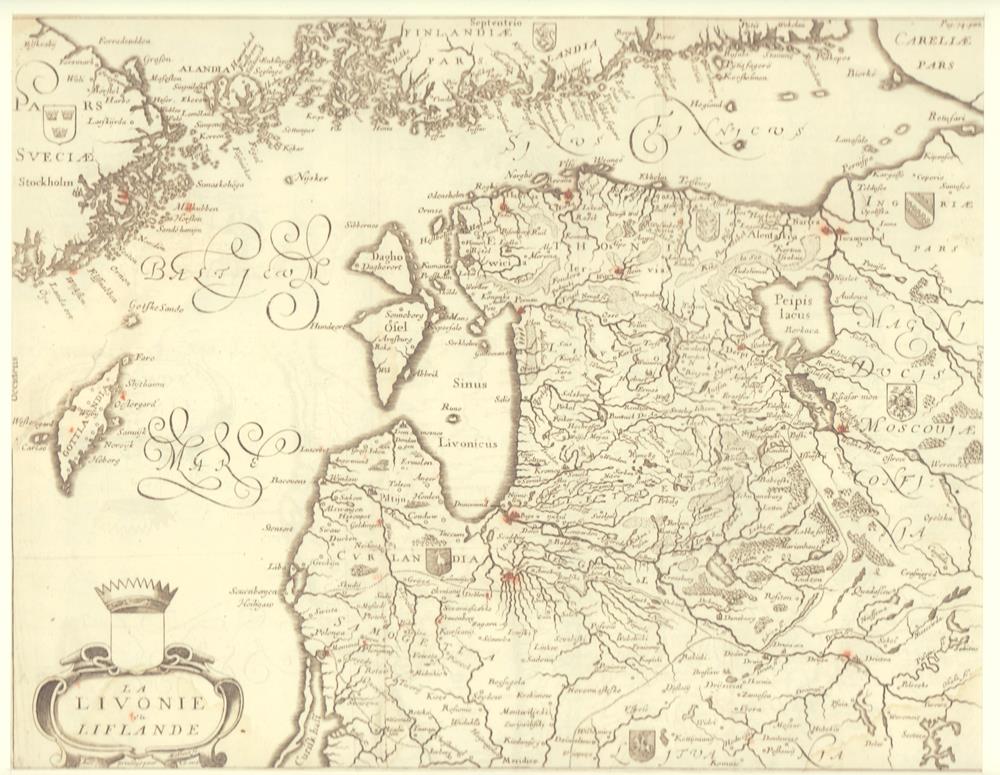
1679Best.-Nr. 78821[Paris, A. Dezailler, 1679]. 28,5 x 36,5. Unter Passepartout.
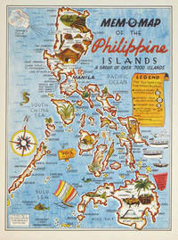
1945Best.-Nr. 204557U.S.A.: Mem-O-Map Co. 1945. Colour pictographic / pictorial map 32.1 x 23.8 cms; 35.4 x 26.6 cms sheet very good condition. Rare pictorial map published in 1945 by John G. Drury aTechnical Officer who served with the 214th Ordnance Battalion to mark the end of World War II as souvenirs for the military. Military personnel could fill in banners "came in on good ship." and "departed on good ship." their name organisation and "Line of Advance or movement" blank in this example. Pictographs mark various memorable spots and wildlife including larger-than-life insects. A "Terrible Tillie Typhoon" looms over the coast at Luzon. Drury published a series of five maps: Philippines and Okinawa in 1945; Japan and Korea Oahu and Europe in 1946. They are all scarce. “These almost whimsical maps are designed to support the creation of personalised geographies. At a time when digital mapping is beginning to experiment with the creation of personalised content that would render the same map in different ways for different users Mem-O-Maps demonstrate the principle in action." Kenneth Field ICA Commission on Map Design. . Mem-O-Map Co. unknown
1898Best.-Nr. 214719Paris.: Erhard Frères. 1898. Lithographed folding colour map 44.5 x 49.5 cms; 54.6 x 76.3 cms sheet towns and cities items of production and trade routes highlighted in red original folds in very good clean condition. Detailed map prepared for the Lyon Chamber of Commerce Mission to China under the direction of a young Henri Brenier 1867-1962 with the purpose of advancing French colonial expansion and shoring up the interests of the dominant Lyon silk trade. The map shows the principal centres of population production waterways roads telegraph lines and railroads togther with the centres of production and distribution for coal iron tin gold and silver opium tea rice sugar peanuts cinnamon wool medicinal plants and leather. The trade mission was organized following the Treaty of Shimonoseki and the end of the Sino-Japanese War: the Chamber of Commerce of Lyon understood that end of this war would signal a profound economic development and change. . Erhard Frères hardcover
1902Outside dimensions 14.5" x 10.5". Circa 1902. Centerfold. Light wear. Please see our photo for details. Book
1980182 pages. Includes the histories of those people who homesteaded or resided within the Favorite and Lyndhurst areas of Morris Municipality No. 312, those within or outside the municipality who had children attending these schools, and also those who were members of Bethel Church and did not reside within the municipality. Clean, bright and unmarked with negligible wear. Chapters include: A History of Bethel Scandinavian Lutheran Church/List of those buried in the Cemetery/Bethel Sunday School/Bethel Ladies Aid; History of Bethel Historical Society; Fifty Years of Favorite History 1913-1963; Lyndhurst S.D. #2583; Social Events of S.W. Curling Club; General Interest Stories; Homestead Information and Maps; Family Histories. Many black and white photographs. Bright gilt lettering and illustration upon maroon front board. Excellent copy. Book
17871 vol. in-8 reliure de l'époque demi-basane marron, Chez L'auteur et Chez Prevost, Le Roi, Paris, 1787, 2 ff., VIII-221 pp. 1 f., 4 pp. avec une grande carte dépliante en couleurs (format 58 x 510 cm) Titre complet : Dictionnaire hydrographique de la France [ Edition originale ] Ou nomneclature des Fleuves, Rivières, Ruisseaux et Canaux ; le lieu où ils prennent leurs sources, leurs embouchures et confluents, leur étendue eû égard à leurs sinuosités, leur commerce flottable ou navigable avec les villes qu'ils arrosent, suivie d'une division hydrographique de ce royaume et d'une description de ses ports &c. enrichie d'une carte de la France relative à l'objet Cette édition originale est bien complète de la belle grande carte en couleurs intitulée : "Carte Physique et Hydrographique de la France ou l'on trouve les principales Chaînes de Montagnes, le cours des Fleuves de France et de toutes les Rivières qui y affluent, avec l'indication des lieux ouelles sont navigables, les Canaux existans ; les Villes riveraines, les Ports et les principaux Ponts, Divisée en ses Gouvernemens et Provinces, dressée d'après la Carte générale de France de l'Académie". Etat satisfaisant (reliure très fort. usée, cachet ancien de séminaire, très bon état intérieur). Ingénieur géographe du Roi et professeur de mathématiques des pages du Prince et de la Princesse de Conti, Maurille-Anthoine Moithey (1732-1805) se fit libraire et éditeur pour diffuser plusieurs travaux géographiques et cartographiques. Français
1787Best.-Nr. 573771 vol. in-8 reliure de l'époque demi-basane marron, Chez L'auteur et Chez Prevost, Le Roi, Paris, 1787, 2 ff., VIII-221 pp. 1 f., 4 pp. avec une grande carte dépliante en couleurs (format 58 x 510 cm) Titre complet : Dictionnaire hydrographique de la France [ Edition originale ] Ou nomneclature des Fleuves, Rivières, Ruisseaux et Canaux ; le lieu où ils prennent leurs sources, leurs embouchures et confluents, leur étendue eû égard à leurs sinuosités, leur commerce flottable ou navigable avec les villes qu'ils arrosent, suivie d'une division hydrographique de ce royaume et d'une description de ses ports &c. enrichie d'une carte de la France relative à l'objet
196714 grandes cartes dépliantes en couleurs (env. 89x90 cm) sous chemise éditeur à velcros avec brochure jointe, Editions Rossignol, Montmorillon, 1967. Rappel du titre complet : Cartes Historiques Jean Pitié. Classe de 3e [ Lot de 14 cartes historiques dépliantes avec la brochure explicative sous classeur commun ] La France 1715-1789 - L'Amérique du Nord au XVIIIe siècle - Les guerres de la Révolution 1792-1802 - La formation du Grand Empire - La chute de Napoléon - La France : 1815-1870 - Paris vers 1870 - Les Balkans et le Proche-Orient : 1815-1870 - L'indépendance de l'Amérique Latine - L'Empire d'Autriche - L'Unité italienne - L'Unité allemande - La guerre de 1870-1871 - Les Etats-Unis au XIXe siècle Rare exemplaire bien complet de la collection des cartes historiques Jean Pitié pour la classe de troisième. La brochure jointe précise à chaque fois les chapitres et les pages correspondants à chaque carte dans les manuels Isaac ou Bonifacio et Maréchal (publiés chez Hachette). Bel ensemble. Français
1922Wonderful 1922 colour map of Alberta "showing the complete railroad system in detail, and accurately locating all towns, post offices, railroad stations, etc. Provincial constituencies are outlined. Verso provides a detailed index of towns and post offices, some of which are indicated to lie along the CPR or CNR. 78 x 61cm. Folds down to 17 x 11.4 cm inside publisher's beige card covers. Unmarked with moderate wear. Few tiny openings to periphery of map and a 5cm opening along fold in upper left corner. A quality example of this fascinating representation of Alberta a century ago. Book
1944Cover: Le Touquet, France Canadian Soldiers Walking Along Promenade. Features include: Our Notebook; Book Review: "Norfolk Portraits" by R.W. Ketton-Cremer; The Great World War: Is This the Final Round? (inc maps); Books of the Day; and The World of Science: The Problem of Migrating Birds. Pictorial Journals include: Stubborn Resistance - American Troops in Moving Up for the Final Assault; The Greatest of Airborne Operations - The Invasion of Holland; Canals and Rivers of the Netherlands, Scene of a Vital Battle (inc map); Le Havre: The British Capture of the Important Enemy-Held Port; Infantry and Flame-Throwers in Action: Some of the Prisoners; The Triumphant Advance of the Allies: Scenes of Liberated France and Belgium; The Dutch Landscape Covered with Grounded and Falling Allied Parachutes; The First Penetration By U.S. Troops of the Siegfried Line; The A.V.R.E.: A British Mortar Tank Designed for Breaching Fortifications; The Battle of Britain Commemoration Service in Westminster Abbey on Sunday, September17, 1944; Secrets of the Flying Bomb: Constructional Details Revealed; The Mystery Structure Near St. Omer - Believed a Long-Range V-2 Base; The Quebec Conference, 1944; War Items of Interest; Pencil Studies of Gandhi and Jinnah, Who Recently Met in Bombay (illus. by Feliks Topolski); and Norman Wilkinson's Exhibition of "War at Sea" Paintings in London. Advertising cover: moderate to excessive wear, with prior owners ink stamp with some writing centre front cover. Page 339/340 missing. Page 361/362 loose but present. Covers loose and taped at fold. Contents clean and unmarked. A worthy reading copy. Book
Best.-Nr. 0976373343-11-1Toucan Maps Inc. 4th. Very Good. It's a well-cared-for item that has seen limited use. The item may show minor signs of wear. All the text is legible with all pages included. It may have slight markings and/or highlighting. Toucan Maps Inc. unknown
Best.-Nr. RO30091077***. non daté. In-4. Broché. Bon état, Couv. convenable, Dos satisfaisant, Intérieur frais. 255 cartes postales collées sur des feuilles de classeurs petit carreaux, perforées, livrées dans un classeur.. . . . Classification : 230-Cartes Postales Anciennes Par Départements
Best.-Nr. CP10Collection d'environ 600 cartes postales.
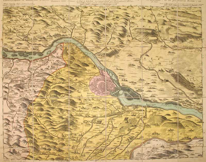
1748Best.-Nr. KART0099Nürnberg, Homanns Erben 1748. altkol. Kupferstichplan nach Nikolaus Visscher (1649-1702), Gesamtmaß: 60,5x 50,6 cm, Ansicht: 56,5x46,5 cm, in 24 Teilstücke zerschnitten u. auf Leinwand aufgezog., kartenmäßig gefalt., zwei kl. Stockfl. im ersten Segment, an den Schnittstellen tlw. etw. Die Donau von Klein Schöhnbühel bis Petronell mit Grundriss von Wien (im Zentrum der Karte), Ortschaften in Vogelschau, Berge bewaldet u. dunkler hervorgehoben.
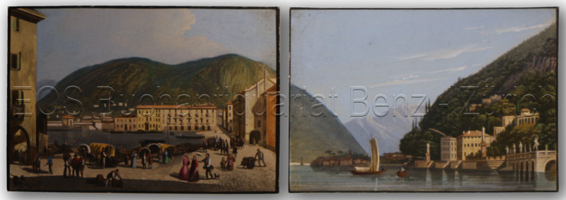
1840Best.-Nr. 658DGum 1840. 2 kolorierte Aquatinata. Bild- Blattgrösse: 8,5 x 12,3 cm. + Wichtig: Für unsere Kunden in der EU erfolgt der Versand alle 14 Tage verzollt ab Deutschland / Postbank-Konto in Deutschland vorhanden +, Abb.
Best.-Nr. 232940(1784), 55 x 77 cm (à vue) - 60 x 82.5 cm (cadre). , Plan replié, en 18 sections contrecollées sur toile. Cadre à baguettes en bois et stuc doré. Cadre accidenté.
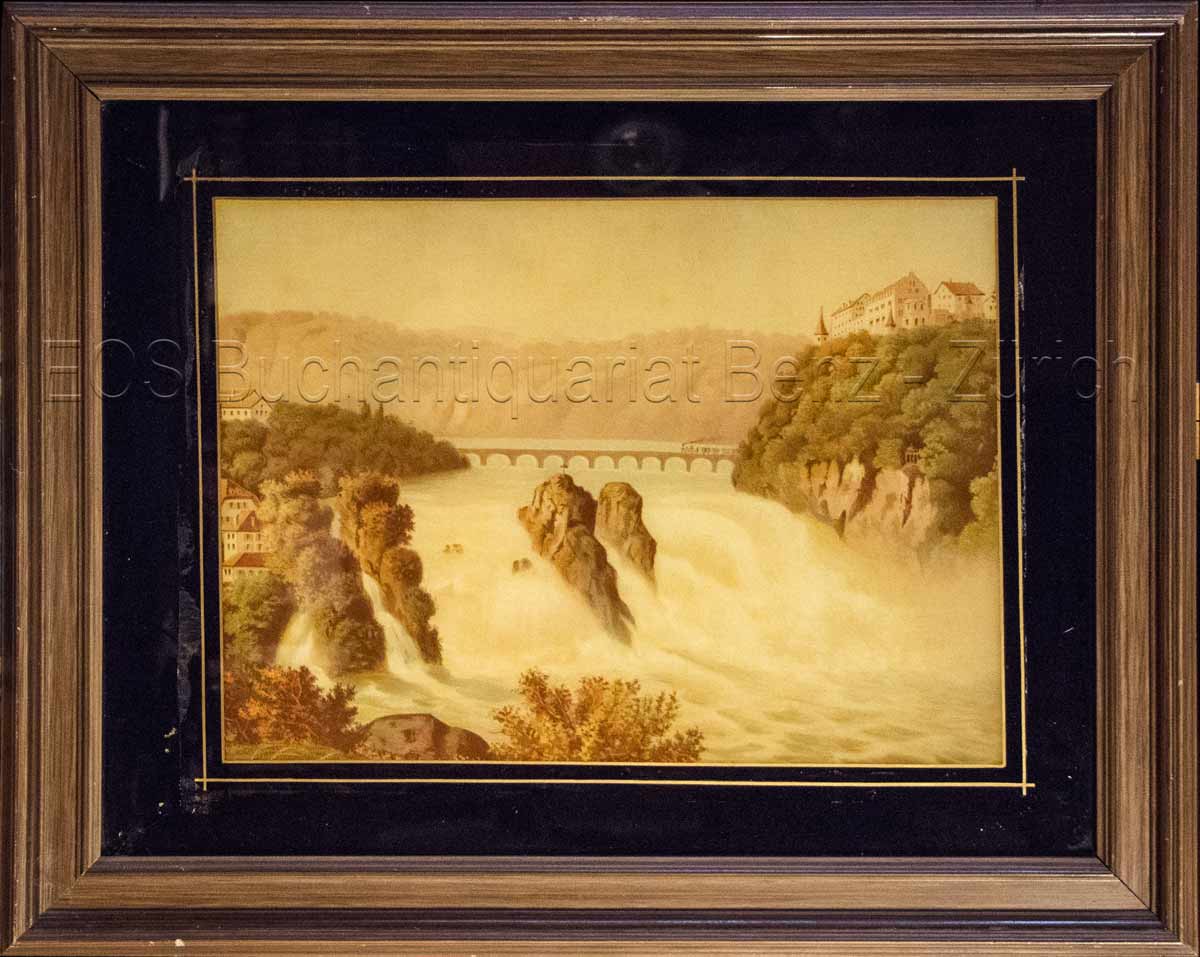
1860Best.-Nr. 825CG(um 1860). Chromolithographie hinter Glas. Bildausschnitt: 28,5 x 39 cm. + Wichtig: Für unsere Kunden in der EU erfolgt der Versand alle 14 Tage verzollt ab Deutschland / Postbank-Konto in Deutschland vorhanden +, Abb.
Best.-Nr. 5178Paris Librairie Larousse 1915-19. 1st Edition . Hardcover. . ~ ~ NOTE: THE PRICE OF THIS BOOK IS CURRENTLY REDUCED! ~ ~ . 41 issues bound in one volume. Thick royal quarto. Unpaginated. With hundreds of letterpress maps many of which are in colour printed on recto only on 246 leaves of plates. Some photo-plates. Explanatory text to each map. Introductions. HARDCOVER bound in handsome brown quarter morocco bit rubbed and scuffed in places spine with raised bands gilt lettering to second compartment gilt fleuron to each of the others vellum French corners marbled endpapers with original yellow card wrapper of first issue bound-in. In about fine condition. Excellent copy. ~ FIRST EDITION. Very rare. G-3 Paris, Librairie Larousse, (1915-19). hardcover
Best.-Nr. LBW-7439[fin du XVIIIe siècle]. 43 x 33 cm.
1810Best.-Nr. LBW-6596[vers 1810]. 21 x 20 cm, sur une feuille de 24 x 23 cm.
Best.-Nr. 232928s.d. (c.1820) 59.5 x 91 cm (cuvette) - 80 x 110 cm (cadre), cadre en bois et stuc doré. Insolations. Petits manques au cadre.
Best.-Nr. 234659S.l., s.d. carte repliée de 50 x 70 cm, en feuille.
17904 (statt 6) grenzkolorierte Kupferstiche, je ca. 864:635 mm (Plattenmaß 748:536 mm). Frankreichteil aus dem Schalbacher-Schrämbl'schen "Großen Allgemeinen Atlas" (1786-1803; hier Bll. Nr. 29-33). Es fehlen Bl. 30 (Elsaß, Lothringen, Champagne, Picardie, Artois) und Bl. 34 (Südfrankreich). Gestochen von I. W. Engelmann; Maßstab ca. 1:680.000. - Im breiten w. Rand minimal angestaubt bzw. kl. Einrisse, sonst sauberes, gutes Exemplar. Dörflinger/Hühnel I, 134, 29-33.
Best.-Nr. 208488Fontainebleau, 31 janvier 1876 in-folio oblong (68 x 96 cm), en feuille, bord supérieur ébarbé.