Collins MapsBiblio.com
1747 resultados
ref. 0008374333.Gspiral_bound. Good. Access codes and supplements are not guaranteed with used items. May be an ex-library book. unknown
ref. DADAX0415676673New unknown
ref. 0007581203.Gspiral_bound. Good. Access codes and supplements are not guaranteed with used items. May be an ex-library book. unknown
ref. 0008285624.Gmap. Good. Access codes and supplements are not guaranteed with used items. May be an ex-library book. unknown
ref. A9780792233794Sheet map. New. unknown
ref. A9780792283195Sheet map. New. unknown
ref. DADAX0714870838New unknown
2021ref. DADAX0792283279National Geographic Maps 2021-06-01. 2021. map. New. 2.05x2.05x50.20. Buy with confidence. Excellent Customer Service & Return policy. National Geographic Maps unknown
2007ref. DADAX0930657403Brand: Outdoor Books n Maps 2007-05-15. Revised. paperback. New. 8.25x0.50x10.75. Buy with confidence. Excellent Customer Service & Return policy. Brand: Outdoor Books n Maps paperback
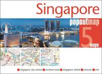
2011ref. SBBI-mon0000041860Footprint PopOut Maps 2011. map. Good. Our good condition books are generally good for reading but not for gifting or collecting. They could have imperfections such as creasing fanning inscriptions margin notes yellowing staining on edge or cover or pages bumps scuffs etc etc sometimes multiple of these. It's a wide category that encompasses anything that isn't almost-new down to anything that is slightly better than poor. We would NOT recommend gifting Good books - these should be considered reading copies. Our books are dispatched from a Yorkshire former cotton mill. We list via barcode/ISBN so please note that the images are stock images and may not be the exact copy you receive furthermore the details about edition and year might not be accurate as many publishers reuse the same ISBN for multiple editions and as we simply scan a barcode or enter an ISBN we do not check the validity of the edition data when listing. If you're looking for an exact edition please don't order at least not without checking with us first although we don't always have time to check. We aim to dispatch prompty the service used will depend on order value and book size. We can ship to most countries see our shipping policies. Payment is via Abe only. Footprint PopOut Maps unknown
2008ref. Q-0792289897Natl Geographic Society Maps 2020-08-25. Spiral-bound. New. In shrink wrap. Looks like an interesting title! Natl Geographic Society Maps unknown
ref. A9780792229872Sheet map. New. unknown
ref. A9780792283119Sheet map. New. unknown
2003ref. Q-092959181XBenchmark Maps 2003-06-01. Paperback. New. In shrink wrap. Looks like an interesting title! Benchmark Maps paperback
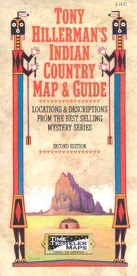
2002ref. Q-1892040107Time Traveler Maps 2002-11-01. Map. New. In shrink wrap. Looks like an interesting title! Time Traveler Maps unknown
2013ref. SBBIH-CSRDX7VJO4PYPopOut Maps 2013. map. Good. Our good condition books are generally good for reading but not for gifting or collecting. They could have imperfections such as creasing fanning inscriptions margin notes yellowing staining on edge or cover or pages bumps scuffs etc etc sometimes multiple of these. It's a wide category that encompasses anything that isn't almost-new down to anything that is slightly better than poor. We would NOT recommend gifting Good books - these should be considered reading copies. Our books are dispatched from a Yorkshire former cotton mill. We list via barcode/ISBN so please note that the images are stock images and may not be the exact copy you receive furthermore the details about edition and year might not be accurate as many publishers reuse the same ISBN for multiple editions and as we simply scan a barcode or enter an ISBN we do not check the validity of the edition data when listing. If you're looking for an exact edition please don't order at least not without checking with us first although we don't always have time to check. We aim to dispatch prompty the service used will depend on order value and book size. We can ship to most countries see our shipping policies. Payment is via Abe only. PopOut Maps unknown
2013ref. SBBIH-HVYSHSVIWKIDPopOut Maps 2013. map. Very Good. Most of our very good books have only minor imperfections such as shelf wear consistent with a new book that's sat on a bookshop shelf for a year or two. Occasionally we may miss other minor imperfections as we have to grade books at speed. Our books are dispatched from a Yorkshire former cotton mill. We list via barcode/ISBN so please note that the images are stock images and may not be the exact copy you receive furthermore the details about edition and year might not be accurate as many publishers reuse the same ISBN for multiple editions and as we simply scan a barcode or enter an ISBN we do not check the validity of the edition data when listing. If you're looking for an exact edition please don't order at least not without checking with us first although we don't always have time to check. We aim to dispatch prompty the service used will depend on order value and book size. We can ship to most countries see our shipping policies. Payment is via Abe only. PopOut Maps unknown
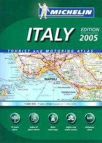
2005ref. mon0000581234Michelin Maps 2005-01-01. Hardcover. Good. 1.1991 in x 29.7774 in x 22.7827 in. NOT an ex-library book. Clean copy in good condition. Michelin Maps hardcover
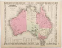
1865ref. 214355Johnson and Ward. Circa1865. Hand coloured map 32.3 x 39.7 x cms including the decorative border; 35.6 x 45.8 cms sheet key to major centres unrelated text on verso sheet age toned in very good condition. Detailed map from the leading mid 19th Century American firm of Johnson and Ward. Although Tasmania was known as such from 1856 the map refers to "Van Diemen Land". . Johnson and Ward. unknown
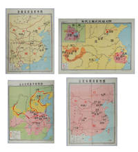
ref. 217061Shanghai.: 地图出版社 Cartographic Publishing House. Four coloured folding maps in the High School Chinese History Teaching Maps series. Map 1 辽北宋西夏形势图 Liao Bei Song Xi Xia Situation Map 106 x 75.6cm Map 2 金南宋西夏形势图 Jin Nan Song Xi Xia Situation Map 106 x 75.6cm Map 3 宋代主要农民起义图 Major Peasant Rebellions During the Song Dynasty Map 76.5 x 106cm Map 4 元末农民战争形势图 Peasant Battles in the Late Yuan Dynasty Situation Map 106 x 76.5. Text in simplified Chinese characters. Some very slight browning at folds on reverse not affecting image or text minor soiling at edges else all in very good bright condition. Descriptive listing in Chinese also included. Map 1 辽北宋西夏形势图 shows the Liao regime established by the Khitan in the north the western Xia established by the Danxiang in the northwest which co-existed with the Northern Song. Important military and economic activity locations also shown. Map 2 金南宋西夏形势图 shows the situation during the Southern Song Dynasty when three regimes co-existed; the Jin established by the Jurchens in the northeast the Western Xia established by the Dangxiang in the northwest and the Southern song. Important military activity locations also shown. Map 3 宋代主要农民起义图 shows locations of peasant uprisings in the Northern and Southern Song Dynasties Map 4 元末农民战争形势图 shows the situation of the three northern expeditions of the Red Turban Rebellion at the end of the Yuan Dynasty and the activities of the rebel armies. . 地图出版社 [Cartographic Publishing House]. unknown
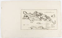
1703ref. 176390Amsterdam. circa1703. Engraved map on watermarked laid paper 16.5 x 26.5 cm plate-mark 26 x 42 cm sheet key in German inset detail of grave sites on the island of "Rhenee" Rineia and Apollonian relics lower corner creased and with a sealed tear to the verso no loss in very good condition. Fine engraving with large margins of the Greek island of Delos of great significance to classical antiquity and the mythological birthplace of the Greek deities Artemis and Apollo. . unknown
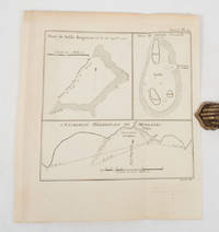
1774ref. 174260A Paris.: Chez Saillant et Nyon rue Saint-Jean-de-Beauvais Chez Panckoucke Hotel de Thou rue des Poitevins. 1774. Engraved map on laid paper 27.2 x 19.9cm 26.5 x 22.2cm sheet size edge fold slight marginal toning but in very good condition. Map of the treacherous coastal waters sandbars submerged rocks and reefs surrounding Mindanao and the Joseph Freewill Islands Mapia Atoll in the Philippines finely re-engraved for the French edition of Captain James Cook's First Voyage 1768-1771 "Relation des voyages.pour faire des decouvertes dans l'hemisphere meridional et successivement executes par le commodore Byron le capitaine Carteret le capitaine Wallis & le capitaine Cook.". . Chez Saillant et Nyon, rue Saint-Jean-de-Beauvais, [Chez] Panckoucke, Hotel de Thou, rue des Poitevins. unknown
1852ref. 180552London.: Longman Brown Green & Longmans. Second Edition. 1852. 5 folding mathematical projections at the rear. v 143pp plus 5 pages of publisher's adverts. Original cloth lettered in gilt on the spine and ruled in blind title page slightly browned head & tail of spine slightly chipped else a lovely clean copy. A presentation copy "With the Author's Cordial Regards' dated July 6th" 1854. 17.5x 10.5cm Born in Westminster London in 1818 William Hughes was a prolific mapmaker geographer engraver printer and publisher. . Longman, Brown, Green, & Longmans. hardcover
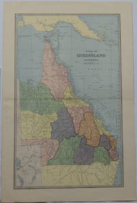
1886ref. 175917Sydney & Melbourne.: The Picturesque Atlas Publishing Company Limited Sydney & Melbourne. 1886-1888. Large printed colour map 60.9 x 37 cm 69.9 x 45.3 cm sheet central fold slight browning at the fold and to the generous margins in very good condition. Detailed map prepared for Andrew Garran's monumental "Picturesque Atlas of Australasia" 1886-1888 with the counties attractively coloured. New Guinea is shown to the North and borders with Northern Territory South Australia and New South Wales. The extent of the Great Barrier Reef is delineated along with the ocean "Border of Colony". Proposed and current railways are shown with an extensive place index printed on the verso of the map. . The Picturesque Atlas Publishing Company, Limited, Sydney & Melbourne. unknown
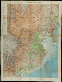
1953ref. 161304Edinburgh.: John Bartholomew & Son Ltd. 1953. Colour folding map laid down on linen. Scale 1:450000. 97 x 72 cm. Small holes and tears at some folds a little light browning. Cloth tape repair at fold adjoining upper card cover. Frederick Warne label upper cover a little creased and torn key includes glossary of Chinese geographical terms translated into English. Contour-coloured world map series. Published in the period immediately following the Korean War this map shows the 38th Parallel. . John Bartholomew & Son Ltd. hardcover