1.974 resultados
ref. 0792249542.Gmap. Good. Access codes and supplements are not guaranteed with used items. May be an ex-library book. unknown
ref. 1597756040.Gmap. Good. Access codes and supplements are not guaranteed with used items. May be an ex-library book. unknown
ref. 1597756059.Gmap. Good. Access codes and supplements are not guaranteed with used items. May be an ex-library book. unknown
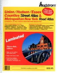
2000ref. Q-0880976403Hagstrom Map Co 2000-01-28. paperback. New. In shrink wrap. Looks like an interesting title! Hagstrom Map Co paperback
ref. DADAX0312187025New unknown
1909ref. 52792Boston: The Bullard Co. Inc. 1909. Large folding accordion-style folded map printed in red & black sized 41 x 38 in. which when entirely folded into covers measures 5.5 x 11.25 in. Original burgundy-coloured boards small lozenge map of New York & Pennsylvania on front cover some edgewear rubbing minor tidemark to upper fore-edge of 1 corner still VG- copy. Second edition revised of this scarce and well documented map showing good roads for automobile travel railroads canals new Erie Barge Canal Steamship lines ferries lighthouses electric railway lines and more. First published in 1908 and then again in 1910 MacNair drew from US government surveys State surveys and other original commercial sources. Worldcat locates 2 copies. The Bullard Co., Inc., hardcover
1984ref. 057032Eldon D. Weber 1984. Book. Near Fine. Hardcover. First Thus. 4to - over 9¾" - 12" tall. Brown leatherette lettered in gold foil. 3rd ptg. 1984 of facsimile reprint edition. Slightly soiled covers nearly as issued. Main text dates to 1895-96 Eby with 1931 supplement by Snyder every-name index and geographical index by Weber. Map in rear pocket as called for. Eldon D. Weber Hardcover
1920ref. 040036New York: Houghton Mifflin. 1920 Book. Very Good . Cloth. 1st US Edition. Greek and Balkan politicsWorld War I and the various contributions of Eleftherios Venizelos up to the Peace Conference at Versailles and the Greek claims in Asia Minor.Foldout coloured ethnographical map of "Turkey in-Europe" 384p. illus platesmaps index. Crispclean tight text.Spine a little faded and scuffed else fine. Only later copies of this US edition found in in WorldCat . Houghton Mifflin. hardcover
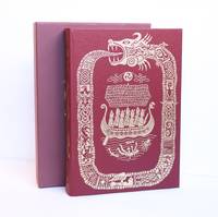
2002ref. 1419316London UK: The Folio Society 2002. First Edition Thus Fourth Printing. Hardcover. Large Octavo xxii 490 pages. In Very Good condition. Housed in publisher's Very Good red slip case. Mild rubbing to slipcase interior. Bound in cloth spine red with gilt lettering. Mild general shelf wear. Slightly discolored along a narrow near-horizontal line in upper center of spine. Top of textblock dyed red. Shelved in Folio Society. 1419316. Shelved Dupont Bookstore. The Folio Society hardcover
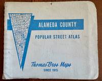
1980ref. 106683Irvine Calif: Thomas Bros. Maps 1980s. Census tract ed. Paperback. Appears to lack first leaf ; last page is 217. 1 atlas various pagings: color maps; 22 x 25 cm. Includes indexes. Uncommon. Street Atlas. Driver's Atlas. Alameda County Calif. -- Maps. California -- Scale 1:26400. 1 in. = 2200 ft. C Thomas Bros. Maps paperback
1601ref. b2-4-3Smithsonian Institution 1916-01-01. Hardcover. Good. 636 pages with 21 plates 31 maps 1 diagram and index. Quarto 11 1/2" x 8 1/4" issued in olive green with gilt lettering to spine and pictorial to cover. Previous owner's name and address is on inside front board. Red price number on fep. Hinges cracked and pages yellowing. Corners worn to board and bent. Worn edges and wavy cloth on boards. Inside pages clean and binding is tight. Smithsonian Institution hardcover
2025ref. SKU1731490Benchmark Maps 2025-03-01. paperback. New. 11x1x15. New Book Ships with Tracking Benchmark Maps paperback
2025ref. SKU1733453Benchmark Maps 2025-03-01. paperback. New. 11x1x15. New Textbook Ships with Tracking Benchmark Maps paperback
ref. SONG1420313231Used: Good unknown
ref. 8170530164.Gpaperback. Good. Access codes and supplements are not guaranteed with used items. May be an ex-library book. paperback
ref. 0540091480.Gpaperback. Good. Access codes and supplements are not guaranteed with used items. May be an ex-library book. paperback
ref. 1581741421.Gpaperback. Good. Access codes and supplements are not guaranteed with used items. May be an ex-library book. paperback
ref. ria9781849077002_inpHardback. New. New Book; Fast Shipping from UK; Not signed; Not First Edition; Capturing the latest world statistics this lavish edition of Philip's RGS Atlas of the World interprets global changes. Filled with clear up-to-date data and captivating cartography and images it gives a powerful view of Planet Earth hardcover
ref. 1581742495.Gpaperback. Good. Access codes and supplements are not guaranteed with used items. May be an ex-library book. paperback
ref. DADAX0007197764New unknown
2024ref. 2-1566959233National Geographic Maps 2024. Paperback. New. 2024 fol m edition. 192 pages. 9.38x4.25x0.59 inches. National Geographic Maps paperback
ref. 0881304433.Ghardcover. Good. Access codes and supplements are not guaranteed with used items. May be an ex-library book. hardcover
ref. 156695861X.Gmap. Good. Access codes and supplements are not guaranteed with used items. May be an ex-library book. unknown
ref. Q-1566954029National Geographic Maps 2019-01-01. Map. New. In shrink wrap. Looks like an interesting title! National Geographic Maps unknown
ref. 1849073937.Ghardcover. Good. Access codes and supplements are not guaranteed with used items. May be an ex-library book. hardcover