12.228 resultados
1942pp. ix, 220 + Plus three large pocket folding airport weather maps. Illustrated with numerous photographs, charts, diagrams and maps. Endpapers beginning to brown. XLib stamp on front pastedown. 8vo. Original full cloth binding. Original dust jacket, torn with slight loss. Nice copy. WWII 2
1986158pp. 25 cm. Hardcover Very good condition good
1986No marks or inscriptions. No creasing to covers, light crease down spine. A clean crisp very tight copy with bright covers and no bumping to corners. 113pp. The culture and history of the island in a gazetteer style, with superb colour photographs.
1972No marks or inscriptions. A very clean very tight copy with bright unmarked boards and no bumping to corners. Dust jacket not price clipped or marked or torn or creased with very minor traces of storage. 172pp. With nearly 150 illustrations, many in colour, this account describes China's Forbidden City which only became accessible to all Chinese citizens after the 1911 revolution.
1961No marks or inscriptions and no creasing to covers. A lovely clean very tight copy with bright unmarked boards, minor rubbing to spine ends and no bumping to corners. 168pp. Comprehensive concise review of the Hull, its industry, sport, shops, suburbs, transport, shipping etc. Undated but Lord Mayors listed up to 1960.
1979The author's purpose was to acquaint the reader with some of the forces that have caused change in the past, looking in particular at eight innovations: the atomic bomb, the telephone, the computer, the production-line system of manufacture, the aircraft, plastics, the guided rocket and television. Black cloth covers. Gilt title on spine. Small, point impact dent on front cover; lower back cover corner a little bumped. This book is extra heavy, and may involve extra shipping charges to some countries
1999ref. 30644Bielefeld : Kerber, 1999. 134 S. Ill. Gr. 8°. Geb. in ill. OPpbd.
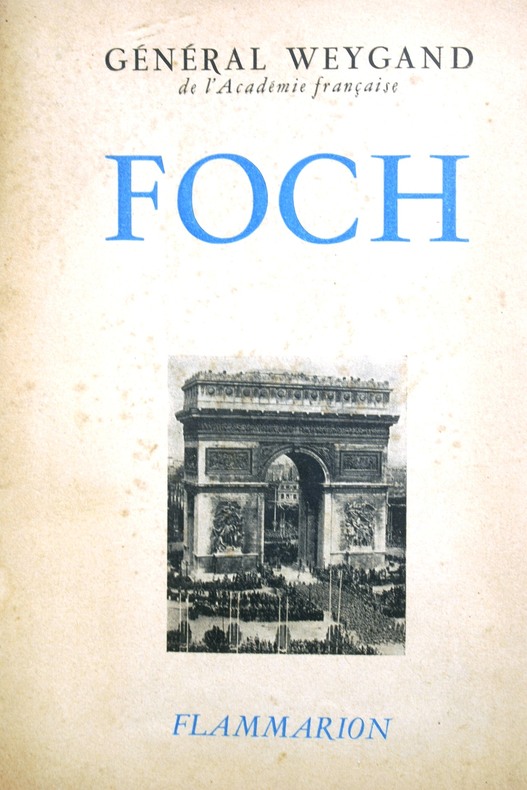
1947ref. 103197Couverture souple. Broché. 370 pages.
2015Ex-library book with the usual stamps, stickers, etc. Binding is solid and text/interior is clean and free of marking of any kind. Barely used; interior is perfect, covers show no wear, maps, b&w illustrations throughout.
2014New English Paperback. Pbo. Large 8vo. (21 x 21 cm). In English and Turkish. 42 p. Color and b/w ills. Beyoglu - Pera (Constantinople) from incunabulum to present day. Maps of Beyoglu.= Beyoglu haritalari. [Exhibition catalogue]. 04-15 December 2012.
1982pp. 298 + Plus photographs. Numerous battle and combat diagrams and maps. 8vo. Original full cloth backed binding, stained. Reprint of the 1967 edition. Coldwar/Economics 1
1946175p. + 21 Two page color maps of individual arrondissements, tab indexed + a Large folding colored map, broken at some folds. Text in French and some English. Penciled addresses. Inked ownership of John Wolf, 1947, on title page. 24mo. Original full cloth binding, lettered in silver. Very worn. Hardbound. TRAVEL/3
1985Fine English Paperback. Pbo. 12mo. (17 x 11 cm). In English. 16 p., 1 map. Map of Japan by Mahmud of Kashgar; The oldest map of Japan drawn by a Turk, Mahmud Kashgar.
1986Fine English Paperback. Pbo. Roy. 8vo. (24 x 17 cm). In English. 20 p., 1 map. The oldest map of Japan drawn by a Turk Mahmud of Kashgar. The map of America by Pirî Reis.
1954pp. vii, 311. Text maps. 8vo. Original full cloth binding. Original dust jacket, worn at extremities. AFRICA/4
1906ref. ABE-4557144886EN COUVERTURE LES AFRIKANDERS A L'ENTRAINEMENT UNE PASSE DE BROOKS-LA COURSE DE VITESSE EN 1907-LES VOITURETTES AU SALON-AU GUIDON ELLEGAARD/PHOTO-COMMENT ON GAGNE UNE COURSE DE VITESSE/2P-LES VIRAGES EN TOBOGGAN/DOUBLE PAGE-LE DECHIREUR DE CARTES PAR JACQUES MORTANE/1P/3 PHOTOS-L'ECOLE DES ACROBATES/2P/5 PHOTOS-LES SPRINGBOCKS HORS DES TOUCHES/2P-LE TROTTING EN HIVER-PAS DE COUV EXT
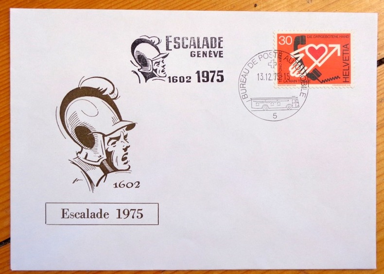
ref. 3976Enveloppe au format 16 x 11 cm., ornée d'une vignette et d'un timbre, affranchissement philatélique (13.12.1975) à l'occasion de l'Escalade 1975.
ref. 23846République et Canton de Genève / Société de Banques Suisses.
1750ref. A163Paris, s.e., s.d. (vers 1750) ; 250/325 mm, 1 pp., une feuille. Carte provenant certainement d'un livre de voyage du XVIIIème siècle. Bon état.
1750ref. A169S.l., s.e., s.d. (vers 1750) ; 255/185 mm, 1 pp., une feuille. Plan provenant certainement d'un livre de voyage du XVIIIème siècle. Bon état.
1750Paris, s.e., s.d. (vers 1750); 165/175 mm, 1 pp., une feuille. Planche provenant très certainement d'un livre de voyage du XVIIIème siècle. Bon état.
1750Paris, s.e., s.d. (vers 1750); 220/265 mm, 1 pp., une feuille. Plan provenant certainement d'un livre de voyage du XVIIIème siècle. Bon état.
1750Paris, s.e., s.d. (vers 1750); 170/220 mm, 1 pp., une feuille. Plan provenant d'un livre de voyage du XVIIIème siècle. Bon état.