1.712 resultados
1976ref. Q-0878132252s.n. 1976-01-01. Hardcover. New. In shrink wrap. Looks like an interesting title! s.n.] hardcover
ref. 4551951589835357Geographia Ltd Fleet Street London. Hardcover. Good. THERE ARE NO TARIFFS OR CUSTOMS DUTIES ON BOOKS. Hardback. Used Very Good. Red boards with gilt title down the spine. Greater London Plans of London And Suburbs Parliamentary Administrative Postal Areas Underground.Railways Underground Stations and Bus or Tram Routes indicated on the maps.See photosThe maps are based upon the Ordnance Survey Maps with the sanction of the Controller of H.M. Stationery Office. Date not given but probably around 1930's. Copyright © Geographia Ltd Fleet Street London THERE ARE NO TARIFFS OR CUSTOMS DUTIES ON BOOKS. An audio offering from William.It's the beginning of the summer holidays and William and the Outlaws see an endless expanse of gloriously carefree days stretching ahead - but how to fill them. The six classic adventures contained in this unabridged reading are: William and the Holiday Centre; William's Treasure Trove; William and the Cottage; William Tackles the Job; William and Detective Journalism; and William and the Parsons' Guy. Read by Martin Jarvis. Copyright © BBC Audio Geographia Ltd Fleet Street London hardcover
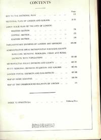
ref. 455964Geographia Ltd Fleet Street London. Hardcover. Good. Hardback. Used Very Good. Red boards with gilt title down the spine. Greater London Plans of London And Suburbs Parliamentary Administrative Postal Areas Underground.Railways Underground Stations and Bus or Tram Routes indicated on the maps.See photosThe maps are based upon the Ordnance Survey Maps with the sanction of the Controller of H.M. Stationery Office. Date not given but probably around 1930's. Copyright A� Geographia Ltd Fleet Street London Geographia Ltd Fleet Street London hardcover
ref. DADAX0198834691New unknown
2000ref. 0904219China Press 2000-01-01. hardcover. Used - Good. Ship out in 2 business day And Fast shipping Free Tracking number will be provided after the shipment.China CARTOGRAPHIC PUBLISHING HOUSE. Bei Jing. 1989. Hardcover. Book Condition: New. First Edition. 380x270mm. Language: Chinese and English bilingual 1989/298 pages China is in a unique geodynamic position and offer a good opportunity for study of dynamics of continental lithosphere. In the past 20 years a wealth of new data from all branches of earth sciences and from every provinces has been accumulated. Thus the time appeared right for an attempt at a comprehensive treatment of the new da. Satisfaction guaranteedor money back. China Press hardcover
2009ref. SONG1931257159StreetWise 2009-05-01. map. Used: Good. 4.00x0.25x8.50. Buy with confidence. Excellent Customer Service & Return policy. StreetWise unknown
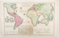
1835ref. 203763Philadelphia.: W. Marshall. Circa1835. Handcoloured engraved map 26.5 x 41.3 cms; 29.6 x 48.3 cms sheet central fold insets of "Oceanica" and "New Holland" central table some light staining in the image and margins in good condition. Eurocentrism laid bare. This 19th Century map includes a "State of Society" for each part of the world declared with a symbol to represent "Barbarous Half Civilized Civilized and Enlightened Societies" as well as noting religion and ethnicity. It includes a table of distances between chief towns or capitals and between these towns and Washington DC. Australia "New Holland" is styled principally as pagan barbarous unexplored and African a thin sliver of what is now New South Wales and Victoria is labelled civilized European and Protestant. Scarce. . (W. Marshall). unknown
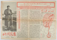
1967ref. 169746Beijing.: 地图戰報.Di tu zhan bao. September1967. Maps printed in red and black single sheet printed on both sides folded scale not given photographic image of Mao Zedong. Some light browning at edges with tears and losses on left edge still good. Text in Chinese. Sheet measures 26.5 x 38.4cm. Includes a map of Autumn Harvest Uprising and also shows the routes of the military advancing towards Jinggangshan between September and October 1927. On reverse left section a map shows the route along which Chairman Mao led the Fourth Army of the Chinese Red Army marching towards south of Anhui and Jiangxi Provinces in 1929. On reverse right section a map titled "The Long March of The Chinese Workers' and Peasants' Red Army October 1934-October 1935". Quotations of Chairman Mao about the Long March insert on corners of the map. Issue no. 6 of a series of maps with text issued by the Red Guards organisations in the form of Cultural Revolution tabloid-sized newspaper. This issue is designed to celebrate the 40th anniversary of the Autumn Harvest Uprising which was one of the earliest armed uprisings organised by the Chinese Communist Party. . 地图戰報.[Di tu zhan bao]. unknown
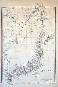
1852ref. 185246London.: Cassell Petter & Galpin. circa1852. Map with outline handcolour 42.5 x 30.1 cms; 49.2 x 34.3 cms sheet margins a little toned small corner crase but in very good condition. Very detailed map of the Japanese islands with Sakhalin above and the coast of Manchuria and Korea. . Cassell, Petter & Galpin. unknown
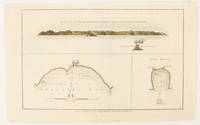
1784ref. 174896London.: Alexander Hogg at the King's Arms. circa1784. Engraved map in triptych on laid paper 20.1 x 32.7 cm three insets: cross section of the north side of Queen Charlotte's Islands Solomon Islands with detail of a volcano "6 leagues North"; Swallow's Bay Harbour; and Byron's Harbour early hand colour trimmed to the plate mark at the top edge neat sealed tear affecting the publisher's caption slight edge wear and paper toning but a most attractive map in very good condition. Attractive engraving of the Queen Charlotte's Islands Solomon Islands. The Islands were named for the consort of King George III by Philip Carteret the British naval officer and explorer who participated in two of the Royal Navy's circumnavigation expeditions in 1764–66 and 1766–69. His ship the Swallow gave her name to the Bay and Carteret's commanding officer on the first of his voyages John Byron to the Harbour depicted in this most attractive early chart. . Alexander Hogg at the King's Arms. unknown
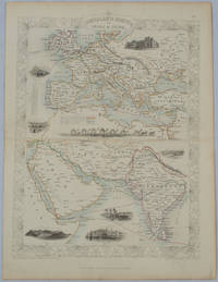
1850ref. 177525London.: The London Printing and Publishing Company. circa1850s. Lithographed map with original outline hand colour 33 x 24.5 cm including border and captions seven vignette illustrations two reference keys decorative border central fold light toning mainly at the central fold and to the verso of the sheet in very good condition preserved in a window mount. Attractive decorative map with fine vignettes of the London Post Office Suez Bombay Madras. Aden Malta Gibraltar and a wonderful camel train led by a carriage and horses crossing North Africa originally by the great mapmaker and publisher John Tallis. The two reference keys note steam packet routes railways electric telegraph and the Suez Canal. . The London Printing and Publishing Company. unknown
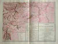
1805ref. 570721805. Copper engraving with handcolouring map shows the border of the Austrian Empire and Hungary Vienne sic and the Danube can be seen at the top of the map Two keys and scale inset. Few closed tears and some browning edges otherwise a clean and bright image. Map measures approximately 34 x 44cm. Map of Germany indicating the present division of this empire as well as the new possessions of the princes who make up the Germanic body and including Batavia and Helvetia Switzerland with their divisions. by E. Mentelle a member of the institute and P. G. Chanlaire one of the authors of the National Atlas. An xiii 1805. Paris. There is a key to the explanation of the signs and an explanation of the colours used for the district of the various states contained in this map. . unknown
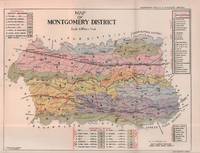
1935ref. 215892Lahore.: Government Printing Office. Revised Edition. 1935. Four folding colour maps xi 311 pages 26.5 x 18 cms; original papered boards spotted and a trifle scuffed linen backstrip with paper title label worn; foredges and endpapers spotted a few leaves toned but on the whole in very good condition the maps particularly bright and clean. A remarkable association copy: the author Frederick Blyth Wace's copy with his inked initials to the front free endpaper and his humorous unpublished foreword tipped in opposite the preface together with a dedication leaf both in Wace's hand and his business card loose within. As a further dedication makes clear this copy was given by Wace's son a couple of his loose notes on scrap paper are included the eminent botanist Nigel Morritt Wace 1929-2005 late head of the Australian National University's department of Biogeography and Geomorphology in 2003 to his fellow academic and marsupial biologist Dr. Hugh Tyndale-Biscoe. Both Wace and Biscoe were born in India and began their schooling in Kashmir at the school founded by Tyndale-Biscoe's father a Christian missionary and for whom the school is named. From the collection of Hugh Tyndale-Biscoe. . Government Printing Office. hardcover
ref. DADAX0198846037New unknown
2005ref. Q-159775000XNational Geographic Society Maps 2005-05-01. spiral_bound. New. In shrink wrap. Looks like an interesting title! National Geographic Society Maps unknown
ref. G088130591XI5N00Thomas Brothers Maps. Unbound. Acceptable. Readable copy. Pages may have considerable notes/highlighting. ~ ThriftBooks: Read More Spend Less.Dust jacket quality is not guaranteed. Thomas Brothers Maps unknown
1997ref. G0881308889I4N00Thomas Brothers Maps 1997. Paperback. Very Good. Disclaimer:May have limited writing in cover pages. Pages are unmarked. ~ ThriftBooks: Read More Spend Less.Dust jacket quality is not guaranteed. Thomas Brothers Maps paperback
2000ref. G1581741294I5N00Thomas Brothers Maps 2000. Unknown. Acceptable. Readable copy. Pages may have considerable notes/highlighting. ~ ThriftBooks: Read More Spend Less.Dust jacket quality is not guaranteed. Thomas Brothers Maps unknown
1938ref. 56963Fresno CA: City Planning Commission 1938. Oblong folio. 13.5 x 9.25 in. 17 blueprint maps variously numbered. w/ first map as the Key Map for the remainders. Stapled at gutter margin w/ protective green-tinted back softcover folded to provide reinforcement at spine from the library of George Reed Volker 1925-2018 former World War II pilot and urban planner in California New York and Washington State. First editions of these exceedingly scarce land use district zoning maps drawn up in 1938 after the passage of the 1937 Housing Act which unfortunately upended much of the spending not only by the WPA but also required any federal money to spent in “blighted” areas. These detailed maps show major streets demarcate singe family housing multi-family housing manufacturing and commercial bases for the community. Eventually the Public Housing which was built in Fresno during World War II began in West Fresno or “Chinatown first with the Sequoia Courts and later the Sierra Plaza followed by others. No copies located in Worldcat; See: Bibliography of Research Projects Reports W.P.A. Technical Series Research and Records Projects Bibliography No. 1 Feb. 2 1940 p. 53 Zoning Ordinance. City Planning Commission, paperback
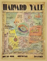
ref. 66643Yale University Athletic Association. Good. 160pp. Thin quarto 31 cm The front wrap is detached but present. The rear wrap is absent. Two small closed tears to the fore-edge of the front wrap. Scarce. Cover art by Utah artist John Held Jr. Utah Artist John Held Jr. 1889-1958 was a prominent illustrator of the 1920s and 1930s. He began by drawing sports and political drawings for The Salt Lake Tribune when he was just 16 years old. Held moved to New York City in 1910 where he went on to gain notoriety for his drawings in the popular magazines "Life" "The New Yorker" "Vanity Fair" "Judge" and "College Humor." His work epitomized the Jazz Age. He is most recognized for creating the short-haired "flapper." The cover of this publication features one of Held's maps. Held's maps illustrate the diversity of his art while at the same time serving to demonstrate Held's interpretation of various notable places and things. Kori Alexander writes in his article entitled Relevant Magic in the Art of John Held Jr. "While it was Held's caricatures of the young college chaps and flapper girls that earned him public notoriety it was his linoleum cuts and pen and ink maps that fortified his legitimacy as a social commentator." Virginia Commonwealth University website. Yale University Athletic Association unknown
1941ref. 48041Minneapolis MN: Global Map Co. ca. 1941. Oblong folio 22.5 x 11.25 in. Two rotating wheels each showing hemisphere projection maps which are attached to a thick brown base w/ printed labels on front cover original rivets still present printed paper label and instructions on verso some rubbing & edgewear minor foxing & scuffing still a G exemplar. First edition of this fascinating and scarce global map which allows the user to view steamship or airline distance routes as well as the principal railroads. The global map was designed so that opposite halves of the earth’s surface could be rotated and synchronized enabling continuous and accurate spherical relationships across any point on the rotating maps. The label on the back lists the area in square miles and population totals of the world. The map is dated to around 1941 because of the inclusion of Vichy France the government allowed by the Nazi occupiers after the fall of France in 1940. Global Map Co., unknown
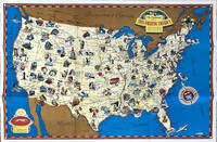
1941ref. 64221Chicago IL: Greyhound Corp. 1941. Oblong atlas folio colour-illustrated pictorial map sized 30 x 20 in. fold creases as issued w/ site index specifically listed on the verso couple text illustrations of Greyhound bus minor age toning couple slight closed tears very minor shelfwear still VG copy. A charming pictorial map focused on natural and some manmade roadside attractions across the United States with Wagner’s pictorial caricatures ranging from the charming to politically incorrect especially for Native American depictions. Attractions range from Craters of the Moon in Idaho to Grasshopper Glacier near Cooke MT Old Faithful in Yellowstone National Park to the Great Salt Lake in Utah. Other depictions include the statue of Tom Sawyer and Huckleberry Finn in Hannibal MO Fort McHenry where Francis Scott Key penned the National Anthem and more. Greyhound Corp., unknown
1947ref. 26905HUDDERSFIELD & District Woolen Export Group ENGLAND Printed at Curven Press. LONDON 1947 FRONT INNER BLANK DJ INNER FLAP HAS ORIGINAL PRICE OF 7S.6D.NET At Btm Corner. HBDJ Stated First Published 1947 on Copyright Page 1st Edition VG/GOOD- AS-IS SMALL Chip Front Btm Left of Dustjacket but Does not AFFECT TITLES Other Small Chips Tears Rub Wear Extremities DJ Interior Nice Tight Clean Light Wear Fox DJ Protected Clear Mylar 70 PGS Five maps by Macdonald Gill one folding and in colour. Original cloth woven in a colourful Freedman Salmon & Brown & White Decorated Endpapers Light Fox wear B/W Photographic Frontispiece at Night in Colne Valley of Lighted Factories & Tall Smokestacks with Illustrated B/W Drawings & Color foldout of a Map of Colne Valley Cloth District with 1946 in Corner ILLUSTRATIONS INCLUDE MARKETING CLOTH IN CHURCHYARD Huddersfield Parish Church 1671 Handthrown Shuttle of a 17th Century Loom Seen Thru Press by Sir Francis Meynell Devised & Supervised by William Haigh List of Illustrations in Color Dustjacket of Red & Green Tweeds CLOTH Woolen FABRICS with Typed Letter from Maurice Barber Chairman of Export Group Huddersfield & District Woolen Sub- Group Includes B/W Drawing of Advent of Tweeds Among the Sporting Fraternity Cog Hole Last of Water Driven Scribbling Mills Colour & DesignQuality Tells Wool & Water aps are By Macdonald Gill Covers & Endpapers by Barnett Freedman WEAVING In cludes Color Illustration Another Page from 18TH Century Clothiers Pattern Book. 1st Edition. Hardcover. Very Good/Good. HUDDERSFIELD & District, Woolen Export Group ENGLAND, Printed at Curven Press. LONDON hardcover
1963ref. 1125558442Chicago: Denoyer-Geppert Social Science Maps 1963. Book. Very Good. No Binding. 1 map : color ; 69 x 105 cm folded to 42 x 28 cm. showing transport routes America wide.main lines and secondary routes divided in sections and laid on canvas eyelets for hanging very good conditionScale ca. 1:4500000 Denoyer-Geppert social science maps A19. Denoyer-Geppert Social Science Maps unknown
1938ref. 28569New York: Thomas Y. Crowell. 1938. HBDJ 1938 1ST EDITION VG/GOOD 6 1/2 X 9 In. BEAUTIFUL RED CLOTH CVR With Printed Title & Illustration LABE on Front & Spine CvrL Hardcover. Book Condition: Very Good with Mild TONING PGS . Dust Jacket Condition: Good. First Edition; First Printing. DJ has some soiling EDGE chipping and wear with chips missing on DJ Spine Ends LIGHT Small CORNER FADE CVR 233 pgs INDEX Old Houses & Park Benches & Index NY IS A BIG EXCITING CITY. The Aquarium Statue of Liberty Empire State Building Syrian Candy Kitchen ETC Each chapter covers a Days Outing. . 1st Edition. Hardcover. Very Good/Good. Illus. by Syd Browne . New York: Thomas Y. Crowell. Hardcover