1992ref. 2080502106508353Not Available 1992. Soft Cover. Fine. Volume: 1 Not Available paperback
1995ref. 2091502135417324Not Available 1995. Soft Cover. Fine. Volume: 13 Not Available paperback
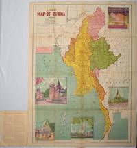
1951ref. 214601Delhi.: S.B. Makhija & Brothers. circa1951. Printed colour map 98.6 x 69 cm folding into pictorial wrappers 25.3 x 19.5 cm five pictorial colour inserts of pagodas and the Shwethalyaung reclining Buddha wrappers a little chipped marginal wear and three small fold splits in the map but overall in very good condition. Attractive large map of Burma with the provinces coloured steamship routes shown in red and printed in the booklet a range of information printed based on the 1951 census including climate agriculture and form of government "Burma became an independent nation completely outside the British Empire on January 4 1948 and is now a sovereign independent republic known as the Union of Burma". . S.B. Makhija & Brothers. unknown
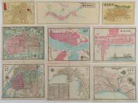
1870ref. 221021Japan. Circa1870s - 1890s. Collection of nine handcoloured copper engraving maps: 大日本全圖. Greater Japan map. 11.5 x 31cm 京都全圖. Kyōto map. 11.5 x 16cm 大阪全圖. Ōsaka map.11.8 x 16cm 大阪市街之圖. Ōsaka city map. 18 x 21.3cm 箱館市街之圖. Hakodate city map. 18 x 21.5cm 長﨑市街之圖. Nagasaki city map. 18 x 22cm 兵庫神戸両港市街之圖. Hyōgo Kōbe city map. 18.1 x 21.6cm 新潟市街之圖. Niigata city map. 18 x 21.8cm 京都市街之圖. Kyōto city map. 17.3 x 21.5cm Occasional light browning on margins of a few maps but all maps in very good condition. This very attractive collection of nine hand-coloured copper engraved maps was most likely published during the early Meiji period between the 1870s and early 1880s. The first three maps depicting Japan Kyoto and Osaka probably date from the early 1870s. On the Osaka map the site of Osaka Castle is still identified simply as a castle while the map of Japan uses Edo-period regional names such as Tosa rather than Kochi Prefecture. The remaining six maps appear to be slightly later probably dating from the early 1880s. On one of these Osaka Castle is identified as military headquarters reflecting the military use of the site during the Meiji period. The map of Kobe also includes an inset railway timetable for services between Kyoto and Kobe. The railway linking the two cities opened in 1877 providing a further indication of the map’s date. The maps are delicately drawn and contain minute details including town names and the locations of numerous public and commercial facilities. Maps of the treaty ports of Hakodate Niigata Nagasaki and Kobe are particularly uncommon. The Hakodate map features attractive illustrations of a Western-style sailing ship and steamship while the Kobe map shows the foreign concession and a cemetery for foreign residents. . unknown
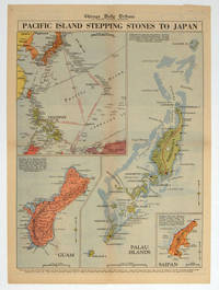
1944ref. 208880Chicago.: Chicago Daily Tribune. 28 September1944. Colour pictorial map on a single newspaper leaf archivally laid down on linen 50 x 39.2 cms; 59.3 x 43.3 cms sheet including captions faint toning to fold lines very good condition. Vivid colour maps of the Palau Islands Guam and Saipan in the Marianas and an inset location map published in the "Chicago Daily Tribune" in September 1944 months after the landing of US and Allied Forces in the offensive against the Japanese during the Pacific War. . Chicago Daily Tribune. unknown
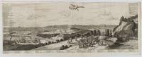
1720ref. 180201A Leide. Leiden.: Chez Pierre van der Aa. circa1720. Engraved panorama on watermarked laid paper 28.5 x 77.5 including captions; 31 x 79.5 cm sheet title cartouche engraved key in French and Dutch the upper margin trimmed to the platemark original folds edgewear and toning neat sealed tear to the outer edge barely visible 5mm intrusion to the image a very good dark impression. Finely composed and engraved panorama of Tokyo prepared for the monumental work "Galerie Agreable du Monde" by the master Dutch publisher Pieter Van de Aa 1659-1733. The detailed key in Dutch and French notes myriad buildings and temples on the horizon and in the foreground two processions converge: of nobles and their attendants dancers a trio of dogs and a priest or religious attending a suppliant. Pieter van der Aa 1659-1733 was born in Leiden Holland and started his own book publishing business when he was only twenty-three. His prolific output of highly decorated maps and atlases culminated in his magnum opus “Galerie Agreable du Monde” which illustrated the world known to Europeans in the early eighteenth century. Comprising 66 volumes it was the of plates published at that time it has been estimated that only 100 copies were published. . Chez Pierre van der Aa unknown
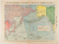
1942ref. 180751Chicago.: Chicago Daily Tribune. Friday June 51942. Printed colour map on a single newspaper leaf 37.5 x 53.2 cm; 44.7 x 59.8 cm sheet inset legend marginal browning and at the folds some undulation of paper and tide mark along lower section but in remarkably bright very good condition. Strategic map published in the Chicago Daily Tribune "The World's Greatest Newspaper" on June 5th 1942 two days after the Japanese attack on Dutch Harbor the site of the US army and navy bases in the Aleutians and as it transpired at the outset of the Battle of MIdway. The owner and proprietor of the Tribune Robert McCormick was staunchly against the United States entering the war and had firm views once it had occurred that American resources should not be used defending the British Empire. Famously the Tribune published the "Victory Program" Roosevelt’s military plan to prepare the United States for possible entry into World War II and was subject to prosecution for an alleged violation of the Espionage Act relating to the newspaper’s front-page account of the Battle of Midway 4-7 June 1942. It became an important test case for the limits of free speech and censorship during war-time. The Legend shows territorial Control of Ocean Areas marking Japanese Naval and Air bases as of 1941 and "according to latest reports" those established in the first six months of 1942. Also shown are pre-war sovereignties as at the bombing of Pearl Harbour on December 7th 1941. The Anson Archipelago is shown but a question mark "indicates islands etc. whose existence or give position is doubtful…". . Chicago Daily Tribune. unknown
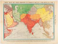
1942ref. 180782Chicago.: Chicago Daily Tribune. April 211942. Printed colour map on a single newspaper leaf 37.5 x 53.2 cm; 60 x 45 x 59.6 cm sheet marginal browning and at the folds but remarkably bright in very good condition. World War II map of Asia save for Japan showing British allies colonies and lines of supply and marking Japanese territorial occupation published in the Chicago Daily Tribune "The World's Greatest Newspaper" in April 1942. "The Indian Ocean and the Bay of Bengal are the strategic waters in this campaign in which the occupied parts of Burma and the Andaman Islands serve as bases" caption ". the historic Chicago Tribune was an innovator in color inks and printing but also a pioneer in bringing colorful art in the form of illustrations photographs cartoons and advertisements to the average person in an everyday medium." see The Janet A. Ginsburg Chicago Tribune Collection Michigan State University Libraries. . Chicago Daily Tribune. unknown
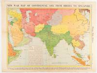
1942ref. 180760Chicago.: Chicago Daily Tribune. January 91942. Printed colour map on a single newspaper leaf 37.2 x 53.4 cm; 45 x 59.9 cm sheet inset legend marginal browning and at the folds lower margin with small edges tears not affecting the caption but remarkably bright in very good condition. Rare map of Asia "Between Suez on the west and Shanghai on the east" showing territorial interests and theatres of war published in the Chicago Daily Tribune in January 1942 barely two months after the Uniited States had joined the war effort after the bombing of Pearl Harbour. Thailand and Vietnam "French Indo-China" are marked "Occupied by the Japanese" and north-eastern China similarly marked Iran "Anglo-Russian Occupation" and the Gulf states "British Ally". The caption notes that "The map inludes waters thru which runs the British life line from the Suez canal to remote Australia and New Zealand. Nearly half the people in the world live in the lands shown on this map--more than 450 million for example in China and more than 375 million in India". ". the historic Chicago Tribune was an innovator in color inks and printing but also a pioneer in bringing colorful art in the form of illustrations photographs cartoons and advertisements to the average person in an everyday medium." see The Janet A. Ginsburg Chicago Tribune Collection Michigan State University Libraries. . Chicago Daily Tribune. unknown
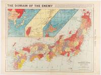
1941ref. 180789Chicago.: Chicago Daily Tribune. December 121941. Printed colour map on a single newspaper leaf 41.5 x 53 cm; 45.1 x 59.9 cm sheet three inset maps of the Japanese Empire; Taiwan and Ryukyu Islands; and Hokkaido and Chisima marginal browning and at the central fold but remarkably bright in very good condition. Map of the Japanese Empire ominously titled published in the Chicago Daily Tribune one week after the bombing of Pearl Harbour. Prefectures are attractively coloured. Based on a Rand McNally map the Tribune briskly got to work issuing maps for readers showing the beginnings of the war with Japan. Later maps were also published for sale separately but remarkably few have survived. ". the historic Chicago Tribune was an innovator in color inks and printing but also a pioneer in bringing colorful art in the form of illustrations photographs cartoons and advertisements to the average person in an everyday medium." see The Janet A. Ginsburg Chicago Tribune Collection Michigan State University Libraries. . Chicago Daily Tribune. unknown
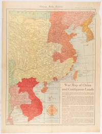
1519ref. 180794Chicago.: Chicago Daily Tribune. January 151942. Printed colour map on a single newspaper leaf 53 x 40.7 cm; 59.8 x 45 cm sheet inset text box marginal browning and at the folds but remarkably bright in very good condition. WWII map of China showing most of China Indo-China Thailand and Korea with territory captured and controlled by Japan shaded in orange and red published by the Chicago Daily Tribune barely six weeks after the bombing of Pearl Harbour. The text on the map reads "Since 1937 China has been at war with Japan. Lacking many essentials of war the Chinese nevertheless have managed to maintain a front against the aggressors. China's principal life line is the Burma road shown on the map which starts at Lashio Burma and extends to Kunming Yunnan province where it links with connections to Chunking the present Chinese capital". Based on a Rand McNally map the Tribune briskly got to work issuing maps for readers showing the beginnings of the war with Japan. Later maps were also published for sale separately but remarkably few have survived. "… the historic Chicago Tribune was an innovator in color inks and printing but also a pioneer in bringing colorful art in the form of illustrations photographs cartoons and advertisements to the average person in an everyday medium." see The Janet A. Ginsburg Chicago Tribune Collection Michigan State University Libraries. . Chicago Daily Tribune. unknown
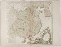
1751ref. 177606Paris. 1751. Engraved map 48 x 52.2 cm; 51 x 67.6 cm sheet provinces highlighted with outline hand-colour elaborate title cartouche central fold small tear at the foot affecting the border old paper repair on the verso affecting the margin only pin-holes to the four marginal corners margins a little browned and dusty a handsome map in good condition. Fine large format map showing China Korea Taiwan and parts of Central Asia prepared for De Vaugondy's "Atlas Universel". The beautifully foliated cartouche features a duo of joyful Chinese musicians one dancing and a diminutive figure holding a parasol. From the Estate of the late collector and scholar Arthur Hacker. . unknown
ref. BN103037IGN - Institut Géographique National. Carte de randonnée : Pau Carte de randonnée : Pau IGN - Institut Géographique National unknown
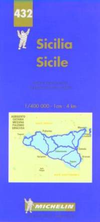
1997ref. BN438239Michelin Editions des Voyages 1997. 1997. Carte routière : Sicile N° 432 Carte routière : Sicile N° 432 Cartes Michelin Michelin Editions des Voyages unknown
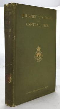
1902ref. 1607050057John Murray 1/1/1902. Stated 2nd Edition revised. Hardcover. Good. Bound in publisher's green cloth. Gilt lettered and stamp of the Royal Geographical Society on front cover. Library stamps and markings. 285 pages. 34 illustrations and maps 6 of which are folding. Large color map of Tibet at rear. Many of the plates are stamped with library stamps on blank side. Sarat Chandra Das 1849-1917 was a Bengali scholar of Tibet. Das has been described as "a traveler explorer.linguist a lexicographer an ethnographer and an eminent Tibetologist." Das was also a British spy. Born in Chittagong Das trained as an engineer in Calcutta. He became headmaster of the Bhutia Boarding School in Darjeeling. Bhutia was a school for Sikkimese and Tibetan boys many of who would be trained to fill a special place in the British colonial regime the role of a Pundit. Das became a "pundit" and an instructor at the school for British intelligence. Pundits acted as a network of British-trained operatives who were tasked to make inroads in the foreboding inner regions of Asia where white embassies could not gain entry. Tibet and other inland areas were increasingly gaining attention from competing British Russian and Chinese economic and strategic interests. Derek Waller speculates that the character of Huree Chunder Mookerjee in Kipling's Kim was based on Das p.193. As a teacher Das learned Tibetan to speak with his students. He read the limited books on the region available notably of Bogle 1773-5 and Manning's travels 1811 to Tibet. Manning and Bogle were the last successful British explorations of Tibet a nation who steadfastly resisted western intrusion. Das's language ability secured him entry with his colleague Lama Ugyen Gyasto to Tashilhunpo monastery in 1879 as the Prime Minister wished to learn Hindi from him. In 1881 Das returned to Tashilhunpo and made his way to Lhasa Sakya and the Tsangpo River. There he met with Thupten Gyatso the 13th Dalai Lama d. 1933 and returned to Darjeeling with a Yak loaded with over 200 Tibetan manuscripts. After Das was revealed to be a British agent Tibetan authorities increased restrictions on travelers and the Minister who had sponsored his entry was put to death. What makes Das's expedition so interesting is that he successfully brought back a wealth of information on an unknown land to the larger world. The Tibet that Das glimpsed is now gone with the passage of history and the destructive forces of modernity and Chinese domination. This book compiles the story of Das's journey his reports photographs diagrams ethnographic observations etc of a lost Tibet. Das went on to become an important Tibetan scholar and author an extensive multi-volume dictionary. The British would not successfully return to Tibet until 1903-4 with Colonel Francis Edward Younghusband's exhibition invasion and massacre of ~5000 Tibetans. Significantly Younghusband was the President of the Royal Geographical Society which notably published the 1902 edition of Das's book. An interesting and dark connection to Das's legacy. Ref: Derek Waller's The Pundits: British Exploration of Tibet and Central Asia. University Press of Kentucky 1990 pp. 193-209. Also Samanth Subramanian's superb piece in the New York Times Magazine March 20 2016 p. MM61. Peter Hopkirk The Great Game: The Struggle for Empire in Central Asia Kodansha 1992. Yakushi D55 Yakushi D356. Marshall 1459 John Murray hardcover
1949ref. 1807230045Kegan Paul Trench Trubner 1949-01-01. Hardcover. Good. 3 volume set. Bound in publisher's green cloth with gilt lettering. Very good bindings and covers. Spines slightly sunned. viii 667 viii 743 xvi 823 pp index many color folding maps. Light foxing. Contents: Vol. 1. From the origins to the arrival of the Portuguese in 1542 A.D.; Vol. 2. During the century of early foreign intercourse 1542-1651; Vol. 3. Tokugawa epoch 1652-1868. Vol. 1-2 3rd impression. Vol. 3 1st impression. Vol. 3 revised and edited by Joseph H. Longford. At Longford's death the work was transferred to L.M.C. Hall. Maps by Isoh Yamagata. First published in 1903 Murdoch's work quickly became an important reference in Japanese history. This is an oversized or heavy book which requires additional postage for international delivery outside the US. Kegan Paul, Trench, Trubner hardcover
1926ref. 1808090055Kegan Paul Trench Trubner 1926. Hardcover. Very Good. 3 volume set. Bound in publisher's green cloth with gilt lettering. Very good bindings and covers. viii 667 viii 743 xvi 823 pp index many color folding maps. Light foxing. Contents: Vol. 1. From the origins to the arrival of the Portuguese in 1542 A.D.; Vol. 2. During the century of early foreign intercourse 1542-1651; Vol. 3. Tokugawa epoch 1652-1868. Vol. 3 revised and edited by Joseph H. Longford. At Longford's death the work was transferred to L.M.C. Hall. Maps by Isoh Yamagata. First published in 1903 Murdoch's work quickly became an important reference in Japanese history. This is an oversized or heavy book which requires additional postage for international delivery outside the US. Kegan Paul, Trench, Trubner hardcover
ref. 58305Hamburg Deutsche Verlags-Gesellschaft D.V.G. 1912. . Außentitel "Pharus Atlas deutscher Städte". - Aachen Berlin Bremen Breslau Coblenz Cöln a. Rh. Darmstadt Dresden Duisburg Düsseldorf Frankfurt a.M. Hamburg Hannover Kiel Leipzig Lübeck Magdeburg München Stettin Stuttgart sowie Brüssel London Paris Wien. Mit illustrierten Bäder- und Kurort-Anzeigen und Führer von Heidelberg Hildesheim Osnabrück und Rendsburg von diesen Städten keine Pläne vorgesehen sowie internationalem Hotel-Register und einem Mitgliederverzeichnis des Internationalen Möbel-Transport-Verbandes. Mit einem Sonderanhang "Schweiz". Besonders interessant durch die zahlreichen schön gestalteten Anzeigen der Zeit viele davon ganzseitig. - Berieben wenig bestoßen innen nur vereinzelt etwas fleckig wenige Blätter eingerissen 1 Blatt m. großem Einriß. Hamburg, Deutsche Verlags-Gesellschaft D.V.G. 1912]. unknown
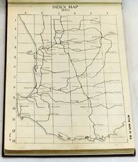
1923ref. 101984Perth: Hale's Motor Maps Ltd. 1923. Octavo cloth boards with block printed title laid on upper boards b&w plates b&w illus pp 244. Rebound with new endpapers in custom-made slipcase. First page creased otherwise contents clean. Very good condition. Road maps of Western Australia from Moora Kondut and Becubbin in the north to Albany in the south and stretching iinward through the wheatbelt. Scale: 4 miles to the inch. With many illustrated advertisements for WA companies decriptions of Perth and Western Australia with photographs lists of garages and hotels and information for travellers. Boards in slip-case. Hale's Motor Maps Ltd. hardcover
1956ref. 76405San Jose: H.M. Gousha Co. on or before 1956. First edition of this gathering. Folio 13 1/4 x 18 inches. 62 unused road maps in color and with inserts each neatly divided by side tabs. All maps bound on stubs. Original red cloth portfolio with flap and snap fasteners the Shell logo stamped on front cover some soiling or darkening to extremities. The portfolio has some expected wear but the maps are fresh and clean. Shell maps of this era are notable for their high-quality cartography colorful graphics and often included travel tips local advertisements and information about Shell services. None located by OCLC. Harry Mathias Gousha a former Rand McNally went independent in 1926 and relocated to California in 1947. It was a propitious time as the 50s in most respects witnessed the onset of the great American phenomenon of the Road Trip. With the improvement in cars longer and longer trips became feasible. None of the great Interstates as we know them today were in existence at that time so road maps were essential for any successful road trip. The H.M. Gousha Company was one of the "Big Three" major producers of road maps and atlases in the United States during the 25 years following World War II General Drafting and Rand McNally were the other two. Shell maps of this era although free are notable for their high-quality cartography colorful graphics and often included travel tips local advertisements and information about Shell services. The H. M. Gousha Company produced millions of oil company road maps used as marketing tools distributed at no charge at gas stations by customers that included Gulf Oil Conoco Shell Standard Oil and dozens of others. Though most Gousha maps were produced for oil companies many others were issued for customers not related to the petroleum industry including automobile clubs state governments banks and realtors. Ironically the company was purchased by Rand McNally in 1996. H.M. Gousha Co. hardcover
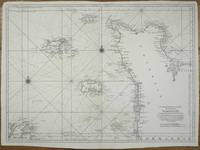
ref. 11443Paris: 1693-1753. No binding. Good. 595 x 815 mm. dark impression on thick paper margins trimmed with repairs to upper edges otherwise in good condition. The third state of the official French sea chart of the Channel Islands and the nearby Cotentin peninsular published by the L'Imprimerie Royale in 1693 utilising recent scientific survey work. The engravers imprint lower right is erased. Two lines of longitude are added across the bottom marked from Tenerife and L'Isle de Fer and a line of latitude is added by the right margin. The chart extends southwards to include the 'Isles de Chausey' the town of Granville in Normandy and Treguier in Brittany. It is from the 'Neptune François' one of the landmarks in the publication of sea atlases a highly significant work. In 1662 Jean-Baptiste Colbert 1619-83 Minister of State to Louis XIV made an initial attempt to have the coasts of France surveyed. The results were disappointing. Colbert tried again in 1670 this time having La Favolière survey the French coast south of the Loire River and Denis de La Voye northwards and through the English Channel. A decade later at the behest of the Académie des Sciences and Jean Dominique Cassini 1625-1712 the astronomers Jean Picard and Philippe de La Hire surveyed the country making astronomical observations of latitude and longitude. It was the results of their work that lost Louis XIV more territory than he had won in wars. These two projects were combined to produce with the encouragement of Cassini 'Le Neptune François'. ""The minister of finance to Louis XIV took the initiative to give the French navy an important advantage over the British. In 1691 a royal privilege was granted to produce a sea chart atlas 'Le Neptune François' engraved and printed on Mercator's projection by royal-appointed engineers and surveyors"" Wardington Catalogue. One of its most innovative features was the laying down of safe channels on the charts along with all the usual hazards and soundings to be expected. Another tradition began with this atlas in that it used soundings based on the lowest tide. It was immediately counterfeited by Pieter Mortier in Amsterdam. Whilst the Dutch version sold well the original French version didn't. Its large size use of Mercator's projection which was not favoured by French sailors and high price meant that the work languished for sixty years. The French government collection of nautical charts became part of the Archives de la Marine in 1699. It was renamed as the Depot des Cartes et Plans de la Marine in 1720. In 1741 Jacques-Nicolas Bellin 1703-1772 became its de facto person in charge. He was one of the most important and prolific French cartographers of the mid-eighteenth century. With access to the latest navigational reports he produced a great many maps and charts of excellent quality compiling atlases of sailing charts for military and official use as well as for commercial publication. A second edition of the 'Neptune François' appeared in 1753 under Bellin's direction. The charts bore added lines of longitude and latitude. Provenance: private Jersey collection. Chapuis 2019; Pastoureau 1984 Neptune Français C no. 17; Pelletier 2019 'Jean Picard' in 'The History of Cartography' vol. IV pp. 1095-7. 1693-[1753] unknown
1759ref. 848041759. T. Kinnersley. London. 1759. In Two Volumes II and III and contains the whole set for the year 1759. Bound in 18th century quarter brown calf gilt very worn and rubbed and lacking portions of leather from heads and tails of spine. Joints tender but holding. Vol. II; ii 372 pages plus 4pages of index. Vignette to general title-page and engraved head-piece for each month. 6 engraved plates of unusual and more ordinary fauna including the dodo the rhinoceros sea hedge-hog the horned didapper flying fish and cassowary. 1 portrait plate of Magliabechi 14 full page engraved maps and plans. Vol. III; ii. 404 pages plus 4 page index. Engr. vignette to general title-page and engraved head-pieces or decorations to each month 4 engraved plates of fauna one portrait plate of Major General Wolfe 1 incredible engraved plate displaying the Torments Inflicted by the Dutch on the English in Amboyna plus the engraved frontis. to Pope's Essay on Man. Three engraved plates - 1 map and 2 plans. A wonderful insight into what interested people in the mid-18th century. Pages browned and occasionally foxed but otherwise a very useful set. hardcover
ref. P33766Mandala Maps: 1988 Kathmandu. This rare late-1980s folding map of Tibet was meticulously hand-drawn by Nepalese cartographer P. L. Shrestha and published in Kathmandu Nepal by Mandala Maps and Himalaya Bookseller. This map was created as a practical navigational field guide to assist independent trekkers and overland tour operators traveling the rugged route between Kathmandu and Lhasa. Additionally it served to document the region's geographical infrastructure strategic borders and local points of interest during a heavily regulated era of Tibetan tourism. Acting as a crucial historical document and rugged field guide from a period of strict travel regulation it features detailed insets of Lhasa and sensitive border areas. This scarce collector's item holds significant value for historians and collectors alike with authentic vintage copies from this specific Nepalese workshop now commanding market prices between six hundred and seven hundred dollars. The map has strong edges and no weak details in the paper. In very good condition. unknown
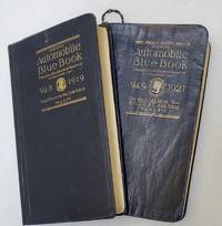
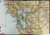
1919ref. 74907Chicago: Automobile Blue Book Publishing 1919 & 1921. Vol. 8; Tall octavo. 776 pp. including numerous inserts maps photographic illustrations. Complete. Publisher's flexible blue cloth with gilt cover lettering. Expertly rebacked retaining the original spine. Ver good.Vol. 9; Tall octavo. 848 pp. including numerous inserts maps photographic illustrations. Complete but for the folding map at the rear often missing as they were used. The map is reproduced in smaller segments on pp. 2-21. Publisher's flexible blue cloth with gilt spine and cover lettering. Some creases and general rubbing but a good complete copy.Between these two books the entire West Coast is covered. Between them they detail 1783 driving routes across the arid west. These are exhaustive and comprehensive guides to early car touring in California and the West. With such instructions as 'turn left after the wooden bridge" we can infer that car travel in 1920 was a difficult proposition at best. There is an illustrated chapter on Yosemite with a full page map and five pages of texts with illustrations. While "Official Automobile Blue Books" are not rare one usually finds the guides for New York or the Midwest with Vol. 8 California and Vol. 9 Oregon and Washington rarely appearing on the market. Chances are that these particular volumes were just generally used to oblivion as California has always been the most car-friendly state in the Union and the Pacific Northwest was by and large empty of people. Automobile Blue Book Publishing hardcover
1928ref. 2443San Francisco and Los Angeles: The Heald-Menerey Company 1928. Very good. Large color map measuring 44 x 64 inches cut into eight sections and folded into book form. Original black limp textured cloth yapp edges titled in pale yellow on front cover. Moderate edge wear titles on front cover almost completely worn away. Internally clean. A rare portable version of the large and impressive Heald-Menerey's Geographical Commercial and Recreational Map of California produced in the late-1920s. According to the sheet of instructions bound before the map: "The first of its kind ever devised for desk home or automobile use. It consists of the California Survey 44 x 64 inches in size cut into eight strips and folded to make a book of 64 pages. Page No. 1 is the extreme northwest corner of our Survey and page No. 64 is the extreme southwest corner." The instructions proceed to inform the user on how to locate points on the map given its form as a book. The verso of the instructions page is a county index keyed to the pages of the map. The cover title begins "California Survey" but the remainder is rubbed beyond readability. The map was produced by the Schmidt Lithograph Company of San Francisco. The legend of the map contains symbols representing roads trails railroads streams springs swamps aqueducts lighthouses county and state boundary lines national forests mountain peaks township and range lines base and meridian lines and more. There are also two inset maps - one showing San Francisco and vicinity and the other Los Angeles and its immediate surroundings. OCLC records just a handful of copies of this book-form map published between 1928 and 1933. The Heald-Menerey Company unknown