BURKE, HOWARDBiblio.com
1.804 resultados
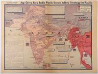
1944ref. 214362Los Angeles.: Los Angeles Examiner. April 31944. Colour pictorial map on a single newspaper leaf 37 x 50 cms; 41.5 x 54.6 cms sheet unrelated text on the verso although with an interesting account from a soldier's letter about an air raid in China toning more marked at the central fold two small splits no loss to the map edge wear with several small marginal edge tears neatly repaired on the verso with archival washi map unaffected in good condition. A dynamic map prepared and illustrated by the Examiner's art critic and editor Howard Burke covering the area surrounding India and Central Asia showing Japanese conquered territory in Malaya Thailand Indo-China and Burma; and in India British-controlled states and native feudal and protected states. Text boxes and pictographs give an overview of the geopolitical situation from the Allied perspective. One box notes "Chanda Bose has many adherents and fanatical followers in Bengal. They may prove to be a powerful fifth column in India". Text at lower edge opines "The situation in India is critical and has grown more so as the all-out offensive against Japan has been delayed. If the Allies do not act at once and with great force all our gains may be wiped out and the war in the Pacific prolonged indefinitely." The decisive and devastating bombings that were to signal such an end were four months away. Rare on the market. . Los Angeles Examiner. unknown
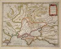
ref. 54794Amsterdam.: Jodocus Hondius. Circa Early 17th Century. Map depicting the southeastern part of present day Ukraine and the Crimean peninsula including the northern most part of the Black Sea and reaching north to Smolensk. Published by Hondius in the French edition of the Mercator-Hondius Atlas. Hand outline colour topographical detail shown pictorially some wear along centrefold occasional pale foxing mostly in margins decorative title cartouche upper right corner French text on verso showing through clear plate mark even age toning 48.5 x 58 cm. . [Jodocus Hondius]. unknown
1798ref. 32540-440Paris Edme Mentelle 1798. C. 330 x 430 mm. Framed 510 x 610 mm. Paris Edme Mentelle 1798. Fine map of the mouth of the Gironde river with Cognac and Angoulème in the centre. On upper corner right the map bears the no. 41. GEOGRAPHY: MAPS ; KARTEN KARTOGRAPHIE ; FRANCE ; Paris, Edme Mentelle unknown
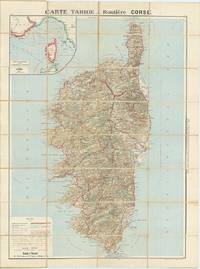
ref. 62609Paris: Cartes Tarides c.1922. Original separately issued colour-lithographed map of Corsica 105 x 81 cm dissected into 32 sections and backed onto linen with an inset map showing the navigation lines between Corsica France and Italy to upper left. Printed by Gaillae-Montrocq et Cie. Folding between drab paper covers. Some light spotting to verso most noticeable along folds some light marginal soiling generally a very good attractive example. The key to bottom left provides plenty of useful information to the motorist including the best roads those to avoid and the main summer seaside and thermal resorts which are highlighted in red. Paris: Cartes Tarides, [c.1922]. unknown
1914ref. 005933Paris: Dépôt des Cartes et Plans de la Marine 1914. Cloth Backed. Very good. This extensive uncolored sea chart provides comprehensive coverage of the entire Eastern Mediterranean Sea in multiple panels which have been assembled and backed with cloth to form a large composite map. Published by the official French hydrographic office in Paris the "Dépôt des Cartes et Plans de la Marine" which became the Service Hydrographique de la Marine around this time the chart is a practical navigational aid rather than a decorative one. It features a dense network of hydrographic data including numerous soundings indications of sea bed composition and detailed representations of coastlines and harbors. The chart's functional uncolored style is typical of official government maritime surveys designed for practical use by mariners with details corrected and augmented over time to reflect the most current surveys. Sheet dimensions: 76 cm x 107 cm approx. assembled from multiple sheets. Condition: Very Good. Sound paper uncolored as issued minimal signs of wear along seams where sheets are joined. Please see photos for full appraisal of condition. Dépôt des Cartes et Plans de la Marine unknown
1914ref. 005930Paris: Dépôt des Cartes et Plans de la Marine 1914. Loose Sheet. Very good. This extensive uncolored sea chart provides comprehensive coverage of the entire Western Mediterranean Sea in multiple panels which have been assembled and backed with cloth to form a large composite map. Published by the official French hydrographic office in Paris the "Dépôt des Cartes et Plans de la Marine" which became the Service Hydrographique de la Marine around this time the chart is a practical navigational aid rather than a decorative one. It features a dense network of hydrographic data including numerous soundings indications of sea bed composition and detailed representations of coastlines and harbors. The chart's functional uncolored style is typical of official government maritime surveys designed for practical use by mariners with details corrected and augmented over time to reflect the most current surveys. Sheet dimensions: 76 cm x 107 cm approx. assembled from multiple sheets. Condition: Very Good. Sound paper uncolored as issued minimal signs of wear along seams where sheets are joined. Please see photos for full appraisal of condition. Dépôt des Cartes et Plans de la Marine unknown
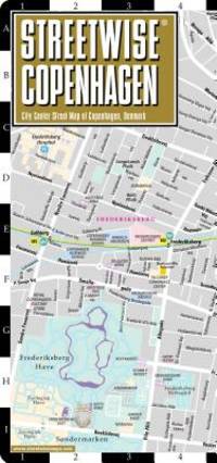
ref. 1931257590-11-1Streetwise Maps Inc. Fol Lam Ma. Very Good. It's a well-cared-for item that has seen limited use. The item may show minor signs of wear. All the text is legible with all pages included. It may have slight markings and/or highlighting. Streetwise Maps Inc unknown
1835ref. 000014144London: Cha. F. Cheffins 1835. Map. Ex-Library. 29 3/8" x 61.5". Linen-backed map done on two sheets. Map printed in black pink yellow and green hand-colored. Housed in a 8" x 5.5" green case with gilt lettering and a gilt device on the front board the front of the case states "London & Birmingham Railway. Map of the Line. above the device Incorporated 6th May 1833". A portion of the map backed with green goat in order to have it enter and exit the case more smoothly. A large and beautiful representation of the London to Birmingham railway line with the stops outlined at the bottom edge of the map. With two engraved vignettes showing the depots in Birmingham and in London. An early example of this captivating map. A bookplate and one stamp on the verso of the map otherwise no markings. The bookplate states that the map was a gift donated by James J. Hill a wealthy bibliophile from St. Paul to the University of Wisconsin Library. The map has three small spots of loss to its folds. The case has wear and light discoloration. Cha. F. Cheffins unknown
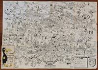
1954ref. BK0099Darmstadt Gemany: Stars and Stripes 1954. Folding pictorial map approximately 2 3¼ x 33 inches unfolded in original illustrated wrappers. OCLC 59284292. Near fine with some wear to wrappers. A wonderfully busy cartoon map of Frankfurt made for American servicemen stationed in Germany during the early Cold War. Byrel "Lefty" Burgess a career U.S. Army engineer and cartoonist fills the city with G.I.s military police beer halls historic buildings street jokes and visual gags while giving particular attention to the extensive American military presence in and around Frankfurt. American sites include barracks the 97th General Hospital WAC quarters Frankfurt High School the PX and residential areas occupied by servicemen and their families. The map ranges from Höchst and Bad Vilbel to Harheim and Offenbach mixing useful street information with caricatures and annotations. Burgess labels historic sites including the Saalhof Karmeliter Kloster Dominikaner Kloster and Drei Königs Kirche while military life and Frankfurt's drinking culture provide much of the humor. Along the upper edge references to places back home-including Texas Chicago Los Angeles Pike's Peak and the Rocky Mountains-reinforce the map's intended audience of Americans temporarily living overseas. Burgess served in the Army Corps of Engineers; he later produced a similarly humorous map of Seoul in 1957. OCLC 59284292. . Stars and Stripes unknown
1889ref. 9062St. Paul Minn: W.C. Riley 1889. 8vo 140 15pp ads and blank journal at rear. Illustrations maps large folding map in pocket at rear as issued. Original leather over card covers stamped in gilt on front with red page edges. Gift inscription on ffep in pencil dated 1907 else clean internally. A beautiful fine copy. Beautiful copy of this illustrated tourist's guide to Yellowstone giving descriptions of the attractions and features of the park with maps a brief history and rules and regulations. Riley issued a just few of these according to OCLC between 1886 and 1890. Scarce and more so in this condition - the nicest we've seen. . W.C. Riley unknown
1992ref. 047410Pachuca Mexico: Consejo de Recursos Minerales 1992 Book. As New. Hardcover. 1st US Ed. The state of Zacatecas is one of Mexico's most historically and economically significant mining regions often highlighted in specialized geological reports including this comprehensive Geological-Mining Monograph of the State of Zacatecas with its detailed text stratigraphic charts and geological maps often in 1:250000 scale that serve as a guide for exploration and academic study of this major mining region. Published by the Consejo de Recursos Minerales now part of the Mexican Geological Survey - SGM 155 p. illus charts col large format fold out maps in rear pockets. As new except for an ownerhip stamp NOTE : Very Heavy 1.5 kg/ large format volume. 35 x24 x24 cm. Consejo de Recursos Minerales hardcover
1857ref. 32586Edward Stanford London unknown circa 1857 First Edition thus. Paperback. maps show slight toning a few stains & marks to back of linen otherwise in very good condition case bumped and rubbed with scuffed corners. approximately 54 x 54 inches. dissected linen backed colour map in two parts: North - from Konigr Ungar & Scharzes Meer to Serbia Bulgarien and Schwarzes Meer: South - Vusitrin & Griechenland to Scharzes Meer Meer von Marmara Kleinasien & Archiplagus Weiss. Both 71 X 137 cm legend in English on the North map boundaries carriage trails battlefields harbours in German scale of English miles 69 to one degree boxed set linen backed maps with marbled paper ends cloth covered slipcase Edward Stanford hardcover
1992ref. 2080502106508353Not Available 1992. Soft Cover. Fine. Volume: 1 Not Available paperback
1995ref. 2091502135417324Not Available 1995. Soft Cover. Fine. Volume: 13 Not Available paperback
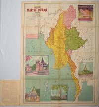
1951ref. 214601Delhi.: S.B. Makhija & Brothers. circa1951. Printed colour map 98.6 x 69 cm folding into pictorial wrappers 25.3 x 19.5 cm five pictorial colour inserts of pagodas and the Shwethalyaung reclining Buddha wrappers a little chipped marginal wear and three small fold splits in the map but overall in very good condition. Attractive large map of Burma with the provinces coloured steamship routes shown in red and printed in the booklet a range of information printed based on the 1951 census including climate agriculture and form of government "Burma became an independent nation completely outside the British Empire on January 4 1948 and is now a sovereign independent republic known as the Union of Burma". . S.B. Makhija & Brothers. unknown
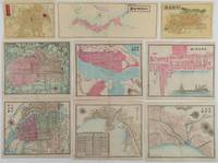
1870ref. 221021Japan. Circa1870s - 1890s. Collection of nine handcoloured copper engraving maps: 大日本全圖. Greater Japan map. 11.5 x 31cm 京都全圖. Kyōto map. 11.5 x 16cm 大阪全圖. Ōsaka map.11.8 x 16cm 大阪市街之圖. Ōsaka city map. 18 x 21.3cm 箱館市街之圖. Hakodate city map. 18 x 21.5cm 長﨑市街之圖. Nagasaki city map. 18 x 22cm 兵庫神戸両港市街之圖. Hyōgo Kōbe city map. 18.1 x 21.6cm 新潟市街之圖. Niigata city map. 18 x 21.8cm 京都市街之圖. Kyōto city map. 17.3 x 21.5cm Occasional light browning on margins of a few maps but all maps in very good condition. This very attractive collection of nine hand-coloured copper engraved maps was most likely published during the early Meiji period between the 1870s and early 1880s. The first three maps depicting Japan Kyoto and Osaka probably date from the early 1870s. On the Osaka map the site of Osaka Castle is still identified simply as a castle while the map of Japan uses Edo-period regional names such as Tosa rather than Kochi Prefecture. The remaining six maps appear to be slightly later probably dating from the early 1880s. On one of these Osaka Castle is identified as military headquarters reflecting the military use of the site during the Meiji period. The map of Kobe also includes an inset railway timetable for services between Kyoto and Kobe. The railway linking the two cities opened in 1877 providing a further indication of the map’s date. The maps are delicately drawn and contain minute details including town names and the locations of numerous public and commercial facilities. Maps of the treaty ports of Hakodate Niigata Nagasaki and Kobe are particularly uncommon. The Hakodate map features attractive illustrations of a Western-style sailing ship and steamship while the Kobe map shows the foreign concession and a cemetery for foreign residents. . unknown
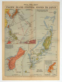
1944ref. 208880Chicago.: Chicago Daily Tribune. 28 September1944. Colour pictorial map on a single newspaper leaf archivally laid down on linen 50 x 39.2 cms; 59.3 x 43.3 cms sheet including captions faint toning to fold lines very good condition. Vivid colour maps of the Palau Islands Guam and Saipan in the Marianas and an inset location map published in the "Chicago Daily Tribune" in September 1944 months after the landing of US and Allied Forces in the offensive against the Japanese during the Pacific War. . Chicago Daily Tribune. unknown
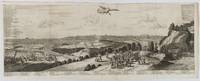
1720ref. 180201A Leide. Leiden.: Chez Pierre van der Aa. circa1720. Engraved panorama on watermarked laid paper 28.5 x 77.5 including captions; 31 x 79.5 cm sheet title cartouche engraved key in French and Dutch the upper margin trimmed to the platemark original folds edgewear and toning neat sealed tear to the outer edge barely visible 5mm intrusion to the image a very good dark impression. Finely composed and engraved panorama of Tokyo prepared for the monumental work "Galerie Agreable du Monde" by the master Dutch publisher Pieter Van de Aa 1659-1733. The detailed key in Dutch and French notes myriad buildings and temples on the horizon and in the foreground two processions converge: of nobles and their attendants dancers a trio of dogs and a priest or religious attending a suppliant. Pieter van der Aa 1659-1733 was born in Leiden Holland and started his own book publishing business when he was only twenty-three. His prolific output of highly decorated maps and atlases culminated in his magnum opus “Galerie Agreable du Monde” which illustrated the world known to Europeans in the early eighteenth century. Comprising 66 volumes it was the of plates published at that time it has been estimated that only 100 copies were published. . Chez Pierre van der Aa unknown
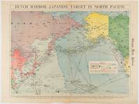
1942ref. 180751Chicago.: Chicago Daily Tribune. Friday June 51942. Printed colour map on a single newspaper leaf 37.5 x 53.2 cm; 44.7 x 59.8 cm sheet inset legend marginal browning and at the folds some undulation of paper and tide mark along lower section but in remarkably bright very good condition. Strategic map published in the Chicago Daily Tribune "The World's Greatest Newspaper" on June 5th 1942 two days after the Japanese attack on Dutch Harbor the site of the US army and navy bases in the Aleutians and as it transpired at the outset of the Battle of MIdway. The owner and proprietor of the Tribune Robert McCormick was staunchly against the United States entering the war and had firm views once it had occurred that American resources should not be used defending the British Empire. Famously the Tribune published the "Victory Program" Roosevelt’s military plan to prepare the United States for possible entry into World War II and was subject to prosecution for an alleged violation of the Espionage Act relating to the newspaper’s front-page account of the Battle of Midway 4-7 June 1942. It became an important test case for the limits of free speech and censorship during war-time. The Legend shows territorial Control of Ocean Areas marking Japanese Naval and Air bases as of 1941 and "according to latest reports" those established in the first six months of 1942. Also shown are pre-war sovereignties as at the bombing of Pearl Harbour on December 7th 1941. The Anson Archipelago is shown but a question mark "indicates islands etc. whose existence or give position is doubtful…". . Chicago Daily Tribune. unknown
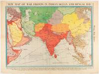
1942ref. 180782Chicago.: Chicago Daily Tribune. April 211942. Printed colour map on a single newspaper leaf 37.5 x 53.2 cm; 60 x 45 x 59.6 cm sheet marginal browning and at the folds but remarkably bright in very good condition. World War II map of Asia save for Japan showing British allies colonies and lines of supply and marking Japanese territorial occupation published in the Chicago Daily Tribune "The World's Greatest Newspaper" in April 1942. "The Indian Ocean and the Bay of Bengal are the strategic waters in this campaign in which the occupied parts of Burma and the Andaman Islands serve as bases" caption ". the historic Chicago Tribune was an innovator in color inks and printing but also a pioneer in bringing colorful art in the form of illustrations photographs cartoons and advertisements to the average person in an everyday medium." see The Janet A. Ginsburg Chicago Tribune Collection Michigan State University Libraries. . Chicago Daily Tribune. unknown
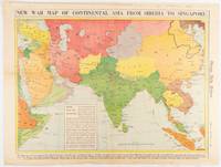
1942ref. 180760Chicago.: Chicago Daily Tribune. January 91942. Printed colour map on a single newspaper leaf 37.2 x 53.4 cm; 45 x 59.9 cm sheet inset legend marginal browning and at the folds lower margin with small edges tears not affecting the caption but remarkably bright in very good condition. Rare map of Asia "Between Suez on the west and Shanghai on the east" showing territorial interests and theatres of war published in the Chicago Daily Tribune in January 1942 barely two months after the Uniited States had joined the war effort after the bombing of Pearl Harbour. Thailand and Vietnam "French Indo-China" are marked "Occupied by the Japanese" and north-eastern China similarly marked Iran "Anglo-Russian Occupation" and the Gulf states "British Ally". The caption notes that "The map inludes waters thru which runs the British life line from the Suez canal to remote Australia and New Zealand. Nearly half the people in the world live in the lands shown on this map--more than 450 million for example in China and more than 375 million in India". ". the historic Chicago Tribune was an innovator in color inks and printing but also a pioneer in bringing colorful art in the form of illustrations photographs cartoons and advertisements to the average person in an everyday medium." see The Janet A. Ginsburg Chicago Tribune Collection Michigan State University Libraries. . Chicago Daily Tribune. unknown
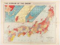
1941ref. 180789Chicago.: Chicago Daily Tribune. December 121941. Printed colour map on a single newspaper leaf 41.5 x 53 cm; 45.1 x 59.9 cm sheet three inset maps of the Japanese Empire; Taiwan and Ryukyu Islands; and Hokkaido and Chisima marginal browning and at the central fold but remarkably bright in very good condition. Map of the Japanese Empire ominously titled published in the Chicago Daily Tribune one week after the bombing of Pearl Harbour. Prefectures are attractively coloured. Based on a Rand McNally map the Tribune briskly got to work issuing maps for readers showing the beginnings of the war with Japan. Later maps were also published for sale separately but remarkably few have survived. ". the historic Chicago Tribune was an innovator in color inks and printing but also a pioneer in bringing colorful art in the form of illustrations photographs cartoons and advertisements to the average person in an everyday medium." see The Janet A. Ginsburg Chicago Tribune Collection Michigan State University Libraries. . Chicago Daily Tribune. unknown
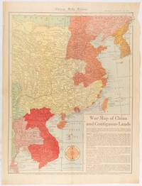
1519ref. 180794Chicago.: Chicago Daily Tribune. January 151942. Printed colour map on a single newspaper leaf 53 x 40.7 cm; 59.8 x 45 cm sheet inset text box marginal browning and at the folds but remarkably bright in very good condition. WWII map of China showing most of China Indo-China Thailand and Korea with territory captured and controlled by Japan shaded in orange and red published by the Chicago Daily Tribune barely six weeks after the bombing of Pearl Harbour. The text on the map reads "Since 1937 China has been at war with Japan. Lacking many essentials of war the Chinese nevertheless have managed to maintain a front against the aggressors. China's principal life line is the Burma road shown on the map which starts at Lashio Burma and extends to Kunming Yunnan province where it links with connections to Chunking the present Chinese capital". Based on a Rand McNally map the Tribune briskly got to work issuing maps for readers showing the beginnings of the war with Japan. Later maps were also published for sale separately but remarkably few have survived. "… the historic Chicago Tribune was an innovator in color inks and printing but also a pioneer in bringing colorful art in the form of illustrations photographs cartoons and advertisements to the average person in an everyday medium." see The Janet A. Ginsburg Chicago Tribune Collection Michigan State University Libraries. . Chicago Daily Tribune. unknown
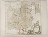
1751ref. 177606Paris. 1751. Engraved map 48 x 52.2 cm; 51 x 67.6 cm sheet provinces highlighted with outline hand-colour elaborate title cartouche central fold small tear at the foot affecting the border old paper repair on the verso affecting the margin only pin-holes to the four marginal corners margins a little browned and dusty a handsome map in good condition. Fine large format map showing China Korea Taiwan and parts of Central Asia prepared for De Vaugondy's "Atlas Universel". The beautifully foliated cartouche features a duo of joyful Chinese musicians one dancing and a diminutive figure holding a parasol. From the Estate of the late collector and scholar Arthur Hacker. . unknown
ref. 250702DHarperCollins UK 2015-05-01. paperback. Good. 4x0x7. HarperCollins UK paperback