2055 resultados
1991ref. SBBI-mon0000010991Philip's 1991. hardcover. Good. Our good condition books are generally good for reading but not for gifting or collecting. They could have imperfections such as creasing fanning inscriptions margin notes yellowing staining on edge or cover or pages bumps scuffs etc etc sometimes multiple of these. It's a wide category that encompasses anything that isn't almost-new down to anything that is slightly better than poor. We would NOT recommend gifting Good books - these should be considered reading copies. Our books are dispatched from a Yorkshire former cotton mill. We list via barcode/ISBN so please note that the images are stock images and may not be the exact copy you receive furthermore the details about edition and year might not be accurate as many publishers reuse the same ISBN for multiple editions and as we simply scan a barcode or enter an ISBN we do not check the validity of the edition data when listing. If you're looking for an exact edition please don't order at least not without checking with us first although we don't always have time to check. We aim to dispatch prompty the service used will depend on order value and book size. We can ship to most countries see our shipping policies. Payment is via Abe only. Philip's hardcover
2011ref. SBBIH-MLCPJ2FHNMNZPopOut Maps 2011. paperback. Good. Our good condition books are generally good for reading but not for gifting or collecting. They could have imperfections such as creasing fanning inscriptions margin notes yellowing staining on edge or cover or pages bumps scuffs etc etc sometimes multiple of these. It's a wide category that encompasses anything that isn't almost-new down to anything that is slightly better than poor. We would NOT recommend gifting Good books - these should be considered reading copies. Our books are dispatched from a Yorkshire former cotton mill. We list via barcode/ISBN so please note that the images are stock images and may not be the exact copy you receive furthermore the details about edition and year might not be accurate as many publishers reuse the same ISBN for multiple editions and as we simply scan a barcode or enter an ISBN we do not check the validity of the edition data when listing. If you're looking for an exact edition please don't order at least not without checking with us first although we don't always have time to check. We aim to dispatch prompty the service used will depend on order value and book size. We can ship to most countries see our shipping policies. Payment is via Abe only. PopOut Maps paperback
2013ref. SBBI-mon0000032215PopOut Maps 2013. map. Good. Our good condition books are generally good for reading but not for gifting or collecting. They could have imperfections such as creasing fanning inscriptions margin notes yellowing staining on edge or cover or pages bumps scuffs etc etc sometimes multiple of these. It's a wide category that encompasses anything that isn't almost-new down to anything that is slightly better than poor. We would NOT recommend gifting Good books - these should be considered reading copies. Our books are dispatched from a Yorkshire former cotton mill. We list via barcode/ISBN so please note that the images are stock images and may not be the exact copy you receive furthermore the details about edition and year might not be accurate as many publishers reuse the same ISBN for multiple editions and as we simply scan a barcode or enter an ISBN we do not check the validity of the edition data when listing. If you're looking for an exact edition please don't order at least not without checking with us first although we don't always have time to check. We aim to dispatch prompty the service used will depend on order value and book size. We can ship to most countries see our shipping policies. Payment is via Abe only. PopOut Maps unknown
1989ref. SBBI-mon0000009291TT. Maps & Publications 1989. paperback. Good. Our good condition books are generally good for reading but not for gifting or collecting. They could have imperfections such as creasing fanning inscriptions margin notes yellowing staining on edge or cover or pages bumps scuffs etc etc sometimes multiple of these. It's a wide category that encompasses anything that isn't almost-new down to anything that is slightly better than poor. We would NOT recommend gifting Good books - these should be considered reading copies. Our books are dispatched from a Yorkshire former cotton mill. We list via barcode/ISBN so please note that the images are stock images and may not be the exact copy you receive furthermore the details about edition and year might not be accurate as many publishers reuse the same ISBN for multiple editions and as we simply scan a barcode or enter an ISBN we do not check the validity of the edition data when listing. If you're looking for an exact edition please don't order at least not without checking with us first although we don't always have time to check. We aim to dispatch prompty the service used will depend on order value and book size. We can ship to most countries see our shipping policies. Payment is via Abe only. TT. Maps & Publications paperback
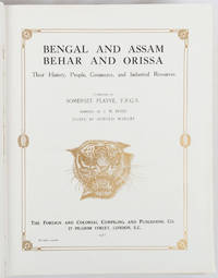
1917ref. 214418London and New York.: The Foreign and Colonial Compiling and Publishing Co. 1917. Numerous black and white photographic illustrations 768pp. 30 x 23.5cm. Full red morocco binding spine lettered and ruled in gilt in compartments 'Tiger head' emblematical device stamped in gilt on the upper board repeated in gilt on the title page corner ornaments blocked in gilt. All edges gilt marbled endpapers light rubbing to corners but a lavishly produced edition in exceptional condition. One of a series of publications published with the object of supplying the British public with a picture - complete as far as literary and pictorial effort could make it - of the several different parts of the Empire. in this instance Northern India. . The Foreign and Colonial Compiling and Publishing Co. unknown
1780ref. 328331780. S.l. s..s.d. circa 1780. Un vol. au format pt in-4 252 x 208 mm de 2 ff. n.fol. 28 pp. 50 planches sur double-page et 19 tableaux in fine majoritairement dpliants. Reliure de l'poque plein veau glac et marbr blond triple filet dor encadrant les plats dos nerfs orn de filets gras froid doubles caissons d'encadrement dors fleurons dors semis de pointills dors piÂce de titre de maroquin fauve agrmente de roulettes dores titre dor palette dore en queue double filet dor sur les coupes toutes tranches dores. L'ouvrage comporte 50 sur 50 : dont une dpliante cartes graves avec rehauts aquarells du temps sur double-page montes sur onglets ; dresses par Rigobert Bonne. In fine 19 tableaux statistiques majoritairement dpliants. Une grande partie des cartes a ici t grave sur joli verg bleut. Vritable encyclopdie de lÕanticolonialisme au XVIIIÂ l'ouvrage constitue dÕun de ces ÇÊvoyages philosophiquesÊÈ prtexte rflexions sur la ÇÊloi naturelleÊÈ et dnonciations mordantes du despotisme du clricalisme de l'esclavage des Noirs ainsi que du colonialisme. Interdite en 1772 lÕHistoire des deux Indes sera nouveau publie par lÕabb Raynal dans une nouvelle dition en 1774 qui est immdiatement mise lÕIndex par le clerg. CÕest en 1780 quÕil publie sa troisiÂme dition de l'Histoire des deux Indes encore plus virulente que les deux prcdentes et quÕil avoue implicitement comme tant de lui. Condamn par le Parlement de Paris lÕouvrage est brl par le bourreau en place publique ce qui lui assure un succÂs considrable. Peignot II Dictionnaire critique littraire et bibliographique des principaux ouvrages condamns au feu p. 71- Sabin 68081 - Tooley Maps and maps-makers p. 44 - Qurard VII La France littraire p. 473 - Cohen II Manuel de l'amateur de livres gravures du XVIIIÂme 854 - rahir BibliothÂque de l'amateur p. 311 - Graesse VI Trsor de livres rares et prcieux p. 41 - Brunet IV Manuel du libraire et de l'amateur de livres 1126. Angles coupes et coiffes lims celle de tÂte arase. Rousseurs affectant les feuillets de texte liminaires ainsi que les tableaux placs en fin de volume ; rares sur les cartes. L'une d'entre-elle prsente un petit manque en marge suprieure sans atteinte la gravure. DiscrÂte cerne en marge suprieure de quelques planches. Nonobstant ensemble en belle condition. b42961 unknown
ref. SONG1577664817Used: Good unknown
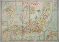
1906ref. 197908Kobe Japan.: Fuku-In-Kwan. 1906. Printed colour folding map on two conjoined sheets laid down 73.8 x 105 cm foxing on verso not affecting map single pinhole in each corner scant spotting small fold splits no loss a few soft fold creases but in good condition. Very rare striking map of Japan published for the Western market. Created under the direction of Takachika Okishio featuring 10 inset maps: Chishima Kurile Islands Hokushu Hokkaido Ogasawara-Jima Bonin Islands Hachijo-Shima Ioshima Okinawa Saki-Shima Kyushu Saikaido Taiwan Formosa and Eastern Asia. The insets of Taiwan and Kyushu are the largest and centrally positioned. A Glossary and Explanation of Signs is printed at the foot of the map which list Towns Railway Stations Boundaries of Prefectures Notable Places Hot Springs Water-falls rapids Volcanoes Light-Houses Gold Silver and Coal-Oil fields. The Japanese Government Railway series of Travellers' Maps of Japan appear to have been modelled after this design. . Fuku-In-Kwan. unknown
1840ref. 018232London: Printed and Published By J. Barfield 1840. Book. Very Good. Hardcover. Fourth Edition. Folio 30 x 46cm. "Revised Collated and Considerably Enlarged by John Satchell Esq." Seventy-four double-page engraved genealogical tables and geographical maps all with original hand colouring contemporary . half black morocco gilt with green cloth boards. Binding good with some general wear and rubbing leather chipped with loss to the base of the spine joints rubbed but still strong corners worn. All edges gilt./ Contents clean and tight contemporary ink stain effecting the fore-edges of the first few pages but not affecting text or maps most noticeable to the front end papers with also have a pencil inscription dated 30 November 1935. All maps and charts in very good condition. Notwitstanding wear to the binding a very good copy. Printed and Published By J. Barfield Hardcover
1920ref. 8575Paris 1920. French naval chart 63 x 91.5 cms black and white with beacons highlighted in yellow insets of Port dAbri the inner harbour at modern day Izmir and two coastal profiles slightly dusty lower margin one or two closed marginal tears blank verso. Engraved in 1866 after British charts by Copeland and Spratt this example of the map was printed in September 1920 during the Greek occupation of the Zone of Smyrna part of the territory awarded to Greece at the expense of the Ottoman Empire by the Allied powers after the Great War. Smyrna became an important base for Greek forces during the resulting Greco-Turkish War of 1919-1922 and in the bloody aftermath of the Greek withdrawal half the city was razed in the Great Fire of Smyrna also known as the Smyrna Catastrophe. Map unknown
1986ref. ABC_49503King of Prussia Pennsylvania USA: Franklin Maps 1986. Folded. Ca. 87.5 x 114 cm. Three maps printed in colour on one large sheet of paper: one large overview map of the Middle East also showing parts of the Soviet Union North Africa and Turkey on one side and the "title page" with two smaller maps - one of Iraq and one of the countries around the Persian Gulf - on the other side. Colourful declassified CIA map of the Middle East probably depicting the situation between January 1972 when the United Arab Emirates UAE was founded and 21 August 1974 when the Treaty of Jeddah was signed. On the present map the UAE still shares a direct border with Qatar which was no longer the case after the treaty as it had to cede territory to Saudi Arabia. The map was likely drawn and used by the CIA because of the tensions in the region but declassified a decade later. It is not dated but must have been published after 1986 as the publisher changed its name from Franklin Survey Company to Franklin Maps and moved its offices from Philadelphia to King of Prussia PA in 1986.With a contemporary ownership annotation "Betty Vomer Meurade ". The map is folded with small holes in some of the areas where two folds meet. Otherwise in good condition.l Cf. for the publisher: Tedyffrin Easstown Historical Society History Quarterly 42-3 Summer 2005 pp. 82-94 online via: https://www.tehistory.org/hqda/html/v42/v42n3p082.html. Franklin Maps, unknown
1934ref. 61915Chicago IL: Published by A.J. Nystryom & Co. Maps Globes Charts 1934. Seven large linen-backed colour lithograph maps sized from 43.5 x 72 in. to 51.5 x 60 in. all mounted on their original spring-loaded rollers wooden pull dowel & metal ring pull some creasing minor edgewear creasing soot soiling to the lower margin averaging about 6-7 in. due to exposure when rolled “Europe” and “United States” with faint tidemark & discoloration at left margin some minor creasing wear all preserved in the original A.J. Nystrom quarter-sawn oak wall bracket sized 58.5 x 15.25 x 3.25 in. all pull-down maps firmly secured in their steel brackets preserving 6 of the 7 original labels on the edge of the pull-down dowels still a VG- set of maps in their original configuration. First editions thus of this complete and exceptional example of the Atwood/A.J. Nystrom Regional-Political Series Map Case reflecting the many geographical and political changes between World War I and World War II. Such changes are reflected in the appearance of Manchoukuo the Japanese controlled rump state established in Manchuria in 1932 by the Japanese Empire and also depicting Korea still as Chosen. The Europe map depicts the East Prussia still controlled by the Weimar Republic and then after Hitler ascended to power; while Africa still retains much of the colonial powers as shown in the Belgian Congo Anglo-Egyptian Sudan French Equatorial Africa and even Beuchuanaland. The Australia and the Far East Map clearly defines the Japanese United States British & Australian mandates across the South Pacific. Atwood 1872-1949 was a noted geographer and educator who was a member of both the New Jersey and Wisconsin Geological Surveys served in the US Geological Survey served as professor of Physiography at Harvard and later from 1920-1946 when he produced these maps was President of Clark University and Head of its School of Geography. No similar complete sets located in Worldcat. Published by A.J. Nystryom & Co., Maps, Globes, Charts, unknown
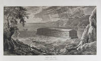
1833ref. 18856Milano: Fortunato Stella e Figli 1833. First Italian edition. Hardcover. f to vg. Oblong folio 12 6/8 x 18 1/2". 1 leaf Title 38 leaves Plates 1 leaf List of content. Original half morocco over burgundy paper covered boards. Gold lettering and tooling on spine. Rare first Italian edition of Paul-Louis-Bernard Drach's atlas volume of his "Sainte Bible de Vence" a series which was originally published in 27 volumes in Paris from 1827 to 1833. The striking 38 engraved plates featured in this atlas are composed of 13 maps by A. R. Fremin and 25 engravings signed by Falkeisen Angelini and Lanzani. The engraved plates have been laid down on beautiful hand-made paper and describe the following: 1. Map of the place of Eden Mesopotamy and Persian Gulf; 2. Noah's Arch construction; 3. Noah's Arch; 4. Map of the land divided among Noah's sons; 5. The Babel Tower; 6. Map of the Land of Canaan; 7. Map of Jews' Pilgrimage; 8. The Jerusalem Sahnedrin; 9. The Temple of Jerusalem plans and sections; 10. The Temple of Jerusalem square plan; 11. Map of ancient Jerusalem; 12. The Temple of Salomon; 13. The Temple's foundations; 14. The East Gate; 15. The Buildings of the Temple; 16. Musical Instruments of the Jews; 17. Hebrew Alphabet; 18. Jew's Vestments and worship's objects; 19. Two Menorah; 20. High Priest's vestments and Golden Menorah; 21. Moses' Tabernacle; 22. The Loaves of Proposition; 23. Plan and section of the Tabernacle; 24. The encampment of the Israelites; 25. Map of the Holy Land South; 26. Map of the Holy Land North; 27. Map of Syria; 28.Map of Israel under Salomon; 29. Plan of the House of the Forest of Lebanon; 30. The House of the Forest of Lebanon; 31. The Bronze Sea; 32. The Washings; 33. The Altars of the Holocausts; 34. Map of the Persian Empire; 35. Map of the Land of Canaan according to Ezechiel; 36. Map of Herod's Reign; 37. Zachary's Vision; 38. Map of the travels of Saint Peter and Saint Paul. The plates measure appr. 12 1/2 x 18 1/4" image size appr. : 9 1/2 x 14 6/8". Binding rubbed on covers and along edges. Head and tail of spine chipped. Previous owner's Ex-libris Calvin Bullock on inside of front cover. Minor and sporadic foxing along paper margin not affecting plates. Title and captions in Italian. Binding in overall fair interior in very good plates in near fine to fine condition. About the author: "David Paul Drach aka Paul-Louis-Bernard Drach after his conversion 1791-1865 was a Catholic convert from Judaism and librarian of the College of Propaganda in Rome. Drach received his early education from his father who was a rabbi. After spending some time in various Talmudic schools he became a teacher at Rappoltsweiler though only sixteen years of age. The love of the secular sciences brought him to Paris where he was welcomed by his coreligionists and became tutor in a wealthy Jewish family. His reputation as a teacher brought him Christian pupils; and this may have had some influence on his subsequent conversion; in fact he had always manifested some leaning toward Christianity. Drach had already begun the study of Greek and Latin so as to become acquainted with the Christian doctrines in their original sources. Struck by the accusation of some of the Fathers that the Jews had corrupted the Hebrew text he began a comparative study of the Hebrew and the Septuagint which study he continued in spite of the remonstrances of the president of the Central Consistory. Drach was received into the Catholic faith in 1823 together with his two daughters and his son Paul who afterward became a priest and a distinguished Biblical scholar. In 1827 Drach accepted the position of librarian of the Propaganda in Rome which position he held until the year of his death." From the Jewish Encyclopedia. Fortunato Stella e Figli hardcover
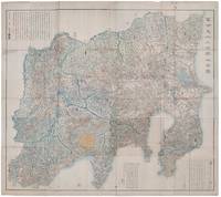
1418ref. 159850Shūseidō 衆星堂. Reprint. Tenpō 14 1843. Large folding handcoloured map of the thirteen provinces from which Mt. Fuji can be viewed. 159 x 178cm. Folds into paper covered card covers measuring 40 x 24cm. Title label upper cover. A little browning along folds occasional spotting and soiling. A little worming causing approximately 1cm of loss in places. Two chops in lower section. A very striking and attractive map. This very large handsome map is a detailed map of the thirteen provinces from which one can see Mt. Fuji. Provinces shown are the eight provinces of the Kantō region Sagami 相模 Musashi 武蔵 Kazusa 上総 Shimofusa 下総 Awa 安房 Kōzuke 上野 Shimotsuke 下野 and Hitachi 常陸 and five other provinces Izu 伊豆 Suruga 駿河 Tōtōmi 遠江 Kai 甲斐 and Shinano 信濃. The map offers a large amount of detailed information such as province and county borders rivers high ways post towns checkpoints villages and scenic spots. The cartographer Akiyama Einen or Nagatoshi 秋山永年 came from Edo and the editor Funakoshi Seizō 船越清蔵 studio name: Shugu 守愚 1805-62 a Confucian scholar from Nagato Province now the western half of present-day Yamaguchi Prefecture. A dedication by Funahashi Akira 舟橋徴 is dated 1843. . Shūseidō 衆星堂 unknown
ref. 26975'Published by Survey Directorate G.H.Q. Paiforce 1944. All one page 20 x 33cms some stained but texts clear and complate. 1. Index map of Iraq and Iran for a 1:100000 scale survey series produced by the British military command PAIFORCE during World War II. All 20 x 32.5cm a couple sl. stained mainly good condition.1.Four Index maps of Iraq and Iran ¼ series I.D.R./X.D.R./G.S.G.S. 9002 3919 nos. 1-42.Index map of Iraq and Iran for a 1:100000 scale survey series produced by the British military command PAIFORCE during World War II. Index Map of 'Irq rn 1:100000 Series I.D.R. 9003'.3.Four Index Maps of places/areas of IRAN:a. Ahwaz 1:10000 series 1D MISC/563 to 573 stamped 11 June 1944b. Askaran and Sanandaj N.W. 1:25000 series …9005 stamped 25 June 1944c. Gach-I-Sar 1:50000 series stamped 11 June 1944d. Khurramshahr Abandan 1:12500 series4.Six Index Maps of places/areas of IRAQ all 1:25000 series ID 9005:a. Ba'qubab. Faidahc. Haffad. Hindiyae. Falluja f. MoselNo reference to other copies yet found. 'Published by Survey Directorate, G.H.Q. Paiforce [1944] unknown
ref. SONG3829770235Used: Good unknown
1963ref. 80578Wesleyan University Press. As New. Hardcover. FREE UPGRADE to Courier/Priority Shipping Upon Request - IN STOCK AND IMMEDIATELY AVAILABLE FOR SHIPMENT - AS NEW THE TEXT BLOCK IS PRISTINE CLEAN UNMARKED AND IN EXCELLENT CONDITION - - xiv 430 pp. 154 photos. bibliog. index 4to. -- with a bonus offer-- . 1963. Wesleyan University Press hardcover
1967ref. 38237Maplewood NJ: Hammond Incorporated. As New. Hardcover. FREE UPGRADE to Courier/Priority Shipping Upon Request – – IN STOCK AND IMMEDIATELY AVAILABLE FOR SHIPMENT - TEXT PRISTINE Pages tight to spine -- with a bonus offer--; T-Coodon; Cooke Donald E.; Illustrated maps By Dwight Dobbins Atlas of the Presidents with Pictures of the Presidents based on Photographs of Portraits Supplied By the Library of Congress . 1967. Hammond Incorporated hardcover
2015ref. 114822Acanthus Press. New. Hardcover. FREE UPGRADE to Courier/Priority Shipping Upon Request - IN STOCK AND IMMEDIATELY AVAILABLE FOR SHIPMENT - IN STOCK AND IMMEDIATELY AVAILABLE FOR SHIPMENT - Flawless copy brand new pristine never opened - -- with a bonus offer-- . 2015. 0926494910 . Acanthus Press hardcover
1664ref. 2341508London: Excudebat J.F. James Flesher pro Jona Hart 1664. First Thus. Hard Cover. Near Fine/No Jacket. Rebound with new end sheets: brown leather spine marbled paper over boards red morocco spine label gilt titles and rules. Binding tight pages clean and unmarked. 1664 Hard Cover. viii 230 pp. Last text page misnumbered 216. Descartes's fundamental and originating work of the modern era in Western philosophy bound together with a work by one of the Utrecht Cartesians Lambert van Velthuysen. This is the first British printing of the Meditations though it does not include Descartes's 'Objections and Replies' as many editions do. Velthuysen was connected by marriage to Descartes's friend Henry Regnier and corresponded with scientists and philosophers such as von Leeuenhoek Spinoza and Leibniz. The work included here shows the influence of Thomas Hobbes - unsurprising given that Velthuysen is credited with translating Leviathan into Dutch. John Locke may have met Velthuysen while in Utrecht in 1684/85 and had eight titles by Velthuysen in his personal library including the Rheims edition of the present title. Bound into this volume are two plates not called for in either work which may be taken from the Hart printing of Principia Philosophia which was published the same year. Wolf 736 Wing D1133a. Excudebat J.F. [James Flesher] pro Jona Hart hardcover
1708ref. 8917London: John Nicholson 1708. Full Leather. Very Good binding. Octavo. xxxviii 2 412; 2 382 2 ads 32 index pp. maps. First edition. Contemporary paneled-calf boards with modern reback. Title page to Volume 1 and four of the eight maps are lacking but are supplied in tasteful facsimile. The maps in facsimile are the North America New England Virginia and Maryland and Carolina. Bindings are solid and presently nicely; contents are clean and bright; but for the maps and title page this is an exceptional set. Of this work William Reese writes: "This basic 18th-century reference work on British America . . . offers an excellent comprehensive survey of Great Britain's American colonies at the point when those on the mainland of North America had grown past their initial phase and were expanding rapidly in population and productivity. . . . This important contemporary work would probably have been the first point of reference for any Englishman at the time" Reese Struggle for North America 1. Usually attributed to Oldmixon who penned the dedication but occasionally gets attributed to Moll according to Sabin. A significant work by the British historian. Howes O-61 "aa"; European Americana 1708/95; ESTC T45485; Sabin 57156. John Nicholson unknown
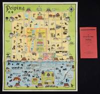
1934ref. 158433Peiping.: Peiyang Press. circa1934. Coloured folding plan of Peking with original envelope. 60 x 50cm. A few neat repairs at folds two panels evenly browned on reverse. A very good copy of a scarce pictorial plan with its envelope. This delightful and scarce pictorial map of Peking with landmarks and streets in romanised Chinese with occasional Chinese characters is surprisingly scarce. Although apparently issued in several editions in the 1920s and 30s it appears relatively infrequently on the market. The divisions of the Legation District are indicated by their flags - this edition shows the German Legation by use of the black white and red bands of the German flag. This flag which was no longer used after 1935 helps date this edition. Other landmarks and attractions shown included theatres foreign shopping area adjacent to the legations quarter Liu Li Chang Curio District the racecourse the many city gates etc. . Peiyang Press. unknown
1788ref. 024356London: Printed for J. Walker 1788. Book. Very Good. Hardcover. First Edition. 12mo. A very good four volume set in contemporary full tree calf binding with double lettering pieces in red and green. Complete pp. iii-vii 1 222; 2 206; 2 238 & 2 198. No half-titles which may or may not be wanting but the pagination for the prelims to vol. I might suggest that one is required Very good bindings with a little rubbing a couple of volumes slightly chipped to the head/tail of the spines corners lightly bruised. Contents clean and tight manuscript Greek initials to title pages dated 1788 otherwise unmarked no foxing paper crisp. A very good set. A Rare Eighteenth Century Novel. We have managed to located just one other copy at auction in the last thirty years and that at Sotheby's sale of July 21 1993 where it made £1000 on the hammer though seemingly not such a nice copy. Referenced by: ESTC T068744. Printed for J. Walker Hardcover
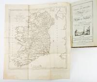
1783ref. ST19355London: Engraved by G. Terry and Sold by T. Longman London and W. Wilson Dublin 1783. Second Corrected Edition. 260 x 155 mm. 10 1/4 x 6". XXVII 289 pp. 4 leaves index. Contemporary half calf over marbled boards flat spine divided into panels by gilt rules red morocco label very neat repair to head of front joint and top of spine. Engraved title page with vignette and dedication leaf large folding map of Ireland and 289 engraved maps. Title page with early ink signature of Jos. Sabine. Moreland & Bannister p. 190; Tooley "Maps and Mapmakers" p. 94. Small signs of age and wear to the binding including slight crackling and nicks to the spine folding map with faint dampstain to tail margin two negligible ink spots to blank area on the map of the Irish Sea but A VERY APPEALING COPY quite clean and remarkably fresh internally and in an entirely solid period binding. This is the second corrected edition of the first comprehensive road atlas of Ireland offered here in especially attractive condition. In response to increasing demand for accurate maps of the country's road system the Irish House of Commons commissioned George Taylor and Andrew Skinner who together had previously produced the first road atlas of Scotland among other works to undertake a survey of the land. Taylor and Skinner completed their work in 1777 and published the first edition of their findings in 1778. This second edition includes updates to the year 1783 as well as an additional map no. 289. Renowned for their precision and detail Taylor and Skinner's maps clearly show roads crossroads and bridges as well as topographical features such as hills lakes and rivers including the direction of the water flow; landmarks such as castles churches and ruins; and the names of local landlords and their homes. The maps appear either as half-page strips or in full-page and the distances are given in both Irish and English miles 11 Irish miles being equal to 14 British miles. The robust list of subscribers which includes a number of earls viscounts lords bishops and British and Irish army men demonstrates the great need for and widespread success of this important work. Our former owner may well be the famed and controversial naturalist Joseph Sabine 1770-1837 who often signed his name as "Jos. Sabine" as seen here. He certainly had good reason to own maps of Ireland. He was from an Anglo-Irish family himself and was Honorary Secretary of the Horticultural Society a position which at the time carried great clout in the botanical community and one that presupposed knowledge of geography across the realm. DNB tells us that "Sabine played a leading part in the establishment of the society's garden first at Hammersmith and afterwards at Chiswick; in sending out David Douglas and others as collectors; in starting local societies in connection with the Horticultural Society; and in growing and distributing new and improved varieties of flowers fruits and vegetables throughout the country." While not a rare book this is the kind of volume that would have normally encountered frequent and inevitably damaging use so to find a copy as well preserved as this one is a lucky occurrence. Engraved by G. Terry and Sold by T. Longman, London and W. Wilson, Dublin unknown
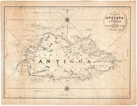
1860ref. 48522Antigua but actually Philadelphia: R.B. Eldridge & Co. ca.1860. Interesting Map of the Island of Antigua An unusual lithographic edition of Norie's 1827 revision of this handsome chart lithographed by Wagner & McGuigan in Philadelphia. A statement in the cartouche reads: "Presented by R.B. Eldridge Antigua to Captain Andrew Tyler." The captain's name is accomplished in manuscript. R.B. Eldridge is not listed in Tooley's DICTIONARY OF MAPMAKERS and appears to be unrelated to publisher of charts George Eldridge. It seems most likely that he was rather an Antigua merchant who commissioned a reprint of the chart for complimentary distribution to sea captains. A handsome piece. Lithographic sheet map 20½ x 26½ inches. Backed with contemporary blue paper. Light foxing and toning. A few small tears in margins. Very good. unknown