Streetwise MapsBiblio.com
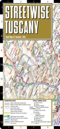
ref. 188670595X.Gmap. Good. Access codes and supplements are not guaranteed with used items. May be an ex-library book. unknown
1997ref. Q-0002555093HarperCollins 1997-01-01. Hardcover. New. In shrink wrap. Looks like an interesting title! HarperCollins hardcover
1927ref. 29334HBDJ VG/VG- 1927 on Title pg 1ST edition Hardcover. Condition: Fine-. Dust Jacket Condition: Very Good. SMALL Dark burgundy cloth with Gold gilt Spine Cvr. Hinges & Binding strong. . 12mo 188 pg INDEX o/w VG Copy in dusty but o/w VG DJ with Spine DJ endchips. Hard Cover. FINE-/Very Good. 12mo Ghostly Castles Seat of its 1st Kings St. cloud St. Germaine MalmaisonVersailles Fountainebleau ETC Robert McBride NY hardcover
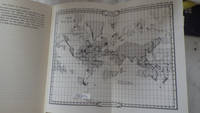
1972ref. 30289HBDJ 1972 Revised VG-/VG AS-IS Blue cloth lettered in White Interior Nice tight light Wear SOME INK NOTES AND UNDERLINING but has FoX Stains 108 pgs DJ light wear & SCUFFING Extremities DJ 8vo - over 51â„4" - 83â„4" with 2 FOLD OUT Maps According to Churchward Lemurians developed homes with transparent roofs lived to be hundreds of years old and were capable of telepathy astral travel and teleportation. ATLANTIS they became greedy petty and "morally bankrupt" and the gods "became angry because the people had lost their way and turned to immoral pursuits" Orser says. As punishment he says the gods sent "one terrible night of fire and earthquakes" that caused Atlantis to sink into the sea. LONDON, Illinois: Theosophical Publishing House, hardcover
1939Very Good Turkish Original TLS document signed 'Aziz Ogan' as 'the general director of Istanbul Archaeological Museums'. 32,5x21 cm. In Turkish. 1 p. Full. Typescript document with autograph corrections and signature. Including request of the photographs of listed 25 Seljuk and Ottoman architectural buildings such as mosques, fountains, hans, tombs etc. Dated 12-9-1939. Addressed to Nuri [Ebussuudoglu from the member board of the Turkish Antiquities Protection Council. Letterhead 'TC Istanbul Müzeleri Genel Direktörlügü' [i.e. The General Directory of Istanbul Museums]. Ogan was a Turkish archaeologist and museologist. He was the one of the earliest archaeologists of the Turkish Republic. He founded Izmir Archeology Museum and was the director of Istanbul Archeology Museums. He is the father of the first Turkish female archaeologist Jale Inan.
2007New Turkish Original bdg. HC. Folio. (42 x 34 cm). Text in Turkish and French. [xx], [66], 37, [1] p., color maps. Charles Edouard Goad'in Istanbul sigorta haritalari. Fire insurance maps of Istanbul by Charles Edouard Goad, (1848-1910). He was a cartographer and civil engineer, was born on 15 March 1848 at High Street, Camberwell, Surrey, the second son of Charles Goad, plumber, of London, and his wife, Caroline Ann (née Vogel). 1000 copies were printed.
1958Very Good Turkish Modern cloth bdg. 4to. (30 x 24 cm). In Turkish. 27 p. text; 21 numerous map feuilles in Ottoman script and modern Turkish. 19. asirda Istanbul haritasi. Ekrem Hakki Ayverdi was raised at a time in which Istanbul was undergoing its late Ottoman-early Republican period. Apart from his persona as an engineer-architect, restorer, and architectural historian, he was a collector passionately dedicated to Ottoman art. Undertaking the construction of different public buildings in Istanbul, Bursa and Edirne, as well as the restoration of many architectural works, Ayverdi not only brought together the most select and refined works of Ottoman art, which had begun to lose its prestige amidst the changing values of high culture in the time he lived, but he also paid particular attention to their conservation and preservation. Ayverdi's two seminal corpuses that study Ottoman architecture from its early days until the end of the Mehmed II era, as well as its examples in Roumelia, continue to maintain their place as the most important reference books for those working in this field. This is a detailed research on a 19th century map of Istanbul city.
1802pp. v, (4), 226, (2) + Plus engraved Frontis, Plates of scenes and large folding maps and charts. One map includes the sketch of soils, canals, etc of Lancashire. LACKS full page plate of Furness Abbey. View of Keswick Lake repeated on page 107 and 125. View of Bassenthwaite omitted. Two pages have old tape repairs with no loss. Map of the districts has small tape repair on one fold. Offsetting from Frontis on title page. Age stained and foxed. Engraved amoral bookplate of William Scott Elliot of Arkleton. 8vo. 215 mm. Original full leather binding. Boards detached. Small loss on spine. Binding worn. Hardbound. A rather poor copy of a great book. SCARCE. **PRICE JUST REDUCED! TRAVEL/7
1824Four volumes in two. Two folding maps and one single full page map (as called for in OCLC). Deckled edges. Foxed. Mildly XLib. XLib stamp of the A.R. Wentz Library Lutheran Theological Seminary Gettysburg, PA on top edges and verso of the dedication page. 8vo. 235 mm. S&S/AI 17982. First American from the fifth London edition. Original boards and label binding, broken. Best to consider as virtually disbound. Text very good. PAIMP 24
1828348 p. Folding colored map of Massachusetts. The map could use some minor repairs at folds, etc. 12mo. Contemporary full leather binding. American Imprints 35374; Howes S-839; Sabin 89563. Atlas Case. QUITE SCARCE. **PRICE JUST REDUCED!
2008ref. SBBIH-WKZAECDOILJ6Hema Maps New Zealand Ltd 2008. map. Acceptable. Please see the condition note after this for details if this is missing please consider Acceptable to mean poor quality that could include major staining water damage writing missing dustjacket etc etc. Our books are dispatched from a Yorkshire former cotton mill. We list via barcode/ISBN so please note that the images are stock images and may not be the exact copy you receive furthermore the details about edition and year might not be accurate as many publishers reuse the same ISBN for multiple editions and as we simply scan a barcode or enter an ISBN we do not check the validity of the edition data when listing. If you're looking for an exact edition please don't order at least not without checking with us first although we don't always have time to check. We aim to dispatch prompty the service used will depend on order value and book size. We can ship to most countries see our shipping policies. Payment is via Abe only. Hema Maps New Zealand Ltd unknown
ref. 29134098-nnew. unknown
ref. SKU1748713Academic Press 2017-04-20. paperback. New. 6x1x9. New Book Ships with Tracking Academic Press paperback
ref. SKU0620141Academic Press 2017-04-20. paperback. New. 6x0x9. New Textbook Ships with Tracking Academic Press paperback
1902Outside dimensions 14.5" x 10.5". Circa 1902. Includes railroads and street car lines. Centerfold. Light wear. Please see our photo for details. Book
1902Outside dimensions 14.5" x 10.5". Circa 1902. Centerfold. Light wear. Please see our photo for details. Book
1902Outside dimensions 7.5" x 10.5". Circa 1902. Centerfold. Light wear. Please see our photo for details. Book
1902Outside dimensions 14.5" x 10.5". Circa 1902. Also shows Prince Edward Island and the Magdelen Islands. Centerfold. Light wear. Please see our photo for details. Book
1902"Sketch map showing the connexion between the Himalaya Mountains and the Tibetan table-land, and their relation to the adjacent plains and mountains." - from lower edge. Outside dimensions 14.5" x 10.5" Circa 1902. Centerfold. Light wear. Please see our photo for details. Book
1902Outside dimensions 14.5" x 10.5". Circa 1902. Centerfold. Light wear. Please see our photo for details. Book
1902Outside dimensions 14.5" x 10.5". Circa 1902. Centerfold. Light wear. Please see our photo for details. Book
1902Outside dimensions 14.5" x 10.5" Circa 1902. Centerfold. Light wear. Please see our photo for details. Book
1902Outside dimensions 14.5" x 10.5". Circa 1902. Centerfold. Light wear. Please see our photo for details. Book
1902Outside dimensions 14.5" x 10.5". Circa 1902. Centerfold. Light wear. Please see our photo for details. Book
1902Outside dimensions 14.5" x 10.5". Circa 1902. Centerfold. Light wear. Please see our photo for details. Book