National Geographic MapsBiblio.com

1.712 resultados
2010ref. DADAX1566958369National Geographic 2022-01-01. 2022. map. New. 4.20x0.50x9.50. Buy with confidence. Excellent Customer Service & Return policy. National Geographic unknown
ref. ANAIS-1566959896National Geographic Maps 2026-06-01. 2026. paperback. Good. 9.5X6.5X1.5. Buy with confidence. Excellent Customer Service & Return policy. National Geographic Maps paperback
ref. 6131516138.Gpaperback. Good. Access codes and supplements are not guaranteed with used items. May be an ex-library book. paperback
2021ref. DADAX0792229878National Geographic 2021-06-01. 2021. map. New. 69.25x48.00x2.36. Buy with confidence. Excellent Customer Service & Return policy. National Geographic unknown
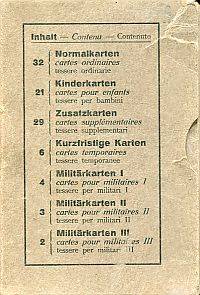
ref. 87699BB16°. 102 Karten in Schuber Inhaltsverzeichnis auf Schuber in Schuber Karten altersmässig etwas angestaubt ohne Gebrauchsspuren; Schuber gebleicht mit Gebrauchsspuren; leicht beschabt; Ecken etwas bestossen Dreisprachig: deutsch französisch und Italienisch. Aus dem Inhalt: Normalkarten - Kinderkarten - Zusatzkarten - Kurzfristige Karten - Militärkarten. unknown
ref. 184907058X.Gspiral_bound. Good. Access codes and supplements are not guaranteed with used items. May be an ex-library book. unknown
ref. 1845876997.Gpaperback. Good. Access codes and supplements are not guaranteed with used items. May be an ex-library book. paperback
2020ref. x-9561126729Editorial Universitaria de Chile 2020. Paperback. New. 468 pages. Spanish language. 6.10x1.17x9.06 inches. Editorial Universitaria de Chile paperback
1985ref. Q-0671466755Simon & Schuster 1985-04-01. Hardcover. New. New. In shrink wrap. Looks like an interesting title! Simon & Schuster hardcover
ref. 0881304654.Ghardcover. Good. Access codes and supplements are not guaranteed with used items. May be an ex-library book. hardcover
1971ref. Q-0385074883Natural History Press; American Museum of Natural History 1971-01-01. Hardcover. New. New. In shrink wrap. Looks like an interesting title! Natural History Press; American Museum of Natural History hardcover
ref. 0007538995.Gspiral_bound. Good. Access codes and supplements are not guaranteed with used items. May be an ex-library book. unknown
ref. 0528956477.Gpaperback. Good. Access codes and supplements are not guaranteed with used items. May be an ex-library book. paperback
2018ref. 1-1876413646Hema Maps 2018. Spiral-bound. New. 208 pages. 9.80x7.95x0.91 inches. Hema Maps unknown
2013ref. 1-1597754110Natl Geographic Society Maps 2013. Paperback. New. lam map edition. 1 pages. 32.00x4.40x1.80 inches. Natl Geographic Society Maps paperback
2011ref. 1-0792292952Natl Geographic Society Maps 2011. Map. New. lam map en edition. 1 pages. 36.50x2.00x2.00 inches. Natl Geographic Society Maps unknown
2020ref. 1-1566958628Natl Geographic Society Maps 2020. Paperback. New. fol map il edition. 8 pages. 9.25x4.25x0.79 inches. Natl Geographic Society Maps paperback
2001ref. 1-1597753351National Geographic Maps 2001. Map. New. fol map il edition. 4 pages. 9.25x4.25x0.20 inches. National Geographic Maps unknown
2012ref. 1-1597752444Natl Geographic Society Maps 2012. Paperback. New. map edition. 1 pages. 38.20x2.00x2.00 inches. Natl Geographic Society Maps paperback
ref. 7610671-6Used - Good. Pages intact with minimal writing/highlighting. The binding may be loose and creased. Dust jackets/supplements are not included. Stock photo provided. Product includes identifying sticker. Better World Books: Buy Books. Do Good. unknown
ref. 088130283X.Gpaperback. Good. Access codes and supplements are not guaranteed with used items. May be an ex-library book. paperback
ref. 0004489810.Gpaperback. Good. Access codes and supplements are not guaranteed with used items. May be an ex-library book. paperback
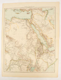
1895ref. 175108London.: Times Atlas of the World. 1895. Double-page folding map printed in colour 46.5 x 36.5 cm. edges gilt central fold with an inset map of Somaliland Somalia and the island of Sokotra key to European possessions outlined in colour small edge fold tears affecting the margin only and two other small edge tears slight toning at the edgaes but in very good condition. Attractive and detailed map prepared for the first edition of "The Times Atlas of the World". . (Times Atlas of the World). unknown
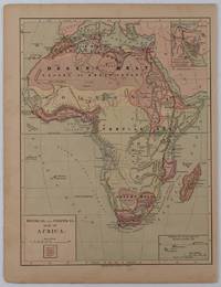
1877ref. 176015New York.: Harper & Brothers. circa1877. Chromolithographed map with outlne handcolour 27.1 x 21 cm major towns marked with a red cross relief by hachures ocean currents marked two inset maps of the Suez canal and Mascarene Island two very small marginal edge tears not affecting the map slight toning unrelated text on the verso prepared for "Harper's School Geography" in very good condition Interesting map of Africa before the escalation of the European race for colonial possessions from 1880. The map shows: the European possessions of the Cape Colony Transvaal Republic Orange River Republic and Natal; regions of the continent as fertile belts and desert belts; and indicates agricultural and other production such as palm oil ivory skins and cattle. Major cities are shown with important trade centers highlighted with a red cross. Prepared for US students in "Harper's School Geography" longitude is shown from the Greenwich prime meridian at the head of the map and from the Washington prime meridian at the foot. A small outline map of Ohio is included for relative scale. . Harper & Brothers. unknown
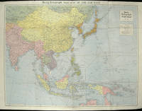
1940ref. 205763London.: Hutchinson & Co. Circa1940. Full colour folding map 70.7 x 93 cms; 76 x 101.2 cms sheet original folds short fold splits previous owner's neat title markings on the verso but the map in very good condition. A "Geographia" map of the war theatre in Asia and the Pacific including the northernmost coast of Australia. Showing railways and canals roads and steamer routes oilfields and pipe lines and a key to the unfederated states of Malaya. The Spratley Islands are marked as French and Thai territorial claims within French Indo China are marked. . Hutchinson & Co. unknown