12.210 resultados
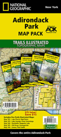
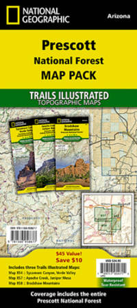
2020ref. 1-1566958679Natl Geographic Society Maps 2020. Paperback. New. fol map il edition. 6 pages. 9.25x4.25x0.67 inches. Natl Geographic Society Maps paperback
2012ref. 2412P-48999A-1308CNational Geographic Maps 2012-10-01. paperback. Very Good. 9x0x15. This Book is in Very Good condition. See our picture for exact item you will receive. All items ship within 24 hours. Packaging is 100% Recyclable. Most items purchased from Charitable organizations. A portion of each sale is also donated to a monthly charity check your package for this month's charity. Reuse-Recycle-Rebook! National Geographic Maps paperback
ref. SONG0792249879Natl Geographic Society Maps 2019-04-11. 2019. map. Used: Good. 3.00x3.00x27.00. Buy with confidence. Excellent Customer Service & Return policy. Natl Geographic Society Maps unknown
2024ref. __0008696063Harpercollins Publishers 2024. Hardcover. New. 5th revised edition edition. 296 pages. 10.51x1.34x14.41 inches. Harpercollins Publishers hardcover
1861ref. 61812New York: W. Schaus; printed by Sarony Major & Knapp 1861. Second Edition. 59 x 76cm open. 19.5x19cm closed. Tinted lithographic map backed in brown silk in black slipcase with printed paper label. Bookseller's ticket of Rev. A. O. Brickman Baltimore. Two ownership inscriptions of "J. M. Deems Maj. 1st MD Cav" and inscribed "Deems" on the slipcase. Trimmed; splits along half of one horizontal fold; minor stains and discoloration to verso not affecting image which is bright and generally Very Good. Hand-made slipcase worn with portion cut out but with manuscript ownership label intact. Uncommon Civil War map used by a distinguished Union Army officer. James Monroe Deems 1818-1901 was a composer and music educator from Baltimore who secured a commission as a major in 1861. He was promoted to Lieutenant Colonel in spring 1863; led the First Maryland Cavalry during the Battle of Gettysburg; retired due to rheumatism in November 1863; and was brevetted Brigadier General in 1867. He likely acquired this map in Baltimore near the beginning of his military career and certainly before his promotion in 1863 given the use of "Maj." in his ownership inscriptions. The map itself is the second edition of this design by J. Schedler despite the title it is not a bird's-eye view. The more common first edition has two insets showing the Lower Mississippi Valley and the city of Richmond see Stephenson 17.3. This version has only one inset showing the eastern United States. Stephenson describes this edition as having a Washington DC bookseller's ticket; the present copy has a Baltimore bookseller's ticket instead. This copy was mounted for use in the field: it was trimmed down to the neatline the captions removed the image cut up into segments and mounted on linen. The printed label on the slipcase appears to be a portion of the original title. This may have been done by the bookseller Brickman possibly at Deems' request. Uncommon. OCLC records about 10 similarly titled maps but few listings distinguish between the first and second editions. STEPHENSON LC Civil War Maps 2nd ed 17.35. 61812. [W. Schaus; printed by Sarony, Major & Knapp] unknown
2020ref. 1-1566958695Natl Geographic Society Maps 2020. Paperback. New. fol map il edition. 6 pages. 9.25x4.25x0.71 inches. Natl Geographic Society Maps paperback
2016ref. 1-0008158517Harpercollins Publishers 2016. Paperback. New. 12 new ed edition. 64 pages. 12.05x8.66x0.24 inches. Harpercollins Publishers paperback
2013ref. 1-0792289862NATIONAL GEOGRAPHIC MAPS DIVISION 2013. Map. New. rol map en edition. 1 pages. 37.56x4.45x4.06 inches. NATIONAL GEOGRAPHIC MAPS DIVISION unknown
2020ref. 1-1566958385Natl Geographic Society Maps 2020. Paperback. New. fol map edition. 140 pages. 9.38x4.25x0.43 inches. Natl Geographic Society Maps paperback
2020ref. 1-1566958504Natl Geographic Society Maps 2020. Paperback. New. fol map edition. 132 pages. 9.25x4.25x0.50 inches. Natl Geographic Society Maps paperback
2017ref. 1-1566957419Natl Geographic Maps 2017. Paperback. New. fol map edition. 6 pages. 9.25x4.75x0.50 inches. Natl Geographic Maps paperback
2017ref. 1-1566957370Natl Geographic Maps 2017. Paperback. New. fol map edition. 6 pages. 7.50x4.00x0.50 inches. Natl Geographic Maps paperback
2021ref. SONG0008430233Collins 2021-09-01. Seventh EditionSeventh edition. paperback. Used: Good. 8.90x0.40x12.28. Buy with confidence. Excellent Customer Service & Return policy. Collins paperback
ref. 1931257361.Gmap. Good. Access codes and supplements are not guaranteed with used items. May be an ex-library book. unknown
ref. 188670547X.Gmap. Good. Access codes and supplements are not guaranteed with used items. May be an ex-library book. unknown
ref. DADAX1566958164National Geographic 2026-01-01. 2026. map. New. 5.50x4.70x10.30. Buy with confidence. Excellent Customer Service & Return policy. National Geographic unknown
2025ref. DADAX1566958326National Geographic 2025-11-01. 2025. map. New. 4.25x3.00x9.25. Buy with confidence. Excellent Customer Service & Return policy. National Geographic unknown
ref. 0935039236.Gmap. Good. Access codes and supplements are not guaranteed with used items. May be an ex-library book. unknown
2023ref. DADAX1597752258National Geographic 2023-01-01. 2023. map. New. 4.25x0.50x9.25. Buy with confidence. Excellent Customer Service & Return policy. National Geographic unknown
1941ref. 21072Window Rock AZ: United States Department of the Interior Office of Indian Affairs Navajo Service 1941. First Edition. Small quarto 26.25cm; mimeographed sheets printed recto and verso and side-stapled into illustrated wrappers; vi 180pp 20; illus. Former owner's name in ink to front wrapper with chipping thin splits and short tears to same; thin vertical paint streak to rear wrapper; text remains fresh and clean; Very Good. Guide book and gazeteer of the Navajo country and adjacent regions compiled by Richard Fowler Van Valkenburgh a former Bureau of Indian Affairs worker and long-time archeological assistant with the L.A. County Museum of History Art and Science. Contains a 4pp key to the Navajo alphabet palatalization and labialization an extensive list of Navajo place names providing detailed information regarding their origins history and significance. Illustrated throughout with maps drawn by Charles Keetsie Shirley. Scarce in commerce. United States Department of the Interior, Office of Indian Affairs, Navajo Service unknown
2005ref. DADAX159775000XNATIONAL GEOGRAPHIC 2005-05-01. paperback. New. 11.25x1.00x14.50. Buy with confidence. Excellent Customer Service & Return policy. NATIONAL GEOGRAPHIC paperback
2009ref. SONG188670547XAbsolute Press 2009-05-01. map. Used: Good. 4.00x0.50x8.50. Buy with confidence. Excellent Customer Service & Return policy. Absolute Press unknown
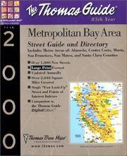
ref. SONG1581741316Brand: Thomas Brothers Maps 0000-00-00. spiral_bound. Used: Good. 9.25x0.75x11.00. Buy with confidence. Excellent Customer Service & Return policy. Brand: Thomas Brothers Maps unknown
1914ref. CJSBM18X1914. Hardcover. Fair. . These are a collection of First World War maps from the 1920s and 30s detailing battles and tactics.They are associated with similar volumes of text but would befit anyone who has an appetite for old war maps war history or those seeking original research.Some are unopened from their original paper clasps and are in almost pristine condition save a bit of fading and the odd library sticker mark.A very rare find.Ex private library stock so expect some library markings and sparse annotations in the text. Binder in good to very good condition with only a few signs of wear considering age. All maps present. Some yellowing of pages and some bleaching on spine. Foxing on some maps and boxes. Please note that the image above is a stock photo and may differ somewhat to that of the item delivered. 1918 variant includes both text AND maps.Many thanks for looking. hardcover
1914ref. CJSBM16K1914. Hardcover. Fair. . These are a collection of First World War maps from the 1920s and 30s detailing battles and tactics.They are associated with similar volumes of text but would befit anyone who has an appetite for old war maps war history or those seeking original research.Some are unopened from their original paper clasps and are in almost pristine condition save a bit of fading and the odd library sticker mark.A very rare find.Ex private library stock so expect some library markings and sparse annotations in the text. Binder in good to very good condition with only a few signs of wear considering age. All maps present. Some yellowing of pages and some bleaching on spine. Foxing on some maps and boxes. Please note that the image above is a stock photo and may differ somewhat to that of the item delivered. 1918 variant includes both text AND maps.Many thanks for looking. hardcover