National Geographic MapsBiblio.com
12.245 resultados
2012ref. 2412P-48999A-1308CNational Geographic Maps 2012-10-01. paperback. Very Good. 9x0x15. This Book is in Very Good condition. See our picture for exact item you will receive. All items ship within 24 hours. Packaging is 100% Recyclable. Most items purchased from Charitable organizations. A portion of each sale is also donated to a monthly charity check your package for this month's charity. Reuse-Recycle-Rebook! National Geographic Maps paperback
ref. SONG0792249879Natl Geographic Society Maps 2019-04-11. 2019. map. Used: Good. 3.00x3.00x27.00. Buy with confidence. Excellent Customer Service & Return policy. Natl Geographic Society Maps unknown
2024ref. __0008696063Harpercollins Publishers 2024. Hardcover. New. 5th revised edition edition. 296 pages. 10.51x1.34x14.41 inches. Harpercollins Publishers hardcover
1867ref. s02256Washington D.C: Government Printing Office 1867. 1st Edition. Hardcover. Very Good. Brown pebbled cloth boards with blindstamped rules; 9" tall; 151 pp plus large folding map. Good condition with wear to spine ends of corners of boards; map itself in very good condition colors bright folded properly modern tape reinforcement at creases. -- The "Map of the United States and Territories" by Joseph S. Wilson was one of the largest and most accurate maps of the country published at the time. It clearly marks major Native American territories and the colored mineral deposits show a clear rationale for expansion to the West. Joseph Wilson was Commissioner of the General Land Office both before and after the Civil War and this map was produced during the first year of his second tenure. The accompanying report asserts the United States' right to possession of the Western territories and states encourages the population thereof and admits to continuing arbitration land claims especially in California. Government Printing Office hardcover
2021ref. SONG0008430233Collins 2021-09-01. Seventh EditionSeventh edition. paperback. Used: Good. 8.90x0.40x12.28. Buy with confidence. Excellent Customer Service & Return policy. Collins paperback
ref. 188670547X.Gmap. Good. Access codes and supplements are not guaranteed with used items. May be an ex-library book. unknown
ref. DADAX1566958164National Geographic 2026-01-01. 2026. map. New. 5.50x4.70x10.30. Buy with confidence. Excellent Customer Service & Return policy. National Geographic unknown
2025ref. DADAX1566958326National Geographic 2025-11-01. 2025. map. New. 4.25x3.00x9.25. Buy with confidence. Excellent Customer Service & Return policy. National Geographic unknown
ref. 0935039236.Gmap. Good. Access codes and supplements are not guaranteed with used items. May be an ex-library book. unknown
2023ref. DADAX1597752258National Geographic 2023-01-01. 2023. map. New. 4.25x0.50x9.25. Buy with confidence. Excellent Customer Service & Return policy. National Geographic unknown
2005ref. DADAX159775000XNATIONAL GEOGRAPHIC 2005-05-01. paperback. New. 11.25x1.00x14.50. Buy with confidence. Excellent Customer Service & Return policy. NATIONAL GEOGRAPHIC paperback
ref. SONG1581741316Brand: Thomas Brothers Maps 0000-00-00. spiral_bound. Used: Good. 9.25x0.75x11.00. Buy with confidence. Excellent Customer Service & Return policy. Brand: Thomas Brothers Maps unknown
1914ref. CJSBM18X1914. Hardcover. Fair. . These are a collection of First World War maps from the 1920s and 30s detailing battles and tactics.They are associated with similar volumes of text but would befit anyone who has an appetite for old war maps war history or those seeking original research.Some are unopened from their original paper clasps and are in almost pristine condition save a bit of fading and the odd library sticker mark.A very rare find.Ex private library stock so expect some library markings and sparse annotations in the text. Binder in good to very good condition with only a few signs of wear considering age. All maps present. Some yellowing of pages and some bleaching on spine. Foxing on some maps and boxes. Please note that the image above is a stock photo and may differ somewhat to that of the item delivered. 1918 variant includes both text AND maps.Many thanks for looking. hardcover
1914ref. CJSBM16K1914. Hardcover. Fair. . These are a collection of First World War maps from the 1920s and 30s detailing battles and tactics.They are associated with similar volumes of text but would befit anyone who has an appetite for old war maps war history or those seeking original research.Some are unopened from their original paper clasps and are in almost pristine condition save a bit of fading and the odd library sticker mark.A very rare find.Ex private library stock so expect some library markings and sparse annotations in the text. Binder in good to very good condition with only a few signs of wear considering age. All maps present. Some yellowing of pages and some bleaching on spine. Foxing on some maps and boxes. Please note that the image above is a stock photo and may differ somewhat to that of the item delivered. 1918 variant includes both text AND maps.Many thanks for looking. hardcover
1986ref. ABC_49503King of Prussia Pennsylvania USA: Franklin Maps 1986. Folded. Ca. 87.5 x 114 cm. Three maps printed in colour on one large sheet of paper: one large overview map of the Middle East also showing parts of the Soviet Union North Africa and Turkey on one side and the "title page" with two smaller maps - one of Iraq and one of the countries around the Persian Gulf - on the other side. Colourful declassified CIA map of the Middle East probably depicting the situation between January 1972 when the United Arab Emirates UAE was founded and 21 August 1974 when the Treaty of Jeddah was signed. On the present map the UAE still shares a direct border with Qatar which was no longer the case after the treaty as it had to cede territory to Saudi Arabia. The map was likely drawn and used by the CIA because of the tensions in the region but declassified a decade later. It is not dated but must have been published after 1986 as the publisher changed its name from Franklin Survey Company to Franklin Maps and moved its offices from Philadelphia to King of Prussia PA in 1986.With a contemporary ownership annotation "Betty Vomer Meurade ". The map is folded with small holes in some of the areas where two folds meet. Otherwise in good condition.l Cf. for the publisher: Tedyffrin Easstown Historical Society History Quarterly 42-3 Summer 2005 pp. 82-94 online via: https://www.tehistory.org/hqda/html/v42/v42n3p082.html. Franklin Maps, unknown
2007ref. USD_9781845876463Compass Maps Ltd 2007. 1ST. Hardcover. Used - Like New/Used - Like New. _ Compass Maps Ltd hardcover
ref. GOR015144698Paperback. Acceptable. paperback
1955ref. 20488AB1955. Madrid 1955 36 : 26 cm. X pages 1 leaf 378 pages 1 leaf 241 facsimiles of maps some folded and titles. Original half calftwo back lables. One of 500 numbered copies on special paper. the illustrations are made in Photogravure a high-quality engraving technique that uses light to transfer a photographic image onto a plate traditionally copper but now often photopolymer to create deep reliefs that reproduce soft tones and fine details when printed on paper. It is ideal for artistic reproductions and precision applications on various materials combining craftsmanship with digital technology. unknown
1959ref. 20489AB1959. Madrid 1959 36 : 26 cm. 129 pages 1 leaf with facsimiles of maps some folded and titles. Original half calftwo back lables. One of 500 numbered copies on special paper. The illustrations are made in Photogravure a high-quality engraving technique that uses light to transfer a photographic image onto a plate traditionally copper but now often photopolymer to create deep reliefs that reproduce soft tones and fine details when printed on paper. It is ideal for artistic reproductions and precision applications on various materials combining craftsmanship with digital technology. unknown
1913ref. 63117New York: C.S. Hammond & Co. Schum Bros. Stationers and Printers 1913. 12mo. 3.5 x 7.5 double-sided colour lithograph map which folds out to 25.25 x 16.5 in. on 28 x 17.75 in. sheet very light dustsoiling slight shelfwear very slight age toning along the folds. Original printed gray-blue pocket portfolio folder blue lettering on recto & verso added affixed label of Schum Bros. over imprint minor age toning still a VG bright clean map. First edition thus of this very scarce Brass Era automobile travel map depicting Manhattan and portions of Long Island from Brooklyn across to Smithtown and Great River. Verso Map includes Long Island fro Great River up to Darlington across to Truman Beach and Bridgehampton with two inset maps: “Contination of North Shore” and “Continuation of South Shore” with “Good Roads” and “Fair Roads” differentiated as well as depiction of the Long Island Railway line and red dots tracing the electric interurban lines. As early as 1906 Hammond & Co. had produced a map for Good Roads enthusiasts and motorists but this updated issue documenting the improved roads was issued in 1913 and then regularly from 1914-1925. No copies in Worldcat. C.S. Hammond & Co., Schum Bros., Stationers and Printers, unknown
1844ref. 63111London: J.&C. Walker 9 Castle Street Published by Longman & Co. ca. 1844. 16mo. 3.5 x 5 in. folding out to 13.25 x 16.5 in. dissected 15-panel hand-coloured steel-engraved map linen-backed w/ 3 leaf folding population and mileage distance chart from Dublin by County mounted on front pastedown. Dark gray-green publisher’s cloth portfolio pocket binding decorative borders in blind gilt lettering stamped on front cover a NF copy. First edition thus of this very scarce dissected pocket map of Ireland published against the backdrop of the full impact of the Great Potato Famine which from 1841-1851 resulted in the diaspora and death of nearly 30% of the Irish population and as reflected in the mileage table mounted with the map the population in 1845 had already dropped from 8.2 million in 1841 to 7.7 million by 1844 and it would plummet further to below 6.5 million by 1851. The bulk of these emigrated to the United States Canada and the United Kingdom resulting in the fact that Ireland’s current population still resides below the high of 1841 and nearly 38 million Irish-Americans claim descent from the successive waves of migration much of which channeled through New York’s Lower East Side and the Bowery in the 19th-Century. John Walker 1787-1873 was a British mapmaker engraver lithographer hydrographer draughtsman and publisher publishing nautical charts and geographical maps with his brothers Charles and Alexander in their firm J.&C. Walker located at 9 Castle Street Holborn from 1841-1847 and moving to 37 Castle St. in 1848 where they remained to 1875. Much of their work was published under the auspices of the Society for the Diffusion of Useful Knowledge or S.D.U.K. Worldcat locates 1 copy Yale. J.&C. Walker, 9 Castle Street, Published by Longman & Co., hardcover
1910ref. 63113London & Norwich UK: Coleman & Co. Ltd. John Bartholomew & Co. Fletcher & Son Ltd. Litho ca. 1910. Sixteen parts. 64 pp unpaginated. double-page colour-lithograph maps throughout sized 9.5 x 7.2 when unfolded. Self-printed colour lithograph softcovers decorated title cover on front of each installment Wincarnis tonic advertisement in full colour on back cover edgewear thumbing minor chipping to a few fore-edges & corners still a G set. First edition thus of this uncommon and complete set of promotional maps for automobile travelers and bicyclists in Edwardian England whose drivers and riders were often fueled by the “delicious tonic and restorative recommended by over 8000 medical men.” The 16 maps featuring sections from London to Cornwall South Wales to Manchester and Lincolnshire to Yorkshire offered an accurate and compact set of travel maps documenting main roads secondary roads “other roads typically nearly impassable local lanes & livestock paths railways and rivers. Wincarnis was first introduced as a medicinal treatment in the Victorian era was a liqueur derived from a mix of secret herbs & spices meat extract malt extract infused with cloves nutmeg and citrus and although not openly marketed as alcoholic featured a significant 17-18% alcohol content. Therapeutic use was widely encouraged and severe motoring and bicycle accidents often included drivers and riders under the influence. Following the 1914 Parliamentary “Commission on Patent Medicines” investigation numerous changes and rules were changed regarding marketing and sales of such products as well as curtailing of hyping the “Restorative” properties. Worldcat locates 2 sets 1 undated - Hartley Library; 1 set misdated -- Wellcome; See: Drinking for Health: Proprietary Tonic Wines Chapter 10 Drinking in Victorian and Edwardian Britain: Beyond the Spectre of the Drunkard National Library of Medicine 2018. Coleman & Co., Ltd., John Bartholomew & Co., Fletcher & Son, Ltd. Litho, paperback
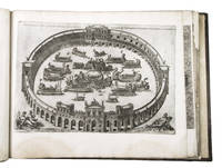
1550ref. ABC_49514Italy 1550. 17th-century gold-tooled brown calf sewn on 6 supports with the corresponding raised bands on the spine a red morocco title label on the spine with the title "Novissima urbis Romae descriptio" lettered in gold gold-tooled board edges. Large oblong folio ca. 59 x 42.3 cm. With 76 full-page engravings and 12 full-page etchings. Remarkable album with 77 beautiful examples of 16th-century Italian cartography all in very fine dark impressions. The collection includes plans of important Italian towns such as Rome Venice Genoa Naples Milan Florence Palermo Siena Bologna and Pisa as well as detailed views of individual buildings and monuments in Rome. They are engraved by several cartographers from the school of Antonio Lafreri 1512-1577 primarily Claudio Duchetti d. 1585 Matteo Florimi d. 1613 and Lafreri himself. Florimi's works are among the rarest of the Lafreri school map makers especially his Siena imprints of which several have here been included.In the middle of the 16th century Italy was the centre of map production and distribution in Europe. This industry primarily took place in Venice and Rome. The most notable of the publishers in Rome was Lafreri. His most important and most popular work is the Speculum Romanae magnificentiae a collection of plans an views of Rome's monuments; no two copies of the Speculum are the same. The present collection contains more than thirty plates from the Speculum. When Lafreri died his nephew Claudio Duchetti inherited the company. He continued to produce the Speculum plates but often made small adjustments and signed his own name at the bottom. Most of the Speculum plates in the present album are by Duchetti. After his death the copperplates were sold to other publishers such as Giovanni Orlandi before 1590-after 1640 who reissued them. The majority of the plates in the present album were printed by Orlandi in 1602.The album further contains 32 engraved city plans mostly of Italian towns although a few foreign cities are also included; one of the rarest is the view of Moscow which is also included here. The collection ends with a incomplete series of 11 etchings of landscapes and biblical scenes.A list of contents is available upon request.With the bookplate of Louis Routy de Charodon seigneur de Grésigny and Charodon 1710-1794 on the front pastedown and remnants of another bookplate above. The boards are somewhat scratched and stained the spine shows traces of use the edges of the boards have been professionally restored and the boards have been lengthened to fit the maps. The maps are slightly browned some are slightly foxed the first few maps have been mounted onto 17th-century leaves the longer maps are somewhat soiled on the fore edge three maps are restored at the fore edge and one at the bottom edge some maps have been cut slightly short. Otherwise in good condition.l Cf. Parshall P. "Antonio Lafreri's "Speculum Romanae magnificentiae"" in: Print Quarterly vol. 23 1 2006 pp. 3-28. hardcover
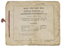
1944ref. ABC_4794483 Rep Group. I.E." 1944. Original beige printed paper wrappers side stichted by hand through 3 holes with a reddish pink cloth ribbon. Oblong 21 x 255 cm. With 1 index map and 16 numbered folding strip maps. Exceptionally rare collection of folded strip maps of roads in Western Iran which was very likely meant for military use during the Second World War. The abbreviated inscription on the front wrapper possibly stands for "24th brigade branch transportation office" though it is unknown which 24th brigade this would have been. The maps were originally printed on quarter inch sheets in 1942 and have been significantly enlarged for this edition to a scale of 1 inch to 2 miles. We have not been able to trace any other copies of either the first or second edition of this work anywhere.With an owner's inscription on the front wrapper. The maps and back wrapper have been reinforced with bookbinder's gauze. The wrappers are somewhat soiled creased and the edges are somewhat frayed. The maps have slightly browned and the index map has a small brown stain in the lower outer corner without affecting the image. Otherwise in good condition. 83 Rep Group. I.E.", hardcover
1939ref. 60959San Francisco CA: San Francisco Bay Exposition 1939. 8vo. 116 pp. With oblong folio. 19.25 x 16 in. colour pictorial map frontisp. detailed sections of island and exhibits in blue on verso fold creases numerous photo illustrations text maps diagrams stepped thumb tabs at outer fore-edge. Blue-cloth backed softcovers featuring the striking Art Deco cover art by Simon “Si” Vanderlaan 1904-1986 famed pin-up artist and illustrator who worked for Walt Disney studios during World War II minor scuffing very minor age toning shelfwear still VG bright copy from the library of Prof. Marvin Nathan. Revised 1939 edition of this excellent guide to the first year in 1939 of the Golden Gate International Exposition including “Cartograph” revealing all of the Art Deco architectural wonders and surrounding areas of Treasure Island. The pictorial maps were issued separately as well as with the “Official Guide Books.” Ruth Taylor White’s 1902-1985 delightful pictographic maps or cartographs included depictions of the Territory of Hawaii in which she had driven or traveled to every corner of the Islands and the Grand Canyon for her for her brother’s book “Grand Canyon Country.” Later Little Brown requested an entire atlas which was published as the very scarce Our U.S.A. “A gay geography.” Her cartographs influenced the style of American cartographic illustration for decades afterwards. See: Griffin Mapping Wonderlands: Illustrated Cartography pp. 192-193; Field MapCarte 29/364: Our U.S.A. A Gay Geography 2014. San Francisco Bay Exposition, paperback