Philip's MapsBiblio.com
12.365 resultados
ref. 1849072256.Gpaperback. Good. Access codes and supplements are not guaranteed with used items. May be an ex-library book. paperback
ref. 1849070601.Gpaperback. Good. Access codes and supplements are not guaranteed with used items. May be an ex-library book. paperback
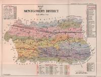
1935ref. 215892Lahore.: Government Printing Office. Revised Edition. 1935. Four folding colour maps xi 311 pages 26.5 x 18 cms; original papered boards spotted and a trifle scuffed linen backstrip with paper title label worn; foredges and endpapers spotted a few leaves toned but on the whole in very good condition the maps particularly bright and clean. A remarkable association copy: the author Frederick Blyth Wace's copy with his inked initials to the front free endpaper and his humorous unpublished foreword tipped in opposite the preface together with a dedication leaf both in Wace's hand and his business card loose within. As a further dedication makes clear this copy was given by Wace's son a couple of his loose notes on scrap paper are included the eminent botanist Nigel Morritt Wace 1929-2005 late head of the Australian National University's department of Biogeography and Geomorphology in 2003 to his fellow academic and marsupial biologist Dr. Hugh Tyndale-Biscoe. Both Wace and Biscoe were born in India and began their schooling in Kashmir at the school founded by Tyndale-Biscoe's father a Christian missionary and for whom the school is named. From the collection of Hugh Tyndale-Biscoe. . Government Printing Office. hardcover
1945ref. 043919N.P.: 104th Infantry United States Army 1945. First edition undated late 1945 signed by Commanding Officer Ralph W. Palladino on the introductory page. History of this venerable US Army Regiment from its roots as a militia unit in the American Revolution up through the end of World War II the period on which this book focuses. Includes maps other black and white illustrations from photographs list those killed or missing in action battle statistics etc. Light blue cloth printed in black Route of Advance map on endpapers book about 7.5 inches tall 153 pages no dustjacket likely issued without. Some soil to covers good hinges sound text block age-browning to the war-era paper used for the pages no other names or markings. Signed by the Commanding Officer. First Edition. Hard Cover. Good. 16mo - over 5¾" - 6¾" tall. 104th Infantry, United States Army Hardcover
ref. 0540082910.Gpaperback. Good. Access codes and supplements are not guaranteed with used items. May be an ex-library book. paperback
ref. 0930657144.Gpaperback. Good. Access codes and supplements are not guaranteed with used items. May be an ex-library book. paperback
ref. 1849074003.Gpaperback. Good. Access codes and supplements are not guaranteed with used items. May be an ex-library book. paperback
ref. 1845876431.Gmap. Good. Access codes and supplements are not guaranteed with used items. May be an ex-library book. unknown
ref. GOR006358642Paperback. Very Good. paperback
ref. P33766Mandala Maps: 1988 Kathmandu. This rare late-1980s folding map of Tibet was meticulously hand-drawn by Nepalese cartographer P. L. Shrestha and published in Kathmandu Nepal by Mandala Maps and Himalaya Bookseller. This map was created as a practical navigational field guide to assist independent trekkers and overland tour operators traveling the rugged route between Kathmandu and Lhasa. Additionally it served to document the region's geographical infrastructure strategic borders and local points of interest during a heavily regulated era of Tibetan tourism. Acting as a crucial historical document and rugged field guide from a period of strict travel regulation it features detailed insets of Lhasa and sensitive border areas. This scarce collector's item holds significant value for historians and collectors alike with authentic vintage copies from this specific Nepalese workshop now commanding market prices between six hundred and seven hundred dollars. The map has strong edges and no weak details in the paper. In very good condition. unknown
1841ref. 13636Oliver & Boyd / Simpkin Marshall & Co 1841 Second edition. Red cloth worn and marked name of Scottish writer Margaret Elphinstone to ffep fold-out map occasional pencil marking and underlining generally clean sound good. Oliver & Boyd / Simpkin, Marshall & Co hardcover
ref. 0007395426.Gpaperback. Good. Access codes and supplements are not guaranteed with used items. May be an ex-library book. paperback
ref. 1886705976.Gmap. Good. Access codes and supplements are not guaranteed with used items. May be an ex-library book. unknown
ref. 1566957370.Gmap. Good. Access codes and supplements are not guaranteed with used items. May be an ex-library book. unknown
ref. 0007455208.Gspiral_bound. Good. Access codes and supplements are not guaranteed with used items. May be an ex-library book. unknown
ref. 1566957427.Gmap. Good. Access codes and supplements are not guaranteed with used items. May be an ex-library book. unknown
ref. 0935039546.Gmap. Good. Access codes and supplements are not guaranteed with used items. May be an ex-library book. unknown
ref. 0008374333.Gspiral_bound. Good. Access codes and supplements are not guaranteed with used items. May be an ex-library book. unknown
ref. GOR008867955Paperback. Very Good. paperback
ref. 1566958725.Gmap. Good. Access codes and supplements are not guaranteed with used items. May be an ex-library book. unknown
ref. 0008285624.Gmap. Good. Access codes and supplements are not guaranteed with used items. May be an ex-library book. unknown
ref. 0008318727.Gpaperback. Good. Access codes and supplements are not guaranteed with used items. May be an ex-library book. paperback
1859ref. 189711Calcutta.: Surveyor Generals Office. 1870. Reissue of 1859 edition. Lithographed map 57.2 x 93 cms; 61.1 x 96 cms sheet original folds old paper repairs to the verso and a sealed marginal tear central folds archivally strengthened some toning to the folds and creasing but the map in remarkably good clean condition. Impressive large Calcutta printing from the Survey of India showing Rajasthan Uttar Pradesh and surrounding states with extremely detailed delineation of settlements roads railways rivers and major points of interest the Taj Mahal is highlighted. . Surveyor Generals Office. unknown
2018ref. 1-1566957443Natl Geographic Maps 2018. Paperback. New. lam map edition. 1 pages. 48.00x18.00x2.99 inches. Natl Geographic Maps paperback
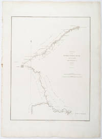
1796ref. 209283London.: George Nicol. 1796. Engraved copperplate map on Whatman paper 43.8 x 33.6 cm; 57 x 42 cm sheet including plate markscale in nautical and English miles; light undulation to sheet marginal toning and edgewear but in very good condition. Finely engraved and detailed map of two routes to Pekin Beijing along the White River Baihe from the Gulf of Petcheli and along the Imperial Highway from Jehol and includes commentary locating palaces and gardens type of cultivation "many barges" and "the road shaded by willow trees". The map elegantly drawn by Henry William Parish was published in George Staunton's account of Earl Macartney's embassy to China 1792-1794. . George Nicol. unknown