ref. 0929591690.Gpaperback. Good. Access codes and supplements are not guaranteed with used items. May be an ex-library book. paperback
1977ref. SKU1037248T & A. D. Poyser 1977. hardcover. Very Good. 9x6x1. T. and A. D. Poyser Pitman Press; Berkhamsted 1977. Hardcover. A Very Good blue cloth binding with gilt lettering on spine binding sturdy and intact some discoloration/sunning along board and spine edges dent bottom front board edge trace scattered foxing top text block edge some age toning to pages previous owner handwritten ink name top front free endpaper in a Very Good some handling/scuff marks to panels mild edge/corner wear spine fade couple of faint creases bottom front flap Mylar protected Dust wrapper. A nice and clean copy. 8vooctavo or approx. 6 x 9 inches 307pp. appendix bibliography tables indexed b&w illustrations. We pack securely and ship daily with delivery confirmation on every book. The picture on the listing page is of the actual book for sale the glare in the photograph is from the Mylar. Additional Scans are available for any item please inquire. T & A. D. Poyser hardcover

ref. SKU1023409Franklin Maps. Very Good. Franklin Maps; King of Prussia 1998. Softcover. A Very Good some handling/scuff marks to covers crease bottom rear cover corners binding solid and sturdy trace edge/corner wear a nice clean and unmarked copy in Oversize stapled Wraps. 4toquarto or approx. 9.5 x 12 inches approx. 151pp. 71 large scale maps 10300 streets indexed with zip codes and 1150 cultural features indexed with telephone numbers. We pack securely and ship daily with delivery confirmation on every book. The picture on the listing page is of the actual book for sale. Additional Scans are available for any item please inquire. Franklin Maps paperback
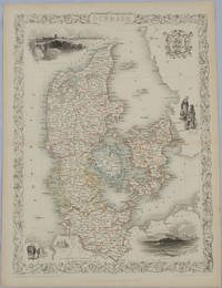
1850ref. 175779London & New York.: John Tallis & Company. Circa1850s. Lithographed map with original outline hand colour 34.5 x 24.7 cm including border and captionsfive fine vignette illustrations decorative border central fold edges with light toning in very good condition. Attractive decorative map with fine vignettes of Copenhagen Sleswig and Elsinore figures in costume the coat of arms of Denmark and an amiable equine pair by the great mapmaker and publisher John Tallis. . John Tallis & Company. unknown
ref. 2712New York : Konecky & Konecky 1965. 1965. Hardcover. Very Good/Very Good. 655 p. : ill. maps ; 24 cm. ; ISBN: 1568520271 ; OCLC: 32905083 ; grey textured cloth with gold lettering in colorful dustjacket ; spot on front cover ; spine creased else VG/VG New York : Konecky & Konecky, 1965. hardcover
ref. 0875300901New. New. Satisfaction Guaranteed or your money back. unknown
ref. 5069824Philips 04/18/2019. Spiral_bound. Used; Good. WE SHIP WITHIN 24 HRS FROM LONDON UK 98% OF OUR ORDERS ARE RECEIVED WITHIN 7-10 DAYS. We believe you will be completely satisfied with our quick and reliable service. All orders are dispatched as swiftly as possible! Buy with confidence! Greener Books. Philips unknown
ref. 0881305715New. spiral_bound. New. Satisfaction Guaranteed or your money back. unknown
ref. 0881309001New. paperback. New. Satisfaction Guaranteed or your money back. paperback
ref. 0881306886New. paperback. New. Satisfaction Guaranteed or your money back. paperback
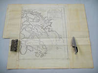
1749ref. 136781Paris. circa1749. Black and white engraved map on laid paper showing entrance to Pearl/Canton river Macao and the area which would become Hong Kong Sinn-gan-hien folded designed by the prominent French cartographer Jacques-Nicolas Bellin. This map is No. 16 Vol. 5 from the impressive 15-volume "Histoire Generale des Voyages" compiled by French novelist Antoine François Prévost. The walled city of Canton upper section is divided into areas of Tartar and Chinese. Some light even browning on paper added at margins good copy. Map measures 25.7 x 20.5. . unknown
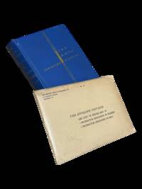
1939ref. 4298Harrisburg PA: The Military Service Publishing Company 1939. Hardcover. Very Good. Twenty first edition April 1939. 4to 216 pp. Publisher's blue cloth with gilt lettering and design. Very good with some soiling to boards and edges of page block. Clean internally with a few annotations in pencil throughout. Included is the supplementary envelope with Special Map "A" and four protractors only 2 are listed on the envelope. A few contemporary papers and supplementary materials for a course taken at the University of Wyoming are laid in as well. The Military Service Publishing Company hardcover
1929ref. 4297Meadville PA: Keystone View Company 1929. 3rd Edition. Hardcover. Very Good. Third edition 1929 12mo 321pp ix pamphlet with three location maps in rear pocket. 3/4 black morocco over blue cloth gilt stamped on spine. Very good with moderate to heavy spotting and soiling to boards. Some moisture staining to fore-edge of page block mainly at the rear index else clean internally. Keystone View Company hardcover
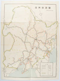
1519ref. 172590奉天. Mukuden.: 満鉄鉄道総局. Mantetsu Tetsudo Sokyoku. 昭和 15 1940. Colour folded map seven small very holes not affecting the printed image otherwise good. 53 x 38.5cm Map showing the comprehensive railway network in Manchuria with names of all the stations. It includes the lines run by the South Manchurian Railway Company their temporary industrial lines light rail as well as the lines run by other Russian and Chinese companies. By 1940 the network had expanded so much that it included almost the whole of Manchuria. . 満鉄鉄道総局. [Mantetsu Tetsudo Sokyoku]. unknown
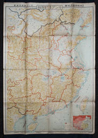
1938ref. 159295Tokyo: 大日本雄辯會講談社 Dainihon Yūbenkai Kōdansha. Shōwa 13. 1938. Two large detailed maps of China and on the reverse of the Soviet Union in Asia Manchuria and Mongolia printed double sided on a single large sheet. Issued as a supplement to Volume 14 Number 1 of the magazine Kingu on New Year's Day in 1938. Holes at a number of holes causing a small amount of loss some occasional browning some chipping on margins. The map has clearly been used but is still largely complete. The colourful map of China on a scale of 1:2600000 includes part of Manchukuo and Inner and Outer Mongolia on the north and part of French Indochina to the south-west. It shows East Hebei Autonomous Anti- Communist Council Jidong Fanggong Zizhi Zhengfu 冀東防共自治政府 south of Manchukuo which existed from late 1935 until February the 1st1938. The legend includes national and provincial borders cities roads railways sea and air routes and undersea cables. There is an inset map of East Asia titled "Present Situation of Far East" on the lower right corner which shows the areas under influence of Communism and those under influence of/controlled or colonised by the United Kingdom France Japan and China. The map on the reverse printed in blue and black shows the Asian section of the Soviet Union Manchuria and Mongolia on a scale of 1:3000000. There is an inset map of Asia titled "Asian Continent" at the upper left corner the area enclosed by a rectangle which indicates the area covered in this map. The legend includes cities railways roads national borders district borders province borders and air routes. . 大日本雄辯會講談社 [Dainihon Yūbenkai Kōdansha]. unknown
ref. 72546E-210. Hardcover. 8vo. Published by Robert Clarke & Co Cincinnati OH. 1875 xiv 454 pp; v 478 pp; iv 22 fold-out maps. 3 volumes including 2 volumes of text plus the Atlas. Bound in red cloth boards with titles present to the spine and front board. Spines have been replaced and rebacked. Atlas is missing the spine. Boards have light shelf-wear present to the extremities. No ownership marks present. Text is clean and free of marks. Spine is missing from the atlas volume with the front board barely attached to the spine. The army originally fought under the name Army of the Ohio until Maj. Gen. William S. Rosecrans assumed command of it along with the Department of the Cumberland; he thus changed the name of the newly combined entity to the Army of the Cumberland. Under Major General George H. Thomas who took command in October of 1863 the Unit played a major role in Sherman's March to Atlanta. In all; the Army of the Cumberland played important roles in the battles of Stones River Chickamauga Chattanooga-Ringgold Peachtree Creek Kennesaw Mountain and Nashville. The Atlas volume depicts the army's movements during these battle and campaigns. ; 8vo 8" - 9" tall . hardcover
ref. 1566959233.Gmap. Good. Access codes and supplements are not guaranteed with used items. May be an ex-library book. unknown
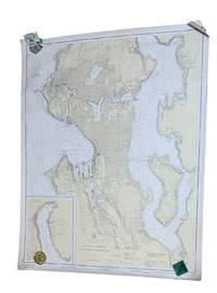
1937ref. 9266Washington D.C.: U.S. Coast and Geodetic Survey 1937. 4th edition. Large 2 color map 34.5 x 42.5" Date of 1948 stamped at the bottom along with stamps from Metsker's Maps in Tacoma. A couple small edge tears not extending into the image and light wrinkling around edges. A near fine example. Original WWII-era copy of this classic Seattle map showing shorelines depths tides etc. in full detail. This is #6449 of the U.S. Coast and Geodetic Survey the first edition appearing in 1922. U.S. Coast and Geodetic Survey unknown
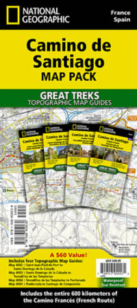
2015ref. __1597756059Natl Geographic Maps 2015. Map. New. 2015 edition. 10 pages. 9.25x4.50x0.75 inches. Natl Geographic Maps unknown
1888ref. 50324121078E J Arnold Leeds 1888. First Edition. Hardcover. Very Good Condition/No Dust Jacket. Illustrator: F D King. Small slim green volume with black lettering and decoration is lightly sunned on the spine. Sound binding clean pages black and white plates and crisp intact fold-out maps. 100 pages plus fold-out maps. No dust jacket as published. Illustrator: F D King. Quantity Available: 1. Shipped Weight: under 1 kg. Pictures of this item not already displayed here available upon request. Inventory No: 50324121078. All our books music and maps are sent by a tracked mail service. E J Arnold hardcover
1881ref. 9118Algiers: Adolphe Jourdan Libraire-Editeur 1881. First edition. 22x14cm vi 70 2. Large folding map "Carte du Sahara Central par M. Camille Sabatier" and table of contents at rear. Stitched in gray laid paper wraps. Single pencil annotation on pg. 47 else clean internally and nearly fine. Scarce French Algerian text by Camille Sabatier 1851-1919 lawyer and politician who wrote extensively on the geography and politics of the Sahara region. Sabatier was French deputy in Algeria from 1885-1889. He was a member of the geographical societies of Oran and Algiers and prepared the map in this text with the assistance of French cartographer Justin Pouyanne. The work focuses on the local tribes of the Sahara region including Hamyan Trafi Laghouati Chambaa Ait-Atta Arib and Doui-Menia their interactions religions etc. The text also details trade routes geography and climate of the region arguing the ignorance of seeing the Sahara as just "a sea of sands" leads to political surprise and disaster. OCLC cites 6 holdings 4 of them in France. . Adolphe Jourdan, Libraire-Editeur unknown
ref. 1928955363.Gunknown_binding. Good. Access codes and supplements are not guaranteed with used items. May be an ex-library book. unknown
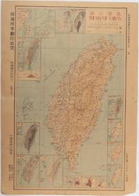
1945ref. 215871Taiwan.: 禹甸圖書局. Yudian tushuju. 1945. 1945 Ministry of Interior map of Taiwan published in the 34th year of the Republic of China with inset title and key top right. Romanised Japanese names for some areas and cities written in capital letters on main map which is surrounded by 15 small inset maps at edges each with its own scale. Paper browned wear at folds and edges repaired with archival washi on reverse some light stains and a few marks. 1 x 3cm chip bottom right corner. 77.4 x 54 cm. Text in traditional Chinese characters. Inset maps show clockwise from right edge; 1. Distribution of inhabitants according to ethnic background or minority group 2. Qing Dynasty prefectures and counties 3. Japanese administrative regions during the occupation 4. Strategic industrial and military places three city maps - 5.Chilung or Keelung port 6. Taipei city and 7. Tainan city 8. Geological formations 9. agricultural metallurgical and mineral products 10. Soil types 11. Topography of the island including sea currents and altitude diagram 12. Taiwan's position in relation to the mainland coast provinces of Fujian and Zhejiang as well as the Liuqiu Ryukyu Islands including Okinawa 13. Okinawa detail 14. Climate and rainfall in January 15. Climate and rainfall in July. . 禹甸圖書局. [Yudian tushuju]. unknown
ref. 1581741421.Gpaperback. Good. Access codes and supplements are not guaranteed with used items. May be an ex-library book. paperback
ref. 158174210X.Gspiral_bound. Good. Access codes and supplements are not guaranteed with used items. May be an ex-library book. unknown