ROBERTSON M.:Livre Rare Book

11.782 resultados
1778ref. 2141A Paris, Chez Panckoucke, 1778. 2 volumes in-8 de XX-540 + 526 pages, cartonnage rose à motifs, étiquette de titre noire. Mors fendus, dos et plats passés, coiffes manquantes, manques aux dos, plats tachés, coins frottés.
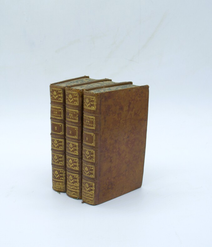
1777ref. PHO-2334Paris, Chez Panckoucke, 1777, 3 volumes in-12 (17x10cm), 2ff.-xvi-382pp.-1f.-537pp., 1f.-487pp., basane époque, dos à nerfs ornés avec titre et tomaison, tranches cailloutées bleues. Coins usés (tome 3), épidermures (tome 1).
1818Tre voll., in -8°, pp. XXXI, 487; 539; 513; pelle con fregi, tasselli e titoli al dorso. Completo delle cinque tavole ripiegate, di quattro carte e una tavola, “Table chronologique des Mexicains”. Complete of five folding plates, four geographic maps and a non folding plate: “Table chronologique des Mexicains”.
1792ref. 5151792 Paris, Buisson, 1792. 20 x 12,5 cm, in-8, VIII - 536 pp. - 2 grandes cartes dépliantes gravées en taille douce sur vergé bleuté (carte de la partie sud-est de l'Asie selon Ptolémée, et une autre selon les connaissances géographiques récentes), reliure de l'époque en demi-basane fauve à petits coins en vélin, dos à 5 nerfs, pièce de titre, tranches mouchetées.
1935ref. 036820Los Angeles California: Title Guarantee And Trust / Title Insurance And Trust 1935 1936 1937 1938 1942 1946 1949 1951 1956 1957 1959 1961 1935. First Edition 1st Printing. Soft cover. Very Good/No Dust Jacket. 9 1/4" High. A Group Of 30 Different Booklets Including 19 Different First Printings 1935-1961 One With Second Issue Tipped In Slip 8Th Printing Of Old Spanish And Mexican Ranchos Of Orange County Six Are First Printings Of Later Revisions There Were Many Minor Revisions Usually Each Time They Were Re-Issued. Several Have Notations On Covers That They Were Gifts To Dr. George Hill Hastings From Arthur Mordan President Of Title Guaranty Who Employed Robinson. The Beverly Hills Book Has A Presentation Inscription From Mordan To Hastings The Island Of Santa Catalina Has A Long Notation By Hastings That It Was A Gift From Robinson Upon The Death Of Mordan A Dear Friend; Signed H. H. All Very Good To Near Fine Except Culver City Which Has Wear And Some Damp Spotting Centered On Spine And Extending Inwards Up To 1/4"; And The Forest And The People Is Only Good Worn And Some Small Light Water Spots. Title Guarantee And Trust / Title Insurance And Trust 1935 1936 1937 1938 1942 1946 1949 1951 1956 1957 1959 1961 paperback
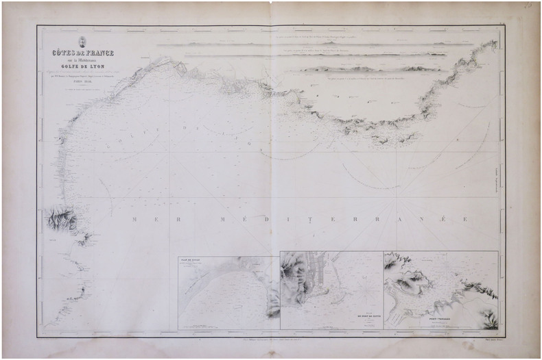
1856ref. LBW-8305Paris, Robiquet, 1856. 610 x 894 mm.
1856ref. LBW-8303Paris, Robiquet, 1856. En deux feuilles de 0,69 x 0,99 m et 0,68 x 1 m.
1856ref. LBW-8245Paris, Aimé Robiquet, 1856. 635 x 892 mm.
2000ref. 23956New Zealand, Random House, 2000. 211 p. with 128 maps and a gazetteer. 30,5 x 25 cm, hardcover with original wrappers.
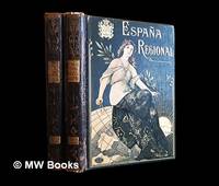
1913ref. 486511Barcelona : Alberto Martín 1913. Second Edition. Hardcover. Good copies both in contemporary quarter calf over gilt and colour-illustrated bevelled boards showing minor surface-wear. Corners slightly bumped. Spine leather rubbed particularly at the joints and endbands. Some preliminary leaves in both volumes show minor creases or tears. Text blocks otherwise remain strong and clean with only the expected sparse and faint foxing. A well-preserved set overall. Physical description; 2 volumes : illustrations ; 38 cm. Notes: Vols. 1-2 of 4 i.e. the complete text without maps or plans. Date conjectural. Contents: v. 1. Texto 1a. parte — v. 2. Texto 2a. parte. Subjects; Spain geography 20th century regional. Spain description and travel 1910s. Spanish topography regional geography. Barcelona : Alberto Martín hardcover
1910ref. 486513Barcelona : Alberto Martín 1910. First Edition. Hardcover. Good copies both in contemporary quarter calf over gilt and colour-illustrated bevelled boards somewhat scuffed. Corners slightly bumped. Spine leather rubbed particularly at the joints and endbands the latter crumbling slightly. Some preliminary leaves in both volumes show minor creases or tears. Text blocks otherwise remain strong and clean with only the expected sparse and faint foxing. A well-preserved set overall. Physical description; 2 volumes : illustrations ; 38 cm. Notes: Vols. 1-2 of 4 i.e. the complete text without maps or plans. Date conjectural. Contents: v. 1. Texto 1a. parte — v. 2. Texto 2a. parte. Subjects; Spain geography 20th century regional. Spain description and travel 1910s. Spanish topography regional geography. Barcelona : Alberto Martín hardcover
1951ref. 19753Lyon, Éditions du Chalet, 1951. In-8 de 396-[4] pages, pleine basane caramel, premier plat orné d'une composition figurant deux cases et de la végétation, dos lisse, couvertures conservées.
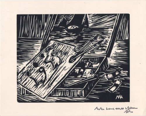
1955ref. 14771955 Carte de voeux de Marcel Roche pour l'année 1955. Carte de 12 x 15 cm, portant une gravure sur bois en noir enrichie d'un mot autographe signé de l'artiste.
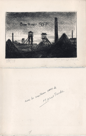
1957ref. 10531957 Carte de voeux de Marcel Roche pour l'année 1957. 14,5 x 19 cm, 2 ff., en deuxième page une gravure en noir représentant un paysage minier, numérotée 58/75 et signée à la mine de plomb, en troisième page un envoi autographe signé à la plume.
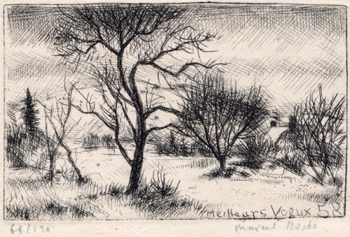
1958ref. 14761958 Carte de voeux de Marcel Roche pour l'année 1958. 10 x 14,5 cm, 2 ff., en page 3 une gravure en noir, numérotée 66/120 et signée à la mine de plomb, le reste muet.
1987No marks or inscriptions. Crease to lower corner of front cover, none to spine. A very clean very tight copy with bright unmarked boards and no bumping to corners. Large pull-out map in excellent condition. 128pp. Walking tours in Corfu plus car trips and picnic places.
1994No marks or inscriptions. No creasing to covers or to spine. A very clean very tight copy with bright unmarked boards, slight fading near spine and no bumping to corners. Large pull-out map in excellent condition. 70pp. Walking tours in Lanzarote plus car trips and picnic places.
1849ref. 87523Washington D.C.: Government Printing Office 1849. Hardcover. Very Good. Octavo 9.2 in. x 6 in. pp. 678 1 index. Personal copy with gilt ownership plate to front board of DeWitt C. Lawrence Chief Clerk of the Patent Office. Illustrated with sixteen folding maps. Black half calf with decorative gilt chain rule over marbled boards. Rebacked spine. Gilt name on black ownership panel to front board. Black title on paper panel to spine. Marbled endpapers. Front free endpaper detached but present. Detailed pencil notes presumably from DeWitt Lawrence to preliminary pages index and rear endpapers and to occasional penciled comments on margins of main text providing reference and guidance. Fremont Preuss's maps #II-VIII in VG condition. Other maps in G condition with additional creases a few short closed tears at seams and light browning to several edges. ALL16 maps detached as they were removed for preservation and study. Maps I IX-XVI folded in archival pocket. The PREUSS Maps II-VIII "The Rockwell Maps" are laying flat preserved in archival sheath and will be mailed separately under cover. Includes additional copy of Rockwell's map of "Section III". The 16 folded maps include: #I. Map of the Country Between the Atlantic and Pacific Oceans. 1848. Rob Mills. Pencil notes on map. #II-VIII. Road from Missouri to Oregon in 7 Sections 1848. Charles Preuss. Includes two identical copies of Section #III map. All eight Preuss maps in VG condition #IX. Republica Mexicana Plano del Curso del Rio Coatzacoalcos. 1843 #X. Profils en Long et en Traviors du Canal. L'Isthme de Panama1841. Garella. #XI. Profile of That Section of the Country between Nicaragua and the South Sea 1838. Based on Thompson's Guatamala. #XII. Nicaragua Realejo Harbour Edward Belcher Harbour of San Juan de Nicaragua George Peacock 1832 #XIII. Chart of the Bay of Limon or Navy Bay 1829. J.A. Lloyd. #XIV. Republica Mexicana Pano de la Parte Austral del Istmo de Tehuantepec 1843. Jose de Garay. #XV. Panama Canal Longitudinal Section. J.A. Lloyd. Four inch closed tear with 1/2 inch chip to seam. #XVI. Carte Topographique de la Partie De L'Isthme de Panama comprise entre Panama Chagres. 1845. Garella. Uniquely annotated copy. The "first major government report devoted to interoceanic communication.Rockwell in addition to his prime focus on Central American canals compiled memorable documents on the suddenly urgent need for more directly binding California to the Union.Foremost.was the matchless seven-section map of the Oregon Trail made by Charles Preuss Fremont's gifted cartographer. Lieut. G.K. Warren in his 1859 memoir wrote that Preuss's 'skill in sketching topography in the field and in representing it on the map has probably never been surpassed in this country.' ".The Senate had issued this map separately in 1846; now the House was trying to make available to the Forty-0niners what was by far the best trail map of them all.this treasure was so deeply buried in this report that but few gold seekers found it and it is still so rare in both editions that Wheat lamented that it ' has been insufficiently appreciated by students of Western history.' ." Plains & Rockies 1800-1865: Supplemental volume to the series News of the Plains and Rockies; 2001 Arthur H. Clark Spokane. [Government Printing Office] hardcover
1750Pianta di Roma a proiezione verticale, orientata con il nord in alto.Incisa da R. Benning per il cartografo inglese John Rocque e basata sulla pianta di Giovan Battista Nolli del 1748."Come annunciato nel titolo (ripetuto anche in italiano e francese), si tratta di una diretta derivazione della pianta piccola del Nolli che l'autore ha voluto riportare nella scala in cui aveva già pubblicato la pianta della città di Londra. In basso a sinistra indice delle fabriche più ragguardevoli contenute nella pianta con 170 voci suddivise in sei colonne. In basso a destra dedica a Sir. Bouchier Wrey. Le emergenze architettoniche sono campite in nero ed il resto degli isolati a tratteggio diagonale. In basso a sinistra il nome dell'incisore R. Benning sc. La stessa pianta fu rstampata nel 1773 dal Sawyer" (cfr. Marigliani p. 274).Acquaforte, finemente colorata a mano, in buono stato di conservazione. Non comune. Vertical projection map of Rome, oriented with the north at the top.Published in 1750 by John Roque, from the earlier plan by Goivanni Battista Noli published in 1748 (These dates are printed on the map).As announced in the title (also repeated in Italian and French), this is a direct derivation of the small map of Nolli that the author wanted to bring back to the scale in which he had already published the map of the city of London. At the bottom left index of the most remarkable fabrications contained in the plan with 170 entries divided into six columns. Bottom right dedication to Sir. Bouchier Wrey. The architectural buildings are in black and the rest of the blocks are in diagonal hatching. Bottom left the name of the engraver R. Benning sc. The same plan was printed in 1773 by Sawyer (see Marigliani p. 274).Etching, finely colored by hand, in good condition. Not common. C. Marigliani, "Le Piante di Roma delle collezioni private", n. 192; Scaccia Scarafoni, "Le Piante di Roma", n. 230.
1916115 p. + Half tone photographic illustrations; + Folding Maps. Tall 8vo. Original cloth backed printed paper boards. Binding worn and slightly soiled. Scarce. PA 24 x2
1972No marks or inscriptions. A very clean very tight copy with bright unmarked boards and no bumping to corners. Dust jacket not price clipped or marked or torn or creased with very minor traces of storage. 172pp. With nearly 150 illustrations, many in colour, this account describes China's Forbidden City which only became accessible to all Chinese citizens after the 1911 revolution.
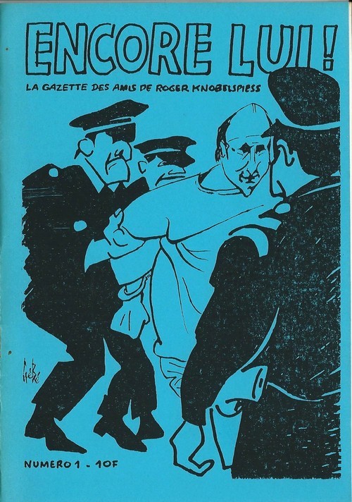
ref. 6305Revue Encore lui ! La Gazette des amis de Roger Knobelspiess n° 1 de 1987. Plaquette in-8, agrafée, de 26 pages au format 15 x 21 cm. Couvertures illustrées par Gébé et Willem. Double page illustrée par Gébé. Directeur de la publication, Marie Rivière. Directeur empêché, Roger Knobelsiess. Rédacteur en chef Jimmy Gladiator. Textes de Roger Knobelsiess, Louis-Jean Calvet, Serge Quadruppani, Jimmy Gladiator, etc. Petit tirage. Edition originale enrichie d'une superbe dédicace autographe, signée, à Annie Gérardin, au verso d'une carte postale expédiée par Jimmy Gladiator de Grèce. Etat proche du neuf.
ref. 64516Librairie Arthème Fayard 1961 livre étude 19,5*14,5 167 pages
199478 pages. Documents over 40 hiking trails in the mid-island area. A wonderful reference including detailed descriptions and maps. Former owner's notes on back page. Moderate wear and light soiling. Author's signature upon title page. Book
1706Veduta tratta dal "Les delices de l'Italie, contenant une description exacte du Païs, des principales villes, de toutesa les Antiquitez" edito, per la prima volta, a Leida nel 1706 da Pieter Vander Aa e successivamente ristampato a Parigi da Guillaume Cavelier.La maggior parte delle copie della seconda edizione reca nel frontespizio l'indicazione Compagnie des libraires, associazione di librai stampatori la cui composizione è variata negli anni ma di cui Guillaume Cavelier faceva parte.La guida, che sappiamo da Barbier I, 872 essere opera di Rogissart e dell'abate Havard, è impreziosita da 152 tavole,Incisione in rame, in buono stato di conservazione. Bibliografia Marigliani (2007): p. 259, n. 169. Panorama of Rome taken from "Les delices de l'Italie, contenant une description exacte du Païs, des principales villes, de toutesa les Antiquitez"published for the first time in Leiden in 1706 by Pieter Vander Aa and later reprinted in Paris by Guillaume Cavelier. Most of the copies of the second edition have on the title page the indication Compagnie des libraires, an association of booksellers and printers whose composition has varied over the years but to which Guillaume Cavelier belonged. The guide, which we know from Barbier I, 872 to be the work of Rogissart and Abbot Havard, is embellished with 152 plates Copper engraving, in good condition. Literature Marigliani (2007): p. 259, n. 169.