11.782 resultados
Colour printed map, ca. 810 x 608 mm. Scale: 1:1,000,000. Shows boundaries, highways and roads, railways, rivers and water features, and other details. Rare 4th GSGS edition of this map of Saudi Arabia, as part of the International Map of the World series, showing the western coastline as well as the cities Medina and Ha'il and the oasis of Al-Ula in the interior. - Stamp of ownership of Arizona State University, along with "withdrawn" and "superseded" stamps on top and next to it. - 56 mm piece of adhesive tape on top edge; pencil marks to lower right corner. OCLC 634944590. Cf. OCLC 35899626 (1962 ed.).
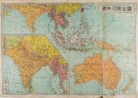
1572ref. 159290東京 Tokyo.: 金鈴社 Kinrei-sha. 昭和十八 October 101943. Two maps printed in colour on a single side of a folded sheet. The map titled "Complete Map of India and Australia" shows the region covering Australia southern India western mainland south-east Asia Indonesia the Philippines and New Guinea. The other map titled "India and Burma" shows the region covering India Afghanistan the western section of China Burma and Thailand on the lower left side. New Zealand is in an inset map in the lower right corner. As the note on the cover says "Including the detailed descriptions of the Solomons New Guinea and southern islands" this map shows the theatres of the Pacific War and the surrounding areas. The map indicates agricultural and mineral resources as well as cities roads railways sea routes national borders etc. Cover and publication details printed on two panels on the reverse. Some marking and browning. . 金鈴社 [Kinrei-sha]. unknown
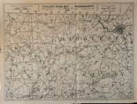
1891ref. List3031Lynn Massachusetts: Arthur W. Robinson 1891. Nine of a ten-map series mostly measuring 14 ½ x 19 inches. Folded with slight marginal folding and wrinkling; Near Fine. Nine of a set of ten maps of the entire state of Massachusetts produced in 1891 for the League of American Wheelmen. The League was founded in Rhode Island in 1880 as a membership organization for cyclists. Besides presiding over racing and producing cycling guidebooks it advocated for increased government spending on road improvements especially for rural roads; these maps indicate roads of superior and inferior quality. In the 1890s there was a boom in cycling’s popularity mainly because of several inventions that allowed a safer and more pleasant ride compared to that of a penny-farthing. This group is near complete; we find two complete editions on OCLC. Arthur W. Robinson unknown books
1891ref. List3031Lynn Massachusetts: Arthur W. Robinson 1891. Nine of a ten-map series mostly measuring 14 ½ x 19 inches. Folded with slight marginal folding and wrinkling; Near Fine. Nine of a set of ten maps of the entire state of Massachusetts produced in 1891 for the League of American Wheelmen. The League was founded in Rhode Island in 1880 as a membership organization for cyclists. Besides presiding over racing and producing cycling guidebooks it advocated for increased government spending on road improvements especially for rural roads; these maps indicate roads of superior and inferior quality. In the 1890s there was a boom in cycling’s popularity mainly because of several inventions that allowed a safer and more pleasant ride compared to that of a penny-farthing. This group is near complete; we find two complete editions on OCLC. Arthur W. Robinson unknown
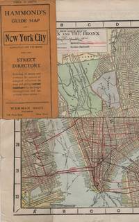
1913ref. 41637New York: Wehman Brothers Publishers 1913. Very good. An impressive color map of the island of Manhattan and the Bronx. Scale is 1" equals 1/2 mile and includes railroads subways elevated railroads surface railroads and proposed railroads. An uncommon early 20th Century New York City street map. Folding color map. Measuring approximately 18" x 36" when unfolded. In original printed card wrapper. Verso a thorough printed street index. Mild handling wear toning. A few tiny holes near fold corners. Overall well preserved; very good. Wehman Brothers Publishers unknown books
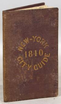
1840ref. 000014171New York: Tanner & Disturnell 1840. Later edition. Hardcover. Very Good. 64mo. 13 cm x 8 cm. 3 4-15 1 pp. Brown cloth with gold lettering on the front board. Yellow coated rear endpaper and rear pastedown. Illustrated with a frontispiece and with a folding map in the rear of the volume. The folding map in the rear of the volume is hand-colored. Its title is "New Map of the City of New-York with part of Brooklyn & Williamsburg". By J. Calvin Smith. Engraved on steel by Stiles Sherman & Smith. The folding map is dated 1840. Phillips 532. Guide books similar to this one were published as early as 1836. OCLC locates a few examples of this exact edition. With a list of wards streets and information on how to get around the city. A fascinating look at early nineteenth-century New York City. Light soiling to the cloth. Lacks the yellow free front endpaper and front pastedown. The folding map with one piece neatly detached but laid in the whole map is present. Tanner & Disturnell hardcover
1960ref. 000015404Mainz: W. Suder 1960. Later edition. Wraps. Near Fine. 24.5 cm x 11.5 cm folded in the wrappers. Map bound in the leporello style. Blue paper wraps printed in dark blue. A colorful map with captions printed in black in 16 folds. A map similar to this one was first published earlier in the twentieth century by a different press. The captions are in English. Castles and other landmarks from Bonn Cologne Linz Krahnenburg Koblenz and from several other suburbs and towns on the Rhine river are pictured and discussed in the map's margins. Light wear to the wraps else a sharp example. W. Suder unknown
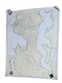
1937ref. 9266Washington D.C.: U.S. Coast and Geodetic Survey 1937. 4th edition. Large 2 color map 34.5 x 42.5" Date of 1948 stamped at the bottom along with stamps from Metsker's Maps in Tacoma. A couple small edge tears not extending into the image and light wrinkling around edges. A near fine example. Original WWII-era copy of this classic Seattle map showing shorelines depths tides etc. in full detail. This is #6449 of the U.S. Coast and Geodetic Survey the first edition appearing in 1922. U.S. Coast and Geodetic Survey unknown
1939ref. 4298Harrisburg PA: The Military Service Publishing Company 1939. Hardcover. Very Good. Twenty first edition April 1939. 4to 216 pp. Publisher's blue cloth with gilt lettering and design. Very good with some soiling to boards and edges of page block. Clean internally with a few annotations in pencil throughout. Included is the supplementary envelope with Special Map "A" and four protractors only 2 are listed on the envelope. A few contemporary papers and supplementary materials for a course taken at the University of Wyoming are laid in as well. The Military Service Publishing Company hardcover
ref. 79037Paris Ch. Delagrave 1881. Two maps printed in black blue and red 25.7 x 25.6 cm; and 16.5 x 17.4 cm on a single folded sheet 46.7 x 30.3 cm. Original printed wrappers. = Two seldom-seen if not downright rare maps showing the Polar region and Africa indicating where the latest explorations were made thus showing the borderline between areas known and those still unknown in the year 1880. Contained in the Bulletin of the Société de Géographie Paris together with descriptive text. Also included is an account of the disastrous Flatters expedition. Paul Flatters 1832-1881 "was a French soldier who spent a long period as a military administrator in Algeria. He is known as leader of the Flatters expedition an ill-fated attempt to explore the route of a proposed Trans-Saharan railway from Algeria to the Sudan. Almost all members of the expedition were massacred by hostile Tuaregs. The survivors resorted to eating grass and to cannibalism on the long retreat through the desert. After a brief outburst of public indignation the fiasco was forgotten." French Wikipedia. The Polar map is in blue the African map in grey. Short tear at map adhesion point; slight fraying to the uncut wrapper's edges; otherwise very good clean and unmarked. unknown
1929ref. 4297Meadville PA: Keystone View Company 1929. 3rd Edition. Hardcover. Very Good. Third edition 1929 12mo 321pp ix pamphlet with three location maps in rear pocket. 3/4 black morocco over blue cloth gilt stamped on spine. Very good with moderate to heavy spotting and soiling to boards. Some moisture staining to fore-edge of page block mainly at the rear index else clean internally. Keystone View Company hardcover
1840ref. k210726bSurveyors Office Little Rock 30th Sept. 1840David Fulton Surveyor Public LandPrinted by W.J. Stone etc. Wash. for 28th Congress 2d Sess. This is the scarce annotated and colored version of the map of the Arkansas Surveying District "shewing the extent of public surveys in said district on the 30th September 1840." Unlike other versions of this map that have appeared this hand-colored version indicates by color the finished unfinished and relinquished townships and lines "the field notes of which have been sent to the General Land Office." The map also depicts the Arkansas and other Rivers Choctaw and Cherokee Boundary LinesLouisiana Line Little Rock and other landmarke. The size of the map is 18.5"x17.5" folded to 4"x7". Condition: Near fine. Possibly clipped from a larger volume; left margin i trimmed with several large tears t top not intruding into the image. Small light stain at boom no foxing or discoloration. Printed by W.J. Stone etc. Wash. for 28th Congress 2d Sess.
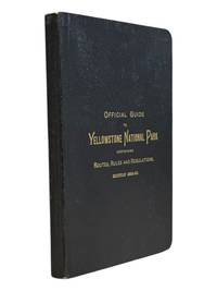
1889ref. 9062St. Paul Minn: W.C. Riley 1889. 8vo 140 15pp ads and blank journal at rear. Illustrations maps large folding map in pocket at rear as issued. Original leather over card covers stamped in gilt on front with red page edges. Gift inscription on ffep in pencil dated 1907 else clean internally. A beautiful fine copy. Beautiful copy of this illustrated tourist's guide to Yellowstone giving descriptions of the attractions and features of the park with maps a brief history and rules and regulations. Riley issued a just few of these according to OCLC between 1886 and 1890. Scarce and more so in this condition - the nicest we've seen. . W.C. Riley unknown
1921ref. 70993Chicago and New York: Rand McNally Co 1921. Engraved map 27 ¾ x 21 inches county and state borders in orange railroads' table and marks and steamship lines on Lakes Superior and Michigan in red locating list of principal cities along left margin with population figures to the nearest thousand or hundred cartouche title: "Rand McNally standard Map of Wisconsin"; verso prints a "Main Highway Map of Wisconsin" with roadways printed in green. Folded into printed brown wrappers 12mo. 47 pp.; spine of wrappers separated a good copy the map fine. Rand McNally Co unknown books
1957ref. k251217i1st and only edition. 4to softcover 9 x11" Pages: xxi 94 Appendices. Approximately 130 pp. in all. Accompanied by 23 large folded maps in slipcase. The booklet is subtitled "Economic Aspects of Comprehensive Survey of San Francisco Bay and Tributaries." It contains research data concerning land use population distribution freeway development employment and economic growth as well as a decade-by-decade chart for growth management. Most of the maps are 36"x42" some two-tone others in brilliant colors. CONDITION: The maps are FINE folded to size with the appearance of never having been opened. The booklet is Good; a clean copy overall but with some discoloration to spine toning to rear cover and one rusted staple. The slipcase is well worn with substantial dampstaining not affecting the contents. U.S. Army Corps of Engineers / U.S. Dept. of Commerce, 1957
1889ref. 70991NY and Chicago: Rand McNally 1889. Engraved map 23 x 28 inches recto showing Lower Manhattan Brooklyn Jersey City and Hoboken lines for Manhattan Elevated Railway Suburban Rapid Transit Brooklyn Elevated R.R. and Kings Co. Elevated R.R. printed in dark red Bartholdi's Statue marked on Bedloes Island verso showing Upper Manhattan and printing a large more detailed inset of Lower Manhattan from Washington Square to the Battery 12 ½ x 13 inches and a boxed index to the street car lines 8 x 6 inches. Printed several times 1886-1889 this printing located in four copies on OCLC Newberry New York Public Boston Public Columbia. Folded into 16mo printed brown wrappers subtitle: Showing Street Car Lines Elevated Railroads Docks Ferries Steam Boat Lines etc.; some soiling several tiny corner fold breaks wrappers separated along the spine but still a good copy. Rand, McNally unknown books
1925ref. 70992Chicago IL: Rand McNally & Co 1925. Engraved map 28 x 20 ½ inches recto showing counties outlined in yellow railroads and identified steamship lines in red along the coast and up the Delaware River and printing a list of railroads verso printing another map of the same dimensions this one in blue Rand McNally Main Highway Map of New Jersey. Title on first map: Rand McNally Standard Map of New Jersey. Index for "principal cities" printed in left margin of each map. Folded into printed brown wrappers spine partly split 12mo. 33 1 4 pp.; C. S. Hammond & Co. label pasted over publisher's imprint on front wrapper more information on cities towns etc. Good copy. Rand, McNally & Co unknown books
1889ref. 70991NY and Chicago: Rand McNally 1889. Engraved map 23 x 28 inches recto showing Lower Manhattan Brooklyn Jersey City and Hoboken lines for Manhattan Elevated Railway Suburban Rapid Transit Brooklyn Elevated R.R. and Kings Co. Elevated R.R. printed in dark red Bartholdi's Statue marked on Bedloes Island verso showing Upper Manhattan and printing a large more detailed inset of Lower Manhattan from Washington Square to the Battery 12 ½ x 13 inches and a boxed index to the street car lines 8 x 6 inches. Printed several times 1886-1889 this printing located in four copies on OCLC Newberry New York Public Boston Public Columbia. Folded into 16mo printed brown wrappers subtitle: Showing Street Car Lines Elevated Railroads Docks Ferries Steam Boat Lines etc.; some soiling several tiny corner fold breaks wrappers separated along the spine but still a good copy. Rand, McNally unknown
1900ref. 70990Chicago and New York: Rand McNally & Co. 1900. Engraved map 28 x 21 inches county and state borders in red inset map "Minneapolis St. Paul and Vicinity" 4 x 4 inches locating list of chief cities along left margin with population figures to the nearest thousand or hundred title at head: "Rand McNally & Co.'s Minnesota." Folded into printed brown wrappers 12mo. 46 pp. Very good. Rand, McNally & Co. unknown books
1867ref. s02256Washington D.C: Government Printing Office 1867. 1st Edition. Hardcover. Very Good. Brown pebbled cloth boards with blindstamped rules; 9" tall; 151 pp plus large folding map. Good condition with wear to spine ends of corners of boards; map itself in very good condition colors bright folded properly modern tape reinforcement at creases. -- The "Map of the United States and Territories" by Joseph S. Wilson was one of the largest and most accurate maps of the country published at the time. It clearly marks major Native American territories and the colored mineral deposits show a clear rationale for expansion to the West. Joseph Wilson was Commissioner of the General Land Office both before and after the Civil War and this map was produced during the first year of his second tenure. The accompanying report asserts the United States' right to possession of the Western territories and states encourages the population thereof and admits to continuing arbitration land claims especially in California. Government Printing Office hardcover books
1867ref. s02256Washington D.C: Government Printing Office 1867. 1st Edition. Hardcover. Very Good. Brown pebbled cloth boards with blindstamped rules; 9" tall; 151 pp plus large folding map. Good condition with wear to spine ends of corners of boards; map itself in very good condition colors bright folded properly modern tape reinforcement at creases. -- The "Map of the United States and Territories" by Joseph S. Wilson was one of the largest and most accurate maps of the country published at the time. It clearly marks major Native American territories and the colored mineral deposits show a clear rationale for expansion to the West. Joseph Wilson was Commissioner of the General Land Office both before and after the Civil War and this map was produced during the first year of his second tenure. The accompanying report asserts the United States' right to possession of the Western territories and states encourages the population thereof and admits to continuing arbitration land claims especially in California. Government Printing Office hardcover
1928ref. 70989Chicago IL: Illinois Commerce Commission 1928. First edition. Mammoth lithograph map 52 ½ x 34 inches showing the railroad lines throughout the state and cities and towns they pas through with an inset detailed map of Chicago and vicinity 15 ¼ x 8 ½ inches and boxed panels for identification of the various railroads and "Passenger Terminals in Chicago" verso prints an index to counties and towns. Relatively uncommon OCLC locating 12 copies 6 in Illinois 4 in Wisconsin. Folded into 12mo printed light brown wrappers; several closed marginal tears into map one two-inch horizontal fold break else very good. Illinois Commerce Commission unknown books
1918ref. 70988Chicago IL: Rand McNally 1918. Minneapolis MN: Hudson Publishing Co. printed label over Rand McNally imprint c1918. 12mo. 74 18 ads pp. Original printed wrappers rubbed stapled map with a few tiny corner breaks else very good. Rand McNally unknown books
1928ref. 70989Chicago IL: Illinois Commerce Commission 1928. First edition. Mammoth lithograph map 52 ½ x 34 inches showing the railroad lines throughout the state and cities and towns they pas through with an inset detailed map of Chicago and vicinity 15 ¼ x 8 ½ inches and boxed panels for identification of the various railroads and "Passenger Terminals in Chicago" verso prints an index to counties and towns. Relatively uncommon OCLC locating 12 copies 6 in Illinois 4 in Wisconsin. Folded into 12mo printed light brown wrappers; several closed marginal tears into map one two-inch horizontal fold break else very good. Illinois Commerce Commission unknown
1844ref. 10175Regensburgh: Georg Joseph Manz 1844. First edition. 8vo xiv 205 1pp. Frontispiece with two engraved views and a large folding 6-section map at back. Original printed boards rubbed and soiled. Some foxing to the frontis and title scattered throughout and the map. Very good. Very attractive copy of this travel guide devoted to the stretch of the Danube from the Ludwig Canal to Vienna. This is a follow up to Müller's first work on the Danube issued in two volumes from 1839-1841 and covering the entire length of the river. Adalbert Müller 1802-1879 was a popular history and travel writer from Bavaria who wrote several works on the scenery and monuments in southern Germany during the steam travel age. Scarce. Georg Joseph Manz unknown