12.267 resultados
1765Primo stato di questa non comune carta del mondo del XVIII secolo, successivamente ristampata nel 1775 e 1787. La carta mostra le numerose esplorazioni del secolo ed è altamente decorativa. La carta è largamente più conosciuta per la sua comune ristampa del 1787, curata dall'editore Louis Joseph Mondhare, che raffigura la scoperta delle Hawaii (Isole Sandwich o Why, come indicato sulla mappa), le esplorazioni nella costa nord-occidentale dell'America e quelle dei viaggi di Cook (1773,1775, 1776, 1777, 1777, 1778), Jean Baptiste Louis Clouet era membro dell'Accademie Royale des Sciences di Rouen e fu autore della Geographie Moderne (1767). Acquaforte, in ottimo stato di conservazione. Magnifico esemplare in piena coloritura coeva. First state of this uncommon World map with the major 18th century explorers. Rare separately published double hemisphere map of the world, issued by Clouet in Paris. The map is largerly known for his second and common issue by Louis Joseph Mondhare (1787) showing the discovery of Hawaii (Ile Sandwich ou Why, as named on the map) and explorations in the Northwest Coast of America are quite prominent, and the major 18th century explorers like Cook (1773,1775, 1776, 1777, 1778). Jean Baptiste Louis Clouet (born 1730) was a member of the Academie Royale des Sciences de Rouen and the author of Geographie Moderne (1767). Etching with full contemporary colour, very good conditions.
1740Mappa del mondo tratta dall’Atlante Novissimo, edito da Giambattista Albrizzi, nel 1740 circa; una delle più interessanti e decorative carte del mondo che compaiono in un Atlante della metà del Settecento italiano. Elegante esempio della scuola italiana di cartografia commerciale; la decorazione intorno alla carta è stata realizzata da Giovanni Battista Piazzetta (1682-1754 ca.), la cui influenza è visibile nella successiva opera di Antonio Zatta e di altri editori veneziani del ‘700. Il contenuto cartografico della carta, che è tratto dal Mappe Monde di De l'Isle (1700), è circondato da allegorie femminili in ogni angolo che rappresentano i quattro continenti, delle quali il Piazzetta è il disegnatore e Giuliano Giampiccoli l’incisore. La mappa comprende una sfera armillare, le rotte dell'esploratore, la sconosciuta costa nord-occidentale dell'America, le proiezioni incomplete dell'Australia (ancora attaccata alla Nuova Guinea) e della Nuova Zelanda, la congiunzione della massa della Terra Asiatica che si estende verso l'Alaska e molti altri miti cartografici e proiezioni errate. Acquaforte, finemente colorata a mano, in ottime condizioni. Map of the World taken from Atlante Novissimo, published by Giambattista Albrizzi, circa 1740. Globe with allegorical representations of the four continents in the corners, surmounted by an armillary sphere. Striking example of Albrizzi's double hemipshere map of the World, one of the most interesting and decorative world maps to appear in a mid-18th Italian Century Atlas. An elegant example of the Italian school of commercial cartography, the art work around the map having been done by important Italian artist Giovanni Battista Piazzetta (ca. 1682-1754), whose influence can be seen in the subsequent work of Zatta and others. The cartographic content of the map, which is drawn from De l'Isle's Mappe Monde (1700), is secondary to the very beautiful, serene female figures in each corner representing the four continents. G. Batta Piaceta is shown as Inventor (left), and Guliano Giampicoli, as engraver (right). The map includes a finley executed armillary sphere, explorer's routes, unknown NW Coast of America, incomplete projections of Australia (still attached to New Guinea) and New Zealand, conjectural Asian Land mass extending toward Alaska and many other cartographic myths and misprojections. Copperplate with fine later hand colour, very good condition.
1781ref. LBW-37301781. 214 x 329 mm.
1800ref. LBW-744Paris, Jean, [circa 1800]. 513 x 754 mm.
1827ref. LBW-6186Paris, chez l'auteur, 1827. 391 x 746 mm.
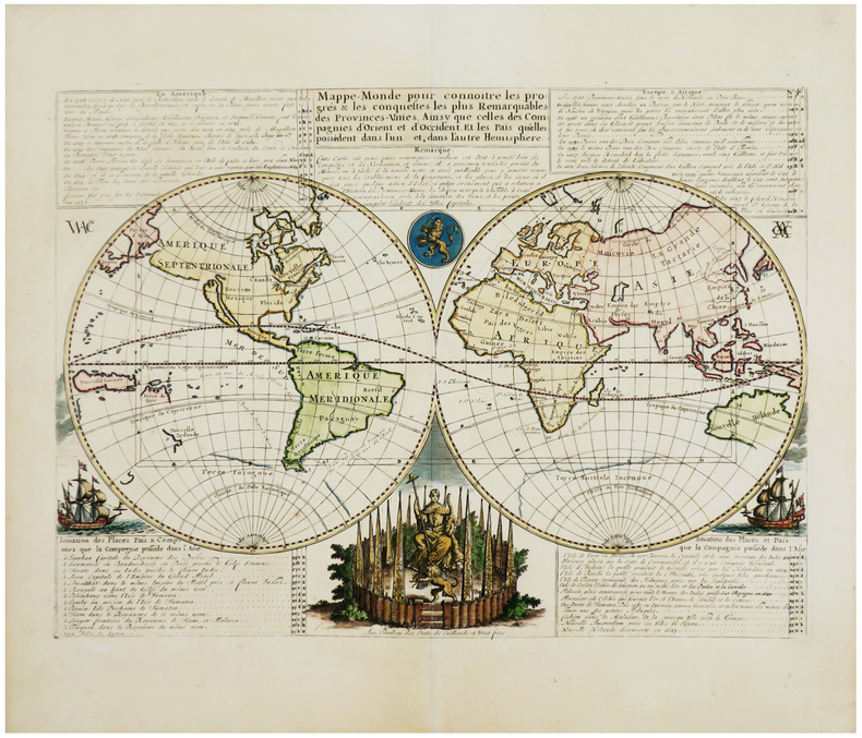
1728Bell'esemplare della mappa murale del mondo di De Fer, pubblicata per la prima volta nel 1700. Il testo rileva che la mappa è una riduzione della mappa murale in quattro fogli del mondo dello stesso autore, pubblicata per la prima volta nel 1695. De Fer afferma che questa mappa è la prima a tenere conto delle osservazioni astronomiche della Royal Academy of Sciences. Sembrerebbe, infatti, che l'autore abbia consultato diverse fonti per meglio realizzare California, Giappone e Australia.L'Australia è mostrata come incompleta e ancora attaccata alla nuova Guinea. La Nuova Zelanda viene realizzata solo a grandi linee. Il fiume Mississippi ha la sua confluenza con il Golfo del Messico considerevolmente più ad ovest rispetto al suo vero corso. Sono inseriti molti altri nomi di luoghi e il commento scientifico è notevolmente dettagliato.Incisa da Johannes Van Loon, la mappa include vignette che mostrano tuoni, fulmini, tempeste e maree, vulcani, ecc. Le osservazioni celesti sono mostrate nella parte superiore. Acquaforte, bella coloritura coeva, in buono stato di conservazione. Rara. Nice example of De Fer's wall map of the world, first published in 1700. The text notes that the map is a reduction of De Fer's 4 sheet wall map of the world, first issued in 1695. De Fer states that this map is the first map to be prepared based upon the astronomical observations of the Royal Academy of Sciences. In fact, it would appear that different sources entirely have been consulted for California, Japan and Australia.Australia is shown as substantially incomplete and still attached to new Guinea. New Zealand appears in partial outline. The conjectural land bridge from Asia to America is still in evidence. The Mississippi River has its confluence with the Gulf of Mexico considerably west of its true course, based upon La Salle's eroneous reports. There are many more place names on this 2 sheet edition of the wall map. The scientific comentary is quite remarkable and detailed.Engraved by Van Loon, the map includes vignettes show thunder, lightening, tempests and tides, volcanoes, etc. Celestial observations are shown at the top. Etching with fine original colour, good condition. Rare. Shirley, The Mapping of the World, n. 600.
1964ref. BIBLIO-56847N. Israel Amsterdam first edition 1964. Laminated illustrated boards 4to 27 cm. xxxii 322 pp mounted illustration on title-page and 37 plates. Front joint split down its full length and rear joint split along lower 14 cm boards marked and with some loss of lamination contents Good. N. Israel, Amsterdam, first edition, 1964 hardcover
ref. CZC-1431CARTE COULEUR GÉOGRAPHIQUE COULEUR format 44 cm x 33,5cm ( pliable en 4 parties) Imprimerie de Selves fils, lithographe de l'Université, rue des Lions St Paul n°14 Bel état, document authentique , couleur envoi Export suivis pour l'étranger ( 6,75 €)
ref. CZC-1431CARTE COULEUR GÉOGRAPHIQUE COULEUR format 44 cm x 33,5cm ( pliable en 4 parties) Imprimerie de Selves fils, lithographe de l'Université, rue des Lions St Paul n°14 Bel état, document authentique , couleur envoi Export suivis pour l'étranger ( 6,75 €)
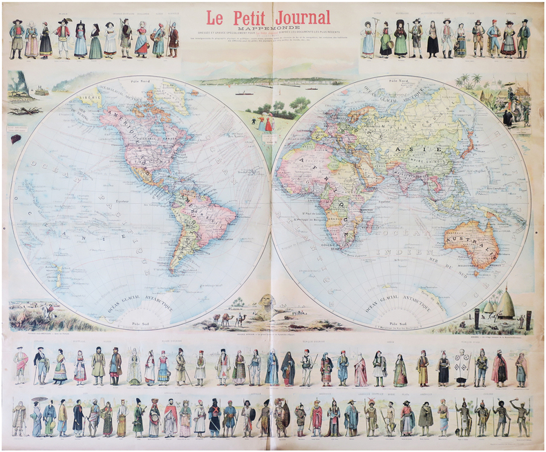
1897ref. LBW-8232Paris, Le Petit Journal, [1897]. 0,90 x 1,06 m.
1798ref. LBW-7904[Paris, P.G. Chanlaire et E. Mentelle, An six de la République - 1798]. 316 x 428 mm.
1798ref. LBW-1710Paris, 1798. 322 x 427 mm.
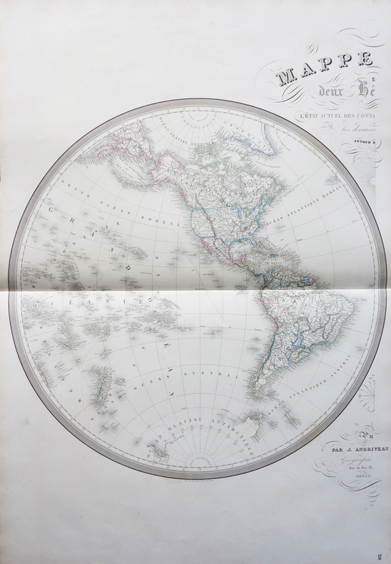
1854ref. LBW-1798Paris J. Andriveau-Goujon 1854 En deux feuilles non jointes pouvant former une carte d'environ 870 mm x 1,31 m.
1838Paris, Delamarche, 1838; 336/475 mm, 1 pp., une feuille. Mappemonde. Bon état.
1838ref. A102Paris, Delamarche, 1838 ; 336/475 mm, 1 pp., une feuille. Mappemonde. Bon état.
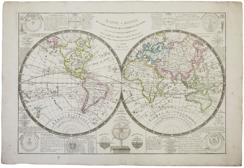
1824ref. LBW-1715[Paris, 1824]. 475 x 630 mm.
1799La carta in esame appartiene a un progetto di atlante – in ambito antiquario noto come “Zattone” – mai portato a compimento, della così denominata Societè Calcographique, un’operazione commerciale messa su da due editori leader del mercato veneto del XVIII secolo, Antonio Zatta (1722-1804) e Giuseppe Antonio Remondini (1747-1811). La denominazione dell’impresa editoriale è nota attraverso una carta del mondo che, nella parte bassa del cartiglio, reca l’iscrizione a` Venise Chez la Societè Chalcographique 1799. (Sicilia 2014: 287). Il progetto sembra non sia stato portato a compimento poiché nessun atlante, con un proprio titolo, indice e frontespizio, contenente queste mappe, è noto in bibliografia. Probabilmente le carte venivano vendute singolarmente o a fascicoli come era comune per imprese editoriali di un certo costo. Le carte a tutt’oggi note sono realizzate mediante l’utilizzo di rami più antichi, appositamente modificati. Le matrici originali hanno molteplici origini: alcune appartengono a un altro sconosciuto Atlante d'Italia dedicato alli Augusti Viaggiatori il Conte, e la Contessa, Del Nort stampato con imprint Venezia MDCCLXXXII presso Vincenzo Formaleoni. Nessun esemplare completo di questa raccolta ci è noto, alcune di queste carte fanno parte di una raccolta fattizia conservata alla Biblioteca Nazionale Marciana di Venezia [284. c. 86], altre sono comparse di tanto in tanto nel mercato antiquario. Il frontespizio dell’atlante di Vincenzo Formaleoni (1752-1797) – che qui pubblichiamo e che ci ha consentito di formulare questa ipotesi – è recentemente apparso in una vendita all’asta Cambi di Genova. Altre mappe dello “Zattone” derivano da lastre di Paolo e Francesco Santini, riusate da Remondini per l’Atlas Universel nell’edizione degli anni 1782/84; altre da matrici impiegate da Antonio Zatta per il Nuovo Atlante pubblicato nel 1796. Le carte dei Santini sono abilmente arricchite, tramite la sovrapposizione di cartigli realizzati, nel classico stile di Zatta, su piccole lastre di rame le cui impronte calcografiche sono chiaramente visibili sulle mappe. I cartigli, realizzati dagli stretti collaboratori di Zatta Pasquali, Zuliani e Pitteri, spesso contengono brevi descrizioni storiche, e le mappe furono realizzate probabilmente per illustrare i notevoli cambiamenti geo-politici cui fu soggetta la penisola italiana durante il periodo napoleonico. Le 60 mappe di questa raccolta a tutt’oggi note, datate tra il 1795 e il 1805, sono principalmente dedicate a illustrare la penisola, ma anche altre regioni europee, i continenti e la già menzionata carta del mondo che riporta l’imprint editoriale della Societè Calcographique. Alcune di queste carte, raffiguranti la Repubblica Cisalpina, sono state descritte come parte di un Atlas très Nouveau del solo Remondini, edito a partire dal 1800: “In sostanza siamo di fronte a una semplice operazione commerciale che pensiamo sia stata operata dal Remondini, sebbene egli non si firmi come editore, poiché proprio nel 1799 egli stava acquisendo i rami dello Zatta” (Terre di Langobardia 2005:14). È molto più probabile che i due editori abbiano collaborato in questa avventura editoriale almeno fino alla morte di Antonio Zatta nel 1804, e che il progetto di un atlante completo non sia stato portato a termine anche per la morte, di pochi anni successiva, di Giuseppe Antonio Remondini. Acquaforte, finemente colorata a mano in epoca, in perfetto stato di conservazione. Bibliografia Il Piemonte nella Cartografia del Cinquecento e Seicento 1991, 75; Terre di Langobardia 2005:14; Le Grandi Alpi nella cartografia 2005: 147, 148; Sicilia 2014: 287. Zeno Davoli, Roberto Sanfelici, Terre di Langobardia - La "Lombardia" e il Ducato Estense nella cartografia a st... A large double-hemisphere map with ornate cartouches in each cusp. Published after Cook's first circumnaviation it has been updated with his discoveries: New Zealand is shown properly as two main islands and the east coast of Australia has been corrected, although still with Tasmania connected to the mainland. In the North Pacific the spurious North West Passage is shown. This very rare map belongs to a never finished project for the atlas of the so called Società Calcografia, a simple commercial trade realized by the two main Venetian publishers of the XVIII century, Antonio Zatta and Giuseppe Antonio Remondini. The term Società Calcografica has been deduced from the map of the world, which is part of the collection and bears in the lower cartouche the French writing “à Venise Chez la Societè Chalcographique 1799”. As already stated, the project was never finished for no atlas containing these maps has ever been listed in any bibliography. Very likely, then, the maps have been sold individually, or maybe as part of smaller, custom collections. The maps of the collection derive from Paolo and Francesco Santini’s plates, used by Remondini in his 1782/4 Atlas Universelle, and from the plates of Antonio Zatta’s Nuovo Atlante published in 1796. Santini’s maps have been beautifully enriched, using the system of small, masked plates which can be perceived through the platemarks on the paper, with great cartouches according to the classical style of Zatta and have been probably engraved by the members of his staff, Pasquali, Zuliani and Pitteri. The cartouches bear very often historical descriptions and maybe the maps have been realized to depict the great geographic changes of the peninsula during the Napoleonic period. The modern bibliography Terre di Langobardia describes some of the maps depicting the Repubblica Cisalpina, presenting them as part of Remondini’s “Atlas très Nouveau”, which was printed starting from 1800. In our opinion, the two publishers worked together to the realization of the project until Antonio Zatta died (1804), and the complete atlas was never finished because Giuseppe Antonio Remondini also died in 1811. I personally know 61 maps which were part of the project. Copper engraving, fine hand color, in excellent condition.
1798ref. LBW-7943[Paris, P.G. Chanlaire et E. Mentelle, An six de la République - 1798]. 330 x 430 mm.
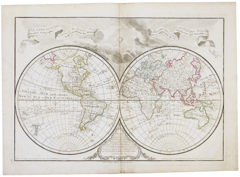
1800ref. LBW-5393Paris, Dezauche,1800. 455 x 658 mm.
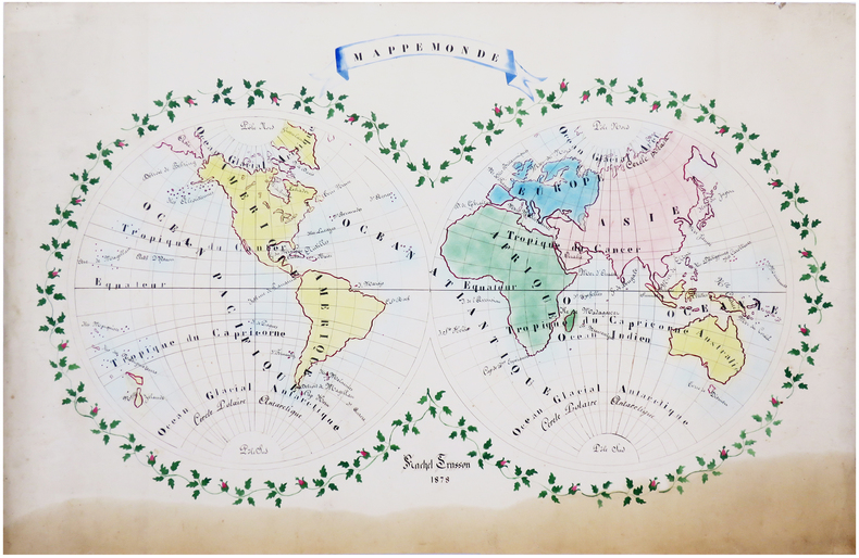
1878ref. LBW-66281878. 61 x 90 cm.
ref. 0309130573.Gpaperback. Good. Access codes and supplements are not guaranteed with used items. May be an ex-library book. paperback
1984243 pages including index and glossary. Normal library markings. Abover average wear to boards with portion of front board peeled off at lower left corner. Corner of title page clipped off. Learn to read all there is to be found on a map. Learn to use the map with a compass. Learn to make simple maps and plans. These are worthwhile accomplishments. They are what this book is all about. Complete with many black and white diagrams and occasional photographs. A very practical book. Book
VG (original green cloth, a little faded and marked, no dj) Octavo 432pp Profusely illustrated, many foldouts. Comprehensive
1999ref. 007290Boston Massachusetts U.S.A.: Harry N Abrams Inc 1999. 272pp/180 illustrations including 150 plates in full color. The largest most comprehensive & most beautifully illustrated collection of Civil War maps ever published. Still shrink wrapped. First Edition. Hard Cover. New/New. 4to - over 9¾" - 12" tall. Harry N Abrams Inc hardcover