National Geographic MapsBiblio.com
12.245 resultados
2023ref. DADAX1597752797Natl Geographic Society Maps 2023-01-01. 2023. map. New. 4.25x0.20x9.25. Buy with confidence. Excellent Customer Service & Return policy. Natl Geographic Society Maps unknown
ref. RO30010635The Denver Post. sans date. In-12. Broché. Bon état, Couv. convenable, Dos satisfaisant, Intérieur frais. Non paginé. Illustrations de Wiswall se dépliant en accordéon, à l'intérieur d'une enveloppe illustrée en couleurs, au format carte postale. Inscriptions sur le devant de l'enveloppe: adresse de l'ancien propriétaire inscrite.. . . . Classification Dewey : 741.68-Illustrations des cartes postales
1900No marks or inscriptions to contents. No creasing to covers. A clean tight booklet with slightly foxed boards, mark to rear (ink ?), rusty staples and no bumping to corners. 24pp. In three parts - 'Guide to the Welsh pronunciation', 'Mountains in the vicinity of Llandudno' and 'Welsh Place Names in Llandudno and District'. Undated ca 1900.
1934ref. 2082702114600786Tsukushi Mountain Club 1934. Soft Cover. Fine. Number of books: 1 Tsukushi Mountain Club paperback
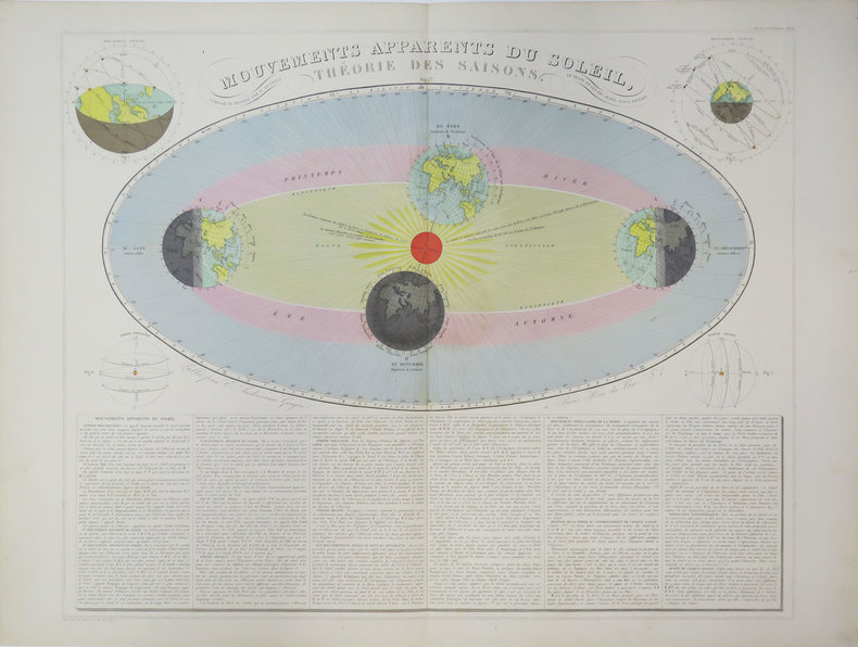
1880ref. LBW-3624Paris, E. Andriveau-Goujon, [circa 1880]. 470 x 587 mm.
ref. SLIVCN-3760024990462MINUS EDITIONS
ref. SLIVCN-3760361290287KEROZENN
ref. 1877689742.Gmap. Good. Access codes and supplements are not guaranteed with used items. May be an ex-library book. unknown
ref. 9993347159.Gmap. Good. Access codes and supplements are not guaranteed with used items. May be an ex-library book. unknown
1937ref. 2083002116201372Oriental Maps Sagenji Kobayashi 1937. Soft Cover. Fine. The book is in fine condition. Oriental Maps Sagenji Kobayashi paperback
ref. SLIVCN-9782897422578CARACTERE EDITIONS (CA)
ref. SLIVCN-9782897422608CARACTERE EDITIONS (CA)
1982No marks or inscriptions to contents. A lovely clean very tight copy with bright unmarked boards, slightly dusty top of page edges, creasing to two page corners and no bumping to corners. Dust jacket not price clipped or marked or torn with slight creasing to edges. Maps + 65 + 752pp. Traveller's guide to Spain plus sixty-five pages of detail about the thirteen Spanish World Cup cities' football grounds with detailed plans of the stadiums, city plans and weather information. Text in English.
ref. CWE42RT
1996No marks or inscriptions. A very clean map with bright unmarked outer covers. 1pp. Opens up to map sise 38.75 x 27.5 inches. Mao and charts of all Scotland's Munros and Corbetts.
ref. 46143Flamignoul, Fietsmuseum, s.d. (ca.1970) Gebonden, kunstleder met titelillustr., 209pp., 16.5x24.5cm., oblong, ills. in z/w., goede staat. Zeldzaam!!
1825ref. LBW-5840[Paris, 1825-1827]. 172 x 128 mm.
1997ref. 110188Somogy 1997 Somogy, 1997, 237 p., cartonnage éditeur sous jaquette, environ 29x26cm, bon état.
ref. 8569Centre National de la Bande Dessinée et de l'Image (CNBDI), 2001. Double carte au format fermé de 15 x 21 cm., illustrée par Swarte. Tout petit pli au coin supérieur.
1980ref. 2090502113713456Not Available 1980. Soft Cover. Fine. The book is in fine condition. Not Available paperback
1931400 pages including 69 black and white reproductions from photographs and numerous maps. Gilt-edged top. Former owner's rubber stamp upon verso of half title page and upon front side of black and white photographic frontis of General Pershing. Small bookseller's sticker inside back board. "My primary purpose in writing this story of the American Expeditionary Forces in France is to render what I conceive to be an important service to my country. In that adventure there were many lessons useful to the American People, should they ever again be called to arms, and I felt it a duty to record them as I saw them." - from the Foreward. Book
1963ref. AUB-4191Paris, éd. Larousse 1963. Bon exemplaire relié, reliure usagée, fort in-4, 282 pages avec annexes dont index.
1963ref. AUB-4443Paris, éd. Larousse 1963. Bel exemplaire relié, reliure et jaquette ornées d'éd, fort in-4, 282 pages avec annexes dont index.
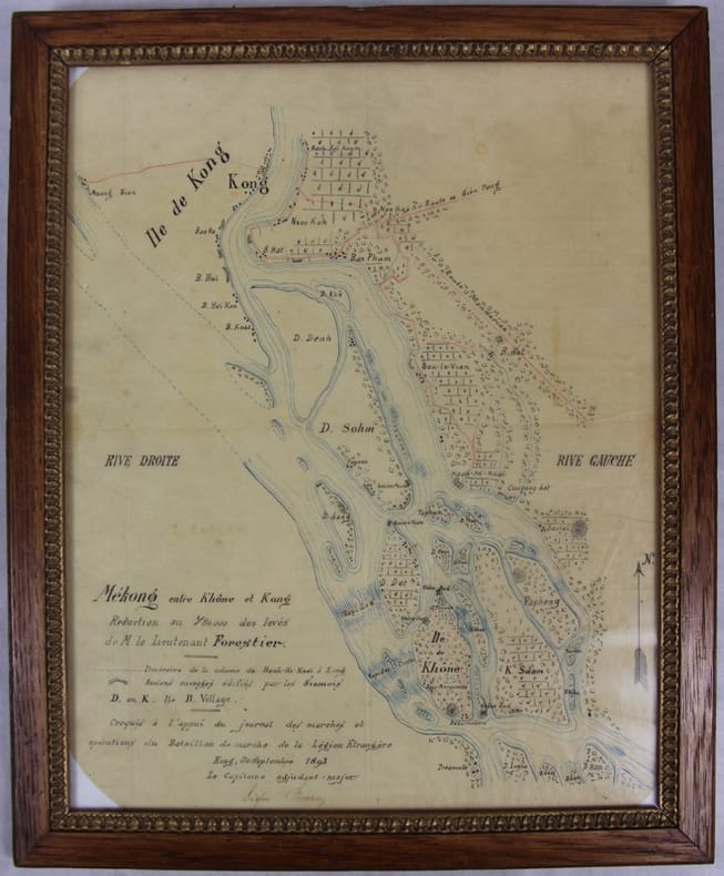
1893ref. 31781Kong, 30 septembre 1893 Carte dessinée en couleurs 42,5 X 35 dans son cadre argenté. Bel état. Rare croquis exploratoire de ce secteur des Quatre mille îles du Mékong dont le franchissement nécessitera la construction d’une ligne de chemin de fer. L’officier reporte l’itinéraire de sa colonne de Hach-Ki-Koaï à Kong [Khong] et les anciens ouvrages édifiés par les Siamois.
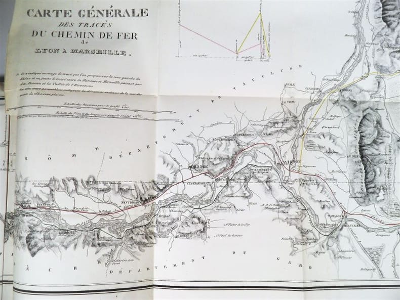
1837ref. 2321Paris, Imprimerie Royale, 1837. In-4 – 22,5 x 29 cm. Broché. 172 pages, 1 carte dépliante en 2 parties. Edition originale. Ouvrage complet de sa grande « Carte Générale des tracés du Chemin de Fer de Lyon à Marseille » très détaillée (150 x 57cm). On découvre le tracé proposé sur la rive droite du Rhône, rehaussé en vert, et celui sur la rive gauche du Rhône, rehaussé en rouge, les deux se rejoignant à Tarascon puis poursuivant par Arles et les Martigues. Un tracé alternatif de la rive gauche, rehaussé en jaune, entre la Durance et Marseille, envisage une bifurcation à partir d’Avignon en passant par Orgon, Salon, Aix, Fuveau, Aubagne et la vallée de l’Huveaune. Mathurin François Kermaingant (1779-1856) est un ingénieur originaire du Nord de la France. Il intègre l'école des Ponts et Chaussées en 1800. Quatre ans plus tard, il est affecté au service de route de la Drôme. Il quitte ce département pour celui du Rhône en 1810, puis y revient en 1821, pour 3 années. C'est dans la Sarthe qu'il poursuit sa carrière à partir de 1824. A la demande du gouvernement, il pilote la commission d'étude sur un futur chemin de fer dans la vallée du Rhône en 1833. Il suggère de nombreuses variantes de tracés. En 1836, il est nommé ingénieur en chef. Il quitte le sud de la France puis s'occupe du chemin de fer de Paris à Versailles.