Borgeaud Georges:Livre Rare Book

ref. 20961Reproduction au format 19 x 13 cm., contrecollée sur papier fort.
ref. 20966Reproduction au format 19 x 13 cm., contrecollée sur papier fort.
ref. 20963Reproduction au format 19 x 13 cm., contrecollée sur papier fort.
ref. 20964Reproduction au format 19 x 13 cm., contrecollée sur papier fort.
1980Large fold-out map in excellent unmarked condition. 1pp.
1979Large fold-out map in excellent unmarked condition. Slip folder with very slight bumps to corners. 1pp. Reprint of the Ordnance Survey map covering parts of Cheshire and (originally) Lancashire with data up to about 1890.
1980Large fold-out map in very good unmarked condition with some rubbing to fold corners. Slip folder unmarked with some rubbing and creasing . 1pp. Reprint of the Ordnance Survey map covering Leicester and surrounding area with data up to about 1890.
Coimbra, 1969 [Separata da "Revista da Universidade"]. Folio; 20 pp. Cubiertas originales.
1703Splendida carta storico-geografica del mondo costruita con proiezione conica polare che mostra l'intero Mondo ad eccezione del Polo Sud; la California è rappresentata come un'isola. E' anche raffigurata una piccola parte, distorta, dell'Australia, indicata come Nova Hollandia.Sulla mappa è riportato il tracciato della circumnavigazione di Magellano. Sulla sinistra è illustrata la nave Vittoria, la sola nave che rimase dell'equipaggio che saklpò da Siviglia nel 1519 alla ricerca di un passaggio a ovest verso le Isole delle Spezie e le Indie.La vignetta a destra, rappresenta i pochi sopravvissuti - 18, dei 237 membri - in pellegrinaggio alla chiesa di Santa Marea di Siviglia, come ex voto per la grazia ricevuta. Il cartiglio in alto a destra, riporta anche la data del ritorno: 7 settembre 1522. Decorativa carta geografica pubblicata nell'opera di Heinrich Scherer Atlas Novus exhibens orbem terraguem per naturae opera, historiae navae acveterus monumenta, artistique geographicae leges et praecepta edita in 8 parti, stampate tra il 1702 e il 1710 a Monaco di Baviera. Heinrich Scherer, professore di matematica a Monaco di Baviera, era un gesuita devoto la cui opera sottolineava la gerarchia cattolica e la diffusione delle missioni gesuite in tutto il mondo. Il suo Atlas Novus contiene mappe di tutte le altre parti che mostravano la diffusione del cattolicesimo e delle missioni gesuite. Incisione su rame, in ottimo stato di conservazione. Map of the world, shown on a north polar projection and showing the entire world except the South Pole, California is shown as an island and the track of Magellan's voyage around the world is noted. There is a distorted portion of Australia noted as Nova Hollandia. On the left is an illustration of Victoria, the only remaining ship from Magellan's Armada de Molucca that sailed from Seville in 1519 in search of a westward route to the Spice Islands. On the right, the few expedition survivors (18 out of the original 237) are shown making their way to the Santa Marea de la Victoria church in Seville, where they went to give thanks for their safe return. The title cartouche includes the date of their return, September 7, 1522.By Heinrich Scherer for his Atlas Novus exhibens orbem terraguem per naturae opera, historiae navae acveterus monumenta, artistique geographicae leges et praecepta...published in eight volumes from 1702-1710 in Munich. Scherer, a devout Jesuit, produced this geographical compendium to depict the Catholic hierarchy and the spread of Jesuit missions throughout the world.Copper engraving, in very good condition. Tooley, R.V. (Amer) p.132, #88, pl.60; Shirley, World, 626
ref. 1334485402.Gpaperback. Good. Access codes and supplements are not guaranteed with used items. May be an ex-library book. paperback
ref. 1527865444.Gpaperback. Good. Access codes and supplements are not guaranteed with used items. May be an ex-library book. paperback
1864pp. 465, (14) [Publisher's catalogue] + Frontis folding map of Antietam battle field, old tape repair at top fold, and full page plans of battle fields. Age stained. Inked ownership of H. R. Pratt, 1935. Large 12mo. Original full cloth binding, lacks spine. Hardbound. SHELF W29
1914304 pages. Index. Colour and black and white photographic plates. Maps. Foldouts. Chapters include: Limestones; Sandstones; Granites and Gneisses; The So-Called Black Granites and Related Rocks; Marbles; Serpenties and Serpentine Marbles; Slates; Glacial Drift; Rarer Decorative Materials; plus appendices. Average wear and soiling externally. Binding intact. Tears to top of spine. Solid copy of this authoritative reference. Book
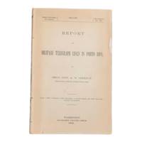
1900ref. 6902Washington D.C.: Government Printing Office 1900. First edition. 8vo 100pp. Color folding map 42x108cm attached at rear. Stitched lacking wrappers or disbound from a larger publication paper toned with light chipping. Map clean. A good copy. Senate Document No. 429 56th congress. This report was given by Adolphus Washington Greely 1844-1935 then Brigadier General and Chief Signal Officer of the U.S. Army. Greely was in charge of maintaining communications networks during the Spanish-American War and oversaw construction and maintenance of telegraph lines in Puerto Rico Cuba and the Philippines. The map in this report is "Map of the Island of Porto Rico Showing the lines of signal communication telegraph telephone and heliograph operated by the Signal Corps U.S. Army with Military Posts." It was prepared by major William A. Glassford under the direction of Greely. OCLC cites 11 holdings. . Government Printing Office unknown
ref. 0484452460.Ghardcover. Good. Access codes and supplements are not guaranteed with used items. May be an ex-library book. hardcover
1886pp. 55, (1), Folding Sketch of Lines and Reconnaissances, (11) Large Folding General Maps and Detail Drawings, (56) Full page Photogravures accompanying report. Plates very slightly soiled and damp stained. Some maps and drawings soiled at folds. 4to. Original full cloth binding, worn at extremities. Hardbound. The cross-Nicaragua route for a trans-oceanic canal was only one of several considered, before settling on Panama. LATIN AMERICA BOX 1
1878ref. PHO-303
1867ref. s02256Washington D.C: Government Printing Office 1867. 1st Edition. Hardcover. Very Good. Brown pebbled cloth boards with blindstamped rules; 9" tall; 151 pp plus large folding map. Good condition with wear to spine ends of corners of boards; map itself in very good condition colors bright folded properly modern tape reinforcement at creases. -- The "Map of the United States and Territories" by Joseph S. Wilson was one of the largest and most accurate maps of the country published at the time. It clearly marks major Native American territories and the colored mineral deposits show a clear rationale for expansion to the West. Joseph Wilson was Commissioner of the General Land Office both before and after the Civil War and this map was produced during the first year of his second tenure. The accompanying report asserts the United States' right to possession of the Western territories and states encourages the population thereof and admits to continuing arbitration land claims especially in California. Government Printing Office hardcover books
1867ref. s02256Washington D.C: Government Printing Office 1867. 1st Edition. Hardcover. Very Good. Brown pebbled cloth boards with blindstamped rules; 9" tall; 151 pp plus large folding map. Good condition with wear to spine ends of corners of boards; map itself in very good condition colors bright folded properly modern tape reinforcement at creases. -- The "Map of the United States and Territories" by Joseph S. Wilson was one of the largest and most accurate maps of the country published at the time. It clearly marks major Native American territories and the colored mineral deposits show a clear rationale for expansion to the West. Joseph Wilson was Commissioner of the General Land Office both before and after the Civil War and this map was produced during the first year of his second tenure. The accompanying report asserts the United States' right to possession of the Western territories and states encourages the population thereof and admits to continuing arbitration land claims especially in California. Government Printing Office hardcover
ref. 1030X61IJR6Hardcover. Very Good. SIGNED by the topographer Col. Graham and apparently amended by him or someone with same contemporary hand. Please see our pics. Senate Document 121; 1852; Hardcover; Very Good; Original brown cloth with title "Report of Col. Graham Mexican Boundary in gilt on front. " 250 pages plus the 2 maps and the barometric report. Text is lightly foxed throughout but completely readable fascinating content. Folding maps & report very good faintly foxed small closed tears as pictured. Well-bound and subtly ex-library. hardcover
1984ref. 13441984 broché in-octavo, dos bleu-marine et couverture illustrée en couleurs sur le recto / verso, illustrations : nombreuses reproductions de cartes postales, 538 pages, 1984 Paris Editions Image-Document,
1850ref. LBW-1282Paris Benard circa 1850 213 x 298 mm.
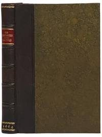
1664ref. 2341508London: Excudebat J.F. James Flesher pro Jona Hart 1664. First Thus. Hard Cover. Near Fine/No Jacket. Rebound with new end sheets: brown leather spine marbled paper over boards red morocco spine label gilt titles and rules. Binding tight pages clean and unmarked. 1664 Hard Cover. viii 230 pp. Last text page misnumbered 216. Descartes's fundamental and originating work of the modern era in Western philosophy bound together with a work by one of the Utrecht Cartesians Lambert van Velthuysen. This is the first British printing of the Meditations though it does not include Descartes's 'Objections and Replies' as many editions do. Velthuysen was connected by marriage to Descartes's friend Henry Regnier and corresponded with scientists and philosophers such as von Leeuenhoek Spinoza and Leibniz. The work included here shows the influence of Thomas Hobbes - unsurprising given that Velthuysen is credited with translating Leviathan into Dutch. John Locke may have met Velthuysen while in Utrecht in 1684/85 and had eight titles by Velthuysen in his personal library including the Rheims edition of the present title. Bound into this volume are two plates not called for in either work which may be taken from the Hart printing of Principia Philosophia which was published the same year. Wolf 736 Wing D1133a. Excudebat J.F. [James Flesher] pro Jona Hart hardcover books
1664ref. 2341508London: Excudebat J.F. James Flesher pro Jona Hart 1664. First Thus. Hard Cover. Near Fine/No Jacket. Rebound with new end sheets: brown leather spine marbled paper over boards red morocco spine label gilt titles and rules. Binding tight pages clean and unmarked. 1664 Hard Cover. viii 230 pp. Last text page misnumbered 216. Descartes's fundamental and originating work of the modern era in Western philosophy bound together with a work by one of the Utrecht Cartesians Lambert van Velthuysen. This is the first British printing of the Meditations though it does not include Descartes's 'Objections and Replies' as many editions do. Velthuysen was connected by marriage to Descartes's friend Henry Regnier and corresponded with scientists and philosophers such as von Leeuenhoek Spinoza and Leibniz. The work included here shows the influence of Thomas Hobbes - unsurprising given that Velthuysen is credited with translating Leviathan into Dutch. John Locke may have met Velthuysen while in Utrecht in 1684/85 and had eight titles by Velthuysen in his personal library including the Rheims edition of the present title. Bound into this volume are two plates not called for in either work which may be taken from the Hart printing of Principia Philosophia which was published the same year. Wolf 736 Wing D1133a. Excudebat J.F. [James Flesher] pro Jona Hart hardcover
1692ref. Alibris.0018045Francofurti Ad Moenum: Frederici Knochii 1692. Ultima editio cum optimis colla. Full leather. Good. No dust jacket as issued. . Good. Scarce edition. Worldcat locates only 1 copy. Spine well worn and chipped. Moderate foxing throughout Includes: illustrations diagrams. On the rear endpaper is an Armorial bookplate of the Princes of Liechtenstein "Ex Libris Liechtensteinianis" above arms with chain of the Order of the Golden Fleece associated with Prince Franz Joseph II 1906-1989. Frederici Knochii hardcover