12.235 resultados
1745ref. 18870Amsterdam Chatelain 1745 une carte ancienne gravée sur cuivre (Copper etching) en noir . Format : 17 x 19,5 cm, Échelle au1:200,000,000ème, pli central vertical normal venant d'un atlas ( vertical centerfold), avec note dans la marge en haut à droite : Tome V Page 338, pour "l'introduction à l'histoire générale et politique de l'univers, Ou l'on voit l'Origine, les Révolutions, l'Etat présent, & les Intérêts des Souverains" ; Commencée par Mr. le Baron de Pufendorff ; complétée et continuée jusqu'à 1745 par Mr. Bruzen de la Martinière, 8 volumes in-12, 1745 à Amsterdam chez Zacharie Chatelain Editeur,
1745ref. 18864Amsterdam Chatelain 1745 une carte ancienne gravée sur cuivre (Copper etching) en noir . Format : 17 x 20 cm, Échelle au1:200,000,000ème, pli central vertical normal venant d'un atlas (vertical centerfold), avec note dans la marge en haut à droite : Tome II Page 1, pour "l'introduction à l'histoire générale et politique de l'univers, Ou l'on voit l'Origine, les Révolutions, l'Etat présent, & les Intérêts des Souverains" ; Commencée par Mr. le Baron de Pufendorff ; complétée et continuée jusqu'à 1745 par Mr. Bruzen de la Martinière, 8 volumes in-12, 1745 à Amsterdam chez Zacharie Chatelain Editeur,
1745ref. 18856Amsterdam Chatelain 1745 une carte ancienne gravée sur cuivre (Copper etching) en noir . Format : 17 x 19,5 cm, Échelle au1:200,000,000ème, pli central vertical normal venant d'un atlas ( vertical centerfold), avec note dans la marge en haut à droite : Tome IV Page 142, pour "l'introduction à l'histoire générale et politique de l'univers, Ou l'on voit l'Origine, les Révolutions, l'Etat présent, & les Intérêts des Souverains" ; Commencée par Mr. le Baron de Pufendorff ; complétée et continuée jusqu'à 1745 par Mr. Bruzen de la Martinière, 8 volumes in-12, 1745 à Amsterdam chez Zacharie Chatelain Editeur,
1745ref. 18873Amsterdam Chatelain 1745 une carte ancienne gravée sur cuivre (Copper etching) en noir . Format : 17 x 19,5 cm, Échelle au1:200,000,000ème, pli central vertical normal venant d'un atlas ( vertical centerfold), avec note dans la marge en haut à droite : Tome I Page 277, pour "l'introduction à l'histoire générale et politique de l'univers, Ou l'on voit l'Origine, les Révolutions, l'Etat présent, & les Intérêts des Souverains" ; Commencée par Mr. le Baron de Pufendorff ; complétée et continuée jusqu'à 1745 par Mr. Bruzen de la Martinière, 8 volumes in-12, 1745 à Amsterdam chez Zacharie Chatelain Editeur,
1745ref. 18877Amsterdam Chatelain 1745 une carte ancienne gravée sur cuivre (Copper etching) en noir . Format : 17 x 19,5 cm, Échelle au1:200,000,000ème, pli central vertical normal venant d'un atlas ( vertical centerfold), avec note dans la marge en haut à droite : Tome I Page 2, pour "l'introduction à l'histoire générale et politique de l'univers, Ou l'on voit l'Origine, les Révolutions, l'Etat présent, & les Intérêts des Souverains" ; Commencée par Mr. le Baron de Pufendorff ; complétée et continuée jusqu'à 1745 par Mr. Bruzen de la Martinière, 8 volumes in-12, 1745 à Amsterdam chez Zacharie Chatelain Editeur,
1745ref. 18872Amsterdam Chatelain 1745 une carte ancienne gravée sur cuivre (Copper etching) en noir . Format : 17 x 19,5 cm, Échelle au1:200,000,000ème, pli central vertical normal venant d'un atlas ( vertical centerfold), avec note dans la marge en haut à droite : Tome IV Page 536, pour "l'introduction à l'histoire générale et politique de l'univers, Ou l'on voit l'Origine, les Révolutions, l'Etat présent, & les Intérêts des Souverains" ; Commencée par Mr. le Baron de Pufendorff ; complétée et continuée jusqu'à 1745 par Mr. Bruzen de la Martinière, 8 volumes in-12, 1745 à Amsterdam chez Zacharie Chatelain Editeur,
1745ref. 18878Amsterdam Chatelain 1745 une carte ancienne gravée sur cuivre (Copper etching) en noir . Format : 17 x 19,5 cm, Échelle au1:200,000,000ème, pli central vertical normal venant d'un atlas ( vertical centerfold), avec note dans la marge en haut à droite : Tome I Page 39, pour "l'introduction à l'histoire générale et politique de l'univers, Ou l'on voit l'Origine, les Révolutions, l'Etat présent, & les Intérêts des Souverains" ; Commencée par Mr. le Baron de Pufendorff ; complétée et continuée jusqu'à 1745 par Mr. Bruzen de la Martinière, 8 volumes in-12, 1745 à Amsterdam chez Zacharie Chatelain Editeur,
1745ref. 18880Amsterdam Chatelain 1745 une carte ancienne gravée sur cuivre (Copper etching) en noir . Format : 17 x 19,5 cm, Échelle au1:200,000,000ème, pli central vertical normal venant d'un atlas ( vertical centerfold), avec note dans la marge en haut à droite : Tome I Page 240, pour "l'introduction à l'histoire générale et politique de l'univers, Ou l'on voit l'Origine, les Révolutions, l'Etat présent, & les Intérêts des Souverains" ; Commencée par Mr. le Baron de Pufendorff ; complétée et continuée jusqu'à 1745 par Mr. Bruzen de la Martinière, 8 volumes in-12, 1745 à Amsterdam chez Zacharie Chatelain Editeur,
1745ref. 18855Amsterdam Chatelain 1745 une carte ancienne gravée sur cuivre (Copper etching) en noir . Format : 17 x 19,5 cm, Échelle au1:200,000,000ème, pli central vertical normal venant d'un atlas ( vertical centerfold), avec note dans la marge en haut à droite : Tome VIII Page 1, pour "l'introduction à l'histoire générale et politique de l'univers, Ou l'on voit l'Origine, les Révolutions, l'Etat présent, & les Intérêts des Souverains" ; Commencée par Mr. le Baron de Pufendorff ; complétée et continuée jusqu'à 1745 par Mr. Bruzen de la Martinière, 8 volumes in-12, 1745 à Amsterdam chez Zacharie Chatelain Editeur,
1745ref. 18859Amsterdam Chatelain 1745 une carte ancienne gravée sur cuivre (Copper etching) en noir . Format : 17 x 19,5 cm, Échelle au1:200,000,000ème, pli central vertical normal venant d'un atlas ( vertical centerfold), avec note dans la marge en haut à droite : Tome III Page1, pour "l'introduction à l'histoire générale et politique de l'univers, Ou l'on voit l'Origine, les Révolutions, l'Etat présent, & les Intérêts des Souverains" ; Commencée par Mr. le Baron de Pufendorff ; complétée et continuée jusqu'à 1745 par Mr. Bruzen de la Martinière, 8 volumes in-12, 1745 à Amsterdam chez Zacharie Chatelain Editeur,
1658ref. 24912Amsterdam JANSSONIUS Joannes 1658 une carte ancienne gravée sur cuivre (Copper etching) en noir et couleurs d'Epoque. Format : 44,5 cm de haut x 55 cm de large, pli central vertical normal venant d'un atlas( horizontal centerfold), texte en latin au verso, carte ornée de 4 cartouches richement ornés de 20 angelots et dun paysan entrain de ramasser des pommes. carte double page gravée et colorée à la main d'époque, provenance : "Atlas novus, sive theatrum orbis terrarum : In quo Galliae, Helvetiae(Volume II)", 1658 Amsterdam JANSSONIUS Joannes Editeur,
1745ref. 18847Amsterdam Chatelain 1745 une carte ancienne gravée sur cuivre (Copper etching) en noir . Format : 16 x 19,1 cm, Échelle au1:200,000,000ème, pli central vertical normal venant d'un atlas( horizontal centerfold), avec note dans la marge en haut à droite : Tome I Page I, pour "l'introduction à l'histoire générale et politique de l'univers, Ou l'on voit l'Origine, les Révolutions, l'Etat présent, & les Intérêts des Souverains" ; Commencée par Mr. le Baron de Pufendorff ; complétée et continuée jusqu'à 1745 par Mr. Bruzen de la Martinière, 8 volumes in-12, 1745 à Amsterdam chez Zacharie Chatelain Editeur,
1745ref. 18851Amsterdam Chatelain 1745 une carte ancienne gravée sur cuivre (Copper etching) en noir . Format : 17 x 19,5 cm, Échelle au1:200,000,000ème, pli central vertical normal venant d'un atlas ( vertical centerfold), avec note dans la marge en haut à droite : Tome IV Page 151, pour "l'introduction à l'histoire générale et politique de l'univers, Ou l'on voit l'Origine, les Révolutions, l'Etat présent, & les Intérêts des Souverains" ; Commencée par Mr. le Baron de Pufendorff ; complétée et continuée jusqu'à 1745 par Mr. Bruzen de la Martinière, 8 volumes in-12, 1745 à Amsterdam chez Zacharie Chatelain Editeur,
1745ref. 18853Amsterdam Chatelain 1745 une carte ancienne gravée sur cuivre (Copper etching) en noir . Format : 17 x 19,5 cm, Échelle au1:200,000,000ème, pli central vertical normal venant d'un atlas ( vertical centerfold), avec note dans la marge en haut à droite : Tome VI Page 1, pour "l'introduction à l'histoire générale et politique de l'univers, Ou l'on voit l'Origine, les Révolutions, l'Etat présent, & les Intérêts des Souverains" ; Commencée par Mr. le Baron de Pufendorff ; complétée et continuée jusqu'à 1745 par Mr. Bruzen de la Martinière, 8 volumes in-12, 1745 à Amsterdam chez Zacharie Chatelain Editeur,
1745ref. 18854Amsterdam Chatelain 1745 une carte ancienne gravée sur cuivre (Copper etching) en noir . Format : 17 x 19,5 cm, Échelle au1:200,000,000ème, pli central vertical normal venant d'un atla ( vertical centerfold), avec note dans la marge en haut à droite : Tome VIII Page 87, pour "l'introduction à l'histoire générale et politique de l'univers, Ou l'on voit l'Origine, les Révolutions, l'Etat présent, & les Intérêts des Souverains" ; Commencée par Mr. le Baron de Pufendorff ; complétée et continuée jusqu'à 1745 par Mr. Bruzen de la Martinière, 8 volumes in-12, 1745 à Amsterdam chez Zacharie Chatelain Editeur,
1745ref. 18849Amsterdam Chatelain 1745 une carte ancienne gravée sur cuivre (Copper etching) en noir . Format : 17 x 19,2 cm, Échelle au1:200,000,000ème, pli central vertical normal venant d'un atlas( vertical centerfold), avec note dans la marge en haut à droite : Tome VII Page 246, pour "l'introduction à l'histoire générale et politique de l'univers, Ou l'on voit l'Origine, les Révolutions, l'Etat présent, & les Intérêts des Souverains" ; Commencée par Mr. le Baron de Pufendorff ; complétée et continuée jusqu'à 1745 par Mr. Bruzen de la Martinière, 8 volumes in-12, 1745 à Amsterdam chez Zacharie Chatelain Editeur,
1763Pianta topografica delle vestigia dell'antica Roma, a proiezione e figurazione verticale, pubblicata nel 1763 nell'opera di Ridolfino Venuti "Accurata, e succinta descrizione topografica delle antichità di Roma".Incisa da Niccolò Mogalli e Giovanni Petroschi, su disegno di R. Venuti.Le indicazioni toponomastiche in parte sono riportate nella pianta, in parte in una rubrica di 77 numeri posta ai lati. In basso, a destra, la firma degli incisori. La seconda edizione della lastra, reca la data 1823.Incisione su rame, in ottimo stato di conservazione. Pianta topografica delle vestigia dell'antica Roma, a proiezione e figurazione verticale, pubblicata nel 1763 nell'opera di Ridolfino Venuti "Accurata, e succinta descrizione topografica delle antichità di Roma".Incisa da Niccolò Mogalli e Giovanni Petroschi, su disegno di R. Venuti.Le indicazioni toponomastiche in parte sono riportate nella pianta, in parte in una rubrica di 77 numeri posta ai lati. In basso, a destra, la firma degli incisori. La seconda edizione della lastra, reca la data 1823.Incisione su rame, in ottimo stato di conservazione. Frutaz, Le piante di Roma, XXXVIII; L. Schudt, Le guide di Roma, p. 405, n. 769; Caldana (2013): p. 107, n. I.64.
1561La mappa di Ruscelli è molto interessante per la sua rappresentazione dei cinque continenti conosciuti, legati tra loro come una superficie continua. Questa mappa presenta una vista della superficie terrestre già piuttosto obsoleta ai tempi della sua pubblicazione. Già in precedenza, altri cartografi, partendo da Matrin Waldseemuller nel 1507, avevano messo in dubbio l’affermazione di Colombo secondo cui Asia e America fossero un unico continente. I viaggi di Magellano e altri esploratori, che permisero di conoscere definitivamente la reale estensione dell’oceano Pacifico, diedero ulteriore sostegno a tali dubbi, sebbene lasciassero aperta la possibilità di una connessione amer-asiatica a settentrione. Intorno alla metà del XVI secolo, tuttavia, anche questa ultima ipotesi venne completamente screditata, per essere rimpiazzata dall’idea di un ipotetico “stretto di Anian”. Altra interessante caratteristica di questa mappa è l’intreccio di “linee dei sestanti” radianti da 16 punti focali intorno alla mappa. Le linee dei sestanti erano strumenti di navigazione che aiutavano a mantenere la medesima posizione della bussola per raggiungere un qualsiasi punto di una linea da un altro punto della medesima. Queste sono semplicemente ornamentali e illustrative, in quanto la mappa è troppo piccola per essere funzionale. Carta tratta dalla "Geographia di Claudio Tolomeo", a cura del Ruscelli, pubblicata in Venezia in pù edizioni tra il 1561 ed il 1598. La carta è basata sulla "Geografia" di Giacomo Gastaldi, che probabilmente disegnò personalmente anche queste mappe, che vennero incise dai fratelli Sanuto. La peculiarità di queste mappe è che sono incise due per lastra e successivamente tagliate; questo il motivo per cui il segno del rame appare solo in tre lati della mappa. Il testo del Ruscelli e le sue carte sono considerate come il miglior atlante moderno fino alla prima versione del Thatrum di Ortelius, 1570. Solo la loro enorme diffusione ne impedisce una valutazione sostenuta nel mercato antiquario. L'opera infatti ebbe una prima stesura nel 1561, stampata da Vincenzo Valgrisi che ne curò anche la ristampa del 1562. Tre sono le edizioni firmate da Giordano Ziletti (due nel 1564 e una del 1574), mentre nel 1597 viene edita dai fratelli Calignani. Tutte queste edizioni contengono 64 tavole. Nel 1598 e 1599 vengono alla luce le due edizioni curate da Giuseppe Rosaccio e stampate dagli Eredi di Melchior Sessa. Queste ultime due edizioni comprendono 69 tavole; sono infatti aggiunte la carta del planisfero e dei continenti del Rosaccio. Nice example of Ruscelli’s Carta Marina, based upon Gastaldi’s map of 1548. Gastaldi's Carta Marina includes the earliest obtainable depictions of the California peninsula, is the earliest obtainable copperplate world map for collectors. Includes Gastaldi's belief in a continuous northern landmass, the isthmus reported by Verrazano in 1524, which closes the northern continents into as unbroken ring. The Asia-America connection was a standard concept, and one of which Gastaldi actively advocated. The joining of North America and Europe is unusual, resulting from two errors. In the east, Gastaldi depicts Greenland as an outgrowth of Scandinavia, based upon Waldseemuller. In the west, Gastaldi follows Verrazano’s model of North America. On the Atlantic coast by Gastaldi notes a green mountain and a large, unnamed cape pointing upwards. This cape, based upon Ramusio’s' map of 1534, first appeared in Ribero’s manuscript chart of 1529, as well as later works, such as Jode’s North America. The cape is believed to be Cape Cod, as both the Ribero and Ramusio maps reflect the reconnaissance along the New England coast by Estavao Gomes, who is believed to have coasted the region. The writing’s of Marco Polo are evident in Asia, with modern corrections.Map, taken from Ruscelli edition of Ptolemy's "Geographia", printed in Venice from 1561 to 1598. Ruscelli's Atlas is an expanded edition of Gastaldi's "Geografia" of 1548, which has been called the most comprehensive atlas produced between Martin Waldseemüller's Geographiae of 1513, and the Abraham Ortelius Theatrum of 1570. Ruscelli and Gastaldi's maps were beautifully engraved on copper, marking a turning point in the history of cartography. From that point forward, the majority of cartographic works used this medium. As it was a harder material than wood it gave the engraver the ability to render more detail. Gastaldi sought the most up-to-date geographical information available, making the modern maps in Ruscelli's Geographia among the best modern maps of the period. The maps are engraved by the Sanuto borthers.Only their enormous diffusion prevents a sustained evaluation in the antique market. The work in fact had a first issue in 1561, printed by Vincenzo Valgrisi who also edited the reprint of 1562. There are three editions signed by Giordano Ziletti (two in 1564 and one in 1574), while in 1597 it was edited by the Calignani brothers. All these editions contain 64 engraved maps. In 1598 and 1599 the two editions edited by Giuseppe Rosaccio and printed by the heirs of Melchior Sessa come to light. These last two editions include 69 plates; in fact the map of the planisphere and of the continents of Rosaccio are added. R. W. Shirley, "The Mapping of the world", 111
1561Acquaforte e bulino, circa 1561. Magnifica prova, impressa su carta vergata coeva, con margini, in perfetto stato di conservazione. Esemplare in meravigliosa coloritura coeva.La mappa di Ruscelli è molto interessante per la sua rappresentazione dei cinque continenti conosciuti, legati tra loro come una superficie continua. Questa mappa presenta una proiezione della superficie terrestre già piuttosto obsoleta ai tempi della sua pubblicazione. Già in precedenza, altri cartografi, partendo da Matrin Waldseemuller nel 1507, avevano messo in dubbio l’affermazione di Colombo secondo cui Asia e America formassero un unico continente. I viaggi di Magellano e di altri esploratori, che permisero di conoscere definitivamente la reale estensione dell’oceano Pacifico, diedero ulteriore sostegno a tali dubbi, sebbene lasciassero aperta la possibilità di una connessione America-Asia a settentrione. Intorno alla metà del XVI secolo, tuttavia, anche questa ultima ipotesi venne completamente screditata, per essere rimpiazzata dall’idea di un ipotetico “stretto di Anian”. Altra interessante caratteristica di questa mappa è l’intreccio di “linee dei sestanti” radianti da 16 punti focali. Il sestante era uno strumento indispensabile per misurare e tracciare, la rotta di navigazione. In questo caso, le linee tracciate sulla mappa sono esclusivamente ornamentali e illustrative, in quanto la carta è troppo piccola per poter essere funzionale. Carta tratta dalla "Geographia di Claudio Tolomeo", a cura del Ruscelli, pubblicata in Venezia in pù edizioni tra il 1561 ed il 1598. La carta è basata sulla "Geografia" di Giacomo Gastaldi, che probabilmente disegnò personalmente anche queste mappe, che vennero incise dai fratelli Sanuto. La peculiarità di queste mappe è che sono incise due per lastra e successivamente tagliate; questo il motivo per cui il segno del rame appare solo in tre lati della mappa. Il testo del Ruscelli e le sue carte sono considerate come il miglior atlante moderno fino alla prima versione del Thatrum di Ortelius, 1570. Solo la loro enorme diffusione ne impedisce una valutazione sostenuta nel mercato antiquario. L'opera infatti ebbe una prima stesura nel 1561, stampata da Vincenzo Valgrisi che ne curò anche la ristampa del 1562. Tre sono le edizioni firmate da Giordano Ziletti (due nel 1564 e una del 1574), mentre nel 1597 viene edita dai fratelli Calignani. Tutte queste edizioni contengono 64 tavole. Nel 1598 e 1599 vengono alla luce le due edizioni curate da Giuseppe Rosaccio e stampate dagli Eredi di Melchior Sessa. Queste ultime due edizioni comprendono 69 tavole; sono infatti aggiunte la carta del planisfero e dei continenti del Rosaccio.Gli esemplari delle carte del Ruscelli in coloritura coeva sono assolutamente rarissimi. - ORIGINAL COLOURING -Etching with engraving, about 1561. Magnificent proof, printed on contemporary laid paper, with margins, in perfect condition. Example in wonderful contemporary coloring.The map of Ruscelli is very interesting for its representation of the five known continents, linked together like a continuous surface. This map shows a projection of the Earth's surface rather obsolete already at the time of its publication. Previously, other cartographers, starting from Martin Waldseemuller in 1507, had questioned the assertion of Columbus that Asia and America form a single continent. The travels of Magellan and other explorers, which allowed him to finally know the true extent of the Pacific Ocean, gave further support to these concerns, although leave open the possibility of a free America-Asia to the north. Around the middle of the sixteenth century, however, this latter hypothesis was completely discredited, to be replaced by the idea of a hypothetical "Strait of Anian." Another interesting feature of this map is the plot of "lines of sextants" radiant 16 focal points. The sextant was an indispensable tool to measure and track, the navigation route. In this case, the lines drawn on the map are exclusively ornamental and illustrative, because the paper is too small to be functional. The map comes from Ptolemy's Geographia, edited by Ruscelli, published in Venice in multiple editions between 1561 and 1598. The map is based on the same work of Giacomo Gastaldi (1548), which probably also personally drew these maps, engraved by the brothers Livio and Giulio Sanuto. The peculiarity of these maps is that they are recorded two for plate and subsequently cut, consequently the sign of the copper appears only on three sides for each map. The text of Ruscelli and his maps are considered as the best modern atlas to the first version of the Theatrum Orbis Terrarum by Ortelius of 1570. Only their ubiquity prevents an assessment supported in the antique market.Girolamo Ruscelli (Viterbo 1504 - Venice 1566), scholar and polygraph native of Viterbo, was formed in Rome but soon moved in Veneto where he treated, for typography Valgrisi, numerous editions of Italian classics. Ruscelli was also the curator of the revised and expanded version of Ptolemy's Geographia, printed in Venice several times between 1561 and the end of the century. The maps are based on those by Giacomo Gastaldi for the Venetian edition of 1548, and engraved by the brothers Sanuto.Example of Ruscelli’s maps in contemporary coloring are absolutely rare. Shirley, The Mapping of the World, 111. Dimensioni 260x195.
1950Coloured map, scale 1:100,000, each sheet 40x48cm + broad margins incl. colour legend. Plano, rolled. - AVAILABLE SHEETS: 7bis Vetta d'Italia / 7 Monguelfo / 14 Pontebba / 25 Udine / 37 Bassano del Grappa / 48 Peschiera / 49 Verona / 63 Legnago / 64 Rovigo. - PRICE PER SHEET.
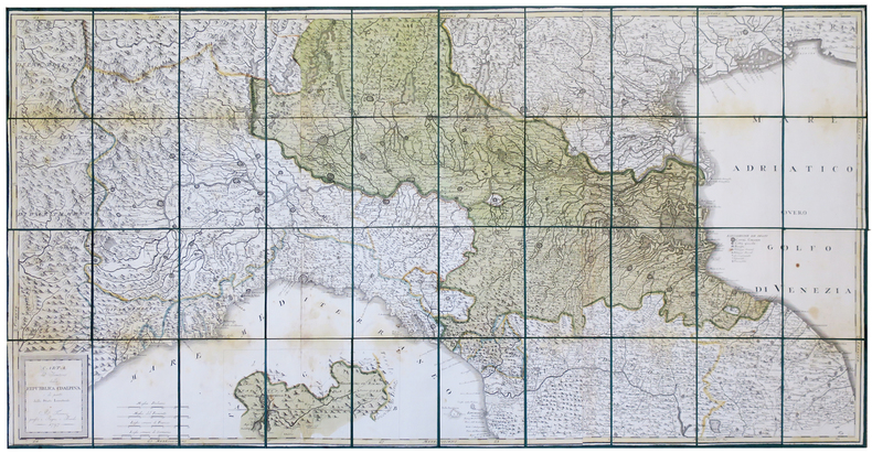
1797ref. LBW-444Firenze, Pagni, e Bardi, 1797. En 40 sections montées sur soie verte et pliées, formant une carte de 725 x 1460 mm ; étui de papier avec titre en lettres dorées.
ref. LFA-126737264Carte géographique format ouvert 1130 x 840 mm, s.d., Geografa, bon état
2001ref. DADAX1566952654National Geographic 2020-01-01. 2020. map. New. 4.10x0.40x9.00. Buy with confidence. Excellent Customer Service & Return policy. National Geographic unknown