VUILLEMIN Alexandre ( 1812 - 1880 ) , GéographeLivre Rare Book

12.289 resultados
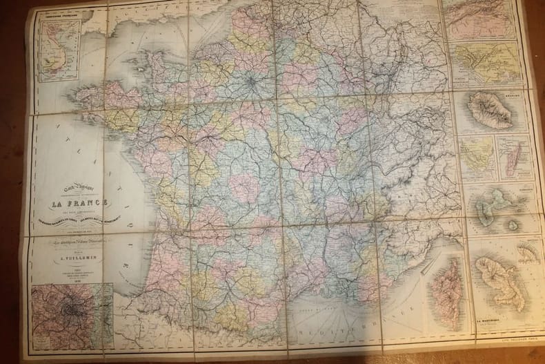
1882ref. 022817Paris MIGEON 1882 In Plano Carte lithographiée en couleurs , dressée par Vuillemin d'après les cartes de Casini en 1853 , du dépôt de la guerre des Ponts et Chaussées et de la Marine . Extraite de l'Atlas : La France et ses Colonies . Edition de 1882 identique à celle de 1879 . Illustrée des villes , bourgs et cantons , communes ( parfois disparues ) , limites du département , limites des arrondissements , routes de 1ère et 2 ème classes , traverses , chemins de fer et stations , canaux , chemins de fer en construction ,entourée de personnages célèbres , de paysages , d'une vue de la ville principale , du blason , dont les textes sont écrits par Isidore . Format 22 cm x 18 cm ou sur marges de 34 cm x 24 cm avec traces d'humidité , montée sur bristol crème de 42 cm x 30 cm . Envoyée en rouleau . - Cartes et Plans . - Une feuille , 250 gr.
1879ref. 10550Paris Bès et Dubreuil Imprimeurs 1879 in-16 cartonné carte en couleurs (map in paper in colours cloth-lined map) avec vues gravées en noir de chateaux, villes, ponts etc... - repliée sous une chemise vieux rose éditeur cartonnée in-octavo (folding under editor hardback jacket) (16 x 10,5 cm), dos muet (spine without title), titre frappé "or" sur le premier plat (gilt tile on the front cover) dans un encadrement d'un filet large et d'un filet fin à froid (plaque spéciale Editeur) , dimensions de la carte dépliée : 85,5 centimètres de largeur sur 60 centimètres de hauteur, petites déchirures aux plis (small tears with the folds), gravée par Bénard, 1879 à Paris Bès et Dubreuil Imprimeurs Editeurs,
ref. 22886Paris, librairie de Théodore Lefèvre & Cie, Emile Guérin éditeur, 1893. Grande carte lithographiée en couleurs par Falconer ( 64 cm X 89 cm), en 18 parties montées sur toile au format in-8. Plusieurs cartouches indiquant les colonies françaises et les environs de Paris. En très bon état.
ref. 242646Paris, aux bureaux du journal "Le Yacht", 1899 in-8, une grande carte en accordéon de 19,6 x 856 cm, percaline verte, dos lisse, encadrements de filets noirs sur les plats, titre poussé en lettres dorées au centre du plat supérieur (reliure de l'éditeur). Petit accroc au centre du premier volet.
1998ref. 109084Paris Société des peintres-graveurs français 1998 1 vol. Broché Carte dépliante sur Arches illustrée d'un beau portrait d'Eugène Delacroix gravé à la pointe-sèche (18 x 14 cm), numéroté 96/240 et signé par Claude Weisbuch. En parfait état.
1998ref. 109084Paris Société des peintres-graveurs français 1998 1 vol. Broché Carte dépliante sur Arches illustrée d'un beau portrait d'Eugène Delacroix gravé à la pointe-sèche (18 x 14 cm), numéroté 96/240 et signé par Claude Weisbuch. En parfait état.
1991ref. 109085Paris Société des peintres-graveurs français 1991 1 vol. Broché Carte dépliante sur Arches illustrée d'un beau portrait de Mozart gravé à la pointe-sèche (19 x 14 cm) et signé par Claude Weisbuch. En parfait état.
1991ref. 109085Paris Société des peintres-graveurs français 1991 1 vol. Broché Carte dépliante sur Arches illustrée d'un beau portrait de Mozart gravé à la pointe-sèche (19 x 14 cm) et signé par Claude Weisbuch. En parfait état.
2000ref. 23956New Zealand, Random House, 2000. 211 p. with 128 maps and a gazetteer. 30,5 x 25 cm, hardcover with original wrappers.
1893400 pages. Index. Three maps in pocket at back. Three fold-out maps, the first of these "Modern Chart of South Pacific Ocean" has been cut in half with each half bound separately at page 32. A portion of this map is detached but present. Two fascimile pages of portions from Cook's original journal. Two plates. Frontispiece illustration of Cook. Sturdily rebound in forest green buckram with covers of the original boards affixed to new boards. Library call number gilt stamped to backstrip. Card pocket adhesive inside front board. Minor bit of peeling to new front free endpaper. Moderate overall wear. Book
2015ref. 114822Acanthus Press. New. Hardcover. FREE UPGRADE to Courier/Priority Shipping Upon Request - IN STOCK AND IMMEDIATELY AVAILABLE FOR SHIPMENT - IN STOCK AND IMMEDIATELY AVAILABLE FOR SHIPMENT - Flawless copy brand new pristine never opened - -- with a bonus offer-- . 2015. 0926494910 . Acanthus Press hardcover
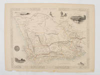
1851ref. 174666London.: Tallis John. 1851. Lithographed map 24.2 x 32 cm districts picked out in original hand colour inset vignette illustrations decorative border lower margin ragged but the attractive map in very good condition. Attractive decorative map from "Tallis's illustrated atlas and modern history of the world." one of the last great illustrated series of world maps. The fine vignettes are of Cape Town Graham Town and entrance to the Knysha Heads. . (Tallis, John). unknown
ref. Q-1566953553Natl Geographic Society Maps 2019-01-01. Map. New. In shrink wrap. Looks like an interesting title! Natl Geographic Society Maps unknown
ref. 1583559248.Gpamphlet. Good. Access codes and supplements are not guaranteed with used items. May be an ex-library book. unknown
ref. CYE42RT
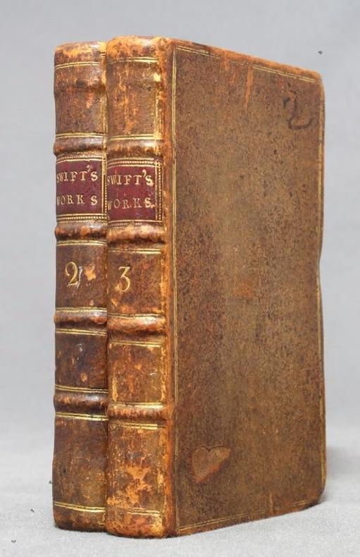
1751ref. 12758London, C. Bathurst, coll. The works of Dr. Jonathan Swift II et III, 1751. 2 volumes in-16 de XXIV-224-[4] et X-244 pages, plein veau brun, dos à 4 nerfs ornés d'encadrement, titre et tomaison dorés, pièces de titre bordeaux, double filet doré encadrant les plats, roulette à froid sur les coupes, tranches mouchetées.
1963ref. AUB-3922Namur, les éd. du Soleil Levant 1963. Bel exemplaire relié, cartonnage orné d'éd., in-12, 266 pages.
ref. 1566957370.Gmap. Good. Access codes and supplements are not guaranteed with used items. May be an ex-library book. unknown
1975No marks or inscriptions. No creasing to covers or to spine. A very clean very tight booklet with bright unmarked boards and no bumping to corners. 20pp. Attractive little booklet with colour and black & white ptotographs of Canterbury with history and description. Undated ca 1975.
1925Collection " Guide-Hachette " avec 1 Carte dépliante en couleurs , 1 carte schématique en noir et blanc et 37 gravures . A l'époque où l'automobile se développe ainsi que les voies de chemins de fer , Hachette lance une série de guides invitant à découvrir tous les départements de France . De très belles cartes réalisées par L'Institut Géographique de Paris permettent d'entreprendre les voyages . Actuellement très utiles aux généalogistes et historiens car nombres de villages ont disparus . Elles permettent de recenser les bois et forêts de l'époque , les lignes de chemins de fer , les petits et grands chemins et donnent de précieuses indications sur l'économie et la population . ( Commandez plusieurs départements dans notre librairie et ne payez qu'un seul frais de port ) . Cartes et plans .- 64 p. + Carte , 150 gr.
1997No marks or inscriptions to contents. No creasing to covers or to spine. A very clean very tight copy with bright laminated boards, tiny rub to spine foot, fine indenting to rear and no bumping to corners. 329pp. Lavish tourist guide to Cancun and surrounding area in Mexico.
1764(Købenahvn, 1764). Kobberstukket prospekt af Kancelli-bygningen. (16x24 cm.).
ref. 1553410882.Gmap. Good. Access codes and supplements are not guaranteed with used items. May be an ex-library book. unknown
1956Prepared for the Technical Assistant to CNO for Polar Projects. "While this work is primarily prepared for military planners, it also presents the foundation study for engineers undertaking any planned construction. It is hoped that the study leads to consideration of a transportation approach from the inland rather than depending entirely on the difficult and unreliable sea approach to certain areas requiring logistic support... Covers in detail the north Canadian mainland and Baffin Island." - from Preface. Includes several bibliographies covering the geographic areas studied. Black and white illustrations and maps. Above-average wear. Usual library markings. Binding intact. A worthy reference copy. Book
1975188 pages. Includes the following papers: A Brief History of Lower Fort Garry; The Big House, Lower Fort Garry; Industrial and Agricultural Activities at Lower Fort Garry; The Sixth Regiment of Foot at Lower Fort Garry; The Second Battalion, Quebec Rifles, at Lower Fort Garry. Includes a variety of black and white illustrations and maps. Unmarked. Moderate wear. Book