12.267 resultados
ref. 10697Paris, Edité par Continental, Société Anonyme de Caoutchouc Manufacturé, 1908. In-8 reliure percaline rouge, VIII pp. + 1 carte d'assemblage et 33 planches. France - Hollande - Belgique - Luxembourg - Alsace-Lorraine - Suisse - Italie du Nord - Espagne du Nord - Algérie et Tunisie.
Gotha - Madrid, Instituto Geográfico de Justus Perthes, Füssel Hermanos, 1904. 8vo. alargado; 36 pp. y 28 mapas dobles grabados en cobre y coloreados. Encuadernación original en tela estampada, fatigada. El mundo en la mano, tal como era poco antes de la Guerra Europea, WWI.
Gotha, Instituto Geográfico de Justus Perthes, 1906. 8vo. alargado; 36 pp. y 28 mapas dobles grabados en cobre y coloreados. Encuadernación original en tela estampada.
1830ref. 2322Sans lieu, sans éditeur, pièce unique, 1830. In-4 oblong – 33,5 x 24 cm. Reliure de l’époque en demi-maroquin rouge à grain long avec coins sertis d’un filet doré, dos à 5 faux-nerfs orné de doubles filets, dentelle et petits fers dorés, supra-libris doré au premier plat, toutes tranches dorées. 29 ff. Bel atlas entièrement manuscrit composé en 1830 par une jeune fille dénommée Angélique Fillon.Il renferme un titre calligraphié et 14 cartes détaillées et rehaussées en couleurs : Europe, Suède et Norvège, Iles britanniques, France, Allemagne, Pologne, Espagne, Italie, Asie, Turquie d'Asie, Chine, Afrique, Amérique du Nord et Amérique du Sud. Un feuillet de texte donne parfois des informations sur le pays ou le continent représenté.
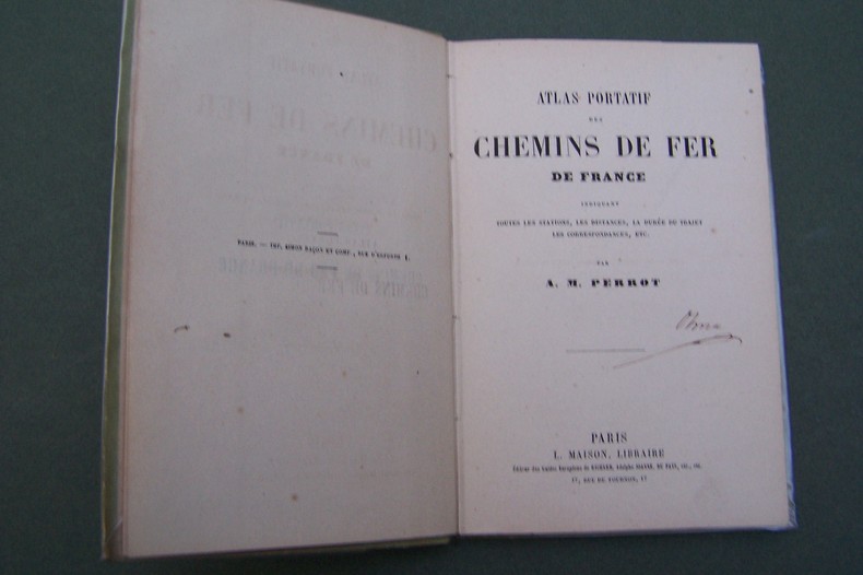
ref. CF343P., Maison, s.d. In-12, carte des environs de Paris en frontispice, 37 pages de cartes, cartonnage.
ref. 014024Paris J. Barreau 0 In-4 Agrafé, couverture illustrée
1957ref. 112925Thomas Nelson & Sons 1957. hardcover. Very Good. 0x0x0. Color Maps. Slender large format hardcover in lightly shelf worn jacket now under mylar. Tight and unmarked. Oversized and overweight Please email for photos. Thomas Nelson & Sons hardcover
1967ref. 38237Maplewood NJ: Hammond Incorporated. As New. Hardcover. FREE UPGRADE to Courier/Priority Shipping Upon Request – – IN STOCK AND IMMEDIATELY AVAILABLE FOR SHIPMENT - TEXT PRISTINE Pages tight to spine -- with a bonus offer--; T-Coodon; Cooke Donald E.; Illustrated maps By Dwight Dobbins Atlas of the Presidents with Pictures of the Presidents based on Photographs of Portraits Supplied By the Library of Congress . 1967. Hammond Incorporated hardcover
1975A very large book. No marks or inscriptions. Minor creasing to some page corners. A clean copy with sound ring binding, slightly dusty slightly sunned unmarked boards with a little peeling to the reinforcing laminate on the boards. Unpaginated. ca 140pp. Mainly a series of maps and associated text showing the statistics applicable to Portsmouth in terms of Administration, Physical Background, Historical Development, Economic Structure & Social Facilities, Census and Community Analysis and Contemporary Growth and Change. Plus a fair number of photographs of the area showing the features referred to in the maps and text.
1977Major classical sites illustrated with detailed maps, diagrams and descriptions. 256p. illus.maps.glossary,index Book
1769ref. 15641769 Nuremberg, 1769. 33x52,5 cm. Recueil de 20 grandes cartes de la Suisse sur double pages, en couleurs ! Augmenté d'une carte de Neuchâtel et Valangin dressée en 1778. Reliure de la fin du XVIIIème siècle ou du début du XIXème siècle en demi-basane à petits coins. Plats recouverts de papier beige moucheté. Dos lisse orné de bandes dorées. Titre sur pièce de couleur orangée. Petites traces d'usage sur la reliure et papier très légèrement bruni par endroit, sinon ouvrage en excellent état et complet, ce qui est exceptionnel !
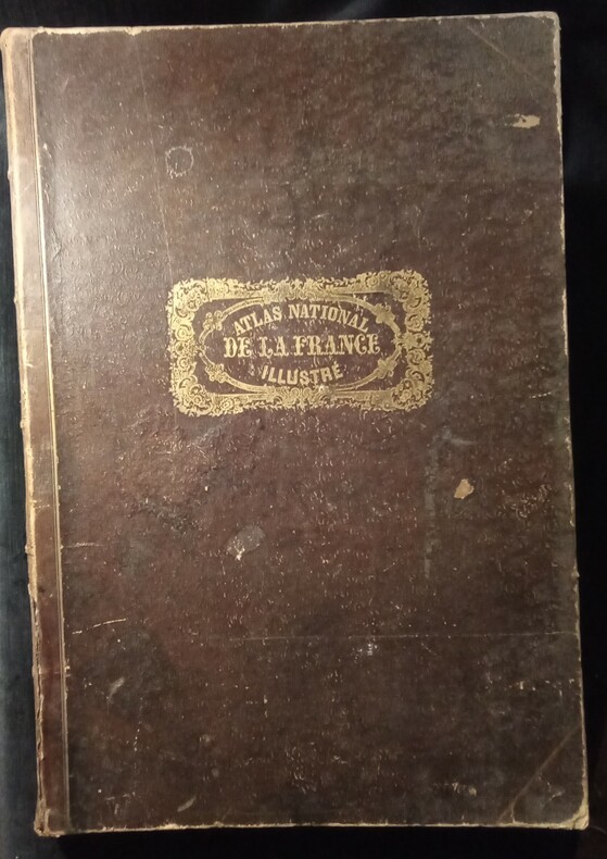
1854ref. WOC-165Avec le tracé de toutes les routes,chemins de fer et canaux. Ouvrage entièrement gravé, comprenant 1 page de titre illustrée,1 tableau statistique,86 cartes départementales françaises,légèrement rehaussées de couleurs, sur les limites de cantons,6 cartes Coloniales(Algérie,Réunion, Guadeloupe,Martinique,Sénégambie,Guyane),1 carte du Monde, 1 carte de l'Europe,1 carte de l'Afrique,1 carte de l'Amérique Méridionale,1 carte de l'Amérique Septentrionale,1 carte d'Asie, 1 carte de l'Océanie et 1 grande carte de la France, soit 100 cartes gravées.Chaque carte est entourée de motifs pastoraux,représentant les productions locales,les statistiques,les personnalités,les armoiries et le tout dans un encadrement.Paris,A. Combette,1854.In-folio(53,5x37cm) relié demi chagrin rouge d'époque à coins,dos très ornés de fers dorés,nom de l'auteur et titre en lettres dorées,titre ornementé sur le plat supérieur. Bon état.
1720Nürnberg, Homannischen Officin, n.date (maps ca 1720-39). Large folio. 54,5x32 cm. Contemporary, probably original, limp full calf with flap (""portmanteau""). (Only 4 maps with dating: 2 with 1732, 1728 and 1739).Cover with blind-tooled frames inside which a crowned monogram and the number 50 (= number of plates). Binding worn at edges, covers and back somewhat rubbed. Flap torn and partly with an old repair. Fine allegorical engraved hand-coloured title, printed title with Index (these 2 leaves strengthened in lower margin, no loss of image), and all 49 engraved maps, all in fine original hand-colouring and in double-folio. In excellent condition, with large cartouches (cartouches uncoloured). A few maps with insignificant small tears in folding. The title-page engraved by Michael Rössler, pointing to an early issue of the atlas, and before the publishing house had its name changed to Homann Erben (from 1730).
1720ref. 51181Nürnberg, Homannischen Officin, n.date (maps ca 1720-39). Large folio. 54,5x32 cm. Contemporary, probably original, limp full calf with flap (""portmanteau""). (Only 4 maps with dating: 2 with 1732, 1728 and 1739).Cover with blind-tooled frames inside which a crowned monogram and the number 50 (= number of plates). Binding worn at edges, covers and back somewhat rubbed. Flap torn and partly with an old repair. Fine allegorical engraved hand-coloured title, printed title with Index (these 2 leaves strengthened in lower margin, no loss of image), and all 49 engraved maps, all in fine original hand-colouring and in double-folio. In excellent condition, with large cartouches (cartouches uncoloured). A few maps with insignificant small tears in folding. The title-page engraved by Michael Rössler, pointing to an early issue of the atlas, and before the publishing house had its name changed to Homann Erben (from 1730).
1969Large folio, 63x42cm. 65 double-page col. maps (sc. 1:7,500,000 or 1:400,000 or 1:5,00,000), with title sheets and double-page leaf of legenda (both in Russian and English), unbound in orig. cloth-backed printed portfolio, as issued. Portfolio with traces of handling but maps in fine condition.
1880Une feuille 36x50 cm. L?g?rement d?fra?chie. D?chirure r?par?e en marge.
2014ref. WOC-687Ouvrage orné de cartes en dont 17 cartes hors-texte. La Salévienne, 2014. Petit in-4 (27,5x21,5cm) cartonnage souple illustré et plastifié. 134pp.
1987Canadian history and geography prior to 1800 illustrated with maps and diagrams. 198p.illus bibliographies A large format VERY heavy volume. (14.5x11x1.5" 5lbs 5 oz/ 2.4 kg] Book
1960ref. L1260Éditions Meddens, 1960, 180 p.
2017ref. WOC-1388Volume 2: Communes Réunies , Communes Démembrées. Nombreuses illustrations de cartes. La Salévienne, 2017. In-4 (28x22cm) de cartonnage souples illustré. 179pp.
2021ref. 106916Neuchâtel : Editions Livreo-Alphil 2021. reliure d'éditeur. WALTER François textes. - ZANOLI Marco cartes.Atlas historique de la Suisse. L'histoire suisse en cartes. 2e Edition. Neuchâtel Editions Livreo-Alphil2021 245x285mm 195 pages cartes en couleurs reliure d'éditeur. Format oblong. Très bel exemplaire. No hidden customs fees for orders shipped to the U.S.A with a value of up to 800 USD PDDP shipping we pay the VAT in advance Editions Livreo-Alphil unknown
1900ref. LBW-8525Paris, Saussine, [vers 1900]. 7 puzzles cartographiques coloriés (env. 29 x 38 cm), présentés dans leur boîte d'origine illustrée (32 x 40 x 5 cm).
1861ref. R120443Paris, Gaume frères et J. Duprey 1861 Atlas contenant 24 cartes à double-page, 43x30cm., reliure d'époque (plats marbrés, dos en cuir brun avec titre doré, charnières légèrement cassées aux bouts, coins usés), feuilles de garde marbrées, cachet au recto et verso de la page de titre, quelques rousseurs occasionnelles, bon état, poids: 2.3 kg., R120443
1873Gota, Justus Perthes, 1873. Large 8vo. Orig. hcalf, but nicely rebacked with buckram. Double-page title-page with ""Table des Matiéres"" and 34 double-page engraved maps with outline-colouring. 8Numb. 1-20 + a,b,c numb). Maps clean, some brownspots seen on verso of maps.
1873ref. 49323Gota, Justus Perthes, 1873. Large 8vo. Orig. hcalf, but nicely rebacked with buckram. Double-page title-page with ""Table des Matiéres"" and 34 double-page engraved maps with outline-colouring. 8Numb. 1-20 + a,b,c numb). Maps clean, some brownspots seen on verso of maps.