MEYER JEAN-CHARLESLivre Rare Book
12.535 resultados
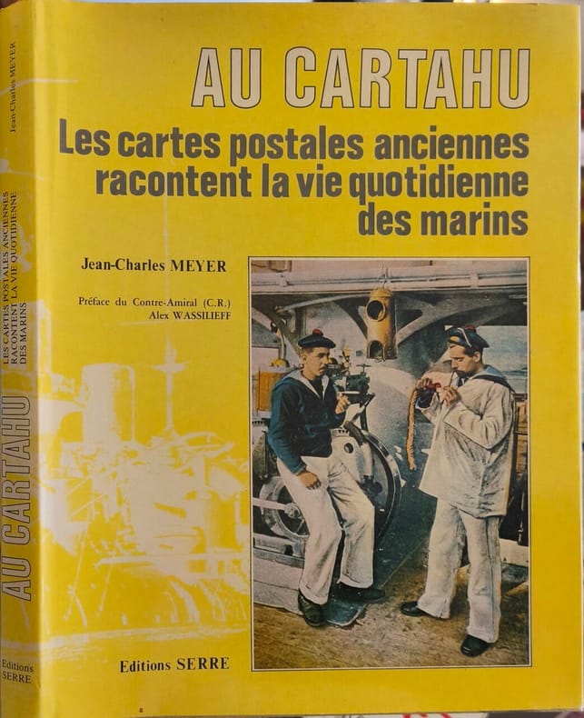
1984ref. 11255Editions Serre 1984 125 pages 0x0x0cm. 1984. Reliure Editeur avec jaquette. 125 pages. Le livre 'Au Cartahu' de Jean-Charles Meyer utilise des cartes postales anciennes pour illustrer et raconter la vie quotidienne des marins. Il est préfacé par le contre-amiral Alex Wassilieff
1934ref. 61915Chicago IL: Published by A.J. Nystryom & Co. Maps Globes Charts 1934. Seven large linen-backed colour lithograph maps sized from 43.5 x 72 in. to 51.5 x 60 in. all mounted on their original spring-loaded rollers wooden pull dowel & metal ring pull some creasing minor edgewear creasing soot soiling to the lower margin averaging about 6-7 in. due to exposure when rolled “Europe” and “United States” with faint tidemark & discoloration at left margin some minor creasing wear all preserved in the original A.J. Nystrom quarter-sawn oak wall bracket sized 58.5 x 15.25 x 3.25 in. all pull-down maps firmly secured in their steel brackets preserving 6 of the 7 original labels on the edge of the pull-down dowels still a VG- set of maps in their original configuration. First editions thus of this complete and exceptional example of the Atwood/A.J. Nystrom Regional-Political Series Map Case reflecting the many geographical and political changes between World War I and World War II. Such changes are reflected in the appearance of Manchoukuo the Japanese controlled rump state established in Manchuria in 1932 by the Japanese Empire and also depicting Korea still as Chosen. The Europe map depicts the East Prussia still controlled by the Weimar Republic and then after Hitler ascended to power; while Africa still retains much of the colonial powers as shown in the Belgian Congo Anglo-Egyptian Sudan French Equatorial Africa and even Beuchuanaland. The Australia and the Far East Map clearly defines the Japanese United States British & Australian mandates across the South Pacific. Atwood 1872-1949 was a noted geographer and educator who was a member of both the New Jersey and Wisconsin Geological Surveys served in the US Geological Survey served as professor of Physiography at Harvard and later from 1920-1946 when he produced these maps was President of Clark University and Head of its School of Geography. No similar complete sets located in Worldcat. Published by A.J. Nystryom & Co., Maps, Globes, Charts, unknown
ref. SLIVCN-9830096004993PASSE-TEMPS EDITIONS
1783Paris, J. Barbou, 1783. Large 8vo. (18,5x13,5 cm.). Contemp. blue boards. Covers with wear and some scratches. Backstrip gone. Old owners names on title.V,(49) pp. and 20 double-page engraved maps, of which 19 are handcoloured in outline (paper measuring 18x22 cm.). Textlvs. with traces of use. 2 maps with some smaller inkspots. Maps fine apart from some browning to margins. Maps unsigned, but after the listing of the maps (verso of titlepage) is printed ""Ces Cartes ont été gravées par M. André sur les dessins de M. Brion.""
ref. 51860Leipzig Georg Joachim Göschen 1830. . Verlags-Bibliographie Göschen 1785-1838 Nr. 1027. Vgl. Studien zur Verlagsgeschichte u. zur Verlegertypologie der Goethezeit S. 190. - Einband stark beschabt Textteil gebräunt/stockfl.; erste Karte gebräunt sonst nur gelegentlich stockfleckig im weißen Kartenrand. - Allgemeine Übersicht. Topographie der vorzüglichsten Orte von A-Z. Grenzkolorierte Karten von Königreiche ENGLAND SCHOTTLAND u. IRLAND; Gibraltar Malta Helgoland Ionien; die Kolonien: Britisch-Ostindien Kap-Kolonie Westindien afrikanische Westküste Goldküste Guinea Mauritius St. Helena Nordamerika Hopparo Britisch-Guyana Australien. - Der königlich sächsische Kammerrat W. E. A. v. Schlieben 1781-1839 Statistiker u. Oberlandfeldmesser war Mitbegründer des Statischen Vereins in Sachsen 1831-1850 u. Leiter des Zentralkomitees des Vereins. Leipzig, Georg Joachim Göschen, 1830. unknown
Gotha - Madrid, Instituto Geográfico de Justus Perthes, Füssel Hermanos, 1904. 8vo. alargado; 36 pp. y 28 mapas dobles grabados en cobre y coloreados. Encuadernación original en tela estampada, fatigada. El mundo en la mano, tal como era poco antes de la Guerra Europea, WWI.
Gotha, Instituto Geográfico de Justus Perthes, 1906. 8vo. alargado; 36 pp. y 28 mapas dobles grabados en cobre y coloreados. Encuadernación original en tela estampada.
1957ref. 112925Thomas Nelson & Sons 1957. hardcover. Very Good. 0x0x0. Color Maps. Slender large format hardcover in lightly shelf worn jacket now under mylar. Tight and unmarked. Oversized and overweight Please email for photos. Thomas Nelson & Sons hardcover
1967ref. 38237Maplewood NJ: Hammond Incorporated. As New. Hardcover. FREE UPGRADE to Courier/Priority Shipping Upon Request – – IN STOCK AND IMMEDIATELY AVAILABLE FOR SHIPMENT - TEXT PRISTINE Pages tight to spine -- with a bonus offer--; T-Coodon; Cooke Donald E.; Illustrated maps By Dwight Dobbins Atlas of the Presidents with Pictures of the Presidents based on Photographs of Portraits Supplied By the Library of Congress . 1967. Hammond Incorporated hardcover
1975A very large book. No marks or inscriptions. Minor creasing to some page corners. A clean copy with sound ring binding, slightly dusty slightly sunned unmarked boards with a little peeling to the reinforcing laminate on the boards. Unpaginated. ca 140pp. Mainly a series of maps and associated text showing the statistics applicable to Portsmouth in terms of Administration, Physical Background, Historical Development, Economic Structure & Social Facilities, Census and Community Analysis and Contemporary Growth and Change. Plus a fair number of photographs of the area showing the features referred to in the maps and text.
1977Major classical sites illustrated with detailed maps, diagrams and descriptions. 256p. illus.maps.glossary,index Book
1720Nürnberg, Homannischen Officin, n.date (maps ca 1720-39). Large folio. 54,5x32 cm. Contemporary, probably original, limp full calf with flap (""portmanteau""). (Only 4 maps with dating: 2 with 1732, 1728 and 1739).Cover with blind-tooled frames inside which a crowned monogram and the number 50 (= number of plates). Binding worn at edges, covers and back somewhat rubbed. Flap torn and partly with an old repair. Fine allegorical engraved hand-coloured title, printed title with Index (these 2 leaves strengthened in lower margin, no loss of image), and all 49 engraved maps, all in fine original hand-colouring and in double-folio. In excellent condition, with large cartouches (cartouches uncoloured). A few maps with insignificant small tears in folding. The title-page engraved by Michael Rössler, pointing to an early issue of the atlas, and before the publishing house had its name changed to Homann Erben (from 1730).
1969Large folio, 63x42cm. 65 double-page col. maps (sc. 1:7,500,000 or 1:400,000 or 1:5,00,000), with title sheets and double-page leaf of legenda (both in Russian and English), unbound in orig. cloth-backed printed portfolio, as issued. Portfolio with traces of handling but maps in fine condition.
1880Une feuille 36x50 cm. L?g?rement d?fra?chie. D?chirure r?par?e en marge.
1987Canadian history and geography prior to 1800 illustrated with maps and diagrams. 198p.illus bibliographies A large format VERY heavy volume. (14.5x11x1.5" 5lbs 5 oz/ 2.4 kg] Book
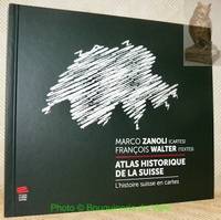
2021ref. 106916Neuchâtel : Editions Livreo-Alphil 2021. reliure d'éditeur. WALTER François textes. - ZANOLI Marco cartes.Atlas historique de la Suisse. L'histoire suisse en cartes. 2e Edition. Neuchâtel Editions Livreo-Alphil2021 245x285mm 195 pages cartes en couleurs reliure d'éditeur. Format oblong. Très bel exemplaire. No hidden customs fees for orders shipped to the U.S.A with a value of up to 800 USD PDDP shipping we pay the VAT in advance Editions Livreo-Alphil unknown
1873Gota, Justus Perthes, 1873. Large 8vo. Orig. hcalf, but nicely rebacked with buckram. Double-page title-page with ""Table des Matiéres"" and 34 double-page engraved maps with outline-colouring. 8Numb. 1-20 + a,b,c numb). Maps clean, some brownspots seen on verso of maps.
1844Paris, Chez l'Auteur - Saint-Petersburg, Issakoff, 1844-48. Small folio. (35 x 27 cm.). In a worn contemp. hcalf. Spine cracked and broken. Boards detached. All parts stitched, a few loose. All parts uncut and unopened. All parts clean and fine. Each part separately paginated and with own title-page. Text to each part (from 8-12 pp.). Each part having a large folded engraved general map and from 11 to 27 engraved folio-maps. In all 292 textpages and 441 engraved maps.
Broch?. 9 planches. A l'Italienne. 34 x 25 cm.
México, Fondo de Cultura Económica, 1964. 4to. menor; 58 pp. y 42 mapas aparte. Enc. original en tela.
1780ref. 328331780. S.l. s..s.d. circa 1780. Un vol. au format pt in-4 252 x 208 mm de 2 ff. n.fol. 28 pp. 50 planches sur double-page et 19 tableaux in fine majoritairement dpliants. Reliure de l'poque plein veau glac et marbr blond triple filet dor encadrant les plats dos nerfs orn de filets gras froid doubles caissons d'encadrement dors fleurons dors semis de pointills dors piÂce de titre de maroquin fauve agrmente de roulettes dores titre dor palette dore en queue double filet dor sur les coupes toutes tranches dores. L'ouvrage comporte 50 sur 50 : dont une dpliante cartes graves avec rehauts aquarells du temps sur double-page montes sur onglets ; dresses par Rigobert Bonne. In fine 19 tableaux statistiques majoritairement dpliants. Une grande partie des cartes a ici t grave sur joli verg bleut. Vritable encyclopdie de lÕanticolonialisme au XVIIIÂ l'ouvrage constitue dÕun de ces ÇÊvoyages philosophiquesÊÈ prtexte rflexions sur la ÇÊloi naturelleÊÈ et dnonciations mordantes du despotisme du clricalisme de l'esclavage des Noirs ainsi que du colonialisme. Interdite en 1772 lÕHistoire des deux Indes sera nouveau publie par lÕabb Raynal dans une nouvelle dition en 1774 qui est immdiatement mise lÕIndex par le clerg. CÕest en 1780 quÕil publie sa troisiÂme dition de l'Histoire des deux Indes encore plus virulente que les deux prcdentes et quÕil avoue implicitement comme tant de lui. Condamn par le Parlement de Paris lÕouvrage est brl par le bourreau en place publique ce qui lui assure un succÂs considrable. Peignot II Dictionnaire critique littraire et bibliographique des principaux ouvrages condamns au feu p. 71- Sabin 68081 - Tooley Maps and maps-makers p. 44 - Qurard VII La France littraire p. 473 - Cohen II Manuel de l'amateur de livres gravures du XVIIIÂme 854 - rahir BibliothÂque de l'amateur p. 311 - Graesse VI Trsor de livres rares et prcieux p. 41 - Brunet IV Manuel du libraire et de l'amateur de livres 1126. Angles coupes et coiffes lims celle de tÂte arase. Rousseurs affectant les feuillets de texte liminaires ainsi que les tableaux placs en fin de volume ; rares sur les cartes. L'une d'entre-elle prsente un petit manque en marge suprieure sans atteinte la gravure. DiscrÂte cerne en marge suprieure de quelques planches. Nonobstant ensemble en belle condition. b42961 unknown
Madrid, Litografía A. Foruny, s.a. (1880). Un mapa de 56 x 39 cm., Escala 1:750000, plegado y contenido en carpeta de cartón.
Paris, Librairie Hachette et Cie., 1907. Gran folio; 64 mapas dobles impresos en color y 600 mapas y planos entre el texto, impreso al verso de los mapas dobles. Encuadernación de época, en media piel con puntas.
Zaragoza, Institución Fernando el Católico, 1995. Folio; 99 dípticos y trípticos con texto, gráficos y mapas, encartados en estuche en cartoné.