[WWII MAP OF SOUTHEAST ASIA] WISNER, W HBiblio.com
2,055 results
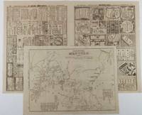
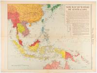
1619ref. 180757Chicago.: Chicago Daily Tribune. December 161942. Printed colour map on a single newspaper leaf 41.6 x 52.8 cm; 45 x 60 cm sheet inset legends marginal browning and at the folds but remarkably bright in very good condition. Map of Southeast Asia published in the Chicago Daily Tribune "The World's Greatest Newspaper" delineating the Pacific theatre of war with a detailed text legend. "This is a new war map of the far east showing an important part of southeastern Asia and Australasian waters from a station in which according to Prime Minister Curtin of Australia a United States fleet will operate." Interestingly New Guinea is marked as British rather than as an Australian administrative region which it became following the Treaty of Versailles. "… the historic Chicago Tribune was an innovator in color inks and printing but also a pioneer in bringing colorful art in the form of illustrations photographs cartoons and advertisements to the average person in an everyday medium." see The Janet A. Ginsburg Chicago Tribune Collection Michigan State University Libraries. . Chicago Daily Tribune. unknown
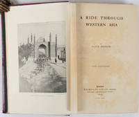
1897ref. 176109London.: Macmillan and Co. Limited. 1897. Photographic frontispiece of 'The Shah returning to Teheran' and numerous full page photographic illustrations four folding printed colour maps marginal spotting xii 275 pages 23 x 15 cm original red glazed red cloth boards occasional spotting the cloth a little marked and flecked the spine sunned but in very good condition. An extensive and intrepid modern Grand Tour account through Constantinople and Turkey to Persia and Central Asia with 34 striking photographic plates. Clive Bigham was an Honorary Attaché to the British Embassy at St. Petersburg and war correspondent in the Near East travelled at the very height of the Armenian troubles when the strict orders had been issued by Turkey that Asia Minor was to be closed to Europeans. Burrell 94. This item is held off-site. Please note there may be a few days delay while it is brought into our shop for viewing or mailing to you. Thank you for your understanding. When referring to this item please quote stockid 176109 . Macmillan and Co. Limited. hardcover
1817ref. 11715AB1817. Vienna Geistinger 1817. 71 : 148 cm. Manyfolded contemporary coloured engraving. Contemporary mounted on linen. Interesting historical map giving an broad overview of the development of the history from ancient times until the 18th century. Friedrich Strass 1766-1846 was a teacher at the monastery of Berge near Magdeburg. His "Strom der Zeiten" got a great populariety and was admired also from the foreign countries. - As mostly browned. unknown
ref. DADAX0415139341New unknown
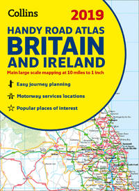
ref. SONG0008276404Collins 2018-10-01. spiral_bound. Used: Good. 0.00x6.00x8.25. Buy with confidence. Excellent Customer Service & Return policy. Collins unknown
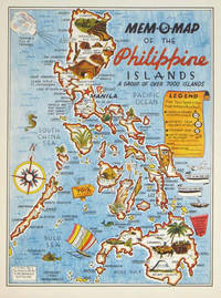
1945ref. 204557U.S.A.: Mem-O-Map Co. 1945. Colour pictographic / pictorial map 32.1 x 23.8 cms; 35.4 x 26.6 cms sheet very good condition. Rare pictorial map published in 1945 by John G. Drury aTechnical Officer who served with the 214th Ordnance Battalion to mark the end of World War II as souvenirs for the military. Military personnel could fill in banners "came in on good ship." and "departed on good ship." their name organisation and "Line of Advance or movement" blank in this example. Pictographs mark various memorable spots and wildlife including larger-than-life insects. A "Terrible Tillie Typhoon" looms over the coast at Luzon. Drury published a series of five maps: Philippines and Okinawa in 1945; Japan and Korea Oahu and Europe in 1946. They are all scarce. “These almost whimsical maps are designed to support the creation of personalised geographies. At a time when digital mapping is beginning to experiment with the creation of personalised content that would render the same map in different ways for different users Mem-O-Maps demonstrate the principle in action." Kenneth Field ICA Commission on Map Design. . Mem-O-Map Co. unknown
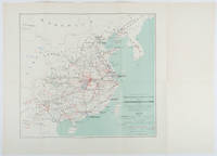
1898ref. 214719Paris.: Erhard Frères. 1898. Lithographed folding colour map 44.5 x 49.5 cms; 54.6 x 76.3 cms sheet towns and cities items of production and trade routes highlighted in red original folds in very good clean condition. Detailed map prepared for the Lyon Chamber of Commerce Mission to China under the direction of a young Henri Brenier 1867-1962 with the purpose of advancing French colonial expansion and shoring up the interests of the dominant Lyon silk trade. The map shows the principal centres of population production waterways roads telegraph lines and railroads togther with the centres of production and distribution for coal iron tin gold and silver opium tea rice sugar peanuts cinnamon wool medicinal plants and leather. The trade mission was organized following the Treaty of Shimonoseki and the end of the Sino-Japanese War: the Chamber of Commerce of Lyon understood that end of this war would signal a profound economic development and change. . Erhard Frères hardcover
ref. DADAX0847828719New unknown
ref. 0976373343-11-1Toucan Maps Inc. 4th. Very Good. It's a well-cared-for item that has seen limited use. The item may show minor signs of wear. All the text is legible with all pages included. It may have slight markings and/or highlighting. Toucan Maps Inc. unknown
ref. 1849075514-11-1Philip's. Very Good. It's a well-cared-for item that has seen limited use. The item may show minor signs of wear. All the text is legible with all pages included. It may have slight markings and/or highlighting. Philip's unknown
ref. 5178Paris Librairie Larousse 1915-19. 1st Edition . Hardcover. . ~ ~ NOTE: THE PRICE OF THIS BOOK IS CURRENTLY REDUCED! ~ ~ . 41 issues bound in one volume. Thick royal quarto. Unpaginated. With hundreds of letterpress maps many of which are in colour printed on recto only on 246 leaves of plates. Some photo-plates. Explanatory text to each map. Introductions. HARDCOVER bound in handsome brown quarter morocco bit rubbed and scuffed in places spine with raised bands gilt lettering to second compartment gilt fleuron to each of the others vellum French corners marbled endpapers with original yellow card wrapper of first issue bound-in. In about fine condition. Excellent copy. ~ FIRST EDITION. Very rare. G-3 Paris, Librairie Larousse, (1915-19). hardcover
1928ref. 62600Ottawa ONT: Natural Resources Intelligence Service 1928-1929. Four large folding colour maps. atlas folio w/ largest sized 45 x 35 in. w/ each sheet including an index map indicating there are 4 in total with outlines fold creases as issued minor age toning to fore-edges a few minor closed tears at fold creases still a VG set of maps. Early printing of this four sheet map depicting the automobile roads connecting Canada and the United States during the 1920’s as the Good Roads Movement rapidly expanded through the Northern Country following World War I. These maps depict the burgeoning highway and national road system which had been fostered by urban centers attempting to convince rural municipalities to replace their seasonal dirt roads with those of gravel or crushed stone and facilitate much greater movement of agricultural and manufacturing products across the continent and with the U.S. The Atlantic map stretches from the maritime provinces down to Washington D.C. and over to Niagara Falls and Buffalo NY; The Middle West map documents the main automobile roads and highways from Port Albert to Port Arthur and South from Denver to St. Louis indicating provincial federal and state roads and highways; The Great Lakes section tracks the extensive network of roads and highways surrounding the Great Lakes including those in Iowa Kentucky Wisconsin New York and the Canadian provinces of Quebec and Ontario; while the Pacific Map records the highways from San Francisco to Denver and up through Alberta and over to British Columbia. Uncommon with all four maps present. See: J.I. Little Confronting Rural Localism: The Good Roads Movement in Quebec’s Eastern Townships 1897-1920 Social History/Histoire sociale Vol. 57 No. 117 May 2024. Natural Resources Intelligence Service, unknown
ref. LD7400c. early 19th century. Hardcover. Very Good. Half cloth and marbled paper over boards handwritten label on upper board; oblong folio 460 x 360 mm; entirely handwritten and drawn in black ink on the rectos only with "tableau des batiments militaires" and 7 maps. Boards heavily scuffed; binding shaken; some dusty finger-smudges here and there. Sold as is. hardcover
1867ref. s02256Washington D.C: Government Printing Office 1867. 1st Edition. Hardcover. Very Good. Brown pebbled cloth boards with blindstamped rules; 9" tall; 151 pp plus large folding map. Good condition with wear to spine ends of corners of boards; map itself in very good condition colors bright folded properly modern tape reinforcement at creases. -- The "Map of the United States and Territories" by Joseph S. Wilson was one of the largest and most accurate maps of the country published at the time. It clearly marks major Native American territories and the colored mineral deposits show a clear rationale for expansion to the West. Joseph Wilson was Commissioner of the General Land Office both before and after the Civil War and this map was produced during the first year of his second tenure. The accompanying report asserts the United States' right to possession of the Western territories and states encourages the population thereof and admits to continuing arbitration land claims especially in California. Government Printing Office hardcover
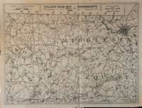
1891ref. List3031Lynn Massachusetts: Arthur W. Robinson 1891. Nine of a ten-map series mostly measuring 14 ½ x 19 inches. Folded with slight marginal folding and wrinkling; Near Fine. Nine of a set of ten maps of the entire state of Massachusetts produced in 1891 for the League of American Wheelmen. The League was founded in Rhode Island in 1880 as a membership organization for cyclists. Besides presiding over racing and producing cycling guidebooks it advocated for increased government spending on road improvements especially for rural roads; these maps indicate roads of superior and inferior quality. In the 1890s there was a boom in cycling’s popularity mainly because of several inventions that allowed a safer and more pleasant ride compared to that of a penny-farthing. This group is near complete; we find two complete editions on OCLC. Arthur W. Robinson unknown
1848ref. 70172Washington 1848. Caption titles of the maps listed below in chronological order according to the date of the action described in the map; almost all bear the lithographer's slug. Several have tears in marginal folds and a few show some foxing one uniformly browned. All are serviceable examples almost all very good. 1 Sketch of the Actions Fought at San Pascal in Upper California between the Americans and Mexicans Dec. 6th & 7th 1846 caption title. 11 x 7 ¾ inches neatline. 2 Sketch of the Passage of the Rio San Gabriel Upper California by the Americas Discomfiting the Opposing Mex. Forces Jan 8th 1847 caption title. From a sketch by Lt. Emory. P. S. Duval Lith. Phil. 6 3/8 x 8 ¼ inches neatline. 3 Sketch of the Battle of Los Angeles Upper California Fought between the Americans and Mexicans Jany 9th 1847 caption title. From a sketch of Emory. 5 ¾ x 8 ¼ inches neatline. 4 Sketch Accompanying Col. Price's Despatch of 15th Feb. 1847 caption title. 8 1/8 x 5 ¾ inches neatline. 5 Linnard Capt. T. B. Plan of the Battle of Buena-Vista Fought February 22nd and 23rd 1847 caption title. Surveyed by Capt. Linnard & Lts. Pope & Franklin. Lith of P. S. Duval Phil. Notes in several margins. 16 ¼ x 20 inches neatline. 6 Sketch of the Battle of Sacramento Feb. 28th 1847 caption title. Printed note of the battle in lower margin. 12 ½ x 9 ½ inches neatline. 7 Coppee Lt. H. Survey of the Mexican Lines of Defence at Cerro Gordo and the Lines of Attack of the American Army under Major General Scott. On the 17th and 18th of April 1847 caption title. Surveyed by Major Turnbull and Capt. McClellan Top. Engineers. Lith of P. S. Duval Phil. 12 ¼ x 18 ¾ inches neatline. 8 Sketch Accompanying Col. Price's Despatch of 18 April 1847 caption title. P. S. Duval Lith Phil. 9 ½ x 11 ½ inches neatline. 9 Map of the California coast supplied title. June 19th 1847. Table in lower margin recording distances between towns and number of men available in each. Lith of P. S. Duval Phil. 14 ½ x 11 ¾ inches neatline. 10 Hardcastle Lt. Edmund. Battles of Mexico Line of Operations of the U. S. Army under the Command of Major General Winfield Scott on the 19th and 20th of August 1847 caption title. Surveyed by Major Turnbull Capt. McClellan and Lt. Hardcastle. Lith of P. S. Duval Phil. 23 ½ x 28 ½ inches neatline. 11 Hardcastle Lt. Edmund. Map of Genl. Worth's Operations on the 20th of Augt. 1847 caption title. Surveyed by Capt. Mason of Engineers and Lt. Hardcastle of Top. Engrs. 18 ½ x 30 ¾ inches neatline. 12 Hardcastle Lt. Edmund. Battle of Molino Del Re: Sketch of the Operations of the 1st Division United States Army under the Command of General Worth on the 8th Sept 1847 caption title. P.S. Duval Lith Phil. 19 3/8 x 12 ¼ inches neatline. 13 Hardcastle Lt. Edmund. Battles of Mexico Line of Operations of the U. S. Army under the Command of Major General Winfield Scott on the 8th 12th and 13th of September 1847 caption title. Surveyed by Major Turnbull Capt. McClellan and Lt. Hardcastle. Lith of P. S. Duval Phil. 28 x 21 ½ inches neatline . 14 Pemberton Bvt. Capt. J. C. Sketch of the Route of General Worth's Column from Chapultepec to the Alameda in the Attack upon the City of Mexico 13th & 14th September 1847 caption title. 14 ¼ x 10 ¼ inches neatline. Notes in lower margin. 15 Hardcastle Lt. Edmund. Map of the Valley of Mexico caption title. Lith of P. S. Duval. 12 x 16 ¾ inches neatline. Fold separations from edges. 16 Plan Accompanying Gen. Quitman's Report caption title. Duval's Lith Press. 13 x 17 ¾ inches neatline. Notes on the battle in lower margin. Some hand coloring. Two splits through margin at folds uniformly browned. 17 Sketch Accompanying Col. Price Despatch caption title. 9 ½ x 11 ½ inches neatline For the lot of 17 maps unknown
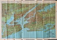
1928ref. List2973George J. Nostrand; Winkoop Hallenbeck Crawford Co 1928. Map measuring 20 x 29 inches; trifold measuring 8 ½ x 12 inches. Map folded with some small tears at folds slightly wrinkled pencil markings verso; very attractive. Overall excellent. Offered here is a large attractive bird’s-eye view map of New York City and the surrounding areas by George J. Nostrand a New York City-based lithographer and cartographer; and a small pamphlet advertising sightseeing tours by car or yacht with “lecturers accompanying each trip explaining all points of interest”. The map highlights the most car-friendly routes around the city and New Jersey as far west as Mountain View and is beautifully illustrated with buildings landmarks and ships in the harbor. It was likely produced between 1927 and 1929 given certain details for instance the George Washington Bridge is labeled only as “proposed”; we find two copies of the 1928 printing and four of the 1929 printing on OCLC. George J. Nostrand; Winkoop Hallenbeck Crawford Co unknown
1881ref. ABE-EBAY-197700219739London: Kegan Paul 1881. Hardcover. Good. A Polar Reconnaissance. Being the Voyage of the ""Isbjörn"" to Novaya Zemlya in 1879. By Albert H. Markham. With Maps and Illustrations. London: C. Kegan Paul 1881. 10 engravings 6 of them full-page plates 2 folding maps. Top and bottom of spine significantly chipped other extremities rubbed spine sun-faded a little scuffing and staining. Pages yellowed with an occasional bit of foxing smudge minor blemish; there are a couple of light pencil marks; a blank page at the end has a few pencil notes. Binding cracked and weak one signature is detached a couple of others are loosening. Owner bookplate James Richardson. Kegan Paul hardcover
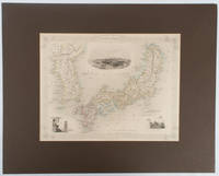
1850ref. 177528London.: The London Printing and Publishing Company. circa1850s. Lithographed map with original outline hand colour 25.8 x 33.5 cm three vignette illustrations decorative border central fold in very good condition presented in a window mount. Attractive decorative map with three vignettes by Rapkin: Yedo; a State barge in sail with penants flying--the paired oarsmen depicted through 10 small windows below deck; and Koreans in traditional costume; the map after the great mapmaker and publisher John Tallis. From the estate of the late collector and scholar Arthur Hacker with his pencilled catalogue mark on the verso. . The London Printing and Publishing Company. unknown
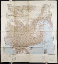
1945ref. 206545Calcutta: Compiled and drawn by the Survey of India. Second Edition. 1945. Large folding colour map 77.5 x 80cm; 95.5 x 86.2cm sheet including legend and small inset showing adjoining maps light toning and wear to upper margins and at corners and folds; but in very good condition. Very large clear map of China printed in 1945. The projection is noted as the "Lambert Conical Orthomorphic" a polyconic projection employed by the exhaustive Survey of India and the map includes surrounding countries: Taiwan Korea French Indo-China with a small inset key to Korean place-name abbreviations. As is typical of maps of this period Arunachal Pradesh is shown as Tibetan territory.The legend lists borders and provinces railways roads and canals with topography indicated with colouration. . Compiled and drawn by the Survey of India. unknown
1904ref. 216797大阪. Osaka.: 大阪毎日新聞社. Ōsaka Mainichi Shinbunsha. Meiji 37 1904. Two black and white newspaper maps issued in the Ōsaka Mainichi Shinbunsha one pictorial with accompanying text and adverts printed on newsprint folded. 39.5 x 55cm Very good condition. This pictorial map of Port Arthur and Dalian was published on 4 July 1904 by the Osaka Mainichi Shinbun as a supplement. It shows Port Arthur encircled by Japanese naval vessels while Dalian is depicted as being occupied by Japanese troops. On the reverse there is an essay on the war accompanied by illustrations of Russian generals and a list of wounded soldiers who had been transported to the rear. A second map detailing developments in the Russo-Japanese War was published by the same newspaper just days later on 8 August 1904. This map provides the dates of various battles along with a chronology of the movements of the Russian Vladivostok fleet and Japanese attacks on Port Arthur. These two maps are rare examples of the kind of information made available to the general public on a day-to-day basis during the war. . 大阪毎日新聞社. [Ōsaka Mainichi Shinbunsha]. unknown
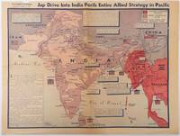
1944ref. 214362Los Angeles.: Los Angeles Examiner. April 31944. Colour pictorial map on a single newspaper leaf 37 x 50 cms; 41.5 x 54.6 cms sheet unrelated text on the verso although with an interesting account from a soldier's letter about an air raid in China toning more marked at the central fold two small splits no loss to the map edge wear with several small marginal edge tears neatly repaired on the verso with archival washi map unaffected in good condition. A dynamic map prepared and illustrated by the Examiner's art critic and editor Howard Burke covering the area surrounding India and Central Asia showing Japanese conquered territory in Malaya Thailand Indo-China and Burma; and in India British-controlled states and native feudal and protected states. Text boxes and pictographs give an overview of the geopolitical situation from the Allied perspective. One box notes "Chanda Bose has many adherents and fanatical followers in Bengal. They may prove to be a powerful fifth column in India". Text at lower edge opines "The situation in India is critical and has grown more so as the all-out offensive against Japan has been delayed. If the Allies do not act at once and with great force all our gains may be wiped out and the war in the Pacific prolonged indefinitely." The decisive and devastating bombings that were to signal such an end were four months away. Rare on the market. . Los Angeles Examiner. unknown
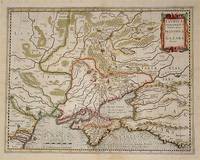
ref. 54794Amsterdam.: Jodocus Hondius. Circa Early 17th Century. Map depicting the southeastern part of present day Ukraine and the Crimean peninsula including the northern most part of the Black Sea and reaching north to Smolensk. Published by Hondius in the French edition of the Mercator-Hondius Atlas. Hand outline colour topographical detail shown pictorially some wear along centrefold occasional pale foxing mostly in margins decorative title cartouche upper right corner French text on verso showing through clear plate mark even age toning 48.5 x 58 cm. . [Jodocus Hondius]. unknown
1798ref. 32540-440Paris Edme Mentelle 1798. C. 330 x 430 mm. Framed 510 x 610 mm. Paris Edme Mentelle 1798. Fine map of the mouth of the Gironde river with Cognac and Angoulème in the centre. On upper corner right the map bears the no. 41. GEOGRAPHY: MAPS ; KARTEN KARTOGRAPHIE ; FRANCE ; Paris, Edme Mentelle unknown
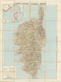
ref. 62609Paris: Cartes Tarides c.1922. Original separately issued colour-lithographed map of Corsica 105 x 81 cm dissected into 32 sections and backed onto linen with an inset map showing the navigation lines between Corsica France and Italy to upper left. Printed by Gaillae-Montrocq et Cie. Folding between drab paper covers. Some light spotting to verso most noticeable along folds some light marginal soiling generally a very good attractive example. The key to bottom left provides plenty of useful information to the motorist including the best roads those to avoid and the main summer seaside and thermal resorts which are highlighted in red. Paris: Cartes Tarides, [c.1922]. unknown