1745ref. 18854Amsterdam Chatelain 1745 une carte ancienne gravée sur cuivre (Copper etching) en noir . Format : 17 x 19,5 cm, Échelle au1:200,000,000ème, pli central vertical normal venant d'un atla ( vertical centerfold), avec note dans la marge en haut à droite : Tome VIII Page 87, pour "l'introduction à l'histoire générale et politique de l'univers, Ou l'on voit l'Origine, les Révolutions, l'Etat présent, & les Intérêts des Souverains" ; Commencée par Mr. le Baron de Pufendorff ; complétée et continuée jusqu'à 1745 par Mr. Bruzen de la Martinière, 8 volumes in-12, 1745 à Amsterdam chez Zacharie Chatelain Editeur,
1662ref. 280971662 une carte ancienne gravée sur cuivre (Copper etching) en noir . Format : 46,5 x 58 cm, par Nicolas SANSON carthographe, 1662 [s.n.] Editeur,
ref. 6996ou les joujoux que l’on peut faire soi-même,texte et dessins en couleurs par TOM TITT,in 8 cartonné souple à l’italienne,dos toilé,plats illustrés en couleurs de Tom Titt,titre en couleurs,48 pages,texte sur 2 colonnes, nombreux dessins en couleurs de l’auteur,à pleine page et dans le texte. Plon et Nourrit éditeur sans date (1894) petites rousseurs habituelles sur les plats,sinon bon état d’ensemble.Les billes,les bouchons,le roseau,les noisettes, les noyaux,les cartes à jouer la mie de pain,la paille, les glands,les coquillages etc.
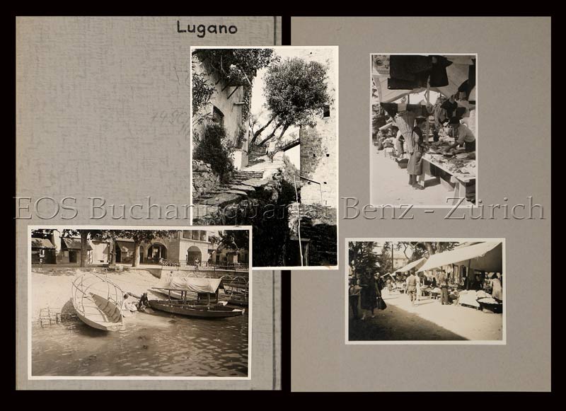
1935ref. 749CG(um 1935). 19 Fotografien, montiert auf Halbkarton. Format: ca. 8 x 6 u. 6 x 8 cm. + Wichtig: Für unsere Kunden in der EU erfolgt der Versand alle 14 Tage verzollt ab Deutschland / Postbank-Konto in Deutschland vorhanden +, Mappe u. Bilder
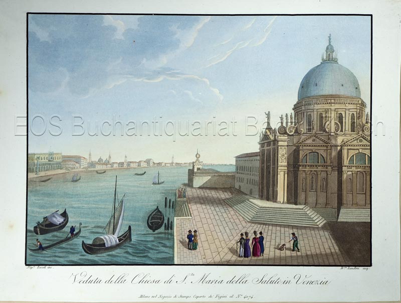
1820ref. 770CGMilano, nel Negozio di Stampe Soperto de Figini al No. 4074., (um 1820). Altkolorierte Aquatina von Landini. Bildgrösse: 15,3 x 21 cm. Blattgrösse: 18,4 x 24,5 cm. + Wichtig: Für unsere Kunden in der EU erfolgt der Versand alle 14 Tage verzollt ab Deutschland / Postbank-Konto in Deutschland vorhanden +, Bild
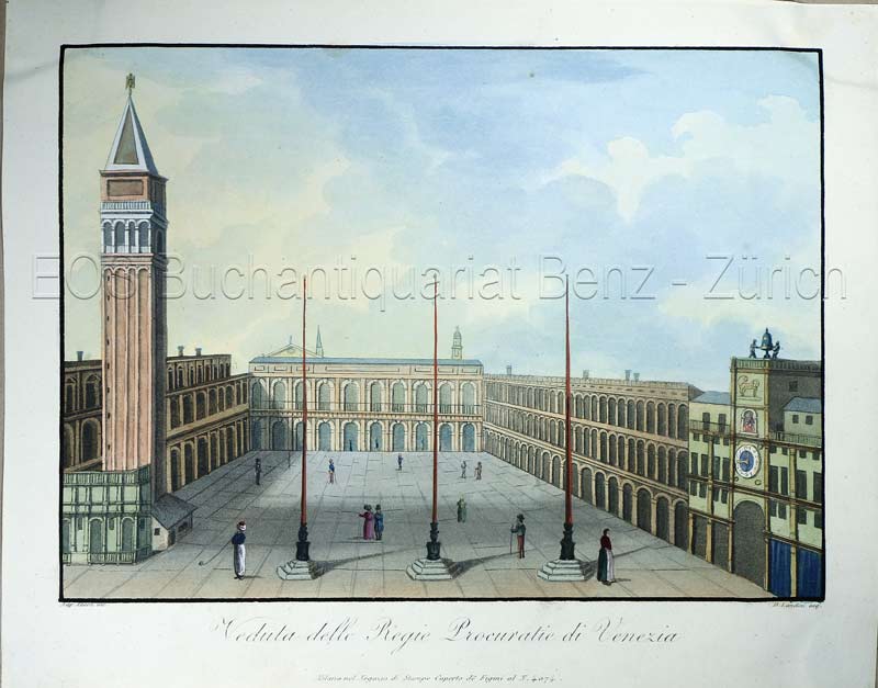
1820ref. 773CGMilano, nel Negozio di Stampe sotto il Coperto de Figini al N. 4074, (um 1820). Altkolorierte Aquatina von D. Landini. Bildgrösse: 15,2 x 21 cm. Blattgrösse: 19 x 24 cm. + Wichtig: Für unsere Kunden in der EU erfolgt der Versand alle 14 Tage verzollt ab Deutschland / Postbank-Konto in Deutschland vorhanden +, Bild
1854ref. 76611854 carte entoilée en couleurs, étui in-octavo, dimensions dépliée : 96 centimètres de largeur sur 63 de hauteur, 21 compartiments, 2 cartouches : le port de Sébastopol en marge de queue et 1 carte de la Mer Noire en marge de tête, 1854 Paris Ernest Bourdier Editeur,
1771ref. 89801771 carte ancienne colorée d'époque en vert , rouge et jaune, cartouche non coloré, gravée par Arrivet. Format total : 50 centimètres de haut par 39 centimètres de large, 1771 Paris Lattré Editeur,
1771ref. 89901771 carte ancienne colorée d'époque en vert, rouge et jaune, cartouche non coloré, gravée par Arrivet. Format total : 50 centimètres de haut par 39 centimètres de large, 1771 Paris Lattré Editeur,
1862ref. 6731862 plaq. éd. in-12, pièce de titre en papier collée / 1 er pl., cartouches en col. représentant des vues de ville de france, encadrant la carte, échelle 1/ 175 000, 1862
ref. 1460Spézet, 2003, coop Breizh publié avec le concours du Conseil Régional de Bretagne, 221 p, br, format à l'italienne 41 x 31 cm, couv offset ill d'une carte, titre typo doré, sous élégant coffret edit. toilé
ref. 0008319758.Gspiral_bound. Good. Access codes and supplements are not guaranteed with used items. May be an ex-library book. unknown
2020ref. SBBIH-BNJ3QXSMQUFLCollins 2020. map. Good. Our good condition books are generally good for reading but not for gifting or collecting. They could have imperfections such as creasing fanning inscriptions margin notes yellowing staining on edge or cover or pages bumps scuffs etc etc sometimes multiple of these. It's a wide category that encompasses anything that isn't almost-new down to anything that is slightly better than poor. We would NOT recommend gifting Good books - these should be considered reading copies. Our books are dispatched from a Yorkshire former cotton mill. We list via barcode/ISBN so please note that the images are stock images and may not be the exact copy you receive furthermore the details about edition and year might not be accurate as many publishers reuse the same ISBN for multiple editions and as we simply scan a barcode or enter an ISBN we do not check the validity of the edition data when listing. If you're looking for an exact edition please don't order at least not without checking with us first although we don't always have time to check. We aim to dispatch prompty the service used will depend on order value and book size. We can ship to most countries see our shipping policies. Payment is via Abe only. Collins unknown
ref. 1566958164.Gmap. Good. Access codes and supplements are not guaranteed with used items. May be an ex-library book. unknown
ref. 0540081558.Gpaperback. Good. Access codes and supplements are not guaranteed with used items. May be an ex-library book. paperback
1990ref. 045014Essex Ca: Tales Of The Mojave Road Publishing Company 1990. 1st Edition 1st Printing. Hardcover. Near Fine. 303 Pp. First Printing. Gold Cloth Stamped In Brown. First Printing. Very Near Fine. Tales Of The Mojave Road Publishing Company hardcover
ref. 368117George Allen & Unwin 1980. FIRST EDITION folding maps detached but tidy and loosely enclosed no price to d/w blue colour faded from jacket super octavo red cloth boards gilt lettering to spine top page edges stained red unpaginated prelims 472pp VG light tanning & foxing to page edges & eps prev. owner's sm label to ffep in d/w VG in fully adhesive plastic wrap- wrinkled minor creasing to edges prev. bookseller's sm label to base of front flap George Allen & Unwin 1980 hardcover
1994ref. Q-1878067575Seal Press 1994-08-01. Paperback. New. In shrink wrap. Looks like an interesting title! Seal Press paperback
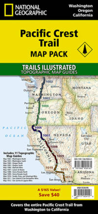
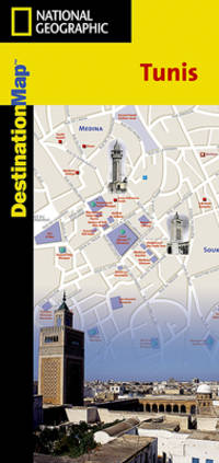
2012ref. SBBI-mon0000051632National Geographic Maps 2012. map. Good. Our good condition books are generally good for reading but not for gifting or collecting. They could have imperfections such as creasing fanning inscriptions margin notes yellowing staining on edge or cover or pages bumps scuffs etc etc sometimes multiple of these. It's a wide category that encompasses anything that isn't almost-new down to anything that is slightly better than poor. We would NOT recommend gifting Good books - these should be considered reading copies. Our books are dispatched from a Yorkshire former cotton mill. We list via barcode/ISBN so please note that the images are stock images and may not be the exact copy you receive furthermore the details about edition and year might not be accurate as many publishers reuse the same ISBN for multiple editions and as we simply scan a barcode or enter an ISBN we do not check the validity of the edition data when listing. If you're looking for an exact edition please don't order at least not without checking with us first although we don't always have time to check. We aim to dispatch prompty the service used will depend on order value and book size. We can ship to most countries see our shipping policies. Payment is via Abe only. National Geographic Maps unknown
ref. T87-ODE-3EPHardcover. Very good. Imperial War Museum in association with The Battery Press 1992 V1. 380 pages V2. 517 pages red cloth hard covers with gold spine stamping no owner's mark or underlining tight and square very light wear. hardcover
39 x 52,5 cm. Mit breiten Rändern (Blatt: 55 x 64 cm). *Mit zwei ausgemalten figürlichen Kartuschen. Zeigt das Gebiet um Magdeburg, Wittenberg, Mansfeld, Halberstadt. - Sauber und sehr gut erhalten in schönem Altkolorit. Landkarten de
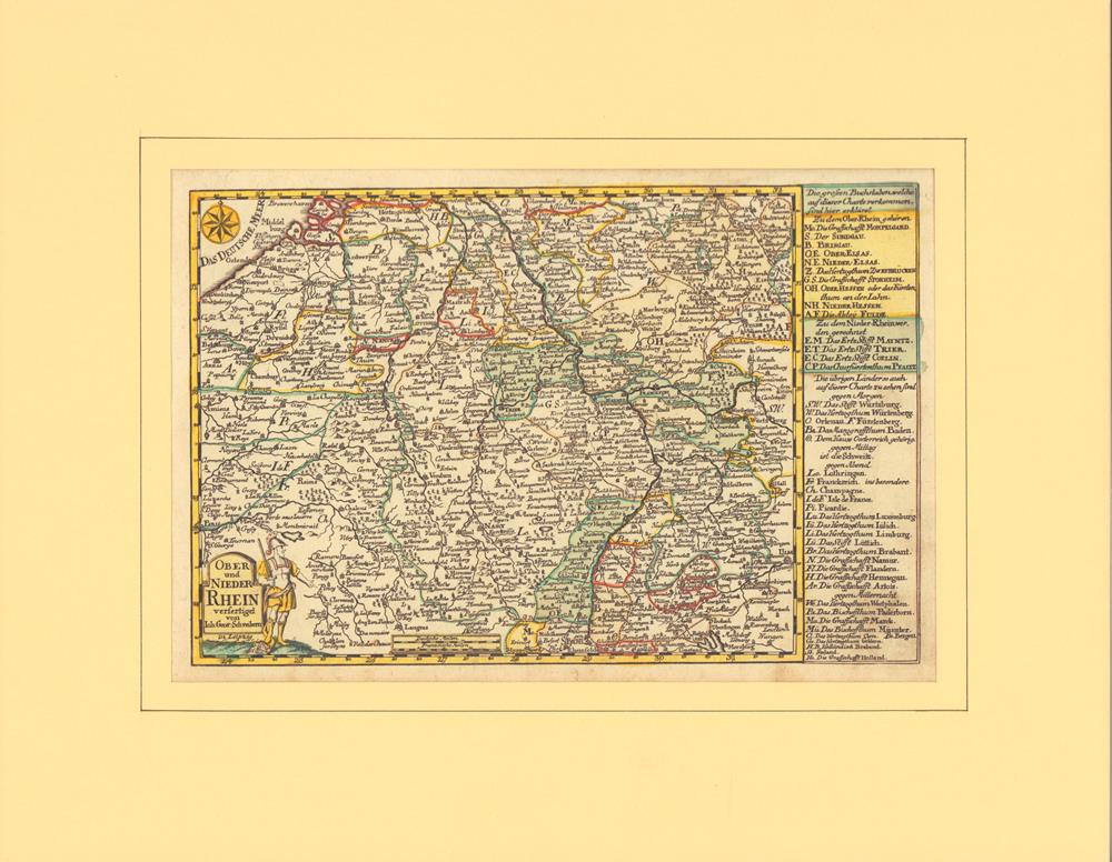
1749ref. 78867Leipzig, J. G. Schreiber, 1749. Grenzkolorierter Kupferstich mit partiellem Flächenkolorit. Mit alter hs. Nummerierung im ob. weißen Rand. Plattenmaß 18 x 27,5 cm. (= Aus: Atlas Selectus von allen Königreichen und Ländern der Welt...). Hinter Passepartout (mit Laugenstreifen montiert).
41,5 x 53 cm. (Blatt: 49 x 60 cm). *Aus der lateinischen Ausgabe des Altlas von W. Blaeu "Theatrum Orbis Terrarum". Die nicht genordete, sondern nach Westen ausgerichtete Karte, zeigt das Gebiet von Oberschwaben mit dem Bodensee mit den Allgäuer und Vorarlberger Alpen linksseitig und der Donau im rechten Drittel des Blattes. - Sauber und sehr gut erhalten. Landkarten de
41,5 x 53 cm. (Blatt: 49 x 60 cm). *Die nach Westen ausgerichtete Karte zeigt das Gebiet von Neuddeutschland, links mit Bereichen der Nordsee und rechts die Ostsee bis nach Stralsund. Schönes Altkolorit. - Sauber und sehr gut erhalten. Landkarten de
ref. 48577, Uitgever: Plaizier, 2016 ?10,5 cm x 15 cm ?.