Author Not StatedMareMagnum

12,595 results
1902"Sketch map showing the connexion between the Himalaya Mountains and the Tibetan table-land, and their relation to the adjacent plains and mountains." - from lower edge. Outside dimensions 14.5" x 10.5" Circa 1902. Centerfold. Light wear. Please see our photo for details. Book
1902Outside dimensions 14.5" x 10.5". Circa 1902. Centerfold. Light wear. Please see our photo for details. Book
1902Outside dimensions 14.5" x 10.5". Circa 1902. Centerfold. Light wear. Please see our photo for details. Book
1902Outside dimensions 14.5" x 10.5" Circa 1902. Centerfold. Light wear. Please see our photo for details. Book
1902Outside dimensions 14.5" x 10.5". Circa 1902. Centerfold. Light wear. Please see our photo for details. Book
1902Outside dimensions 14.5" x 10.5". Circa 1902. Centerfold. Light wear. Please see our photo for details. Book
1902Outside dimensions 14.5" x 10.5". Circa 1902. Centerfold. Light wear. Please see our photo for details. Book
1902Railroads and street car lines indicated. Outside dimensions 14.5" x 10.5" Circa 1902. Centerfold. Light wear. Please see our photo for details. Book
1902Outside dimensions 14.5" x 10.5". Circa 1902. Centerfold. Light wear. Some soiling to lower left corner. Please see our photo for details. Book
1902Outside dimensions 14.5" x 10.5". Circa 1902. Centerfold. Light wear. Bit of soiling along top edage. Please see our photo for details. Book
37 x 48,5 cm. (Blatt: 46 x 56 cm). *Das Bistum Münster. Schönes flächiges Altkoloriit, sauber und sehr gut erhalten, breitrandig. Landkarten de
ref. 66108CBo.J. [3 Warenabbildungen] (Jacques-Nicolas Bellin, geb. 1703 in Paris, gest. 21. März 1772 in Versailles, französischer Kartograph, Ingenieur-Geog
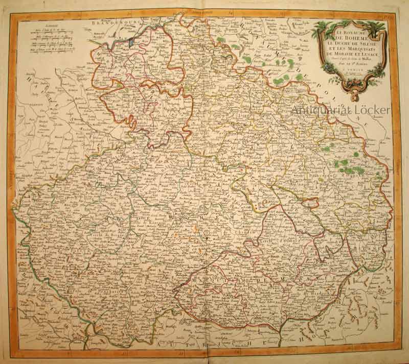
1777ref. KART0153Venise, P. Santini chez M. Remondini 1777. Kartengröße: 55x48,5 cm; Blattgröße:76x53,2 cm; rechts oben dekorative Titelkartusche, li. oben Maßstabsskala, kolorierte Randleiste, Mittelalz leicht gebräunt und unten über die Randleiste eingerissen, rundum Randrisse im weißen Rand. Die Karte zeigt das Gebiet Böhmens, Tschechiens, Schlesiens etc.
1758Dressé sur les dernières Observations par J. B. Nolin Géographe, gravée par Vallet, carte au format 535 x 650 mm, limites des présidiaux et bailliages rehaussées en couleurs, Chez Longchamps, Paris, 1758 Mouill. et frott. en marge droite. Prix en l'état. Français
1792ref. 5151792 Paris, Buisson, 1792. 20 x 12,5 cm, in-8, VIII - 536 pp. - 2 grandes cartes dépliantes gravées en taille douce sur vergé bleuté (carte de la partie sud-est de l'Asie selon Ptolémée, et une autre selon les connaissances géographiques récentes), reliure de l'époque en demi-basane fauve à petits coins en vélin, dos à 5 nerfs, pièce de titre, tranches mouchetées.
1745ref. 18879Amsterdam Chatelain 1745 une carte ancienne gravée sur cuivre (Copper etching) en noir . Format : 41 x 28,5 cm, Échelle au1:200,000,000ème, plis centraux verticaux et horizontaux normaux venant d'un atlas (pliage) ( verticals and horizontals centerfold), avec note dans la marge en haut à droite : Tome I Page 235, pour "l'introduction à l'histoire générale et politique de l'univers, Ou l'on voit l'Origine, les Révolutions, l'Etat présent, & les Intérêts des Souverains" ; Commencée par Mr. le Baron de Pufendorff ; complétée et continuée jusqu'à 1745 par Mr. Bruzen de la Martinière, 8 volumes in-12, 1745 à Amsterdam chez Zacharie Chatelain Editeur,
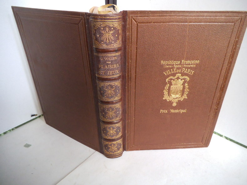
ref. 5313in 4 demi-chagrin marron à nerfs,titre et caissons dorés. plats percaline chagrinée.Triple filet à froid en encadrement,armes de la ville de Paris sur le premier plat. Faux-titre,frontispice en couleurs d’après le dessin originale de l’auteur,sous serpente.Titre en noir et rouge avec une vignette,XVIII,344 pages,tranches dorées.279 planches et vignettes d’après les peintures, estampes, dessins originaux, 18 héliogravures sur 19 annoncées, il manque, semble-t-il l’escarpolette en regard de la page 158. J Rothschild éditeur 1903 les jouets, les divertissements à travers l'histoire:poupée,croque-mitaine,les animaux dans les jeux,la chasse aux papillons, la pêche,le cerceau,les billes,balançoires et bascules,la balle,colin-maillard,cerf-volant,croquet,criquet,saute-mouton,les boules,les échecs,les cartes,Bel exemplaire
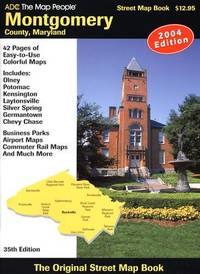
ref. 0875304435.Gpaperback. Good. Access codes and supplements are not guaranteed with used items. May be an ex-library book. paperback
ref. 1841395730.Gmap. Good. Access codes and supplements are not guaranteed with used items. May be an ex-library book. unknown
ref. 4465710Philips. 01. Spiral-bound. Used; Very Good. Simply Brit welcome to our online used book store where affordability meets great quality. Dive into a world of captivating reads without breaking the bank. We take pride in offering a wide selection of used books from classics to hidden gems ensuring theres something for every literary palate. All orders are shipped within 24 hours and our lightning fast-delivery within 48 hours coupled with our prompt customer service ensures a smooth journey from ordering to delivery. Discover the joy of reading with us your trusted source for affordable books that do not compromise on quality. 04/05/2018 Philips unknown
ref. DADAX0226054934New unknown
1934ref. 2083002116201764Oriental Maps Yoshimitsu Nonaka. Kiyoshi Tsukamoto 1934. Soft Cover. Fine. The book is in fine condition. Oriental Maps Yoshimitsu Nonaka. Kiyoshi Tsukamoto paperback
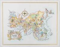
1964ref. 195995Pan American World Airways. 1964. Colour pictographic/pictorial map of Asia 23.2 x 30.1 cm gilt double-rule border printed on a folding decorative menu card 32 x 50 cms open highlighted in gilt text in English French and Japanese central fold and later central vertical crease in very good condition. Pan Am menu card for First Class passengers dubbed "The President Special" the deluxe cuisine by fabled Maxim's of Paris "Good food is the basis for true happiness". Passengers were feted with gourmet meals on bone china with silver cutlery. The witty pictorial cover-map of Asia was by French artist and commercial illustrator Jacques Liozu 1910-1974 also known for his larger scale maps. . Pan American World Airways. unknown
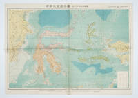
1572ref. 160554Tokyo 東京: 統制社Tosei-sha. 昭和 Showa 18. 1943. Colour folding map 54 x 75.5cm with original envelope. Envelope a little torn some occasional browning very good. The 13th map in this Standard Maps of Greater East Asia series of 20 maps. All text in Japanese. Shows railways shipping routes administrative boundaries airfields ports lighthouses mines oil wells etc. . 統制社(Tosei-sha) unknown
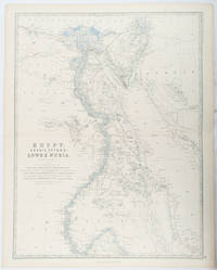
1861ref. 177021Edinburgh & London.: William Blackwood & Sons. 1861. Engraved map with original outline hand-colour 57 x 43.8 cm 61.1 x 49 cm sheet central fold very slight edge toning but the map in very good bright condition. First edition. Fine large folding map: the Nile delta and river with attractive original outline colour railways and canals marked and name references to biblical and classical geography. Published for inclusion as map 39 in "Keith Johnston's royal atlas of modern geography" . William Blackwood & Sons. unknown