[CRIMEA - MAP]. TARDIEU, AMBROISEBiblio.com
12,235 results
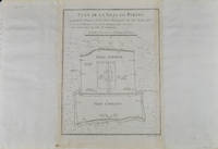
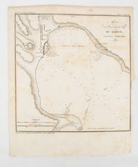
1839ref. 175248Paris.: Librairie de Gide. 1839. Engraved map 21.1 x 20.8 cm 27 x 22 cm sheet original folds trimmed to the inner margin with slight loss to the border only map spotted but otherwise in sound condition. Map of the Port of Kerch in Crimea prepared for the 1839 edition of the French Journal "Nouvelles Annales des Voyages." the editors for this edition amongst others the translator and geographer Jean-Baptiste Benoît Eyriès and Alexander von Humboldt founding members of the world's first geographical society the Société de Géographie. . (Librairie de Gide). unknown
ref. 1583559248.Gpamphlet. Good. Access codes and supplements are not guaranteed with used items. May be an ex-library book. unknown
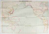
ref. 169329東京. Tokyo.: 九段書房.Kudan shobo. 大正十四 1925. Coloured folding Japanese map showing the military strength of Japan the United States and the United Kingdom in the Pacific original pictorial envelope scale not given. Some small holes at folds occasional light foxing a prior owner's signature on reverse minor wear envelope. Very good copy in like envelope. Map measures 54.4 x 78.8cm. The explanatory text in Japanese printed on the reverse in blue summarises the colonial possessions of the US and the UK as well as providing a comparison between the land size naval presence natural resources immigration issues and maritime transport capacities of Japan the United States and the United Kingdom. Legend indicates national regional provincial territorial boundaries canals undersea cables airline routes metropolitans capital cities mining fields hot springs ancient battle fields major trade ports Japanese embassies and consular offices. A large area marked 日本委任统治 "South Pacific Mandate" highlighted in a box is adjacent to Australian occupied Papua New Guinea. . 九段書房.[Kudan shobo]. unknown
1819ref. 162103Tokyo.: Tōseisha. Showa 18 1943. Folding colour map of Australia 54.2 x 76.4cm. Some foxing particularly along folds and upper right margins a few repaired tears and small holes at folds.With original sleeve. The 15th map in the Standard Maps of Greater East Asia series of 20 maps. Shows the natural resources such as sheep gold pearl diary regions opals etc. Tasmania appears as an inset in the bottom right corner. Text in Japanese. . Tōseisha. unknown
1749ref. 136794Paris. circa1749. Black and white engraved plan map of Peking on laid paper folded designed by the prominent French cartographer Jacques-Nicolas Bellin. This map is No. 18 Vol. 5 from the impressive 15-volume "Histoire Generale des Voyages" compiled by French novelist Antoine François Prévost. This city map shows two areas of walled cities: Ville Tartare Imperial city and the Forbidden City and Ville Chinoise ethnic Han residential area. Notes A and B represents buildings within the Forbidden City. A: Lieu de Plaisance ou l'on voit une Montagne faite a la main B: Grandes Cours du Palais de l'Empereur. Two missionary buildings French and Portuguese as well as the Tower of Mathematics illustrated within Ville Tartare. Two temples illustrated side by side near the south gate of the Ville Chinoise. Overall in good condition very light browning on edges and darker toning along the borders of the map. Text in French. Map measures 21 x 16.4cm. . unknown
1572ref. 160538東京.Tokyo.: 日本名所圖繪社.Nihon Meisho Zuesha. 昭和16 1941. Folding colour Japanese map of the Malay Archipelago and Thailand scale 1: 8500000 with attractive original pictorial paper envelope. This map also shows the Dutch French and American colonies. Hainan Province and the South China Sea are shown in the north. Agricultural and mineral resources indicated across the map. Few small holes at holes and other light signs of wear. Slipcase lttle torn. Text in Japanese and English. 53.3 × 78.2cm. . 日本名所圖繪社.[Nihon Meisho Zuesha]. unknown
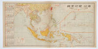
1572ref. 160545No place of publication.: 朝日新聞社. The Asahi Shimbun. 昭和十五1940. Published by 朝日新聞社 The Asahi Shimbun Japanese folding coloured WWII map with a calendar from January to June Shōwa 15 at the left scale 1:300000. Map includes French Indochina Dutch East Indies and parts of the territory of Papua China and British India. Some light browning and foxing otherwise very good. Text in Japanese. 25.3 x 51cm. Legend at lower left lists the boundaries between continents countries and provincials or regions railways airline routes capitals and Japanese embassies and consulates. The natural resources are indicated across the map. The map also shows parts of the territory of Papua under Australia's administration " 濠洲委任統治領 Gōshū inin tōchiryō". . 朝日新聞社. [The Asahi Shimbun]. unknown
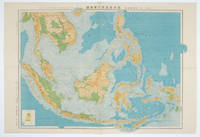
1572ref. 160533Tokyo.: 日本名所圖繪社.Nihon Meisho Zuesha. 昭和 17 1942. Folding Japanese coloured map of the Malay Archipelago and Thailand during World War II scale 1:8500000. Legend in lower corner indicates altitudes. Ink annotation in Japanese left edge. Pin holes at three corners upper right corner torn with loss evenly browned otherwise very good. Text in Japanese and English. 52.8 x 75.6cm. This map shows most of Thailand former Indochina Hainan Province and South China Sea Sumatra and Java Sea Borneo the Philippine Islands Celebes Timor New Guinea and parts of Micronesia. Natural resources such as tobacco spices wood sugar metal mines tin iron and etc. rice and other resources are indicated on the map. . 日本名所圖繪社.[Nihon Meisho Zuesha]. unknown
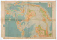
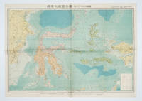
1572ref. 160554Tokyo 東京: 統制社Tosei-sha. 昭和 Showa 18. 1943. Colour folding map 54 x 75.5cm with original envelope. Envelope a little torn some occasional browning very good. The 13th map in this Standard Maps of Greater East Asia series of 20 maps. All text in Japanese. Shows railways shipping routes administrative boundaries airfields ports lighthouses mines oil wells etc. . 統制社(Tosei-sha) unknown
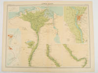
1920ref. 47836London.: The Times. 1920. Map printed in colour 47 x 59.5 cm sheet showing cultivated land in green and desert in cream five insets: Port Said Suez Environs of Cairo and two showing continuations of the Nile; original fold two small edge tears but in very good condition. Attractive large map prepared as plate 79 from "The Times Survey Atlas and Gazeteer of the World". . The Times. unknown
ref. 1845879945.Gmap. Good. Access codes and supplements are not guaranteed with used items. May be an ex-library book. unknown
ref. 0783499000.Gmap. Good. Access codes and supplements are not guaranteed with used items. May be an ex-library book. unknown
ref. 000810204X.Gpaperback. Good. Access codes and supplements are not guaranteed with used items. May be an ex-library book. paperback
ref. 1581740700.Gspiral_bound. Good. Access codes and supplements are not guaranteed with used items. May be an ex-library book. unknown
ref. 1849071535.Gpaperback. Good. Access codes and supplements are not guaranteed with used items. May be an ex-library book. paperback
ref. 1841392723.Gmap. Good. Access codes and supplements are not guaranteed with used items. May be an ex-library book. unknown
ref. 1849073937.Ghardcover. Good. Access codes and supplements are not guaranteed with used items. May be an ex-library book. hardcover
ref. 0008272735.Gmap. Good. Access codes and supplements are not guaranteed with used items. May be an ex-library book. unknown
ref. GOR009437064Paperback. Good. paperback
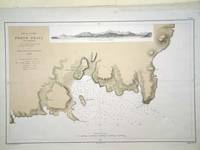
ref. 6279Paris: 1868. No binding. Very Good. 305 x 470 mm. in very good condition. A fine large scale plan of the harbour of 'Porto Praya' Praia on Santiago the capital of the Cape Verde Islands. It is situated on the south coast and shows wonderfully how the town has grown; the whole area to the south and west of the town is now developed. A prospect of the approach is shown above. The roads and individual buildings are shown as are numerous soundings in the Bay. The original survey in 1834 is the work of Lieutenant William Arlett of the British Royal Navy who is duly credited in the title. 1868 unknown
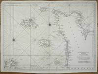
ref. 11443Paris: 1693-1753. No binding. Good. 595 x 815 mm. dark impression on thick paper margins trimmed with repairs to upper edges otherwise in good condition. The third state of the official French sea chart of the Channel Islands and the nearby Cotentin peninsular published by the L'Imprimerie Royale in 1693 utilising recent scientific survey work. The engravers imprint lower right is erased. Two lines of longitude are added across the bottom marked from Tenerife and L'Isle de Fer and a line of latitude is added by the right margin. The chart extends southwards to include the 'Isles de Chausey' the town of Granville in Normandy and Treguier in Brittany. It is from the 'Neptune François' one of the landmarks in the publication of sea atlases a highly significant work. In 1662 Jean-Baptiste Colbert 1619-83 Minister of State to Louis XIV made an initial attempt to have the coasts of France surveyed. The results were disappointing. Colbert tried again in 1670 this time having La Favolière survey the French coast south of the Loire River and Denis de La Voye northwards and through the English Channel. A decade later at the behest of the Académie des Sciences and Jean Dominique Cassini 1625-1712 the astronomers Jean Picard and Philippe de La Hire surveyed the country making astronomical observations of latitude and longitude. It was the results of their work that lost Louis XIV more territory than he had won in wars. These two projects were combined to produce with the encouragement of Cassini 'Le Neptune François'. ""The minister of finance to Louis XIV took the initiative to give the French navy an important advantage over the British. In 1691 a royal privilege was granted to produce a sea chart atlas 'Le Neptune François' engraved and printed on Mercator's projection by royal-appointed engineers and surveyors"" Wardington Catalogue. One of its most innovative features was the laying down of safe channels on the charts along with all the usual hazards and soundings to be expected. Another tradition began with this atlas in that it used soundings based on the lowest tide. It was immediately counterfeited by Pieter Mortier in Amsterdam. Whilst the Dutch version sold well the original French version didn't. Its large size use of Mercator's projection which was not favoured by French sailors and high price meant that the work languished for sixty years. The French government collection of nautical charts became part of the Archives de la Marine in 1699. It was renamed as the Depot des Cartes et Plans de la Marine in 1720. In 1741 Jacques-Nicolas Bellin 1703-1772 became its de facto person in charge. He was one of the most important and prolific French cartographers of the mid-eighteenth century. With access to the latest navigational reports he produced a great many maps and charts of excellent quality compiling atlases of sailing charts for military and official use as well as for commercial publication. A second edition of the 'Neptune François' appeared in 1753 under Bellin's direction. The charts bore added lines of longitude and latitude. Provenance: private Jersey collection. Chapuis 2019; Pastoureau 1984 Neptune Français C no. 17; Pelletier 2019 'Jean Picard' in 'The History of Cartography' vol. IV pp. 1095-7. 1693-[1753] unknown
ref. 0540092193.Ghardcover. Good. Access codes and supplements are not guaranteed with used items. May be an ex-library book. hardcover
ref. 0930657098.Gpaperback. Good. Access codes and supplements are not guaranteed with used items. May be an ex-library book. paperback
ref. 184907058X.Gspiral_bound. Good. Access codes and supplements are not guaranteed with used items. May be an ex-library book. unknown
ref. 092959195X.Gpaperback. Good. Access codes and supplements are not guaranteed with used items. May be an ex-library book. paperback